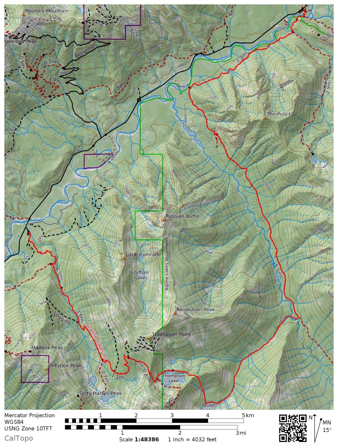
Spider Lake has been an objective of mine for a few years now. It’s just over a steep and forested ridge from Thompson lake. A trail goes around the head of the valley and you can look down on Spider Lake but nothing descends to it. The outlet stream from Spider Lake is a straight shot down the valley to the Pratt River and and I’ve hiked the easy Pratt River trail several times. All that was needed was a little bushwhacking…
Saturday
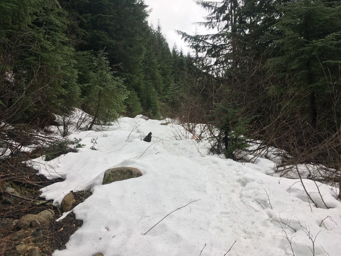
I was familiar with the first part of the route from a previous (mis)adventure. I started in the afternoon from the Granite Lakes trailhead (western terminus of the route in the map above) and found the snow line a little higher than I’d expected. It was nice that once the snow started, it stayed. No constant stopping to put on and take off traction devices.
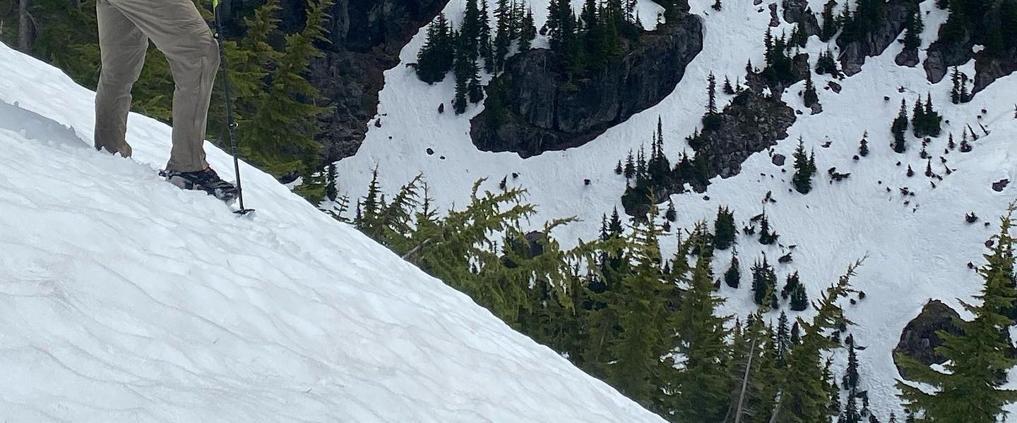
I was dressed in just leggings, athletic shorts, and a synthetic long-sleeved T-shirt despite the snow since I knew I’d be heading uphill until the top of the ridge west of Thompson Lake. Coming back from that ridge, just before I continued off the old forest road into the trees for the last traverse to the ridge was a small group of hikers in full winter gear. They answered my questions about snow level but had turned back at the ridge crest due to the conditions and seemed to be appraising my lack of proper clothing.
The walk to crest the ridge was much easier now that I’m familiar with the way. Going down was steep and narrow but not exposed and I’ve been down it too. You kinda get guided along the correct course because it’s the easiest way to move. Everything else looks just a little too steep or bushy.

This was my first time turning left when I reached Thompson Lake. I’m not really sure where the trail goes and wound up pushing through some grabby, spiny, entangling bushes while listening to a part of Watership Down where one of the main rabbits gets stuck in a snare. The timing didn’t put my mind at ease.
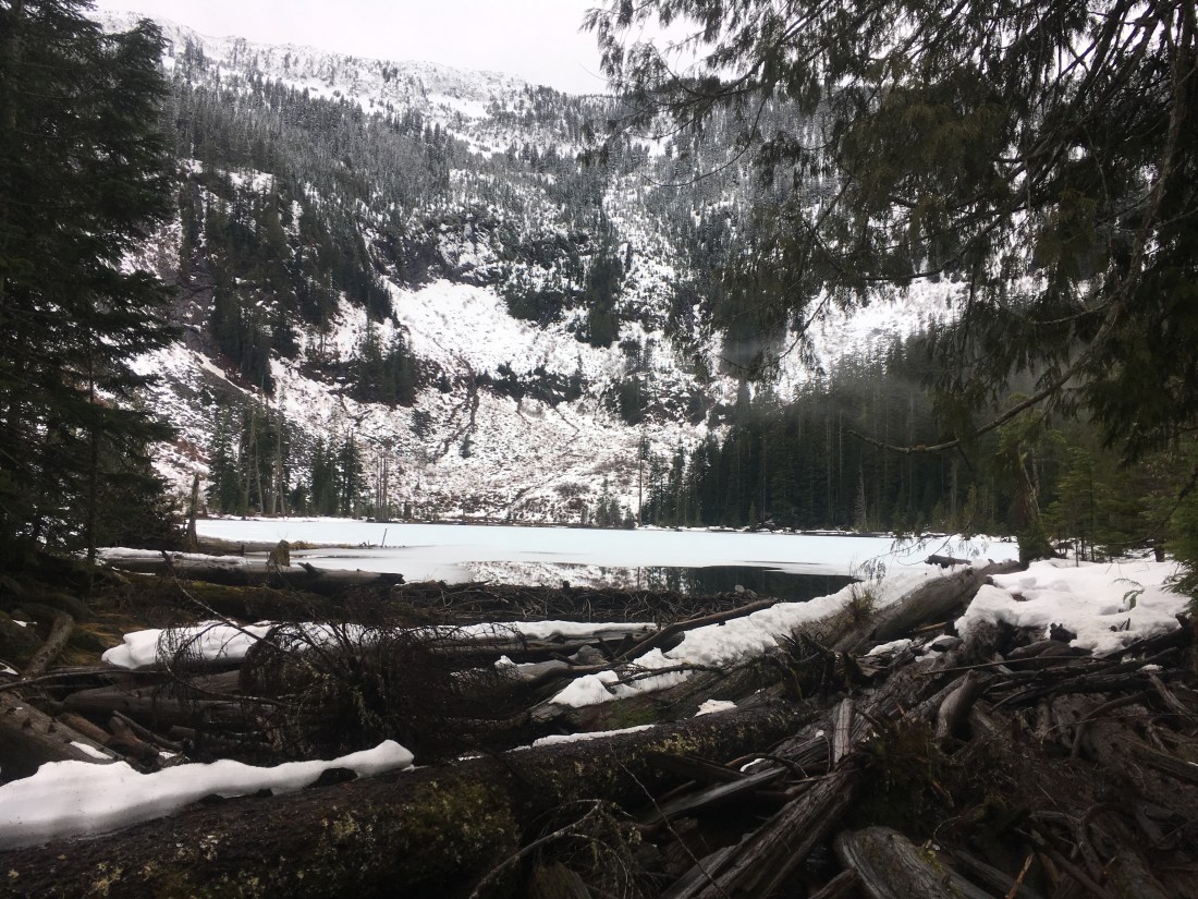
I found a flat, if not level, spot just after Thompson Lake’s outlet stream which I guess put me on the north side of the lake and set up for the night. I hadn’t gotten particularly wet at any point during the day but it was humid and cold so everything felt clammy. Not really feeling adventurous, I warmed up water for Ramen in the vestibule, put on lots of warm clothes, and tucked in despite there still being a weak light in the sky.
Sunday
The damp (but not rainy!) overcast continued into the next morning and I didn’t rush. Saturday had really just been a set up for the real adventure which now began. The immediate question was whether to go around or over the ridge separated my campsite at Thompson Lake from the objective of Spider Lake.
The snow was crunchy and relatively compact so I opted for the flexible crampons instead of snowshoes and set out to contour around the ridge. Pretty quickly this became an obstacle course where snow had covered downed trees and surface depth was completely unknowable. Better to go up and over where the steep sides of the ridge had kept snow from accumulating. The thin, crusty layer which had stuck made for even better footing than the loose dirt I would have encountered in summer. I gave up on trying not to break a sweat (sweat will quickly drop your body temperature when you stop in freezing temperatures) was pretty quickly at the top.

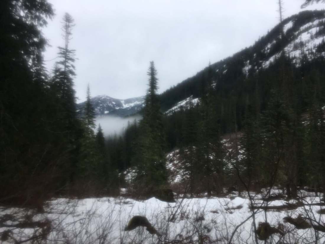
It was a little disconcerting going almost straight down the other side knowing there was no trail to route me around unacceptably steep terrain but at least I was pretty sure there were no cliffs. I’ve traveled off trail for hundreds of miles on the Hayduke but I’m still not at ease with it. I had to follow the path of least resistance which kept trying to push me into a rivulet which was forming. I wasn’t sure if it flowed into Spider lake or merged with the outlet stream so I kept trying to bear a little more southward, away from the forming waterway but steeper slopes kept nudging me back. As the ground began to level out, thickets appeared blocking my desired course so ultimately I decided that if the stream didn’t end at the lake but joined it’s outlet stream, I could just hike up the outlet stream and find Spider Lake. I debated whether or not to just pull out my GPS and check if I was on course but I knew that it was such a short distance and I was in such constrained geography and I wanted to push myself not to treat the GPS as a safety blanket. I kept on without it and in a bit was rewarded with a view of Spider Lake.
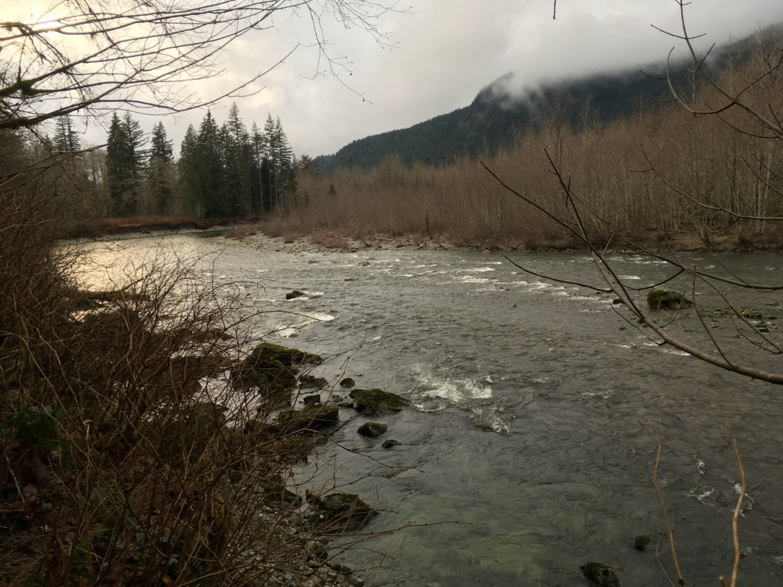
Spider Lake isn’t impressive and the ground under my feet was alternately boggy and treacherous with deadfall which didn’t make for pleasant travel, especially when snow made it a guessing game as to what was actually under you feet. Hiking over the ridge to the lake was supposed to have been the easy part and it hadn’t been easy. It was about 11am which put me behind enough that if something went wrong when following the outlet stream or I couldn’t cross Pratt River at the bottom of the valley, I wasn’t sure I’d be able to make it all the way back out to my car that night. Not a big issue since I had food and wouldn’t be missed on a Monday morning but I felt that I was doing something new and risky and didn’t have as much margin for error as I’d have liked. The moment was anti-climactic and I decided to keep going.
After working my way around to the outlet stream and crossing it on a log jam, I started down the valley towards the Pratt River. This was one of only two times I got a clear sight of the hill whose base I needed to reach before turning north-northwest on the Pratt River trail. My plan was to stay on the right side of the outlet stream so that when I reached the Pratt River, there would be no chance that I would fail to notice it’s confluence with the outlet stream and accidently turn up it while thinking that I was still following the outlet stream. This was critical because I’ve been unable to cross the Pratt River before and accidentally following it downstream as it accumulated more water would not help.
The next two-ish miles to turned out to be the most physically demanding two miles I’ve ever hiked. Maybe that’s par for the course when bushwhacking in the Pacific Northwest but even on the Hayduke, the term “fighting” had never seemed a fair characterization.
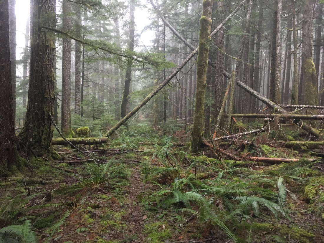
It started with a boulder field, covered with just enough snow to hide the holes between the rocks. The bushes weren’t thick enough to prevent passage but added an upper body element to the hiking.
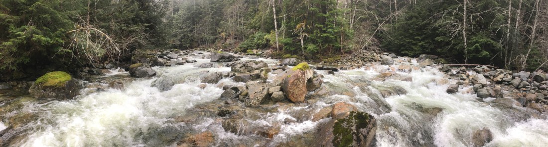
On entering the trees, it was quickly clear that my plan to stay on the right bank wouldn’t work. Things got steep, rocky, brushy, and sometimes deadfall simply formed barricades. I crossed to the other side of the outlet stream and continued for sometimes as much as a hundred feet before being forced back to the other bank. Finally I came to the realization that there were going to be places where the stream itself was the path of least resistance. If I hadn’t had neoprene socks, my toes would have been in bad shape.
This middle way quickly started getting deeper and wider. What I’d first been able to step across the outlet stream, I later could wade across at my convenience, but soon was avoiding the wells formed behind large rocks and was frequently above the knee. And so it continued: follow the stream until I was forced to a bank. Fight with that bank until I was forced to the other. Every step was a large one, tactically planted.
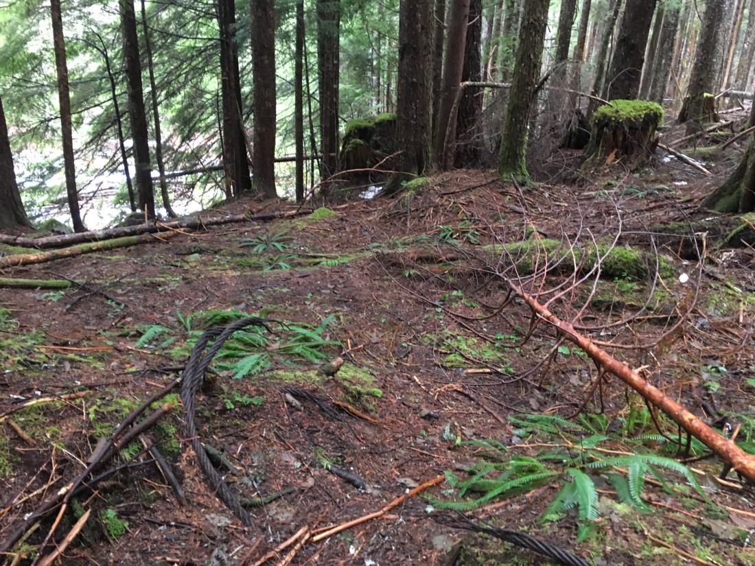
Metal rope evidencing previous human passage in a bygone decade.
Noon passed unrecognizable in the uniform grey clouds. Every moment seemed to offer a chance to break into the open and gain a few unmolested, level strides. I decided to delay lunch until 1pm. Hopefully by then I would have found the confluence with the Thompson Lake outlet stream and so have a measure of my progress. Around 1:30pm I recognized that I was running on adrenaline. My fingers were stiffening ever so slightly and though my body felt warm, the warmth felt thin.I hadn’t eaten since breakfast. The stream was keeping my feet at the temperature which would have been desirable for beer. For the first time in my hiking career, I stopped with the express purpose hypothermia prevention.
I pulled up on a bank, dug my fleece, gloves, and hat out of my pack and put them on. I wolfed down a bar and got my stove heating a cup of water. Because I’d been surrounded by water all day, I didn’t have much more than a cup in my water bottle and had been putting of drinking the last of it.
I never did find the confluence of the outlet streams from Thompson and Spider Lakes which was supposed to have been the only waypoint between Spider Lake and Pratt River. When I finally decided on a map check, I discovered that my maps weren’t in my pack. Abandoning the effort to go without GPS, I pulled out my phone and discovered that I hadn’t cached the base map. All I had was a blue dot representing my location in a sea of undifferentiated pixels. A compass check showed the valley running North. From memory, this valley should have run NNE. Didn’t the Pratt River run N or NNW? Had I missed the confluence with the Pratt River as well? I’d been hiking long enough to have covered that much ground under typical adverse conditions but was traveling at a snail’s pace in this terrain. Should I just turn around and fight my way out?
Ultimately, I made a gut decision to just continue which didn’t fit with any of the evidence. However, if I could cross the Pratt River (and last Spring I hadn’t been willing to risk trying), then the way forward was all downhill. I really didn’t want to turn around since that would require the significant exertion I’d already been expending and in addition require an uphill march. The value of having been wrong about map and compass work so much in the past is that I had the option to just not believe my memory of the map and apparent lack of landmarks. It was only two miles from Spider Lake to the Pratt River, even if I were going a record slow pace, I’d get there eventually. If I couldn’t cross Pratt River, that was tomorrow’s problem.

Shortly before 3pm, I saw a tree with some kind of survey marker. This somehow comforting. The stream and it’s immediate banks had gotten difficult enough that I’d scrambled the extra 50ft or so onto a higher bank which was a little more open and level. Being on the left side, I was risking a failure to spot the confluence with the Pratt River and change from a NNE to NNW bearing without really realizing it so I tried to keep keep a course which went frequently to the edge of the deepening cut made by the outlet stream. Eventually I was worried about getting “cliffed up” and descended to the stream. The timing was impeccable, for in moments, I was at the Pratt River.
At first I thought it might have been the Thompson Lake outlet stream but it was coming from the wrong direction for that. The area was familiar, but the water level was so much lower than last spring that I didn’t recognize it immediately. The flood of relief was tangible when I accepted that this was the Pratt River and that it was clearly fordable.
After a slow, victorious ford of the Pratt River (I did have to chance course once to avoid an unexpectedly deep pool), I just had to get onto the upper bank and where I should encounter the Pratt River Trail which would guide me along a level course seven-ish miles to a trailhead where I would road walk another six-ish miles back to my car.
The trouble was actually spotting the Pratt River Trail which runs along an old forest road in various through various states of overgrowth. I’d recalled that a spur of the abandoned road went down to the river but couldn’t find it. I climbed up the upper bank and pushed forward perpendicular to the river. No trail. About the time I felt I’d gone too far, something seemed familiar and I looked left, the direction home. There was the trail. It was like one of those paintings made with broad strokes which just looks like a bunch of blotches up close but when you back away, the picture becomes recognizable.
It was so good to have level ground under my feet. I hiked quickly just for the joy of being able to move easily. There’s only one tricky place on the Pratt River trail but I’d been there before and knew to just contour right until the trail reappeared.
Eventually the Pratt River joined the Middle Fork of the Snoqualmie River
Two or three miles later I crossed to a trailhead. It was so good to see well maintained human structures again.
At the trailhead there was a single SUV with it’s rear door open and two hikers packing up their gear. I stopped at a respectful distance, introduced myself, and asked for a ride to the next trailhead down the road. They agreed and it felt wonderful to relax and make small talk instead of grinding out road miles in the dark. Good people and a good ending to a good day. All’s well that ends well.
