Orange – Frosty Pass (Sunday)
Red – PCT (Monday)
Saturday, September 19
Emily and I met at the PCT trailhead just south of the Slate Pass trailhead. While gearing up, a couple pulled up and asked if this was the place to wait for their son who was finishing the PCT with some friends. It was and they gave us several homemade chocolate chip cookies from a real cookie jar. We walked a short distance up the road to a nearby trailhead and started up the Buckskin Ridge Trail from the Slate Pass TH.
The Buckskin Ridge Trail starts by contouring along Gold ridge past Silver Lake. After a while, it reaches Silver Pass and switches from the east side of Gold ridge to the west side of Buckskin Ridge. Ideally, it would slowly climb from there to the shoulder where it descends to Buckskin Lake. Instead, it drops most of the way to the valley then climbs almost straight up the steep hillside before beginning contouring again. We completed this pointless up and down in the rain. A long food break had been planned for Buckskin Lake but the mileage on Emily’s watch was counting past the 10 miles which the trailhead sign had claimed it would get us there. We were both getting hungry so we ate at the top of the climb from which the topo map promised a uniformly downhill trip. I was in shorts and a t-shirt and had enough body heat to get through the meal without shivering. Emily had the opposite experience and it was a funny contrast.
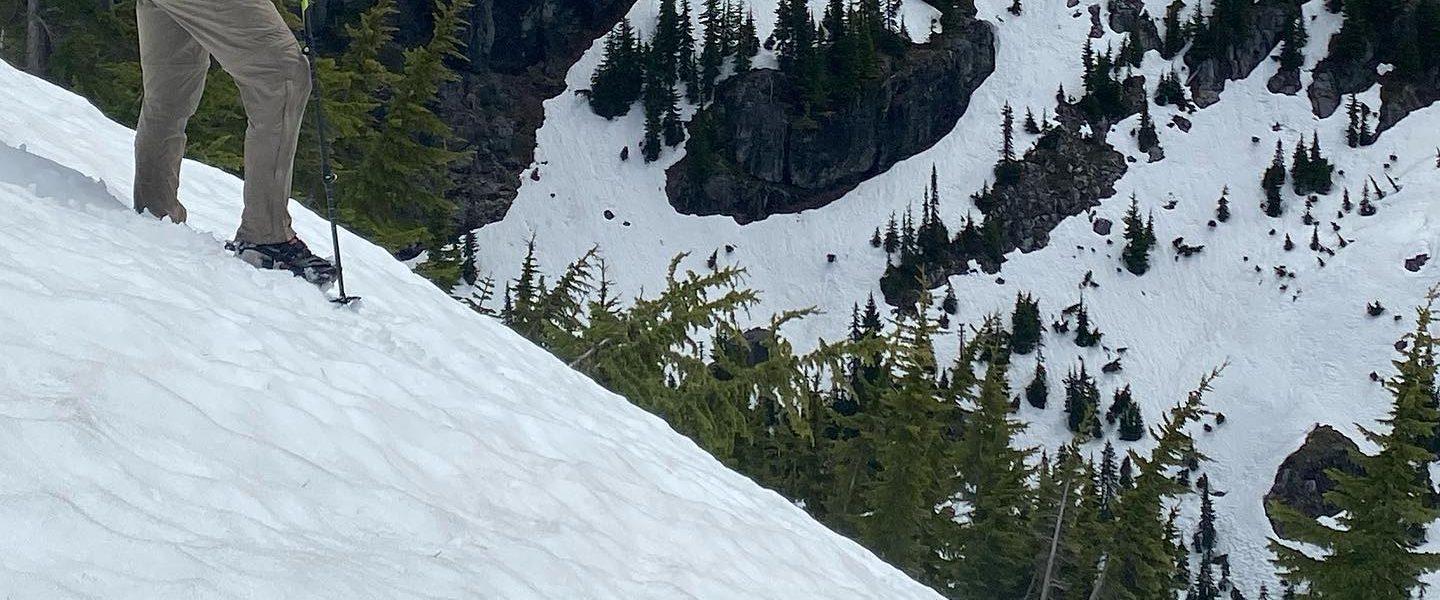
The larches were beginning to change but other than that, we had a view of the cloud.
Eventually we did reach Buckskin Lake. It was pretty and made a tempting place to stop. However, with the mileage a little uncertain, we decided to get down the hill at least as far as the Middle-Fork Pasayten River. This would carry us past daylight and from the steepness of the valley on the topo map, wasn’t clear to me that there would be campsites when we first neared the river. Oddly, when we neared the river, there was a 3-way intersection, not the left turn southward that our maps showed. With no sign, we made the decision to turn south, away from our destination, thinking that was a spur trail to the water. This turned out to be correct, except for the spur part. This was a connector trail to a well built bridge to access a parallel trail which runs down the valley on the east side of the river. We camped on our side but it was fascinating finding a well maintained, unmapped trail exactly where you might expect one.
The rain had stopped but we were cold and so made hot chocolate while setting up the tents after which we spent most of the rest of the evening hiding in them.
Sunday, September 20
Fortunately, it wasn’t raining when we woke up. Just as we were packing the tents, it started just a little. This is fall in the pacific northwest. Always a threat of rain, even when none is forecast.
The trail ran flat along the river valley for several miles, the river always out of sight. The trail was good, with cut logs and horse hooves showing recent trail maintenance.
We got turned around briefly after crossing Rock Creek by a switchback which was actually a spur trail to the horse ford. It was funny to reach a river, look upstream, and see the bridge we’d just crossed. We turned around and found a rock hop across the next stream with an exit path partially hidden behind bushes. This lead us up the bank to a collapsed cabin. I can’t run into something like this and wonder about the history. It’s old enough to have collapsed due to deterioration but has somehow survived all the fires which have claimed similar cabins in the area.
From here the trail seemed to have degraded significantly. Perhaps the trail maintainers had come down from the Rock Pass Trail then turned south along the West-Fork Pasayten Trail leaving this northbound section to the bushes and blowdowns? After vaulting over a fallen log every ten yards or so and pushing passed the low bushes encroaching on the trail, we suddenly came to another trail, broad and clear. Where did it come from? Maybe were were supposed to have crossed somewhere else?
This good trail brought us to a strange gate with three crossbars which you lifted out of their sockets and replaced after passing. It was a curious design, at approximately the junction with a mapped trail which appears to no longer exist. On the other side were a number of recent hoofprints. There didn’t seem to be land ownership boundary so we were curious about the gate.
The trail then lead us to an open field. This must be the Pasayten Airstrip which Scott Williamson had mentioned when I encountered him on my last sojourn in these parts. It was very exciting to unexpectedly find things I’d heard about. Then we saw horses. That explained the hoofprints. They were tied to a hitching posted. Then we spotted a cabin and heard voices.
Our maps showed two trails north of us which connected from our current valley to the PCT. I was worried that our intended one, labeled “Old Boundary Trail” wouldn’t be maintained because the other was labeled, “Boundary Trail” and so was presumably newer. I stopped by the cabin to see if they occupants had any beta. Inside, I met Ray who has been running a trail crew in the area and who we have to thank for the ease of our passage. There was a large map in the cabin so I went to show Ray our intended route. All the names on this map were different from ours. Then, I realized that the “Boundary Trail” on my map simply wasn’t shown on Ray’s map. “Anything we haven’t been maintaining will be pretty rough” said Ray. We believed him. Old Boundary Trail (aka Frosty Pass Trail) it would be.
The Frosty Pass Trail started as a turn-off so easy to miss it was cairned and quickly became hikerwash but otherwise was a well graded uphill full of yellowing and reddening ground cover. The slightly sinusoidal motion with which Jolly walks earned him the name “Shrub Shark” since his back was just about level with the bushes.
The Frosty Pass Trail crosses two passes. The first is a low one with a long, flat top which traps a thin body of water called Dead Lake. It’s unique in that it could have two outlet streams, though there appeared not to really be one at either end.
From there the trail wound its way down to the Chuchawanteen River at an old cabin site. It would have been exciting to see another cabin, but we couldn’t find it. The trail which would have connected down from the “Boundary Trail” (the one not on Ray’s map) had several blowdowns visible from the intersection and had a much darker and narrower trail bed implying less use. Many thanks Ray.
The trail to Frosty Pass itself contained a few points of interest.
From Frosty Pass, we descended to the PCT. This is a view PCT hikers don’t get to see since they’ve been under the trees for the several miles leading to the junction and so it was fun to see familiar terrain from a new angle.
A primary goal of the trip was to meet Emily’s friend from Instagram, Greg. He’s Canadian and came down to the PCT’s northern terminus to meet us. Emily was beside herself with delight: this was her first time revisiting a place pregnant with memories. Meeting Greg and sharing the moment with some thru-hikers who had just finished their trip made it all that much better. The mood was celebratory and a lot of champagne was consumed. Greg would later tell me that moments before we showed up, the thru-hiker couple got engaged (they didn’t mention this to us, but it’s been a while and I haven’t used their names so I’m assuming it’s OK to say).
We camped with Greg at the campsite just inside Canada, making Emily an international criminal. I’m already a repeat offender. Our tents were set in a tight triangle so we could see each other and talk from reclined comfort. Food offerings were made. Libations were drunk. Conversation was had. We spent a lot of time quizzing Greg on his career outdoors. It was a good night.
Monday, September 21
Wake-up was 6am, a little before sunrise. Greg accompanied us for the first hundred yards south of the border to experiment with international criminality. He didn’t have the stomach to accompany us the 7-8 miles to breakfast at the top of the first climb. On the way, we recreated pictures from the end of Emily’s 2016 PCT hike which she’d since lost.
This is my second time hiking this section this year. The big difference was the colors. At the end of summer they were bright. The greens were varied, subtle, luscious, and brilliant. They made you ache with life. In the early fall, the colors were more subdued but august. The overcast skies, ominous but grand and added an intensity to the whole experience.
After a long day of hiking, golden hour softened into twilight as we walked the final miles. The sun lit a fire behind the cascades to the east. The cascades to the south and west turned purple and other-worldly. The moon rose. The PCT just north of Harts Pass is always beautiful if not socked in but this was the most enchanting I’d ever seen it.
The moment, however, which may have most captured the experience was about a mile from the end. I looked back and saw Emily looking up toward toward the moon, still low in the southern sky. Her head was forward to balance the weight of her pack and so instead of tilting her head back, her eyes were wide and upturned like a child’s. The expression captures not just the wonder of the moment but also Greg’s enthusiasm for a life lived outdoors and the ebullience of the couple at the terminus. Hiking alone, you can experience all of this by yourself. To experience it collectively is a mild form of ecstasy.
