Today was mostly a getting off trail to resupply. Along the way, I encountered Germans and Bryce Canyon. One was great the other was a let down.
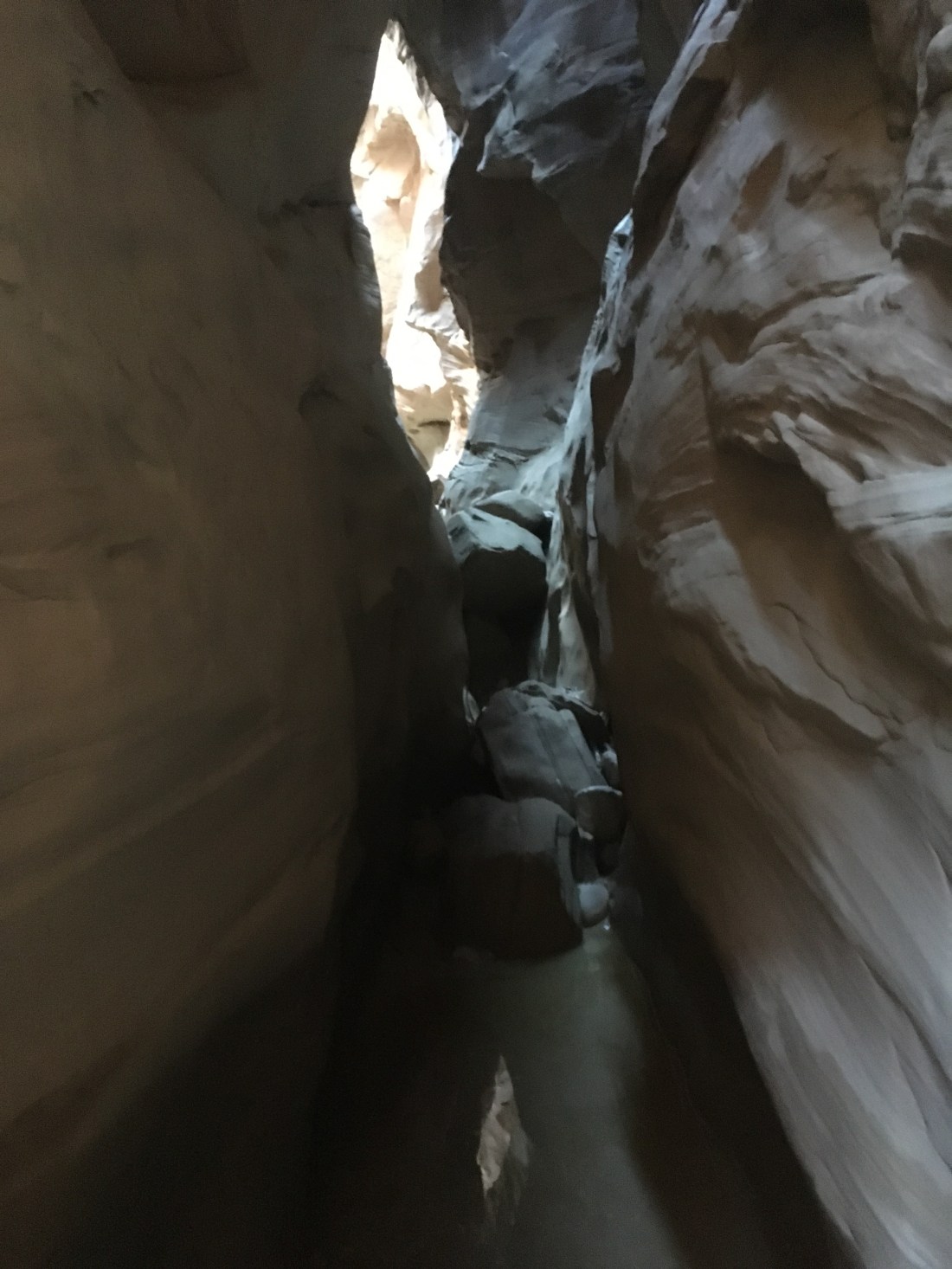
I woke up in Sheep Canyon and was quickly in the slot canyon up Willis Creek. This time there weren’t pools of water to avoid and the floor was level so I could pretty much just enjoy.
Okay, there was a pool of water but it was pretty and there was a bypass route.
As the slot canyon was winding down, I saw two people ahead, one taking a picture, so I stepped behind a turn, waited a second, then continued past. “Thank you” the photographer said in the most quintessential German accent. This made me so happy. Every German I met two years ago on my last through hike was a fantastic hiking companion: polite, good natured, and as tough as nails. Also, all the Germans I’ve met in normal life have been good people. I spent most of the road walk to the Grand View Trail contemplating Germans.
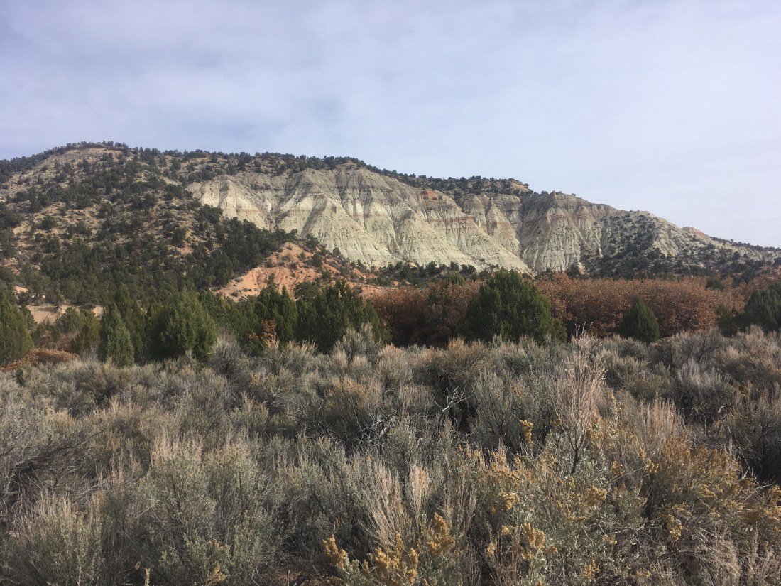
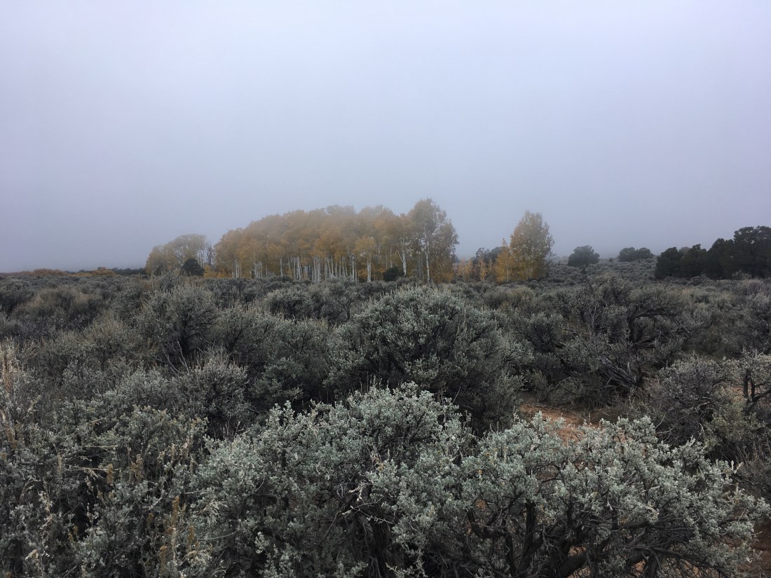
The iconic walls of Bryce Canyon had appeared in the distance and were drawing close, though always distant or partially hidden by the developing pine forest.
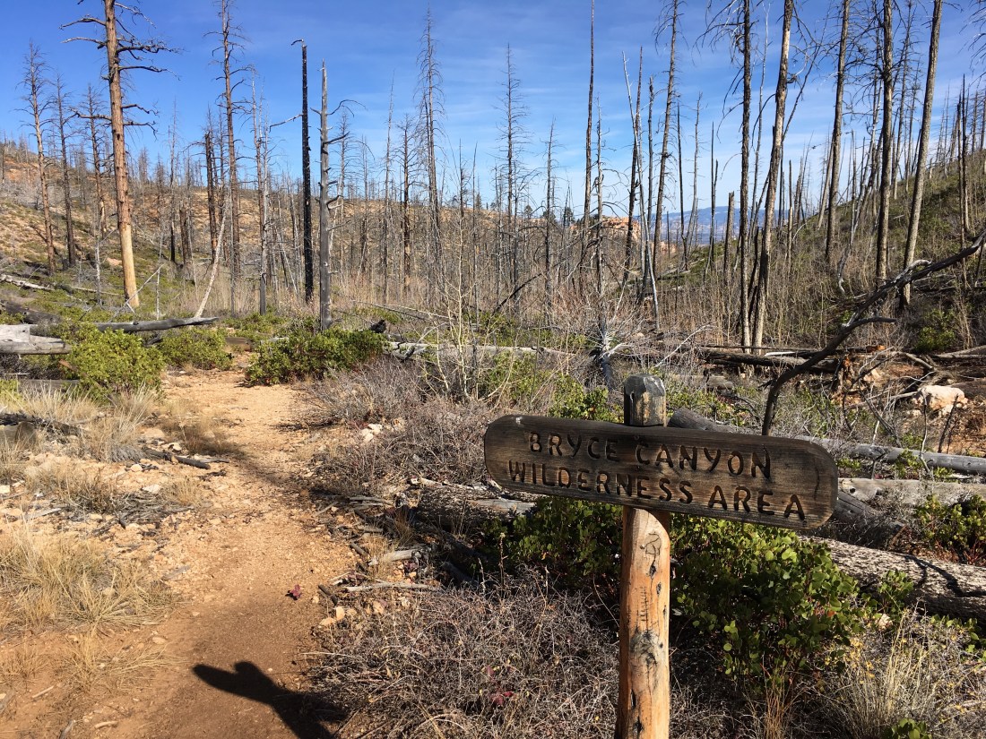
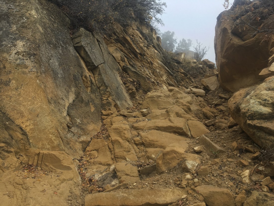
The Grand View Trail has devolved from a clear double track to a faint, though well signed, use trail when it hit the clean, taught fence of Bryce Canyon National Park. I had turned off the Hayduke route to head north on the Under the Rim Trail so I could resupply in Bryce Canyon City. There was a gate in the fence so I walked over to it and found the Under the Rim Trail. The gate looked almost new which is very unusual in the backcountry.
The trees in the area were mostly burned and there was a moderate amount of deadfall across the trail. The marks of old trail maintenance were there but nothing recent.
This was all explained when I got to a campsite where I was to turn up a connector trail to get to the road. In my defense, I had to turn around to read this and there hadn’t been any signage on the way in.
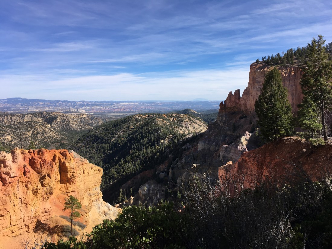
I did finally get a good shot of Bryce Canyon, though.
Walking the scenic drive towards north was not particularly scenic other than at the designated overlooks.
I was a little over half way to the visitor center when a car stopped and asked if I’d like a ride (hitching is illegal in national parks otherwise I’d have had my thumb out). My benefactors were a German mother-daughter pair who were touring a bunch of the local sights. Aren’t Germans wonderful? (disclosure: I’m not any part German).
They dropped me at a lodge where the registrar where the person working the front desk circled the laundry facilities while detailing the complex. Yes, my clothes are dirty.
I had stopped last night with about two miles of Hackberry Canyon remaining even though I could normally have made it out in time just in case things got slow. They turned out to be fine. Cottonwood Creek would have made a great campsite with it’s large areas of flat, white sand and leafy cottonwood trees to prevent condensation.
I took a road which paralleled Cottonwood Creek because I wanted something simple to walk on. The road runs through private property which is apparently for sale
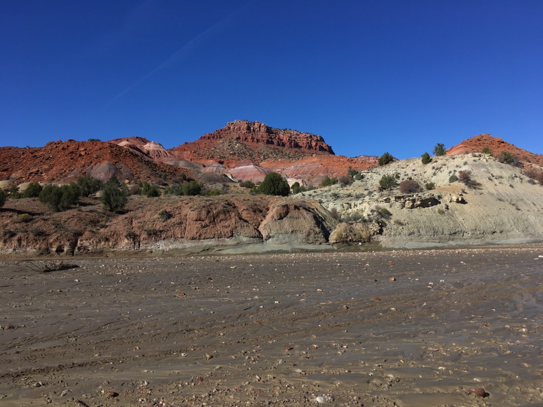
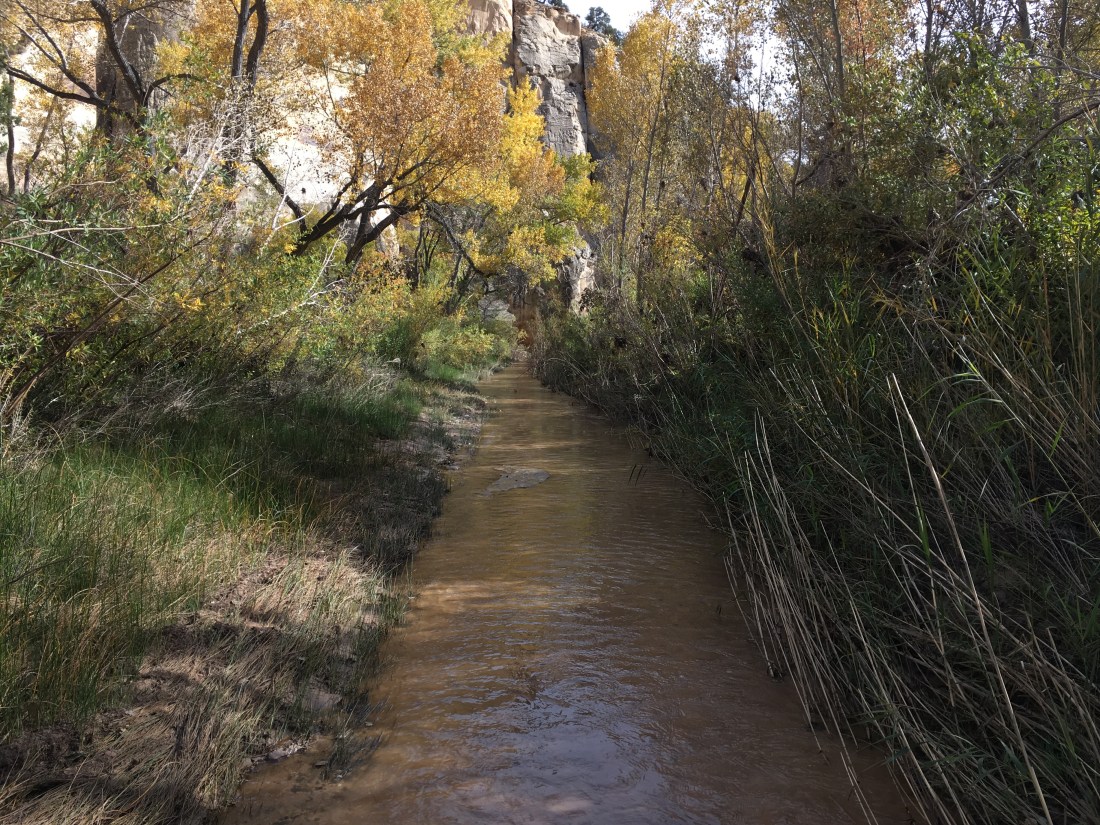
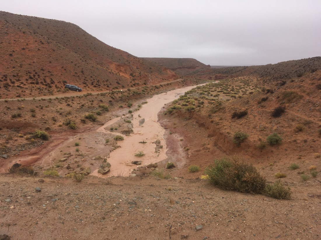
After reaching the Paria River, most of the day was spent hiking up it.
The rock in places looked as red as a tomato and there were slopes with many colored bands.
The river was shallow but with water constantly present I didn’t carry any besides what happened to not be drunk after last dipping my bottle in the stream. The rhythm of walking became familiar: try to find the most stable looking surface to walk on. Sometimes that’s in the river where it’s washed away the silt and had exposed rocks. Sometimes it’s on the banks. Sometime you try to shortcut a turn. Sometimes that shortcut turns into more of a bushwhack that was bargained for.
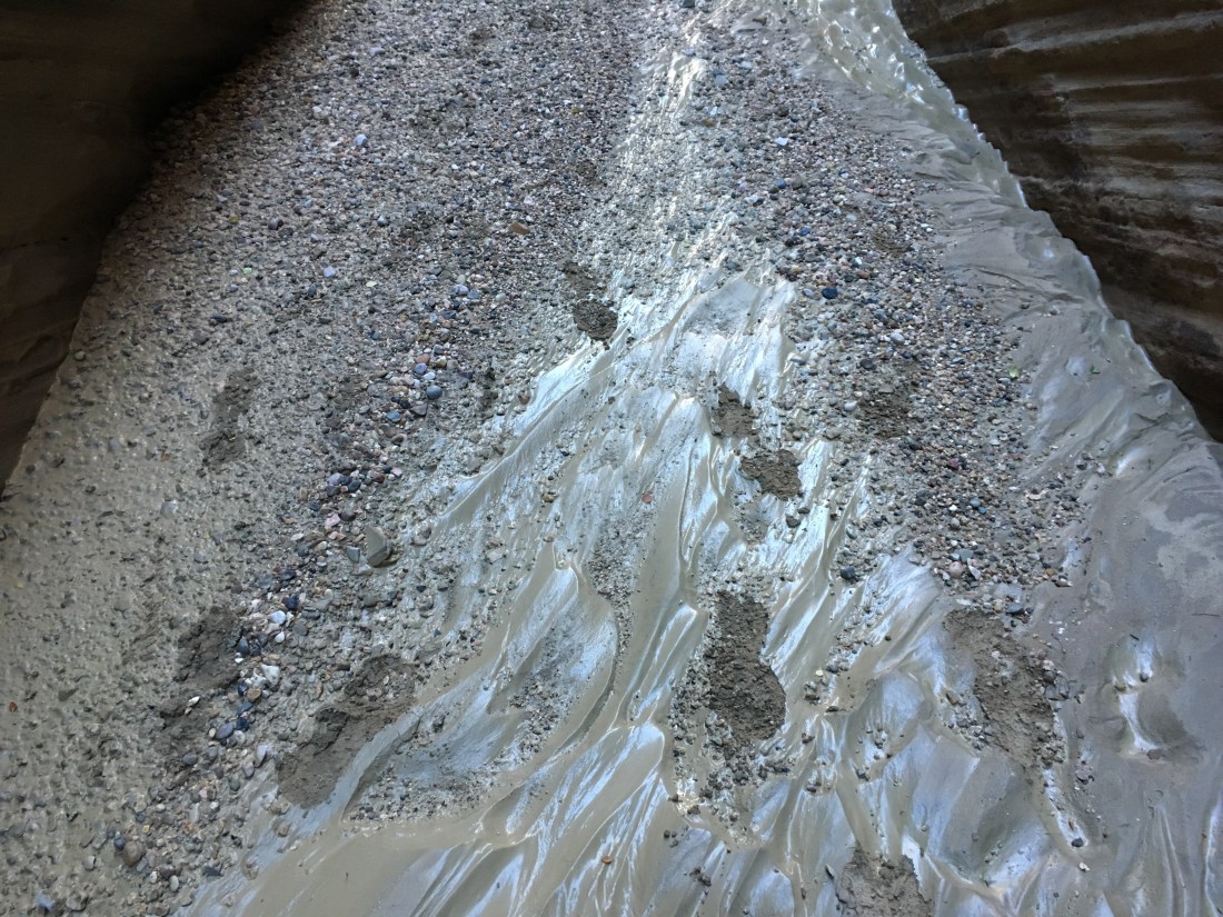
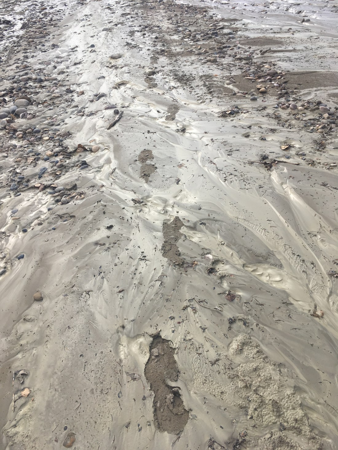
Towards late afternoon I made the turn up Sheep Creek. The stream lessened significantly and I thought I’d been keeping an eye on whether it was still running or not when I realized that the creek bed was dry. I had about half a liter of water and the next water source was supposed to be a little under 5 miles. Not a good situation but not an emergency. I wasn’t going to make it before sundown but if you cover more ground, you’re more likely to find water. Of course I could have gone back a bit but I hate doing that. There was moisture everywhere: thin mud, damp sand, and dark dirt. Standing water was nowhere.
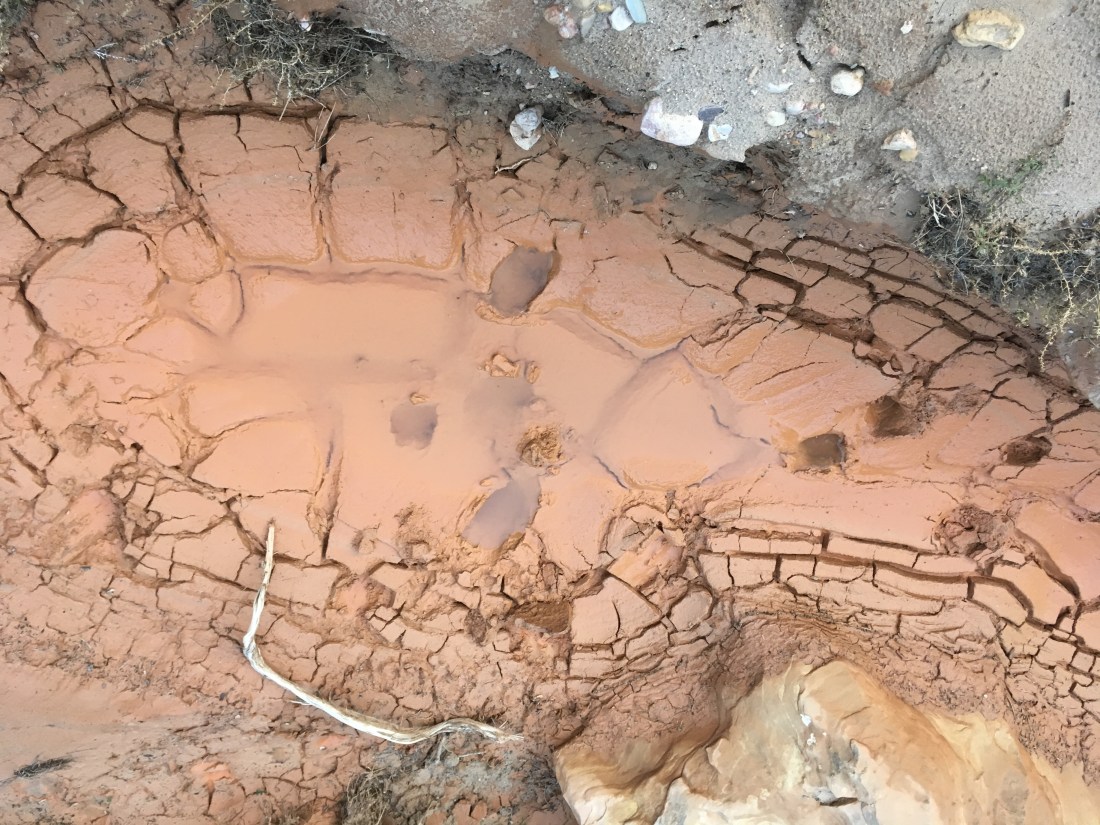
About 10 minutes before sundown I found a clay lined puddle in a deep depression. It had hoof prints and looked disgusting. The sides looked soggy and I was worried about stirring it up just by stepping too close. It turned out to be cleanser than the Paria had been and re edges solid. What a wonderful surprise to end the day on.
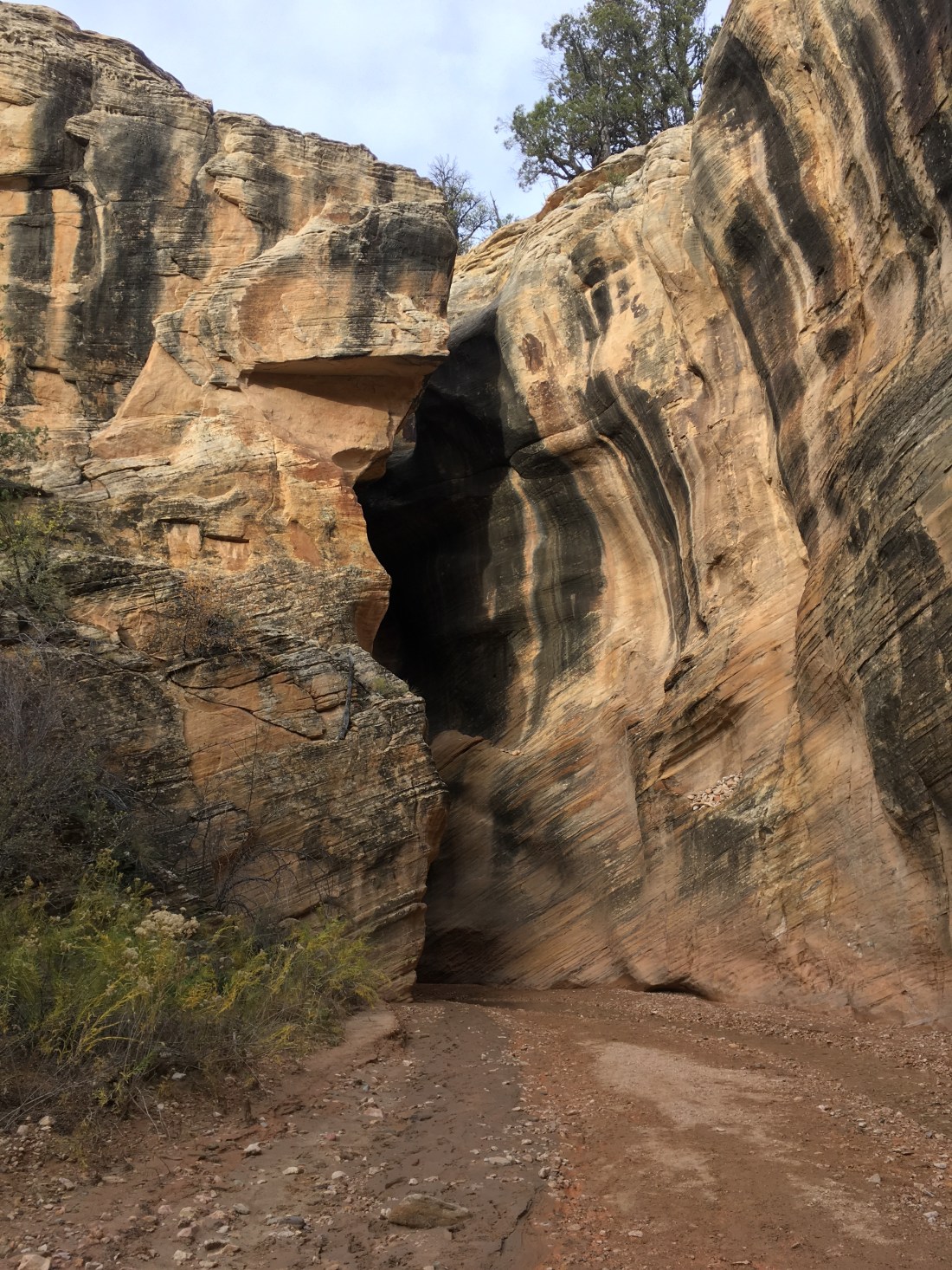
Mom and Dad walked with me as far as the turn off to the slot canyon which starts Section 8. It was just as well because things went from tame to insane pretty quickly.
To start. I saw two sets of footprints around the start of the slot canyon. There was a thin layer of clay mud in the slot canyon and only on footprint inside which makes me think I’m the first person to navigate it since the rain. The trail register listed Day hikers yesterday and a Hayduker named Sampson Superhip whose tracks I’ve been following since Hite.
Others have written about this slot canyon so I’ll keep to my particular travails. However, the entrance which gets attention in the guidebook, Skurka’s notes, and both of the blogs I used as my primary sources for researching this trip, wasn’t that tricky: drop the pack down and slide down after it. I reap the dividends of not learning how to properly climb slots properly in a few moments.
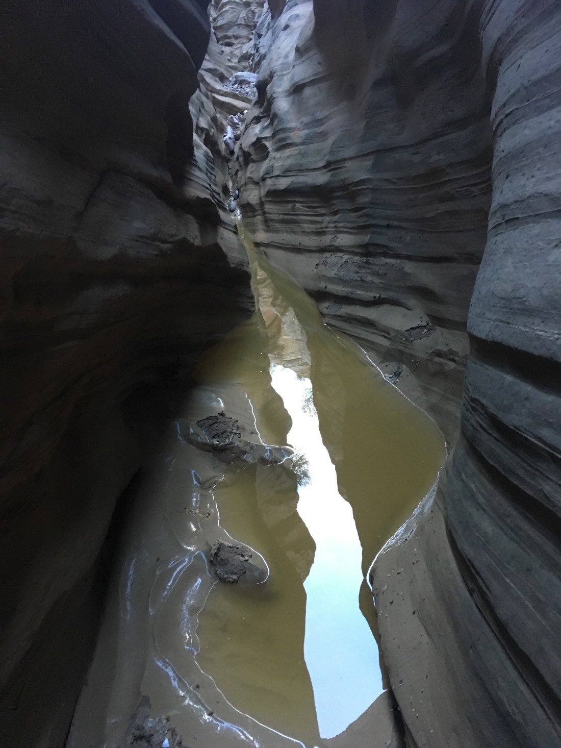
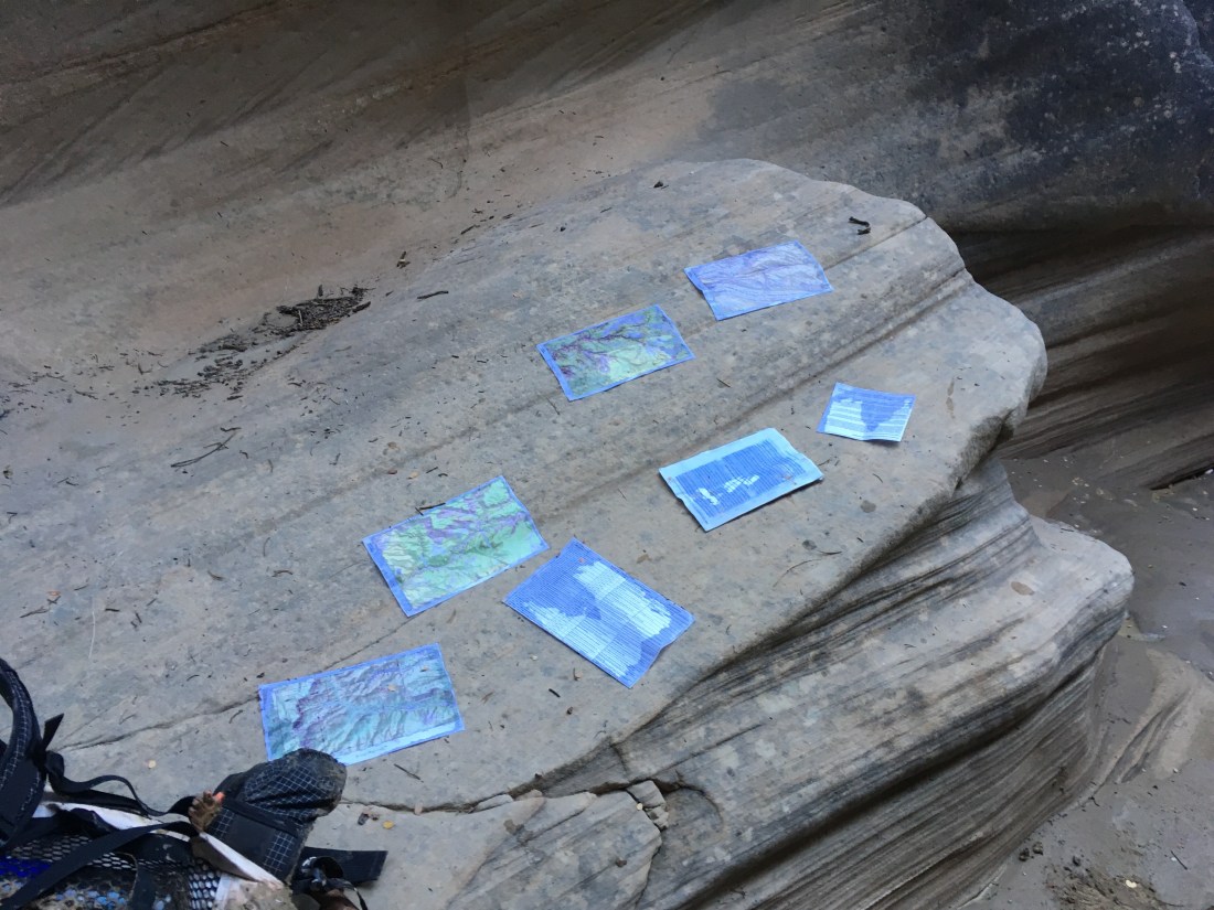
Since I’d just gotten new shoes and socks in my resupply, I’d been hoping to keep them dry for as long as possible. Unfortunately the slot canyon has many pools of water. I couldn’t put my back on one wall and my feet on the other because of my backpack and so at my most acrobatic, wound up almost horizontal with my right shoulder on a sloped part of one wall while my feet walked along the other. Unfortunately this meant this lead to my water bottle and maps fell into the pool. The water bottle stuck cap down in the clay. The ziplock for the maps trapped water inside it. After that I gave up and gave in to the inevitable and sunk my fresh shoes into the mud.
The second notable almost-misadventures was at the second place I had to take my pack off to get down something. While not particularly far down this descent was clearly going to involve a slide or fall into a murky pool of indeterminate depth. A haul line would have just let my pack into the water. I considered hurling it (as I had my poles) but that seemed a little too brutal, even for someone who regularly drops their pack instead of using a haul line. So I started the climb down to the position where I would slide into the water, but I faced backwards so that I could wedge the pack far enough down the crack that I could probably reach up and grab one of the hip belt straps I let dangle after my descent. As I was positioning the pack with one hand, the grip I had on a rock under the ledge started slipping. I only had one foot wedged in the crack and it was on the same side of my center of gravity and so a fall would be head-first backwards into water, maybe after bouncing off a rock wall. The ledge was sloped and I could find no other hold or angle to brace or wedge anything for more support so I yanked my backpack into the crack and kicked my feet out to make the best controlled slide that I could. The water was less than knee deep which was a great relief. There was a foothold under the ledge from which I could grab one strap on my backpack. Since it was already wedged, the pulling compressed the bag a great deal. Some of the mesh on the pockets abraded away and if the holes get much larger, I won’t be able to carry water bottles in the side pockets.
This is looking back at the ledge. I’m not sure what’s wrong because it looks like you can just climb down. I’m convinced it looked different from the top.
Once past the interesting obstacles, I picked up footprints again near a widening in the slot near a branch which I could imagine provides an alternate entry. However one of the three sets of footprints was heading back; the other two were outbound. What great peril lay ahead that only one had returned?
None, as it turned out. Hackberry Canyon was the definition of pleasant. Level floored and sun lit, there was something about it which made me think of Dinotopia. After an hour of hiking I found a turn in the canyon which created some shade and set up my gear to dry while I ate lunch. I also discovered that my hat had disappeared out of the rear mesh pocket. I thought I’d seen it after exiting the slot canyon but with the sun lower hadn’t bothered to put it on. Time for the bandana and sunglasses.
After lunch, I’d planned on getting water from a spring mentioned in the guidebook and Skurka’s notes. Shortly after the spring’s expected location, the wash bottom began to get soggy and small pools appeared. Worried these might go away further down, I put some effort into gathering enough for the next 15 miles from the shallow puddles which became turbid if disturbed. After filling my bottles I kept walking and discovered that the pools became a stream.
The stream continued down Hackberry Canyon for the rest of the day. It was usually 1-3 inches deep but I once hit quicksand and was up to my knees on both feet in an instant. I ploughed forward, trying to walk as though on my knees for several steps before getting out.
Hackberry Canyon widened for a while and it was fun bushwhacking overland to shortcut long turns of the creek. I was surprised how often I found footprints after committing to a particular line through the brush or crossing point of the creek. There’s a strange sense of camaraderie in thinking that complete strangers in different circumstances independently made the same chooses you did, sometimes down to the specific footing chosen.
About 40 minutes before sunset the Canyon narrowed. It’s about two miles to get out and it would have put a nice finish on the day. At my normal pace for flat ground this would have been an easy choice. However, narrow canyons tend to get choked with boulders, requiring careful footing and sometimes a little pathfinding. Not something I want to get caught doing after dark so I quit while campsites were still easy to find. Probably for the best but feels a little disappointing nonetheless.
Today’s miles were mostly road walking to the end of the section where my parents were going to meet me.
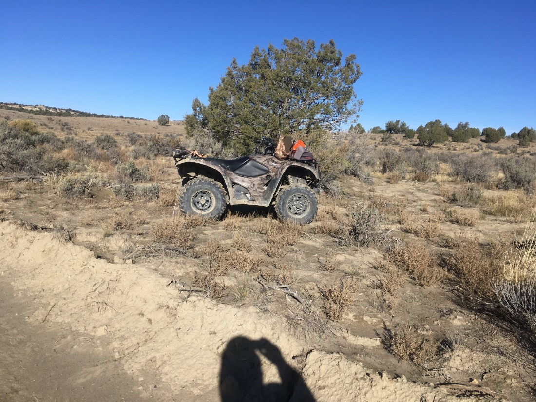
There were many ATVs, trucks, and even campers in pull-offs. I think hunting season is in full swing. A quartet of ATVs hummed by like a small caravan. One stopped to ask if I was “having fun” which seemed like a pleasant way to ask if I was ok. I said yes, pointed to his rifle and said he looked like was off to have some fun. He grimaced and asked if I’d seen any deer. Apparently things aren’t going so well.
There were some rock layers jutting out in an interesting way.
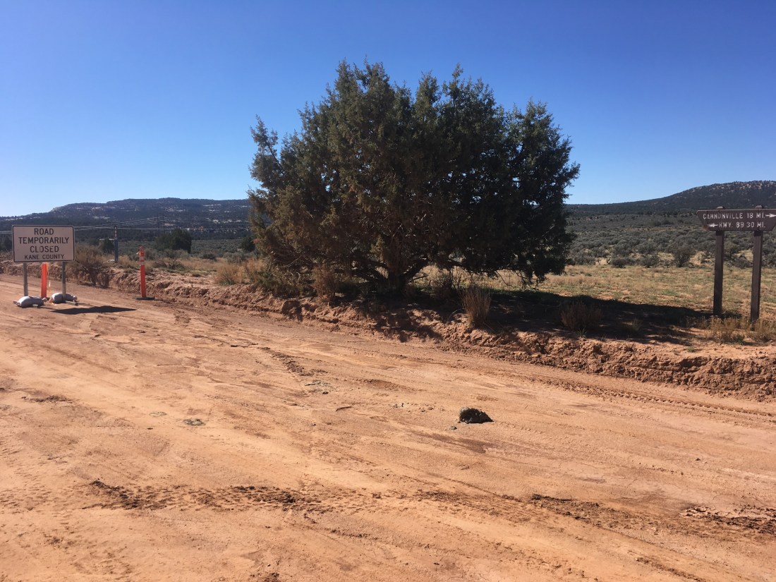
This is my new favorite road sign. Think about what must have had to happen and how many times for it to get made.
At the road which apparently does lead to highway 89, apparently things aren’t much better. For some reason, I find this hilarious. Hope there’s nothing important on Highway 89.
Shortly before Grosvenor Arch is this pond which reflected the sandstone nicely.
Grosvenor Arch.
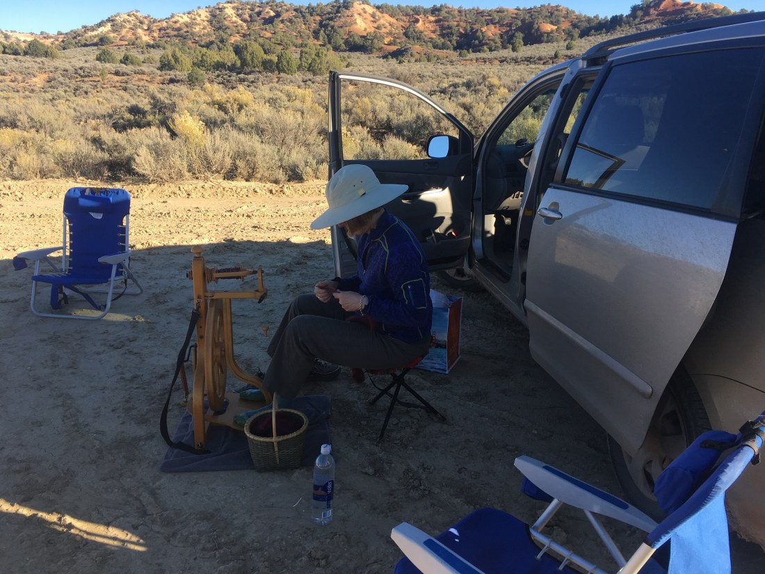
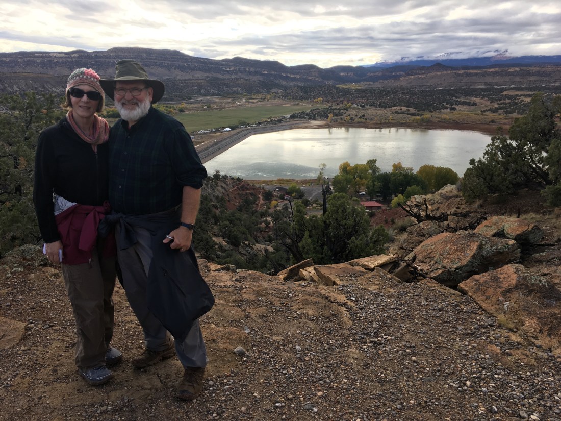
I got to the end of the section where my parents were. Mom had tried to hike out and meet me but had started down the road which starts the next section so I got a head start on tomorrow as Dad slid the minivan over the slightly muddy road to get her.
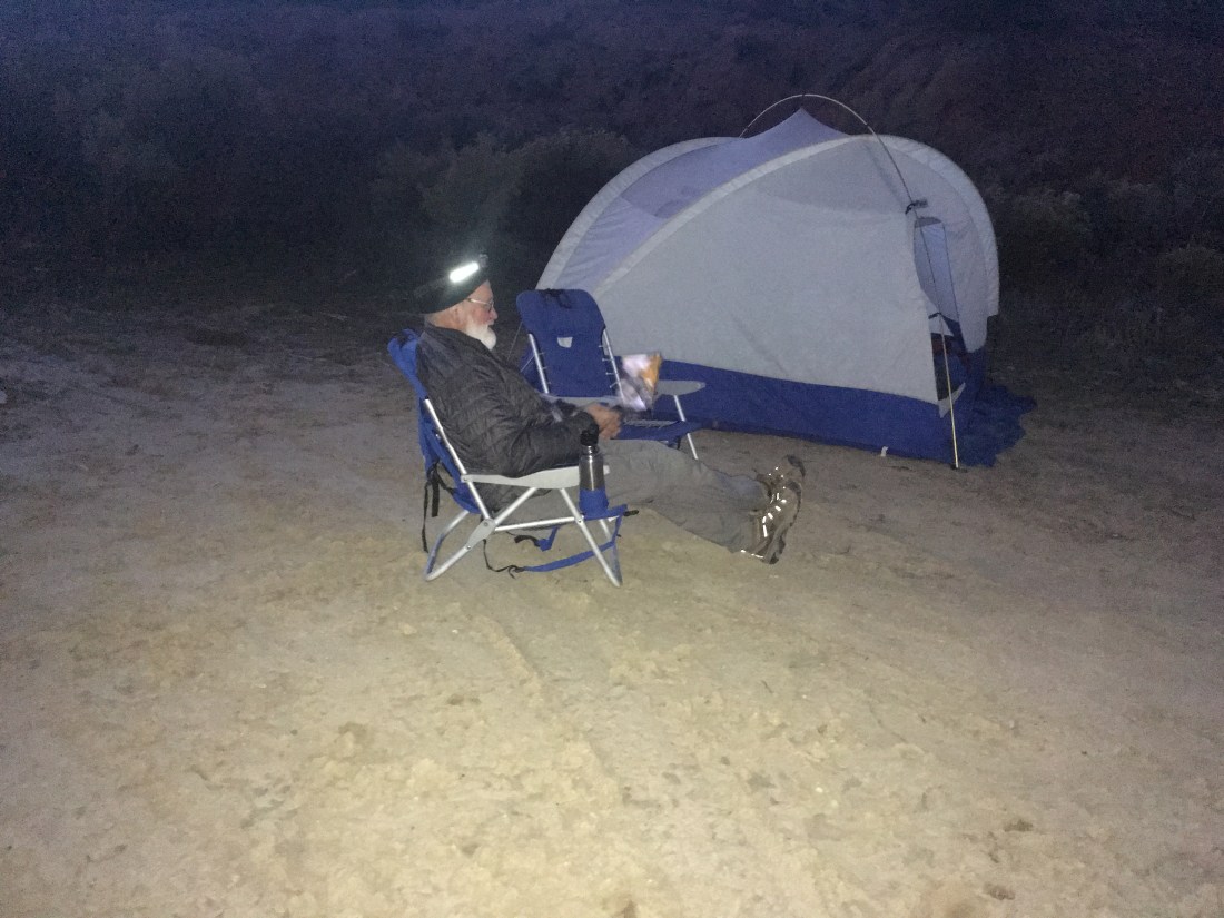
The Cannonville PO had given Dad my resupply box since I’d written a note authorizing him to pick it up so there was no reason to go into town. My parents got their car camping on. Mom had her spinning, Dad a folding table to put under the stove and pulled out his laptop after dinner. Copious quantities of fresh fruit were consumed. It felt so good to sit in a chair.
Today was really pleasant. There were zero obstacles all day. I just walked up Last Chance Creek and Paradise Canyon letting my mind wander and wonder, checking the GPS every once in a while.
I had been dreading doing this with map and compass because I feel the need to track every turn and side canyon. My mind has to be on and engaged constantly. GPS made today feel like a vacation.
The mud made a set of footprints very visible. It’s like having an invisible hiking partner.
The only notable event was that I had human contact after about 50hrs of solitude. I was eating lunch and drying gear (mostly condensation on the tent) where a dirt road crosses Last Chance Creek. A trio of motorcyclists came by and one checked on me as he passed.
Other than that the only thing with mentioning besides some joke about having been to Paradise is that my water treatment drops ran out. There are two dropper bottles with different chemicals which you combine before adding to water. Only one dropper bottle ran out and on closer inspection it appears to have a defect which created larger drops. Good thing I’ve got a filter. Back home where I rarely treat or filter because there’s such a short distance between you and snowmelt. Not so here where the cows roam everywhere.
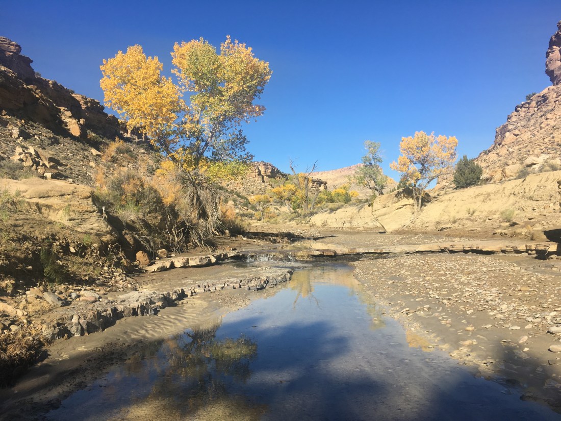
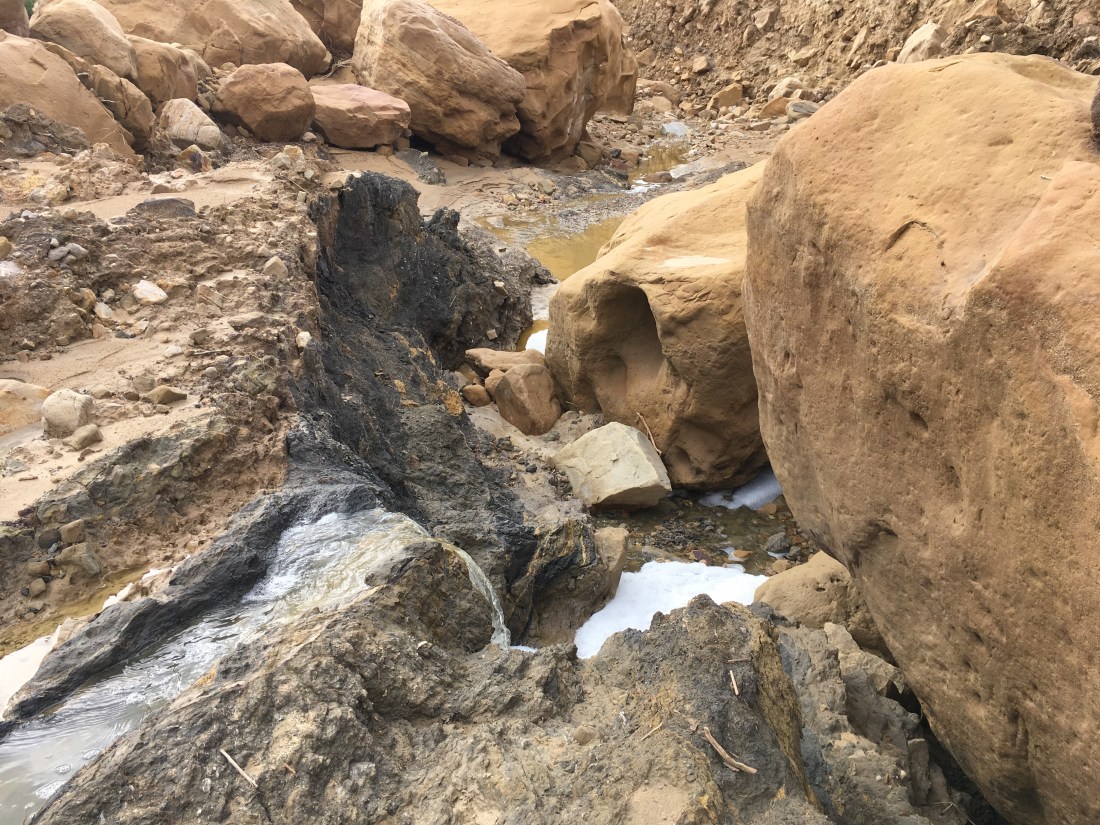
At the confluence with Roger’a Canyon, there was a stream. This started today’s theme of beautiful was water can pour over rock. Pictures never really captured it though.
Boulders, which had slowed yesterday’s progress significantly, eventually disappeared and walking became easy on the wide, level stream bed. I had a small pain in my left knee after a particularly large jump down but that subsided by the end of the day.
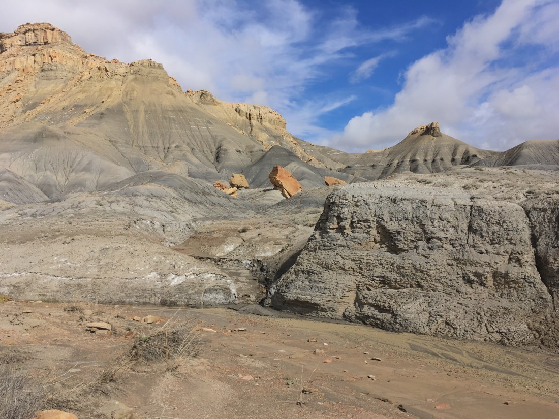
Navajo Canyon was barren with dark and light sand, mud, and stones. This was a stark contrast to Roger’s Canyon where there and been trees, grasses, and sometimes even real dirt instead of fine sand.
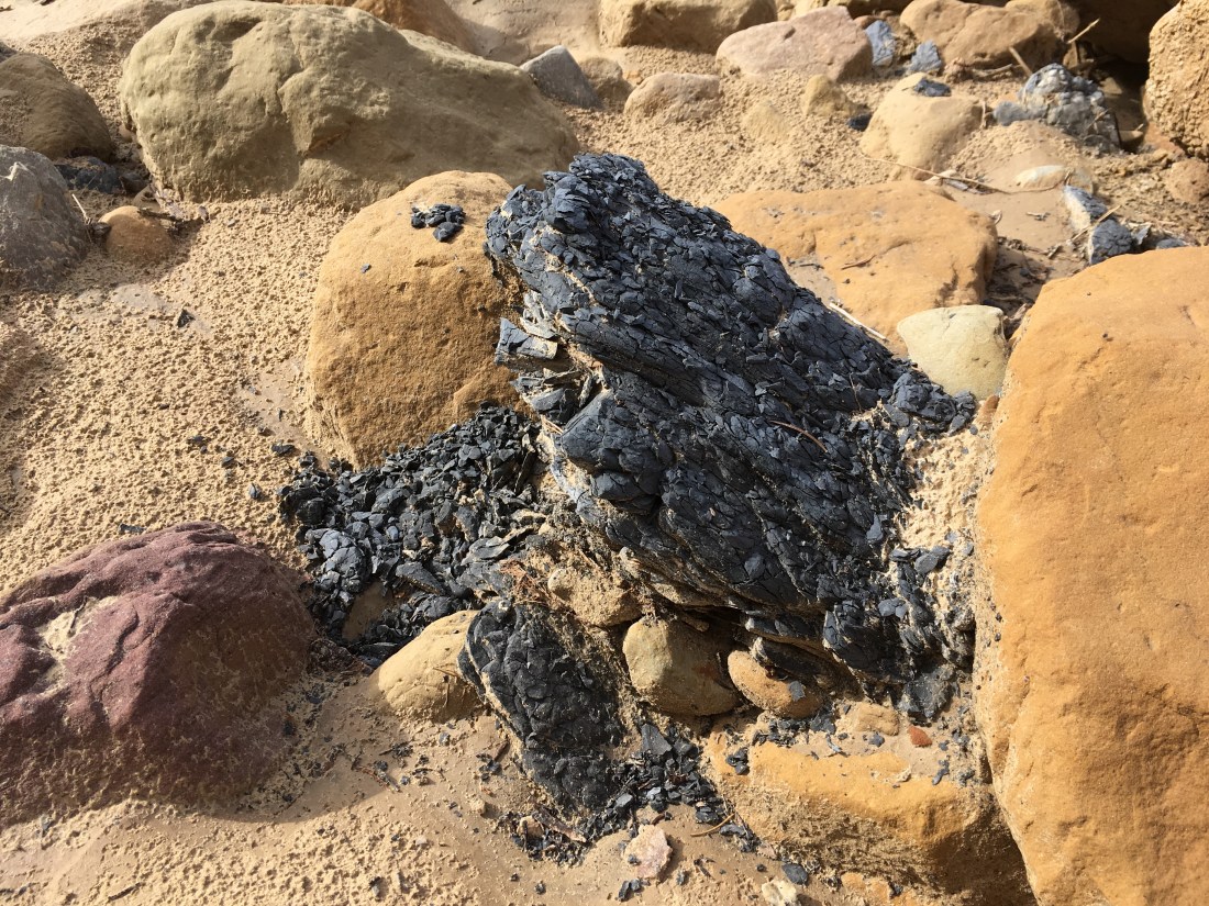
One of the unique features seems to be this rock which is usually bluish and appears to be flaking off the way a charred log flakes off as it burns. This is a small piece but there are layers of the stuff in the canyon walls.
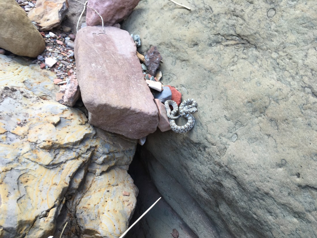
As I moved up Navajo Canyon, there were a few small blockages caused by seemingly out of place boulders.
While bypassing one, I almost stepped up onto this little snake which rattled at me. It’s positioned so precariously, as though it has just jumped up or was about to jump down, that it made me think that it was trying to bypass the boulder as well.
Eventually the stark barrenness changed to the more common yellow sandstone with attendant small trees and shrubs. The turn-off of Surprise Valley was marked by an easy to miss cairn so I was happy to have GPS.
Reese Canyon seemed like yet another world. The going was easy, on a dry, hard streamed. The rock was red with lots of green cover.
Eventually the rock itself became green. It felt kind of like walking through an aquarium.
I camped by the confluence of Reese Canyon and Last Chance Creek. There was an old trailer and corral nearby. With Reese Canyon’s bed a better road than some ATV tracks I’m not surprised that someone ran cattle down here.
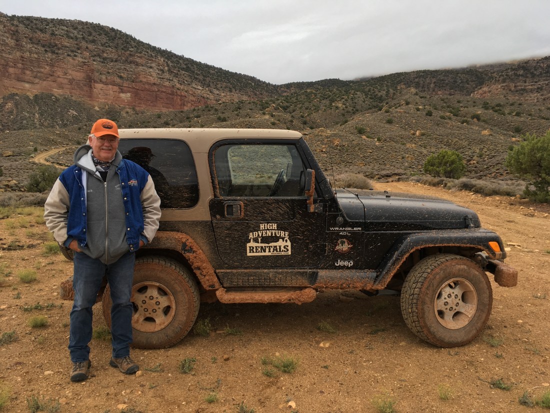
Today started at normal hiking hours despite being in town. By 7:15am we were packed up and at a coffee shop. My folks dropped me at at a tour company where I’d reserved a ride down Hole-In-The-Rock road back to the Hayduke. I’d made a reservation online but it was only in person that they told me there was a two person minimum. There was some confuse with the software, in part because I was only going one way, so we’ll see what I wind up being charged.
I had a great time chatting with Mark, the driver, as we fish-tailed and slid along the road. He even drove me a bit past the official drop-off point. Free miles!
Then it was up, up, up, into the mist shrouding the 50 Mile Cliffs. It was one of those quintessential Hayduke moments where the place you’re definitely going doesn’t look passable at all.
Just before the cliffs, I ran across what looks like an old water cache.
The climb through the upper cliff band was on a trail which I appreciated a great deal as I couldn’t have found my own route in the fog.
The kinda cross country portion at the top of the cliffs was also cloud enshrouded. I’ve given up the map-and-compass-only game and having “hiking avionics” made life much easier as there wasn’t really a trail.
I loaded up water at the not at all muddy Mudhole Spring which had a cabin nearby.
Around mid-afternoon I’d made my way into Monday Canyon. The going was pretty rough but the colors were pretty even if they made the going slow.
In several places I slid down sandstone slides.
For some reason the canyon walls made me think of the monkey’s palace in The Jungle Book.
I mistook a side canyon for Roger’s Canyon and thought I’d been making great time. Checking the GPS, as I have to do when I’m not “staying found” with map and compass was a let down.
A real tent had higher requirements for a campsite than a tarp and the canyon was rough and uneven as light began to fade. After a steep bypass of some pour-offs on loose dirt, I suddenly came across a spot just large enough and relatively flat after clearing out the sticks and small plants. While tents seem demanding, they sure are nice once set up. This is a small two person tent and it feels palatial after my one person tarp.
This is my first zero day after about two weeks of hiking and a few particularly hard days recently. I spent as much time as possible in the motel bed napping, consuming digital media, eating trail food, and getting the crumbs on the blankets.
Memories from October 20, 2018.
I checked out of the motel and loitered around Hanksville waiting for my parents. I listen to Man’s Search For Meaning and then chat with the fellow running the restaurant whose porch I’ve been sitting on for 5 or more hours.
The parental units arrive and we drive to a campsite near Escalante, stopping to eat at a restaurant with a view so good I wonder why I’m hiking the Hayduke.
Memories from October 21, 2018.
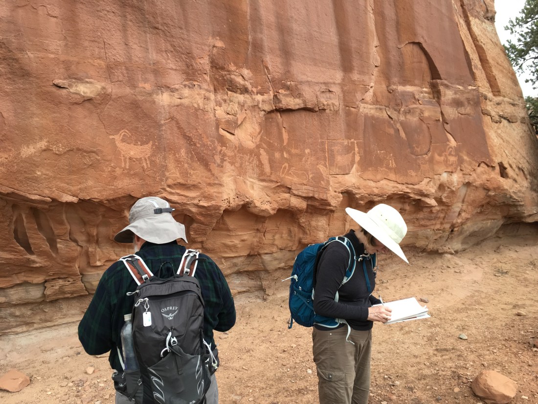
I spent the day doing little hikes with my parents until it rained in the afternoon. They got to experience slickrock, ambiguous trails because footprints never wash out and so you can’t tell the main trail from the side ones, and incorrect directions because pour-offs aren’t the end of washes. They did get to see petroglyphs. We had dinner at the Hell’s Backbone Grill and it was one of the best meals I’ve probably ever eaten – and that was before digging into the meatloaf.
Memories from October 22, 2018.
Forecast thunderstorms made me decide not to get back on trail today. I got my resupply boxes. One had food and the other had cold weather gear because based on historical averages I’d been expecting things to start getting cold soon. It looks like I won’t need it in the near future and the freestanding tent, zero degree sleeping bag, and extra layers significantly increase my base weight.
In the evening after the storms cleared, we went on a short hike in Petrified Forest State Park. There was definitely a closed sign at the start of the trail but mom said, “what about this way?” and pointed to an alternate start of the trail five yards away which immediately joined the trail behind the sign which said closed. The parents got to experience hiking in the mud but the view from the top of the cliffs above camp was picturesque.
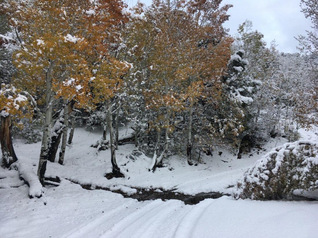
I woke up some time last night to find that the side of my quilt had slid to the edge of my shelter and was getting some water on it. Closer examination showed that snow had bowed the tarp in. That’s what I get for taking my good weather shelter into the rainy, snowy, sleeting desert.
At daylight, I broke camp packing things up without much care as everything was a little damp and headed for the road back to Hanksville in the snow and rain. I unapologetically used the GPS as I just wanted to get back to town. I’d gotten lost in this section on the way out and I wasn’t feeling like extending the hike back.
It took less than an hour to get a hitch but it was something of a cold and miserable hour. Several jeeps pulled in to Poison Spring Wash and an outbound hiker actually got dropped off.
Looking cold and wet apparently increases your pathos among the we-just-want-to-make-sure-you’re-ok-but-don’t-have-any-seats crowd but not the luxury sedan crowd. A local woman and her son gave me eventually picked me up. I haven’t hitched enough to know for sure but is seems like locals are the most generous when giving rides. They also mentioned that they’d gotten as much rain in the last (two?) weeks as in the last two years as there’s been a drought.
I crashed at a restaurant to warm up and dry out. I must have looked the part as another patron asked what had happened as I was walking to the bathroom to clean up. “I was setting out for a 120 miles section of this hike I’m doing and 35 miles in discovered that I’d lost the satellite communicate which keeps my parents from calling search and rescue. After hiking back seven hours in to find it, I was left I only had four days of food for the five days it would take to try and finish so had to bail out” became a pretty well rehearsed story.
I’d spent the morning’s muddy slog figuring out what the criteria would be to quit this trip. There were lots of justifications and rationalizations but eventually it came down to weather. I came out here to have an experience of walking all day in bright, clear weather, cool by day and cold by night with a sprinkle of rain here and a dusting of snow there. That my most valued piece of gear has been neoprene socks and that my greatest difficulty has been moisture management say that this trip has not met expectations. There have been some incredible experiences but I’ve been saving vacation for two years to make this trip happen which means there’s a lot to lose if I’m ultimately unhappy.
Around 2pm the sun first started lightening a section of the otherwise unyielding grey overhead. By 4pm the clouds were beginning to break up. I checked into a motel and started laundry. The hiker who had been dropped off outbound while I was hitching in showed up while I was sitting outside the laundromat in my rain clothes (so everything else can be washed) trying to dry my shoes in the sun. He’d come back in because of the mud was aggravating a foot injury. We hit it off talking trail. He’s hiked the triple crown and has met some interesting personalities.
The forecast shows several days of rain but mostly sun. My mood had changed. Cuts and scrapes which had never scabbed properly on account of the moisture final started forming protective shells. My folks had been planning on visiting at the end of the next section (another reason to rescue the all important satellite communicator) and we rearranged plans. While I could possibly be back on trail the day after tomorrow the logistics are tricky, brittle, and potentially expensive. To stay on schedule I need to skip from Hanksville to Escalante which isn’t an easy connection to make without a car. Better to take a few days off, see my parents, rest and try again in a few days.
It rained a long time last night and was still raining this morning. I was going to get to the nearest road 10 trail miles away but guessing from the map, it looks like a rarely used 4×4 road and a hitch would be unlikely. That means the better thing is to go back the way I came. I remembered where I last used the inReach and it was 7hrs of hiking from where I camped. So back I went.
This is where the rain comes in. The ascent onto Tarantula Mesa is steep and muddy at the start. It had been dry, soft, loose dirt the day before and I was initially concerned that it might not be passable. I accidentally ascended in the wrong cove and that was not passable due to cliffs but that’s a different issue. Taken one step at a time and with GPS to help my failing memory, things worked out. Plants make good footholds in the mud. Everything else might move under you. Two sandstone handholds exploded during the course of ascending between cliff bands. Very adventurous.
The walk back from Tarantula Mesa to Pilot Spring where I’d left my inReach was long, rainy, muddy, and eventually snowy. When I found the inReach on an exposed rock down trail from where I’d sheltered to eat lunch yesterday (down trail so I couldn’t miss it on my way out – has always worked before), it was showing yesterday’s forecast for today: warmish and sunny.
At this point, if I’d tried to continue the section, I’d have about 100 miles and 4 days of food. Fine for most of the PCT. Not good for the Hayduke. Plus, the road had degraded significantly from the rain and sleet while I walked and I wasn’t sure I really wanted to try descending Tarantula Mesa in conditions much worse than I ascended this morning.
So I hauled myself back up to Copper Ridge and made it down to the reservoir my the mine just as it got dark. After a very pouty mood this morning (I hate having to re-hike miles and Tarantula Mesa isn’t very interesting) the snow actually made me quite cheery. There was just enough sun behind the clouds to keep things visually crisp and never having had to shovel snow as a chore, I have only fond associations with it.
Tomorrow I’ll get back to Hanksville and figure out my next move. Section 6 is probably a lost cause on account of limited vacation time.