Day 129: When something is named Deception, how are you deceived?

Memories from August 27

Today some really great scenery. I finished the Goldmyer Hotsprings alternate and hiked out through the Deception Pass area to Deception Lake.

Lake Ivanhoe. The passing up through Miller Gap and down to it was really fantastic.

Most of my pictures don’t capture the colors of the water in many of the better lakes so here’s a study.

Overlooking Deep Lake from the top of a ridge before dropping in to the next valley.

This creek has a sign at the previous fork in the trail warning that it can be dangerous. While it is passable at this time of year, it was one of the more complex crossings I’ve done in a while since it was so wide and the trail enters and exits at very different places.

A live note written on a torn bit of envelope which I found tragically left on the trail.

Deception Lake. I usually cowboy camp but tonight, I set up the tarp.

Day 128: Goldmyer Hot Springs

Memories from August 26

I camped last night just a short distance past I90 at Snoqualmie Pass. So close in fact that when the trail angel who said they were going to make pancakes this morning didn’t appear to be stirring in their tent, I walked back to the Summit Pancake House. The most important thing I did during that time was that instead of hiking the PCT proper out of Snoqualmie, I was going to take an alternate route which goes by the Goldmyer Hotsprings which I’d heard about but never visited. Notably, the shortest way to get to the hot springs is a 4.5 mile hike but that’s only when the road is open and the caretaker implied it wasn’t. Also, the alternate route is shorter and has less climbing. As I discovered, though, it was pretty rocky in sections and going was slow. While I passed a bunch of day hikers, looked like they were all going up to one of the lakes which are in the first three miles of the nine or ten miles which may currently be the shortest public route to the hot springs. The funny thing about a pool of hot water is that it only feels great but only until you begin to over heat and then you want nothing more than to get out. So, despite my initial visions of potentially luxuriating all day in ease and comfort, I eventually hiked on. The trail after the hot springs follows the Snoqualmie river, which was very clear and clean, down a valley with high rock walls. I haven’t been in one like it since the Sierra. There were a number of blueberry and huckleberry bushes but I didn’t do much beyond grabbing the berries which were so well positioned that I could pick them without breaking stride. I camped a few miles before the end of the valley in an area covered with low, green berry plants and shorter pine trees with a nearby meadow and plenty of water. What a great day.

Snow Lake (not the only Snow Lake in WA) was the first body of water I happened across in the Alpine Lakes Wilderness.

The lakes, the foot traffic dies off and the trail gets rougher. There was a temporary sign about trail damage but fortunately nothing was completely blocked or washed out. There is a shrub which adds some red coloring to the otherwise green-grey color scheme. It might be the huckleberry’s fall color but I didn’t look too closely.

Crazy log bridge. You have to jump down to the first log. The Goldmyer Hotsprings website warns that the trail strenuous but they really weren’t kidding. It turns out there are other trails to get there, this is the back entrance.

The Goldmyer Hotsprings. There are three pools, the uppermost of which is a cave which goes back 30ft or so. It’s technically on private property which allows the nonprofit group which owns it to keep the area in a natural state, and provide a few amenities like the simple cabana from which I took this picture.

The Snoqualmie River is very clear.

This looks like it was once a piped spring and something has gone wrong.

I never expected to see a shower just sitting next to the trail if I hadn’t just had a bath, I might have used it.

The valley walls of the afternoon’s hike.

The most impressively obstructive deadfall I’ve seen and at this point, I’ve seen a few.

Valley walls by sunset.

Day 127: Close to Home

Memories from August 25

Mirror Lake is 8-9mi from Snoqualmie Pass. I live a little less than an hour from the pass and have skied at the ski resort through which we descended to I90. The folks were in the area on vacation and so I got to see mom and dad. They even took me to see a movie, which is the most non-trail experience possible (sitting motionless instead of walking and synthetic instead if natural audio and visuals). After getting dropped off at the trail I was going to write a quick e-mail and get a mile or two in before camping. Instead, I ran into a trail angel about 0.1mi in and camped next to the picnic table they’d set up at with the promise of a pancake breakfast in the morning.

Mirror Lake where I started the day. The water is very still and you can see why its so named.

Hiking with Blackberry and Gibblets towards Snoqualmie Pass. The vegetation is dense and there were lots of blue berries and huckle berries. Puppy had already dropped behind to pick some. The ruggedness of the hills in the distance is exciting. I’ve hiked in them before but never gotten to approach from where I could see them except from beneath.

Snoqualmie Ski Resort without the snow. I’ve skied here several times and it looks very different but just familiar enough that you’re not sure whether or not you’ve seen it before.

Day 126: Like a Day Hike, Just Longer

Memories from August 24

Today’s objective was to get to Mirror Lake in time for a swim. There was a lot of elevation change at a steeper than normal grade. For comparison, there was 25% more elevation gain than when I did 51.5 miles into Timberline Lodge and today there was a little less than half the miles. I’m getting close to where I’ve day hiked near home and the trail felt more like those day hikes than the PCT.

Nice little view of Rainier. I think today will be the last on which I see it.

Hey look, evidence of civilization. Sometimes power lines are just an ugly scar on the earth. These fit into the scene pretty well.

Nature’s own water bottle fill station.

Looking towards Yakima Pass from the top of the outlet stream from Mirror Lake.

I’m getting near to places which I’ve day hiked and in some respects today felt pretty familiar. It was like a day hike, just longer.

This evening I had dinner with the family at the adjacent campsite. It was their first time taking their kids out camping and the kids were fun to play with while chatting about gear with dad or trail nutrition with mom. We told ghost stories and the dad used a branch of green pine needles which popped rapidly to create “zombie smoke” which turned him into a zombie at which point he chased the kids around. It was a really pleasant evening and a nice change while still being relaxing.

Day 125: Mighty Mike

Memories from August 23

I stopped by a hut called the Mike Zurich hut during the mid-morning today. There was good sunlight for the solar charger so I caught up on blog posts and read for a bit.

The cabin has a great dedication poem.

I’ve decided to call burn areas sunburns because that’s what it feels like I’m going to get when I walk through one.

Most of today was pretty well forested but not so dense as to prevent seeing the surrounding area.

There was a longish dry stretch and so I wound up dry camping in a large flat spot at the end of a forest service road after the last water source, a spring where I took a siesta.

Day 124: Misty Mountains

Memories from August 22

Last night, fog rolled in and water drops collected on the needles of the trees over my head. As I was cowboy camped (no tent), it was particularly annoying to get rained on when the rain storm was localized to exactly my camp. I unrolled my tarp and pulled it over me like a blanket which left me head uncovered but that was fine as very few drops hit me. It was cold in the morning and the fog remained for some time which made for mystical views of some of the ridges just to the north of white pass. Things never really got that warm though I took off my gloves and jacket after a few miles. I camped with the Grey Coyotes and we spent some time around an excellent fire. I tried sleeping next to it and found that it was generally more effort than it was worth to keep the fire going as most of the heat goes up, not to the side where you lay. What does come to the side are embers an I now have a number of duct tape patches in my sleeping bag, so many that I’ve used most of the tape I’d wrapped around my trekking poles handles way back at the beginning of the trip.
On the left is dog poop, properly bagged and ready to be removed when its owner comes back this way on their day hike. On the right is horse poop. For some reason, horses are the only type of pet, after which, people don’t have to clean up. Leave No Trace ethics get preached to hikers. Why don’t riders have to dig a hole 6-8in deep and bury the feces produced by their party? Alternatively, they could be like dog owners and pack it out.

Mystical mists.

Most bridges cross steams. This one crosses an asphalt stream. Look at how pretty it is. Asphalt streams must be realky special.

Sheep Lake with some really nice ridges in the background.

More misty mountains. One of the things that maked today interesting was how many little valleys we got to pass over on high traverses.

More of the same. I was loving it. The Ritz crackers ans Hershey’s Bar I had for lunch wasn’t quite as agreeable.

Cool mushrooms. I don’t think eating these in real life has the same effect as in Super Mario.

Towards mid afternoon I escaped the clouds and merely had pastoral scenery to enjoy before descending into the woods.

This is Jugs. Usually he hikes with a gallon jug of water in his hand. I’ve seen him on and off since the start of the trail. He’s got a high voice, simple manner, and is probably the thriftiest hiker on the trail. He carries more gear than most, in part because he doesn’t like being cold but has an incredible consistency to his hike and spends very little time resupplying.

Day 123: Near Wonderland

Memories from August 21

Today was mostly a pleasant hike with a few notable uphills.

Buesch Lake

Nice view down a valley.

I’m sure some second amendment advocates take issue with this sign.

The highlight of today was Mt Rainier. There’s a trail which goes around the mountain called the Wonderland Trail. Based on what I saw today, it’s an apt name.

Andersen Lake. There’s a sign just before this which says only Camp and points to a side trail. Out of context of there being to coming near Andersen Lake, I found it funny since I have a permit to camp anywhere near the trail except where prohibited.

I camped at Dewey Lake which looked like it would be a very pleasant place to swim if it weren’t late. If only I hadn’t taken a three hour lunch to read an H G Wells story.

Day 123:

Memories from August 21

Today was mostly a pleasant hike with a few notable uphills.

Buesch Lake

Nice view down a valley.

I’m sure some second amendment advocates take issue with this sign.

The highlight of today was Mt Rainier.

Andersen Lake. There’s a sign just before this which says only Camp and points to a side trail. Out of context of there being to coming near Andersen Lake, I found it funny since I have a permit to camp anywhere near the trail except where prohibited.

I camped at Dewey Lake which looked like it would be a very pleasant place to swim if it weren’t late. If only I hadn’t taken a three hour lunch to read an H G Wells story.

Day 122: White Pass

Memories from August 20
The requisite picture if Mt Rainier. Having Adams, St Helens, or Rainier overlooking a forested valley is one of the more common views when there’s a break in the trees in southern Washington.

A nice view of Horseshoe Lake.

Morning fog in the valley.

Hope I didn’t leave anything behind since I guess there’s no going back. I wonder how out-and-back weekenders deal with this. I’d been hoping one of the ski runs would cross the trail so I could take it straight down to White Pass, which is a ski resort, instead of walking half a mile down the road into it. Unfortunately, I didn’t see one. In hindsight, it should have been obvious that the trail named Chair Lift #12 was what I was looking for. 

I resupplied at the Kracker Barrel at White Pass. This started when I walked in around 11am and started a tab. It ended when I stopped eating around 4pm. In addition to eating, I chatted with other hikers as people came in and out to resupply. My resupply box was short on calories so I supplemented from the store. It’s funny how the mark up on Clif Bars specifically is especially bad at stores near the PCT. A hiker who had a room at the nearby inn invited me to come see the men’s gold medal water polo match since we’d both played in high school. Unfortunately we couldn’t find the game on at the appointed time (water polo never gets the respect it deserves) but I got to use the shower which is nice because the trailside lakes I’ve encountered recently during bathing hours (early enough in the afternoon that the sun will dry you quickly) have been scummy.

The lakes I passed in the evening were very nice. Here’s Sand Lake.

It took longer than usual to lose cell service so a few friends called me back which was fun and I didn’t quite make it as far as I’d intended despite hiking a little past dark. When I went to collect water from Buesch Lake were I camped, it wasn’t immediately clear from the light of my headlamp if the water was good. Fortunately, it was.

Day 121: Goat Rocks Blow My Mind

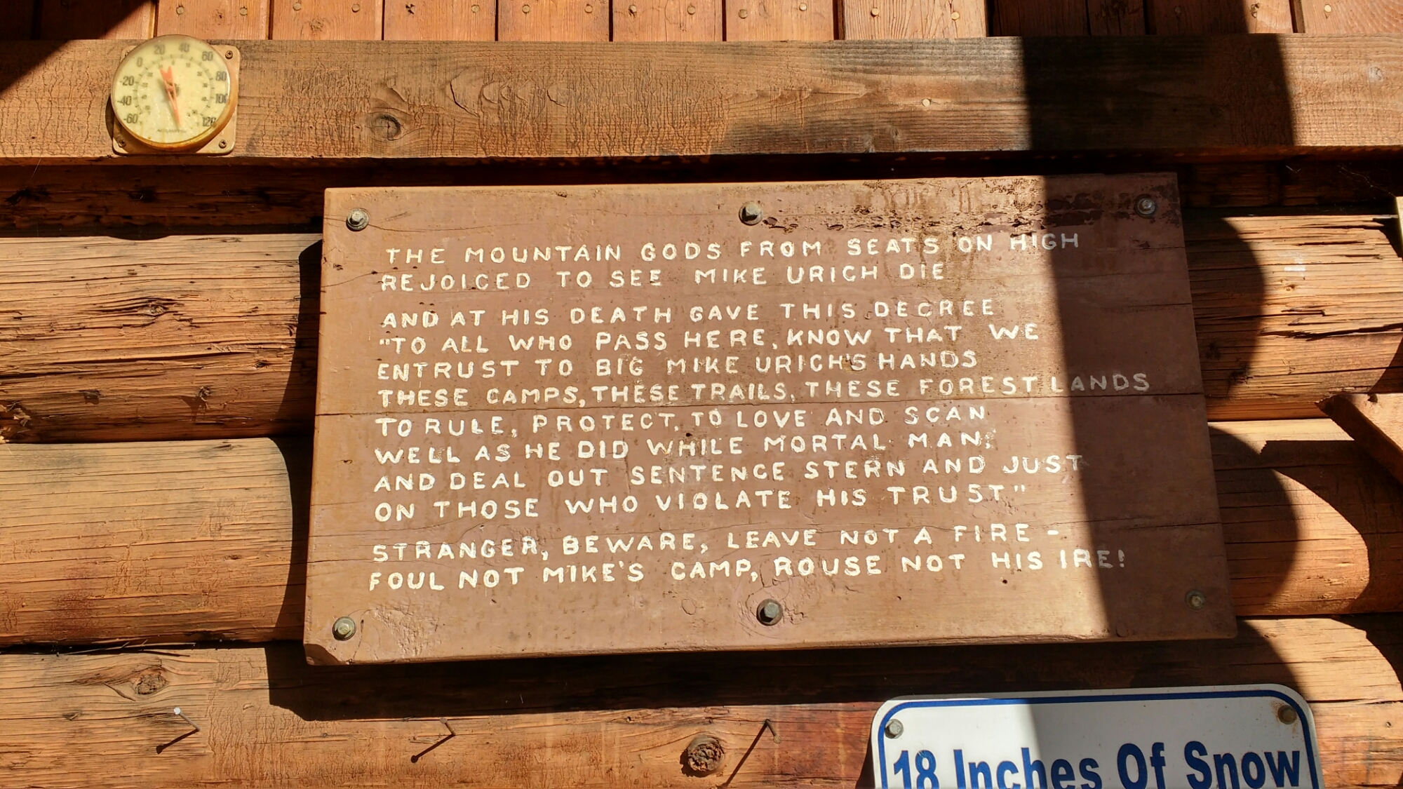
Memories from August 19

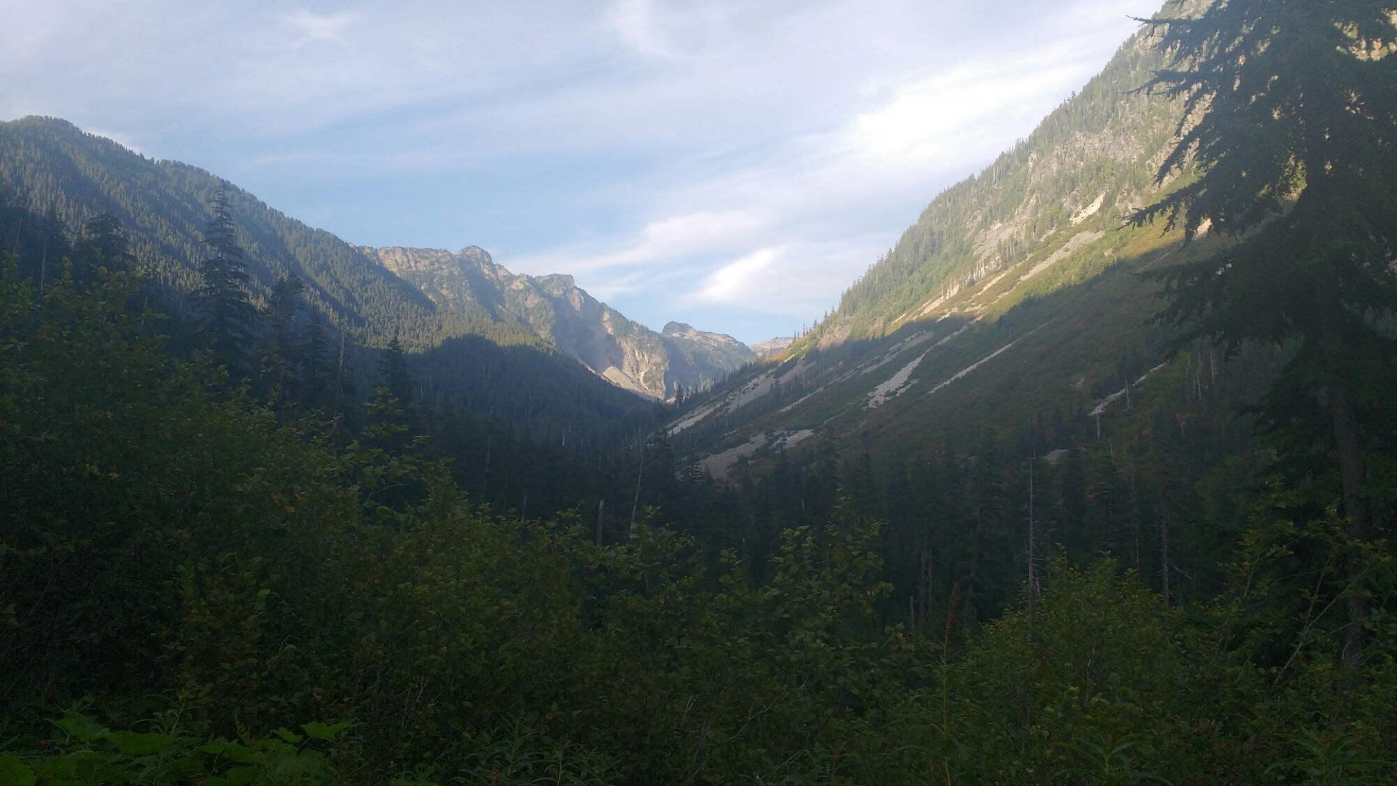
I remember a shot from a documentary about the PCT in which a hiker, in motion through falling snow under a grey sky, looks at the camera and says, “Washington stole my heart”. Since crossing the border, I’ve been anticipating something that would justify such a comment. Today I had such an experience. It’s too insignificant to say that I saw something which justified that comment. Twice I almost peed myself with the magnificent of the landscape through which I traveled. I felt like an addict, sober since the Sierras, amid blissful relapse. Panoramic pictures might help capture the view. Hiking is more than that in that the exertion and travel create a sense of participation in the landscape which other modes of travel don’t. This was not a picturesque moment, made uncomfortably hot by the comparative cool of a car’s air conditioned interior on a family road trip. Today’s emotion came from the depth of over 2,200 miles of trail walked one step at a time. The quality of the day can partially conveyed in that there was no one defining moment of which I have a flashbulb memory. Until now, Forester and Muir passes stood out like giants in my visual memory of the trail. Each has a small set if single pictures which, for me, completely capture the experience. Something about today required motion. Having something like four different, multicolored valleys each with treasures which only appeared at certain angles. Grand geographic features would appear or disappear around a corner, above a pass, or behind you and could only be seen over your shoulder. There was foreshadowing and climax like any good novel but the the denouement did not go quietly towards resolution but thrashed and fought for its own place in the story. You had to be there.

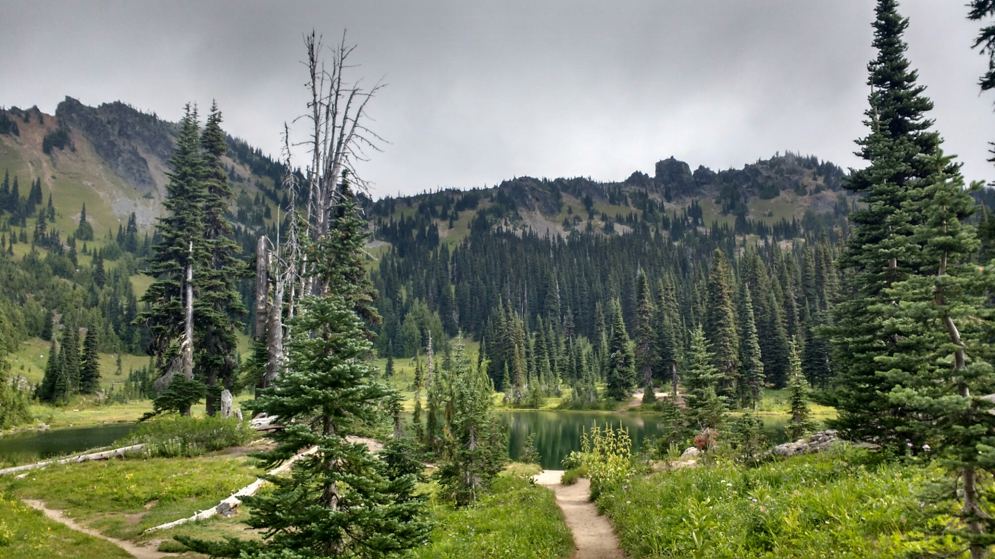
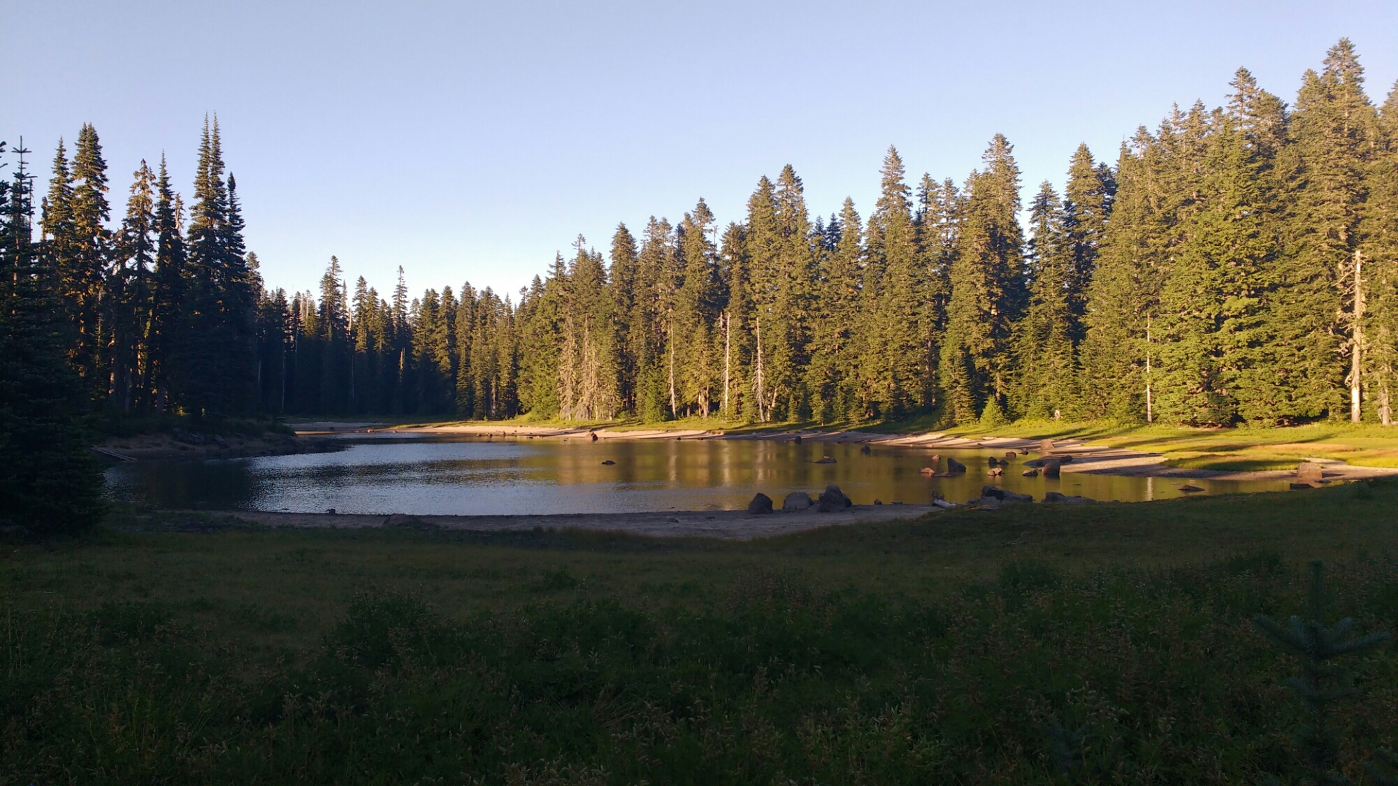
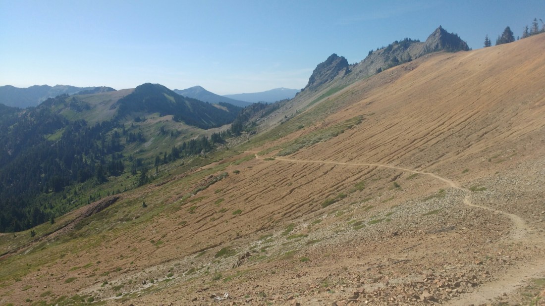
Entering the Yakama Indian Reservation before Viscous Pass. After a uniformly green landscape with a smattering of brown, the variety of colors which appeared within a few steps made for a completely different experience. 

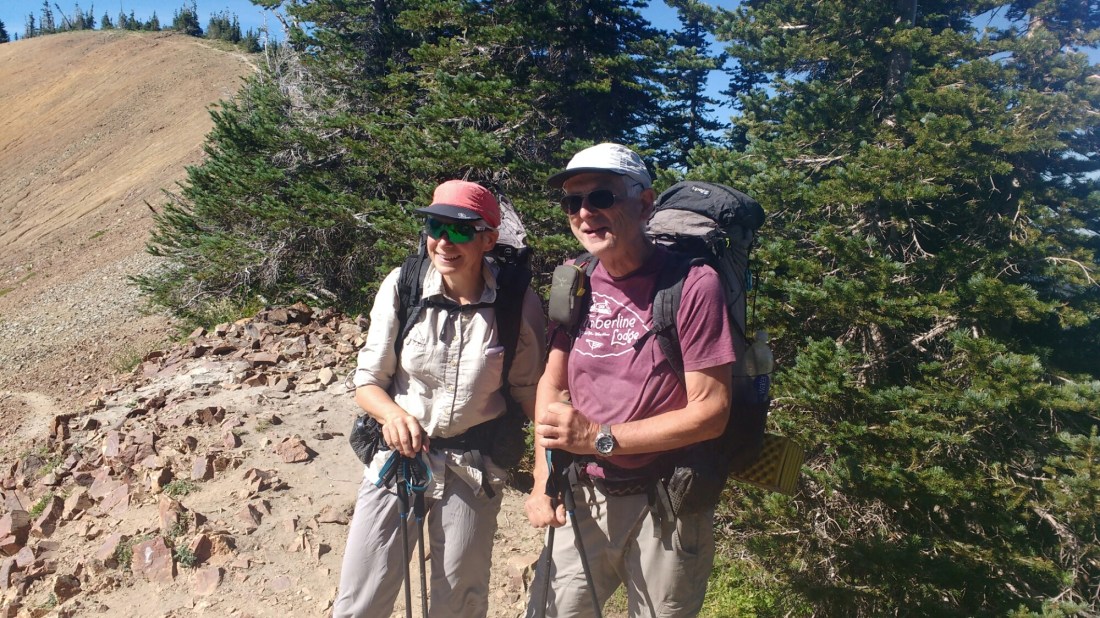
At Cispus Pass, I ran into Bert and Monique who I’ve been leapfrogging since South Lake Tahoe.

During the break, Pathfinder and Mountain Lion caught up. They’re two of the four Swiss retirees who make up the Grey Coyotes which are proving that you’re never to old to hike the PCT.

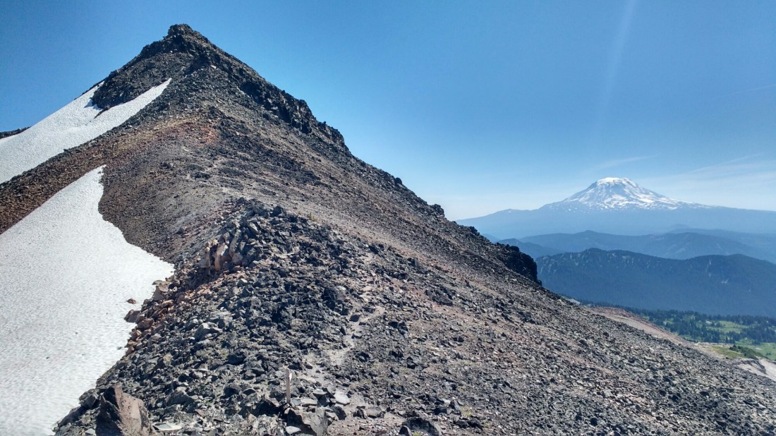
Looking back from Cispus Pass.

Monique looking back at Mt Adams.

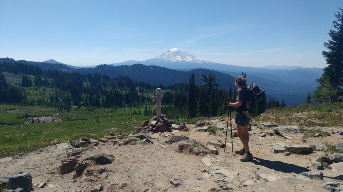
Monique says that Bert usually passes the good view and sets down for lunch just below the treeline. Not today.

An interesting slab of rocks which look like they were water cut.

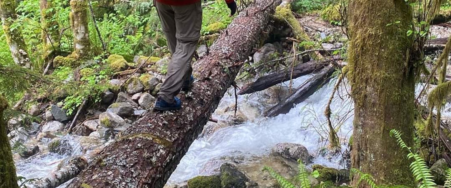
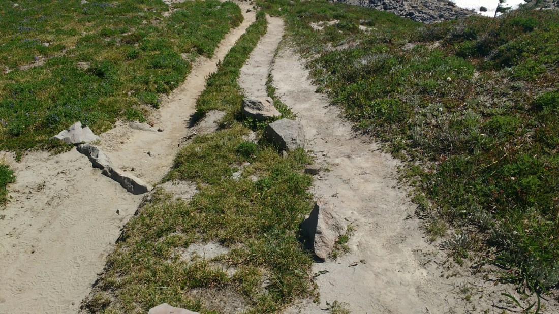
You can tell this area is really wet earlier in the year because of the third trail (the one which hikers make when the trail people make to avoid a flooded trail is also flooded).

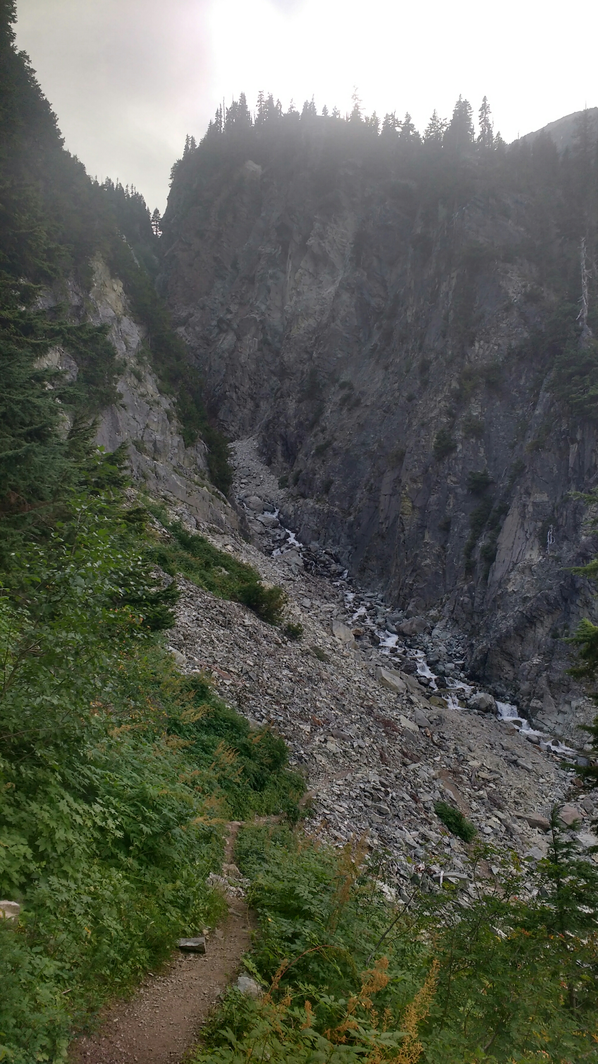
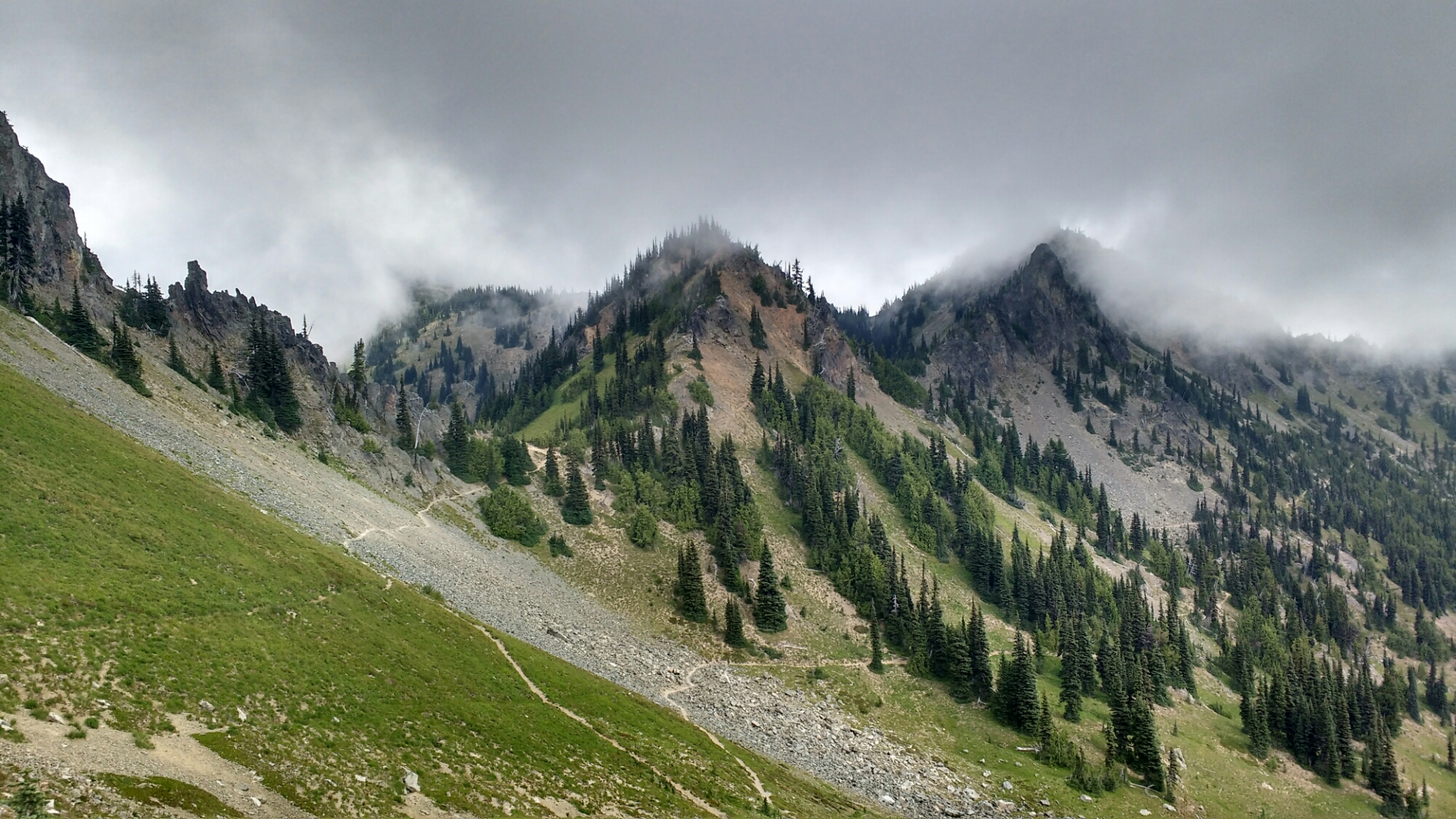
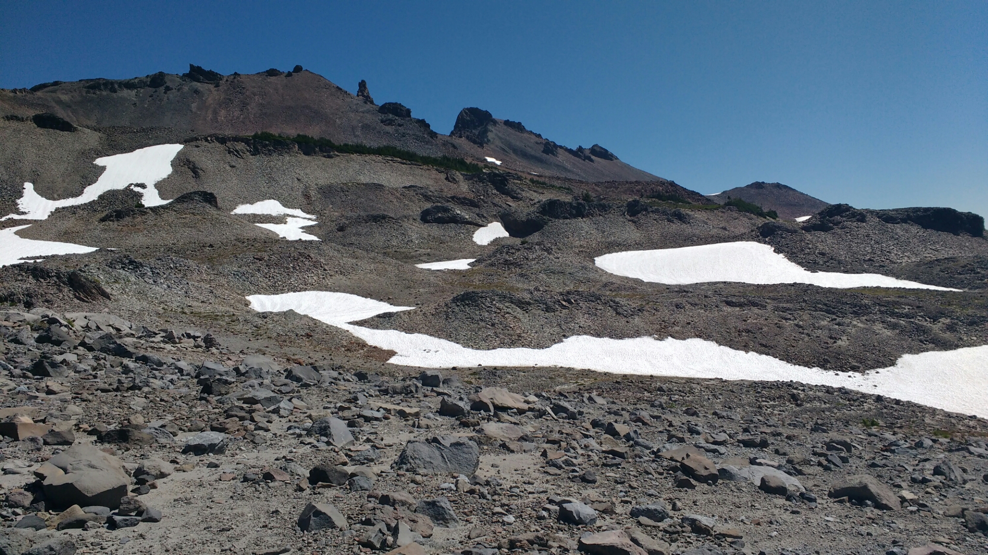
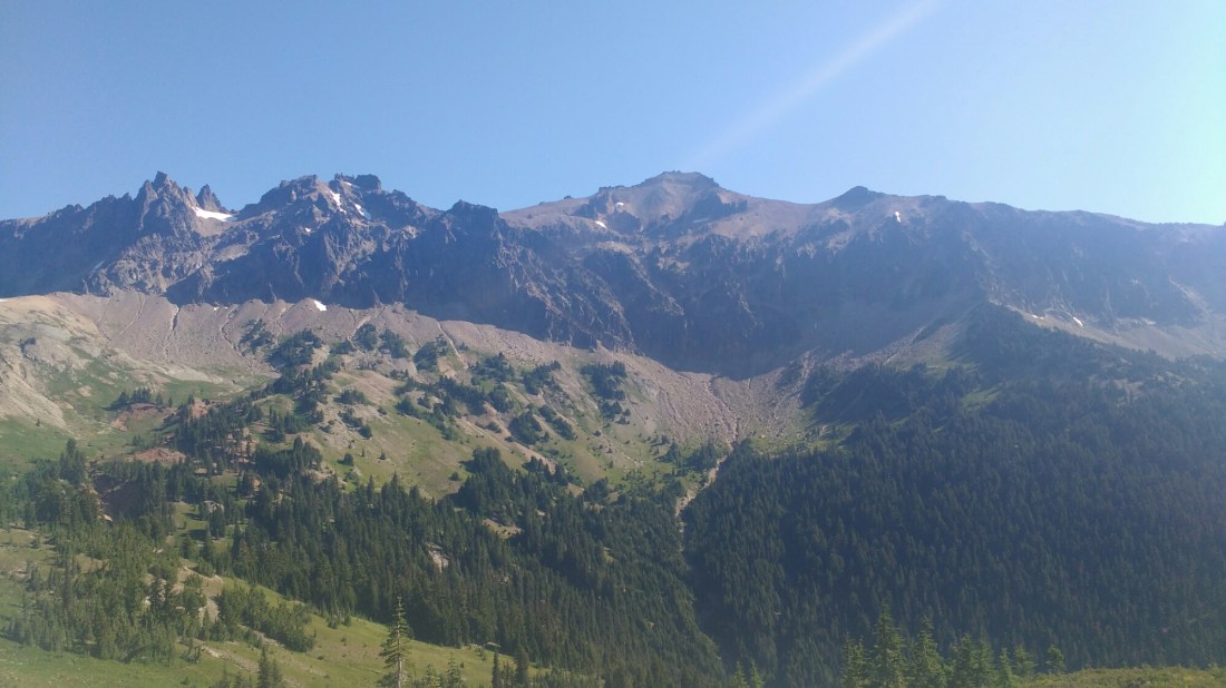
Dark rocks rising dramatically above us.

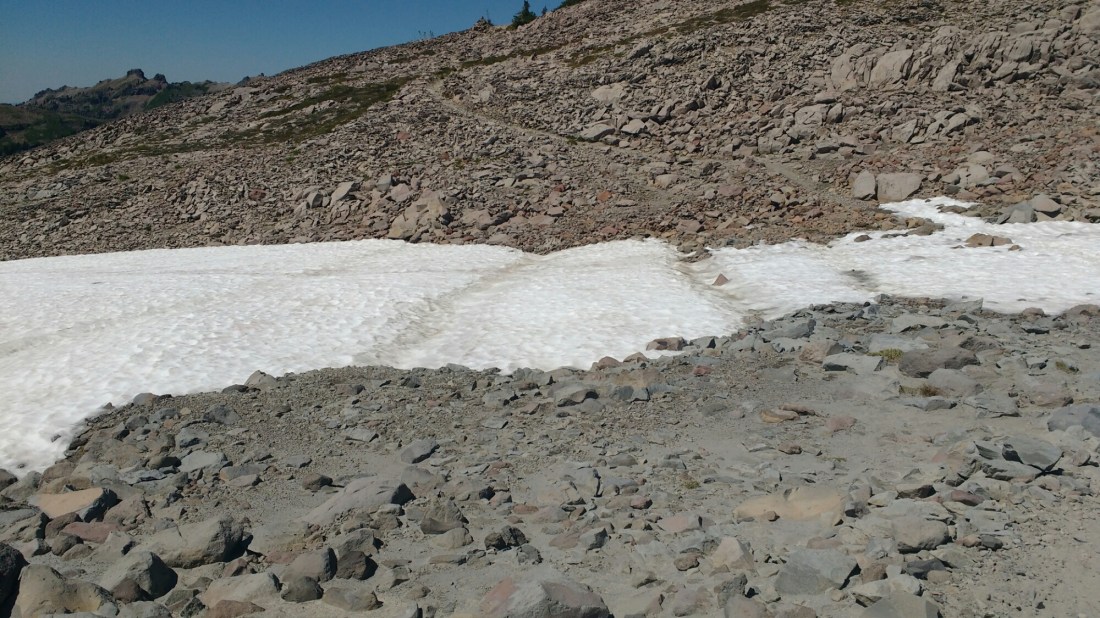
Over time as the snow melts hikers take different routes over the snow as more of the trail is uncovered. It looks there have been as many as four routes over this snow patch this year.

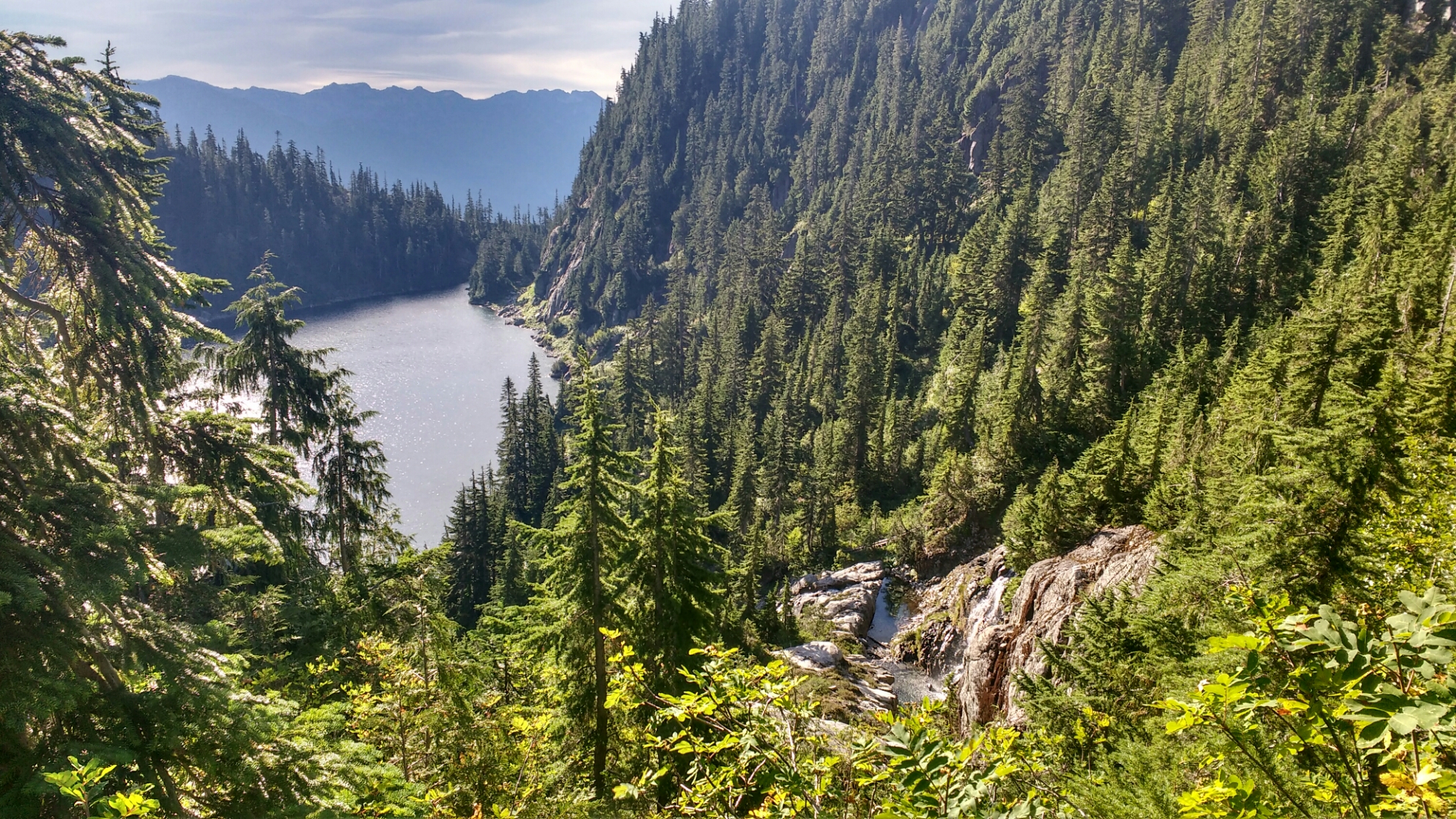
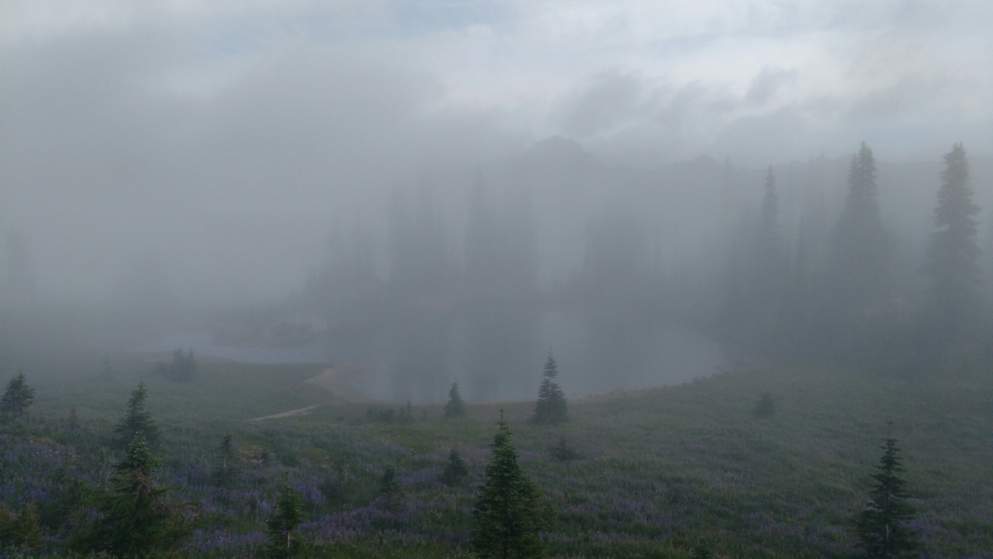
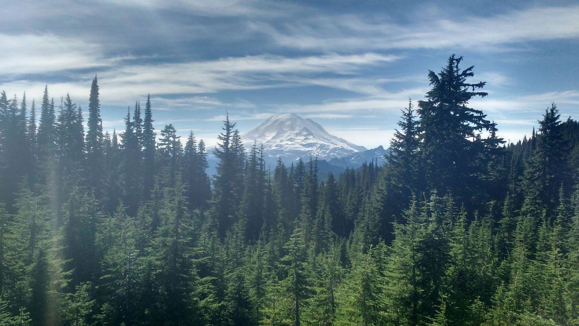
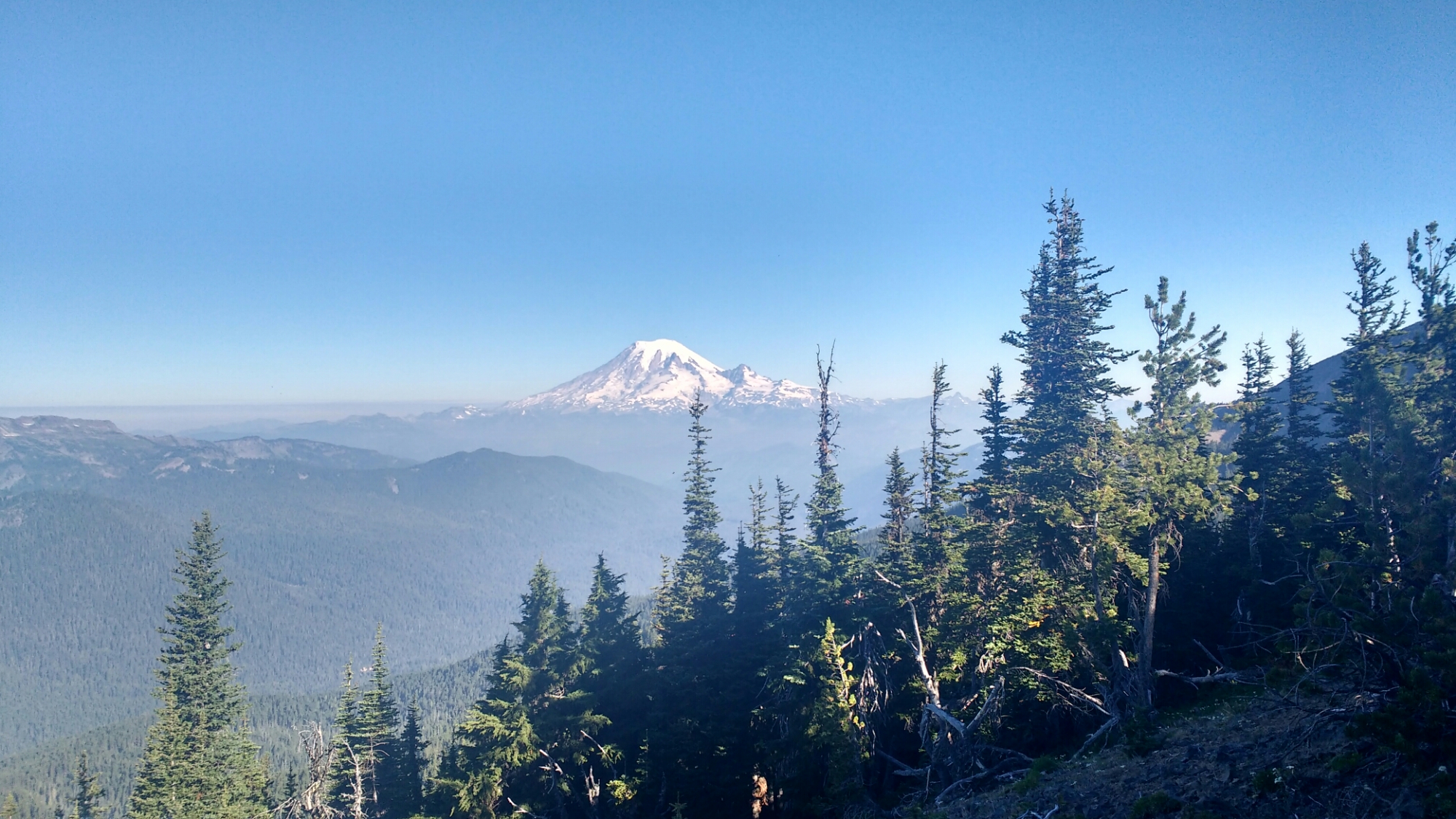
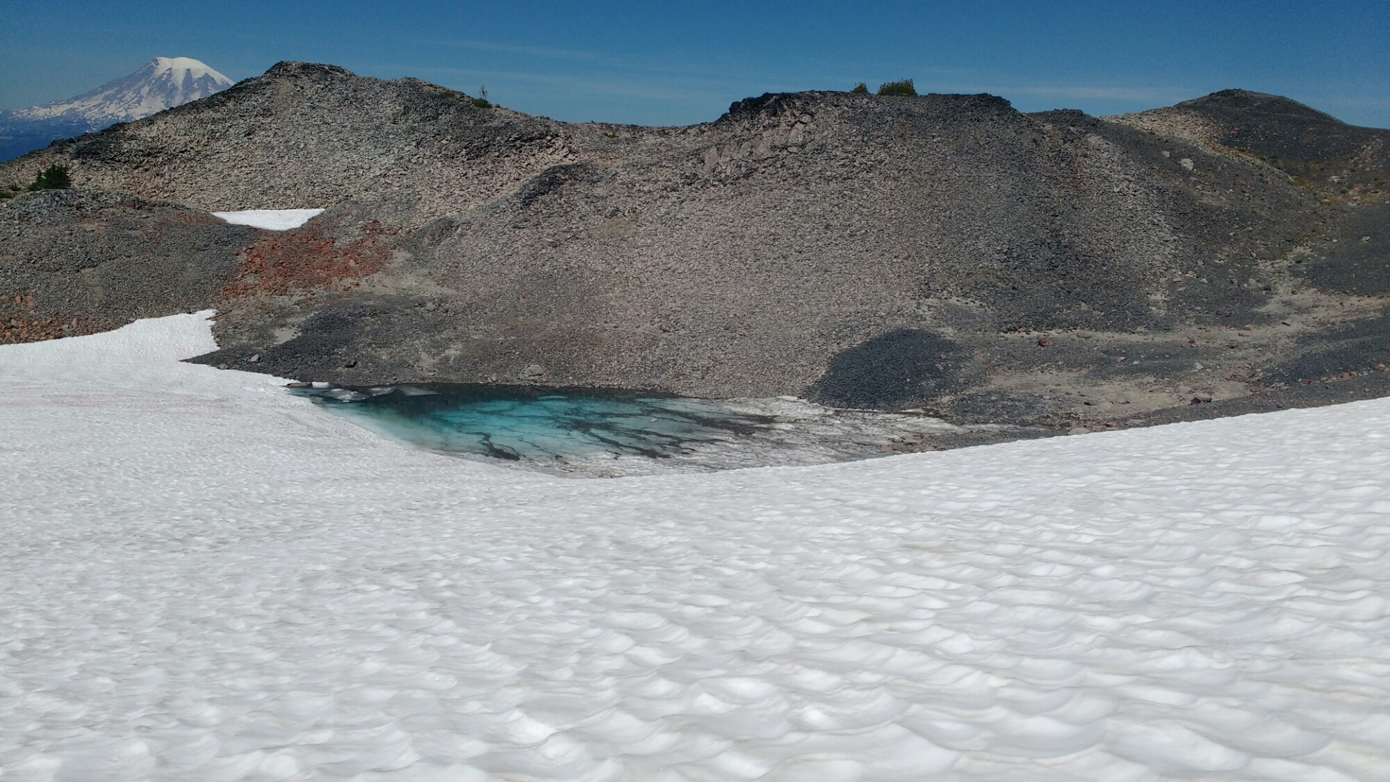
Rainier ambushes you when you take a few steps off trail to get a picture of the waterfall coming out of the emerald lake.

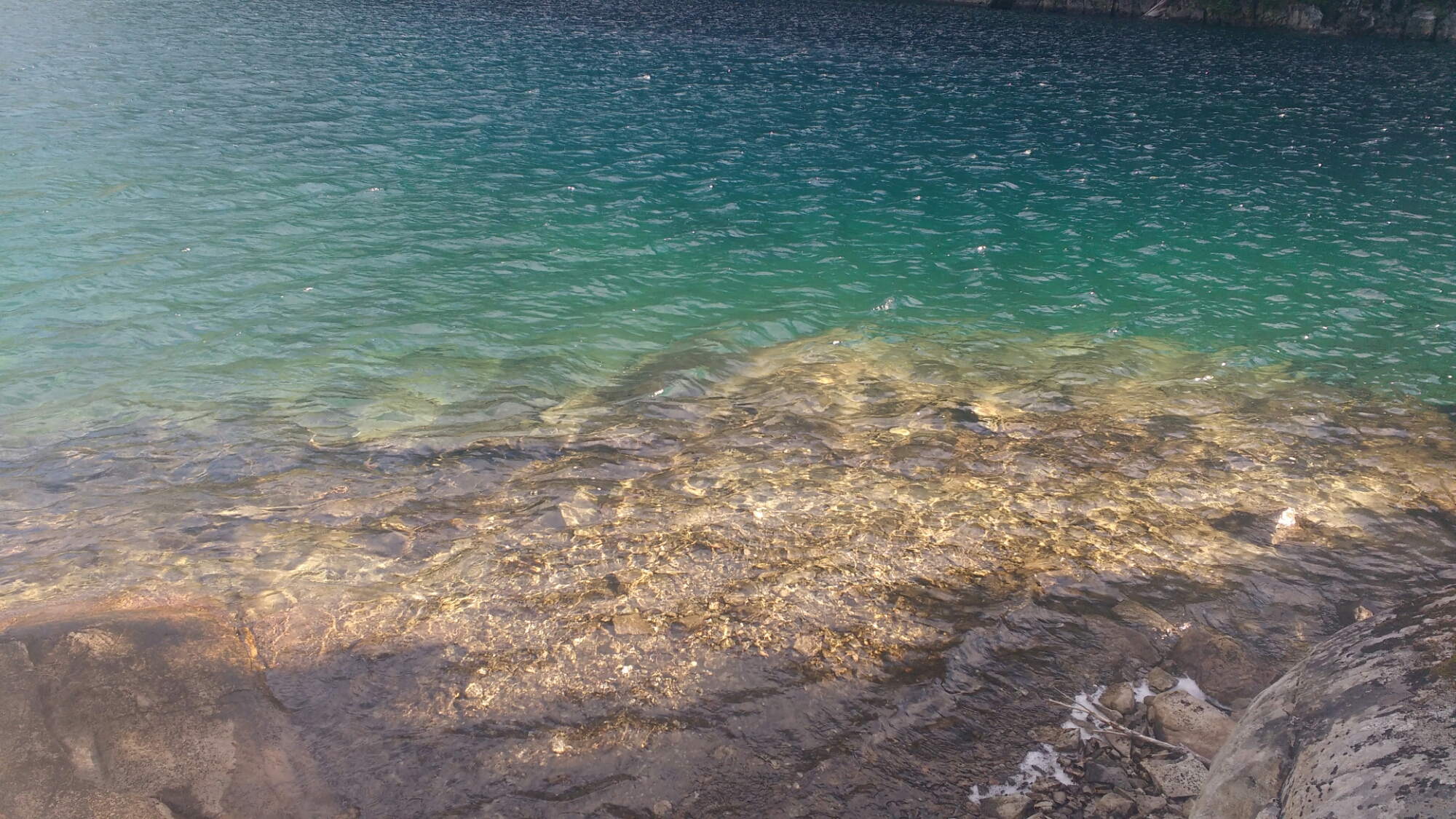
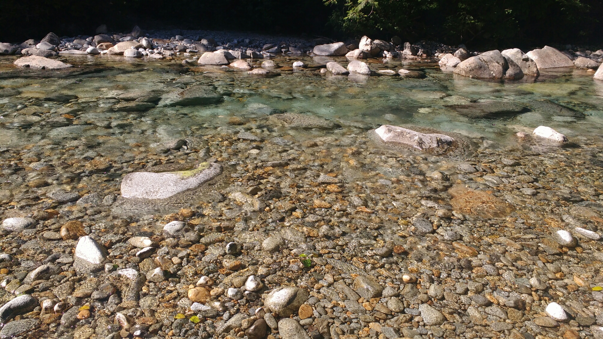
The blue of pools of snowmelt has an intensity not frequent in much of what I see.

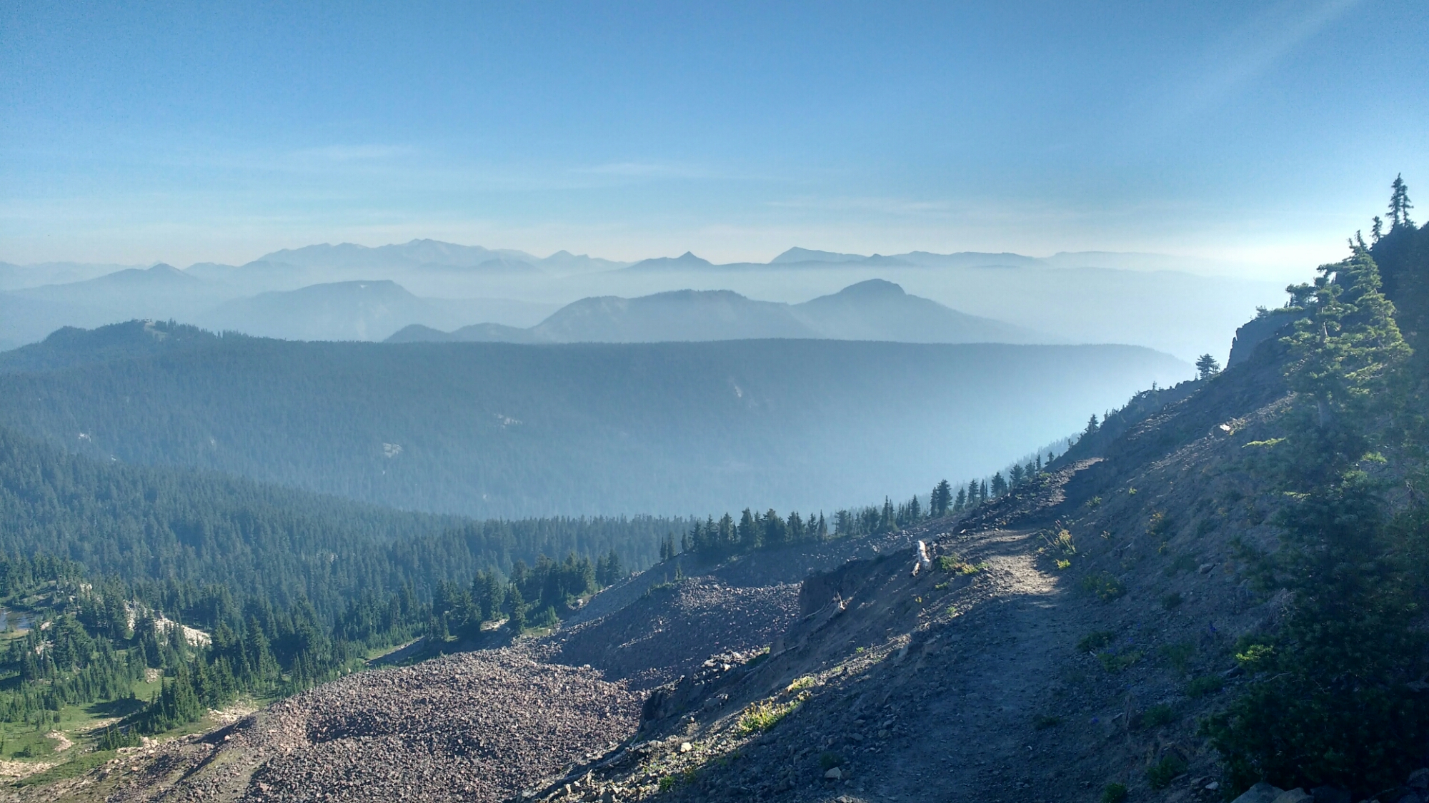
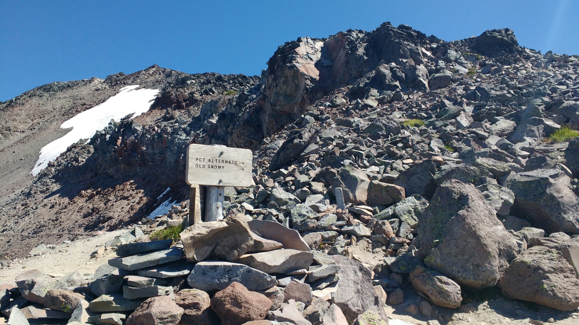
Skipping ahead a bunch of pictures, I took the Old Snowy alternate route which bypasses a couple of steep snowfields. It’s just a little longer but offers a view which includes aspects of most of the rest of the day. If I just showed you the pictures which I took before this, they might seem redundant with the ones I took at the top. Experientially, they weren’t. Each was like an act in a play and the Snowy Alternate (which had no snow and in fact is used to avoid snow on the PCT) like at the end when the entire cast comes out to take a bow.

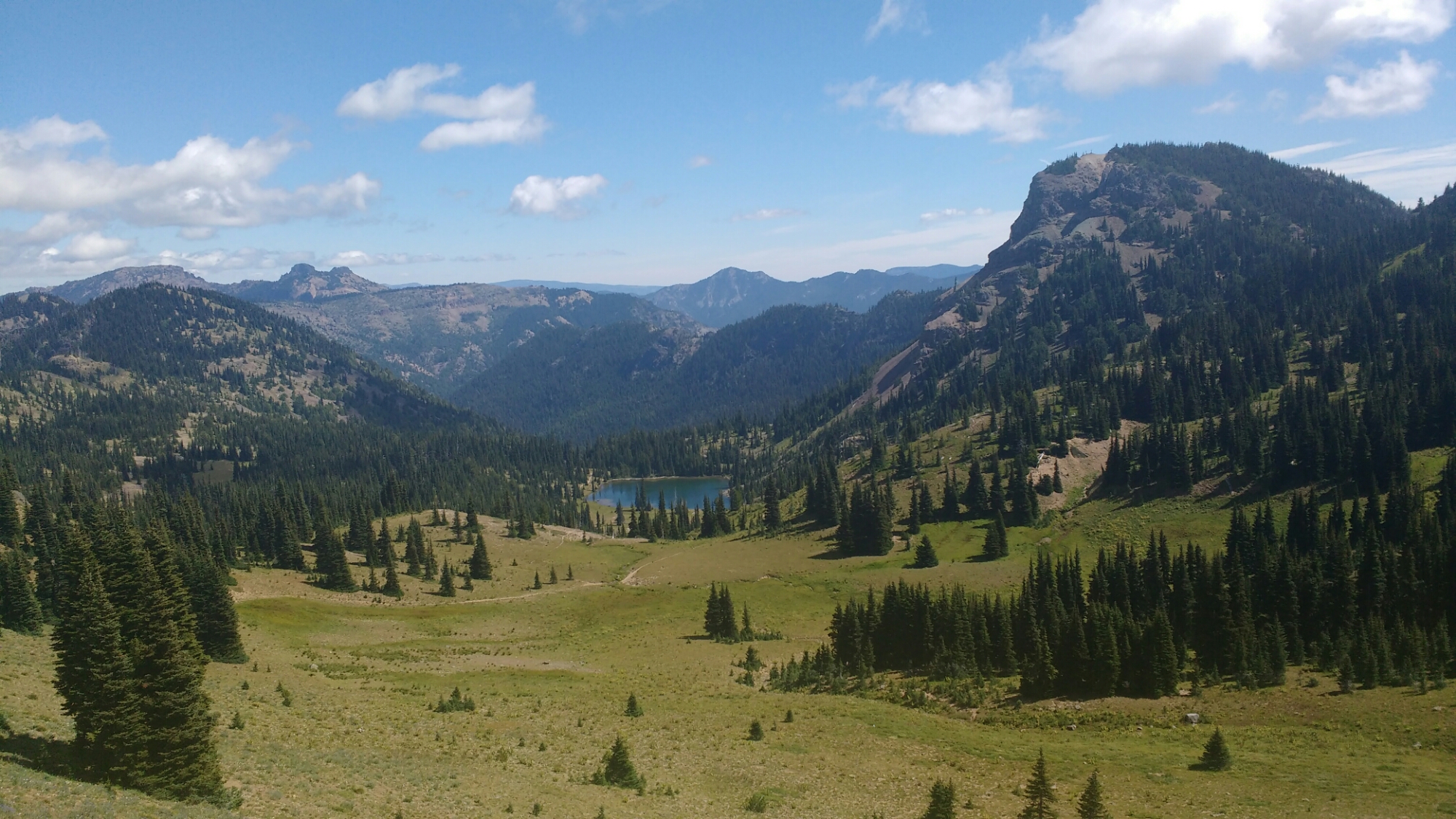
Two lakes, both of usual blues, set in rugged but not sharp, rocky hills.

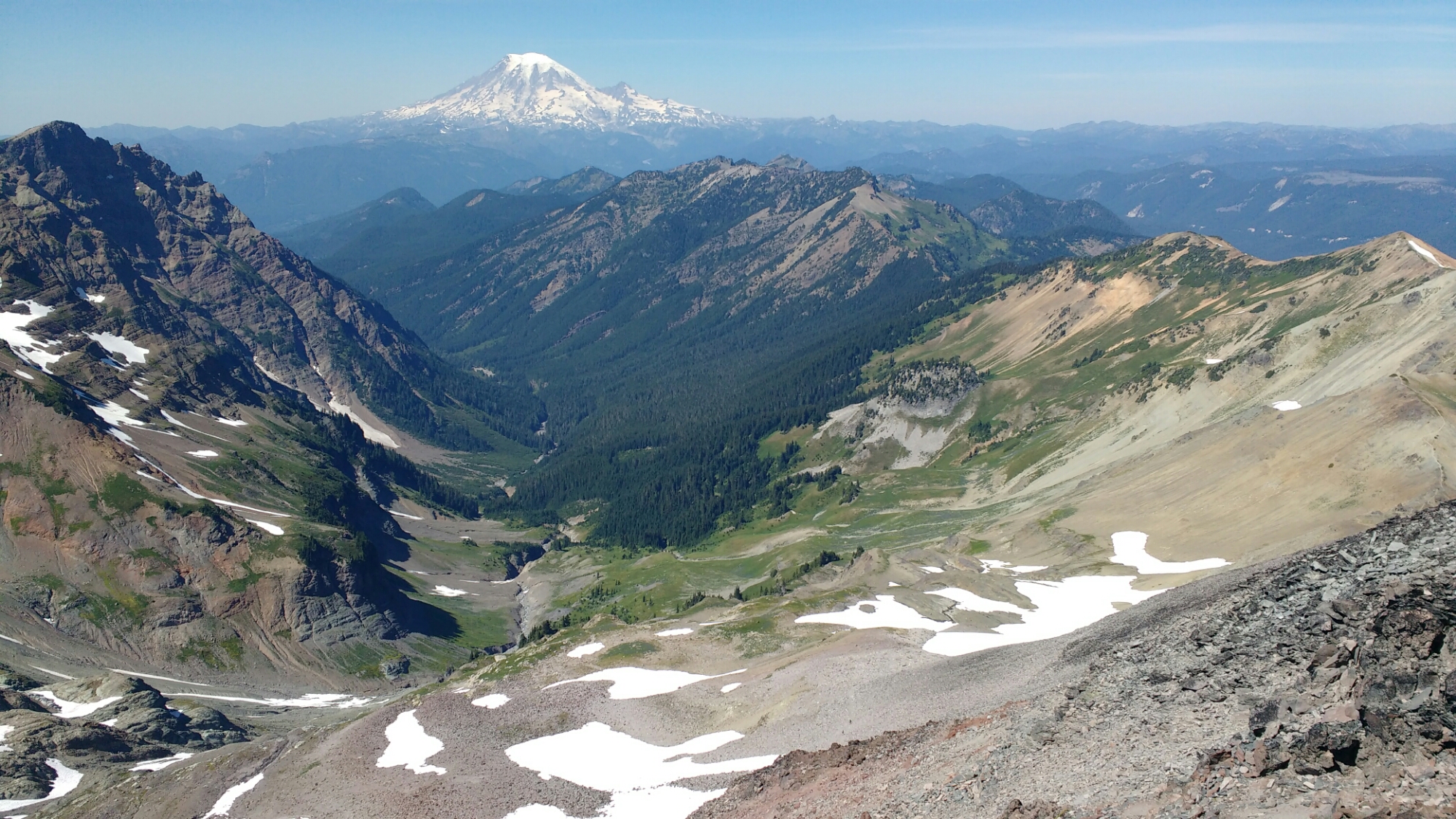
Pivoting a little to the right, Mt Rainier overlooks a valley. There’s a little red in some of the rock, the dirt on the ridge is orange-yellow, there’re a few shades of green between the trees and grass of the valley, the far hills and sky are an array of blues, and there are hints of purple in the mountain and some of the darker rock (these might have been one of those differences between eye ans camera). That’s most of the rainbow. The only more colorful scene I can remember off hand is Sonora Pass with all its lichen.

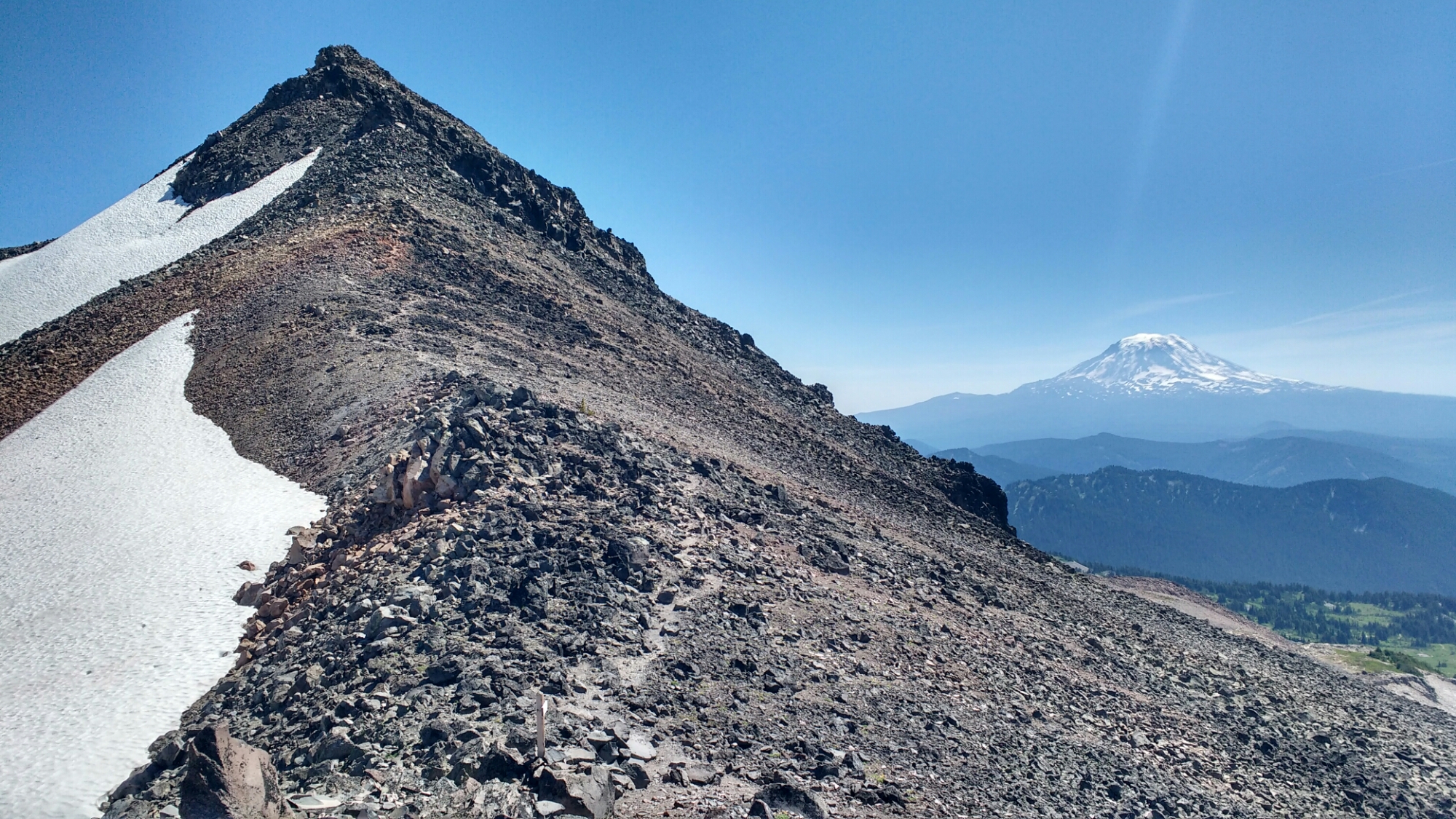
The knife edge on the right side of the previous valley. I’m not sure how this will turn out at full resolution but looks where the trail goes. When walking it, I was able to see deep into both valleys when looking at me toes. During lunch at my wilderness first aid training, a woman told me how the trail had slid out from under her and fallen away thousands of feet below. Having walked that line, I’m pretty sure her story was from somewhere along it.

And finally, coming all the way around and see in Mt Adams again. The nearby peak is composed of large pieces of slate like you might see in a stacked stone wall or slate walkway.

On the way out, there were even stream and flowers.

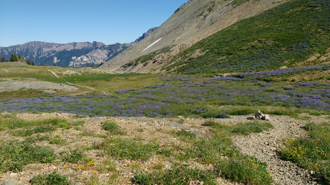
Looking back towards the peak by Old Snowy.

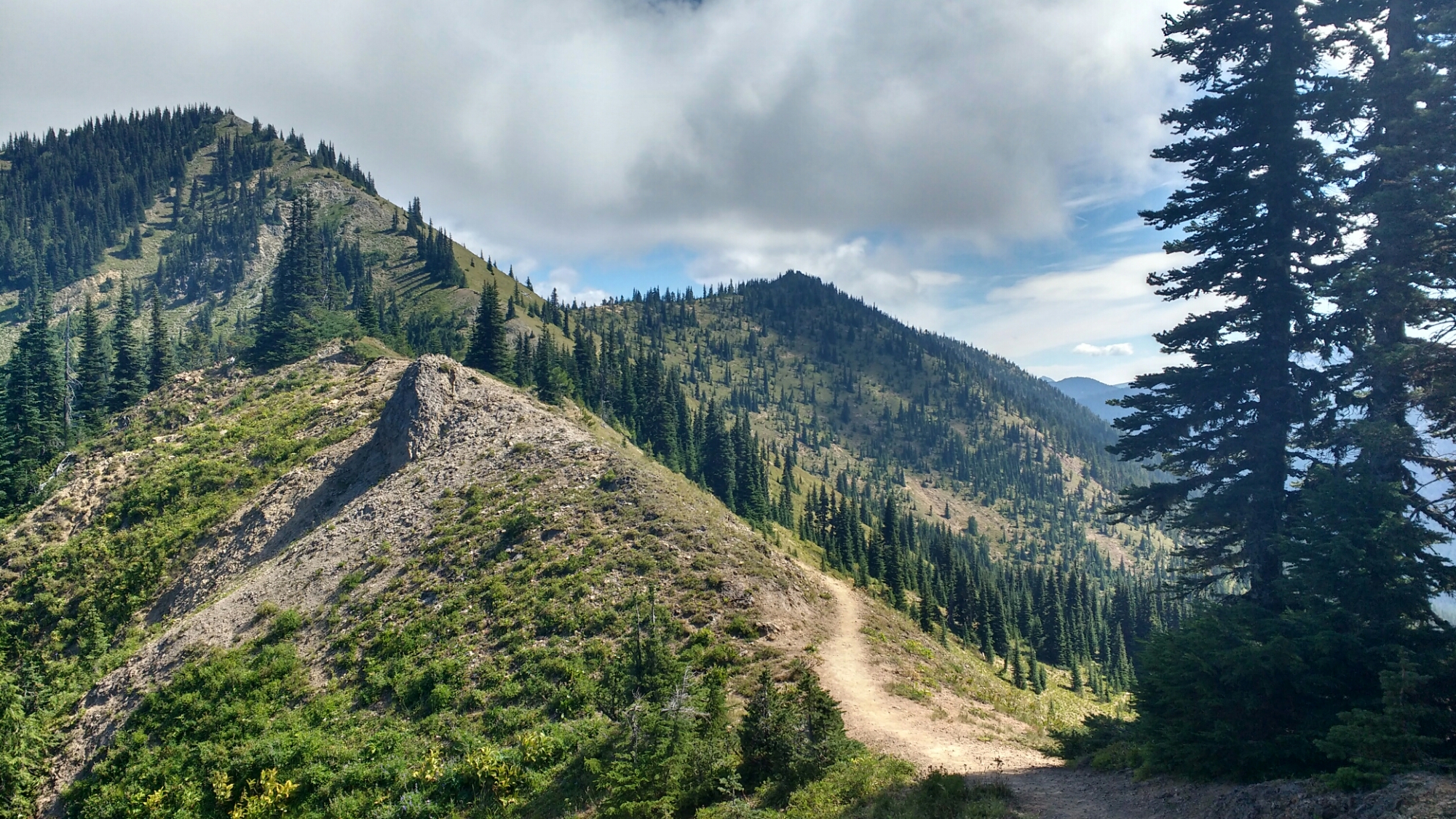
As you’ll probably realize from these pictures, this experience was contained within just a few miles. Yet the under foot trail conditions ranged from well packed dirt on shallow slopes to slippery, loose dirt on steep traverses, snow, large rock, and even a few rock hops over streams.

I’m sure everyone has a different place which was their favorite part of the trail. Other places were had more aggressive or peaceful terrain; sharper, more rugged mountain ridges; better lighting; more shade; more water; more grandiose rock formations; and a few even have wider views or more colors. For me all of the other contenders have first time experiences associated with them. Given that I’ve seen all of these individual pieces before, this is the first place to have so affected me. Maybe I’ve just been crowded in by the trees for too long and am hyperbolic in my reaction. Either way, it was a good day.

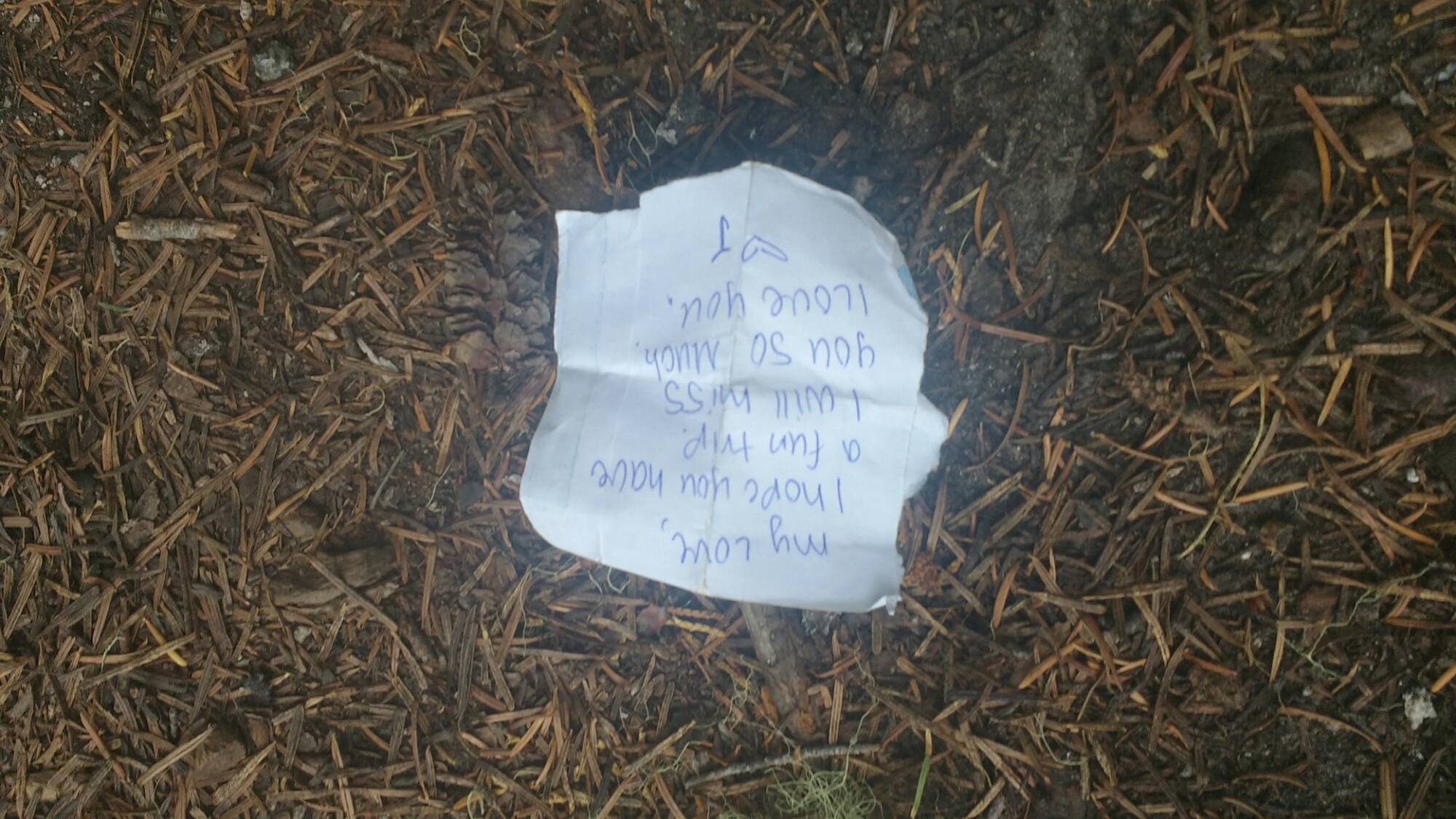
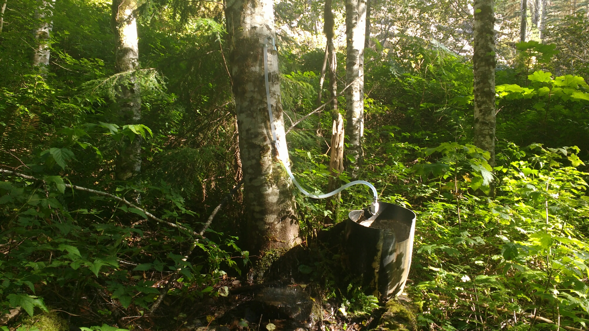
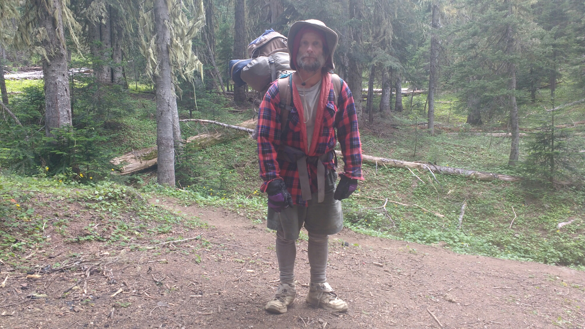
In the evening I camped near the Grey Coyotes at the campsites near Triton Pass. Pathfinder showed me where I could get water from and unmarked trickle of a stream which disappeared into the ground and then reappeared. I’d forgotten my water bottles when I’d gone for the water in my trail notes which was pretty far down a hill and apparently a popular destination with the local fly population. I didn’t wear my hat today and am sunburned enough that it’s made me tired. The silver lining is that it feels wonderful to be in my sleeping bag on my short air mattress with my backpack tucked under my feet, falling asleep while it’s still light.