Hayduke Day 51

Memories from November 23, 2018.

Today I finished the trail. It’s anticlimactic because I’m on a schedule and need to be back at work.

The first few miles were to get back to Hildale. I’m still not quite sure how to do this with complete confidence that no trespassing occurred but I did a little better than when I was outbound.

From Hildale, I hitched to Hurricane. A friendly, bearded young carpenter picked me up in less than 15 minutes. In Hildale, I make a sign that said, “Zion” and stood under the mileage sign to Zion. Two Polish women from Chicago picked up and dropped my by the walk-in entrance to the park.

Zion seems to require that you take a shuttle to the trailheads and the line for that shuttle as long. I hadn’t made a reservation for accommodations for the night thinking that there would be plenty of vacancy because it was late in the season and so immediately called the first local hotel I found and managed to reserve their last room. A little while later, while still standing in line, I got to talking with the family behind me who had a son who shares my name. They had actually seen my trying to hitch and a jovial game of blame started for why they hadn’t picked me up.

On the bus, I hit it off with two pairs of just-out-of-college day hikers heading for Angel’s Landing. My trail ends at the Weeping Rock but I kinda wanted to get off and hike with them instead.

The bus in Zion has a narration which plays after each stop. At one point, it actually mentioned flash floods in the Virgin River specifically and warned not to be in the river in bad weather. This made me feel a little better about my decision to turn back yesterday.

The Weeping Rock itself is at most an tenth of a mile from the trail head. I flew up the paved, graded path and got a my finishing picture taken by a guy who’s been pointing a fancy camera around and he did pretty well with my camera phone.

At this point I was done. In total I’ve skipped about 100 miles (last 10 of section 6, all 70 of section 7, and the last 20 of section 14) of the approximately 810 miles in the guidebook and so maybe it’s more accurate to say that I had a Hayduke Adventure than that I hiked the Hayduke. Either way, time is up and I started at the beginning and ended at the end.

Since things had gone so well today I decided to hike up a little to a half-way point to burn a little time but still get back to the hotel during daylight. On the way down, I wound up in a conversation with a pair of deeply sunburnt hikers about long trails. One of them had hiked the AT. After I had passed them and they complemented me on my choice of backpack, the shouted down from a switchback above asking if I were in the Hayduke. About 30 seconds later it was obvious that trying to hold a conversation across 20 odd vertical feet in a crowded path wasn’t going to be convenient for us or the passerby’s so we walked back to the bus together and then bussed back to the visitor’s center together. Having this human connection to the through hiking and outdoors community created a feeling of closure to the trip.

Soaking in the hotel hot tub while watching the shadows lengthen on the rock walls above did too.

The end.

Hayduke Day 50

Memories from November 22, 2018.

Today was supposed to be a quick few miles down to the Virgin River, a sketchy descent, five miles of spectacular river walk, and as many miles of Zion backcountry as could fit in before sundown. That plan died almost before I was fully awake.

Last night felt warmer than it should have. This meant there were clouds. There weren’t supposed to be clouds because last night the inReach had said there was only a 10% chance of rain today. The problem with rain is that the guidebook says that the Virgin River is extremely prone to flash floods.

The sky was overcast and heavy in most directions though there was some blue to the northwest. The forecast was now for up to 40% chance of rain starting around noon. When I crested the last low rise and got a clear view to the northeast, it was socked in. Everywhere else there was a clear gap between the top of the sandstone or trees and bottom of the clouds. The view to the northeast, however, reminded me of the waves of rain which swept past when I was walking through Lockhart Basin. The problem with northeast is that it is upstream and water flows downstream to where I’d be hiking.

I’d known that today was going to be a gamble because the weather channel had said there would be rain today and tomorrow but it had looked like it would be in northern Utah and I am a day’s walk from the Arizona border. I had hoped that if there was rain here I could sneak through before it really started. Unfortunately it had clearly already started. This also meant that since rain was here now, it wasn’t worth trying to wait for tomorrow to see if it would be better.

I had been anticipating day of beauty and challenge which I had been anticipating since the starting this trek. It help the last two physical challenges on the Hayduke, the final hurdles which would have been followed by an easy cruise into the finish tomorrow. Bending my will to the commandment that thou shalt not enter a flash flood zone in bad weather was hard. Discipline is always hard and so I walked away before I could find an excuse to chance it.

I had a short half liter of water and 15ish miles to get back to Short Creek which was the nearest water I’d passed yesterday. Fortunately it was cool and sprinkled just a little which made the sand a little firmer than yesterday’s slog. There was a pothole with clear water a few miles early which meant I could sit and enjoy a late lunch with yesterday’s best views under today’s improved lighting.

I wanted to do the Hayduke to be forced to face real challenges and make hard decisions. Staying found, finding safe bypass routes, safely traveling across difficult terrain, and deciding how much water to carry were what I had in mind. This was perhaps the most difficult decision I’ve made because I still feel like everything would probably have been fine. Normally, that realization that everything usually turns out fine helps me move past fear. Other people have for before and I’ve never heard of a Hayduker dying. With flash flood deaths, there’s a consistent theme of underestimation of either their power (due to lack of experience) or probability (because the weather you can see is fine). In other words, the same reasoning which helps safely navigate other situations is what gets you killed in flash floods. Knowing that doesn’t change the fact that, having passed every other test, I feel like I let fear win the final round with the finish almost literally in sight. Maybe that was the test: to walk away from a dangerous situation which is out of your control even though you think you can handle it. Flash floods are not storms which can be weathered or sketchy traverses which can be taken one step at a time. Maybe the final test was to differentiate between clear eyed courage and blind stubbornness. My mind cycles through reasoning like this for most of the day trying to rationalize away my frustration and disappointment.

It’s Thanksgiving and this motivates me to try to get back to gratitude. Even if today was hard, I’m thankful for the Hayduke and for the experiences I’ve had so far.

I traded a few messages with my parents via InReach. I might be camping without company tonight after a bitter retreat but I have family who love me and so I am not alone. This is a deep and unearned blessing. Happy Thanksgiving.

Hayduke Day 49

Memories from November 21, 2018.

I took the alternate north northeast out of Hildale this morning. The first problem was that the obvious route (based on the roads on my GPS app) to get to the trail running down Short Creek was blocked by private property. I backtracked and cut over to the creek through a fence and garbage strewn drainage which didn’t say No Trespassing. Eventually a 4×4 came in from the right so I guess a I should have taken the road out of town which didn’t appear to connect all the way to the trail.

The Squirrel Creek Trail (per GPS App) was actually pretty interesting. It connects the was to an ATV route at the top of the wash and is steep at the end but goes up through some sandstone and trees which reminded me of the Sundown Trail after Dark Canyon.

I had been expecting to cruise on the ATV route but it was sandy and windy and while visually interesting (the sand was kinda like snow in some ways) was a little onerous. The ATV route exits a wilderness boundary which says no ATV to a Jeep road which is also sandy.

Today was more tiresome than I expected through that might also be because I ate a lot as I have extra food. I stopped at about where the alternate joins the main trail. However instead of bushwhacking directly across for the last mile or so, I followed the road in a big U which probably added a few miles.

Hayduke Day 48

Memories from November 20, 2018.

I woke up in the artificial blackness which is experienced when you pull your beanie down over your eyes and hide deep in your sleeping bag. After burrowing out of the mess I discovered a weak sunlight shining uniformly on everything it touched. This is different from most other mornings on the Hayduke where you have to wait for the sun to rise over the canyon rim or trees.

Getting direct sun quickly helped thaw my frozen water bottles.

In just a few miles of flat walking I was at the highway and hitched in to Colorado City. I was picked up by a nice fellow who was making a complicated offer to help take care of all my resupply needs when he interrupted himself and said that sometimes he means to help people but it doesn’t turn out that way. His reasoning for wanting to help me had to do with there being Mormons in Colorado City and asked if I knew about Mormons. He meant a particular cult, noted for it’s polygamy and insularity, which branched off the mainstream Mormonism which is practiced by several friends, neighbors, and coworkers of mine. With a few recommendations for hiking in Zion NP we parted ways at the gas station.

The mapping app on my phone guided me trough a few industrial blocks to a location which was definitely not the coffee shop where I was hoping to eat a second breakfast. However there was a large building nearby which said Dairy Store on its pitched roof. I wound up resupplying in the equivalent of a minimart if it were stocked by hipsters and staffed by women from 70+ years ago.

En route to a my next choice for a dining establishment I ran across the cafe I’d been looking for originally. Despite having passed a school with children in the yard dressed in formal, traditional clothing from a bygone era, the cafe was quite hipsterish with WiFi, overstuffed chairs, pumpkin spice waffles (delicious though not filling) and daycare themed decorations. As seemed to be happening in Escalante, it seems like there’s a younger generation moving out to small town America and putting down roots which contrast sharply against but ultimately integrate with the more traditional folks who would otherwise be left in a dying town.

With the assistance of a power outlet and my phone, I was able to locate a nearby hotel. Multiple inquiries with locals had not uncovered despite it being adjacent to the high school. From there the typical resupply pattern took hold and I toddled off to my first shower in over a week sick to my stomach with eggnog and waffles.

Hayduke Day 47

Memories from November 19, 2018.

Today I finished up Hack Canyon with a road walk which climbed mostly on the side of the wash as its bed got narrower and rockier. Some cows were on the double track and which turned into a graded dirt road and got herded along as I walked. When they got trapped by a fence their personalities came out. One tried to descend into the ravine, got cliffed out, then took the hint that I was standing to one side and galloped past while watching me the whole time. The second was a bull which tried butting the fence and starting at me and only passed after I climbed the embankment to vacate the road for the cattle to feel comfortable turning around. The third just stood there and peed.

After that, it was road walking across the Arizona Strip. It’s mostly gently sloping grassland. I hadn’t been looking forward to it since the topo map makes it look boring. It was actually quite pretty. The Hayduke doesn’t have many wide open spaces so I actually enjoyed it. It was also nice to be able to hit cruising speed for long periods of time.

I called it for the night a few miles short of the highway where I’ll try to hitch into Colorado City tomorrow. I was going to sleep behind a corral so I couldn’t be seen from the road but the cow patties looked fresh so I camped on the other side, hopefully far enjoyed away that headlamps wouldn’t catch me. A few cars passed (surprising as the only things which passed before dusk were a backhoe and a large hare) but none seemed interested so I guess It worked out.

Hayduke Day 46

Memories from November 18, 2018.

I spent most of the day hiking the rest of the way up Kanab Creek from shortly after Showerbath Springs to Hack Canyon. I took 9l of water and so was a little disappointed when water reappeared (then disappeared) a few miles before Hack.

There were fish in shockingly shallow puddles of water.

See the fish?

In some places I tried to shortcut a meander. Usually after bushwhacking up a bank, I’d find a clear trail though sometimes the trail was badly overgrown. When the creek bed was dry and level, that made for the easiest walking.

The canyon walls got lower towards Hack Canyon and that turns into a broad wash. I met some cowboys and cowgirls driving a small herd of cattle in the opposite direction. They finished their work and caught back up to me just as I was at the Hack Canyon Trailhead. We chatted briefly and they offered to leave a beer for me when they got to the road where they’d left their vehicles. Then they rode off as the sun dropped behind the canyon walls.

I actually caught up to them just as they were driving off and Shane, who had offered the beer, left me two and some candy since he said I’d probably missed Halloween.

I’m an awkward distance from Colorado City where I hope to next resupply. It’s either a long day and a hitch or a day and a half with the need to avoid private property when camping. I’ve decided on the latter and so camp near the Hack Canyon Mine at sunset instead of pushing on into the night. Tomorrow I’ll start the last of the Hayduke’s 14 sections.

Hayduke Day 45

Memories from November 17, 2018.

Started at daylight with 4.4 miles of picking my way over rocks on the sloped bank from Fishtail Canyon to Kanab Creek. I wish I’d figured out some way to go faster but there really weren’t any tips other than just getting it done.

I was really happy to reach Kanab Creek. From here I’ll be getting out of the Grand Canyon. It’s been beautiful, exhilarating, and in places tough . I’m ready to be done with it.

There was no campsite on the east bank that the guidebook mentioned but on the west side had a nice sand beach. The rafters I’d seen yesterday passed while I was having a snack. I was glad to have made it before they passed so they would see I was safe.

I only made it a short distance past Showerbath Spring. My pace was meandering which matches the feel of the Canyon. Sometimes the walking was easiest in the creek, others it was on the bank, and sometimes there were boulders to scramble over or deep pools to avoid.

Hayduke Day 44

Memories from November 16, 2018.

I lolligagged around for half an hour again this morning. My left knee aches a little and so I wasn’t feeling motivated.

The last bit of Tapeats Creek was mostly trail on the bank with frequent crossings. I stopped off at the designated campsite I was supposed to be at last night to use the privy.

On the way up the Thunder River climb, the cairns direct you to the spring not Surprise Valley. I was pretty confused for a bit and even pulled out the GPS which didn’t help other than to say I needed to keep going up. There was what appeared to be a trail up but there were rocks across it and I can’t ever remember a time when stepping over “don’t go here” rocks or branches went well for me. I guess there’s a first time for everything.

Surprise Valley was pleasant. I like the mid-canyon elevation.

On the descent to Deer Creek I was using my lone good pole to guard my left knee which made going slow. This wasn’t such a bad thing because the trail and view were quite interesting.

Deer Creek itself was peaceful. I ate lunch by a small waterfall.

The narrows over which you walk to the Colorado are out of this world. Deer Creek flows below you and you’re on this narrow ledge where you sometime have to squeeze around a corner to not get bumped off.

Instead of descending to the Colorado River like the guidebook says to, I took a clear use trail hoping it would connect to the upcoming trail which you have to find to get you over some high cliffs. Unfortunately it just dropped to a different beach.

While walking the beach, a rafter at the back of the flotilla which had launched from the Deer Creek beach while I was descending checked on me. I explained that there were supposed to be some cliffs coming up and I was looking for a trail over them then was trying to get to Kanab Creek along the beach. He said it was quite a ways and to be safe then let me go a they were at their night’s camp. There’s a real art to checking on people, especially when they have aggressive plans and he did it pretty well.

Still hot on the tracks of a couple of Haydukers.

In the end. I never found the start of the use trail over the cliffs and scrambled up a steep gully high enough to get above the cliffs. There were many little drainages to go around and the going was slow. Then, just as I reached the ridge running down to the first cliff. I saw a cairn down the ridge just a few yards from the edge. Looking out, I could see a trail following the edge of the cliffs. This kept it from having to deal with all the gullies but would have been way to close to the edge for my comfort were I scrambling. This was a huge relief.

The trail was quite clear and in a few places where it was washed out or there were rocks it was pretty well cairned. You couldn’t cruise but it was easy walking with a few places where you had to navigate some interesting rocks. It’s such an incredible trail and with such beautiful views. I’m quite curious as to its history.

After the short beach walk which meant frequently having to off the narrow, steep beach onto the rockier, plant infested shore above I was at Fishtail Canyon. With a little over two hours of daylight left I decided not to push it the 4.4 miles to Kanab Creek. The pace would be aggressive given the terrain and there don’t appear to be many places to camp en route if night found me part way. I could mostly see rocky slopes under cliffs with little sand down canyon and the map didn’t show any clear outlet stream beaches like it had south of Nankoweap. Stopping early might give my knee a chance to heal up a little but this does mean I’ll need some high mileage days going into resupply.

Hayduke Day 43

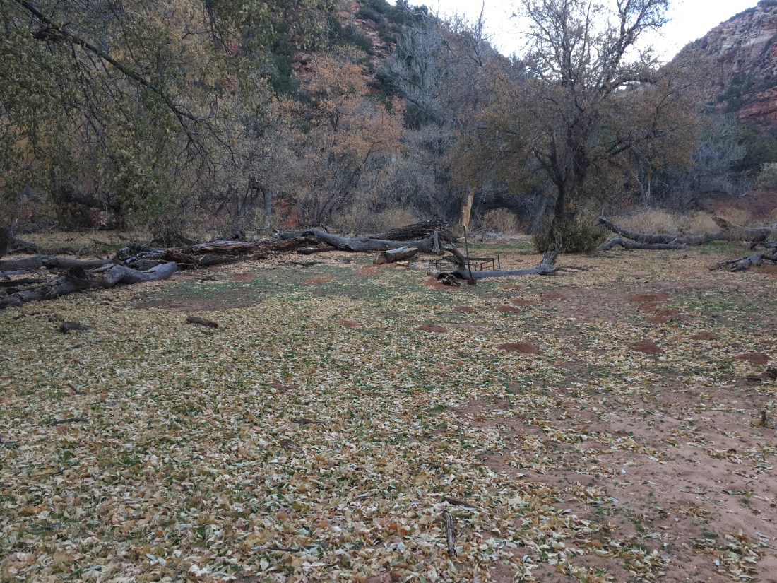
Memories from November 15, 2018.

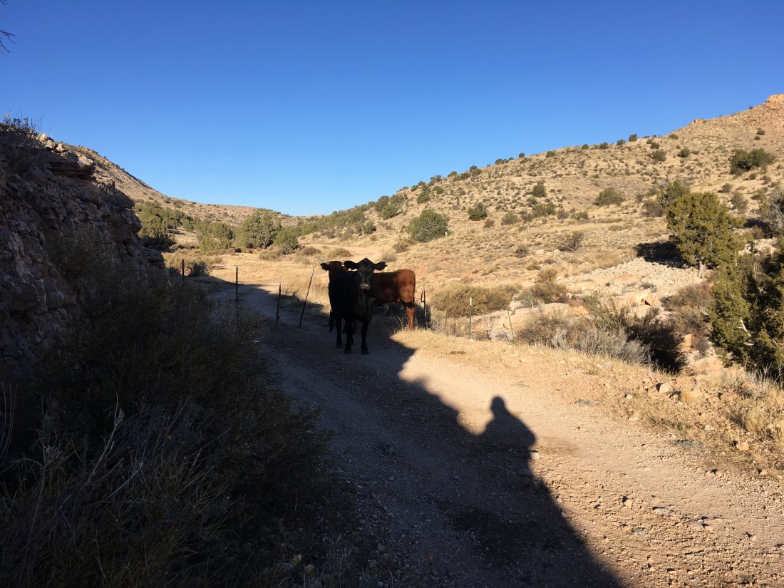
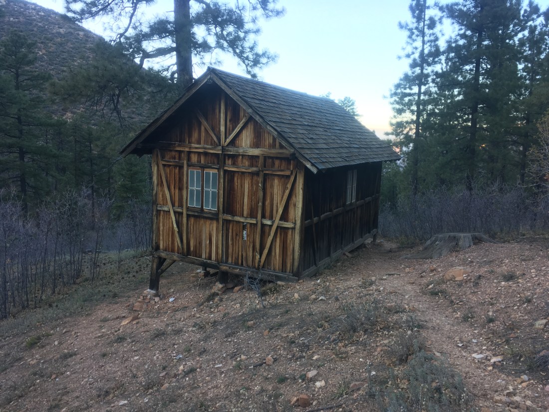
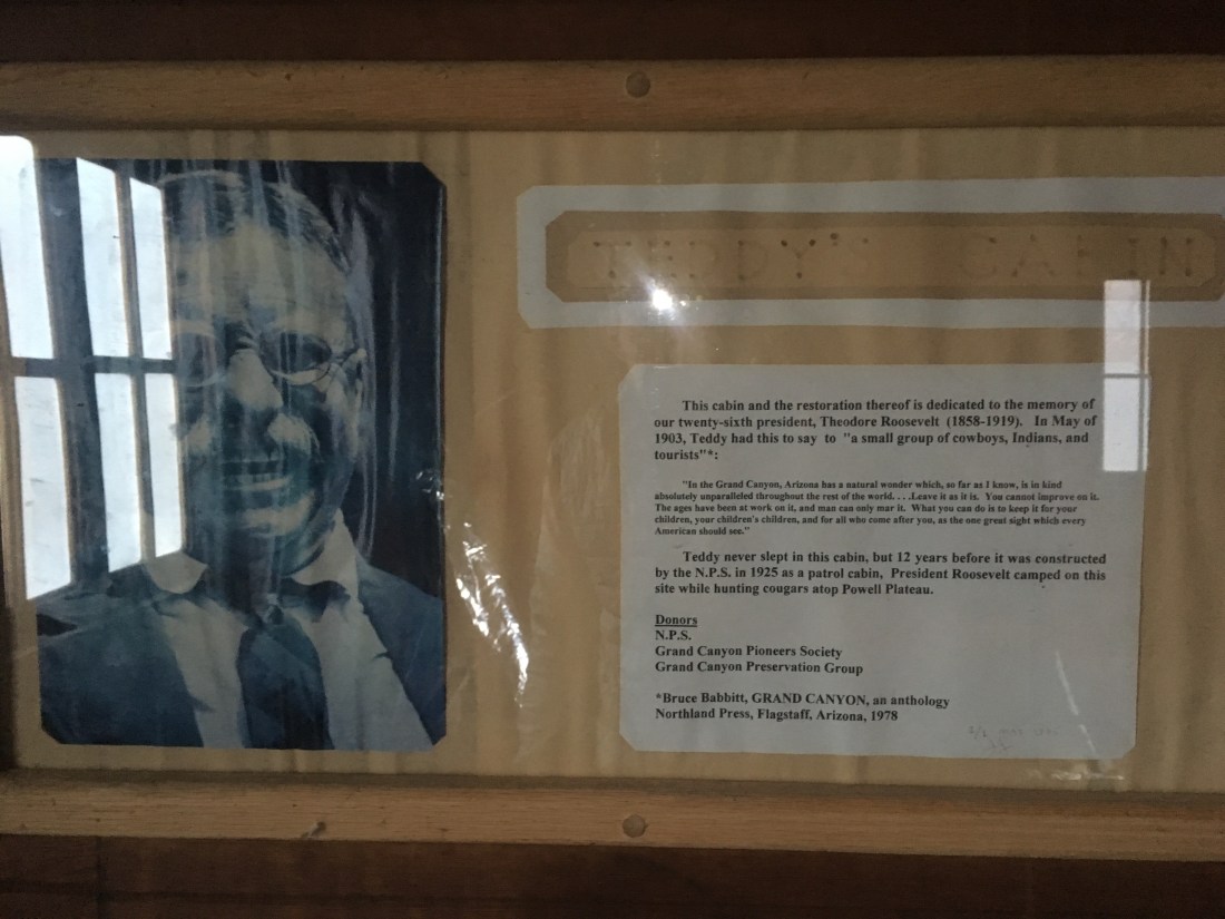
Last night there was some animal which was walking around the outside of Teddy’s Cabin in which I was sleeping. At one point it clawed softly at the door and later under a window. Great for peace of mind.

Knowing that it was going to be tough going, I procrastinated for half an hour while it was still dark instead of starting getting started at 6am. I ate my largest meal for breakfast instead of the usual pop tarts so they I wouldn’t have to pull my food bag out in the middle of the plunge pool section.

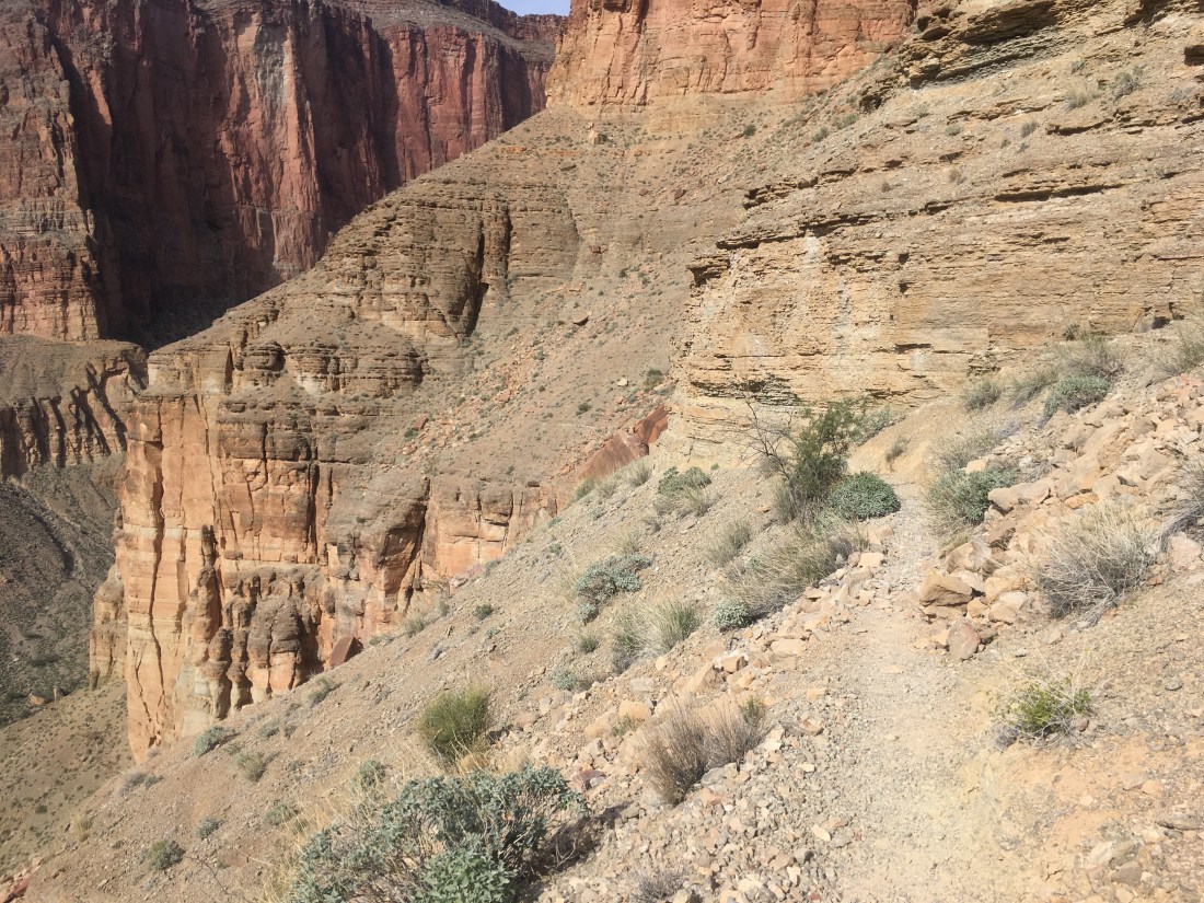
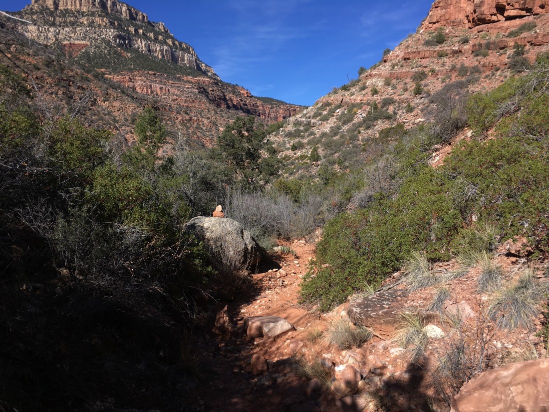
The bushwhack started half an hour after sunrise. I was wearing my puffy (a 13oz synthetic – one of those 8oz UL thing would have gotten shredded), gloves, and per the guidebook’s recommendations pants. With they much armor, the going wasn’t that bad though there weren’t any thorn bushes which were my great fear. The brush was usually easy to push through and rarely very deep. As at many points today, I thought back to Young’s Canyon, my previous hardest day on trail, and and this was easier that pushing through the reeds.

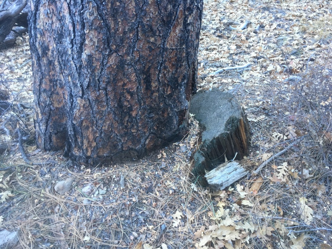
The most interesting thing I saw was a cut tree stump. I didn’t see evidence of other trail work and it wasn’t close to anything in particular so I wonder why it had been cut down.

About two hours in, I reached the impossible pour off. There were some smaller pour offs before it. In one case it was just high enough that I tried a sketchy bypass. The bypass was sketchy enough that I lowered my pack and then lowered myself as much as possible before jumping the last few feet.

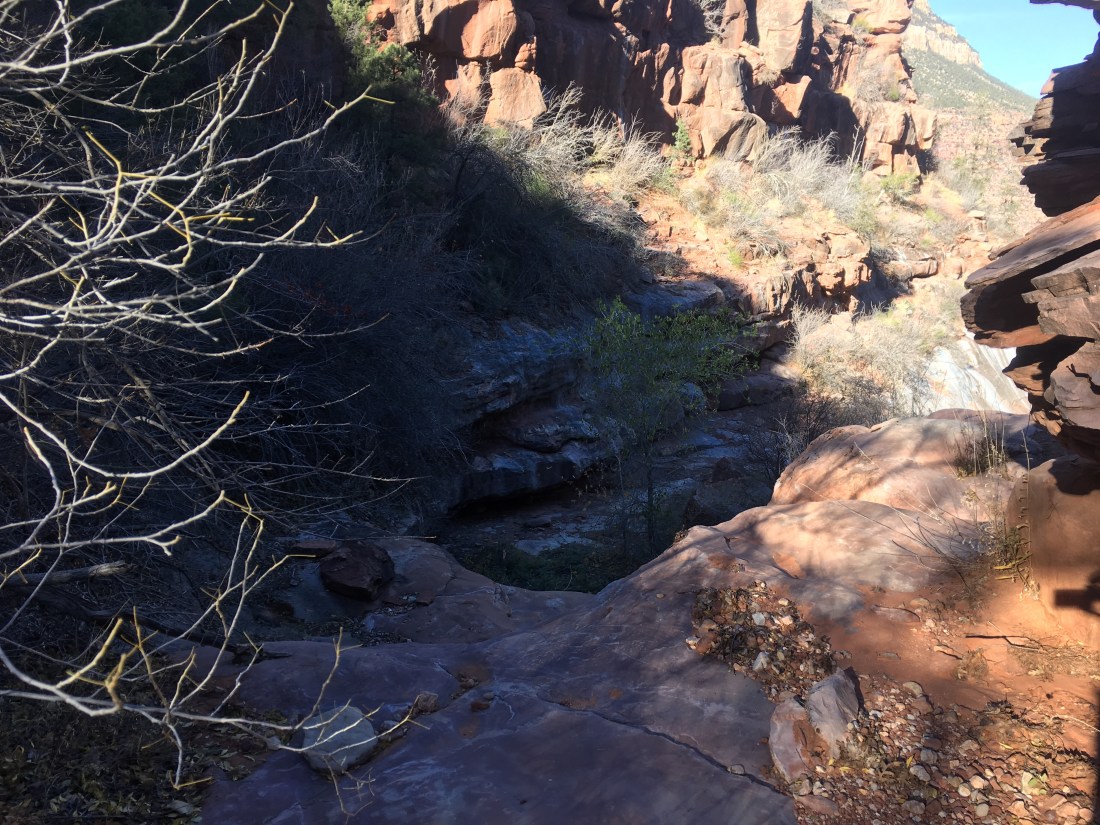
I found the cairns marking the impassible pour off’s bypass route pretty quickly by backtracking. The use trail is pretty faint and I went a little too high which lead to me backtracking once when the footing got too sketchy. At some point I picked up a familiar set of footprints which I’m pretty sure belong to the last two Haydukers to sign the log book at Teddy’s Cabin.

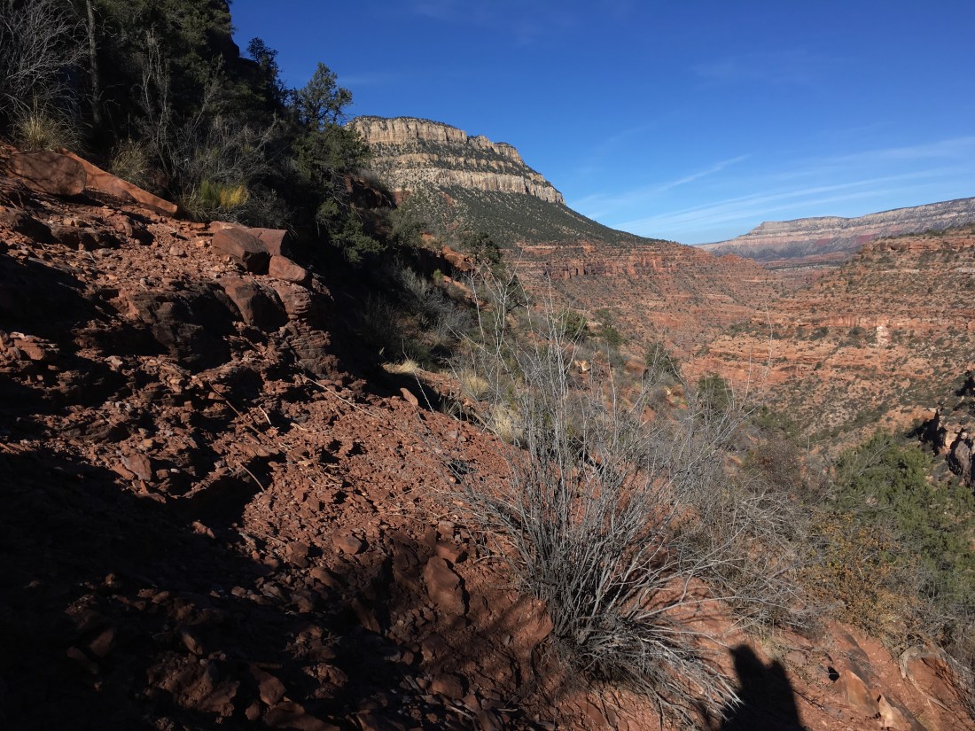
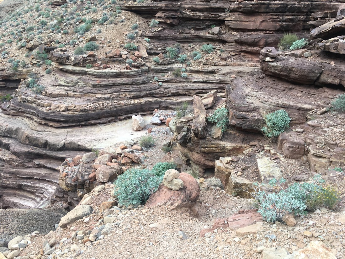
In what was a short distance but a long time due to the extreme caution exercised (a theme for today), the top of the ridge descended under the contour I was on and I followed the top of the ridge. There were cairns but the only one which was useful was near the end of the flatish length before a drop off. Without it I would have descended the left side sooner but instead was able to continue more or less along the top. Eventually, I started dropping to the left side following footprints or what looked like use trail. Things had started well with the rocks and rivulets almost forming switchbacks and stairs.

Eventually thing started to get sketchy but I could see the skid marks from where someone had gone before. At this point, the descent was in a gully into the canyon west of where I’d started the bypass which didn’t sound like what the guidebook’s directions were but it joined the correct canyon so I wasn’t too concerned.

Eventually, I had to switch back up canyon to avoid getting cliffed out. I haven’t been in a steep sketchy gully while worrying about getting cliffed out before so it was a pretty uncomfortable. My final line to the canyon floor was one I’m sure hasn’t quite been taken before since it was through dense manzanitas with no sign of previous passage. The nice part about the dense brush a this point was the when I slipped, I almost didn’t hit the ground because the bushes held me up.

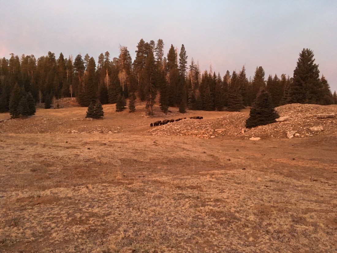
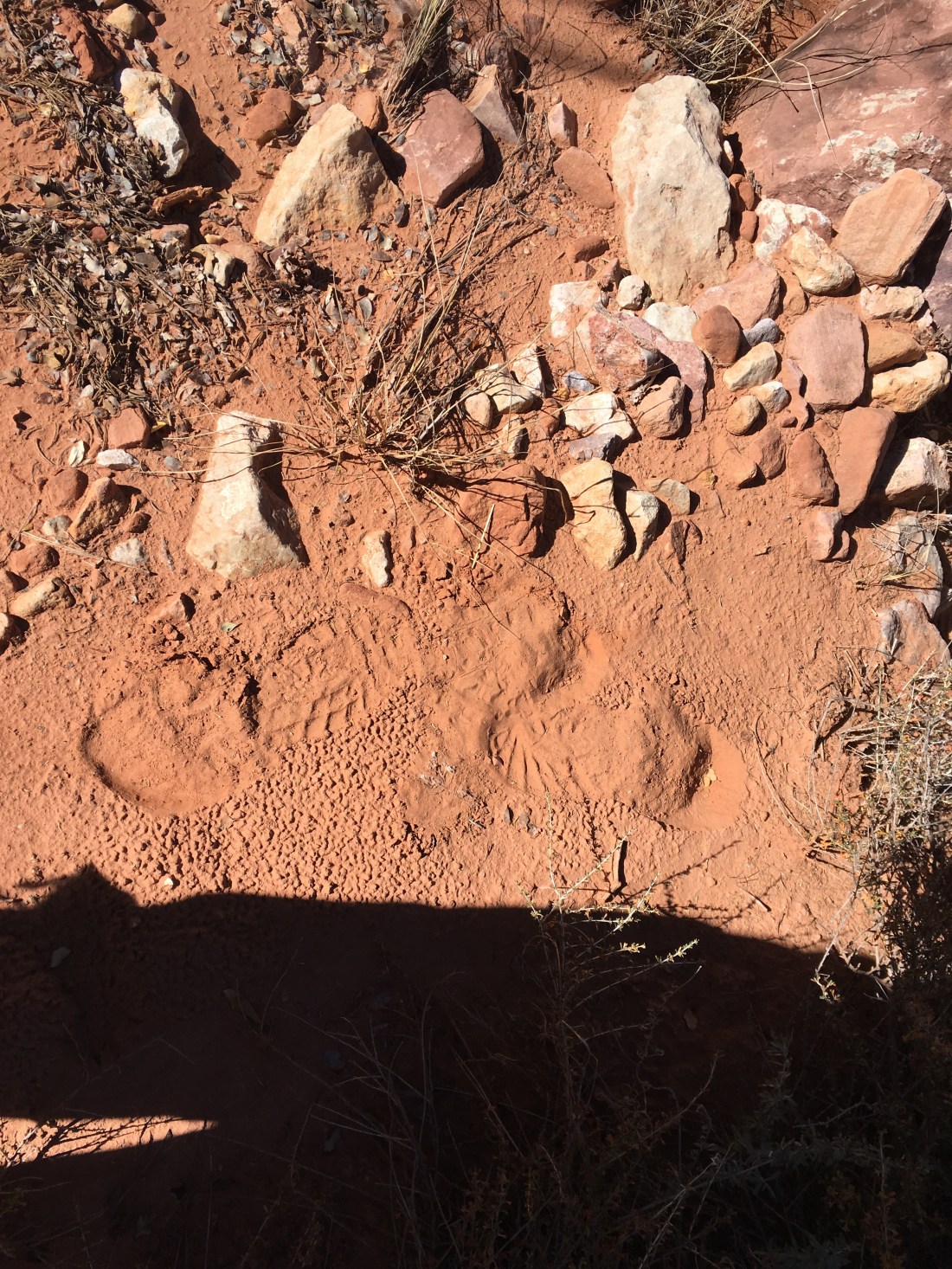
Once on the canyon floor, I hiked in the direction of the confluence with Saddle Canyon when encountered a cairn. Two in fact. Apparently you are supposed to descend into the drainage west of Saddle Canyon instead of walking the spot of land all the way to the end.

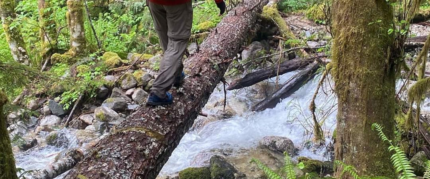
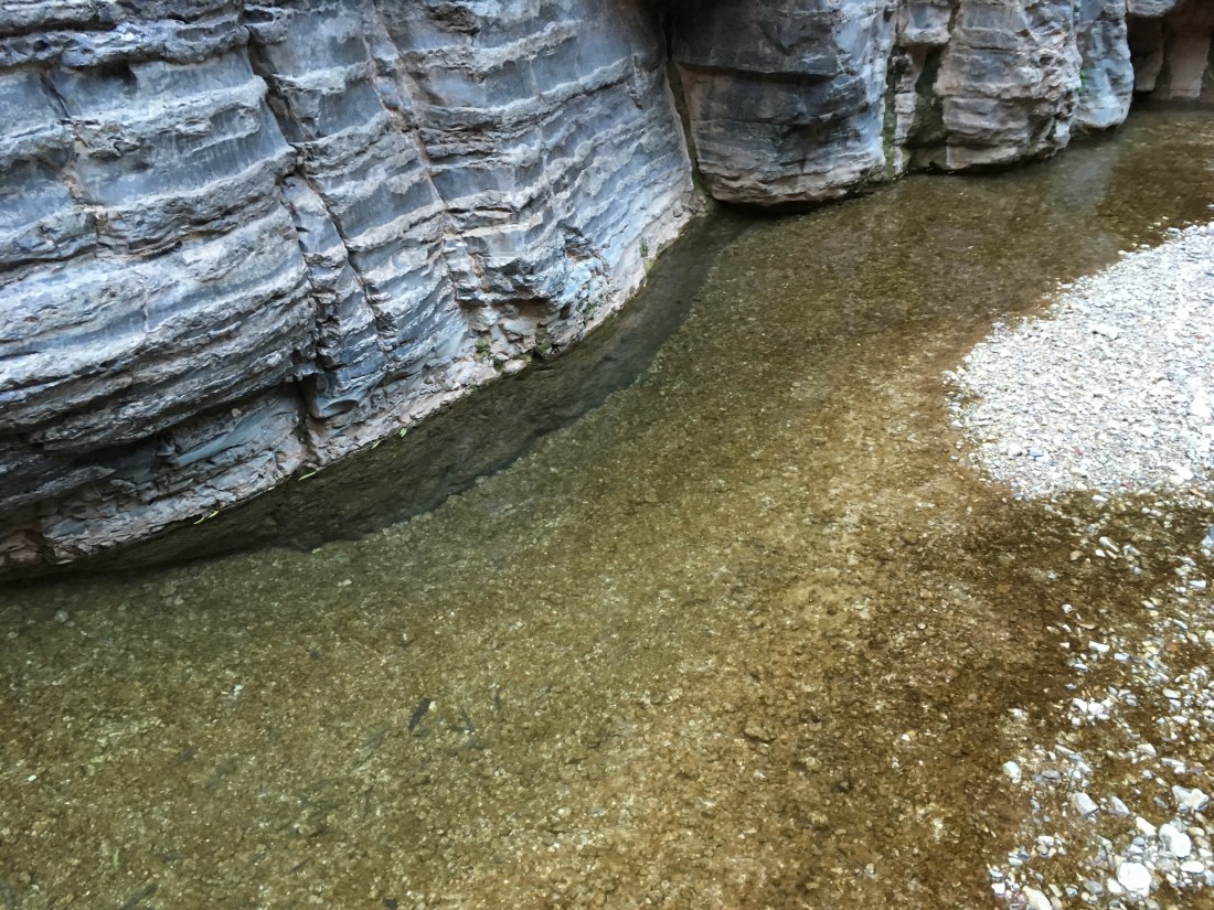
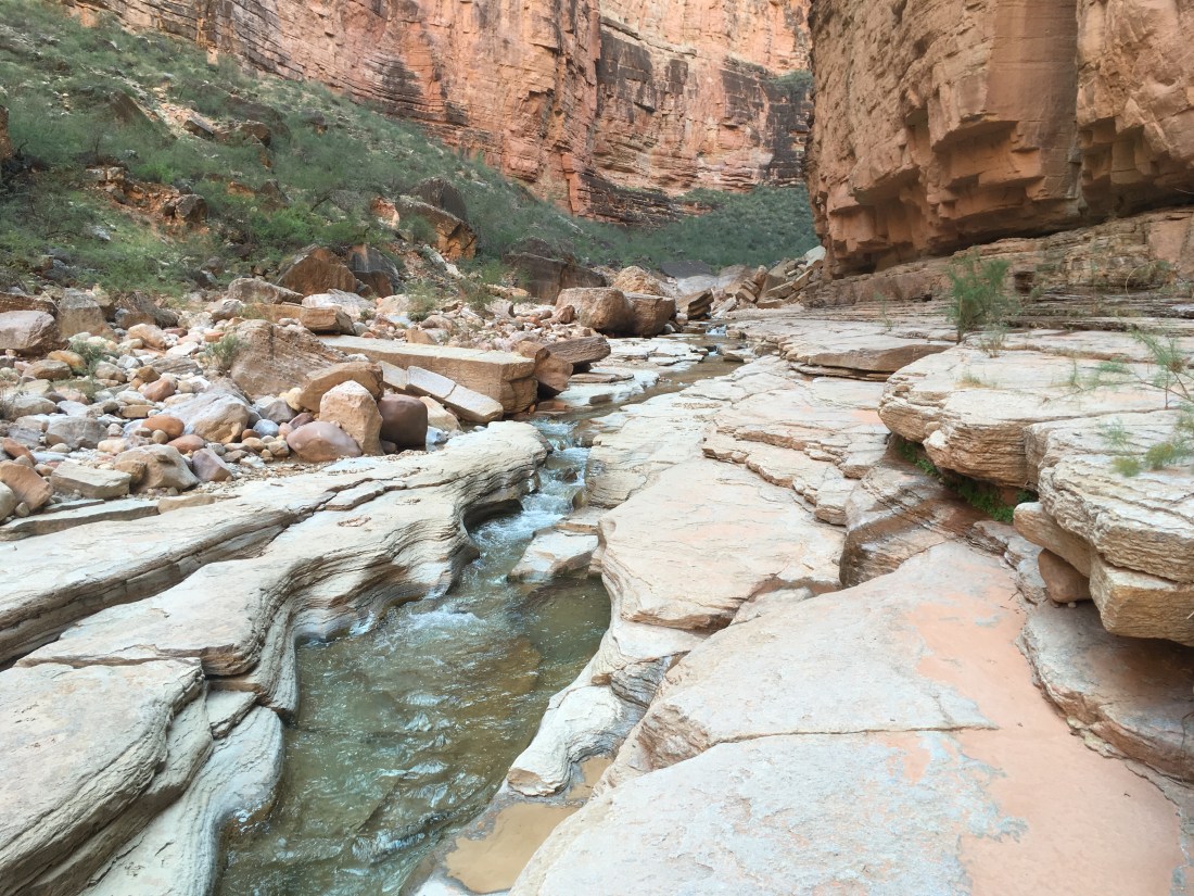
This would have been enough adventure for one day. But pretty quickly, I started running into smooth slides leading into pools of water. I’d been expecting them later and so initially I though I’d made great time. I went through one which was knee deep and then decided to bypass as many as I could. I think there were only two others I didn’t bypass. I’d been lulled into thinking they were all shallow and so wound up surprised when one was waist deep. I’d had my backpack boosted up onto one shoulder instead of over my head so I could control the descent with my other hand. On hitting the water, I pitched forward in waist deep water and got completely soaked though my head didn’t go under. In a later case, I lost a slim foothold just above the waterline on a bypass and slid into butt deep water. Plunge pools had gone from being a fun diversion to a real nuisance.

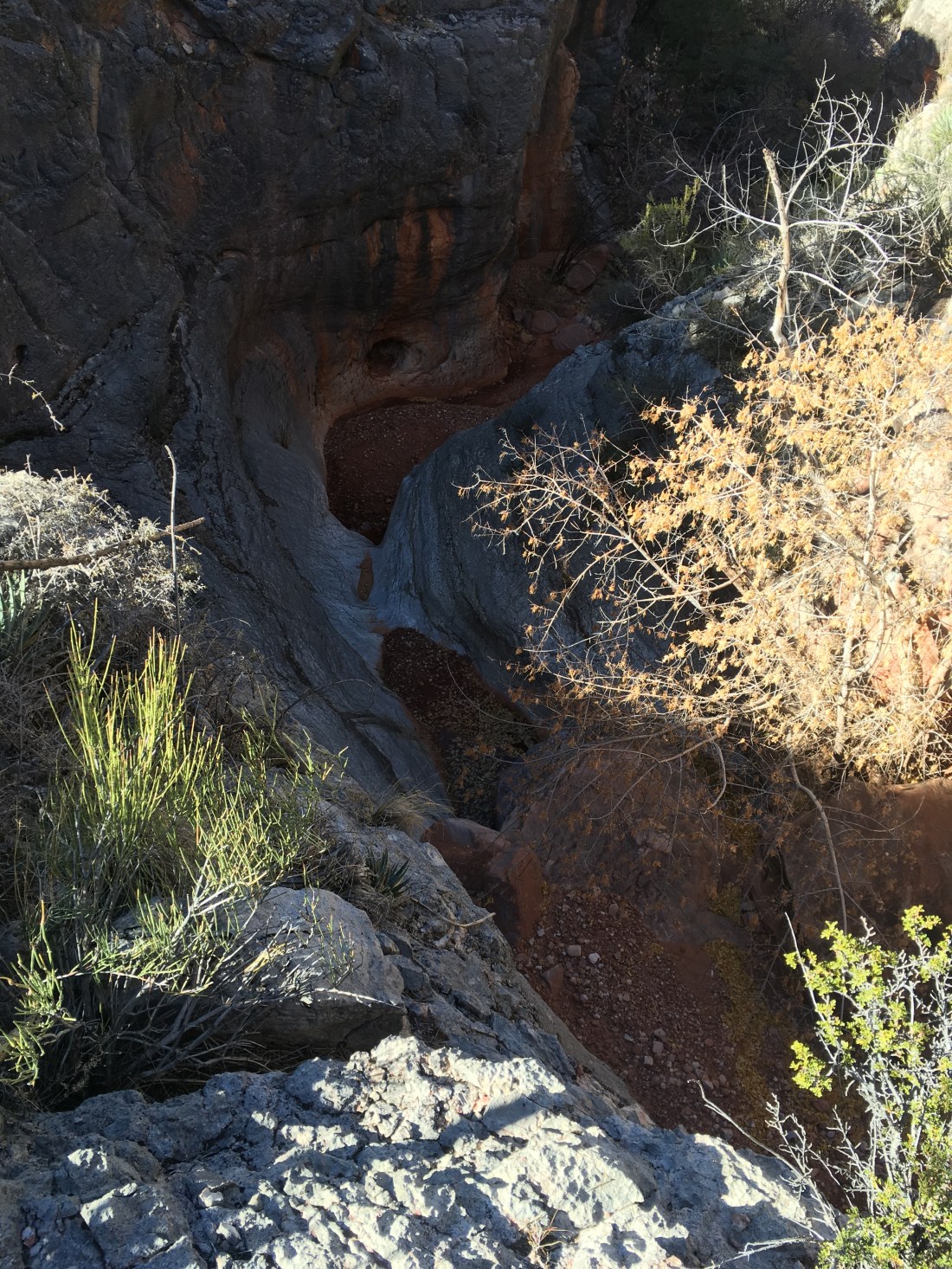
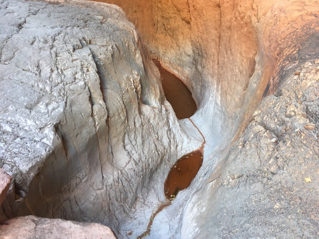
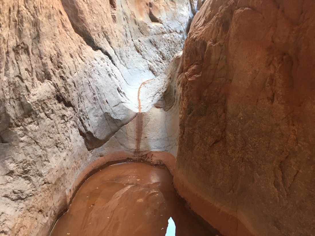
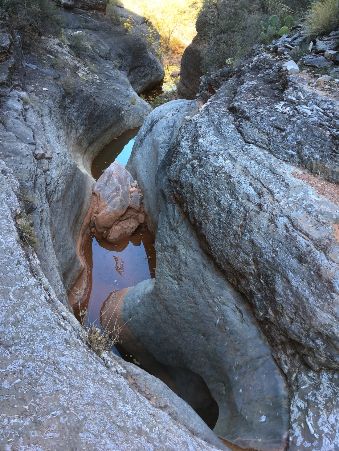
In time, I came to a plunge pool which lead to a larger plunger pool down a bigger slide which was partially out of sight. I climbed up on the flat bank of rock to see where it went and saw that it lead to another plunge pool under a pour off large enough that only a cliff diver would consider it.

Thus started the search for a bypass route to a pool I’d thought wasn’t bypassable. Apparently I wasn’t the first person to have some trouble here. The first thing I found was a ring of rocks outlining a small bivvy site in the narrow, flat lip of the pour off which was the only flat area large enough to support a person’s body. No picture because at this point my mind was on other things.

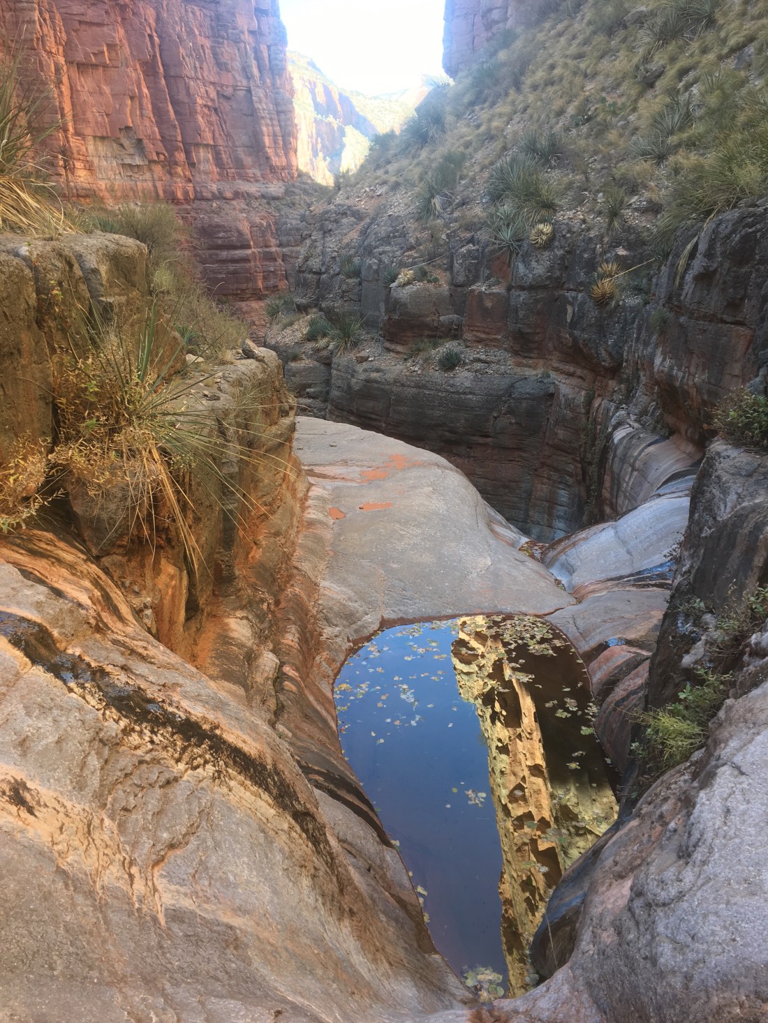
What ensued was by far the worst combination of sketchy footing and exposure I’ve experienced. The fact that it struck me as passable is only because the Hayduke has put me though so much else (and I suppose because there was obviously no alternative). On the way, I glimpsed a second large pour off below the first. This extended the sketchy scrambling and at one point I was back in a steep lose cut and about to be cliffed out. Maybe scrambling isn’t my thing.

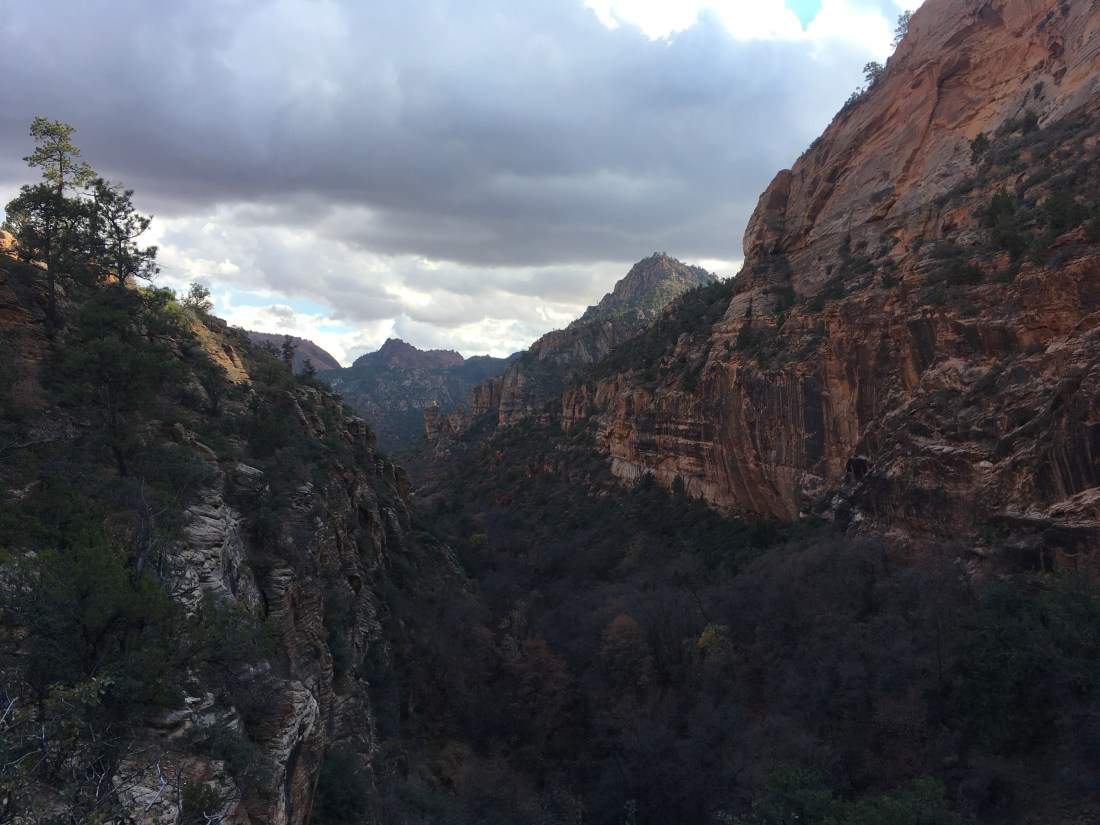
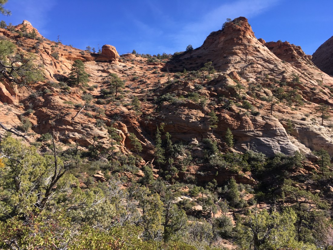
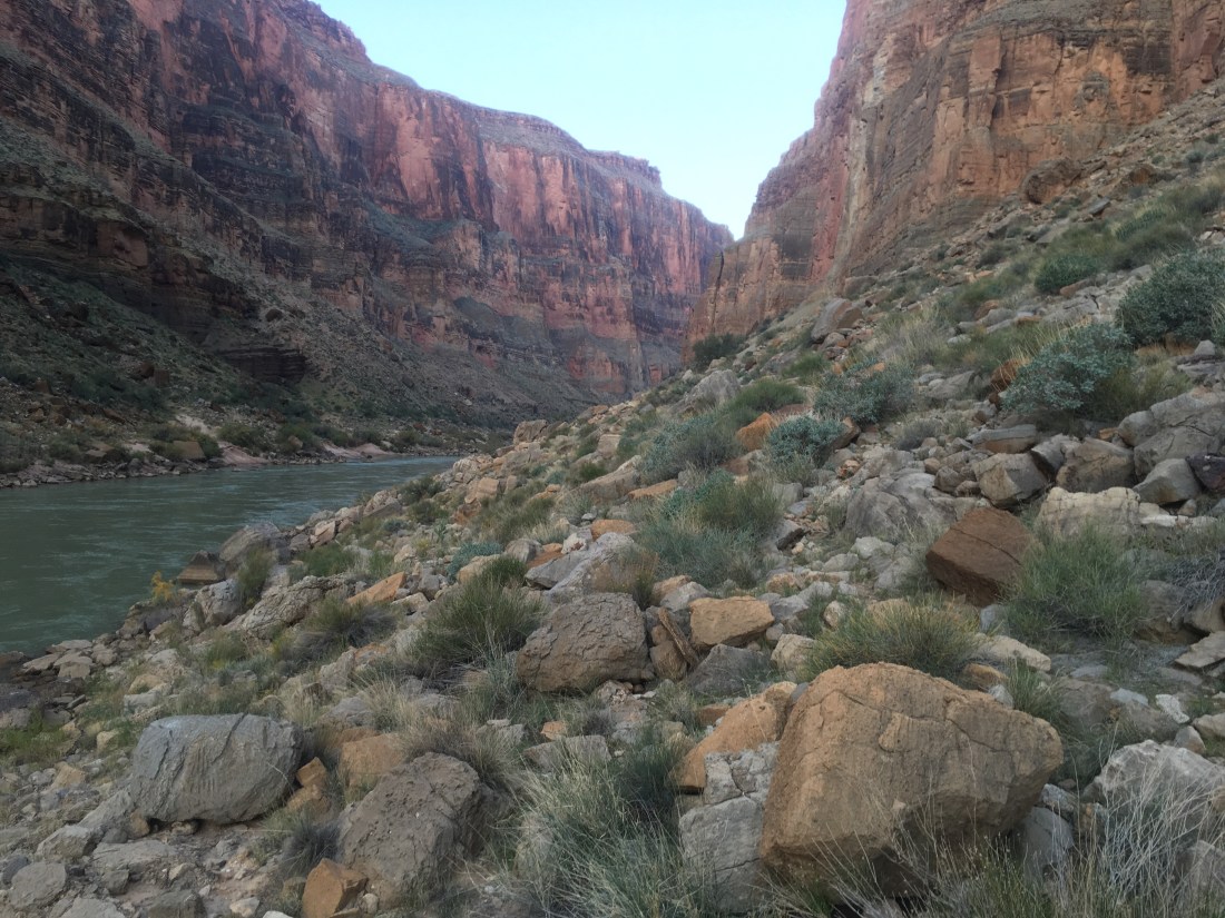
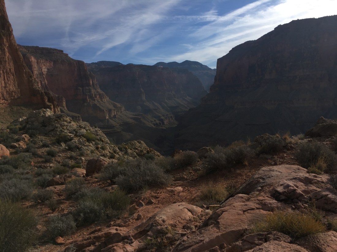
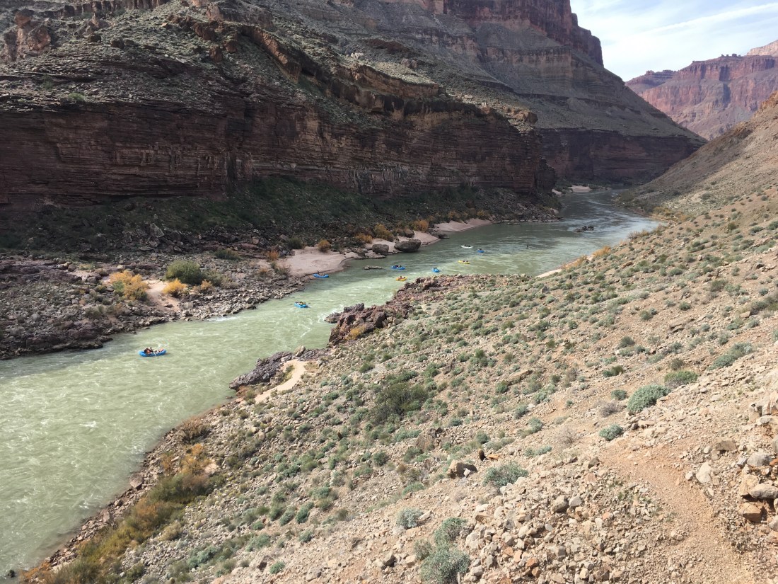
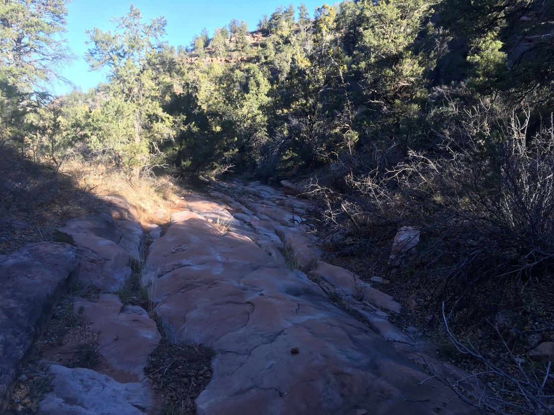
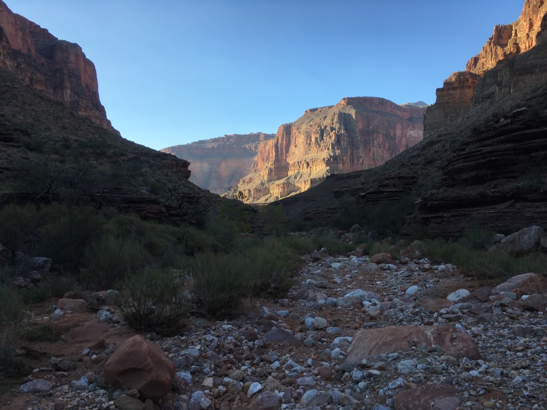
Finally on the canyon floor again, things were rough and boulder choked but the plunge pools were over. Unfortunately, according to my compass, the canyon was still northbound. It wasn’t until 7 hours after starting that I reached the westward bend and confluence with Crazy Jug Creek. These five miles were brutal though when the fear washes out of my memory, I expect the unique sculpting of the walls along this stretch to remain.

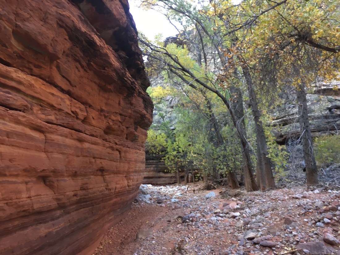
Tapeats Creek started quite shallow and quickly disappeared. I’d poured out my extra water and kicked myself mentally while trying to walk and hop down the rough streambed. The guidebook mentions that it might be easiest to just walk down the middle of Tapeats Creek and I thought it was so nice that the stream was dry to assist the mileage I was hoping to make to stay on permit, this still being Grand Canyon National Park.

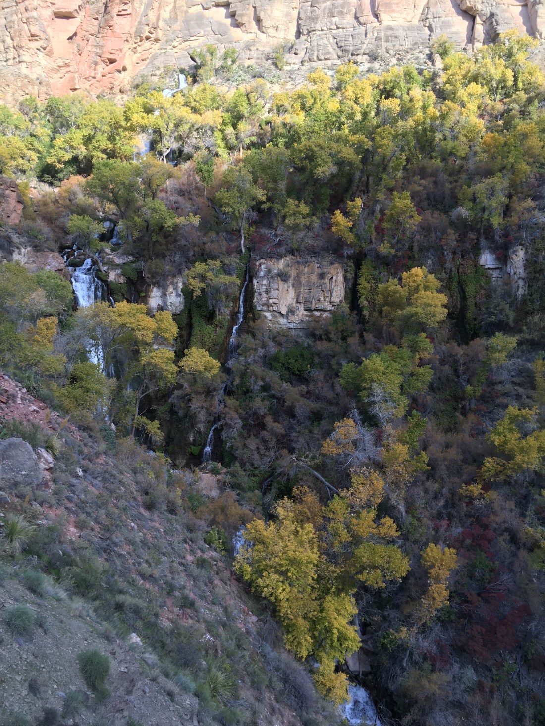
Then, from a side canyon came a thundering stream. Not Thunder River but thundering nonetheless.

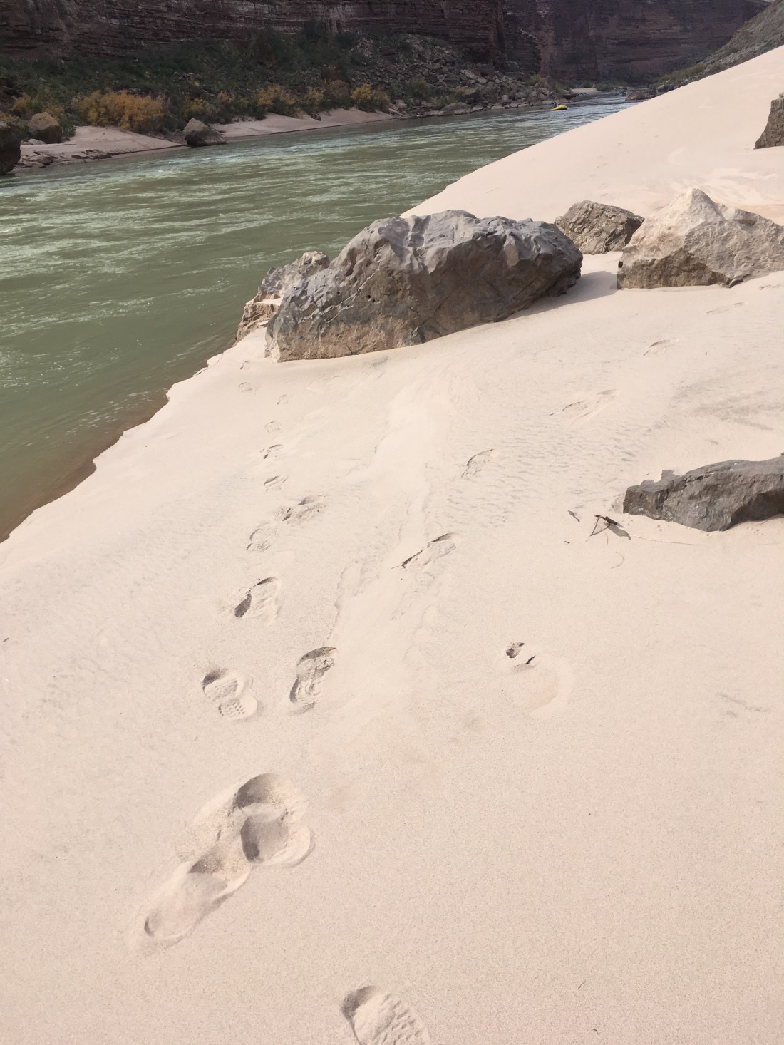
At this confluence, there was a cairn across the stream with a clear trail. I followed it uphill as it started it fade and decided that this was the high water alternate the guidebook had mentioned. With about an hour until sundown and what I thought was just a mile of creek left, I doubled back and found a trail on the south side of Tapeats Creek. Shortly, however, it ended, pointing into the rushing creek where the canyon walls left no bank on either side like a wide narrows.

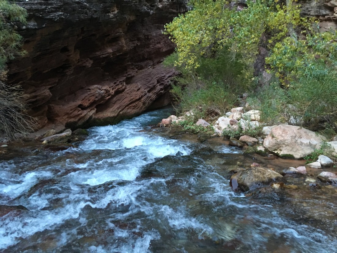
I didn’t like the idea of wandering down the middle of a fast moving knee to thigh deep creek with no banks on waning daylight. I went for it though and discovered that where the creek was particularly deep or fast, a bank appeared and on that brief bank, a trail.

This connecting of small bits of land with creek walks was actually quite fun. You have to try to pick a line which won’t suddenly become deep. You can’t see your footing and have to feel your way a bit. One of my poles and it’s tip broken off earlier and I would have wished for both poles but the water wasn’t forceful enough to need it.

Half an hour before sundown the stream appeared to enter another “narrows” section just after a bank with a great campsite under and overhanging ledge. I broke down and pulled out the GPS to see if my assigned campsite were “just around the river bend” or if I’d be risking a river walk at night. My phone’s GPS put me just of the edge of what I might have been able to do and so I decided not to push it.

The InReach never got a fix so my parents will have to do without an evening waypoint today. I hope the helicopter I heard just now wasn’t them calling SAR on me.

Hayduke Day 42

Memories from November 14, 2018.

Today was a long hike to Swamp Point so I got up at 4am. I hadn’t gotten a head start last night because there’s a no camping zone a short distance ahead and I didn’t want to try and keep my water from freezing overnight. After loading up water at the admin building, I used the hanging scale to weigh my pack. 53 pounds. That’s with 9 liters of water for two days as I was told Saddle Canyon is dry, 6 days of food (and 2 of trash), and a large book I’d bought on the South Rim detailing all the deaths in the Grand Canyon which has proved quite gripping and might be why I’m carrying 9l if water.

The hike itself was on dirt roads for about 28 miles through pine and aspen woods.

Shortly after sunrise I heard a strange low grunting sound. It wasn’t a motor, it wasn’t a roar, it made me think of the phrase “Wookiee lullaby”. It turns out it was a heard of bison in a meadow which I entered shortly thereafter. Now I know what sound bison make.

Other than a stop by Point Sublime it wasn’t particularly scenic.

I think hikers use the road more than cars as a tree was down across it with footprints bypassing.

Swamp Point itself is spectacular. All day the canyon has been out of sight to the left. Within a half mile of the point, the ground stars to fall away on both sides until you’re left overlooking a huge saddle with complex valleys on both sides.

There was a Jeep at the trailhead which must have come in from the north. Despite being slightly off permit, I decided to go down to Teddy’s Cabin on the saddle because I’ve been wanting to visit it before the trip started. Fortunately the Jeep’s owners had had other plans so I had the place to myself. There are a few cots inside and a table. I unpacked everything so I can pack up with plunge pools in mind tomorrow and patch some gear. It’s not nearly as cold as the top of the north rim yesterday and the cabin makes things practically cozy.