Day 139: Oh Canada

Memories from September 6

I woke up 20 miles from the border today so there was no question that today was my last day on trail. Knowing that a watched pot never boils I avoided GPS and map checks. The scenery was great and the clouds cleared slowly over the course of the day. I saw a small rock slide which didn’t sound small. Really though, it was just another day on trail. Except for this:

I was expecting to spend the rest of the day at the Northern Terminus of the PCT. In an incredible anti-climax, nature called. There was a wilderness toilet just three miles away so I only spent an hour before making a high speed departure. 

I had been expecting to feel something at the end of the journey but other than a modest excitement, on par with cresting a big climb, I felt nothing. That said, walking from Mexico to Canada through wilderness doesn’t leave you unchanged. How those changes manifest, even what they are, is a thing of the future, and not really of the present. I expect that as I return to society, I’ll find that you can take a hiker out of nature but you can’t take the nature out of a hiker.

The End.

Day 138: Hart’s Pass

Memories from September 5

I didn’t want to get up this morning. This is something of a first on the trail but the intermittent rain and view occluding clouds had me pretty well down. At first I thought the light was too bright for overcast skies. Then I looked out saw grey instead of blue. What’s the point of hiking a National Scenic Trail (the PCT’s official name is Pacific Crest National Scenic Trail) if you don’t see it and the wind up cold and wet? Also, my air mattress has had a slow leak since the night before Stehekin.

Eventually I got moving. Exercise helped and at least what I could see was nice. Also, the rain was kind enough to limit itself to intervals of 5 min or less at a time.

Suicide bomber tree?

Eventually the clouds began to clear enough and I started getting almost giddy. The terrain is strangely like the desert but richer somehow.

Also, I get to Canada tomorrow. Wow.

There was trail magic at Hart’s Pass. I saw Salty which I hadn’t expected to again. His sawed off Crocs have been augmented with a tread he got somewhere to deal with all the rocks. I wound up trading stories with some thru-hikers from 2014 until there was a patchy blue sky instead of rain and headed out in great spirits.

The clouds came back but never followed through on their menacing.

Larches! These things look evergreen but eventually turn bright yellow and orange like something from Dr. Suess. 

Sometimes the clouds are as interesting as the terrain.

I camped about 20 miles from the Canadian Border. After all this time, I still have trouble pitching my tarp unless I can tie at least one guy line (but preferably 2) off to a tree.

Day 137: Missed Connection

Memories from September 4

Yesterday a friend and left a note at Rainy Pass saying she was in the area and was hoping to catch me on the way through. I wasn’t able to get in touch yesterday so after breaking camp, I waited by the road until around 9am in case she drove by. Finally, I was getting cold and mad at the WordPress app when it lost the contents of yesterday’s post which I was composing with stiff finger so I decided to call it a missed connection and move on. Anda – if you stopped by shortly thereafter, I apologize.

I spent most of today hiking with Starfish who you can see here being dropped off by a state trooper as I was getting ready to move on. She said that before giving her the hitch, the trooper ran her ID like a traffic stop. I suppose that’s a new definition of “tough hitch”.

A water feature on the way up to Cutthroat Pass.

The view from Cutthroat Pass. There were a lot of day hikers and weekenders that we passed on the way up then had to pass again because they passed us during this break.

The clouds made the morning views particular interesting.

Eventually those clouds decided to hail. And then rain. I would have preferred less indecision and that they had just stuck to the former as it bounces off instead of soaking in.

50 miles to go.

Love you Ma.

I slept at a campsite near Glacier Pass. Not quite as cold as the name implies which is good because I failed to start a campfire. I did clear out my unneeded maps and the lichen population. There were some weekenders nearby who, by the sound of their laughter, were being kept quite warm by their consumption of liquor.

For those of you who remember Jan who I’ve hiked with a number of times, a hiker I ran across today named June said that he and Strapless has trail names Jan Punisher because he does big miles despite shin splints, blisters, chafe, and disintegrating or misfitting shoes. I wholeheartedly support the motion.

Day 136: No Rain at Rainy Pass

Memories from September 3

On the way in to and out of Stehekin, the bus stops by a bakery. A really good bakery. And the bus stops there for 10 minutes. I didn’t get very far this morning because of a food coma.

Coon Lake. Not for from the High Bridge Ranger Station where the bus drops you to get back to the trail. I didn’t make much beyond this before taking my first break to let the blood finish up its work in my mid section so it could go back to the legs.

The Bridge River from the bridge over the river.

There was a lot of medium high shrub on the climb so there wasn’t much in the way of views.

This bridge is broken.

Fortunately, there’s another right next to it. Enjoy, for a moment the irony that a falling tree probably took out the bridge above while another falling tree provided the bridge to replace it. Once you’ve appreciated that, be a little disgusted at the horse poop (bottom left) mixing with the water just at the edge of the stream. I almost drew water downstream at the broken bridge.

This bridge is rolled. I haven’t seen this before but the recent rain made it slippery and so a particularly high stakes test of balance beam skills.

No rain at Rainy Pass! I did get a little drizzle and hikerwash on the way in.

Where the PCT crosses Washington Highway 20 at Rainy Pass, I got my first piece of trail mail. Anda, the friend who came out to hike with me between Vermilion Valley Resort and Red’s Meadow, had left a note saying she was in the area for the weekend and was hoping to catch me on the way through. There is no cell service and her name wasn’t in the trail register at either of the nearby trailheads. I walked both parking lots peeking in car windows like a car prowler hoping to find her car but no luck. Fortunately no one was around to alert the local authorities to my behavior. Having exhausted my list ideas of how to get in touch, I sent two SPOT check in messages, one at the highway and the other at the trailhead where the PCT continues. I set up camp behind the outhouse (it smelled as bad to me as I probably smell to most people) where the only flat spots were and figured that if she were in a nearby town and not out hiking she might check the map where the SPOT messages go and come find me in the morning.

Day 135: Stehekin

Memories from September 2

Today I walked the 12 miles to the High Bridge Ranger Station where I could catch a bus to Stehekin. Stehekin is on the northern tip of Lake Chelan and only accessible by ferry or float plane. There’s one road which runs between the town and the trail with stops at a couple of hiking spots, a ranch, and an excellent bakery. The walk itself was pretty uneventful with moderate foliage and light rain.

The view if Lake Chelan from Stehekin.

I was waiting for the public showers and laundry machines to become available when a hiker named Safe Bet I’d met on the bus said he’d booked a room an asked if I wanted to split it since there was a second bed. Originally, my plan had been to get out on the last bus. However, a well informed family which vacations in Stehekin every year said the ranch had a large or all you can eat dinner then pointed out free camping and so I decided to stay the night.  In the end I wound up going in for half the room which was a very nice break from the rain which has been dogging me on and off for the last few days. Things cleared up in the afternoon and a few hikers celebrated Safe Bet’s birthday on the deck overlooking the water.

Day 134: More Rain

Memories from September 1
It rained on and off for most of the day so I don’t have very many pictures. Water messes with the capacitive touch screen on my phone so I can’t swipe to open the camera from the lock screen. Also, clouds obscured most of the views so there wasn’t as much to take photograph.

During drier spells, I did get some pictures. This bridge, over the Suiattle River is the longest I’ve seen in the back country.

Here’s an amusing trail sign. North and South are within a few degrees of each other. Across from them (behind me) was a trail sign to Suiattle Road or something like that.

For a moment, I was hoping it would clear up.

Red Cross and Napoleon who I camped with last night caught up while I was taking a snack break. Toward the beginning of a long, climb shortly before the rain restarted. Napoleon left the break hiking like a mad man and I chased him up the hill for my own motivation. Like yesterday, I think the scenery would have been fantastic as the terrain seemed to open up towards the crest into an lush, unoccluded (except for the clouds), well watered, and sufficiently varied trail. Here was an attempt to capture the gist of it.

I wound up camping just short of a ford where a trail side boulder had a large space beneath, making for a warm and sheltered campsite. The last mile or so had appeared untouched by the rain and I considered trying to build a fire to dry my clothes. Since I’ll be getting in to Stehekin tomorrow, I washed my socks instead since they were wet anyways and spent a little time trying to arrange logs to bridge to creek.

Day 133: The Wait Is Over, It Rained In Washington

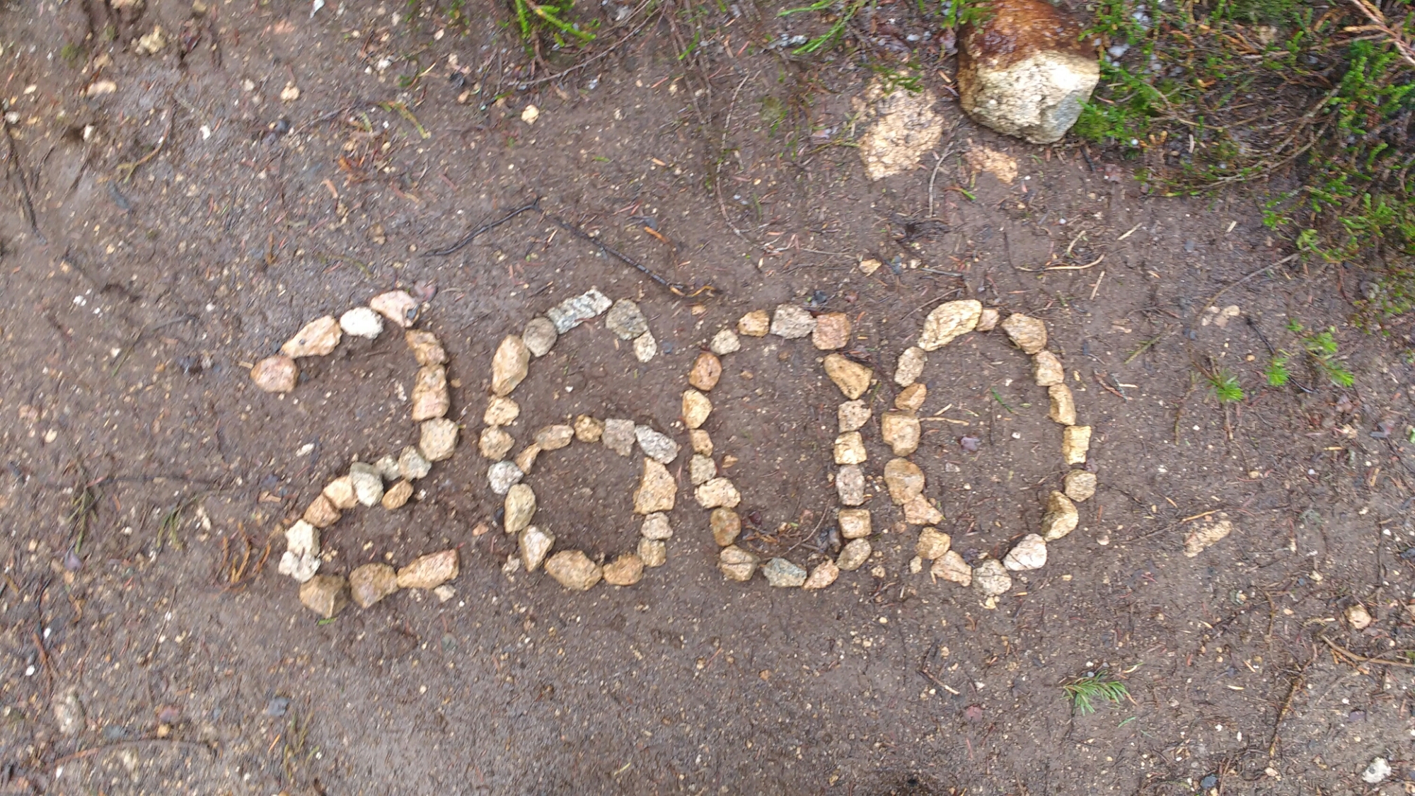
Memories from August 31

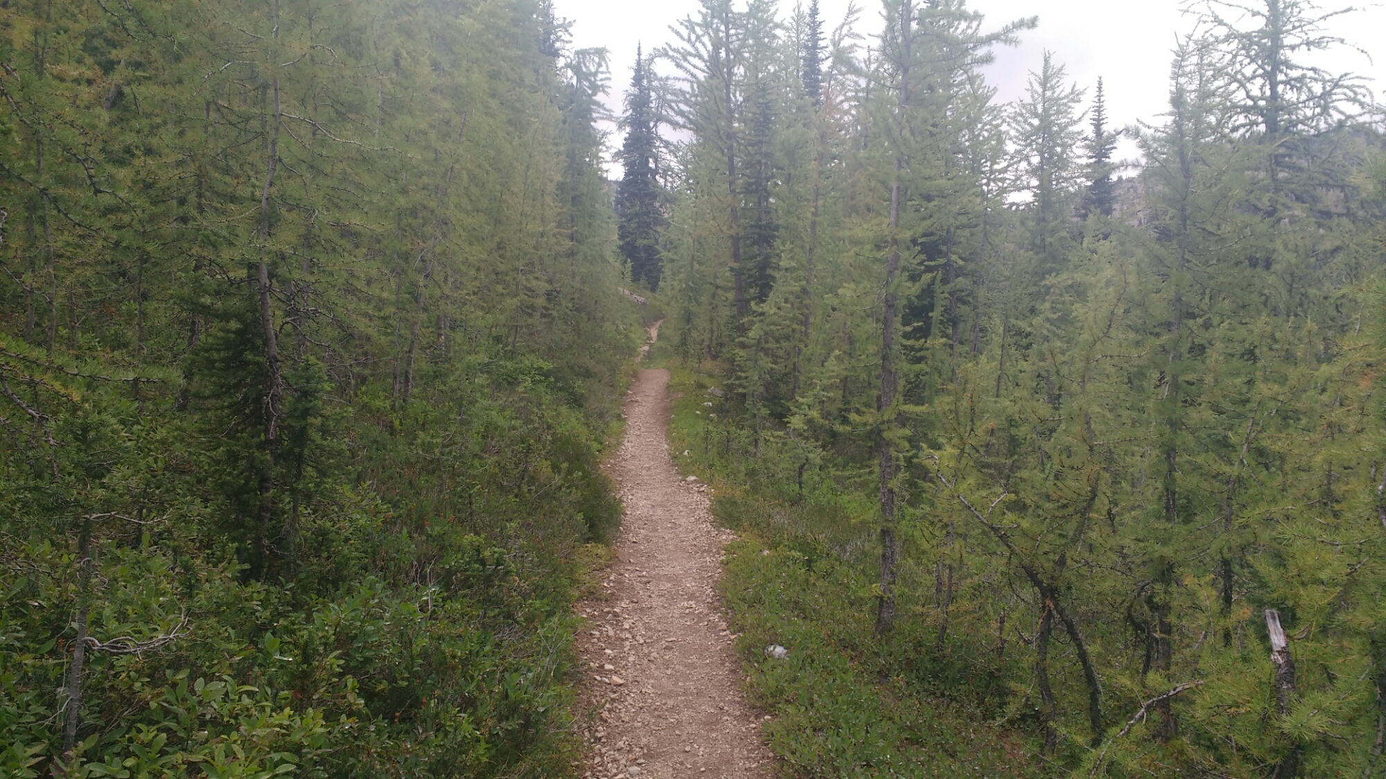
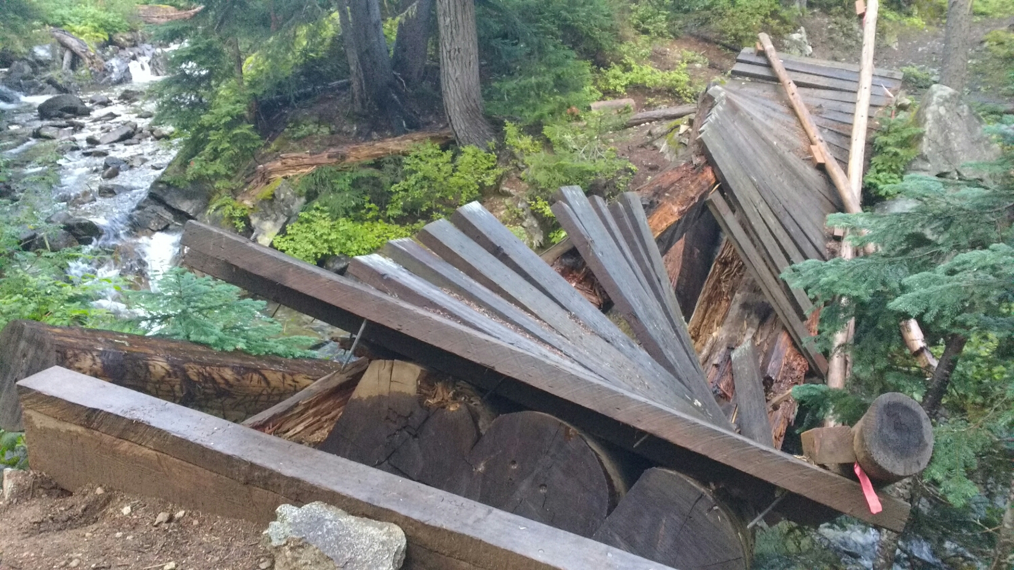
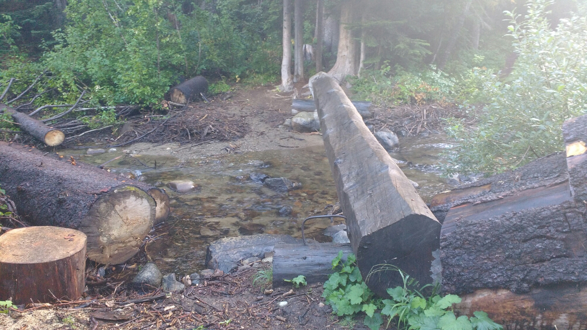
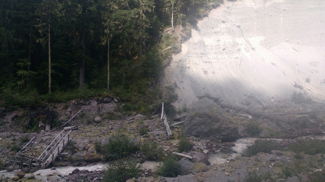
The first part of today was mostly a walk in the woods. I did learn that if you’re going to break a bridge, this is the way to do it (lower left). That way, it’s still usable, at least later in the season when the creek is low.

During a break at Glacier Creek, was passed by Lap Song (who I knew of as Will) who I last saw at the Deep Creek Hotsprings and Matador (who I knew as Emily) who I last saw at the Big Bear Hostel. I remember Emily in particular because she carried a Bluetooth keyboard so she could blog and correspond more easily. They had flipped up to Canada from Castella and are now hiking south to avoid being stuck in Washington at the end of fall.

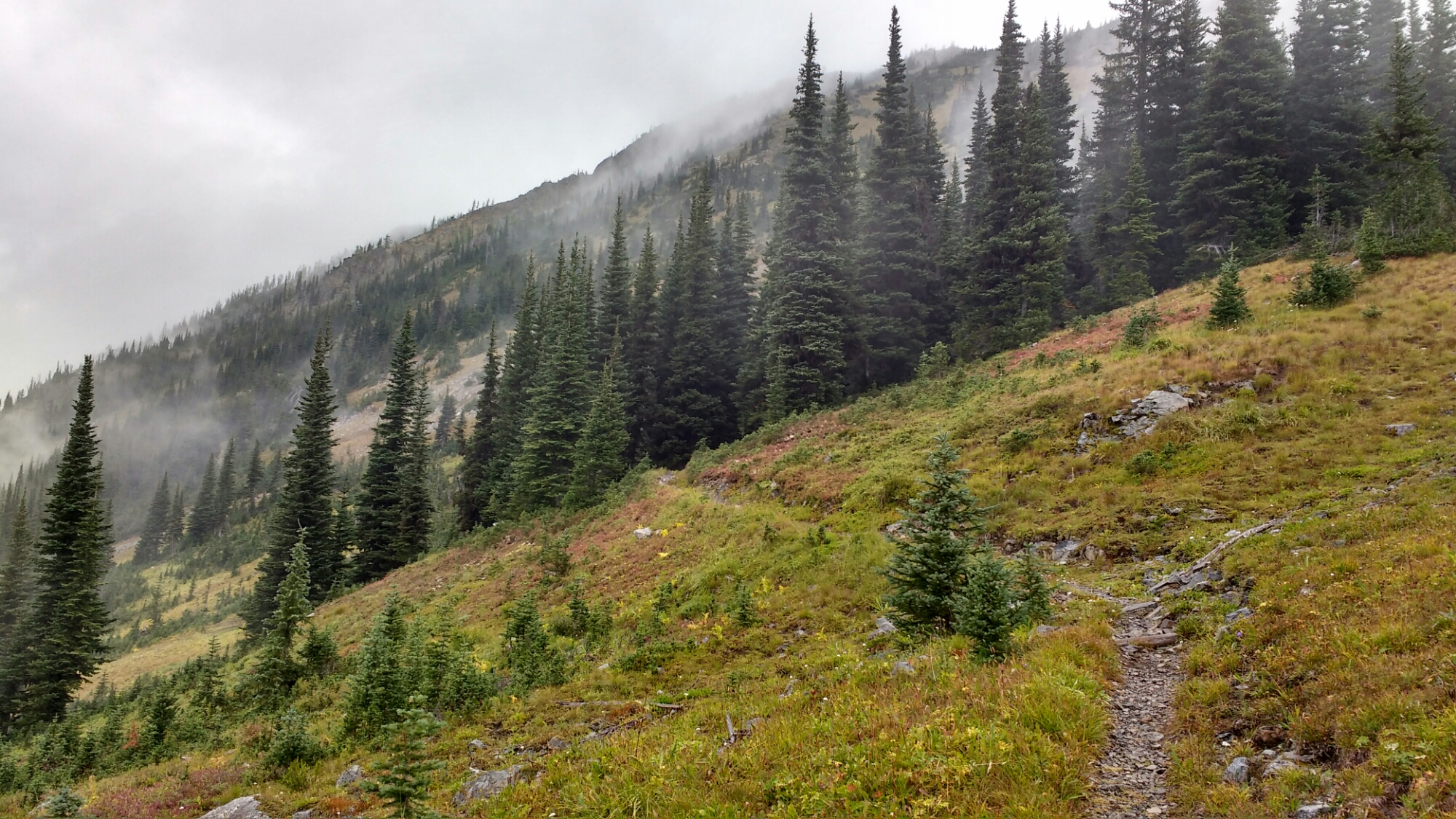
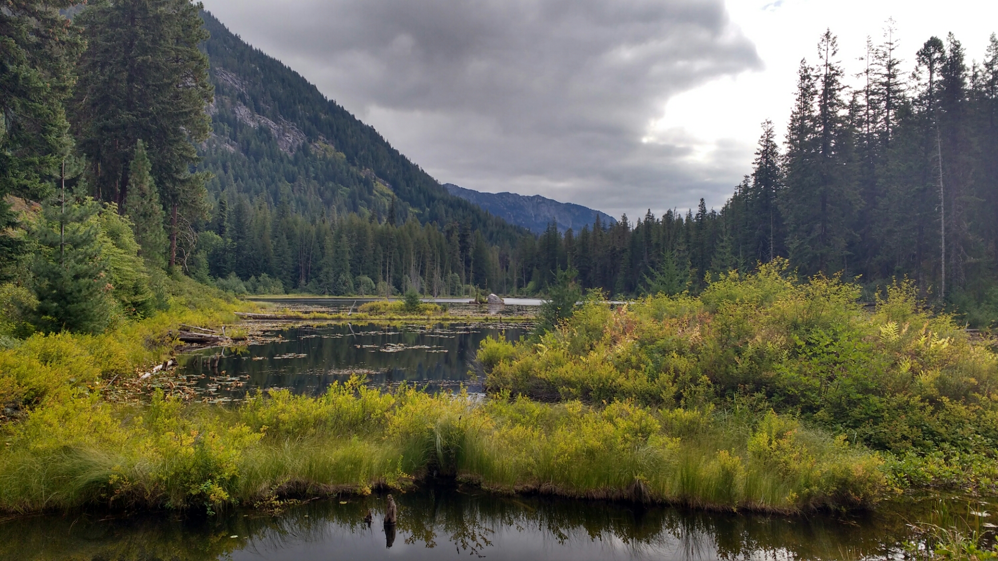
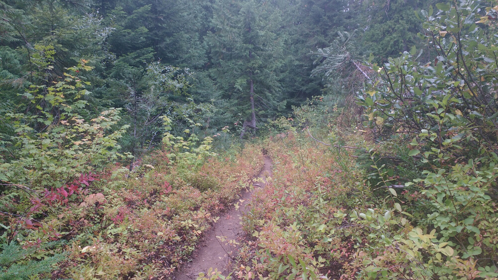
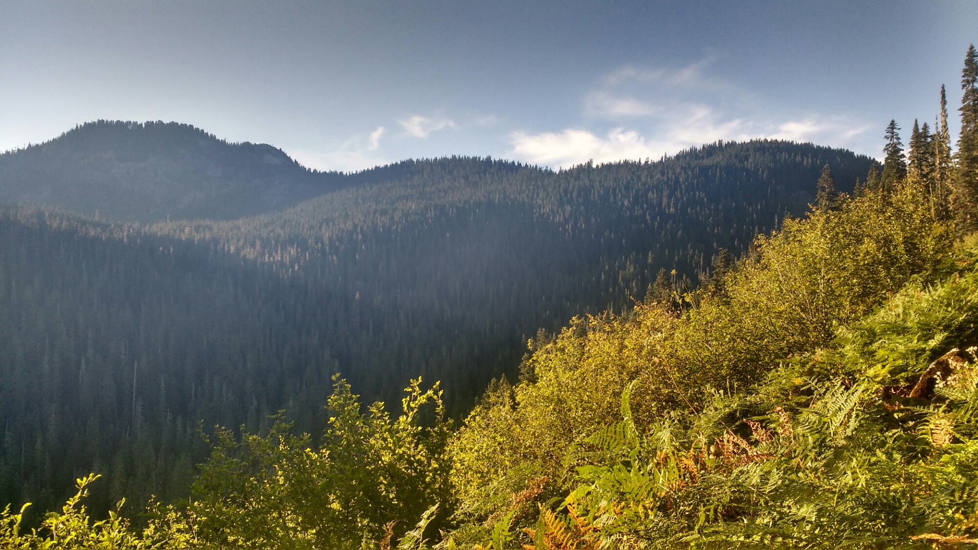
The long uphill portion of the  morning and early afternoon eventually lead out of the woods and contained some really nice scenery.

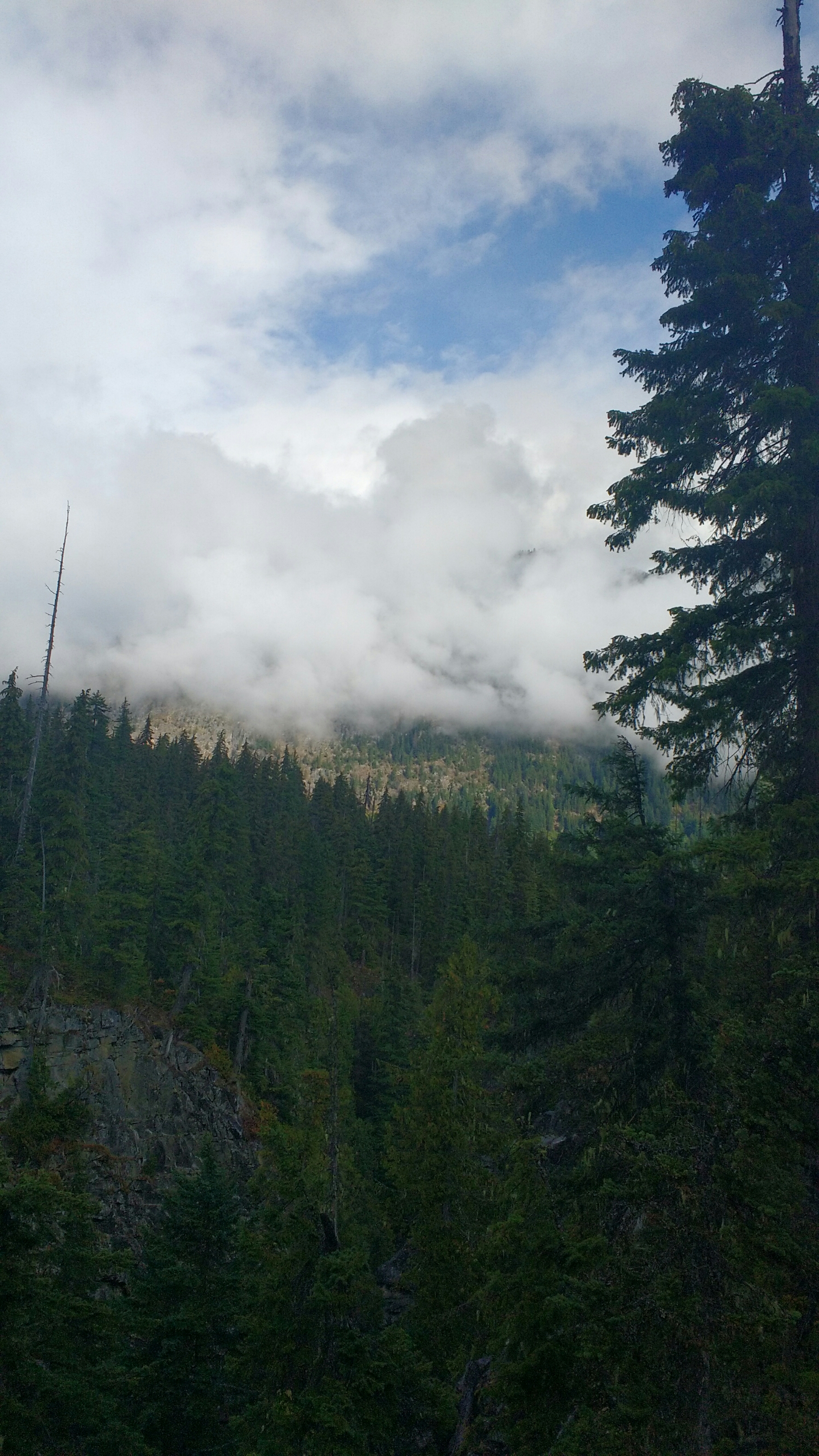
Valley and clouds. The clouds have been more and more a factor in the hike. It’s been cooler because of the overcast and sometimes the softer light makes it easier to take pictures but other times the contrast between cloud makes it hard not to over expose the sky.

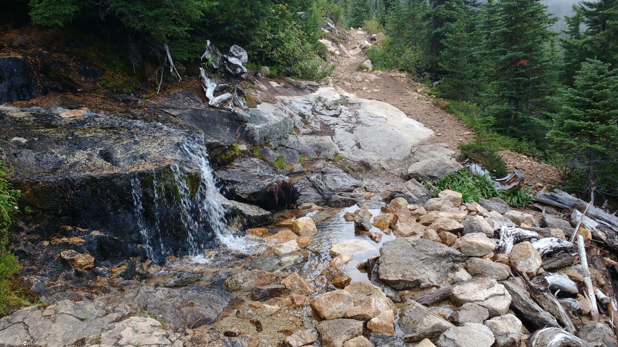
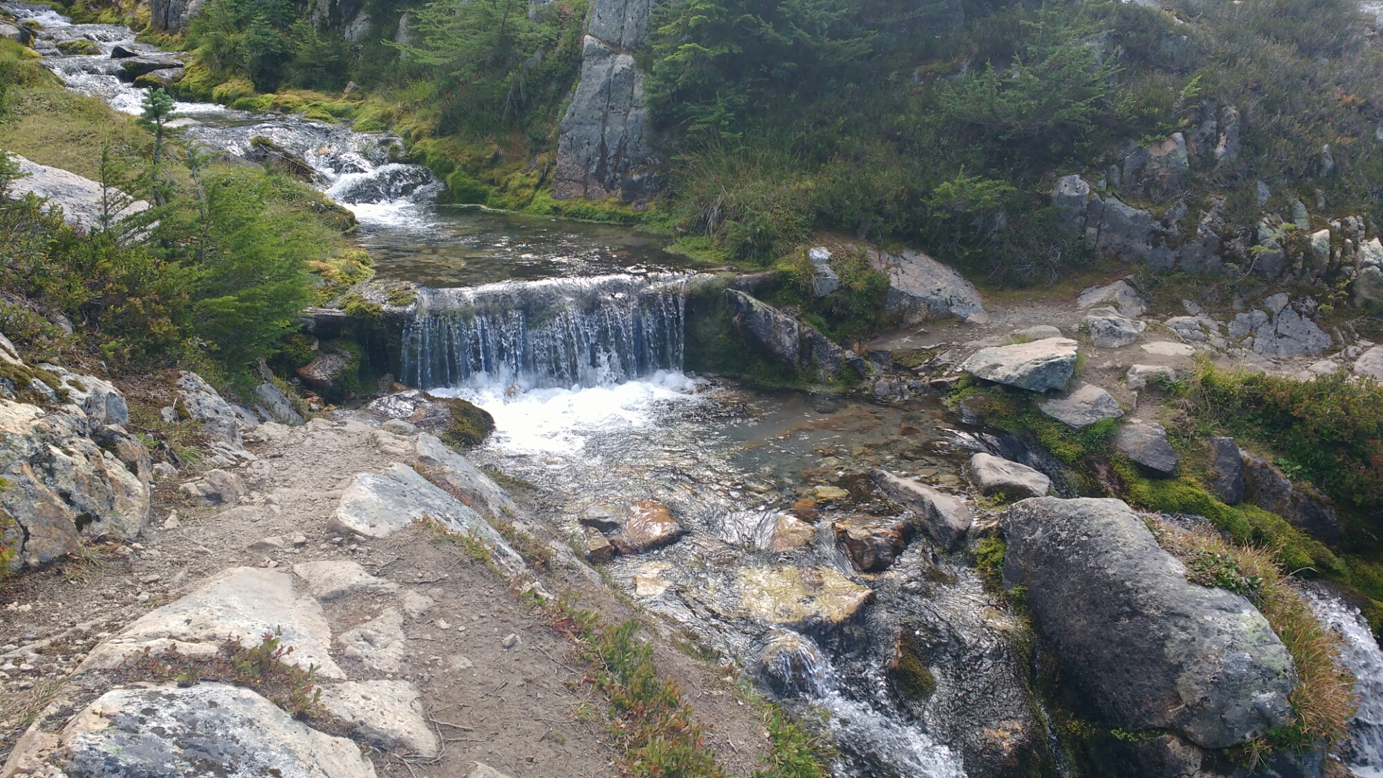
A small water fall by the trail.

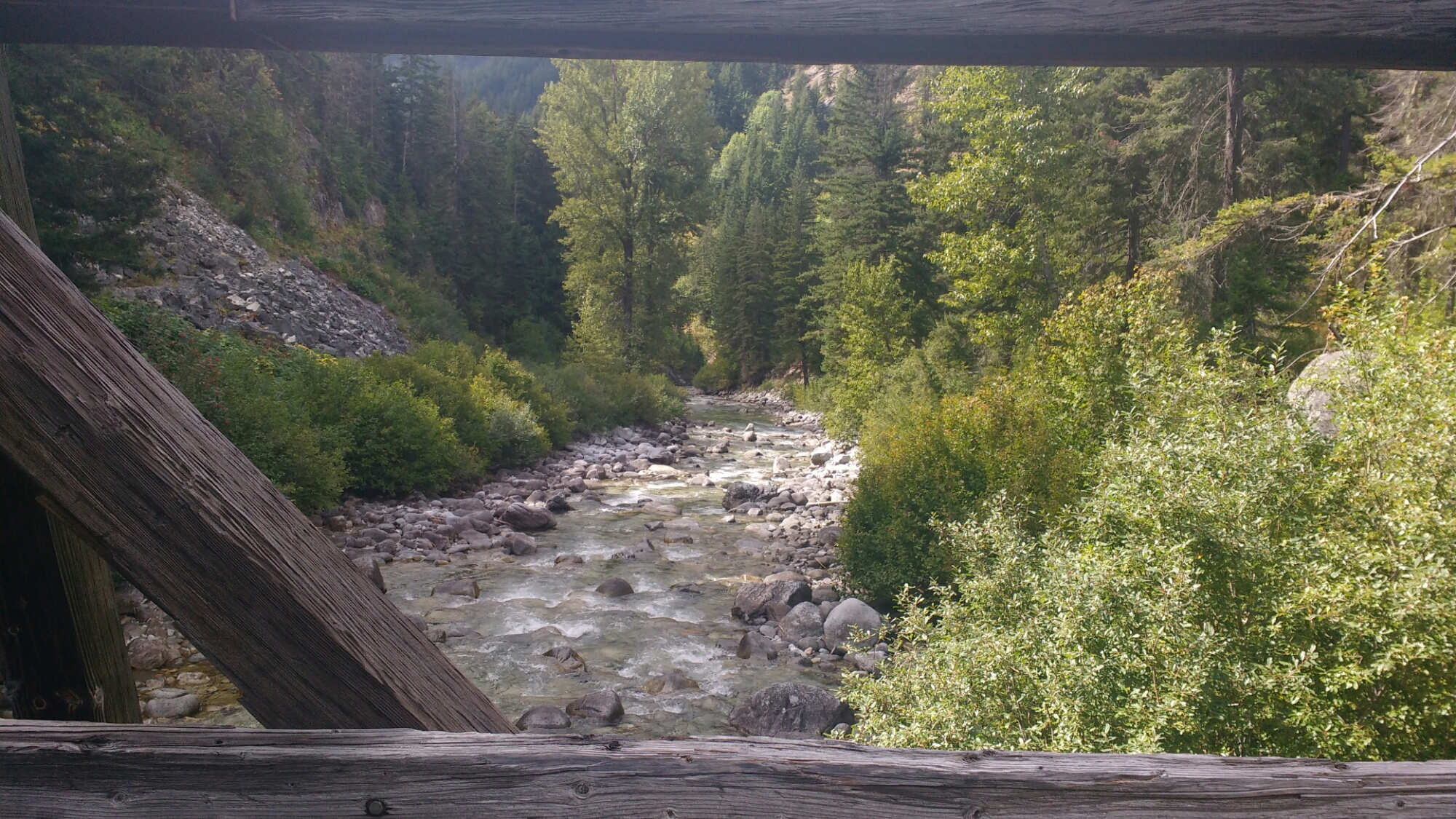
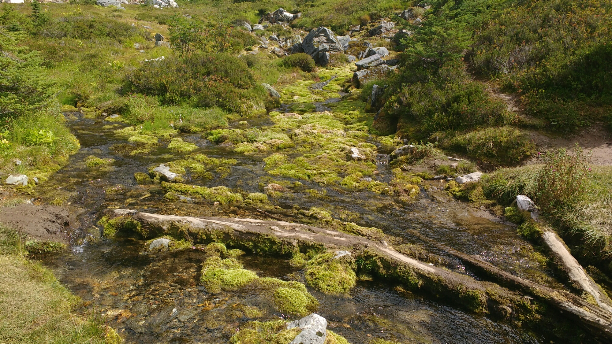
Two streams merging where the trail crosses.

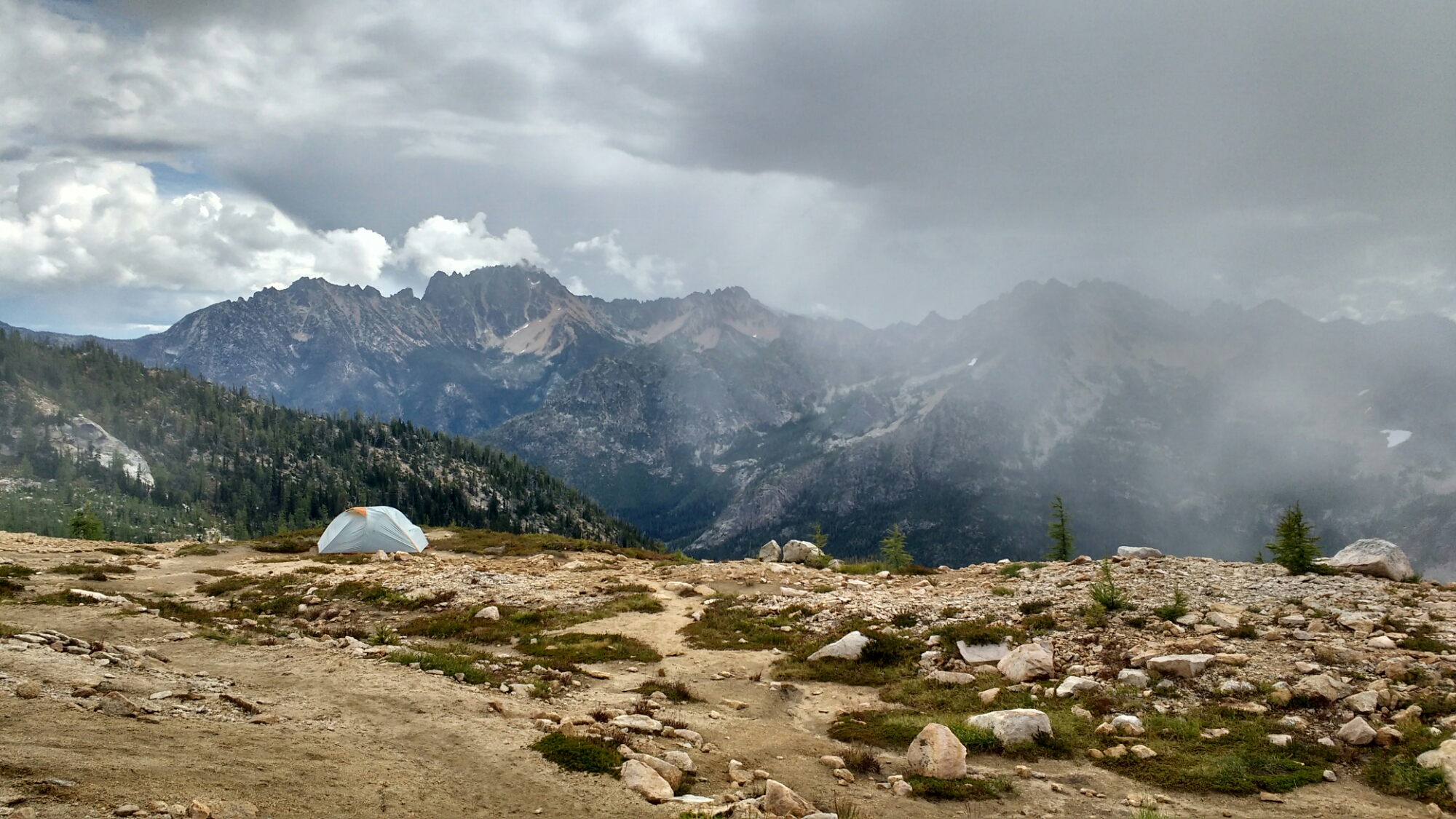
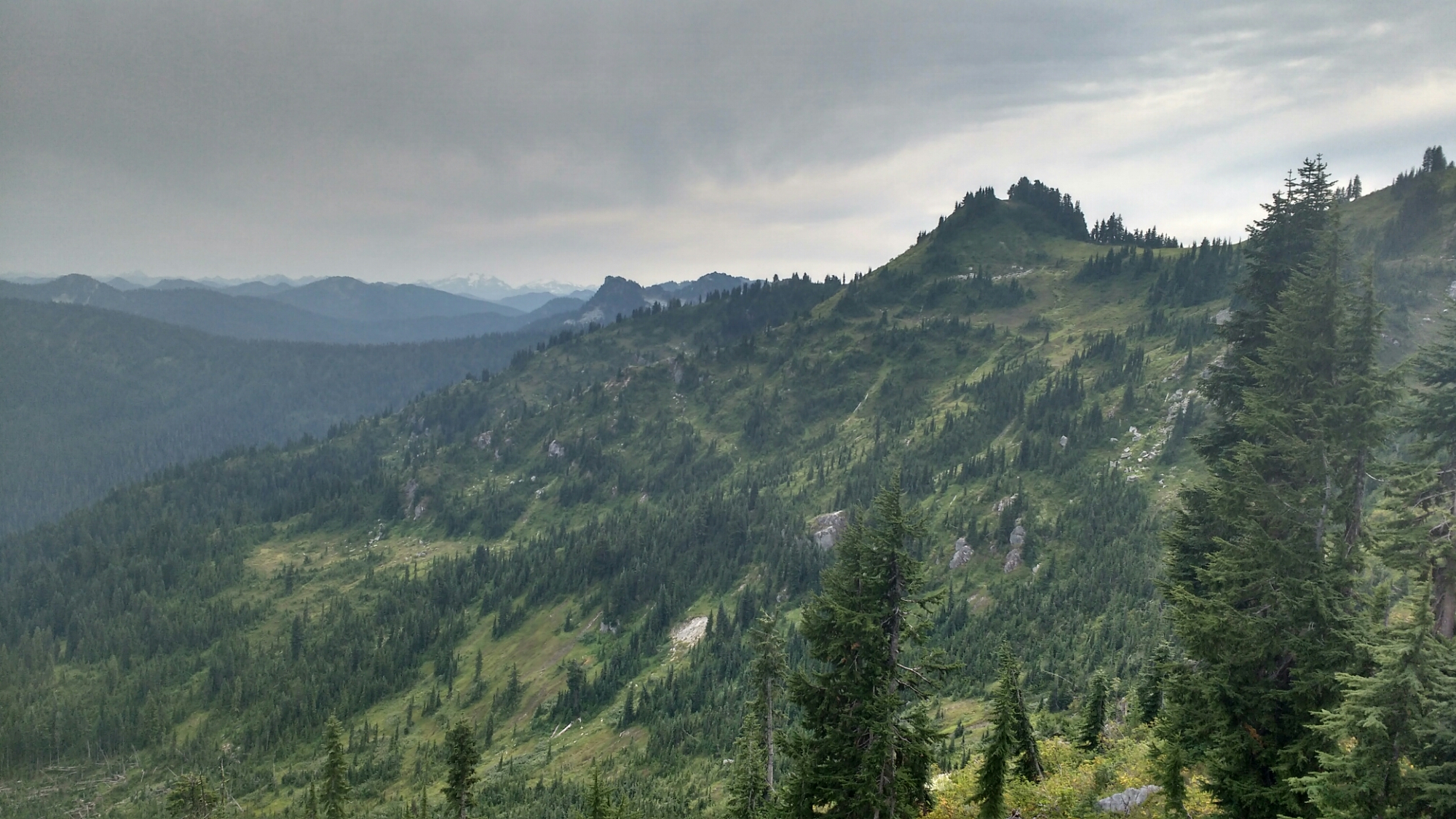
The top of the first climb for the day. Look at the mountains at the horizon.

From there the trail descended several thousand feet to Milk Creek which would have been more aptly named Water Creek, like most creeks. On the way down, I passed an elderly woman on her way up to Mica Lake carrying a fully loaded, old school external frame pack. She was moving slowly but surely and I was suitably impressed since many people, when their hair are as white as hers, like to use the hand rail when climbing the stairs. The punch line, though was that trailing by a switchback or two was a visibly younger, late middle aged lady who I assume was her hiking partner.

I don’t have any more photos from the day since it started raining while I was drawing water at Milk Creek. There was a long climb out of the creek and two women I met at there had gotten a tip about an unmarked campsite several switchbacks up. Given that the next listed campsite was over four miles up the hill, it seemed like a great place to stop. In actuality, it was probably more like 10 switchbacks up and by that time, I’d gotten used to the rain. There was exactly enough room for two tents so I left it to the women.

When the trail finally reached the crown of the hill and broke out of the trees, I was able to catch glimpses of the opposing hillsides through holes in the constantly changing cloud. Sometimes it was forested and plain, other times it might be ragged rock with a waterfall. Over the crest of the hill, there was only grey-white cloud in the expanse away from the hillside but I imagine it would have been beautiful as the trail wandered trough low, bright green brush (aka hikerwash) and small pine trees with frequent streams.

As the light began to lessen, my socks and shorts were soaked from the hiker wash and my shirt under my rain jacket was damp, I’m not sure from sweat or rain which had wetted through. I had been seeing fresh tracks in the new mud and wasn’t surprised at having to share the campsite with other hikers. My fingers had gotten cold enough to lose much strength so, while full limb tasks like hammering in tent stakes were as easy as usual, untangling guy lines, zipping up my sleeping bag, and opening foods wrappers for dinner were surprisingly difficult. Ironically, it makes me glad that I didn’t have a stove since operating one is a relatively complex manual task and I just wanted to lie in my sleeping bag and wait for my body to warm itself up.

Washington has a well deserved reputation for being wet. I had been hoping that if I were done early enough I might slip through before the rain. Oh well.

Day 132: Blueberry Fields Forever

Memories from August 30.

If the trail keeps turning up days like today, northern Washington will beat the Sierra for my favorite section. The trail was usually exposed so there was an almost continuous view of craggy ridges, lush multi-green hillsides, and sometimes snowy mountains. The exposure can be unpleasant because of constant sunlight but today was overcast which brought out the colors and kept me cool. The dominant ground cover has been blueberries and huckleberries which makes me think that the reason this area was classified as wilderness was because the Big Blueberry wanted to constraint supply…

There were lots of these little meadows.

Fields of huckleberries with the constantly shifting clouds which characterized today.

A large part of what made today so special was that the area seems encircled by distant, rough terrain. I took lots of pictures of it but things which are far away show up really small in pictures. Here’s a reasonable one. Look across the middle how the horizon is underscored with snowy mountains.

This is what I meant when I used the term, “multi-green”. There are so many different shades of green that you want to eat it like a vegetable.

Lake Sally Ann. At this point in the season many of the lakes don’t seem to have outlet streams which makes me a little wary of drawing water from them. Of course, I could go back to treating my water but ain’t nobody got time for that.

The PCT is supposed to be a horse trail as well. I’ve never seen this before.

Almost done.

Fire in the sky. Not the most amazing picture but I didn’t take anything from the hiker-only section which climbed above everything I could see, as the sun was on the horizon, and then into the mist before dropping steeply into a different valley.

What a visually sumptuous day. If I’d had a GigaPan, maybe I could have captured it.

Day 131: Day Hike

Memories from August 29

Today I met a friend from home around 10am who brought me a resupply box. We hung out and hiked a few miles. I finished out the day by making it to Janus Lake.
Having camped last night just out of bounds at Steven’s Pass Ski Resort, I woke up with a star ship peeking in my window.

Ski lifts with dramatic clouds.

Today was short and didn’t crest anything notable. The trail mostly ran along forested hills like this.

Day 130: Steven’s Pass

Memories from August 28

Where I’m going today. About two months before starting this trip, I twisted my knee skiing here. The twist was bad enough that it took until the trup to heal which ruined my plans to train.

Look at the clouds.

I spy a new mountain. I bet that like Lassen, Shasta, Adam, and Rainier we ger to hike towards it for days as it slowly gets larger and larger.

This was not Mig Lake. Oh well.

Steven’s Pass Ski Resort. I hiked most of the way in with Panini but took a longer lunch than he did. I had a second lunch / first dinner at the restaurant here. I’d wanted to camp where I twisted my knee but it was all boulder field so I hiked out of bounds past the top of one of the ski lifts and found a dry pond which was flat.

This is Feugo who I hiked out of Scissors Crossing with when I did my first 30. We hadn’t seen each other since until Snoqualmie. He’s planning on finishing sooner than I am so this is probably the last I’ll see if him. Fuego is the only other hiker I know to only have used two pairs of shoes this trip.

Steven’s Pass by night.