I’m not sure what’s so attractive about the Issy Alps 100 mi. The route is basically every hill or mountain west of Mailbox Peak until the Seattle metro area. Instead of enjoying each peak one at a time while walking at a leisurely pace with your friends on a Saturday morning, you enjoy them all at once with sore legs and sleep deprivation, sometimes in the dark and mostly alone. However, with all the races canceled due to COVID-19, and a feeling of unfinished business after my run of the Issy Alps 100 km, I set out to get my first hundred miler.
Prepping for the run was an exercise in compromises. Was I sufficiently recovered from the GVRAT? Maybe, maybe not, but running on the summer solstice to maximize daylight seemed like a good idea. How to fit 36hrs of food into my pack for an unsupported run? How about Chocolate Chip Clif Bars and Chewy Bars which were supposed to come on a thru-hike with me this summer. They tend not to go down well in large quantities so the mix was leavened with GUs left over from the 100km run. Knowing that my stomach tends go downhill over a race, especially if a course climbs, I decided to eat only Clif Bars for the first 50k to get them out of the way and then try to survive on GUs and Chewy Bars for the rest. In an effort to add a little variety, I mashed some yams and put them in a ziplocks but didn’t think to pack a spoon. There wasn’t room for both ziplocks so I only brought one. Would it rain? Hopefully not much since didn’t want to carry a raincoat bungie’d to outside of my pack. How cold would it be? hopefully not too cold because I definitely didn’t have space for a full fleece. The weather seemed like it’d just cooperate (<0.1″ rain predicted, 48F at night) but things can still be volatile at this time of year. I’d seen a post on social media saying that if you weren’t wearing shorts and flip-flops, it wasn’t June. I did decide to wear shorts without tights but not the flip-flops. Also, I don’t think that poster was from the Pacific Northwest.
Saturday Morning – Mailbox to Little Si – First 50k
Alarm at 3:30am. Driving to High Point Trailhead by 4:00am. By 4:30am I was waiting for the ride I’d scheduled the night before (I decided this cost was the price of my race entry fee). In a moment of inspiration, I scratched out a plea not to tow my car despite parking in front of clear and regularly spaced “No Overnight Parking” signs. My first transgression of the run. The ride shows up around 4:40am. On the way to the lower Mailbox parking area, the driver asks how I’m getting back to my car and I explain that I’ll be walking back. He doesn’t really seem to know how to respond. Around 5:05am I’m dropped off. Some guys are gearing up for morning hike and one of them acquiesces to snap a starting line photo.
Have run the 100km version before, there were some optimizations I wanted to make for time. The first was not taking Mailbox slow. I did have to slow a little on the uphill (1:36 at the top – maybe 4min ahead of my 100km pace) but the real bet came on the descent when I stashed my trekking poles and took the large, pounding drops to quickly navigate the broken, eroding, root-laced Old Mailbox Trail. Time was just under 2:30 back at the gate which is half an hour faster than I’ve ever done a roundtrip on Mailbox. I wasn’t hurting yet so this felt like a huge win. Given that I would later not run most runnable sections of the course, I should have probably taken a more conservative approach to start.
I settled into an alternating walk and run on the Granite Creek Connector trail and was shortly passed by two women I’d seen pushing hard up the Old Mailbox Trail when I had been descending past the intersection with the new trail. They were running and chatting. I was doing neither. Gotta run your own race.
The descent to the Granite Creek Trailhead was dry enough that I didn’t really have to worry about slipping, a nice change from when I ran the 100km. Again, no slowing-but-preserving pole use on the downhill. At the parking lot, I texted Paul an ETA of 9:30 – 10:30 at the base of Teneriffe, crossed the bridge, and ducked down the connector trail.
The Snoqualmie River had been running high and so I’d been concerned that the connector trail might be flooded or mucky. Neither was true beyond it’s normal state. In one place where the trail collapsed near a small water crossing some time last fall or summer, the bypass is becoming well enough used to be visible. In all, I found myself at the CCC road in what felt like a short time. To save battery, I had configured my watch to shut the screen off so wasn’t monitoring speed along this very runnable section. One of things which makes the Issy Alps so interesting for me is that there is so much climbing that when I do get runnable sections, I don’t take advantage of them. 9:47 found me texting Paul that I was starting up Teneriffe and that if he took the new trail, we might cross on my way down.
The climb to Teneriffe Falls starts gradually and I was able to shuffle-jog much of it before the rocky sections. I didn’t feel like I was moving quickly but it I felt very athletic dancing past people on the edge of the trail if they didn’t step aside when I called, “on your left” or “passing left”. At one point I even was able to confirm that this was in fact the trail to the Falls while hiking past a women and girl consulting a map. We’d both be lost if this weren’t the correct trail. The one time I kinda cut the course was when I took advantage of some multi-trailing to bypass the main switchback at Teneriffe Falls which was packed with about 20 people. At this point, my watch rolled over to a new mile so I have pretty clear stats for the Kamizake trail. The next time my watch would beep to indicate that another mile had passed, I was on the summit block and 1:10 and 2,300ft had passed. As a trio of tall, stocky young men with a dog which they’d had to carry up some of the rocks said, “this is steep”.
The effort on the Kamikaze Trail had had caused me to start disassociating and letting my mind wander off into flights of fancy. My balance didn’t feel solid – on par with when you don’t want a second beer because the first one kicked way harder than one beer should. It’s a strange place because you can tell you’re weak and not all there but you’re not panting or in pain. The limiting reagent is some kind of ability to handle full-system load. You could push but would risk of losing your connection to the world. The first time I sat down during this run was on the top of Teneriffe while I stashed my poles, watched the cloud density fluctuate, and try to plan my next moves. I gave up on the planning and decided to just keep moving slowly and wait to recover. I did take the precaution at the first intersection of asking a couple if I was turning on the the correct trail.
The main Teneriffe trail takes you along a ridge and down and old forest road, rocky and hard-packed. It was runnable enough that as I sobered up I let myself fall into a jog, if only because I couldn’t rationalize not running. My legs weren’t in it anymore. The footing was stable but uneven and the grade was such that each step was largely just shock absorption. This section down to the Talus Loop goes on longer than you want it too. Despite expecting this effect from my 100km run, “Am I there yet?” worked it’s way into my head every time I saw a west-bound social trail splitting off the main trail. When I finally did turn up the Talus Loop, I fell into a walk despite the varying angle lending itself to run-walking. A runner passed me coming downhill and I pre-emptively stepped aside to snatch a few seconds of guilt free rest. Just being polite. The stream just before Talus Loop intersects the Mt Si trail wasn’t deep enough and didn’t have little pour-offs to completely fill my bottles so I took what I could and then drank a bunch.
I’d been forcing myself to eat a Clif Bar every hour and had noticed that soon thereafter think I was about to have stomach issues. This would make me not want to eat and require the next bar to go down only with a lot of water and small bites. So, sitting on the little log on Talus Loop, I put Tailwind into my bottles hoping that would avoid the necessity of eating, never mind that experience has shown that this isn’t true for me. I’d repackaged bulk Tailwind into popsicle bags (net savings of $0.65/oz!) and so probably looked like a drug addict pouring white powder out of a baggie. Food is a kind of performance enhancing drug, at least in the sense that it’s required for performance.
Going up Mt. Si felt pretty much like a hike. I was passing people but at about the same pace as when hiking. I was starting to lean forward and stick my butt out to give my quads a rest while pulling uphill with my hamstrings. Someone who was actually running passed me. Then coming down the trail, I heard someone say, “There he is”. It was Paul and his friend Brendan. “OK, we’re going back up”, he told Brendan, and they turned around to follow me. I’d given up on meeting Paul, having texted him at the Talus Loop that we’d probably missed each other and wished him well. Apparently they’d tried to chase me up the Kamikaze Trail but then not having caught up, took the ridge to Mt. Si to get ahead. Part of the confusion was that I’d started an hour earlier than I’d originally told him and by his math, I’d been flying. If only it were so.
Our stop and the viewpoint which marks the “top” of Mt Si (the route to Haystack isn’t part of the Issy Alps) was brief. I stashed my poles, put something in my face, and snapped the preceding picture of Paul and Brendan. Then we went down the Old Si Trail, Paul needing only short prompts from me to fill the silence. It was good to have company, particularly when the nipple came off one of my bottles and hid itself in some twigs. Brendan found it while Paul was running a search pattern. We drew water at Little Si, just after having joined the Little Si Trail. Then it was Paul’s turn to have lost something. I felt like a bad friend for continuing while he searched, but I was on the clock. He and Brendan caught me well before the top which says something about how fast I could move at this point. I mentioned feeling pretty beat and we discussed strategy, which boiled down to the odds of being able to make it under Highway 18 before nightfall. They tried to make me feel like I had a chance.
Paul and Brendan turned off back to their car where we’d joined the Little Si Trail and I continued down the parking lot, now using poles for the descent. It was a revelation that I could move downhill without hurting. My legs had moved past the initial phase of tiredness and were now sore as though I were starting a new run too soon after having finished some other great effort. It’s strange to be sore from a race you’re still running.
Per the strategy of optimizing out small breaks, I didn’t linger at the Little Si Trailhead which marked the end of the first 50k, but headed down the road, across the bridge, and up the Snoqualmie Valley Trail towards Rattlesnake Mountain. Recovery was foremost in my mind and I still had accessible food so I ate with the plan of taking my first pack-off break at the base of Rattlesnake to rearrange food for the second 50k and prep for the night. In the end, I wound up walking most of the Snoqualmie Valley Trail which is a huge indictment of my race strategy to this point, despite finishing the first 50k in 11:50 compared with 13hrs when I did it as part of the 100km route (recording note: the watch showed ~12,800ft gain). That gain was now being used up on easy terrain instead of built up.
Saturday Night – Rattlesnake to Tiger – Second 50k
When I got to the base of the Rattlesnake Mountain trail, I was greeted by 1) a swollen Rattlesnake Lake which made it very convenient to refill water and 2) several hundred feet of chainlink fences with signs saying the trail was closed due to to COVD-19 social distancing guidelines. Not that I hadn’t walked past a sign at the gate saying the trail was closed but that was a lot of fencing. It seemed like the authorities really wanted to make a point. It seemed like the end. I sat down and called Paul to see if he could give me a ride back to High Point Trailhead but he was in the middle of dinner. Then I watched a couple walk blatantly around the fence on a now beaten social path. This gave me pause. There was a cloudburst and they turned around. Then a large family came down the trail and skirted the fence. So I called Paul back to let him know I wouldn’t need the ride.
Rattlesnake Mountain is not normally a difficult trail. The problem was that I wasn’t moving quickly despite having been slow on the Snoqualmie Valley Trail and had a sit-down break at the base of the trail. Daylight was wasting and I was worried about whether the bushes and brambles would have overgrown the lightly maintained trail under Highway 18, making it difficult to navigate in the dark. Under normal conditions, I could just run and be there at about nightfall. That just wasn’t happening. I was now into my supply of GUs and was able to eat without having to brace for stomach concerns. The light was at the point where it was almost dark enough for a headlamp when I was in the trees and light enough that it still seemed like early evening in open areas. At East Peak, the wind was blowing sat on a bench to get a headlight, light-weight fleece, and eat some of the precious mashed yams. GU isn’t very filling and so while it seems to provide enough calories, I can enter a state of “stomach collapse” where my stomach turns into a knot because there’s not enough inside to keep its walls apart. There was a drizzle which I decided to ignore, hoping it wouldn’t get worse. Fog came and went, making it hard to use the headlamp.
The descent down Rattlesnake, after the rolling of the top ridge, and incorrectly taking the trail at the top when you’re supposed to take the road which parallels it, was a relief. My mind settled into a good place. I was below the fog and could see when using the headlamp, I was jogging downhill with trekking poles and felt like I was moving well again but without too much load on my legs. I turned west at the power lines and followed the road. Coming through here last time had involved constant navigation but it was easier now. Not that I didn’t take a wrong turn in the mountain bike trail network, but it was only one and I’d been able to run through all the turns and check my watch after the fact for confirmation rather than having to pull out the more detailed GPS on my phone at each bifurcation or deviation. Pushing through the overgrown trail under the powerlines in the dark was a little unnerving because it was hard to tell if you’d missed a branch of the trail. On the other hand, the path of least resistance was the correct one so perhaps the lack of distraction was a boon. To my surprise, I was simply dumped out on the edge of the Raging River, under Highway 18 with relatively little fanfare. The approach had taken much less mental energy than I’d expected.
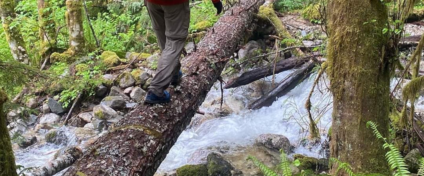
The sound of Raging River grew suddenly in the last few yards approaching it. Having seen all the other swollen rivers on this run, that was an immediate concern. Looking across though, it didn’t really seem to be running high and without searching for an alternate line, I plunged in. It was just above knee deep and the water pushed, but not hard. I only had to avoid one pool formed behind a large rock into which most of a trekking pole disappeared before I pulled it back. Conveniently, my headlamp had shown all the way across from the beginning so I knew my line to the take-out point. The take-out point was near a large pylon supporting the highway overhead, and had the assurance of a whisp of trail leading up the bank.
The dark may have been a blessing because just as I had been herded down to and across Raging River without distraction, I was picked up on the other side and carried by a clear path of least resistance through the weeds. I only checked my GPS once where a jeep track ran perpendicular to the the powerline cut and wanted to be sure where to enter and exit it. In what felt like just moments, I was at Deep Creek without the bushwhacking through blackberries I’d been bracing for. Deep Creek initially looked to be running a little high but it wasn’t and I splashed across, drew water, and was once again pulled uphill along a clear path of least resistance.
Reaching the road on the south end of Tiger Mountain was a big emotional relief. One of the to major obstacles I’d have to navigate during the night was now passed and it had been much shorter and easier than I’d expected. The road and the Northwest Timber Trail to which it lead were very runnable. I jogged here and there to try and pick up some time but focused on walking quickly, with long strides, and pushing with my poles. The travel was easy and I soon found myself at the Tiger Mountain Road which would run 3.5 miles to the summit. This was well graded and I tried to achieve a long, hamstring-oriented stride. Less than 0.5mi from the top the desire for sleep caught up in that way where your mind and body actively try to shut down. It was about 1am. When I would force my eyes to stay open, my vision would blur. I tried to cede ground to sleep slowly, letting my eyes shut in long, regular blinks and trying to keep a regular stride. Eventually I sat down and ate a Chewy Bar. My stomach was empty and in the excitement of being close to the end of the last climb in the second 50km I wasn’t sure that I’d kept up eating. I hadn’t immediately been able to find a good place to sit and so having to push a little farther was another good way of slowing the compromise with sleep. After a short break, I continued and was greeted by red, otherworldly light which turned out to be some visual effect of the yellow-orange lights on the facility at the top of the Tiger’s main peak.
I let myself go on the descent and it felt easy. I didn’t require myself to run, trying to walk quickly and use poles to preserve my legs as the dirt bike trail which forms the first portion of the descent to High Point Trailhead rolled on its way down the hill. Where you turn off into the top of the clearcut, there was a sign that the trail was closed due to COVID-19 and crews working on a trail which might be felling trees – even on weekends. I doubted they were working at 2am. This was the beginning of the night’s second navigation obstacle.
There isn’t a trail through the clear cut but there’s a large, raised, logging road which forms a long catch line so you’re safe plunging off over fallen trees and low, dead brush in a down-and-to-the-left direction. I was a little chagrined to hit the road near its end, thinking that if I’d started the bushwhack a little sooner or steered a little too far left, I’d have overshot. For what it’s worth, I hadn’t followed the new mountain bike trail as I might have so I think the road is still a pretty generous catch line, certainly in the daylight. I turned down the road and followed it around several turns. If this had been my first time through, it would have been a little nerve wracking. The road is cross-cut with deep furrows so you run a few steps down one side, jump the little rivulet at the bottom, and try to carry your speed back up to the roadbed. This section deviates from the GPX track which is just a straight line. Based on a comment from the route creator, I think it’s an intentional design to force people to find their own way as the GPX track has a similar defect under Highway 18. The last two or three road mounds are grassy and particularly large and seem to be degrading into nothing when suddenly you can see the reflectors on a bridge. This bridge is back on the route and, even knowing what to expect, it was a most welcome sight. The shock of having to turn off the nice, safe, clear road onto the poorly maintained East Tiger Trail was much reduced this time through.
From here to High Point TH had been the scene of slowly increasing panic during my 100km effort. At that time, the sun was beginning to go down and I didn’t know how much distance was left other than that it was clearly farther than I’d expected. Things seemed to drag out forever. This time, I’d memorized the turns and despite being dark, it went reasonably quickly, though I did check my watch several times to ensure I was on track. The sky between the tree tops was lightening a little as I descended the Lingering Trail onto the frontage road, and made my way back to my car at an easy jog. It was a relief to see my car hadn’t been towed.
Sunday Morning – Tiger to Cougar and back – Final >50k
There was nothing in my car with which to resupply, so I didn’t bother opening it. Instead, I sat on a rock rearranging food and gear to for another day segment. Caffienated products rested on my left rib, non-caffienated on the right. Non-gel were in the front-right and my phone was in the front-left. Somehow this all took about 20 minutes. I’d arrived at Highpoint TH around 23:10 (elapsed time) and it was now 23:30. An hour faster than my 100km effort but I felt like I’d wasted that gain (recording note: the watch said something like 19,200 ft of vert). I dallied again near the parking lot trailhead to sit on a bench and take my lightweight fleece off. I didn’t feel weak, but speed was clearly not a concern. Sleepiness set in again as I started up the West Tiger Mountain Trail and after fighting it a while, I saw a concrete bench several tens of yards ahead and decided I would sit on it. I looked up again and it turned out to be just a pair stones. I’d hear that hallucinations were common in longer distance events. I’d been mistaking interesting tree stumps for people out of the corner of my eye for some time but something this real while I was this tired was too much. I saw a log just the right size for a pillow, set my alarm for 15 minutes, and let myself sleep. 8min later a light drizzle woke me up and I continued uphill.
My mental math wasn’t great but it seemed like it had taken 2hrs to get up to Tiger #1, even factoring out the nap and other stops. I think that’s usually 1:20 via the Cable Line Trail. I felt like I was falling behind and wanted to move so after the bypass trail, I let myself run down the Bootleg Trail as fast as I could with poles, energy cost and tired legs be damned. Ironically, this paid off as after the Bootleg Trail comes the 15 Mile Railroad Grade which is quite runnable due to it’s relatively good surface and slight downhill grade. Sparse grass is growing over the trail but only tickles your legs as you go by. My memory was that the 15 Mile Railroad Grade was supposed to intersect a trail coming up from the left and at the intersection thereafter become the Tiger Mountain Trail. Feeling good and wanting to press the advantage while I had it, I carried on past a sign on my left as the the trail became more overgrown. At knee-high, you could still run through the overgrowth. After pushing through a head-high section, I decided to check my GPS and found I was seriously off route.
Photo is off-kilter reflects the state of my mind.
Pushing my way back up the trail was a huge emotional downer. I just didn’t care to move faster than a walk. I was trying to guess how far I’d gone off-route and eventually decided it was probably 1mi outbound for a total loss of 2 miles. When I found the Tiger Mountain Trail, it was the sign I’d run past thinking it was the intersection before the Tiger Mountain Trail. Also, it went uphill and then rolled on its way west instead of being smooth and runnable. The disappointment was harsh.
Eventually I got to the One View Trail, almost made a wrong turn onto the Poo Poo Point Trail (per the map, you turn onto it when crossing it the second time, though I don’t remember doing this), and started seeing energetic people charging up the trail. I was jogging downhill by bouncing with my calves and the balls of my feet trying to use my poles, arms, and chest as shock absorbers. While my legs did twinge with each step, it wasn’t as hard on my quads as running downhill without poles, even if my hands were beginning to feel raw. The hill seemed long and winding, eventually crossing several bridges, and coming out to Front Street by the high school.
“Just 4 more climbs” I told myself on my way up Sycamore St to the East Ridge Trail on Squak Mountain. I was now going uphill by thrusting my butt way out and waddling with hamstrings and outer glutes. An observer might have thought it was a training drill. It was just survival.
I stopped at the first bridge on the East Side trail on Squak to gather water. The stream was running low and it was difficult to fill the soft bottles. They have the disadvantage of a bottle since they have a hard top which prevents the mouth from getting next to a shallow flow of water and the disadvantage of a bladder since the body collapses when submerged. I settled for half-filled bottles and tried to make up the extra by drinking. It struck me that where it had been easy to collect water, I had probably stopped for less time that I would have at an aid station. Where it was difficult, I stopped for longer. The East Side Trail was runnable but I didn’t really bother. Running on flat or even slight rolls took real effort. Fast walking, propelled by my poles, could be accomplished with relatively little effort. The speed difference just didn’t seem that much and while I had less than a marathon to go, I kept reminding myself that a even a half-marathon isn’t actually a very short distance.
The descent to WA 900 on the West Access Trail was pretty much like the descent on Tiger: jogging down while planting a pole with each step to keep the shock off my quads. Ascending Cougar was so slow that when I spotted some very fat hikers pushing hard, it wasn’t initially clear to me that I was going to overtake them despite thus far having overtaken every hiker a with a similar lead. Shortly thereafter I turned onto the Deceiver Trail and decided it was so named because it winds all over the place leaving you completely without a sense of direction or how much you’ve descended. On the Deceiver Trail, I started having to make water rationing decisions because I hadn’t filled up below Shy Bear Pass and was passed by a runner with a medium running pack who was flying. The Deceiver was clearly mocking me.
So inspired to at least appear like I wasn’t out of place in my athletic garb, I jogged after turning onto the Indian Trail which marked the start of the return back to High Point TH. At one point, I passed a woman who nodded to me and then told her child, “say hi to the … [yes there was a pause] … walker”. It was nice to external confirmation that I was moving as slowly as I thought.
Normally, I might have monitored my speed on my GPS watch. However, I had configured it to turn off the display in the hopes of getting it to last 41hrs instead of 32hrs, enough that I decided not to bring an extra battery pack. Not being tempted to check my watch had eased the pain of consciousness and reduced the weight of the future. Shortly after having turned back west up the Quarry Trail, onto the penultimate climb of the route, my watch beeped to tell me that it was at 10% battery and estimated only 3hrs left. If I switched to Ultra Mode, it promised 10hrs. I was over 3hrs out. It was a blow to have have to switch to Ultra as I had minimized every setting except GPS resolution in the hope of maintaining an accurate track. A full track was more important than an accurate one and so I made the change.
Until this point, I’d been calculating distance remaining by looking at the distance and subtracting it from 102 (2mi added for the overrun on the 15 Mile RR Grade). Now, I reached as far back over my head as I could to get the paper maps in the other sleeve of my pack. I was walking anyways and so could study them. I’d annotated these with key mileage markers and now found that they differed slightly from my watch-based calculations. From just below the top of Cougar Mountain, I’d have about 10.5 miles left and given that I was shooting for <36hrs, I could make it at 3mph with a few minutes to spare! This was huge. Since getting back on the Tiger Mountain Trail after overrunning it, I’d been trying to catch up the point where a 3mph pace would get me in on time. Oddly, feeling that I would make it was mental boost. It actually lightened my step and carried me down Cougar and back up and over Squak. I had a long stop on the way up for a difficult water draw since I’d gone dry and wound up losing some time. However, with an estimated 5.5mi remaining, I was at the top of the East Ridge trail and had 1:54 before the 36hr goal (my C goal, but any thought of A or B had long since passed). Despite wanting to finish well, I poled my way down to Sycamore St before stashing the poles and running. From here in, I wanted to finish like a runner, even if my pace was that of a walker.
The first hitch in that plan came after successfully navigating to the east of the high school and onto the path north of it. Then I was ambushed by an irrepressible urge to poop, something I hadn’t done in over a day and a half. Just 2.5mi or so, could I hold it? No, I couldn’t and so I dove off into the bushes. This was not a poop I was proud of: insufficient distance from the trail, no trowel, no toilet paper. This is the kind of thing which gives runners a bad name. Fortunately, no one passed and the results didn’t leave me messy. Just as I was about to continue, my watch beeped. Now it was at 3% battery and was going into “Low Power” mode. So much for Ultra Mode. I pulled out my phone and started recording a track there. So much for a complete record of the run.
The second hitch came in the form of my third trail closure of the trip. Clearly I was well beyond a little rule breaking at this point so I walked past the sign and about 10 feet up the hill found a beautiful path whose entrance I’d somehow missed.
The third hitch came on the climb to the Brink trail. The climb is very short. This notwithstanding, it felt like the hardest part of the event (yes, even compared to the 2300ft/mi Kamikaze trail) because my poles were stashed. Sweat burst across my skin in a way it hadn’t during the entire race but I was going to finish like a runner – no poles. There was less than 5km left, I told myself, and I was going to finish strong. I had shit in the bushes without toilet paper and disregarded four posted notices to get here. I damned well was going to finish strong. My legs didn’t didn’t get the memo. Nor did they get it when I reached the top of the Brink trail and started to make my feet step faster and faster hoping that I’d start running. My feet taking steps at the speed of a run but the distance of each step was so short that it was faster to walk. Defeated, I deployed my poles and fell back into a long stride, pushing myself forward from atop my straightened legs like a physics problem involving an inverted pendulum. Still, it was faster than “running”.
I followed the Brink Trail across the first powerline cut to the second, zig-zagged in it, and stepped onto the Swamp Trail. There had been a notice on the Issy Alps site that there was some maintenance in progress and I was mentally prepared to step past another sign and slog through a swamp if necessary. Much to my surprise, the only thing I was met with was fresh trail.
The power walking carried me onto a dirt road which I recognized as being adjacent to the High Point Parking Lot (not to be confused with the High Point Trailhead). No time to stash poles, just try to run. The asphalt road which would take me the short distance back to my car and the end of the this journey was the perfect grade of downhill. The grade broke the rust off my sore, stiff legs and I felt like a runner. It even felt like I was lifting my knees instead of shuffling (looking down to check confirmed this). I flew at what was probably a 5mph sprint and almost had to fall back into a walk when the road leveled. Then another downhill tipped me like a drop of liquid on the edge of a pitcher down into sight of my car and to the gate at the High Point, signalling the end of the run.
Sunday Afternoon – Epilogue
I almost panicked when my watch face didn’t light up the first time I pressed a button. On the second press, held a little extra long, it lit up. The elapsed time was about 35:33. I pressed again to end the route, and hoped that the Saving screen would finish before the battery ran out. A few moments later, and the watch beeped to tell me it was at 2%. It turned out that it had stopped recording a track when it went into low power mode and I’d been fortunate to think to start recording on my phone.
June 21, 2020 was Father’s day and so after some brief texts to Paul and some other friends who I’d updated after each section, I called Dad. Father’s day is supposed to be about the father, not the son so it was a little strange to talk about me and what I’d just done but I was crying and wanted to share it with him. It’s rare that you finish something you’re really proud of at a significant moment in time, and these moments when I’m truly proud of myself are fewer and farther between as I grow older. He seemed to understand. One of my great blessings in life is that my father has always understood me when I needed him to. That’s been true at deep moments like when seeking advice on which job offer to accept out of college (I’ve been there for about 10 years), buying my first real estate (the condo in which I still reside), or as the case now was, understanding that my stomach had turned into a painful knot and I needed to get off the phone and find some food which would require driving in a sleep deprived state since I hadn’t pack a post-race meal. God, I love my Dad.
That meal wound up being a lot of chicken nuggets, Coke, a soft-serve treat with M&Ms, and fries at the nearest drive-through. At the pick-up window, I explained that I’d just run 100 miles, felt it wasn’t safe for me to be operating a car, and asked if I might eat and sleep in their parking lot till I felt ready to go. The young woman at the window seemed unsure what to say initially, then explained this was a common thing for people to do. The food felt like a hedonistic delight. Just sitting without any desire or impulse to move would have as well if my butt hadn’t been so sore that I had to keep shifting to prevent pressure points from developing. Eventually, I opened the window, put my feet up on the edge which tilted my pelvis enough to releave all the pressure, and drifted off to the sounds of Irish fiddle playing from the car radio.
