Intro
- This write-up has been dragging out too long. It started as a chronological outline I was going to turn into a narrative. For the sake of being done, I’m going to press Publish without transforming them or proof reading. Leave a comment if you want something clarified or corrected.
- Route beta is in bold. My track with notes: https://caltopo.com/m/9KNE
- Many thanks to Ella Raff (blog, 1st attempt, 2nd attempt) for using the phrase “Issy Alps” to describe an ultra-running route and then, after I ran a 43mi route from Cougar to Rattlesnake tagging all the summits along the way, clarified that there was an official route by that name.
- Unsupported: carried about two 500ml soft bottles, 7500 Calories, a fleece, hat, gloves, poles, and raincoat in a large running vest. Drew water from natural sources without filtering.
- I would recommend 2L water or scouting water sources ahead of time.
- Official Issy Alps Run page.
- All Pics
Mailbox
-
What have I gotten myself into? (Photo Credit: Ella Raff) - Dry on the way up
- Set headlamp to lowest setting.
- started hitting some fog
- changed into rain coat near the treeline
- moderate wind, low visibility (fog) above treeline
- thankful for the steps through the rock field
- 1:50 at the top
-
On top of Mailbox. - light rain on the way down, nothing really below treeline
- lost the trail where it multi-trails
- tried to go up but couldn’t find something which stayed as a trail so decided to go down
- trail was nearby on my watch but eventually separated enough from it that it was clear I needed to tack left instead of right
- Filled water where there’s a clear 5ft spur trail to the stream near the bottom
- cloudburst just as I got to the gate leaving Mailbox – convenient place to put the raincoat back on. ~3hrs
Connector
- First section with real rain
- slight uphill. Chose to take a “if you wouldn’t run it at the end, don’t run it now” approach
- worried about downhill from the Granite Creek Connector b/c I’ve slipped a lot on that before
- Turn off onto social trail to CCC road is immediately after the bridge. As soon as the bridge’s side turns to guardrail, step over it and look down. You should be just in front of a brown roadsign. Initially descends towards bridge (for 10ft) then turns right.
-
-
Just crossed the bridge. Step over the guardrail. See this sign. Now look down. There’s the trail (not pictured)
-
- Small stream you cross shortly is muddy
-
- easier to follow than expected, visibility was moderate
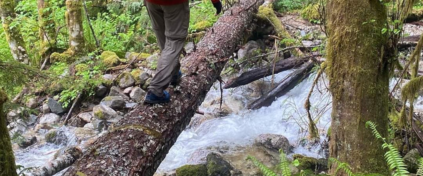
- There’s a stream crossing where the bank has collapsed on the far side, you have to look up a bit to see where the trail continues. The water looked good here.
- less muddy than expected but I was able to jump over a few spots which I knew weren’t well drained
- Very happy to see CCC road, spent a lot trying to figure out what it would take to get back to 3mph average
- Jogged up until the turnoff for Teneriffe Falls
Kamikaze Trail
- Drew water at the falls. It was a little hard to find the correct switchback to drop off to get the water. It’s short (10ft) but steep.
- Kamikaze trail is easy to follow because there’s no to get off trail.
- Felt very steep but wasn’t hard because it was it was technical enough (hands help to support a big step up in a few places, but not class 2) and visibility was low enough that I wasn’t pushing.
- At one point I my watched beeped and I had an 1:08 mile.
- Found my way to the top. Easy to see where to get to but stone is a little steep and was wet. Fog prevented any good pictures
- No rain or wind for which I was really thankful. In my head I was 2/3 through the first 50k (by elevation) and felt like I was past the dangerous parts. At least the first 50 felt doable for the first time.
Teneriffe Connector through Talus Loop
- was a little concerned that I was starting back down the Kamikaze Trail. I’ve seen people think that the new trail was the old trail and was worried about making the opposite mistake
- Water in two or three places when the trail turns into an old forest road
- It look longer to get down to the Talus Loop turn-off than I expected once the old forest road turned down hill into switchbacks after the signed intersection. This was actually one of the most mentally “itchy” sections because it was easy enough that my mind began to wander past the immediate need to stay place my feet, visibility was good enough to see nearby terrain and I kept guessing at the turn-off.
- “All of an ultra runner’s problems come from the inability to run only the ten feet immediately before them” (apologies to Blaise Pascal)
- There’s drainage where there’s usually water on the Talus Loop, but I’d only ever taken the lower part of the loop. If it hadn’t been raining, the drainage would have been dry. I drew from a slowly flowing, clear puddle which was too shallow to completely fill my bottles. Cameling up would up when I did stop for water was an important part of being able to carry only one liter.
-
-
Town from the Talus Loop
-
-
Big Si
- This was much shorter than I’d been mentally prepared for. That’s kind of a theme of the trip: things not being as bad as the life threatening monstrosities my imagination had built them into. Minimal rain helped.
Old Si
- Quality of travel is quite good. Relatively few rocks and roots. A little steep and tight to fly down but would be a real pleasure to hike if you can control your effort level.
- At this point, I was calculating miles to the finish of Little Si. Again, playing this game reduced my mental game when things were a little longer than I’d expected.
- I’d been hoping for 12 hrs as an A goal. 13hrs was my B goal because that’s when I guessed Ella had done. Didn’t really want to have 14hrs because that was the time from the week before and she’d described it as “slow”. I didn’t want to be the slow one!
- I didn’t let this trick me into pushing. I kept the long game in mind and let the time fall there it might but I felt pressure going into Little Si.
- I’d been hoping for 12 hrs as an A goal. 13hrs was my B goal because that’s when I guessed Ella had done. Didn’t really want to have 14hrs because that was the time from the week before and she’d described it as “slow”. I didn’t want to be the slow one!
Little Si
-
- One good water source shortly after turning onto the Little Si trail where a shallow stream runs under a culvert. I’ve seen this running in many seasons but it might dry up in late summer.
- Little Si is popular and so has a lot off well beaten paths which aren’t quite the primary trail. This is different from the route up to this point point where were 0 or 1 candidates for the main trail. Several times, I hit dead ends and had to back track 5-10 feet.
- Little Si is runnable if you have energy. I didn’t and it rolls enough and has enough roots and rocks that I never really found a rhythm.
- The sky was lightening when I reached the peak.
- Saw my first person of the trip about half way down, overweight, hiking in Crocs, large day pack and breathing hard. I made so many judgements about and comparisons to them. It’s one thing to give in to lesser motivations when you have nothing else but despite a growing awareness that I was falling behind on my calorie intake, I was still usually running the flats.
- The more I read about US history, this kind of comparison and judgement seems to the cement solidifying many social ills. It’s a hard moment to recognize yourself in the face of the enemy.
- There was enough light at the bottom of Little Si to take a selfie with the sign but not enough to turn off the street lights.
- 50k was over and it felt good. I’d had a lot of apprehension going in to the experience never having pulled a true all nighter, even without doing more elevation in a 12hr period than I’d ever had before and with weather. I was mighty pleased with myself in an abstract, intellectual way. My mind was still on the course.
-
Done with 50k!
Snoqualmie Valley Trail
- From the Little Si trailhead, I started walking the road towards the bridge and then took a left down the Snoqualmie Valley Trail.
- The sunrise was really well matched with the easy start to second leg of my journey.
- At this point, I was feeling good and hadn’t ruled out going for the 100miler so I couldn’t tell if it was the second of two or three legs.
- I could tell that I’d under fed during the night. My raincoat was tight when I’d put it on over the pack and bottles which had made it hard to access the side pockets for food. At this point, my goal was to reset, so I pulled out trailmix, a food which I can’t stomach when pushing hard but is quite filling, and chewed mouthfuls until I could see my belly pushing out again.
- I took a quick stop to re-arrange gear since it didn’t look like rain and I wanted to move my bag of Chex Mix up front where I could eat. Chex Mix is my go-to “real food” to balance out sweet tasting high energy gels and bars.
- Ran several of the miles to Rattlesnake Lake but when I slowed to walk as the path neared the park, it was clear that my energy reserves were low, so I started eating generous amounts of Chex Mix.
- At Rattlesnake Lake, I looked around for water fountains but couldn’t find any so drew water from the lake. The lake water was clear and tasted reasonably clean.
Rattlesnake
- Going up Rattlesnake Ridge is well graded and easy. A nice change from the previous climbs. I saw lots of other trail runners out and about, though usually not as loaded with food and moving faster.
- On the way up, I started losing motivation. Mental tiredness started creeping in at the edges of my eyes. I finally broke into the caffeinated gels. Boy did I feel good after that. I wasn’t necessarily moving faster but my mind was wonderfully clear, calm, and alert. What a wonder drug.
- I followed the trail the whole way. From reviewing the official GPX, apparently you’re supposed to follow a road near the clear cut at the top for a bit and rejoin the trail. I don’t think it matters and George didn’t comment on this when I submitted my GPS track. It’s actually harder to follow the trail because it rolls more.
-
From the trail above the clearcut on Ratttlesnake. I think I was trying to take a picture of Rainier. There’s a road just below this which is the route proper. - As I descended, I kept a pretty close eye on the GPS because my memory is that the turn off the spine of the ridge is easy to miss. It’s actually not since you come out into a clear cut for the power lines.
- Things can be a bit confusing from here so I watched the GPS pretty close. In several places there’s multi-trailing. The general idea is to follow the power lines.
- There’s a place where you have to turn right onto a bike trail (this was a >90 degree turn for me) and follow it through the woods on the north side of the clearcut. There’re lots of trails in there so I was pretty shameless with the GPS. You can miss the initial turn off because the hillside is overgrown and steep so it’ll force you to turn back and find the bike trail.
Connection Across Raging River and Deep Creek
- Continuing down from the power station by whatever path seems clearest will eventually pull left in the clear cut as it descends towards Raging River. Before descending low enough, I looked across the valley to get an overview of where I’d be going. It didn’t look like there was a clear trail but there was definitely an easiest way.
- At raging river, the shallowest crossing was on the left side. Multiple crossings are flagged. Since the river was low, I scouted right a little bit hoping for a rock hop but wound up crossing almost directly under the road, then moved towards the green grass and let it carry me out of the river valley and towards Deep Creek.
- In this section, the GPS track was just wrong. I just followed open areas which had clearly seen some foot traffic and generally headed in the correct direction.
- There was one place where I had to turn right onto a cut which had been mowed, then turned left again when the trail picked up under the other power line.
- Just before Deep Creek, there was a split where you could got up a 5-10ft bluff with a clear trail or descend a lesser used path. The lesser used path looked like it hit dense brush by the side of the river so I stayed on the nicer path. This wound a little and I had to duck as I walked through a tunnel of brush.
- The trail appears to present multiple options for crossing Deep Creek. The most obvious one has a log in an awkward place which creates a pool which was deep enough to look uncomfortable but probably not deeper than I was tall. This can be avoided by ducking under a branch and crossing on the upstream side of the partially submerged log. I checked another crossing just downstream hoping for a dry foot rock hop and got most of the way across but didn’t see an exit up the cut bank.
- I drew water from Deep Creek
- From Deep Creek, the route stays left in the clear cut, start moving up steeply (not Mailbox/Teneriffe steep) until it connects to an almost flat road, the edge of which is a clear horizontal disturbance in the hillside above. The road is obvious when you’re on it but there are a few red herrings in the area which made me want to push right a little early.
South Side of Tiger Mountain
- The road after the connection was wide, flat, level, etc… and I was able to jog again.
- I passed a hunter out with a rifle over his shoulder. I didn’t know there was hunting in the area.
- The turn off the road onto the Northwest Timber Trail is almost 180 degrees. There’s a road just above it which was much more obvious. I almost took the road since some cyclists were stopped in just such a position that they occluded the trail.
- The trail remains relatively level. I was tired and so mixed some walking in with the jogging but felt bad about it, especially when I crossed paths with some other runners who were stretching. I felt awkward walking past with my overstuffed adventure vest, aggressively attacking the flat, level ground with my poles as though my trip was all show and no substance.
- There was water in a stream just after the only switchback. This actually confused me for a moment because the switchback isn’t in the official GPX and I wasn’t sure if I was supposed to just bushwack across. It looked like there was a better crossing below and in looking around for the best way down, realized the trail had switchbacked behind me.
- The Northwest Timber Trail eventually crosses the Main Tiger Mountain Road (no signage, it’s just well kept forest road. You’re supposed to take the road. From here it’s a gentle up and up to the top of the mountain. I crossed and continued on the trail then had to double back when I noticed on my watch that I was diverging from the route.
- I walked hard up the road but never really ran. One mountain biker passed me on the way up. I passed one mountain biker on the way up. Tie game.
- Just before the top there’s a mountain bike trail, the East Tiger Summit Trail, which goes left. Don’t take it. I walked past it but my watch was ambiguous and made it look like maybe I was supposed to be on the trail. Since I knew it formed a loop, I took it thinking the course designers would have put in a loop instead of an out-and-back. On post-run inspection of the route, it appears this is not the case. I think my watch down-sampled the GPX file in a way which was confusing. Also, I had to dodge out of the way three times as mountain bikers whizzed past.
Descent to High Point Trailhead
-
- At the top of Tiger Mountain I stashed my poles and prepared for what I thought would be about 3.5 miles down. My watch had logged about 59 miles and with 100km equivalent to about 62 miles, I figured that 63 plus a little was a safe guess for how long it would take me to get down. When I rain the Plain 100k, the same watch computed the course length as 63.3miles so I assumed things would come out the same here. If I could hold 5mph I’d finish under 23 hours. On the nice bike trails which I assumed would carry me back to High Point TH, that seemed like a slam dunk. With I’ll Make a Man Out of You from Mulan, playing in my head, I hobbled off the flat area at the top and let the angle of the hill coax a little speed out of my legs. Despite the mismatch between my performance and the chorus looping in my head, I was feeling good.
- My watch read 22:57 when it rolled over to mile 62…. A quick glance at the GPS showed that I was nowhere near down the mountain. New goal: 24hrs. I guessed there were 3 to 5 miles left. Shortly thereafter, I turned left off the dirt bike trail at a hikers-only trailsign (Caltopo doesn’t show a trail here). The trail transformed into scuffs and footprints as it fell into a clearcut. It started raining again. Not even kidding.
- The GPX in this section is just wrong. It gets you to a road, but I didn’t see anything continuing across the road so turned right downhill. The road is cut with deep perpendicular furrows every 15-30 yards so it feels like a BMX course. Fortunately, Gaia showed it linking up with the official GPX which went straight across the hillside. The last few bumps were grass covered instead of gravel with drops well over my head. This didn’t make for good travel and I was worried that it was going to carry on this way for some time. Shortly after rejoining the official GPX, a paved road appeared and I felt greatly relieved.
-
Gravel road with deep furrows. -
This road is on the GPX and doesn’t have furrows and is back on the official GPX. The grass in the foreground is the end of the worst part of the previous road which wasn’t on the official GPX.
- The road run doesn’t last for long. I stood for a moment looking at the gate where the Tiger Mountain Trail started. It looked thin and overgrown. The sun was getting low and I was definitely behind pace for a 24hr finish. I really didn’t want to be route finding in the dark but the trail condition seemed to suggest the possibility. Particularly hard to stomach was that based on a thorough examination of the route on Gaia, this would just link up with the road I was already on.
- The Tiger Mountain Trail wound up being easy to follow but part way I stopped to take out my headlamp. I hadn’t charged it since I was expecting to be done before dark and was pleasantly surprised how little the battery had been drained by running it on low for 13 hours the night before. Now I left it on full brightness. It couldn’t be too long now and I didn’t want any missed turns. A 24hr finish time was still potentially in the cards when I got to the wider but still leaf covered trail beyond the exit gate of the Tiger Mountain Trail.
- From here to the end, there were a number of turns. I would check Gaia on my phone, not trusting my watch to alert me to an upcoming turn, memorize the next few features and what to do at them, then try to get through them as quickly as possible. Initially I was cautious on the wet leaves. As the minutes ticked towards the 24hr mark, urgency manifested as faster and more reckless running. I gave myself permission to burn my legs out and started running the brief uphills.
- One feature was the that a trail was going to join the Bootleg trail from the left for a short distance, then exit to the right. At the split, I needed to be sure to stay left. Looking at it now on Caltopo, it’s the Preston Trail which came in from the left. I remember this. I don’t remember seeing the West Tiger Trail exit to the right.
- With about 10 minutes until the 24hr mark, I missed a turn by staying on Dwight’s Trail instead of turning right onto Lingering Trail. Given that the destination was High Point TH, my mistake was to assume that the 0.1mi to High Point Trail was the route. I caught the error on my watch after a few tens of yards and after running back to the intersection, realized that I hadn’t even seen the Lingering Trail on the right when I’d originally come to the intersection.
- This was where I committed the final directions to memory, “At every intersection, turn downhill. At the road, sprint.” I made it to road and past a homeless encampment but I as ducking under the long arm of the gate, time rolled past 24hrs.
- From here, I was on the road I’d driven in on and put in a good effort to get back to my car. I was worried that they might close the lot at sundown. I noticed the trailhead which marks the end of the Issy Alps 100k but didn’t think to stop because in my mind, the end was my car. At my car I stopped, then realized that the end was supposed to end at a trailhead but that I was in a parking lot and so dashed off to find something which looked like a trailhead. I stopped my watch in a clearing just off the parking lot where a kiosk stood, hoping that this would be acceptable end point. The elapsed time was 24hrs 9min 7s and it was around 5:40pm.
- I had the track for the Issy Alps 100mi in my watch and Gaia but that ship had long sailed. I’d just gone my first night without sleep (in college, I always managed to get some sleep around 6am after an all nighter) and wasn’t ready for a second. I’d eaten through most of the 7500 Calories I’d stuffed into my pack and while there was a back-up stash of gels in the main compartment, it wasn’t nearly enough for another 35ish miles (my watch logged this “100k” as 66.7mi). This was an unsupported trip and so I’d only cached a soda in the trunk of my car as a finish line treat. This all certainly made a good excuse to call it quits. I was actually feeling pretty good all things considered.
Epilogue
- Finishing celebrations were brief. I drank the soda and texted friends and family. The first replies were wonderfully supportive and snarky. I got my car outside the gate before replying to be sure I wouldn’t be locked in.
- Within 10 minutes of finishing, I was on the road home. My legs tightened up and soreness which I hadn’t felt during the run set in. The balls of my feet ached enough that would naturally start easing up on the accelerator to relieve the pressure. This was not popular with the vehicles behind me.

One thought on “Issy Alps 100k (Nov 15-16, 2019)”