Thanksgiving on Mt St Helens (Nov 21-23, 2019)

Thanksgiving Day (Thursday)

I’d cooked a Turkey the night before, yams and marshmellows the night before that, and strawberry jello nut salad (a family tradition) the night before. I spent the morning prepping and packing. Carve the turkey, cover everything in foil, nest bowls and plates so they won’t rattle or break in the car, find polar fleece leggings I haven’t used since last year, take my larger backpack down from where I’m using it as wall art, will titanium shephards hooks hold my tent up if there’s more than the inch or two of snow we expect? The list goes on. Almost forget to buy and print a Sno Park permit.

Lizi, Ella’s friend texts her as she crosses the border. Rendezvous a little before noon at Ella’s place. I park on a hill several blocks away. In this neighborhood, parking is notoriously difficult. After securing the lid of the borrowed fire pit against the incessant rattling it had made on the drive over, I walk past several open parking spots. I guess people get out of town for Thanksgiving. We sure are.

The faded walls of Ella’s apartment where we wait are decorated with photographs of friendship and adventure. Her coffee table has books on history, philosophy of science, and adventure. Soft christmas music plays and we verbally process our nerves about the cold by talking about gear and reliving misadventures. Lizi arrives and asks all the same questions and charges her phone. I ask if Ella still has my USB-car adapter from the Enchantments Through-Swim. She does and covets it. She also returns the fleece I’d left in her car when she dropped my off for the Issy Alps 100k, just as she’d left a shirt in my car when I’d dropped her party off for their Issy Alps 100k attempt. I’ve forgotten a ball cap and borrow one. We identify a budding tradition. At the end of the trip she almost leaves a pair of knickers in my car and I still have her ball cap.

Lizi and Ella are college friends (“uni” as the Brits call it) and have lots of catching up to do as we drive south. Lizi rides shotgun and passes around a bag of goldfish crackers which winds up being most of lunch. She’s been ski bumming in popular ski town but now works for a non-profit. This trip has just started and they’re already making plans plans for another.

The Forest Road to Marble Mountain Sno Park at the base of Mt St Helens winds up being dry an clear. We’d be worried about ice. This appears but we’re almost at the end. It’s past 4:30pm so night has fallen. We make two laps of the parking area looking for a place to camp. This is a parking area, not a camping area. It’s not looking good until the headlights of the car pick up a cleared, flat, level spot. I park. A small fire ring is visible so no need for the one taking up space in the trunk. I shut off the car and turn on the interior lights. Someone cracks a door open and the scramble to layer up begins.

The campsite has several flat areas. We set up tents in the furthest one back. There’s plenty of room. The snow was little more than a dusting and the titanium shepard’s hooks held just fine. Dinner time.

Ella puts a string of fairy lights around the rock fire pit. We unload plates from the car, unwrap aluminum foil, stuff crumpled newspaper and under logs. Then we light the newspaper, the logs catch, and we are warmed. The food is cold but hadn’t frozen. I load a bowl and eat, seated in a backpacking chair. The ladies wrap food in foil and tuck it into the fire, “hobo style”, and sit on their foam sleeping mats. Lizi cheats on her vegetarian diet. Champagne is consumed from back-country pots and cups.

And that’s how we ate Thanksgiving Dinner. Bundled up against the cold, drinking champagne from back country cups also used for food.

A car and a truck arrive, revving their engines and doing donuts. Huddled around the campfire, we talk about how people should have something better to do on Thanksgiving. The revving stops and a hood is popped. Some time later they drive off, ice crunching under the wheels.

I’m barely hungry after a first course. The fire throws embers and pine needs into the serving dishes so everything looks like it has cracked pepper and rosemary. I go for seconds anyways. We talk about how ridiculous we are, eating a Thanksgiving dinner in the woods bundled in every layer we have, in temperatures not cold enough to freeze our water bottles but not warm enough to melt the lose granular snow burdening the ferns. I get asked why I cooked so much food and respond that I want to be a father who makes pancakes on Saturday morning and turkey on Thanskgiving.

We let the fire start to die. Ella warms up pie, hobo style, for everyone. We move closer and the logs turn to coals. I’ve been avoiding drinking from my water bottle, intending it for tomorrow’s hike. We start collecting snow to melt, Ella and I in our cups placed beside the fire, Lizi in her stove which is much faster. This is my first time melting snow to drink. Initially, it’s easiest to brush clean snow off plants into my pot’s coozie for transport back to the fire but snow shrinks so much when melted that I end up scooping it off the ground. The water tastess like the pine needles I filter out by poking bandana into the top of my water bottle and slowly pouring the warm liquid through. This chore keeps us busy while the fire dies.

Despite the cold, we kill the fire completely dumping cups of snow on it. I intend to finish the job by peeing on the fire, a favorite benign ritual of masculinity, documented in the movie Boyhood. Ella informs me that this rite is not strictly limited to males and wants to go first, apparently unaided by a feminine urinary device. Neither of us quite quenches the fire so Lizi stirs the ashes around. All is quiet. We turn in before the cold can creep back in to our fingers and toes.

There’s no liquid water in the area so we made some.


Friday

Motor vehicles crunching the thin ice in the parking lot wake me up shortly after 2am. They keep coming, sometimes washing the tent walls with luminescence which makes it hard to sleep. I relax and lay conscious with my eyes closed until I hear rustling from Ella or Lizi’s tent. It’s 4:10am. Start time is 5:30am. I had planned on stirring at 4:30am. Ella points out that the target start time is 5:00am, 5:30am was the cut off for late comers. A dog barks which is probably Jolly, Emily’s tan, long haired dog. She’s bringing Ben who I haven’t met. Garrett was having Thanksgiving at his parents’, 5.5hrs away and not planning on leaving until after a particular guest but also said he’d make it one way or another. I drag myself through through packing up, deciding to keep on all my sleeping layers, and rueing the fact fact that my sleeping bag goes in the bottom the pack must be packed first. Toasty legs meet chilly air.

I’m greeted by a woofing and bounding Jolly half way across the parking lot. I return his woofs, match his bounds with jumping jacks, then finish crossing the slippery parking lot to find that Garrett has already connected with Emily and Ben. Turns out I’m the last one up.

We fill out self-issue climbing permits. Conversation flows and for a few minutes we don’t notice that everyone is ready. The trail starts wide, probably and old forest road, lightly covered in snow but not enough to interfere with walking. This is vaguely familiar from the Bigfoot 100k earlier this year. We’re taking the Worm Flows route which is a name I enjoy seeing on the trail signs which guide us guide us through the first few turns.

Pacing with a group of six was always going to be a bit interesting. Multiple people had expressed concern about being able to keep up and one was injured enough that they were skipping their run training. This started to play out a bit as a group of three pulled ahead, two fell behind. I wanted to listen to both conversations! I love eavesdropping while hiking. This was briefly remedied when I forced everyone to take a de-layering break.

The two groups re-formed and drifted apart again. I chose the rear group to better make the acquaintance of those with whom I was less familiar. The trail narrowed and began to get a little rocky as we passed the treeline and got onto the rocks. The lead group stopped now and again to let us catch up, and sometimes people would switch groups when this happened. Breaks dragged out as we admired the sunrise and layered up or down as the wind came and went. I learned a new term, “puffy envy” which is apparently when you see someone wearing a puffy jacket and it makes you want to put on your own. Ben had spent several years in Guatemala. Emily had completed a climbing project. Garret had hiked the Triple Crown. Everyone had a story to share. Each story inspired another.

At the base of the first ridge, a peach layer split the blue snow and blue sky.

The trees became smaller and sparser, then gave way to rock. The route follows ridges which don’t leave much room to get lost and it was clear where many feet had tread. We continued to stop regularly and informally, trade conversation partners, and whoever was least patient at the moment would eventually lead off. The only consistency is that Garrett was always second. Contrast against the last hike with Ella and Garrett which involved just as much elevation gain, but only two brief breaks.

The originally stated goal for this adventure had been to climb Mt St Helens, then circumnavigate it on the Loowit Trail. By the time we reached a sensor array our pace meant this wasn’t likely to happen. No one cared. The day was clear and now windless. We could see for hundreds of miles. Some chose to leave their packs at the sensor array to finish the climb without camping gear. I finished the mashed yams I’d taken from the Thanksgiving leftovers. We ascended the last three ridges.

Several times we leap-frogged with strangers. Jolly would usually bark at them the first time and we’d have to call him back, but would warm up the the stranger on subsequent passes. Jolly was an excellent climber, bounding up rocks which the humans navigated using hands for balance. He would pace back and forth while we practiced the rest step, a mountain climbing technique to walk sustainably without sweating. Once at a distance I saw what appeared to be a hiker with light brown hair and a green shirt. It was Jolly partially obscured by rocks his long hair looking like a shaggy haircut and green side bags appearing as a shirt.

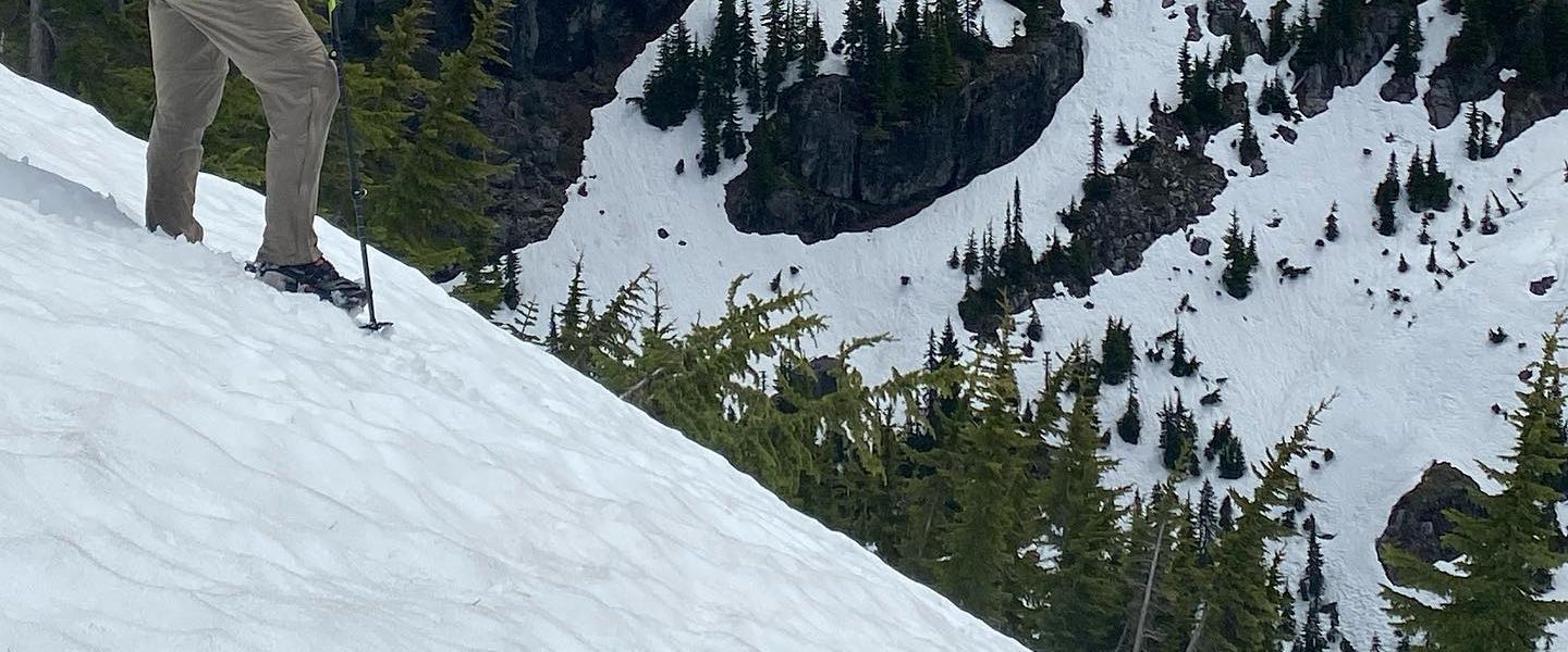
The hiking surface changed on the final ridge where the summer and winter routes overlap. In some places the snow, instead of being an inconsequential covering over grippy rock, was now a mortar between polished, pebble-sized ice balls making for beautiful and treacherous travel. There were fields where every disturbance in the dirt served as the nucleus of a wind loaded snow sculpture.

Which way do you think the wind blows?

The top was spectacular. You could see forever. The air was still. The direct sun let us me relax, even if I still had a puffy on. Jolly doesn’t have a particularly refined sense of safety and meandered close to the vertical drop into the crater. I teased Emily about being such a dog mom and she motioned over to the caldera’s edge for a surprise. Ben pointed out all the mountains he’d climbed and ones he still wanted to. We tried to identify obscure mountains in the North and South cascades. Ella and Garrett started planning a ridiculous trip to do an “Infinity Loop” (hike half way around a mountain, then over it, then the other half around, then over again to return to the start) of each and connect all the big mountains into a single hike.

Just one of several landscape dominating volcanoes.

Garrett and Emily put on flexible crampons which we hadn’t worn on the way up (I’d say Microspikes like everyone else but I significantly prefer a competitor) and walked over to the actual summit. Ben discovered he’d left his traction devices at the sensor site. We admired the view endlessly. Everyone but our group seemed dressed for a more intense adventure, many with crampons, snow shoes, ice axes, and ski goggles or glacier glasses.

What a good crew.

Ben lead the descent to get a head start since he had to cross the slippery ice pebbles without traction. Garrett tried to blaze a path in deeper snow where the footing would be less slippery but we doubled back to stay on the regular route for simpler route finding. Still, we missed the turn onto the winter route and were held up by a kind couple who asked us where the winter route was. I was adamant and vocal that we still on the portion where the winter and summer routes overlapped until someone spotted a hiker on the winter route above us. Half our group took off up hill and then overshot the turn off and had to come back down when Emily found the proper place to turn.

Back down at the sensor array we ate, not having had a proper lunch and it now being about 2:30pm. I’d brought and alcohol stove and spent an inordinate amount of time waiting for water to melt and then the fire to burn out. During this time I realized I’d brought one worse stoves from the batch of five that I’d made and tested that week.

Garrett and Ella, probably high off their inspirational and outlandish infinity loop scheme, proposed the idea of getting up at 2am to be able to hike almost the entire Loowit tomorrow. I nixed the idea as cleanly as I could. The trip had been too mellow and pleasurable to contemplate a committing and aggressive adventure tomorrow on low sleep. It was about 3:30pm when we left, an hour to sundown.

Garrett probably explaining a hairbrained and wonderful scheme.

The plan we ultimately agreed on was to get down to the Loowit and hike counter-clockwise towards June Lake then camp near there. The descent spread us out in pairs, each pair conversing as we picked our way down the rocks. We met up on the lowest ridge but Garrett and Emily were talking about climbing and we weren’t particularly hurried in our departure.

Eventually we did get to the Loowit trail and take a left. It was easy to follow in the trees. Ben was in the lead as we went out onto the boulder fields and managed not to turn an ankle or break a leg despite there being just enough snow to make the rocks slippery and hide the holes between them. We were moving well but not fast enough to get to June Lake by sundown.  Eventually, I spotted a flat area below the trail, we all gave Ben, who was in front, different directions on how to get there but he hiked another hundred yards or so and found that the bank of a gully created an easy path down to it.

The first order of business was getting the tents up. We were spread out in the trees wherever we could find flat places. A common cooking area was set up but Emily had been excited to try her new sleeping bag. Apparently it was good enough that she decided to stay in her tent to eat the lasagna dinner she’d brought while describing it loud enough for the rest of us over in the kitchen area to hear. Ben stayed in the tent too and shouted his highs and lows out to us. On any trip with Ella you will be required to say highs and lows. There are rules too: go clockwise, lows first, nothing sappy, nothing about the current moment. I can’t remember what my stated low was but after dinner I had to used an improvised blue bag and that was definitely the low.

I had my alcohol stove back out and was trying to melt water which was taking a very long time. I had brought a normal backpacking stove but finished off a fuel canister and didn’t want to start on open another. The alcohol stove was difficult to light with a lighter and I tried matches. They didn’t light easily against the box so I took to lighting the matches with a lighter. This wasn’t as successful as it should have been and the others enjoyed watching me fail at simple tasks. When I finally got the stove lit and had melted water for dinner, I poured more alcohol directly onto the stove so I wouldn’t have to light it again. A little spilled out but the fire was surrounded by snow and had no place to go. We started warming our hands and wet feet over it. Steam rose from Lizi’s socks. With the fire slightly outside the stove, and us treating it like a campfire, we realized that some twigs over the the top would give us a campfire. Wood was gathered with great purpose and soon we had a much nicer fire to dry socks and feet. No major gear damage occurred in the process. It was sublime. We loudly proclaimed our joy so the tented folks would hear. They never responded, probably because they were catching up on sleep lost the night before.

Moments later, we realized that we could just build a campfire.

Saturday

Jolly was the first up the next morning. I heard someone calling him and the sounds of a dog running around. Eventually I heard people moving but that died off. Finally it was light and I decided to be a good teammate and not keep people waiting. All the tents were still up when I poked my head out. The tents were still up when I’d packed up and settled on to my foam pad in the kitchen area to eat breakfast. It turns out that Garrett and Ben had been up to see the sunrise but been nice and not woken anyone up. Jolly had been contained after he’d escaped. I was the first one willing to impose my wakefulness on others.

The few short miles back to the Sno Park and our cars were passed much as the rest of the trip had been, in conversation. The morning was clear, the snow brilliant, and our spirits bright. I might have sung if I’d have thought of something appropriate. Again, no one got hurt on the rock fields.

When we reached the parking lot, the traditional cries of mourning were sounded for the end of a wonderful trip (traditional at least on trips with Ella). We stood around talking in a circle for some time with our packs on. I managed to find my car key in the pocket of a jacket I wasn’t wearing (I’d lost it earlier) and at a lull in the conversation opened my mouth to end our gathering. Before I could finish a word, Ella cut in with “not yet”. Our circle shifted back into the sun which had moved enough since we’d finished that we were shaded. Conversation continued. At some point, many hugs and goodbyes were exchanged. It was like leaving your friends after a week of summer camp.

We signed out of the trail register and returned to our cars, only to form a caravan on the slow drive to get under the snow line. In time, the road separated us. Emily and Ben turned south to Oregon. Garrett pulled into the travel lane northbound for the long drive home. Lizi, Ella, and I pulled off onto a side road to lunch at a local diner. Some things could be drawn out just a little longer.

Issy Alps 100k (Nov 15-16, 2019)

Intro

  • This write-up has been dragging out too long. It started as a chronological outline I was going to turn into a narrative. For the sake of being done, I’m going to press Publish without transforming them or proof reading. Leave a comment if you want something clarified or corrected.
  • Route beta is in bold. My track with notes: https://caltopo.com/m/9KNE
  • Many thanks to Ella Raff (blog, 1st attempt, 2nd attempt) for using the phrase “Issy Alps” to describe an ultra-running route and then, after I ran a  43mi route from Cougar to Rattlesnake tagging all the summits along the way, clarified that there was an official route by that name.
  • Unsupported: carried about two 500ml soft bottles, 7500 Calories, a fleece, hat, gloves, poles, and raincoat in a large running vest. Drew water from natural sources without filtering.
    • I would recommend 2L water or scouting water sources ahead of time.
  • Official Issy Alps Run page.
  • All Pics

Mailbox

  • What have I gotten myself into? (Photo Credit: Ella Raff)
  • Dry on the way up
  • Set headlamp to lowest setting.
  • started hitting some fog
  • changed into rain coat near the treeline
  • moderate wind, low visibility (fog) above treeline
  • thankful for the steps through the rock field
  • 1:50 at the top
  • On top of Mailbox.
  • light rain on the way down, nothing really below treeline
  • lost the trail where it multi-trails
  • tried to go up but couldn’t find something which stayed as a trail so decided to go down
  • trail was nearby on my watch but eventually separated enough from it that it was clear I needed to tack left instead of right
  • Filled water where there’s a clear 5ft spur trail to the stream near the bottom
  • cloudburst just as I got to the gate leaving Mailbox – convenient place to put the raincoat back on. ~3hrs

Connector

  • First section with real rain
  • slight uphill. Chose to take a “if you wouldn’t run it at the end, don’t run it now” approach
  • worried about downhill from the Granite Creek Connector b/c I’ve slipped a lot on that before
  • Turn off onto social trail to CCC road is immediately after the bridge. As soon as the bridge’s side turns to guardrail, step over it and look down. You should be just in front of a brown roadsign. Initially descends towards bridge (for 10ft) then turns right.
      • Just crossed the bridge. Step over the guardrail. See this sign. Now look down. There’s the trail (not pictured)
    • Small stream you cross shortly is muddy
  • easier to follow than expected, visibility was moderate
    • There’s a stream crossing where the bank has collapsed on the far side, you have to look up a bit to see where the trail continues. The water looked good here.
  • less muddy than expected but I was able to jump over a few spots which I knew weren’t well drained
  • Very happy to see CCC road, spent a lot trying to figure out what it would take to get back to 3mph average
  • Jogged up until the turnoff for Teneriffe Falls

Kamikaze Trail

  • Drew water at the falls. It was a little hard to find the correct switchback to drop off to get the water. It’s short (10ft) but steep.
  • Kamikaze trail is easy to follow because there’s no to get off trail.
    • Felt very steep but wasn’t hard because it was it was technical enough (hands help to support a big step up in a few places, but not class 2) and visibility was low enough that I wasn’t pushing.
  • At one point I my watched beeped and I had an 1:08 mile.
  • Found my way to the top. Easy to see where to get to but stone is a little steep and was wet. Fog prevented any good pictures
    • No rain or wind for which I was really thankful. In my head I was 2/3 through the first 50k (by elevation) and felt like I was past the dangerous parts. At least the first 50 felt doable for the first time.

Teneriffe Connector through Talus Loop

  • was a little concerned that I was starting back down the Kamikaze Trail. I’ve seen people think that the new trail was the old trail and was worried about making the opposite mistake
  • Water in two or three places when the trail turns into an old forest road
  • It look longer to get down to the Talus Loop turn-off than I expected once the old forest road turned down hill into switchbacks after the signed intersection. This was actually one of the most mentally “itchy” sections because it was easy enough that my mind began to wander past the immediate need to stay place my feet, visibility was good enough to see nearby terrain and I kept guessing at the turn-off.
    • “All of an ultra runner’s problems come from the inability to run only the ten feet immediately before them” (apologies to Blaise Pascal)
  • There’s drainage where there’s usually water on the Talus Loop, but I’d only ever taken the lower part of the loop. If it hadn’t been raining, the drainage would have been dry. I drew from a slowly flowing, clear puddle which was too shallow to completely fill my bottles. Cameling up would up when I did stop for water was an important part of being able to carry only one liter.
      • Town from the Talus Loop

Big Si

  • This was much shorter than I’d been mentally prepared for. That’s kind of a theme of the trip: things not being as bad as the life threatening monstrosities my imagination had built them into. Minimal rain helped.

Old Si

  • Quality of travel is quite good. Relatively few rocks and roots. A little steep and tight to fly down but would be a real pleasure to hike if you can control your effort level.
  • At this point, I was calculating miles to the finish of Little Si. Again, playing this game reduced my mental game when things were a little longer than I’d expected.
    • I’d been hoping for 12 hrs as an A goal. 13hrs was my B goal because that’s when I guessed Ella had done. Didn’t really want to have 14hrs because that was the time from the week before and she’d described it as “slow”. I didn’t want to be the slow one!
      • I didn’t let this trick me into pushing. I kept the long game in mind and let the time fall there it might but I felt pressure going into Little Si.

Little Si

    • One good water source shortly after turning onto the Little Si trail where a shallow stream runs under a culvert. I’ve seen this running in many seasons but it might dry up in late summer.
    • Little Si is popular and so has a lot off well beaten paths which aren’t quite the primary trail. This is different from the route up to this point point where were 0 or 1 candidates for the main trail. Several times, I hit dead ends and had to back track 5-10 feet.
    • Little Si is runnable if you have energy. I didn’t and it rolls enough and has enough roots and rocks that I never really found a rhythm.
    • The sky was lightening when I reached the peak.
    • Saw my first person of the trip about half way down, overweight, hiking in Crocs, large day pack and breathing hard. I made so many judgements about and comparisons to them. It’s one thing to give in to lesser motivations when you have nothing else but despite a growing awareness that I was falling behind on my calorie intake, I was still usually running the flats.
      • The more I read about US history, this kind of comparison and judgement seems to the cement solidifying many social ills. It’s a hard moment to recognize yourself in the face of the enemy.
    • There was enough light at the bottom of Little Si to take a selfie with the sign but not enough to turn off the street lights.
    • 50k was over and it felt good. I’d had a lot of apprehension going in to the experience never having pulled a true all nighter, even without doing more elevation in a 12hr period than I’d ever had before and with weather. I was mighty pleased with myself in an abstract, intellectual way. My mind was still on the course.
    • Done with 50k!

Snoqualmie Valley Trail

  • From the Little Si trailhead, I started walking the road towards the bridge and then took a left down the Snoqualmie Valley Trail.
  • The sunrise was really well matched with the easy start to second leg of my journey.
    • At this point, I was feeling good and hadn’t ruled out going for the 100miler so I couldn’t tell if it was the second of two or three legs.
    • I could tell that I’d under fed during the night. My raincoat was tight when I’d put it on over the pack and bottles which had made it hard to access the side pockets for food. At this point, my goal was to reset, so I pulled out trailmix, a food which I can’t stomach when pushing hard but is quite filling, and chewed mouthfuls until I could see my belly pushing out again.
    • I took a quick stop to re-arrange gear since it didn’t look like rain and I wanted to move my bag of Chex Mix up front where I could eat. Chex Mix is my go-to “real food” to balance out sweet tasting high energy gels and bars.
  • Ran several of the miles to Rattlesnake Lake but when I slowed to walk as the path neared the park, it was clear that my energy reserves were low, so I started eating generous amounts of Chex Mix.
  • At Rattlesnake Lake, I looked around for water fountains but couldn’t find any so drew water from the lake. The lake water was clear and tasted reasonably clean.

Rattlesnake

  • Going up Rattlesnake Ridge is well graded and easy. A nice change from the previous climbs. I saw lots of other trail runners out and about, though usually not as loaded with food and moving faster.
  • On the way up, I started losing motivation. Mental tiredness started creeping in at the edges of my eyes. I finally broke into the caffeinated gels. Boy did I feel good after that. I wasn’t necessarily moving faster but my mind was wonderfully clear, calm, and alert. What a wonder drug.
  • I followed the trail the whole way. From reviewing the official GPX, apparently you’re supposed to follow a road near the clear cut at the top for a bit and rejoin the trail. I don’t think it matters and George didn’t comment on this when I submitted my GPS track. It’s actually harder to follow the trail because it rolls more.
  • From the trail above the clearcut on Ratttlesnake. I think I was trying to take a picture of Rainier. There’s a road just below this which is the route proper.
  • As I descended, I kept a pretty close eye on the GPS because my memory is that the turn off the spine of the ridge is easy to miss. It’s actually not since you come out into a clear cut for the power lines.
  • Things can be a bit confusing from here so I watched the GPS pretty close. In several places there’s multi-trailing. The general idea is to follow the power lines.
    • There’s a place where you have to turn right onto a bike trail (this was a >90 degree turn for me) and follow it through the woods on the north side of the clearcut. There’re lots of trails in there so I was pretty shameless with the GPS. You can miss the initial turn off because the hillside is overgrown and steep so it’ll force you to turn back and find the bike trail.

Connection Across Raging River and Deep Creek

  • Continuing down from the power station by whatever path seems clearest will eventually pull left in the clear cut as it descends towards Raging River. Before descending low enough, I looked across the valley to get an overview of where I’d be going. It didn’t look like there was a clear trail but there was definitely an easiest way.
  • At raging river, the shallowest crossing was on the left side. Multiple crossings are flagged. Since the river was low, I scouted right a little bit hoping for a rock hop but wound up crossing almost directly under the road, then moved towards the green grass and let it carry me out of the river valley and towards Deep Creek.
  • In this section, the GPS track was just wrong. I just followed open areas which had clearly seen some foot traffic and generally headed in the correct direction.
    • There was one place where I had to turn right onto a cut which had been mowed, then turned left again when the trail picked up under the other power line.
  • Just before Deep Creek, there was a split where you could got up a 5-10ft bluff with a clear trail or descend a lesser used path. The lesser used path looked like it hit dense brush by the side of the river so I stayed on the nicer path. This wound a little and I had to duck as I walked through a tunnel of brush.
  • The trail appears to present multiple options for crossing Deep Creek. The most obvious one has a log in an awkward place which creates a pool which was deep enough to look uncomfortable but probably not deeper than I was tall. This can be avoided by ducking under a branch and crossing on the upstream side of the partially submerged log. I checked another crossing just downstream hoping for a dry foot rock hop and got most of the way across but didn’t see an exit up the cut bank.
    • I drew water from Deep Creek
  • From Deep Creek, the route stays left in the clear cut, start moving up steeply (not Mailbox/Teneriffe steep) until it connects to an almost flat road, the edge of which is a clear horizontal disturbance in the hillside above. The road is obvious when you’re on it but there are a few red herrings in the area which made me want to push right a little early.

South Side of Tiger Mountain

  • The road after the connection was wide, flat, level, etc… and I was able to jog again.
  • I passed a hunter out with a rifle over his shoulder. I didn’t know there was hunting in the area.
  • The turn off the road onto the Northwest Timber Trail is almost 180 degrees. There’s a road just above it which was much more obvious. I almost took the road since some cyclists were stopped in just such a position that they occluded the trail.
  • The trail remains relatively level. I was tired and so mixed some walking in with the jogging but felt bad about it, especially when I crossed paths with some other runners who were stretching. I felt awkward walking past with my overstuffed adventure vest, aggressively attacking the flat, level ground with my poles as though my trip was all show and no substance.
  • There was water in a stream just after the only switchback. This actually confused me for a moment because the switchback isn’t in the official GPX and I wasn’t sure if I was supposed to just bushwack across. It looked like there was a better crossing below and in looking around for the best way down, realized the trail had switchbacked behind me.
  • The Northwest Timber Trail eventually crosses the Main Tiger Mountain Road (no signage, it’s just well kept forest road. You’re supposed to take the road. From here it’s a gentle up and up to the top of the mountain. I crossed and continued on the trail then had to double back when I noticed on my watch that I was diverging from the route.
  • I walked hard up the road but never really ran. One mountain biker passed me on the way up. I passed one mountain biker on the way up. Tie game.
  • Just before the top there’s a mountain bike trail, the East Tiger Summit Trail, which goes left. Don’t take it. I walked past it but my watch was ambiguous and made it look like maybe I was supposed to be on the trail. Since I knew it formed a loop, I took it thinking the course designers would have put in a loop instead of an out-and-back. On post-run inspection of the route, it appears this is not the case. I think my watch down-sampled the GPX file in a way which was confusing. Also, I had to dodge out of the way three times as mountain bikers whizzed past.

Descent to High Point Trailhead

    • At the top of Tiger Mountain I stashed my poles and prepared for what I thought would be about 3.5 miles down. My watch had logged about 59 miles and with 100km equivalent to about 62 miles, I figured that 63 plus a little was a safe guess for how long it would take me to get down. When I rain the Plain 100k, the same watch computed the course length as 63.3miles so I assumed things would come out the same here. If I could hold 5mph I’d finish under 23 hours. On the nice bike trails which I assumed would carry me back to High Point TH, that seemed like a slam dunk. With I’ll Make a Man Out of You from Mulan, playing in my head, I hobbled off the flat area at the top and let the angle of the hill coax a little speed out of my legs. Despite the mismatch between my performance and the chorus looping in my head, I was feeling good.
    • My watch read 22:57 when it rolled over to mile 62…. A quick glance at the GPS showed that I was nowhere near down the mountain. New goal: 24hrs. I guessed there were 3 to 5 miles left. Shortly thereafter, I turned left off the dirt bike trail at a hikers-only trailsign (Caltopo doesn’t show a trail here). The trail transformed into scuffs and footprints as it fell into a clearcut. It started raining again. Not even kidding.
    • The GPX in this section is just wrong. It gets you to a road, but I didn’t see anything continuing across the road so turned right downhill. The road is cut with deep perpendicular furrows every 15-30 yards so it feels like a BMX course. Fortunately, Gaia showed it linking up with the official GPX which went straight across the hillside. The last few bumps were grass covered instead of gravel with drops well over my head. This didn’t make for good travel and I was worried that it was going to carry on this way for some time. Shortly after rejoining the official GPX, a paved road appeared and I felt greatly relieved.
    • Gravel road with deep furrows.
    • This road is on the GPX and doesn’t have furrows and is back on the official GPX. The grass in the foreground is the end of the worst part of the previous road which wasn’t on the official GPX.


  • The road run doesn’t last for long. I stood for a moment looking at the gate where the Tiger Mountain Trail started. It looked thin and overgrown. The sun was getting low and I was definitely behind pace for a 24hr finish. I really didn’t want to be route finding in the dark but the trail condition seemed to suggest the possibility. Particularly hard to stomach was that based on a thorough examination of the route on Gaia, this would just link up with the road I was already on.
  • The Tiger Mountain Trail wound up being easy to follow but part way I stopped to take out my headlamp. I hadn’t charged it since I was expecting to be done before dark and was pleasantly surprised how little the battery had been drained by running it on low for 13 hours the night before. Now I left it on full brightness. It couldn’t be too long now and I didn’t want any missed turns. A 24hr finish time was still potentially in the cards when I got to the wider but still leaf covered trail beyond the exit gate of the Tiger Mountain Trail.
  • From here to the end, there were a number of turns. I would check Gaia on my phone, not trusting my watch to alert me to an upcoming turn, memorize the next few features and what to do at them, then try to get through them as quickly as possible. Initially I was cautious on the wet leaves. As the minutes ticked towards the 24hr mark, urgency manifested as faster and more reckless running. I gave myself permission to burn my legs out and started running the brief uphills.
  • One feature was the that a trail was going to join the Bootleg trail from the left for a short distance, then exit to the right. At the split, I needed to be sure to stay left. Looking at it now on Caltopo, it’s the Preston Trail which came in from the left. I remember this. I don’t remember seeing the West Tiger Trail exit to the right.
  • With about 10 minutes until the 24hr mark, I missed a turn by staying on Dwight’s Trail instead of turning right onto Lingering Trail. Given that the destination was High Point TH, my mistake was to assume that the 0.1mi to High Point Trail was the route. I caught the error on my watch after a few tens of yards and after running back to the intersection, realized that I hadn’t even seen the Lingering Trail on the right when I’d originally come to the intersection.
  • This was where I committed the final directions to memory, “At every intersection, turn downhill. At the road, sprint.” I made it to road and past a homeless encampment but I as ducking under the long arm of the gate, time rolled past 24hrs.
  • From here, I was on the road I’d driven in on and put in a good effort to get back to my car. I was worried that they might close the lot at sundown. I noticed the trailhead which marks the end of the Issy Alps 100k but didn’t think to stop because in my mind, the end was my car. At my car I stopped, then realized that the end was supposed to end at a trailhead but that I was in a parking lot and so dashed off to find something which looked like a trailhead. I stopped my watch in a clearing just off the parking lot where a kiosk stood, hoping that this would be acceptable end point. The elapsed time was 24hrs 9min 7s and it was around 5:40pm.
  • I had the track for the Issy Alps 100mi in my watch and Gaia but that ship had long sailed. I’d just gone my first night without sleep (in college, I always managed to get some sleep around 6am after an all nighter) and wasn’t ready for a second. I’d eaten through most of the 7500 Calories I’d stuffed into my pack and while there was a back-up stash of gels in the main compartment, it wasn’t nearly enough for another 35ish miles (my watch logged this “100k” as 66.7mi). This was an unsupported trip and so I’d only cached a soda in the trunk of my car as a finish line treat. This all certainly made a good excuse to call it quits. I was actually feeling pretty good all things considered.

Epilogue

  • Finishing celebrations were brief. I drank the soda and texted friends and family. The first replies were wonderfully supportive and snarky. I got my car outside the gate before replying to be sure I wouldn’t be locked in.
  • Within 10 minutes of finishing, I was on the road home. My legs tightened up and soreness which I hadn’t felt during the run set in. The balls of my feet ached enough that would naturally start easing up on the accelerator to relieve the pressure. This was not popular with the vehicles behind me.