The initial plan for this weekend was three day hike with a border meetup at the PCT’s northern terminus. Then work schedules intervened. Emily decided to visit the Stehekin Bakery instead and it sounded like a good idea to me. The Stehekin Bakery is a notable stop on the PCT. I spent $60 there in 2016 and gave myself a raging food coma. The cinnamon buns are particularly notable. The trip’s secondary objective was to get away from the smoke blowing north. In this regard, we were partially successful.
Northern Terminus – Bridge Creek TH Southern Terminus – Stehekin Bakery Outbound – east over McAlester Pass Return – west over Rainbow Pass & PCT
Friday, September 11
I drove to Bridge Creek Trailhead as soon as work was over, arriving a little after dark. Emily pulled in while I was circling the parking area looking for the stand up paddle paddle board usually strapped to the top of her car. She parked and I pulled up and got out to say hi. I turned around to actually park my car and it was dead. This is a new-to-me car named Elliot since I tore an engine mount bracket on my last car (Eleanor) which isn’t produced anymore. Elliot had done so well on his maiden voyage. At a loss for what to do, we decided to jump Elliot and in the process, accidentally bumped the connection to the positive battery terminal. Elliot powered back on. Rotating the wiring 90 degrees kept Elliot on long enough to park. We’ll call this the pre-adventure adventure.
We made it a few miles of easy downhill to Fireweed Camp in the dark, chatting the whole way. This area was full of memories for me despite being ostensibly nondescript. At one point there was an enormous frog in the middle of the trail. Its camouflage was perfect until it moved. Unfortunately, it moved very slowly, jumping up an embankment and running into plants mid-jump and falling back. It seemed too large for it’s own good. Jolly, Emily’s dog, sniffed it but was kind enough to let it live.
The night was warm and there was no rain forecast so we both cowboy camped in an established site, ate the very soft ice-cream we’d packed in (ice cream ranks as one of the most desired trail foods so why not take some if the first leg of your journey is short?), and admired the stars for a bit before falling asleep.
Saturday, September 12
It was a dry morning – no dew on our sleeping bags and no hikerwash. This is one of the things which makes summer camping so easy and comfortable it feels like cheating. Of course, that dryness was feeding the fires to the south. The smoke from those fires made a light haze in the air, but the sky was still more blue than brown.
The trail was easy and well cut. It climbed slowly through a forest to McAlester Lake which I swam across, and then through some meadows with low peaks on each side. The ground cover is beginning to turn red, signalling the start of my favorite color scheme in the mountains.
Smoke was still a light haze in the morning. Ground cover starting to redden.
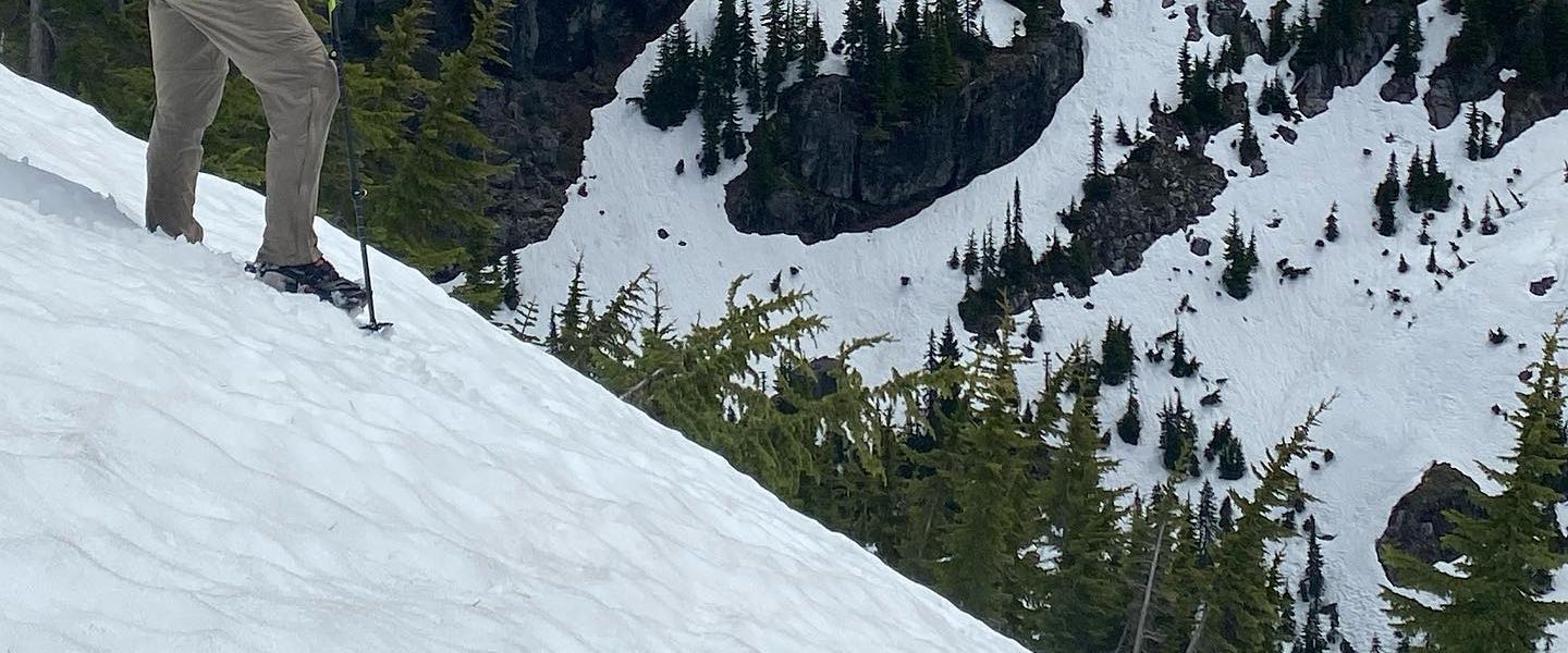
On the descent from McAlester Pass, there was a short, wobbly bridge. The trick with these is to place one foot in front of the other to minimize side-to-side sway. We intended to go one at a time so as not cause the bridge to sway for each other, but Jolly didn’t get the memo. He was very unhappy with the bridge. If only he’d waited his turn.
Jolly, unhappy with the swinging bridge, puts Emily off balance.
There’s one road through Stehekin. It doesn’t connect to any other roads. The only way in to Stehekin is by foot or ferry. Clearly we’d chosen foot, but I assume that the presence of cars meant that some people choose ferry. This road presented us with a problem: should we follow it right or left. The bakery wasn’t marked on our map. Fortunately, there was a sign.
A terribly taken selfie. That sign was well welcome guidance. Clearly a popular destination.
The bakery was full of people and baked goods. Surprisingly, there were no PCT through-hikers. We ate two courses, lounged around for a while, then bought some baked goods for the road. Emily tried to make friends with some chickens which were wandering around but they’d run off whenever she got close.
Full bellies don’t make walking easy so in the late afternoon we decided to amble, mosey, or saunter – but not walk – back to the trail in the hopes of getting a head start on tomorrow’s mileage. Smoke had rolled in and shortened our sight lines. However, most of the hike (we did eventually start moving with a little more zest) was up a valley where there weren’t long or sweeping views to ruin.
The sky was now brown, not blue.
We made it as far as the wobbly bridge then cowboy camped. Dinner was mostly an apple pie from the bakery.
Sunday, September 13
It was another dry summer morning. On our way out of camp, we crossed the wobbly bridge which Jolly didn’t like. This time he realized that he could just splash across the low stream underneath instead of placing his paws on its unstable boards.
As the trail crept upward (but mostly horizontally) towards Rainbow Pass, we came suddenly across a large biped munching happily in patch of huckleberries. Fortunately this was a human, not a bear. Josh was his name, and he gave us some tips on berrying and told us about some of his off-trail adventures in the area. It was a great connection because we both like berries and we’d spent some time tracing probable off-trail routes on Emily’s large NatGeo map the prior evening.
The smoke had stayed from the night before. Rainbow Lake didn’t appear to be particularly pretty and the smoke certainly didn’t help. We ate more baked goods instead of real food. On a stump, Emily found a book on transhumanism which made for an interesting conversation and took our mind off the switchbacks to Rainbow Pass. Unfortunately, there were no rainbows, only smoke.
No rainbows over Rainbow Lake, only smoke.
From there, the trail dropped steeply into a river valley then descended gently to a crossing just before the PCT. It was one of those odd situations where a trail gets close to a river but the point where it hits the bank is clearly not where you’re supposed to cross. We found a well used footlog which Jolly liked more than the swinging bridge.
The joys of stability.
We ate a meager lunch at the PCT, having consumed all the baked goods we intended too. I had a bunch of bars left, all the same flavor. Then we made it back the way we’d come.
The last miles were the ones we’d walked on Friday night. They were nondescript miles surrounded by brush and trees. Oddly, it seemed to match my memories from 2016 of the PCT less than when outbound on Friday, despite Friday’s hiking having been in the dark and the opposite direction. Still, the final miles outbound were memorable because we debated how positive modern music is compared to music from an older generation. Having taken the negative side, I lost the debate when Emily introduced me to the music of Michael Franti which seemed like a good match for how fun the weekend had been, even with the smoke.
I’m prepping for a long running event this October (so long it’s not officially a race, they just happen to record your time and give out prizes to the winners) and running 82mi around Glacier Peak some weekend seemed like a good training exercise. My friend Anda was prepping for a slightly larger circumnavigation trip and mentioned that many trails in the area had been abandoned. I called off a trip earlier this year due to lingering snow but with a free weekend and a need to put miles on my feet I set out to see what was what.
Glacier Peak circumnavigation route (hiked counter-clockwise) ~82mi, ~20,000ft elev gain Car was parked at SE tip of route. Orange trails were presumed abandoned at the start of the hike. ITB symptoms started about 30 miles in. Camp was set about 38 miles in. Yellow trails are not recently maintained.
Saturday
My alarm went off in the back of my car at 5am. I turned it off an didn’t move. Somehow I was walking past the kiosk having filled out a self-issue permit at 5:35am.
The plan was to get to the Boulder Creek trail after sunrise since that’s where I thought the trail had been abandoned and wanted good light and as many hours as possible to deal with whatever would come. It turned out to be well cut, often traveled (even by pack animals based on the poop), and I was able to climb leisurely up to Boulder Pass.
My route goes right. I’d assumed it’d be abandoned and was pleasantly surprised to find it well maintained.
As the route worked it’s way up through the high valley, the sun rose, pulling a line of light down the ridge of granite above the pass. I managed to stay in the shade almost until the top. This game of trying to stay out of the sun on a hot day or get into the sun on a cold one is a standard feature of early morning starts.
Near the top of Boulder Pass.
The trail down from Boulder Pass had tight, sinusoidal switchbacks which looked like a tan snake in the dull green ground cover. I tried to cut a few switchback by boot skiing down a snow patch on a rock field but fell near the end. Boot skiing, where safe to do so, is probably my favorite form of back country transit.
I tried to cut a switchback by boot skiing and ended with a “unintentional glissade”
At one point, the trail split. I was about to follow the better worn fork, but reasoned that it looked like a spur trail to a viewpoint. Then I noticed a small cairn to the left and followed it. It’s always interesting when the lesser trail at a fork turns out to be the main path. Perhaps this section hasn’t see much official maintenance, just a lot of foot traffic.
Don’t be fooled, the trail goes left (note the cairn).
Back under the treeline, I was ambushed at one particular turn in the trail by a bleached skull. I’m guessing it was a horse. The trail here was thin and the hillside very steep. The first blowdowns had finally appeared. It was easy to imagine an in injured pack animal getting stuck in this section and eventually expiring. Or maybe someone just left the skull there to spook people.
A horse skull (I guess) on the descent from Boulder Pass.
I saw my first other person, a slightly larger version of Justin Simoni. They were dressed like an endurance runner with ankle gaiters on their thick-soled trail runners, compression socks, a low-volume pack overnight pack, hiking hard uphill. They traded brief words but shouted them over their shoulder as they passed. On meeting two fashionably dressed, well coiffed fellows shortly thereafter, I asked if they knew what the runner was up to. They said, “some crazy shit”. I wondered if the runner was also doing a circumnavigation and hoped I’d see them again (it was not to be). I told the pair that I’d heard these trails were abandoned and they said they thought they’d used to be but were now seeing a lot of traffic. They also said I was about to encounter some alder which would make me take back my positive assessment of the trail condition. The alder turned out to be minimal and barely overgrowing the trail. When I got to the river valley where the wet conditions breed dense, rapidly growing plants which eat trail, there was still a clear path to follow. I don’t know if these trails are officially abandoned or not but if they are, the foot traffic is doing quite well for them.
Clearly this has seen maintenance in the last few years plus a lot of foot traffic.
After being unable to find a dry-foot crossing of the Napeequa River I got my feet wet and turned left at the Little Giant trail. This was dominated by high grasses which had been trodden and smashed along the trail forming a corridor which funneled you along with little opportunity to divert. I’d feared traveling on what I’d thought would be an abandoned trail in a river valley. Trails have a way of disappearing into luscious meadows with no hint of where they might exit. The facts on the ground were a welcome relief.
The Little Giant trail follows the valley past two waterfalls, then climbs almost straight up the hill through the dense brush on the north side of the second. I passed a trail runner on their way down. The conversation was quick, “wow, this is steep”, “it’s ok the views at the top are great”, “in 100ft or so it flattens out, you’re almost done”, “you’re not”. They smiled mischeviously over their shoulder and dropped out of sight. In the grand scheme of things it wasn’t a long climb but it was claustrophobic.
The trail goes almost straight up through the bushes on the left.
Above the waterfall was a high valley where the trail played hide and seek. It seemed to follow a bit of the ridge in the middle when that was present but sometimes you could see trail on both sides which really means that there’s no trail. Just go up the valley and pick the correct saddle to exit when you come to the top. GPS made the macro navigation trivial, but in one case, I tried to avoid a small climb, then wound up climbing up some slippery rocks when the stream branch I was following ended in a small waterfall.
Trail disappears. Frolic as you please, just stay right at the end of the valley.
Around High Pass, I got my first real views of the wild high country for which the Glacier Peak Wilderness is famous. Something I hadn’t realized is that Glacier Peak itself doesn’t dominate the area like Rainier or Adams. Despite being almost a quarter of the way around Glacier Peak, it was just getting my first glimpses of it, and they were distant.
There’s a lake under High Pass which, from the topo map, was under a steep drop-off. I didn’t realize how steep until I got to the pass and didn’t see the lake. It wasn’t until I was almost at the edge that lake became visible. After crossing a short scree field at the head of a bowl, I ate lunch overlooking the lake from another angle. There were voices below me and I’d seen two people near High Pass. For all it’s reputation as remote, the Glacier Peak wilderness didn’t seem that lonesome during the height of hiking season.
After high Pass. Glacier Peak is the ghost of a mountain in the distance.
After lunch it was clear I was behind schedule. I’d planned for ~2mph until reaching the PCT and I wasn’t averaging that. Fortunately the trail around Liberty Cap and Bucks Pass was well maintained and I cruised the long winding descent that eventually becomes a steep, but still well maintained, drop to the PCT. There were recently cut logs on the final descent and I mentally thanked the trail crews as I zipped past piles of fresh sawdust.
It was about 4:45pm when I reached the PCT and I’d gone about 24 miles. I wanted at least 30 on the day and since the trail here was a gentle slope of manicured uniformity, I decided jogging wouldn’t hurt. I passed several groups and individuals and then a pain started building in the outside of my left knee. It started quietly and since there are many fleeting aches and pains on any long bipedal excursion, I ignored it. Eventually, it built to the point where I had to consciously brace my left leg to keep it from weakening under the sharp pain during the load and release of each stride. This seemed unlikely to be transient so I stopped for a few seconds, then walked. That gave whatever was happening a chance to gather it’s forces and the only relief I could find was in keeping my left knee perfectly straight. This allowed me to hobble without pain, but realistically the knee had to bend a little here and there. The next several miles were on gently rolling trail and saw me apply great creativity to bipedal walking mechanics: swing the hips, trekking pole skipping, hips back, bouncing on the balls of the foot. Anything which would give the left leg a little extra room to swing through each stride without bending the knee.
After 7-8,000ft of elevation gain and loss, this gentle, well-maintained section is what damaged my knee.
The next several miles were slow and difficult, though not without their charms. I saw a porcupine. I saw a hut of sticks, though I didn’t have motivation to walk the 10 yards off trail to investigate. I saw two hikers with PCT markers attached to the shoulder straps of their packs and chatted with them for a bit. Since I was moving slower, I asked them where the next water was as I didn’t want to take it for granted that I’d get to water soon.
A porcupine!
As the trail descended to the Suiattle River, there was a switchback which I remembered from my PCT hike in 2016. It’s a 3-way intersection where the the Suiattle River trail joins the PCT and could have provided a bailout option. I looked at the map but didn’t know if the road to that trail head was passable. I didn’t know the condition of that trail, even if it was much shorter than the ~52mi ahead. My knee pain had lessened slightly and might go away with a good night’s sleep. If it did, I’d regret bailing. If I could do 10 more miles tonight for ~40 on the day, I’d be able to walk it in tomorrow even if I had to go slow the whole way. I decided to roll the dice and kept going.
Dinner at the bridge over the Suiattle River was brief and light. I’d cold soaked ramen, ate potato chips, put my feet up and lay in the trail feeling the aches of the day and low energy bleed out of me. Eventually the ramen was done and there was nothing to do but keep walking. The light was getting dim so along with my headlamp, I put on an audio book to keep me company and distract me from the dread of running through distance-time calculations and scenarios for which I simply didn’t have enough information.
The Suiattle River bridge has a bend in the middle.
The goal had been to climb up to a small saddle where I’d hoped to camp. If things went really well, I’d make it part way along the following traverse to a campsite where I’d spent a night in 2016 shivering in my rain gear which was dry since I hadn’t put it on when the rain started. At some point, I ate bar to keep my energy up but wasn’t feeling hungry. My knee was allowing several degrees of bend which allowed a moderate pace on the easy switchbacks with a visible but not horrifying limp. Around 10pm I realized that my feet weren’t planting cleanly but stepping left and right to catch a subtle swaying of my upper body as though I were having trouble keeping balance. Sure my legs were tired, but that simply didn’t explain it. I didn’t feel like I was bonking and I didn’t feel the full system exhaustion of depletion, but something was definitely not right either.
The GPS said there were just a few more switchbacks to where the trail would cross a ridge at a slight depression. I held out for that and the flat spot which it implied and found something good enough where I figured I wouldn’t roll or slide off anything steep. Rain wasn’t expected until tomorrow evening which was good because I couldn’t find the motivation to put up my tarp with all the dexterity and calculation it requires. Even a tent with poles would have been hard to put up. I did manage to get a ground-cloth under my air pad. Inflating the air pad had taken what seemed like an eternity. I put on my rainsuit to help with the chill which had had me hiking uphill in a fleece (that’s uncommon even on winter excursions) and lay down exhausted. This was the kind of exhaustion that you’re not completely aware of because you’re so exhausted.
At some point in the night I had to pee. I’d wanted to hold it because I was almost out of water and for some reason I think that holding your pee reduces the need to drink. I couldn’t, so I stood on the edge of my sleeping area and relieved myself. The standing made me dizzy and my stomach felt like it was caving inwards. That means a calorie deficit. I ate two bars for the energy and some more potato chips since that’s all I had for salt. It was I had without digging into emergency supplies or food I’d expect to need tomorrow and while I didn’t feel full, it was a clear improvement. I slept much better the rest of the night.
Sunday
I woke as the pre-dawn softening of the sky was just beginning to hide the stars. I didn’t want to go but I didn’t want to stay. I felt clammy from sleeping in my rainsuit, even with layers underneath. It was obvious my knee hadn’t healed in the night so walking meant pain and chill, at least until the chill left and then there’d only be pain. Staying meant feeling damp, smelling rank, but it would be a warm misery. By now I’d looked at the time and my best case projections involved finishing by 11pm. There was naught for it, so I threw off my quilt and faced the day. At least I’d packed clean socks.
My knee wasn’t happy but as long as I kept it pretty straight, it wasn’t complaining too much. There was less creativity required to attain a moderate pace. With the sun rising, and the trail bed relatively good, it was a pleasant morning. At one point, there were horses on the hillside above me and as the light slowly increased, the ground cover went through a range of hues. In 2016 I’d walked this traverse in the early morning and the symmetry of revisiting it under similar conditions was pleasant.
Horses.Trail.
As the sun was beginning to draw a clean line of light and shadow on the tops of ridge lines, I encountered the descent to Milk Creek. It was exactly as I’d remembered. Heavy vegetation tries to push you off the narrow, broken trail into the open space vacated by a steeply dropping hillside. Going was either slow or painful, and sometimes both. It was hard not to think about the consequences of such a pace. I knew that this too would end in a more forested, less bushy trail but the shallow switchbacks weren’t getting there very quickly.
The ridge across from Milk Cree. Note the dense vegetation in the foreground.
The map shows a trail leaving from Milk Creek and running out to a trailhead where I might have used my inReach to ask a friend to pick me up. It’d have to have been a good friend for the drive would have been long and then they’d have had to drop me off at my car which would have required a circuitous series of roads. The notion was tempting, but not particularly so when it was obvious that that trail was abandoned.
The Milk Creek trail provides no escape.
At Milk Creek, I ate breakfast which was oatmeal with raisins, sugar, and cinnamon. I hadn’t had enough water to soak it overnight so it was flat and felt like chewing cud but was an honestly welcome change from the bars I’d been eating. However, I knew the trail up to Mica Lake was relatively well maintained so I put in the audiobook I’d been listening to the night before and things started looking up (yes, both literally and metaphorically).
The trail up to Mica Lake. Well graded and easy to stride even with a stiff leg.
Mica Lake was beautiful. I’d remembered wishing I had more time to spend there when hiking the PCT in 2016 (I was on a schedule to finish the trail by my birthday) and now I had the same desire. I was behind schedule but I had to eat lunch some time so I pretended that 10am was lunch time. I wanted to swim but the water was cold enough that it would have take a long time to adapt if I’d been able to adapt at all and I’m not usually one to just in all at once. Still, I changed out of my tights, took my shirt off and soaked up the sun while I let my left knee soak up cold. Unfortunately, my projected finish time was slipping towards 3am so when I was done snacking, I moved on.
Mica Lake. Oh how I want to spend more time here.
Despite having iced my knee in Mica Lake, it had become more sensitive. The rest of the climb to Fire Creek Pass was stiff with little jolts of pain whenever I slipped out of a perfectly lock-kneed form. The descent after the pass saw the invention of an new form of skip-hopping to get over little rocks and deformations on the slightly steeper grade. I started becoming quite impressed with the strength and endurance of my right leg which was responsible for most of my forward progress and while not feeling fresh, wasn’t feeling like it was approaching exhaustion either.
Looking at the west side of Glacier Peak shortly after Fire Creek Pass.
Along the west side of Glacier Peak the trail contours across several steep, lush hillsides, then drops to a river valley. On the map, two trails run westward from different ridges, but I found a third which was marked with a yellow sign saying the trail had been damaged. Apparently this area saw massive flooding and landslides in 2003 and while some of the trails have been rebuilt, much also remains degraded or lost.
Where I had my actual lunch.
The river valley had two bridges which were collapsed perfectly in the middle. I passed a number of hikers, including two ladies who were partially running despite having large packs. Their background was as trail runners. They appeared not to have GPS and were navigating off major trail intersections. When they asked if there were which of the two trails we were near, I told them there were three… but that they weren’t at the first one yet. They were moving well and really didn’t have anything to be concerned about since the PCT is by far the major trail at all the intersections.
I guess if the bridge is going to break, this isn’t such a bad way to have it break.Apparently the Glacier Peak wilderness is good a breaking bridges, but not so good at washing them out.Taken from a non-broken bridge.
The last hiker I talked to was just as the climb out of the river valley started. Dundee was a Crocs-wearing PCT hiker who matched my complexion and bear color, but with a stronger build. We talked for 10-20 minutes and in this time, my knee apparently healed. Not completely, but it had significant range of motion and could carry enough weight to walk on easy grades without a limp. Fortunately, the climb to Red Pass was easy. I had my mojo back and it was exhilarating.
Rain was forecast for the evening, just like it had been when I passed through in the opposite direction in 2016. The upside was that the air was cool and the light soft.
Part way up to Red Pass.
I reached Red Pass with 2 hours, 15 minutes to make it about 5 miles to the turn-off to the Indian Creek Trail before daylight’s end. It was so runnable and I was wearing a glorified running pack but the knee would not take it so I walked, but at least I could walk pretty quickly.
I kept wondering when the rain would come and it came very hesitantly. At first, the drops were tiny and rare and so would evaporate with my body heat. At dinner (7pm, 1hr of daylight left), I ate the last of the potato chips, the last bar, and broke out the 15 serving container of caffienated gel. 7hrs of calories and my first caffiene of the trip. While I’d been hoping to finish before the rain came, I was feeling optimistic. The temperature was now cool enough that I could wear my light, cheap, easily damaged rainjacket with comfort.
So runnable, so not runnable. Either way, so beautiful.
Eventually, I found myself at a sign of excellent quality which pointed to the White River Trail. This confused me since I thought the White River Trail was abandoned. The trail to which it pointed seemed in good shape. This is a mystery which may require future investigation.
Shortly thereafter, I was at the Indian Creek Trail with 15 minutes of daylight remaining. This was the last leg of my trip and since the WTA description of the White River Trail said that the Indian Creek Trail had been to focus of their maintenance efforts, I was expecting to cruise in the 11 miles by midnight at latest. 11am things went well. Maybe I should have read the WTA’s description of the trail itself which as of this writing opens with, “this crucial connector trail to the PCT in the ultra-rugged Glacier Peak Wilderness requires keen navigation skills (and a strong sense of adventure) as years of overgrown brush make this trail difficult to follow”. And so, after 70ish miles of walking, around 7:45pm, with fading light, the adventure truly began.
The start of the Indian Creek Trail, before dark fell and the rain increased.
The only picture I have from the next four-ish hours that it took to make it down what should have been 9 easy miles is the broken (and not in a nice way) bridge blocking access to the final leg of my journey. In retrospect, dividing out those miles by that time doesn’t seem like I kept such a bad pace. On the ground, the experience was frequently knee- to shoulder-high brush. Fortunately the brush usually had a clear weakness. When the trail was overgrown with bushes and not grass, the trail bed had a distinct feel which suggested that you hadn’t turned off onto a game trail. Under the trees, the trail was frequently faint in the weak beam of my headlamp (turned down to preserve battery given the likely need for extended use), but logical and so wrong turns were relatively unlikely. I found myself praying for treed sections and in the bushy sections, praying. Slowly, tactics developed: when in doubt, barrel ahead and if things don’t work out in 10ft then reconsider. Look for the trail bed under the brush and alder to find an exit from a streambed. This trail does see some traffic, have faith that it goes.
There were two great moments of doubt. The first was in head-high grass. Unlike bushes, which don’t long hold the marks of a recent passage, grass, even head-head grass, is trampled under foot by anything going any which way. These fallen stalks form a mat over the trail bed, obscuring it from sight and feel making it difficult to differentiate among game trails, exploratory side-trips, and the real trail. At points of greatest route-finding difficulty such as streambeds and cracks in the earth, those exploratory trails multiply. This is how I found myself turned around so badly in the rainy dark that I couldn’t find the way I’d come, despite knowing it couldn’t be more than 10 yards away. At this point I stumbled, fell, and on standing up, felt that my phone with it’s blessed GPS and detailed, backlit maps (yes, I had paper maps but they’re useless for micronavigation, particularly in the dark) was gone from its protective holster. I froze, knowing that any motion might take me farther from the point it had fallen and having lost my way from the trail which I knew to be nearby, I had no confidence in my ability find this point again if I left it. I knelt forward, retracing the arc of my fall, cursing the headlamp’s tendency to illuminate the foreground and obscure the background, making it difficult to see under things. I patted the grass and ground with my hands along the line the phone might have been ejected given the angle of my fall. I’d been searching just a few square feet for over a minute and the panic now required conscious suppression. The phone’s screen was cracked – would rain get in and so make it useless even after I found it? I lay my trekking poles down with points touching where phone’s pocket had been closest to the ground, then stepped back, expanding the search radius. Time passed slowly. Was I in over my head in this dark and rain and being so dependent on a water-sensitive device? (literally, yes given the height of the grass) Should I cut my losses and camp here? But I might lose track of where the phone had fallen if I move away to camp. But daylight might make the phone unnecessary…. It was probably less than two minutes before I had the phone back in hand though it didn’t feel that way. The phone was off and didn’t immediately respond to the power button. I held it under my raincoat against my bosom – one of the areas of dry clothing – and after a little more cajoling, it resuscitated. The GPS on that warm, bright screen told me I was on the trail. Right on it. I was just facing 180 degrees from my desired direction of travel. I turned around, stepped a few feet to one side and everything fit again. Then I noticed the subtle dip of the trail bed under a tree which had grown bent, blocking the airspace over the trail from ankle to head. It didn’t look like there was a trail corridor behind that tree but after working around it, I quickly found one and was on my way again.
The second great moment of doubt involved bushwhacking up a dry creek bed against alder after having lost the trail at a previous creek bed whose alder-lined banks showed no evidence of an exit. I’d searched up and down before pushing through, only to be confronted with a sea of hip-high brush with several weaknesses, any or none of which might have been a trail. I picked a line which only required pushing through one or two alder trees before encountering a second bush-filled clearing. This lead to another stream bed but that seemed to provide access to the under-belly of the alder which blocked any uphill move. The GPS said the trail was uphill but would soon turn downhill. I could reach it by going up the stream bed or trying to push across it. I was worried that the downhill would be another stream bed with no apparent exit and so I’d cross the trail without knowing it. I started pushing up the stream bed, displacing alder branches with my head where the headlamp hadn’t illuminated their presence. While it was frustrating and unnerving to be in dense vegetation without the sweet security of a clear path, the my real point of anxiety is that the map source I was using had betrayed me on previous outings when the trail had disappeared. Limited visibility and close vegetation would leave me with somewhat less recourse than the open (if steep) hillside I’d found myself on last time. Luck, however, was on my side and after just a few tens of yards, I suddenly came upon a clear line through hip high shrubs with a trail bed at the bottom. Such was the intensity of my focus in the moment that I barely felt relief. I had a probable way forward and plunged ahead. At some point in recent hours, I’d come to believe that certainty was a fleeting luxury best exploited quickly.
While I’d expected the trail to get better as it reached the intersection of Indian Creek and White River, it wasn’t until the last mile or two that the forest became uniform and the trail was easy to follow. The rain stopped too. This took me to a shattered bridge where I carefully made my way to water level and then eased my way across several rocks, leaning heavily on my poles to avoid having to shift my footing their glistening, slippery surfaces.
This is why you learn to walk on a balance beam in gymnastics.
After that, I took a dump well outside the campsite just on the other side of the river and cruised the easy last two miles to an excellent bridge, across which lay my car. It was 1:01am when I reached my car. I changed out of my damp clothes, partook of my recovery food, and started the car to drive home. I could be home by 4am, time for enough sleep to function at work the next day.
The end (kinda).
Epilogue
When I depressed the button on the shifter to put my car in reverse, it didn’t depress. My car would not shift out of park. My foot was on the break. I popped the hood but had no idea what to look for. I applied as much force to the shifter as I dared. After 15ish minutes, I sent messages by inReach to tell my emergency contacts the situation and not to call Search and Rescue. Then I lay down in the back of my car and slept.
At 7:30am the next morning, I sent another inReach message, this time to my Dad’s phone asking for recommendations on what to do and if he could call a tow truck for me if he didn’t have a better course to recommend. I also send my boss a message explaining that I wouldn’t be at work. Dad wrote back shortly to look for a blown fuse. I do know what the fuse box looks like in my car and since fuses are labeled, I discovered that the one labeled “Brake” was blown. There was one labeled “Spare” and so I changed it. Actually, I changed it for something related to the fuel system first but realized I’d made an accident when the engine wouldn’t start. Either way, that fuse immediately blew as well.
The blown brake fuse and the fuel related fuse which I thought was a spare.
While I still had the hood up, an SUV pulled into the trailhead. This was unexpected, given that it was a Monday. More unexpected, given that they’d just shown up and that COVID is a public health concern, was that the driver agreed to drive me back out to cell service. Mil gracias Allen. The cell service was poor but I was able to call Dad and explain the situation in full. Dad offered to do some research. I got another hitch to good cell service, called a local auto-shop who told me that there was place to put my key near the shifter which would get me out of park. In all my time chasing lost food wrappers and spare change under my front seat, I hadn’t seen a slot for my ignition key which wasn’t related to starting the car so I was skeptical. Internet searches didn’t help. The auto-shop owner had said it’d be in the owners manual, but that manual was two hitches back up the road and out of cell service, a very committing endeavor and auto-shops have been wrong several times about my car. Dad called back, having talked with two dealers and having had an actual computer with which to do internet reserach. He hadn’t found a definitive set of instructions for my, just something about tearing up my center console under the shifter and there being some way of bypassing some interlock mechanism. Right, cut up the shroud over my shifter with my Swiss Army knife and then figure it out. I decided to see if the dealer who’d promised to call Dad back would.
Waiting for auto dealer who never called back. Aka relaxing, which I hadn’t done for two days.
Around noon, it seemed like we’d exhausted the easy options and so I called the expensive tow truck company which, unlike AAA, will pick you up on forest roads.
An hour later the tow truck driver who, for their expensive hourly rate, was willing to pick me up and turned out to be a good conversationalist, drove me back to my car. The driver thought they knew how to fix the issue and, after popping off a panel which I didn’t think came loose, found a lever which let them get the car out of park. Having fixed my car instead of towing it, the driver then met me at a gas station where they instructed me to buy fuses and then told me to replace them without having the key in the ignition (oops). Now everything worked! Then, they only charged me for one hour, not the two they’d quoted. Maybe they calculated the likelihood of repeat business and gave me a loss leader. Either way, many thanks to Nick with Mountain Highway Towing.
How to bypass the brake interlock on a Saturn LW200.
And with that, I drove home, arriving in time for dinner.