AK Epilogue

The flight on Wright Air from Bettles back to Fairbanks was the only time on the trip when I saw rain.

Some group members had a room where we’d stayed before heading out so we regrouped there, then went to lunch. Everyone had an entire pizza to themselves and there weren’t many leftovers.

Back at the hotel, we got back in touch with the world. E-mail, text messages, and social media were checked. The inbound group recognized me as the PB&J guy from Andrew’s Instagram. One by one, people would say goodbye and head for the airport.

I was on the same flight as Lance so we went to the airport together at the terminal and said farewell as we walked onto the plane.

It’s incredible to reflect on the trip. In most groups, there’s a slowest person. Ours didn’t have one. Some were faster up or down talus. Others were faster in tussocks. Everyone hiked all day and had a good attitude. Everyone had something interesting to talk about. The group were all high performers athletically (ex: a former army ranger, a triathalon coach, several ultra-marathoners) and in professional life (ex: doctor, retired-early wall street guy, financial advisor, business exec), but no one’s personality got in the way.

On top of that, no one got seriously injured. There weren’t any good evac plans short of walking out. Despite this, Andrew had taken us on a trip with relatively little intel and the need to adapt had been real. There weren’t many snow reports and no beta from anyone else this year. We’d skipped the highest pass of the trip, a mountain called Ariel, because it was was too risky. The Awlinyak had been running high when we crossed it. There were many unknowns which could have seriously risked the trip. Everyone had pushed themselves pretty hard and yet no one had broken. Despite all the risks, the trip had been offered and the participants trusted to make it work.

Andrew, our primary guide, could probably write a book on leadership or management. The trip was logistically complex (ex: he’d had to set up an LLC in Alaska to operate there). The team’s physical and emotional needs had to be balanced against with the demands of the route and schedule. People needed to be pushed to take risks so they would learn, frequently by failure, but correction couldn’t come across as diminishing. His concise style was sufficiently informative and trusted us to do the right thing. All of this from a guy who clearly does better after having his morning coffee. Andrew’s site & blog.

Justin, our second guide, was a fantastic balance to Andrew’s firm, clean, business like manner. Justin was goofy and sociable but didn’t make a scene. He was competent and self deprecating. His experience in the mountains came across in casual, independent opinions which you couldn’t help but trust. He felt like just another group member, but one who Andrew depended on to keep us out of trouble.

I wish them and all of our group the best on their future adventures.

AK Day 7

I was proud of dead man anchor (I haven’t had to make them very often) I used last night to hold up my tent. The ground had been shallow and there hadn’t been many rocks around but I found one large one and put it on a fallen branch to which I tied off the only guy-line for which I couldn’t place a tent stake.

I had only taken two liters of water for dry camp and was low when we started hiking so I was glad to hit a small ditch with running water soon after starting.

It was only two miles to Arrigetch Creek but the going was hard. We used GPS, which was a rarity, and were counting tenths of a mile to stay motivated.

Arrigetch Creek was running strong and it took several minutes to find a suitable crossing. Fortunately there was one nearby since the creek didn’t appear to widen downstream and it would have been miles upstream before we would have passed above the feeder streams to cross at a point with reduced flow.

After crossing we ate breakfast in the woods. It was perhaps the most low key stop we’d had for the entire trip. While we always rested when necessary, most of our meals and rest stops had an underlying tension from the knowledge that we needed to get somewhere before camping. We weren’t at circle lake yet but we were almost there and there was no need to get there early.

A little over two more miles brought us to Circle Lake where a float plane would pick us up. The group was elated. I lost and under-over bet with John on when it would show up.

There were only 5 seats so I elected to be in the second group. The bugs were worse in Bettles and now that we’d made the rendezvous with the float plane, there was no rush.

Video of the float plane taking off. The float plane (a “Beaver”) didn’t fly very high and the view made a great way to tie off a hard week of hiking.

On the flight to Bettles, we spotted a forest fire starting. The pilot circled and called it in.

In Bettles, we got a shower and bought up most of the snack, healthy and otherwise, before dinner. Alan and Brian, the guides from the other trip were there and we spent the evening talking about our trips, hiking, adventures and the like.

Perhaps because the we were no longer in our Permethrin impregnated clothes, the mosquitoes were by far the worst of the entire trip. We camped by the river so the breeze would help clear the out but there was no shade during the night and it was difficult to fall asleep until the temperature dropped.

AK Day 6

Woke up in camp by Awlinyak. There had been some discussion of getting over to Arrigetch Creek by ascending an unnamed drainage and working our way up to the north ridge overlooking the creek. The route was involved and required a great deal of elevation gain and I was glad when it was eventually decided against as it would have introduced a lot of unknowns on our last full day of the trip when bodies are beginning to break down.

We hiked down Awlinyak was mostly on game trails. There were a few places where side creeks came in that we dropped into a creek and had trouble finding a trail on the climb out. Some tussocks at the end near the Alatna River when we were forced up over a cut bank. The group was chatty, with 2-3 conversations going at a time.

Lunch on a small rocky beach by a channel. Talked about types of trips and reasons for different clients being on the trips. Gave Justin a PB&J. Previously he’d coined the term “no calorie left behind” which was now a group motto.

After lunch the travel seemed like it was mostly tussocks, or sponga and willows. There were some grunts as people pushed through hurting feet and stubbed toes. There were some tears. I worried about a small but sharp pain in my right knee which would happen from time to time. There was also a lot of conversation and comraderie. It took two tries to find a place to camp. Andrew’s expectation management and handling of group and individual morale was superb.

It was a dry camp on a hill top but the view was gorgeous and honestly all I remember now is the joy. There was a grand view down the Alatna and a side drainage made soft by puffy clouds. I had been so focused on trying to stay upright in all the tussocks that I hadn’t thought to take any pictures until then.

After dinner Andrew went around and checked on everyone. I was in my tent but through the wall he said he’d taken a risk on a newbie but it had worked. I laughed and thanked him for the complement.

AK Day 5

From here out, I was too tired at the end of the day to write a full post so I’ve reconstructed the following from quick notes and memory typed before passing out.

We woke up and continued climbing talus towards Skinny ‘Bou Pass. The going was slow but we were close to a low ridge which we thought was the pass. It turned out not to be which was kind of a downer since we’d headed out before breakfast, as was our custom, and had been hoping to eat at the pass.

The actual pass required some ticky side-hilling on talus, and snow travel where we all lined up and followed Andrew’s tracks. At one point, he post-holed deeply when passing one side of a boulder, reversed to the other side but dropped through there as well, and so we helped each other in rapid succession up on to the boulder (video). It was kinda like some sort of game you’d expect to play at camp. The issue with post-holing in this area is that the rocks under the snow can be large and sharp so falling through the snow onto them potentially dangerous.

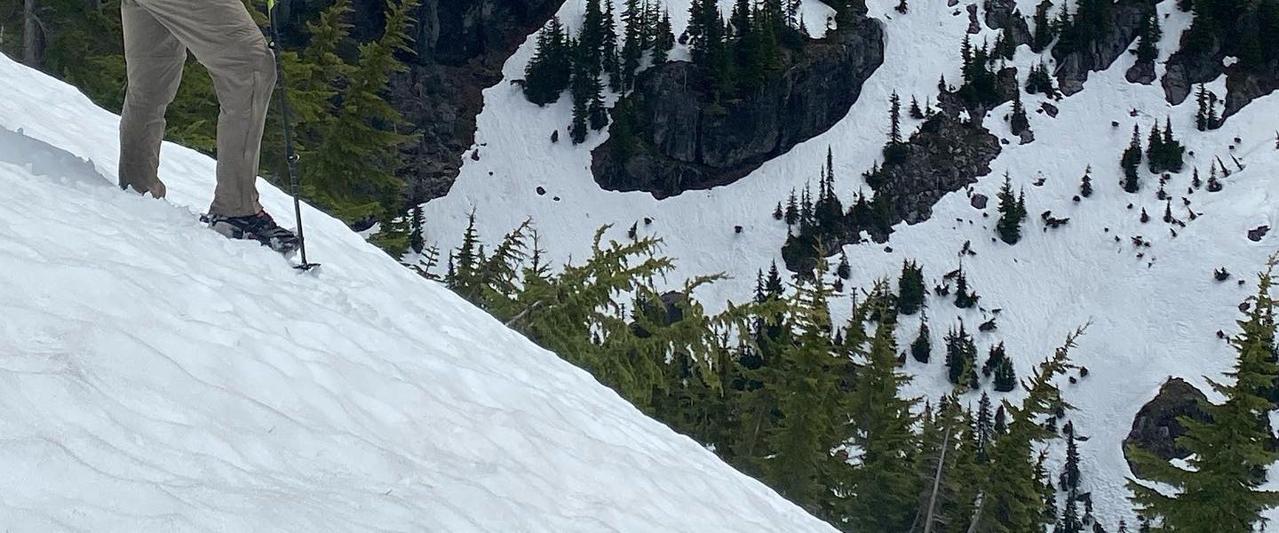
Skinny ‘Bou pass itself was a small notch in the south side of a bowl ringed with steep, ragged granite ridges. Very pretty but very steep on the descent and Justin to, “keep them out of trouble”. At the bottom of the talus immediately under the notch we had several hundred yards of picking our way over mixed rock and snow with the snow hiding more sharp rocks.

Finally, we breakfasted at a lake near on the right side of the valley below the snow line. The meal was an southwestern egg burrito which was finicky to cool but delicious. A fitting reward, however delayed, for the morning’s work.

On the lake was a small bird with black and white feathers. It hopped around on the very thin ice, pecking at the surface. We recounted the surprisingly few number of birds we’d seen so far on our journey, just four.

The next pass, appropriately named Talus Top, was less than a mile away on the other side of the head of the valley. A thin, long ridge of pure talus to the left of a pointed peak. There was a small stream to cross and everyone got their feet wet. It was strange to realize that this was the latest in the day we’d gotten wet feet. Normally, wet feet are a constant out here and letting them dry at every sufficiently long break is imperative.

Talus Top pass was a steep 900ft climb but wonderfully straight forward. There were no turns or navigational issues. No false passes. No snow. I had been feeling a little down for some reason and remembered something John had said about cycling psychology: when you think you’re suffering, go to the front. I shot up Talus Top as fast as I could, pretending I was a kid climbing a gravel pile. It was exhilirating and exactly what I needed.

The way down was very steep scramble. I hadn’t been able to see a way down but Andrew found one. The transition to snow at the bottom was tricky because snow near rock is the most likely to give way suddenly and dangerously. We handled this by sliding down the snow which spread out our weight. It was short and not steep but was a delightful break from the concentration of the down climb.

The snow was melting into a stream which came rushing out from under it and down the left side of the valley. Crossing to the dry bench to eat lunch was quick but cold. I have a little extra bread and so got to eat three PB&J sandwiches instead of my planned two. It was good to feel full and not just not hungry.

From lunch we descended a drainage, with incoming branches, to Awlinyak Creek. The going was dry, firm, and largely devoid of brush. In a word: pleasant. At one point we got to walk the nose of a medial moraine with a game trail on the top. It was so nice, and the peaks across the valley so dramatic that we stopped and took a group photo.

One group member’s achilles started bothering them. They only slowed slightly and moved well on the downhill. By InReach, we’ve had word that someone in the other group is having significant knee trouble and can’t keep pace. We’re all happy that our group is strong, healthy, and experienced enough for the terrain.

On the last side hill before reaching the Awlinyak, our easy going ended. We’d initially found a game trail which Andrew had noted on a previous trip to these parts. Eventually it disappeared and we were pushing through slide alder on a slope for some time. We decided that you knew you were bushwhacking when the bushes started whacking you. No one let it get to them and the comraderie was good but we were all relieved when the final nose down to the Awlinyak had only small brush. Justin captured the group’s feeling when we came out of the bushwhack with leaves under his hat, holding his trekking poles like a weapon, and acting like a crazed jungle soldier.

There was something about our first tough bushwack which made me understand why Andrew had always been so quick to move us to better terrain. Earlier in the trip, if going was so-so, I’d usually stay the course because it could easily be worse elsewhere. After dealing with the alder, my mind changed: why put up with anything difficult longer than strictly necessary?

Crossing the Awlinyak turned into quite an affair. It was clearly deep in places and moving fast. Andrew scouted two potential crossings but turned back (video). He’s done a great job pushing the group while staying well within it’s capabilities. This was just another example. River crossings are a leading cause of death in national parks and this was not place to mess around. We could wait for morning when the flow would be lower and, do to good trip planning, had the time to spare. Ultimately, he found a place where we could all cross. The guides went first with the lighter group members. There was an underwater gravel bar part way across which we regrouped in shin deep water. Then there was a deep channel where a lighter members of the group had trouble fighting the current to stay on the safe line which had been scouted. This differed from our normal stream crossing technique which we’d been taught: head across the current until it starts pushing you, then walk with it, angling only slightly for the far bank. For whatever reason, I was pretty comfortable in the water and walked along side a teammate in the channel for morale support.

We had a snack break to let the intensity of the crossing subside and I ate a bag of jerky. So much food today! I’d really enjoyed crossing the Awlinyak since it was a long crossing and you had a chance to see the river from it’s middle which is an unusual view given that we usually walk on the banks. The Awlinkyak Creek valley had trees, a first for the trip. It was nice to rest and travel in the shade.

For the rest of the day we walked mostly on game trails through the forest. The game trails would disappear near slides or open areas but we’d pick them up again. In one place we found a bear tracks mixed in with the footprints from the group about a day head of us.

We also found a tree with claw marks running up it’s trunk. Apparently bears do this to mark their territory. The highest mark indicates the size of the bear, warning that you’d better not come in unless you’re ready to tangle with something at least that tall.

When we stopped, the camping on was good, flat ground with water nearby. This was probably the most intense day of the trip and it was nice to decompress over dinner. I traded tents with Lance since I’d wanted to try some of the other styles.

AK Day 4

The day started with a hike down the Noatak until we got out of the shade. There isn’t really night here but the sun gets low enough that we had some respite at “night”. Mornings are cool enough to want a mid layer at the start.

Mostly we tried to find game trails on the right bank. A couple of times I made macro errors, like trying to stay in moderate brush to avoid a bog not realizing that the low willows on the other side of the big would make much better travel.

Eventually we got to the valley which would lead us up to Mystery Spot. Pete and I started the ascent the soonest and so had the most gradual climb. We regrouped before starting the last climb and the down-steam view was beautiful.

The upper valley was our first real encounter with snow. It wasn’t deep and hid many rocks making deep postholing likely. We stayed in a single file in the snow. Andrew lead which made the steps easier for the rest of us but most still post-holed despite following his tracks. I think I have one of the higher weight to foot size ratios and two people behind mentioned at some point that I found all the post holes for them.

Mystery Spot is probably so named because there’s a low point just after the pass but a walk of talus rises on the far side creating a bowl. The exit from that bowl involved scrambling extremely precarious rock. Andrew explained the geological reason, told us to keep space between people, and call “rock” if anything falls. His speeches are a concise but completely sufficient for the group. It’s really enjoyable to be in a group that doesn’t need to be overloaded with rules to compensate for bad judgement. People ask questions, sometimes multiple times if people had a hard time hearing or were going at their own pace or were too far away to hear some commentary.

The descent from Mystery Spot was quick once we got past the rocks. Lance was out front moving quickly and easily but still having time for photos. It was around 4pm when we had an official lunch. There had been snack breaks but not enough for me to break out the PB&J. I really enjoy that this group can take care of themselves, keep their energy up, but still express their needs. Today, the natural time for a lunch break was pretty late and there were some grumbly tummies but that was ok.

I don’t have an altimeter and so almost descended too far. The plan was to contour at a certain elevation across a creek to get under the next pass. Plans are always up for redefinition given the situation and there are many judgement calls to make. Since our ultimate destination was up I ascended to get above some gullies which intersected the contour. This took a bunch of the group well above the line Andrew picked and we had to descend a few hundred feet to the creek were part of the group had followed him instead of running ahead. He keeps a loose leash but it might have been a little too loose time. Ultimately it was clear that losing the elevation only to regain it on the other side of the creek was better than contouring way up the valley in tougher terrain. In some ways this should have been obvious but in a large group which regularly spreads out, I’d put too much weight on a strict definition of the plan instead of reconsidering what would be best and challenging the plan. Group dynamics can be difficult factor in navigation, especially when we’re prone to make mistakes. I think I wind up in front a lot because I’m more comfortable being wrong but it still doesn’t feel good to be wrong.

Our last leg of the day was up a steep hillside next to a creek which flowed elegantly over exposed rock. I was tired of making navigation mistakes and so took an easier pace up the hill. There was a break at the top of the hill looking up at the complex talus fields which lead up to the pass. The map showed 4 lakes hidden from view above us which was strange given that everything was made up of rocks at least 6 inches large to boulders. It seems like it would be hard to make a watertight seal to hold a lake because water would find its way through gaps between the rocks. The group was ready to be done and so we camped at the first lake we came to.

The surrounds were stunning: high jagged rock walls painted in places with red lichen above a clean shallow pond. Dinner was Thai Peanut noodles and it was delicious. It was probably also the first dinner I’ve seasoned properly.

Over dinner, one of the discussions was about how to convert a gradient (feet gained per mile) into the angle of a slope. Pete had a simple formula and I objected on the ground that the units seemed wrong and eventually said it seemed like it should involve and arctangent. Somehow I got labeled the math nerd despite Jeff and Sonja remembering SOA CAH TOA properly, Drew being able to compute examples we could use to compare, and John wanting to get calculus involved. It’s actually kinda cool that people didn’t just check out the second math came up; the group seems to be composed of people who engage with interesting challenges whether they’re intellectual or physical.

AK Day 3

Woke up at 5am.

We started straight up a hill. It’s kinda nice to just go straight up with no trees or brush in your way. No switchbacks to drag things out.

At the top we wrapped around to the right on a steep side hill above a drainage. This would have freaked me out on the Hayduke but with good company and good shoes it was pretty fun, even with cliffs below.

We ate breakfast in the sun just above the river. This was something like chia seed oatmeal and was delicious.

The climb up to the opposing ridge was quick but steep. A small snow patch at the top was initially stable but most of us wound up postholing knee deep and Drew wound up crawling the last few yards because it was so annoying to punch through. We’d received word from another group that there was still snow on some of the passes which we’ll be doing in the next few days.

The descent to a tributary of Angayu Creek was steep and soft. The brush at the end took some navigation.

Getting down the tributary of Angayu Creek required a lot of finding our way through brush on game trails. It was fun to spread out and follow different “weaknesses” in the brush. If your particular opening dead-ended, you’d just double back and follow whoever had the best trail. In practice there were never more than three groups but shouting back and forth and seeing what went and what didn’t was exciting. Andrew has to push us to try take chances and be ok if one particular line didn’t work out. Still, it was hard to take a lead when you weren’t really sure where to go.

We had lunch overlooking the confluence with the Noatak. The valley stretches out wide, the walls were majestic, the rivers braided. It was beautiful and grand.

The rest of the day was spent working our way up the south bank of the Noatak. Some times we found game trails almost as good as groomed park service trails though we also had tussocks to trip over in many places. In a few places, particularly at the end of the day, things got a little brushy.

We found 3 pieces of trash: a torn section of a packraft which Andrew picked up and stuffed in his pack, a large section of PVC pipe, and a rusted out bucket. Even in the distant middle of no-where people leave their mark.

We wound up camping about as the group energy level was dropping. Apparently we made it about 19 miles today which is pretty good for off trail travel. The camp was pleasant and sunny near the river and some washed their clothes or dunked themselves.

We’re not expecting the sun to drop behind the mountains for long tonight so it’ll be hot tonight. There’s a light breeze which will help. Tomorrow is supposed to be a two pass day.

AK Day 2

A certain indication that I’m a good fit for this trip is that we decided to hike a few miles before breakfast. After four miles we stopped in a small gulley which sheltered us from the wind. We had cream of wheat with more ingredients than I use at home.

Shortly after breakfast we wound up walking on aufeis, which is ice that is frozen to the bottom of the river. It made for great walking. We had to cross a small waterway to reach it and ice water followed by walking on ice was a little cold on the toes. Motion kept things warm.

We finally made our first big turn of the trip, navigation up a valley, traveling mostly in the river.

Andrew spotted an alternate pass which required a multi-part ridge walk. When we were close enough to see the mountain itself, we double checked and headed straight up. The view was incredible.

Eventually, we got to see the back side of the pass we had intended to cross. It was all snowy. I think our way, improvised though it may have been, was much more pleasant.

There were goat trails all along the ridge. It’s incredible that they just hang out up there.

Andrew was taking pictures of everyone with this huge smile as they went by and so I took a picture of him.

During a break on the ridge I asked for a latrine stop in the next valley and was invited to try using snow from a nearby snow patch as a bidet after going just up the ridge. Large snow granules aren’t quite your standard two-ply but icing my rear was surprisingly un-objectionable.

The way down was steep but initially soft, dry sponga. Then it got steeper so you couldn’t see what was below you. I kept thinking that we’d hit a cliff but we never did. At set of large rocks, I was glad that John went first as I hate moving towards things which look like drop offs. Ultimately it went and we wound up down near the next river.

After a short debate over the next day’s route, we hiked another mile or so down the Iyahuna River and camped in a gently sloping, lumpy, soft area.

I didn’t think I felt tired but I my head just could not multiply by 28 to convert ounces of water for dinner to milliliters. I turned in as soon as dinner was over but it was roasting as the sun was overhead still. Eventually it dipped behind the mountains and the temperature dropped immediately and I could get under my quilt.

AK Day 1

My alarm went off at 6am and flailed for a while trying to shut it off. Fortunately, my roommate, Drew, was getting up at the same time. Opening the black out drapes proved what we expected, the sun was up and as bright as it had been at noon the day before.

After a quick shower and repacking, I met five others from our group at the continental breakfast. Jeff was passing around a packet of smoked salmon he’d bought the day before which made a pretty good stand-in for sausage. We almost forgot to actually put the bags we’d left by the storage room door in the storage room before heading to Wright Air.

We and our gear were weighed at Wright Air and came in within our allotment. Then we waited around for an hour during which time I realized I hadn’t packed toilet paper and stole some from the restroom.

The Wright Air flight has about 10 seats with Lance riding shotgun and our gear visible through one of the rear windows. The safety instructions took less than 60 seconds. The landscape we flew over was interesting but not in impressive. Much of the flight followed the Haul Road and so didn’t feel that isolated. However the landing strip in Bettles was gravel, and I think a quick survey showed that no one had landed on a gravel airstrip before.

Bettles is a small village. There’s a Park Service office, airfield, and a few run down, closed buildings. We met Justin, our second guide who had gone out the day before due to limited seating. The year round population in Bettles is something like 10 according to the park service intern who gave us our orientation. She also did an excellent job dramatizing how to act if various bear related situations.

There was only one pilot flying for Brooks Range Aviation and our group was the second and third flights of his six seater float plane. We sat around for a while and the guides started to get a little antsy. I was in the first flight from our group.

The flight from Bettles to lake Omelaktavik near the Noatak was incredible. The terrain build in height and ruggedness, climaxing in close passes near the Arrigetch range. There was a lot of whooping and hollering from the seat behind me. Cameras were out nearly all the time and we got some intel on the condition for the coming days.

The Brooks range seems to consist of wide, flat valleys with little standing vegetation and many lakes. The mountains separating the valleys draw from the a low saturation color palette and the little amount of ground cover makes the whole thing look very walkable, at least from the air.

The float plane landed and we formed a bucket brigade to pass our bags along the float and onto the bank. The landing was very smooth and the pilot had just coasted until the plane had softly nudged the bank. Two in our party were apparently so excited they had to relieve themselves immediately despite having gone just before the flight. “We’re in it now boy’s”, “you’ve never been this far from everything in your life”.

While waiting for the second half of the group. The consensus seems to be that naps are in order. We’re weren’t expecting them until 7pm and there was some discussion of hiking for 4-5 hours thereafter. Andrew mischievously took to photographing some of the sleeping “wild life”.

When the second group arrived, bear spray was passed around and we headed out. We had been on sponga, a soft topsoil which is dry until you spend too much time lying in one place and compress it. Immediately we were passing through tussocks, which cause bipedal travel to be like post-holing but without the snow) and low willows which indicate soggy ground.

The soggy ground and tussocks continued up onto the shoulder of of the Kugrak River valley and going was slow. Eventually we hit dry ground because gravel had been deposited underneath by a glacial collision and enabled it to drain.

The pace was good and everyone kept in a loose group, sometimes single file on a caribou trail, sometimes spread out on drier ground. We stopped every now and again for Andrew to talk us through a point of terrain or navigation. The map has a large scale factor so we don’t travel across it quickly and I could only spot the largest landmarks.

It wound up being a little difficult to find a place to camp as we were crossing an alluvial plain, which slopes gently but consistently, when we started looking for campsites. After a series of “everyone still have 10 minutes in them?” we camped near a dry streambed where everyone was able to find a mostly flat spot.

I set up my borrowed tent, a mid, and remembered the guy line system from the pre-trip curriculum (link). Given that I traditionally forget knots just when I need them most, this was made me very happy.

Dinner was a communal affair as we’re all carrying some ingredients for the group. Andrew would divvy up the group ingredients and gave tutorials on how to use the alcohol stove system a number of us had borrowed. Only one person’s fire escaped their little stove.

It was after midnight when we finished and the only indication that it was now “night” was that the sun had dipped below the peaks bounding the valley leaving us in shadow. I pulled my beanie down over my eyes to block the light and slept soundly.

AK Day 0

I got up at 3am, glad that I’d actually put everything in my bag the night before. Somehow I was still barely ready for the rideshare which came at 4:10am. The security line at SEA moved well despite worries about TSA staff being reallocated away and so I read a book on my phone for two hours before the flight took off. After small talk and more reading at 35,000ft I was in FAI.

My phone didn’t immediately have reception so I walked around trying to find a map of Fairbanks or and information desk. I had reservations at a hotel just across the highway where the whole group was staying tonight. I enjoyed the irony of trying to use a map to find my way to the start of a trip where map and compass would be taught. Good thing as I couldn’t quite line up the tourist map I found with the airport roads. After rebooting my phone, I got service was called for the courtesy shuttle.

The afternoon passed with a trip to the grocery store to get lunches for the trip (2 loafs of bread, PB&J), a nap, a pre-father’s day call to dad, and some more reading, I went downstairs for the gear check.

The group trickled in one at a time, shaking hands and learning names. Andrew, our guide, showed up with a porter’s cart of the demo gear some of us were borrowing, maps, and food to distribute. I was borrowing a pack and tent, and had purchased an bearproof sack from Andrew. Fortunately the loafs of bread, an usual choice for backpacking trips due to their size (tortillas are a much more common), fit.

This is a more advanced group and I’m the only one who hasn’t been on a trip with Andrew before so the gear check was complete but not rigorous. Special attention was given to the fact that I was bringing PB&J on real bread (not tortillas) for 7 days straight but the calories checked out so after some laughs and pictures I given a pass (Instagram).

Andrew laid out the maps and showed the proposed route. Part of what makes this trip interesting is they while we have an intended route, there are some options and we’ll wind up choosing based on time and group interest.

In the evening, we all went out for dinner nearby. I guess you know you’re in Alaska when a Bacon-Cheddar Burger is listed under Lighter Fare & Vegetarian Options.

A lot of reminiscing happened. Apparently Andrew ran a trip or two in Alaska around 2011 at the start of his guiding career. While all ended well, the mishaps and learning moments made for good stories. The group began to gel and I’m looking forward to spending the next 7 days with these folks. There’s a range of personalities and styles which will make it all the more fun.

I seem to have gotten a (well deserved) reputation for laughing loudly. The best comment came during dinner: “it’s a good thing we’re going to be out in open spaces because that laugh needs some room”.

Mason Lake Snowvernight – March 2-3, 2019

The first part of this adventure was figuring out where to park. Normally turn off I-90 at exit 45 then double back on forest road 9030 west past exit 43, gaining a little elevation as you do. In the winter, FR 9030 is probably no passable so you park at exit 43. This wasn’t completely clear from the direction on wta.org which only hinted at a “winter trailhead” but I’ve had previous adventures not realizing that FR 9030 wouldn’t be plowed in the winter and so a little research on caltopo made it pretty clear where to go.

The route I took from the wide turnout which serves as a parking lot off exit 43 was to go uphill, but no too easterly until I hit FR 9030. The only reason for this was that I followed a less distinct pair of tracks up an a small stream instead of the much wider, clearly more traveled track which would have gotten me to FR 9030 a few hundred yards west of where I eventually crawled onto the road. The tracks had disappeared and it got kinda steep at the end.

It was kinda funny following the forest road to normal trailhead. “Alright, time to start my hike” I chortled to myself having clearly already started my hike.

The “winter route” to Mason Lake is supposed to follow a tree covered ridge straight up above the lake. This avoids the avalanche risk posed by the summer route which switch backs up an open rock field now covered with several feet of steeply angled snow. The problem is that I’d never been this way before and the turn-off up hill into what turns into the ridge isn’t very distinct where it meets trail. I’m distinctly aware that streams on a map don’t always align with streams in real life and so it was with great relief that I encountered a man coming back from Mason Lake who said the turn off was just past the bridge (a well known landmark) and hard to miss. However he also said that there were two routes and that the one by the gully was sketchy. Just stay right he said. This being my second real snowshoe and first solo or overnight snowshoe, I really hoped it would be that easy.

The turn-off was easy to find though I wasn’t immediately confident that there was far enough east to be sure I wasn’t going to end up in the gully. Instead of following the tracks which appeared climb west, toward the gully, I followed a glissade route straight up figuring that if I was going up the way someone had come down that I couldn’t get too lost. This was a great deal of fun. In the summer you don’t really get to go straight up steep hillsides unless there’s snow on the ground. Erosion and all that. In the winter, you don’t even mind that it warms you up.

A clear nose of the ridge began to form and then narrow. The slope lessened a little. I avoided two obvious opportunities to traverse left in favor of continuing up. On my map, the route was supposed to traverse under the top of the ridge at some point but a couple on their way down seemed to say that it walked the very top. The glissade chute gave way to a little zig-zag track which eventually dodged around a small stream then made a final push onto… the very top of the ridge.

It was a beautiful day. Having been here many times in the summer I now had my bearings again. I walked the ridge for a bit, enjoying the opportunity to walk a line which, with snow filling in between the large rocks, was comfortable and easy now but impassible in the summer.

I stopped for lunch just before the turn-off down to the lake and was passed by a couple moving surprisingly quickly on their snowshoes. Guess I’ve got a lot to learn. It was also comforting seeing so many people on the track. These weren’t going to Mason Lake but I wasn’t going to be as far from people as I’d thought going into the hike.

Dipping off the ridge toward Mason Lake requires traversing a steep slope which in the summer is a narrow trail. Unfortunately, snow doesn’t build up evenly under snowshoes and even though I was following track, they were now single steps instead of track and usually banked outward. The traverse wasn’t high but I didn’t like the feeling that mother nature was trying to push me off at a particularly vulnerable moment.

Once at Mason Lake, I only saw one pair of snowshoe tracks. I guess the lake itself isn’t such a popular winter destination compared with the ridge above. It was so fun seeing everything I recognized from summer under several feet of snow.

I only have a three season tent and so wanted to find a sheltered spot. Wind was coming in the sloping snow-dunes seemed not to provide any sharp walls to hide behind. I found the flatest spot I could and put my pack shovel to work widening the site after stomping it down to provide a solid surface.

I had to sleep with my water bottles inside my sleeping bag to keep them from freezing. Unfortunately, I’d discovered that the caps on these bottles weren’t completely watertight and so had to be sure that they were always standing up. This made rolling over in the middle of the night quite a process.

In the night, the wind shifted and came at my tent from the exposed side facing the lake. I’d forgotten to attach the velcro strap which connects the rain fly to the spine of the tent and so the tent would lean over pretty far. Initially I wasn’t sure if a stake had pulled out but since the tent would pop back up after each gust, I decided to burrow a little deeper into my sleeping back and keep my eyes shut. If I can’t see it, then it’s not actually happening, right?

I’d slept in most of my clothes and so getting up the next morning was relatively easy. Still, I’ve got to do some research on how people stay warm while breaking camp. By the time I was in motion, my finger and toes were cold enough that reheating them would have been a priority if hiking wasn’t going to warm them up anyways.

The hike out the next day was quick and easy. I didn’t do any glissading myself since I was wearing expensive, thin rain pants as an outer shell. I guess you know your stuff owns you when you skip out on having fun because your stuff is too expensive to break.

All in all, a great first winter camp. I need to up my insulation game, particularly around the hands and feet in the morning but also all up when stopped. I’d tried to treat this as “three season but a little colder” and had needed to get in my sleeping bag while making dinner to keep from getting too cold.

All Pics