This is a trip about which I wax philosophical. I’m sorry. It moved me.
Saturday, August 5
This adventure started with a U-turn. On my way to the trailhead, I was struck with a terrible sense that I’d left the garage door open. I’d also forgotten my ice axe and head net but who needs safety or comfort? Not getting killed by my girlfriend (now wife), who was out of town for the week, because the fish had been stolen out of our chest freezer was the deciding point. I was even able to water the garden so it wouldn’t dry out while we were away.
I typically have very little patience for eating when there’s hiking to do. The best breakfast is one you can eat on your feet. Tomorrow, I would pick my way down a social trail with an expensive, bright yellow package of bland, rehydrated trail breakfast in one hand, a spoon in the other because I lacked the patience to stop for longer than was required to boil water. Only Andrew Skurka seems to be able to make oatmeal delicious in the back country, and as I understand it, he had to pay a professional chef to figure out how. All this is to say that, despite my natural tendencies, I ate lunch at the trailhead instead of on my feet while they carried me down the valley. Not having to carry the empty packaging preserved the feeling of a clean start.
The path out of the Gold Mint trailhead is flat, wide, packed, and grainy as though made from a yellow sand while not being soft like a dry oceanside beach. The most common animal at this point was the domestic canine, though several wild cyclists passed me heading in the opposite direction. People sometimes ask about danger from animals in the back country. I’ve never encountered an unreasonable bear. I have encountered unreasonable humans. I saw several humans openly carrying guns and wondered what I should do. Bear protocol seemed to work: make sound so you don’t surprise them.
The river in the middle of the glacial valley would visit briefly with the trail at silty openings in the brush where children, dogs, and one smoker enjoyed the water. I think the trail builders forgot about the mile 2 marker, otherwise I was walking at 10min/mi after 3 miles. Eventually, the trail turned boggy, then bushy, then bouldery and back again to bushy and boggy. It became more of a “social” trail with elements of bushwhacking than a “trail” trail. Apparently my bear protocol wasn’t so good. I surprised a pair of heavily laden backpackers wallowing their way along, doing combat with small branches.

This hike would make we wonder about the qualifiers we give to trails. When is a “trail” a “route”? When is a “social trail” more of a “game trail”? If there’s a boulder field and it’s obvious where to go but there’s no canonical way to get there, is it still a trail? If you happen to get the same place everyone else did by following broken vegetation, scuffed lichen, and sometimes your own nose, is that a trail, a route, a way, a ‘shwack, or just an adventure?
Those questions wouldn’t be raised until after the Gold Mint Hut, towards which, the Gold Mint trail now began to climb. I passed a red faced, sweaty fellow in a cowboy hat and holster, belly sagging over his belt as he sat on grass with his legs over a mud puddle. Children played around him in a small clearing. It was hard not to judge him as in over his head. A short while later, I stopped to get beta from a lean, tan climber who’d casually stepped aside to let me pass. He’d been out for a few days, summited a nearby peak in the morning and was heading out for a town day. He’d referred to the peak by name, assuming my familiarity with the area. I thought Montana was a state. My nervous, repeated questions about snow and trail conditions contrasted with his easy manner and must have left him with the same thoughts I’d just had about the seated man. Apparently the high snow year had left a hard snowpack and it was good that I was going over Backdoor Gap later in the day so the snowfield would be softer. It wouldn’t be a problem if I was good on my feet, he said. The way to Snowbird Hut was like this, he’d said waving his hand broadly at the steep, brushy, mountainside but without a trail. “Like this but no trail” I said. I’d just been appreciating how the social trail left just enough weakness in the bushes for my small pack to sneak through.

Glaciers, hidden at the back of hanging valleys began to appear. The view expanded to have a below and not just an above. The sun was bright. The sky was blue. The ridges were ragged, the valley bottom green. The trail was a fall line picked carefully to avoid ravines and sheer rock faces. A stout young man, stepping confidently on the steep tundra-covered rocks commented on the quality of the day. In a brief exchange, he mentioned making a living off social media. The drone in his pack was for work. He hadn’t gone over the pass and I wondered if it was because he had to get the footage edited and published to maintain engagement with his audience. Why not do a longer trip, perhaps the entire traverse instead of just going to the first pass? The view was good, but the experience of hiking up to a beautiful view is never as rich as walking through a beautiful view. He asked me if I was out for a day hike. Something about the small pack.
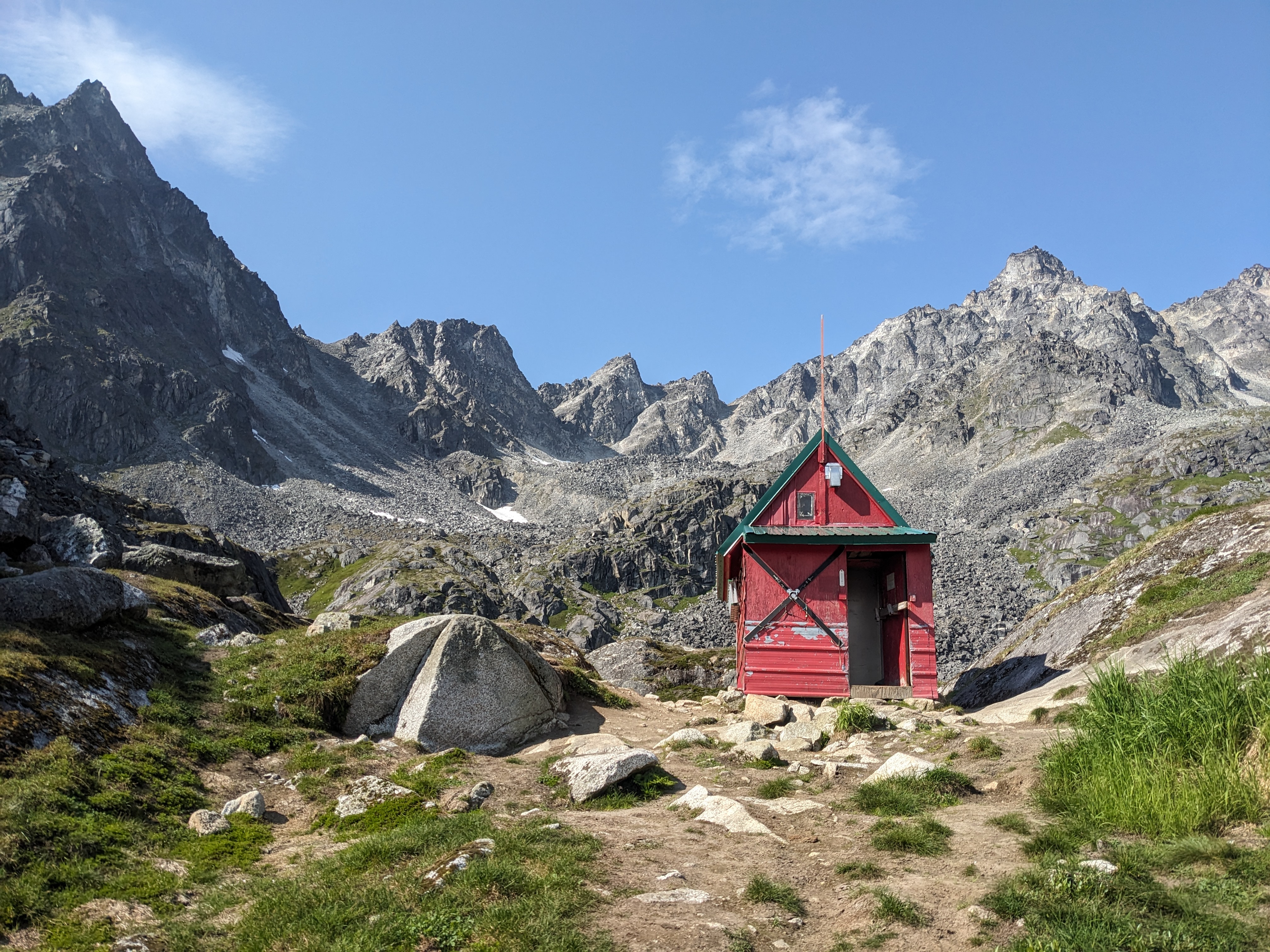
The Gold Mint Hut is red. Classic barn red and just as faded. The contrast with everything surrounding it fits perfectly with the feeling of arrival when my slow, upward pace made it suddenly rise out of the bowl on whose lip it rests.
There was a pair of hikers enjoying the view. In contrast with the loquacious, if brief, encounters with other hikers, these were kind enough to direct me to water before moving regain some semblance of solitude. It was a nice reminder that good etiquette out here is centered on giving everyone as much of the wilderness to themselves, not connecting with others through shared enjoyment of the outdoors, even if I’m prone to do the latter.
From the small stream behind hut, the trail washes out somewhat. Simply identify the correct pass, and walk up the gravel. There is a social trail on the south side which looked to me to be more difficult than hopping from stone to stone because at such a steep angle, any dirt under the foot would want to become dry lubricant. A fellow was descending that way carrying two packs. His companion was unburdened but moving slower and I intended to inquire if all was well. He beat me to it with a cheery salutation.
Just short of the pass a helicopter flew overhead. The sound came suddenly, perhaps blocked by the ridge until it was overhead. Low flying helicopters appeared several times while I was at Backdoor Gap. I assumed that some were for search and rescue but others had a more military look and I wondered if the used the area for practice.

I stopped frequently on the climb as I haven’t kept up with the sorts of efforts which occupied me for the last several years. The view was progressively more engaging so photography was my cover story. At each stop the view inspired awe and so I have a collection of images which were all breathtaking in the moment (though my breath may have also been taken on account of exertion), but capture views lesser than the one from Backdoor Gap itself. I usually try to skip taking a photograph if I know I’m about to get a better view but just couldn’t help myself.
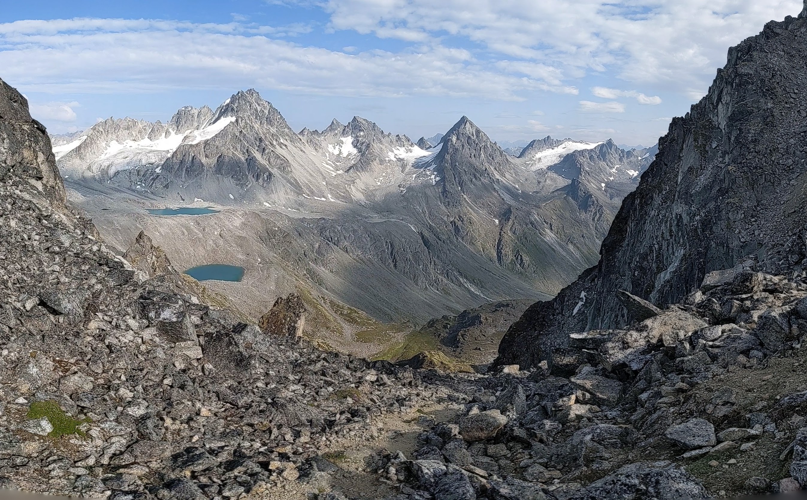
The view to west of the gap was no less exciting. I felt as though in several hours I’d gone from home to the best of what I’ve experienced in the Sierra Nevada. Passing to the interior side of Backdoor Gap, I suddenly felt a significant distance from people even though several I’d met had come this way earlier in the day.
The mid-afternoon started by descending a rope about 15 feet to the snowfield. I had the bowl to myself and reveled in it. My route would trace the path of water, starting at the top of a snowfield, descending to where the snow was melted and ice remained, descending to where the ice melted into desolate field of rock and silt, descending still to where trickles coalesced into streams and the pioneers of the plant world began to put down roots. The plants formed a gradient in their density and size, reaching a full ground cover where the lip of the hanging valley diverted the gathering stream to one side, denying it the most direct route to the valley floor.

In passing this way, I deigned to wear traction devices until I found myself on the glacial ice where the snow had melted away. It felt like a rare honor to witness this process of glacial retraction. Glaciers had once covered all of these valleys. It seems that soon plants will replace them. There is a seasonal process as I’m sure the snow is somewhat deeper in the winter and some of the frontier plants freeze to death but over years the line of vegetation has chased the ice up the valley, reached the lip of this hanging valley, and is continuing its pursuit. I felt blessed to be witnessing the beautiful mixing of the two on this trip and felt sad at what my surroundings made so obvious – that the green from below will rise like a tide until all the ice disappears under it.
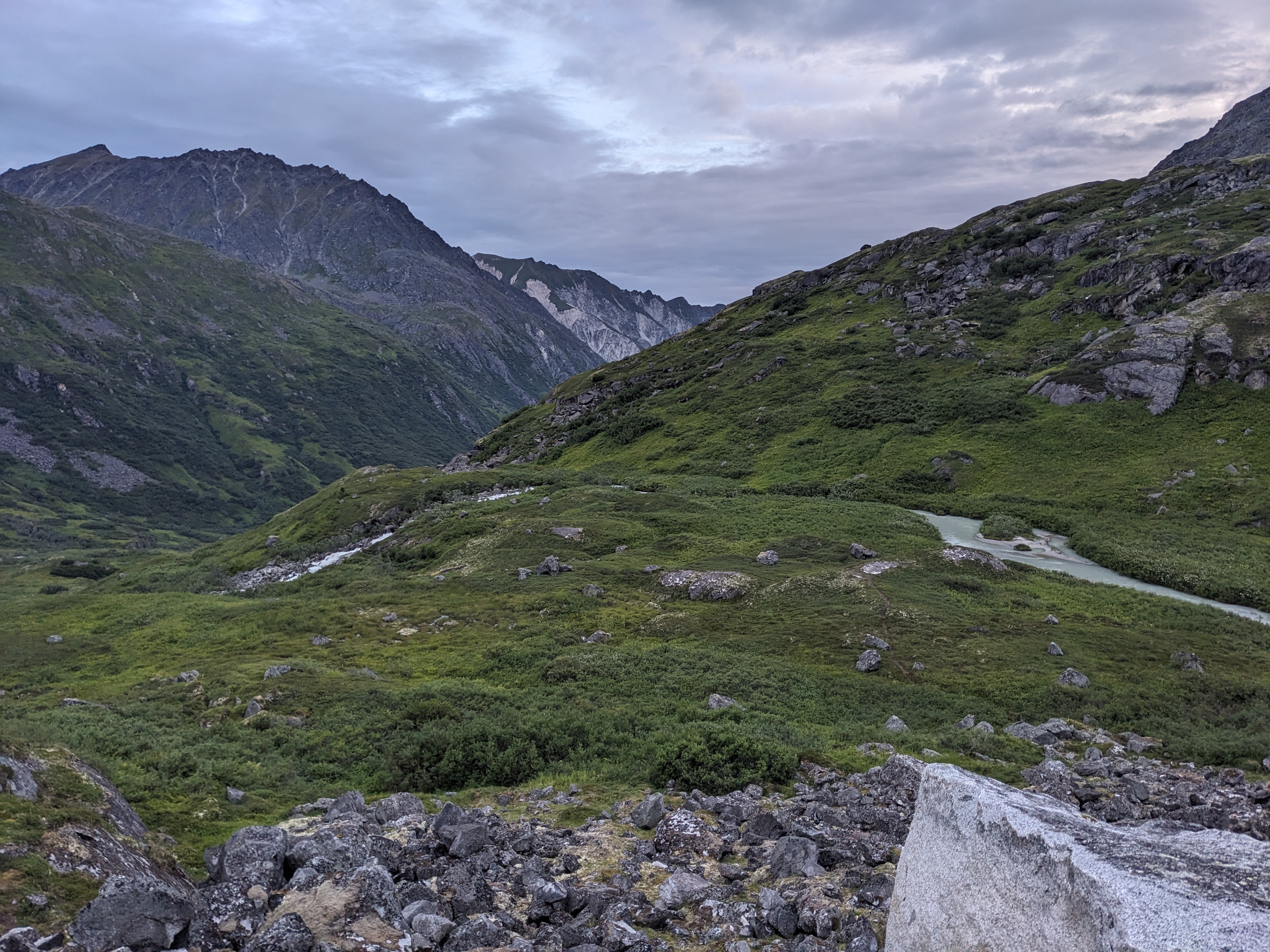
Elegiac feelings aside, I now had to find my way to the Bomber Hut. No trail had emerged, but the map had indicated it was on the north side of the river, somewhere after the river formed. Precision didn’t matter, accuracy did. So I found my way across rocks here and low bushes there. Springing over a brook and tip toeing along a hill side of large rocks. This is the freedom of off-trail travel in good terrain. Such is the pain of off-trail travel in poor terrain. That would be tomorrows problem. Today, I only felt the freedom.
Wanting to keep my feet as dry as possible, I found my way around the head of the river. It came down from another hanging valley under a tumble of large, weathered, lichenous rocks. I could hear the river beneath the rocks while I hop-scotched my way across, thankful that a light pack made fancy footwork fun. Clouds were beginning to gather and rain had been forecast, though not much. Not much might mean anything, of course. I wanted to find the hut so as to be secure in my position (precision, not accuracy). This is an odd thing as I could align every valley in view with the map and so there was no question of getting lost in the big picture. Yet, when I wandered in to the warm, green building crowded around with tents and crowded inside with people, I felt a security which provided a satisfying counter-balance to the brief absence of human company that afternoon.
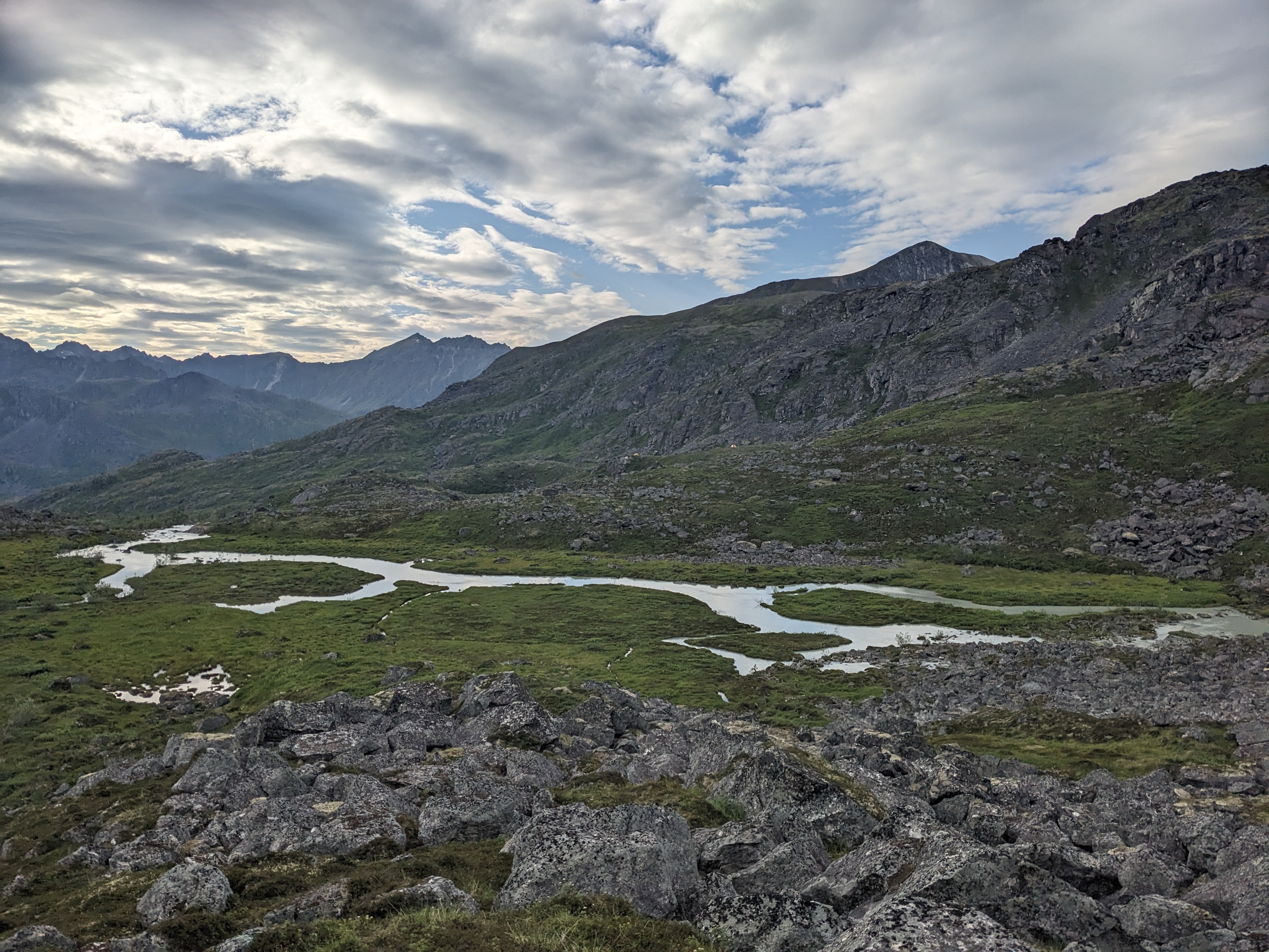
The company in the Bomber hut was welcoming and conversation pleasant. I learned that there an excellent map set of the area is freely available so that I needn’t have drawn my own line or been so deprived of information about conditions. This area is well traveled yet retains an intoxicating, primitive feel. I took a picture of someone’s GPS with routes down the valley. I planned to exit quickly over Bomber Pass if the rain came early tomorrow, but attempt to find my way to Snowbird if I thought I could get a dry start. A woman who had come that way said it had taken the better part of a very foggy day despite having a GPS to come this way from Snowbird. I bid them goodnight and camped a short distance down the trail leading west from the hut.

Sunday, August 6
I woke, broke camp quickly, boiled water for oatmeal, then soaked and ate it while walking down the trail which descends from the Bomber hut to Wintergreen Creek. I hadn’t known about this trail and it greatly expedited my morning while also answering the key question of where to make the first of the two water crossings I was expecting today. The oatmeal was expensive and bland but the packaging was bright yellow on an otherwise overcast day.
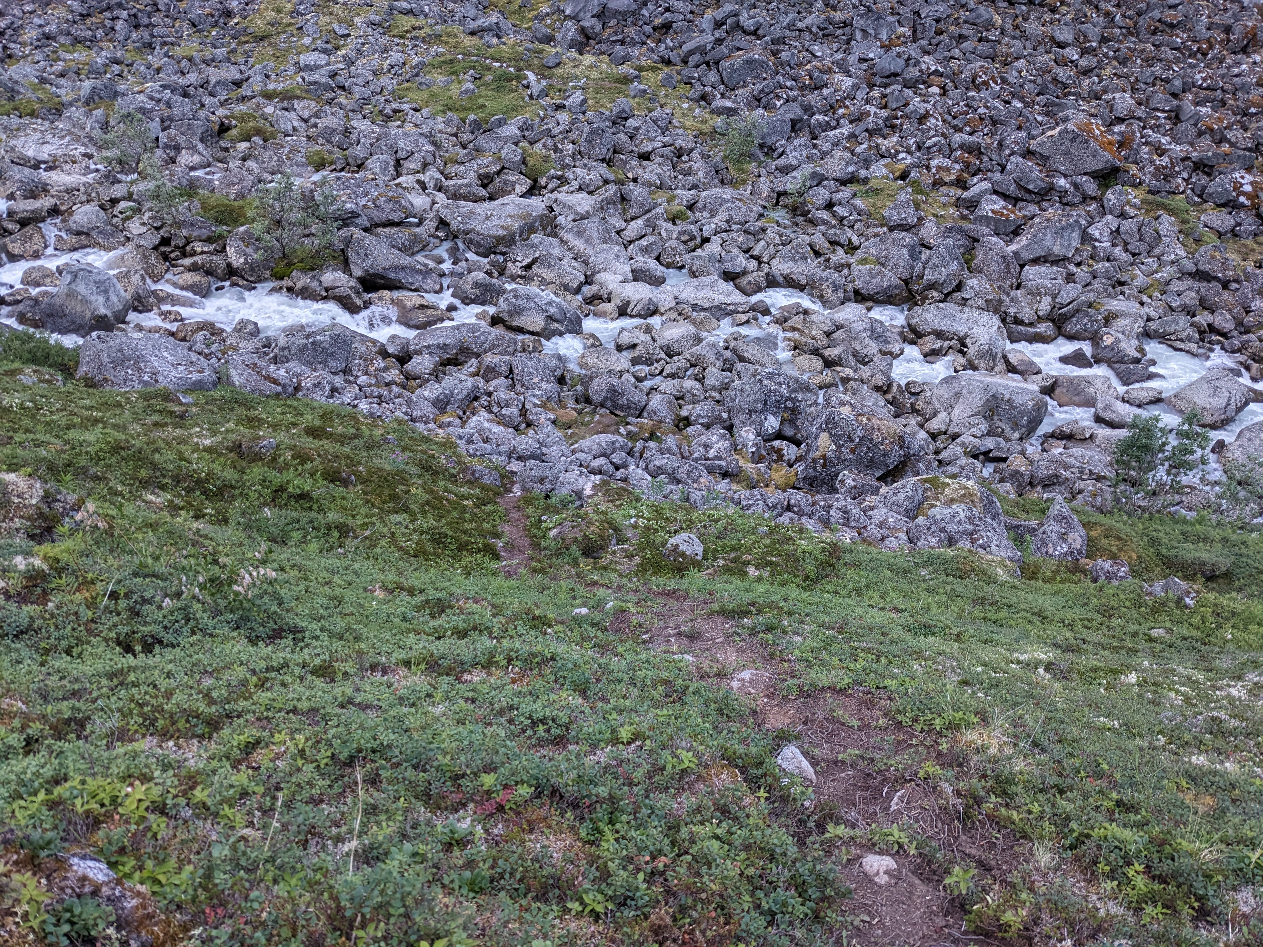
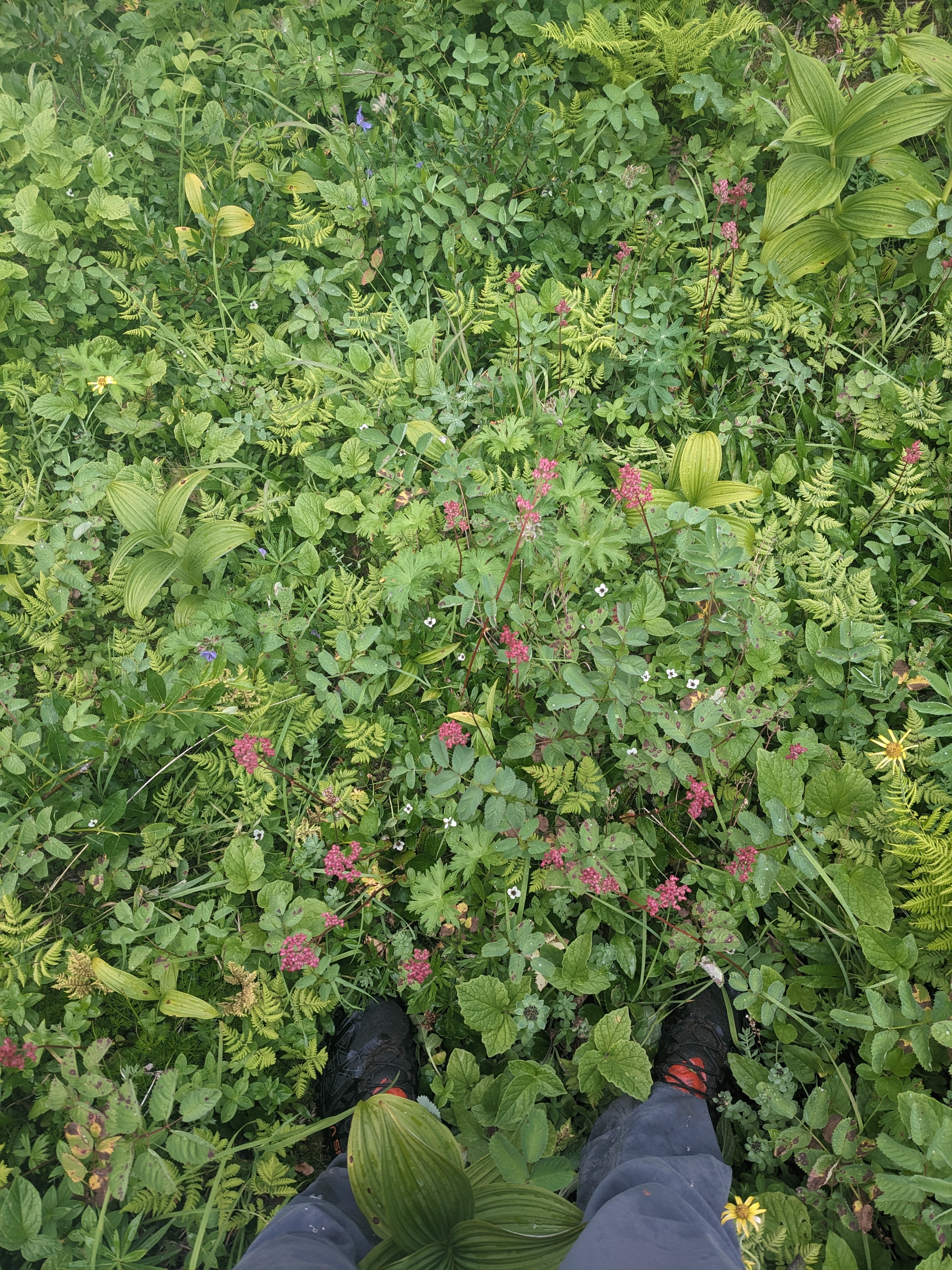
The social trail seemed to come and go on the far side of Wintergreen Creek. I quickly lost it in a rock slide where I thought I saw evidence of footprints above me, only to see a brown scratch in the green foliage next to the river. The brush was now dense enough that missteps had consequences. I had a constant fear of floundering through alders for hours because I couldn’t see the proper path just a few feet away. My guiding principle was now to follow the path of least resistance. This principle hinges on the fact (or hope?) that no animal wants to flounder through alders and so bears, moose, humans, goats, etc… will all be funneled to the weakest point in the bushes. By individually rejecting the less pleasant options, they collectively maintain a passable route through what would otherwise be overwhelming plantlife. My second principle for the day was not be an idiot. This is a somewhat more subtle principle as it relies on common sense and common sense takes a good deal of practice to develop at an intuitive level. Until that is achieved, I, in particular, am prone to overthinking.
Knowing that I wanted to follow the river to the next valley then turn up that valley before crossing the river, I went whichever way was easiest as long as it kept me near the sight or sound of water. This path of least resistance soon began to conflict with the principle of not being an idiot. I found myself about to descend about 10 or 20 feet into deeper brush which appeared to start to form a cut which would carry the stream down the valley and past my turn. My goal was to diverge from Wintergreen Creek, travel up Barthof Creek, and so, while I wasn’t sure quite where to go, it seemed important to turn around and begin my turn up the valley forming on my left. This was a lot of thought for what might have been summarized as, “turn left at the next valley”.
And so I wandered with a loose aim, making slow progress and finding hints of others’ passage like this:
Short sections of trail would sometimes emerge. It seems that where the plants are slow to grow, the path holds well, but there isn’t enough foot traffic to keep the more aggressive plants at bay. I felt I was rediscovering some lost civilization, not simply walk a popular hiking route.
The next big movement was to cross Barthof Creek somewhere before Snowbird Lake, but I wasn’t sure where. When looking at topo maps before the trip, the terrain hadn’t struck me as particularly difficult and so I figured, I’d cross wherever it made sense. When looking at those maps, I’d interpolated a smooth gradient between the topographic lines and imagined them covered in low, tundra-like vegation. Reality was somewhat more like a series of step functions with bushes which could defend themselves. I walked the line between least resistance and idiocy a few times. For example, even if its easy to get to the waters edge, there needs to be an exit on the far side to complete a crossing. If there’s a weakness in the wall of bushes on the far side, you can’t cross in the middle of a water fall, though that idea would be tested later.
At one point, I couldn’t decide whether to cross or not, and broke the tie by looking the picture I’d taken of the route the night before. While I wasn’t particularly sure where along the valley I was, the crossing was slight above 3200ft. My elevation was 2800ft. I wasn’t there yet. I had learned about using an altimeter to locate oneself on a map during a wilderness navigation course several years ago but this was my first time using the technique.

The path of least resistance eventually resolved into a trail which lead to a well tread ford. It continued on the other side and was steep in places. I wound up scrambling boulders up a rocky ravine only to spot a social trail on the far side of the knoll at the top. It had looked so much simpler on a map, but maps don’t show the drop offs, large boulders, and small gulleys which don’t go where you think they would. Perhaps a more experienced backcountry traveler would be able to keep the big picture in mind and see through the obstacles, but I felt very much alive finding my way in places. At one point, I could find no way up other than a hand-over-hand scramble for a short distance with a hundred foot fall into Snowbird Lake if I had slipped. Yet, there was scuffed groundcover to follow and other rock faces seemed even more intimidating.
I was still below Snowbird Lake when the forecast rain started. I had thought that reaching Snowbird Lake would put me within easy travel of Snowbird Glacier but this proved not to be the case. Since I was stopping anyways to put on rain layers, I took a picture. Since I had my phone out anyways for pictures, I looked at the map stored there and discovered that the Snowbird Hut was on the south side of Snowbird Glacier. My current intention was to ascend the ridge to the north. Oops. I was well positioned to get back on course by crossing a stream descending from the glacier’s outlet lake. This looked like a simple task until I got close enough to realize that all of the shallower places lead to frothing pools where the turbulent water would press hard to sweep me away while I was feeling around to place my foot among rocks hidden at unknown depth by the torrent. In some places, I might have risked a long jump but the possibility of beings carried over a ledge if I were to fumble the landing on a smooth rock made slippery by rain kept me from making the leap. After several exploratory attempts to cross, I pulled out the hiking poles which had remained stashed in my pack the entire trip, sometimes catching on branches in taller bushes. These helped buttress the few steps it took to cross a deep, raging pool to a shallow, rushing pool and continue up the ridge of boulders that fell away steeply to Snowbird Lake.

Snowbird Hut was marked on my GPS but I was enjoying the game of using the GPS as rarely and as minimally as possible. At first I continued following the outlet stream, staying on the boulders a little above. I passed tents which so far on the trip indicated that a hut was nearby. Someone the night before had told me Snowbird Hut was hidden until one was almost upon it, but I found more time passing and the ridge varying more than I expected. Eventually, I succumbed to the desire for certainty as to my position and the fear that I’d missed the hut and looked at the GPS. It was still ahead. The ridge was simply more difficult than I’d expected.

I ate lunch on the porch of Snowbird Hut but for some reason never thought to go inside. The company on the porch was good – a pair of wilderness therapists spending their vacation in the wilderness. I idealize work in the outdoors industry as vacation trips like this feed my soul. While the pair clearly found joy and meaning in their work, it didn’t take much reading between the lines to see why they weren’t expecting long careers in the field.
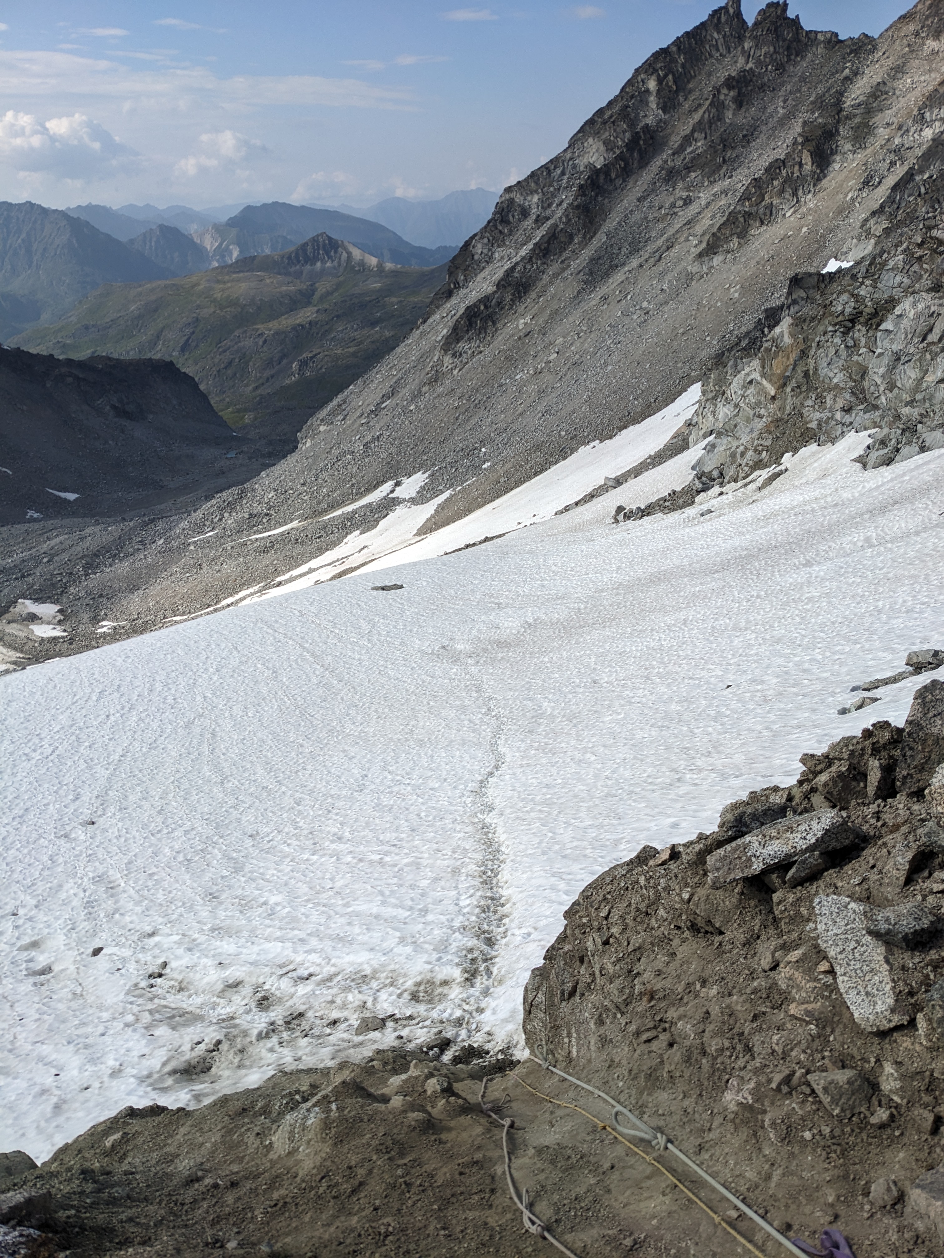
Moving on from Snowbird Hut, I naively assumed that I could continue walking the ridge. Apparently I hadn’t yet learned my lesson that boulder hopping in the rain just grinds me down rather much more than walking a sunny, maintained trail. After a hundred yards or so, I realized that I could make my way around some drop-offs to Snowbird Glacier and walk up its smooth, perfectly graded surface with traction devices making for effortless footing. This freed my mind from the details of micronavigation to experience the awe such surroundings naturally bring to someone who experiences them infrequently. I walked up to Snowbird pass fascinated by the way streams of glacial melt form small and large crevices, some deep and sinuous. It was quite literally like getting to see a giant ice cube melt.

Across Snowbird Pass, the landscape remained inspiringly rugged, but changed from a grey ice-scape to an increasingly luscious mountain valley. A trail was easy to follow and only disappeared twice, the first time near a delightfully long boot-ski opportunity and the second near some old mining equipment.

The descent was steep enough that where red dirt was exposed, it was convenient to have an old cable, perhaps from a mining tram, available as a hand-hold. In other places, the cables crossed the trail about ankle level and were the perfect tripping hazard. The miners employing them presumably had a gritty, hard won life on such steep slopes. A pleasure trip isn’t fair comparison to daily life, but I felt a greater connection to the miners by encountering their abandoned, rusting infrastructure in such a physically demanding experience than if I had encountered it a polite museum exhibit. At the base of the descent, the trail merges with the valley’s main thoroughfare to Reed Lakes. The path whence I came is unnamed on the signpost at the fork. If you don’t know, I guess you shouldn’t go?

The trail was now flat, wide, packed dirt and ran along a stream. This felt like the home stretch in that it carried me as fast as I could walk past day hikers and was a return to the conditions from which I’d departed a little less than 24 hours before. At the trailhead, there was a map with a large “You Are Here” highlighted. It was perhaps the only time I already knew where I was before looking at a map.

The Reed Lakes Trailhead, however, was not the trailhead from which I’d departed and so I walked for several more hours. First on a dirt road. Then on a paved road. Then on a highway. Clouds rolled in and it began to rain but I was walking at my utmost and the warmth of my body evaporated the light rain, keeping my stretchy, synthetic sun shirt surprisingly dry. I’d had no worries about danger from wildlife so far on this trip. Approaching the end, I now regularly had to step aside to avoid rushing metal beasts which passed so close they perturbed the air around me. It was a final, dramatic variation in a trip so filled with variety.

