The Desolation Double is a trip up the East Bank Trail and Lightning Creek Trails along Ross Lake in the North Cascades up to the Canadian border (~32mi) and back. The reason it’s not called the East Bank Out-and-back is because you summit Desolation Peak at 6086ft (~10mi) going both ways. If you’re doing the official Desolation Double as an Ultrapedestrian Wilderness Challenge, you’re supposed to read a book by Jack Kerouac because he spent time in the fire lookout on top of Desolation Peak. I tried to do that once it wasn’t worth doing again.
My introduction to the East Bank and Lightning Creek Trails was in summer 2018, when testing my legs after ACL surgery. I did an out and back to Canada, the knee held together, and my hiking ambitions took flight. A few weeks later, my friend Ella and I failed the Desolation Double after bivvying with insufficient gear on Desolation Peak’s false summit in unexpectedly bad weather. The southern part of the route overlaps the western side of the Devil’s Dome Loop, which I’d done in 2017 as a last hike before ACL surgery, and was part of my Anacortes Crossing – Castle Pass Loop trip in 2019. So, really, this adventure wasn’t about getting out and enjoying nature because I’d enjoyed this particular bit of nature quite a lot. Memories, however, are worth revisiting, particularly when done with friends on a ridiculous, arbitrary adventure of our choosing. Technically what happened is that Ella wanted a training route and the Desolation Double matched the distance, grade, and elevation of the route for which she was training. I was invited and it turns out I’m a “yes” man for this kind of thing.
Thursday, July 2 – Prelude
I picked up Ella after work. There had been some negotiation over timing largely based on what we thought our employers would accommodate. One way or another, the goal was to get to Canyon Creek Trailhead in time to have a relaxed evening and go to bed early. Friday morning would come early (for me at least, apparently Ella did 4am wake-ups for years).
Canyon Creek TH was a strategic basecamp. Our journey would be largely within North Cascades National Park which requires permits for camping and parking. Permits require showing up the day before your a trip or wasting several hours on the morning of the trip. Given current events, it would seem apropos to analyze the privilege this requires to do long weekend trips in national parks. Since we weren’t getting away from work early enough to get a permit on Thursday night, we chose to stay just east of North Cascades National Park on USFS land. This would add three miles of walking to get to the East Bank TH where the Desolation Double starts. Unfortunately, the bridge across the creek at Canyon Creek TH was out so those three miles would be road walk.
The drive to Canyon Creek TH was a little under three hours and we pulled in around 8pm. Despite it being Independence Day weekend, we had the place to ourselves. To underscore how unexpected that is I have to point out that this is one of the most popular weekends of the year for camping and the campsites here are about 15 yards from the parking lot and 5-10 from a sizeable creek. We’d eaten on the drive to avoid the time pressure of having to cook in camp, so I set up my backpacking hammock (which took several attempts as I’m not good with knots), Ella set up her tent and we were done. Camp was seemed strangely empty without more gear strewn around. At some point Ella said she’d tried to lying in my hammock and it made her sick. Fortunately, she suppressed the desire to vomit and got out. With nothing else to do, we stood by the creek. We were silent except for rare observations like how difficult it was to keep your eyes in one place as the mid-stream turbulence flowed past. Your eyes would always try to follow it. The rushing noise of the water acted as something of a sensory deprivation tank. You didn’t notice anything or perceive anything except the water. The light faded. I turned in. Ella took a seat by the stream.
Friday, July 3
I thought wake-up time was 4am but I woke up to Ella’s voice calling through the fabric walls of my hammock that it was 3:40am. Sleeping near a stream is always peaceful. Fortunately waking up was too.
Packing up didn’t take long for me since I was just bringing a running vest. Ella wanted to use the trip as a training for an ambitious upcoming endeavor and so she carried my quilt, sleeping pad, and pillow to add weight to her pack. The idea was that we’d meet Ross at the border and he’d have shelter for me. I thought the backup plans was to squeeze into Ella’s tent if Ross didn’t show. Bringing anything for me was hedge against Ross not showing because he could have provided my sleeping arrangements in full. As we realized later, there had been a miscommunication and Ella had only brought her bivvy. Ross would have to be there.
Breakfast was brownies my mother had sent as part of a care package after I ran my first 100 miler. This is something of a callback to 2016 when my mother gave away so many brownies to PCT hikers, including Ella, that people would run into me and say, “Oh you’re DQ? Your mom is wonderful. She makes great brownies”. Just to be clear my mom’s brownies are made with Ghiradelli Double Chocolate Brownie Mix and love. This is aught to be the definition of “special brownies”. I’ve made brownies with Ghiradelli Double Chocolate Brownie Mix and they just weren’t the same.
The three mile road walk from Canyon Creek TH to East Bank TH was a breeze. It was light enough that I didn’t turn on my headlamp and so forgot about it. The road seemed downhill which made me think that it might be a bit annoying to end a long trip with an uphill. Oddly, when I would come back this way at a run to finish the trip, it would seem downhill as well.
From the trailhead, we just followed East Bank Trail, chatting the whole way. The greenery was luscious, the trail was easy, and we kept a good pace for the 16ish miles to the base of Desolation Peak. The East Bank Trail’s most defining attribute is how unmemorable it is. This creates an effect where you always, always, always underestimate the time it takes to get anywhere. The effect is compounded when you’re talking since you’re less engaged with the trail.
The turn-off up Desolation Peak is a little complicated because of how the trails intersect and wrap around the mountain. We made the same wrong turn as we did last time, but at least we were quick to recognize it. Also, it helped that it wasn’t dark. The hike up Desolation peak is something like 4.7mi long and 4200ft of vertical gain. However, it starts with a long flat section so the climb is compressed. We passed a old man and young man hiking together with some of the largest packs I’ve ever seen. One appeared to have a full sized camp chair. After that, the difference between my full running vest (probably 5lbs) and Ella’s full training pack (probably 25lbs) kicked in and I took off ahead of her.
When coming down Desolation Peak, it would be odd to realize how little of the uphill I remembered because it seemed to go quickly. I think I spotted the tree where I’d sat down after bonking after midnight in the fog and rain on our previous Desolation Double attempt.
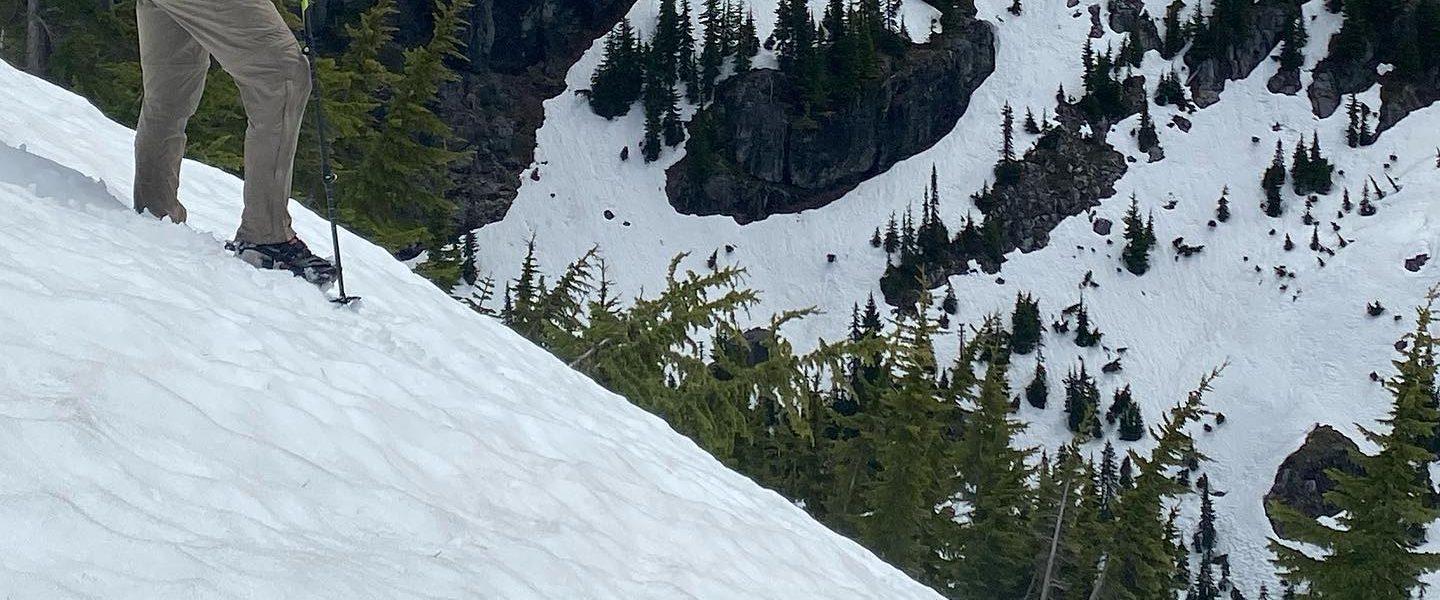
There was enough mist and fog that the views from the top of Desolation Peak were mystical but not grand. I’m developing a theory that Clif Bars (>90% of the calories I’d packed) are fine for low-exertion activities like walking along the gently rolling East Bank Trail. For high-exertion activities like hiking quickly up Desolation Peak, they become unpalatable and I had no appetite for lunch. I’ve also recently realized that it’s much warmer to take off sweaty layers, dry out, and then put on warm layers than to put on insulation immediately over sweaty layers. I suppose this is obvious in hindsight but it’s a little odd to start the warming-up process by taking clothes off. I walked around fire watch house with my shirt off, flapping my arms for better airflow and hoping that the heat from my uphill effort would dry me off. There was an older couple from Grand Coulee at the top and I’m not sure what they thought of me. Apparently, I wasn’t so odd that we couldn’t take each other’s pictures.
Ella made it up a little over 20 minutes later and my appetite had returned enough to choke down some Clif Bars. She had potato chips and we compared calorie counts. Much to my surprise, things came out equal so I think I might try to crush up potato chips into a baggie the size of a Clif Bar the next time I need compact calories.
The hike down felt like it took a long time. It was strange to think that we’d climbed all that way up.
At the bottom of Desolation Peak, the trail goes east and becomes the Lightning Creek Trail to wrap around the side of the peak away from the lake. It’s a little disappointing not to walk along the lake which would be a much shorter way. It looks like there may have once been a trail to do that, so I’m curious about the history. The east side allows access to the Castle Pass Trail which connects to the PCT. Also, the trail to the east starts by climbing, not exactly what I wanted to do at the moment but at least it wasn’t down.
As the trail turned north again, we ran across a group heading south which stopped us to say that there were blowdowns completely covering the trail so that it seemed impassable. Ella had beta from a friend that the trail was a mess so this wasn’t a surprise. The forest began to change to consist of denser, smaller trees. Less light got through and the feeling grew more sinister.
Initially, we hoped that somehow the group we’d just encountered been mistaken because it’d been so nice walking on cleanly cut, well graded trail. The first blowdown we encountered had fallen onto the trail long-wise so we joked that it was completely covering the trail and since that matched the description we’d been given, perhaps that had been the worst of it. Shortly after that, we were forced to bypass several brief sections where the trail was covered and the steep hillside provided better travel. While the worst bypass was the first one, it slowed us down enough that we started to become concerned about when we’d make it to Canada. We’d told Ross to expect us between 8 and 9pm and been about on track for 8pm. If this slowed us to 2mph, we’d be getting in well after dark and it would be hard to connect.
After descending to Lightning Creek, we found the shack and bridge had dodged the falling trees. The blowdowns became less frequent, though one small bridge had received glancing blows from three trees. We started encountering some cut trees and thought we might have reached clean trail again. Then we ran across more blowdowns, some of which had been cleared. What criteria had they used to decide what was cut and what wasn’t? Why would a trail crew decide to skip past some blowdowns which were much worse? I don’t know but I’m thankful for the logs we didn’t we didn’t have to approach like a jungle gym.
Not being sure what pace we’d be able to keep and with limited daylight on my mind, I found myself floating ahead of Ella. It helped that my running vest made it easier to duck under or vault over logs. Separating on the climbs and bypasses had broken up the running conversation which had dominated the first part of the hike.
Just before crossing Lightning Creek to get to Nightmare Camp (yes, that’s the actual name), there’s a sign which says “Hozomeen 6.1” and “Ross Lake 8.7”. We were far enough into the hike now that while this differed from what we calculated based the track Ella had been keeping on her watch, we weren’t sure what to believe. This sign seemed to indicate we had farther to go than we’d thought. With uncertainty from the blowdowns, our finish time might be as late as 11pm, but it certainly seemed like we weren’t going to be finishing in daylight.
The last climb on the route is from Nightmare Camp up to a small pass. From the topo map it looked to be 600-700ft. It moved oddly, jumping from one flat bench, carrying on for a flat bit, then jumping up again. At their edges, the flat benches seemed to fall off steeply into the river valley. It made me think of a mossy, treed version of so many parts of the Hayduke. At one point the trail climbs the arm of ridge. Then it traces up a narrow ravine with a picturesque little stream in the middle. It isn’t clear when you’ve reached the top. The grade becomes gentle, the ravine widens, and at some point you realize it’s tipped over and you’re walking slightly downhill. It’s a strange climb because each section is so distinct as though it had been assembled from mismatched pieces. This makes oddly memorable compared with most of the route whose uniformity leaves relatively little impression per mile walked.
About the time we passed Willow Lake, Ella decided to challenge the distance we’d guessed based on the sign before Nightmare. In 2018 when hiking this route (minus Desolation Peak) to try big miles on my new ACL, I’d run out of daylight near Willow Lake and based on the mileage marker at Nightmare called it for the night, giving up on the attempt to make the border. The next morning I’d decided I really wanted to touch the border and managed to do so and make it back to my car by dark despite having come up short the day before. Back in the present, I didn’t want to put too much stock in the idea that we might be close enough finish before nightfall, but it seemed to jive with my memory that this section was shorter than the sign indicated.
Shortly after Willow Lake, we passed through some area which triggered a strong memory of being “almost done”. The trail sloped gently but constantly downhill, the hill rose on the left, the vegetation was luscious and well watered. My mind kicked into home-stretch mode. Of course, the end dragged out for longer than I remembered but the end is always the longest part of any trip. Finally, though the trail passed a rocky section with sparse trees and deposited us in a dirt parking lot by a greying cabin. It was before 8pm and still light out. This was a huge win emotionally and a great relief.
From here, it was just mile or so road walk to the Canadian border. There was plenty of soft light to see by. The road wasn’t paved but it was hard enough that I carried my poles. There were campsites and we started looking for a place where we might be able to camp. Due to a miscommunication, I didn’t have a shelter and it was looking like it would drizzle in the night. There were a few spots with dense trees, picnic tables, and if necessary, the camp toilets had long eves. I really hoped we’d find Ross.
We were low on water and had expected to draw from a stream which appeared to cross the road on the map. When we got there, it wasn’t conveniently accessible, but we would need water for the night so we decided to draw from the lake if we had to. Then we saw a spigot by the road. I turned the handle and water came out. I put my soft bottle under it but the liquid was milky. Perhaps it was stale? We let the water run for a bit then tried again. Still milky. I decided to taste it anyways and while it wasn’t quite like the streams we’d been drawing from, it seemed clean. Ella expressed great displeasure having to fill up with milky water. A minute or two later, I looked at her bottles and they were clear. It was just a little aeration.
The road carried us along as we played, “where should we camp if we can’t find Ross?”. Eventually, it passed a small cabin and reached a gate closed across the road. This was the Canadian border. Nothing to really prevent cross border access and it I don’t remember seeing anything about not crossing into Canada. This was good since the plan was to meet Ross in the Ross Lake Campground a few hundred meters on the other side. As we approached the gate and we began wondering what came next. There was a figure in Canada who might have been Ross but their gait wasn’t right and when they turned so we could see them in profile, there was no rich beard gracing their chin. There was, however, a bright-orange piece of tagboard with “Isaac & Ella” written across the top. I pointed this out and Ella lost her shit. She convulsed with inarticulate sounds of happiness interspersed with exclamations of “I love him” and other joyous expressions. I don’t think I’ve previously witnessed such intense expression of positive emotion.
Ross had left us directions to his van (he’s vandwelling at the moment). We stepped over the gate and found a short trail down to a boardwalk. We stopped just long enough point this out to some people who were failing to mount the steep, muddy bank to the road. A few steps later, we made out a figure dressed in dark colors like the person at the border. This one had Ross’s confident gait. I might not have Ella’s depth of emotional expression but I there was some volume behind the salutation I used to the figure’s attention. Ross turned towards us and restraint was required to draw close at a measured pace and give a large, warm, dignified hug instead running up and tackling him.
Ross showed us to his van and had recovery food out immediately. We wanted to hear about his adventures in Betsy, his van, and he wanted to hear about our day. It was so good to finally sit down and just be done. We’d been walking for something like 18 hours and other than lunch had stopped only long enough to draw water. Instead of sleeping rough with minimal rations, our journey had brought us to the comfort of a friend cooking dinner and trading stories in a shelter with running water and recessed lighting.
Ella and I had been planning to fore an early bedtime on Ross so we could get an early start the next day. Of course that didn’t quite happen but after a dinner of freshly cooked stir fry, a tour of the van’s features, and a hasty clean-up, Ross drove about a kilometer to where we could park for the night. I rolled out my sleeping pad on the floor next to Ross’s bed/bench where he slept. Ella laid out with her head almost between the seats but managed to fit. It was a little after 10pm when we turned off the lights and drifted off in the coziness of a well insulated space. Of course this meant we all overheated since we’d brought quilts intended for use in highly breathable tents but that didn’t change the fact that we were happy. Very, very, happy.
Saturday, July 4
I’m not sure when the alarm went off but this morning but it was a little bit slower. We out of the van and walking around 4:30am. Ross had packed most of this stuff the night before and so there was a little bit less of his usual last-minute packing routine where something gets forgotten (pointedly, he remembered his bagels this time). Some of this packing had happened while I was laying down and he was opening and closing a drawer which cleared my by a very small margin. Every time he was about to open it, I’d see a little smile creep across his face.
Since we’d parked a short distance up the road, we had a bonus walk to get to the border. There were signs posted warning about non-essential travel, but I think getting home counts as essential so we stepped over the gate like the callous international criminals we are.
Ross had packed his gear into a running vest with a rolltop compartment large enough for minimal overnight gear. It looked like a fat running vest and so, since I enjoy objecting to the term “fastpacking”, decided to call this “fatpacking”. Much dissension followed since it’s obviously a fat vest, not a fat pack but I think I now prefer the term fatpacking to fastpacking.
Since Ross hadn’t hiked with us the day before, we alternated between trying to terrify him about all the blowdowns and reassure him that it wasn’t really so bad. He claims not to have been training much recently and so was worried about keeping up. Of course, this is a guy who for whom not training meant he did >67mi at the Quarantine Backyard Ultra before quitting instead of timing out. Ross kept up just fine.
Initially we were all hiking together until Ella dropped back with that “I’ve got to dig a cathole” look. As experienced hiking partners, Ross and I just kept walking. This understanding that it’s OK to separate and rejoin and trust that your hiking partner with wait somewhere and that you’ll catch up without really knowing when that’ll happen is one of the cultural differences between shorter outdoors trips and thru-hiker culture. We certainly enjoy each other’s company but given the amount of time you’d have to spend tied to another person, it’s easier to let people go at their own pace trust them to be responsible.
As it turns out, I too had to dig a cathole and after drawing water hiked a distance off trail, away from the water, and did my business. I was fortunate enough to have chosen a sheltered spot as it started raining during the process. When I made it back, Ella had passed and Ross waited for me. We walked and talked about topics varying from gloves to old movies. My left knee had started hurting when stressed on the descent into Nightmare and I could feel my right leg getting tired compensating. Given that Desolation Peak was still ahead, this was a little worrying. We caught up to Ella just as she reached Nightmare Camp. In her low for the day (on trips with Ella, you will always play Highs and Lows), she said that she’d hoped to stay ahead of us until after Nightmare. I thought her low would have been what she later shared, that she’d dug a cathole and not been able to poop. Anyone who’s felt the need to dig a cathole and then actually done the unpleasant chore of digging a proper one knows that it would feel like a terrible waste if it weren’t necessary.
At some point while catching up to Ella, Ross and I encountered a pair of women Ella and I had passed the day before on their way north near Willow Lake. They were the only people we’d seen on the Lightning Creek Trail. They had real backpacker backpacks and were working their way through a large mass of deadfall by handing their packs over and under the logs. I felt a little sheepish being able to just hop over and under things with a light-weight, low profile vest. We asked if Ella had passed. They said she had. We asked about their trip. They’d done ~30mi from the Ross Lake dam up to Hozomeen Lake. They hadn’t been moving quickly the day before and so it must have taken them the full day and speaks highly of their capabilities. At some point walking another mile isn’t just about muscular strength, but the soreness of your feet. They also mentioned having had to wait for three hours to get a permit on Thursday for such a rarely used campsite as Hozomeen Lake. In my mind, this validated our decision to have started and ended just outside North Cascades National Park instead of dealing with the bureaucracy. I was kind of surprised that the women didn’t tease us a little about having running vests while Ella carried a full backpack. Apparently they’d told her, in, I suspect, commiserating tones, that our packs were stupid. It is strange being on such an asymmetricly loaded trip, but Ella wanted training and I was still in recovery mode. What I was very pleased not to receive was any crap implying that men should be rough and tough and carry heavy stuff. I’ve had bystanders or people I pass comment on me not conforming to that version of masculinity and while I find their small-mindedness amusing, it detracts from the experience.
Looking back on it, we didn’t push the miles which took us to the base of Desolation Peak as hard as we had the day before. We’d had a debate about whether northbound or southbound was preferable on the route. I’d picked southbound because you got all the blowdowns and climbs out of the way and could cruise the second half without pressure. Apparently we hadn’t felt any pressure on the first half southbound and this logic would wind up reversed. When we started up Desolation Peak, I somehow thought that it was 10:30am which seemed a little slower than yesterday but only by the same amount that our start had been delayed. Ella said something about probably getting down around 5pm but I didn’t really process it and only later realized that we were much farther behind schedule than I’d thought. Ross and I took off up the switchbacks deep in a conversation about the trade-offs involved with living in small towns.
Ross and I eventually fell into separate paces. I passed a pot bellied fellow in mountaineering boots who told me his friends were up ahead and to tell them that “Paul was on his way up”. I did eventually catch his friends spread between the false and true summits and passed the message. Ross and Ella made it up and we had lunch. More Clif Bars for me, though Ross gave me a gummy worm to mix things up. Neither Ross nor Ella had seen someone matching Paul’s description which was a little worrisome. Eventually Paul’s friends decided to head down and our little trio had the views to ourselves. Things were clearer than the day before but there was still a cloud later with some low drifters which tended to obscure things just when you tried to take a picture. Just after we started down, we saw Paul’s friends coming back up, this time he was with them.
We left the summit a little before 2pm and weren’t back to the base until about 4:30 or 5pm. Ella would fall back then catch up at a run. It seemed intentional, like she was practicing running downhill. It had taken us 6 hours to get to the turnoff to Desolation Peak on the way in so we were looking at a 10:30 – 11pm finish. What happened? I like finishing with light in the sky and so this realization put me out of sorts. My pace quickened and I wasn’t much for conversation. I’d get ahead but not far. Ross would catch up at water crossings before I’d filled my water bottles and try to sleep before Ella showed up. While usually out of sight, she was never more than a minute or two behind. She and I would mime laughter to each other watching Ross sleep or meditate, then I’d wake him.
The one notable event in the first miles south of Desolation Peak was when we saw a bridge jumper climb over a No Jumping sign to dive into the water. There was a small boat waiting for him below.
Somewhere before Rainbow Point, Ella said that she thought there were just six miles after the next camp. This seemed too optimistic to me, but between two GPSs, some approximations from the map, and sloppy mental conversions between kilometers and miles, it was anyone’s guess. At May Creek it looked like were were still on pace to finish after dark. Ella proposed having dinner, which she’d been carrying as a training weight, in an hour or so. Some time later, I asked if we could try to have dinner at the East Bank Trailhead since chasing daylight would be a major motivator. At Roland Creek, I was feeling full of energy. I tend to get a second wind around evening and was eating well. I stopped by the trail sign. Ross pulled up and tried to nap standing up. I pitched him on the idea of me running the ~9mi remaining (my estimate) to the car and bringing it back to the East Bank TH so that he and Ella only had to hike ~6. They didn’t object and neither did Ella, so off I went.
If anything, the fact that I was running, and uphill for the first two miles (a detail I’d forgotten about from our hike in), just goes to show that walking and running are fundamentally different. At one point, I kicked a rock which didn’t move and so I moved from vertical to horizontal. Fortunately the ground was soft. I stopped once before the descent to pee and check the GPS. If all went well, I’d get to the East Bank TH around 9pm, still within daylight. From there, the road to the car wouldn’t require a headlight. Given the option, I have a strong preference against headlights.
This wasn’t my first time racing daylight to the East Bank TH and so the run was full of memories. The shape of the trail and it’s relation to the river in the deep ravine below and WA 20 on the other side were the primary memory triggers. I’ve read stories where blind people would feel someone’s face with their finger tips to recognize the person. This was like me tracing a familiar path along the face of some wilderness. The angle at which you can see the bridge. The hope it gives out. The short climb out on the other side destroying that hope. It was all familiar. I exited the East Bank Trailhead around 9:10pm and turned left onto the road. It was still light.
The road run felt downhill which was odd since it had felt downhill to walk to the trailhead from the car. The pavement was much harder under my feet than the trail had been and while initially I made good time, I’d burned through the energy which had kicked off this endeavor and was too focused on the better food at the car to eat anything more. Eventually, I passed a sign which I’d remembered driving past shortly before Canyon Creek TH. The next turn didn’t have Canyon Creek TH. The turn thereafter had a large pullout which aped the shape of Canyon Creek TH and an interpretive sign which I’d forgotten about. I was empty and decided to walk so I could check the GPS and catch my breath. The GPS said it was around the next bend. Of course. I jogged it in, opened my car, and drank a lot of sugary, caffeinated, carbonated beverage.
Canyon Creek TH was not full but now held a number of other cars. Dark had fallen so I put on my headlamp and went to check out the camping options. We’d either have to encroach on another site or set up in a flat non-campsite. I drove back to the East Bank TH and there were Ross and Ella! It was funny to have a joyous reunion when I’d only just left them but showing up in a different mode of transport changed the dynamic. Ella hadn’t started making dinner so we rearranged the contents of the car so Ross could have a seat and drove back to Canyon Creek.
Ross and I established a camp around an fire ring which was a little close to another campsite. In exchange for food and shelter yesterday, we were putting Ross up tonight and I felt like quite a car camper handing him a duffel bag with a tent, sleeping bag, and air pad instead of a tightly optimized ultralight pack. Ella made dinner in her Jetboil by the car and despite it being relatively simple fare, it tasted amazing. After 12 Clif Bars, I think my body wanted anything with salt, fat, protein, or soft texture and that pretty much described dinner: ramen, tortellini, a salmon packet, potato chips, hummus, and olives. We sat eating in the folding chairs I’d brought to mimic the post-hike hangout Ross had put on a few weeks before when we overnighted at Deep Lake but it was dark so we didn’t linger before going to bed.
Sunday, July 5 – Epilogue
Ross was going to run back to Canada and so we couldn’t wait around all morning. I’d brought a skillet and omelette ingredients and so got up a little before 6am to try and make my first skillet-on-the-fire meal. As usual, I overestimated the quantity of meat and vegetables so I became something of an egg-dish instead of an omelette. Despite being an early morning, I’d risen without an alarm and didn’t feel rushed or tired. The fire had started easily which wasn’t surprising given the pre-treated log and quantity of denatured alcohol used in doing so. Ross’s tent had been pitched with one stake in the fire ring so I moved pulled that out and then put a folding chair in front of the entry so he wouldn’t wake up and roll out into the fire. The one thing I hadn’t brought was a pot holder. While casting around for something suitable, Ella tossed me her hiking skirt which had dried overnight. I guess even our attempts at car camping have the marks of being hiker trash.
Packing up camp is surprisingly easy when it just involves throwing things into large bags and carrying them a few yards to the car. I could get used to this car camping thing.
We dropped Ross off at the East Bank Trailhead to start his run back to Canada where Betsy (his van) was waiting. He repacked his bag. We had some last minute small talk. Hugs were exchanged. Promises made to stay in touch. Yada, yada, yada. Finally, he got up, started his watch and took off with a loping gait. 7 hours and 28 minutes later he was home again.
What a guy.

Thanks for sharing