The original plan was to open 2021 with a ski around Crater Lake. Car breakdowns, ambiguous weather, and uncertain avy conditions lead to cancellation. With rain forecast to carpet the Pacific Northwest, including the areas where it should be snowing, Whidbey Island seemed to be an island of relatively low precipitation. Satellite imagery showed extensive beaches and maps showed trails on them. It might be a little blustery but that seemed to be the least bad option for a New Year’s adventure.
Friday (January 1, 2021)
With only ~13mi of beach to walk, Lydia and I didn’t feel the need use get an early start despite the relatively few hours of daylight. We parked around 9am at a small beach front parking area at the southwest tip of Joseph Whidbey State Park. Immediately, plan and reality diverged. We were supposed to walk south with the open water of the Sound to our right but this part of the coast was private with the surf breaking almost at the back porch of the poorly maintained houses. I’m not sure why these houses had been built between a thin strip of land between a pond and the Sounds – it seemed like an obvious flood risk, especially with a sign which said to expect water and debris in the road at high tide. Still, they were there so we walked the road.
At the next beach access… there wasn’t really much beach. But there was a sign saying to stay away.
So the road walk continued. The silver lining was seeing a bald eagle in a tree less than 20 yards away and just above eye level. Still too far for a good picture (see for yourself), but that’s the advantage of being there in real life.
The road walk continued over the rise and down to Hastie Lake road. We weren’t going to Hastie Lake but since it got us to the water, and even a walkable beach, we decided that the Sound was actually Hastie Lake. Notable was that while this was private beach (and not much beach at that), trespassing was OK. That’s the first time I’ve ever seen that on a sign.
The reason that the beach was private became obvious shortly. There were pipes running down from the bluff above, sometimes in bundles like tentacles. These pipes had liquid coming out of them. I didn’t smell sewage so hopefully they were just fancy downspouts to avoid erosion.
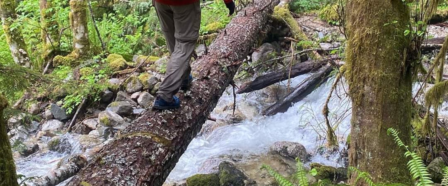
The beach walk was beautiful as the weather remained nice. This was the one part of the trip which went as I’d planned, though the beach was much narrower than expected. The sun even came out a little.
Eventually the bluff above sloped down to another beach access. This had a sketchy ladder and driftwood bench which looked as though they should have blown away long ago. We walked past them only to realize that the small park another hundred yards or so at the north tip of Fort Ebey State Park wasn’t actually accessible without getting our feet wet. We doubled back, climbed the ladder, and had lunch on the surprisingly sturdy bench.
Multiple maps show trails on the beach around Fort Ebey State Park so I can only assume that the lack of beach meant that the tide was unusually high. Either way, it appeared that, having not been able to continue at the northern point of the park, we wouldn’t be able to access the beach elsewhere. We walked a road to a loop which touched the water at the end of Libbey road only to find that it was the point we hadn’t be able to reach earlier.
At this point, we looked at a map and decided to walk the road and trails to WA-20 on the far side of the island and then loop back, mostly via the Kettles Run trail. The route was largely through Fort Ebey State Park and so wasn’t busy as there was a paved path alongside the highway. Some of the trails which we didn’t take had funny names like Escape, Confusion, and Humpty Dump.
The return back across Whidbey Island from WA-20 to the western coast was along the Kettles Spur trail. There were piles of brush stacked in the dense, low trees which arched over the trail to give the feeling of a malicious fairy tale setting. The cut brush must have been recent as we passed a cleared deadfall which still smelled sweetly of recent cutting. It had been turned into two benches.
The trail wove through some private land then dropped to a popular beach access. It was about 2pm and no one was along the beach outside the parking area despite there being long walkable stretches north and south. This was a more committing section as it appeared that the waves were hitting the cliffs (ie there was no beach) in a distant section of the beach to the south and there didn’t appear to be an exit along the ~2mi until the bluffs descended back to the water. There was a 0.5mi stretch designated as a private beach which contained a narrow, rugged footpath to the top of the bluff which we noted as an escape route in case the beach disappeared. Fortunately, the tide was going out and so we weren’t worried about reduced travel options. I only wished that it would go out faster so I could walk on the firmly packed wet sand at the water’s edge.
Most of the the time we walked near the top of the beach on small rocks, loose under foot, which had been piled up by the waves. We decided that “trudge” was the most accurate word to describe our bipedal motion. “Slog” sounded wetter and muddier. With the wind up and footing tricky, I spent a lot of time looking at the rocks under foot. It struck me that they were quite varied in color: mustard, green, blue, purple, and sometimes red. Other than the mustard colors, these were different from the bluffs which were a dark tan. I wonder if they were carried from a distant area or represented unseen geology.
Clouds rolled in and out ominously, appearing to rain in the distance. Wind picked up and briefly turned a light rain into drops which stung when they blew under my hat’s brim and into my eyes. Dark comes early in the winter – about 4:30pm. Overcast skys can make that seem like it’s happening much sooner. Having measured our pace between the two signs marking the half mile of private beach, it seemed like we were going to get to camp about dark. Fortunately, that included a walk around Fort Casey State Park, and when we got to the camp at it’s northern edge, we opted for an overland route to explore the WWI era fortifications.
Clouds cleared a little and so it actually became more light just before sundown and this lightened the mood. I’d gotten a reservation at the campground on the south side of the park (I’d have preferred dispersed camping but that didn’t seem to be an option). After having wandered along the line of fortifications, a spur trail appeared to lead steeply down the hill to an area with a bunch of RVs. We took it about half way down the vertiginous hillside only to find that what started as clearly a path definitely did not “go” except that it “went” into a patch of thorny blackberry bushes.
After having found a proper route to the campground, I went through the unfamiliar steps of registering for our site, despite having gotten a reservation online. A kindly state parks employee explained it all to me, including where to put my vehicle’s license number (ha!).
Normally I feel cozy and protected in the tent I’d brought – a two person ultralight model sold at REI. In a campground surrounded by RVs and people, I suddenly noticed that the rainfly was transparent. Should I change into my sleeping clothes in the bathroom? It felt strange cooking dinner on my single burner camp stove at the picnic table while no one else seemed to be outside except for those reclining in folding chairs by fire rings or visiting with neighbors. As night fell, people used flashlights instead of headlamps. Such a strange new way of camping.
Saturday (January 2, 2021)
Some time in the middle of the night, the wind started. It was strong (weather.gov says +/- 20mph) and knocked the tent around, bending the ridge pole and pressing the walls in against my side so that insulation of my sleeping bag compressed and I could feel the cold seep in. At one point, I got out to check the stakes and guy lines. All were solid. The tent had simply been designed along the lines of bending and not breaking.
The wind was still blowing the next morning. Here’s a photo of the tent with Lydia still in it. You can see her knee pressing against the rainfly on the upwind side where I used to be.
I typically camp surrounded by tress and bushes which break the wind, even if I can hear it whistling and shaking them. This whole RV campground was built right on the water with no defensive perimeter. The Sound had been relatively calm the prior evening and now breakers were rolling in a few dozen yards away. Seems like a good place to test mountaineering tents.
Given the aggressive surf, Lydia and I decided to walk roads and trails back from Camp Casey. So much for a beach hike. Cars were a regular nuisance. When we got to Fort Ebey State Park, we stayed on the road because the beach didn’t run the entire length of the park above the water. Maps didn’t show access to the bluffs above part way through. If we hadn’t gone southbound the day before, we might have tried to go a mile or more before having had to turn around.
Coming back through the Kettles Spur trail, where the fragrant, freshly cut benches were, we saw that someone had written THANKS with small pine cones. We were thankful for a convenient spot to stop and have lunch. While we were eating, a man passed by and from a distance asked to take our picture because his brothers and nephew had cleared the tree and cut the benches the day before. It was an incredible small-world connection and we asked him to pass on our appreciation of their work.
The high tide and waves even made the first section of beach we’d walked the day prior look impassable, so we closed out the trip with more road walking. The silver lining was that we found an excellent farm stand which sold pie and the richest chocolate milk I’ve ever drunk. Payment was honor system and I didn’t have exact change so now I have a winter squash as well. And some jam (very sweet despite being “low sugar”). After that the rain started.
About a half mile from the car, we found a place for Lydia to stop because of a shooting pain in her left foot for which she’d been pausing every hundred yards or so. I was experiencing a sharp, building pain in my in my right knee. I assumed this was because we’d worn thin shoes expecting to be walking on soft sand and instead gotten hard top from walking roads. Fortunately, my knee didn’t hurt when running, so I got the car and brought it back as the rain increased. Not exactly walking the beach off into the sunset.
In Closing
Not every trip goes as planned and this certainly was one of those that didn’t. I’ve always been fortunate in the resilience of my hiking partners as nothing ruins a trip faster than a sullen or complaining attitude. On this trip good spirits reigned despite things going off the rails immediately. Good spirits continued despite this adventure staying off the rails. And so it is that 2021 starts on a note of gratitude.

One thought on “Whidbey Island Road Walk (January 1-2, 2021)”