When I hiked the PCT in 2016, I took an alternate route out of Snoqualmie Pass to stop by the Goldmeyer hotsprings (and cut 10 miles off the trail). Now, I was curious to see what I’d missed.
Friday
My housemate dropped me off at the PCT trailhead after work on Friday so I could, “cheat in” a little. My understanding was that this was still early season for this section and I wasn’t sure what to expect from the conditions so I didn’t mind knocking a few extra miles of climbing off the start. They weren’t particularly notable miles, mostly treed with one nice view down a valley. Some day hikers on their way out said they’d been turned around by snow near Kendall Catwalk but I’d planned to stop before that. The highlight of the pleasant, bugless evening was walking a forested ridge. Even without the views, having the land fall away to both sides creates a feeling of adventure.

Saturday
When I turned my phone on in the morning, it said the time was about 9am. I hadn’t seen the sun come up but was surprised it was so late. Either way, the patches of snow I started encountering were still hard packed. I had my ice axe and microspikes but didn’t use them yet since the patches were brief and stopping to gear up is irritating.

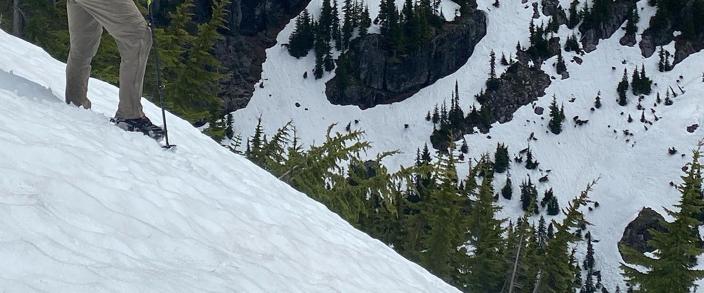
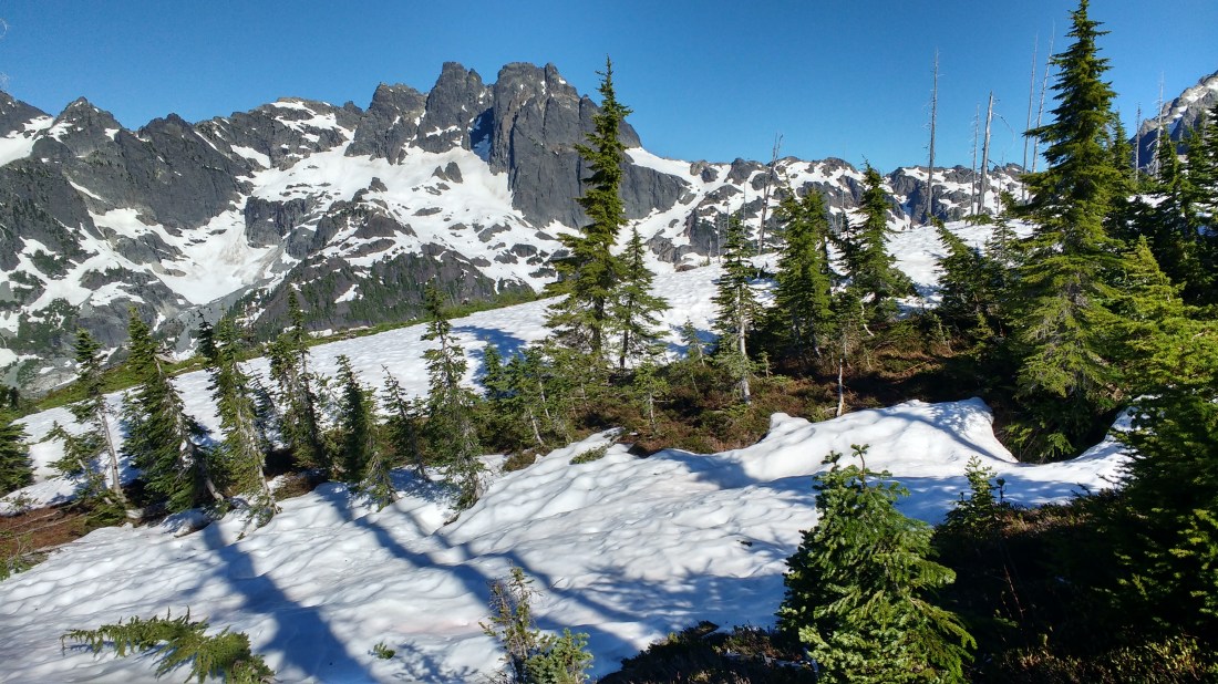
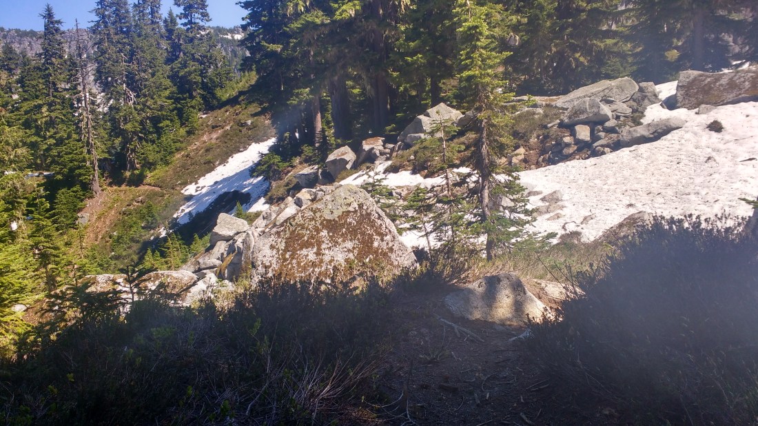
Shortly after the catwalk, I’m trying to follow footprints over snow which completely buried the trail. At one point, someone had drawn an arrow where two footprint tracks diverged. Crossing snow without a strong sense of where the trail is can be uncomfortable for me as it’s easy to imagine ways to get lost and there may be few indications that you’ve diverged significantly from the route. I guess that’s what I get for being a fair weather hiker.
Small signs that I was heading in the correct direction were very reassuring. At one point, I saw a tent off by a small pond. Shortly after that, I unexpected encountered a trail sign. Eventually, I wound up on a traverse where the snow was intermittent and the contents of the valley below were easy to align with the map.
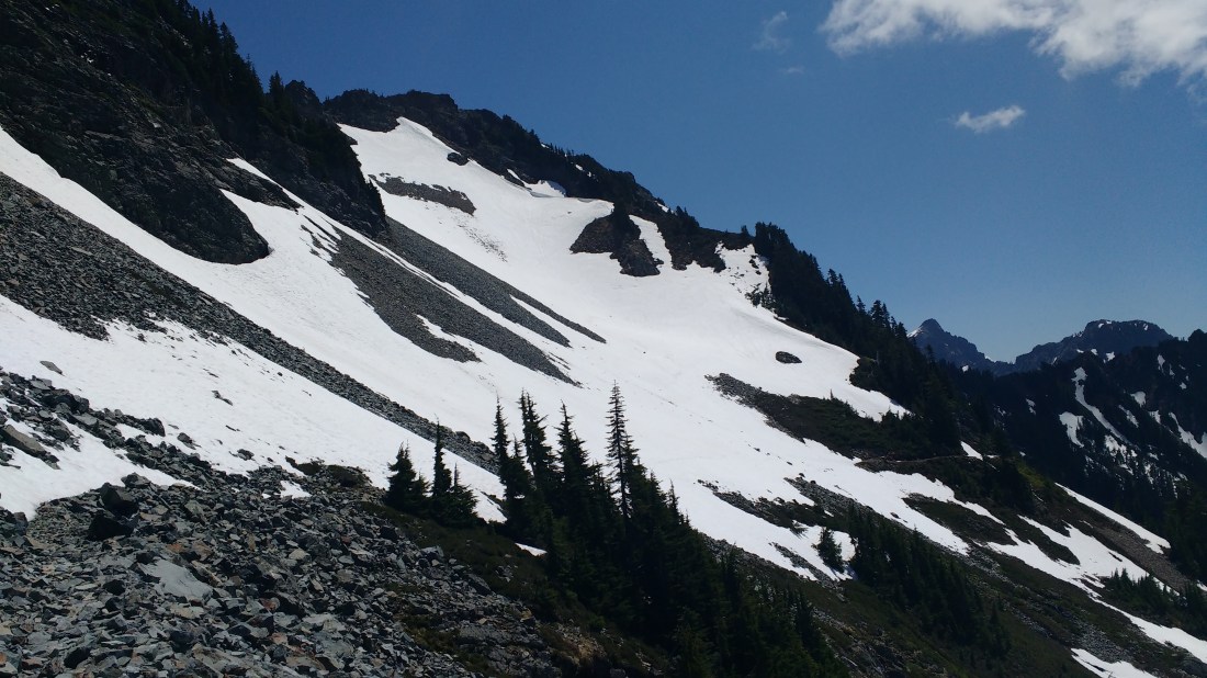
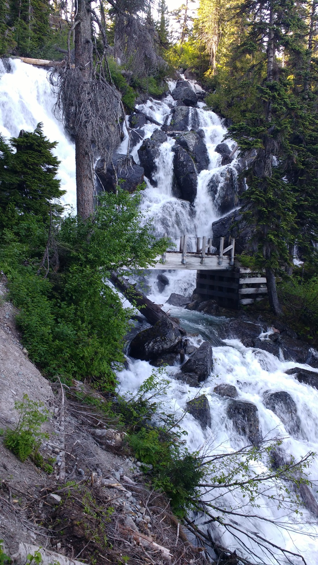
While the going was usually easy, I found myself quickly winded when the trail turned slightly up and made the most of lunch of tortillas, spam, American cheese, and Nutella. At the end of a long traverse where the trail doubles back on itself, but on the other side of the ridge, I stopped for a time check. It was late afternoon by my phone and I wasn’t making nearly enough progress to keep with pace needed to get through on Tuesday. There had been a few tricky, exposed, snow crossings with little runout where I’d felt compelled to bury the ice axe’s head with each step since I felt so close to sliding. These were tiring because all limbs were engaged and the motion was awkward. In once case, I’d crawled down and around a patch of snow thinking it would be faster but the mountainside was steep enough that it proved not to be. I’d even seen two bears in the distance, romping around on the slope as though it were flat. Certainly enough adventure for one day, just not enough miles.
At this turn in the trail, I pulled out my compass to align the map. The view was fantastic but some lakes below didn’t quite match the shape I’d have expected from the map. I’d discovered that morning that the backup battery I’d brought was drained so I wanted to use my phone for navigation as little as possible. The question I was trying to answer was whether the trail (nowhere in sight after switchbacking down under the snow) went to the left or right of the lakes. In the distance, I saw a pair of hikers heading towards a middle route which didn’t help matters. Ultimately, I couldn’t make up my mind and so followed the trail until it disappeared and then tried keep going according to little hints. When some tracks I found petered disappeared into a patch of dry ground but without apparent exit, I reluctantly pulled out my phone for a GPS check and found myself a quarter mile off trail. What followed as a great deal of playing hot and cold as the my GPS app only has a back-to-trail pointer, not a map displaying your position. As it turns out, the trail had switchbacked under the snow (one of my great snowtravel fears) and what the track leavers had been up to is anyone’s guess. I’d had a terrible map reading, even by my standards and mistaken those lakes for ones several miles away.
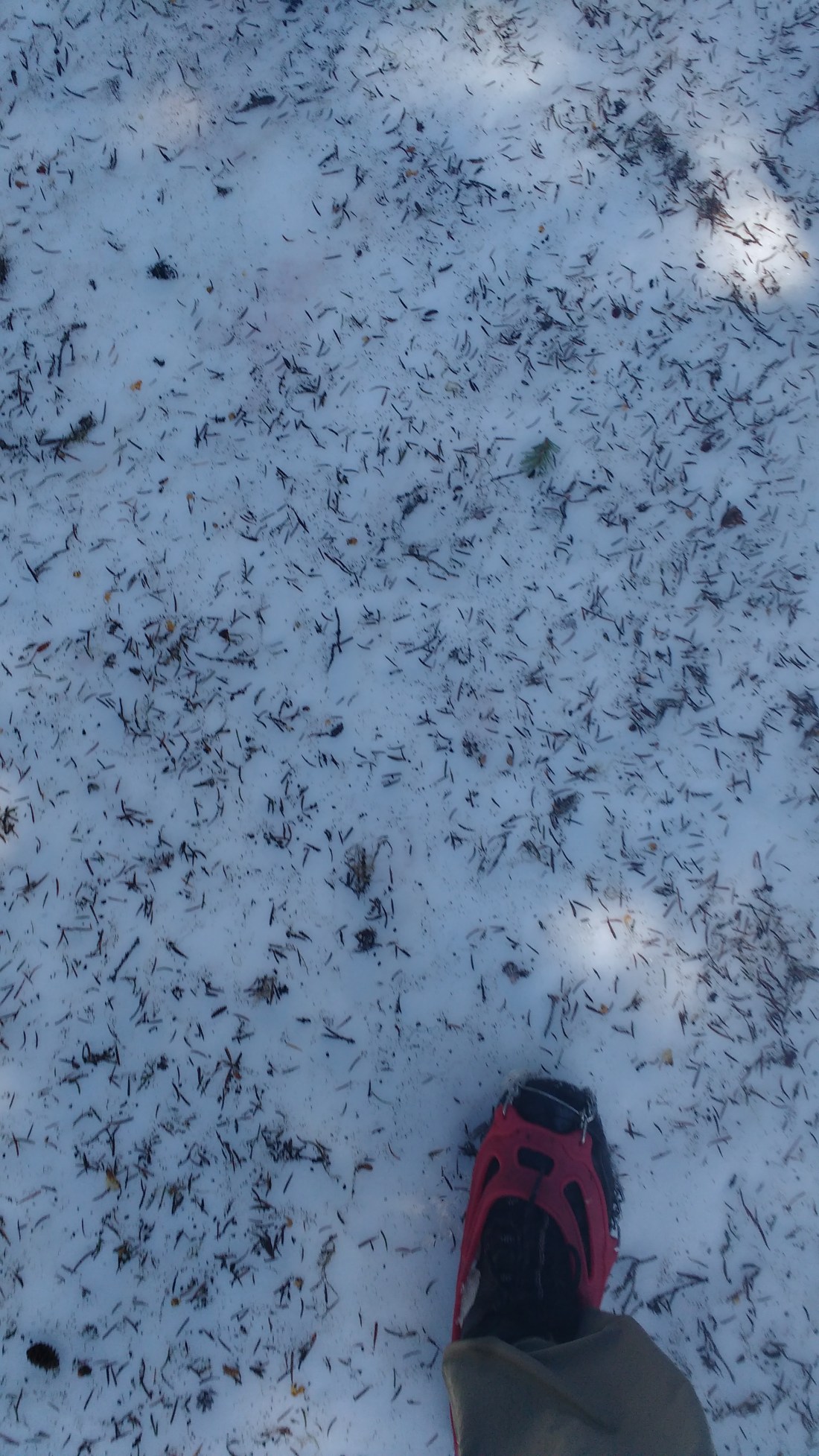
For the next hour or so the land rolled lightly as I wandered around with my phone out like a divining stick. Walk a hundred yards, check the back-to-trail arrow, and correct for the next hundred yards. At some point I ran across a trail sign. I heard a dog bark. Distant voices. Learned that it’s easier to spot shallow footprints if you crouch down to look across the snow across instead of looking straight down. And saw no one. Eventually the snow lessened a little and I’d be able to catch glimpses of the trail like someone playing hide and seek.
The climax of this game was when my phone lead me to the dry edge of a slope with a trail visible. That trail dead-ended within 15 yards like the little trails which hang off the edges of campsites. Even as I followed, it my back-to-trail pointer would tell me I needed to go back to the edge, away from this little trail I’d found. Could the trail possibly be down a relatively steep snow-covered slope? If so, I should probably just give up now. If I was having this much trouble navigating now, how much worse would it get if I just went deeper? if the trail did go over that edge, I didn’t feel equipped to handle the conditions. After having tried several times to suss out where to go, I was resolved to give it one last try and if that failed, to admit defeat and go home.
Then I spotted dog prints on the top of the mound of snow that formed the top of the slope. I had been visualizing things wrong – this wasn’t a rapid, steep descent, it was the beginning of a short traverse. That short traverse still ended in a descent steep enough that I boot-skied part of it. However there were dog prints, boot tracks, and the corners of switch backs to guide me. Eventually the snow gave way and I was flying down switchbacks past the turn-off to Spectacle lake.
As my phone read 9pm then 10pm then 11pm, there was still sun, if late afternoon sun. By my guess, it had jumped 3 or 4 hours ahead when I turned it on in the morning. What stress this had caused!
I ended the day with a long flat walk into some campsites. I had trouble finding an empty one and was too tired to care when I interrupted a couple snuggling by the fire to ask if they knew of any available spots. The guy was actually quite helpful and walked with me just down the way to point out site whose entrance was overgrown, making it hidden. He also mentioned that a ranger had said that the top of the next valley was full of snow. Wonderful day now that it’s over.
Sunday
I was up out pretty early, being sure to track time roughly by the sun and less by my phone and proceeded down the valley.

Near the top of the valley, I hit snow again and the trail disappeared. I was trying to line the map up and not really confident at all given how yesterday’s map reading had gone. While I was puzzling things over and beginning to feel like I might need to bail soon, a woman and her dog came from behind me (wow am I bad with direction) and said that she’d made it about one pass over before not being able to find her way around a lake because she’d lost her map. For the life of me, I can’t remember if I asked her whether she’d been on the PCT near Spectacle Lake the day before as her large boots and dog roughly match the tracks which had gotten me through in my moment of despair the day before. Her tracks were pretty easy to follow and I used the snaking of the trail to find myself on the map. When I made it to the next lake (a pond really), I was able to circle it at the water line then cut uphill in a dry patch until I found the trail. From there, the snow disappeared and it was smooth sailing.
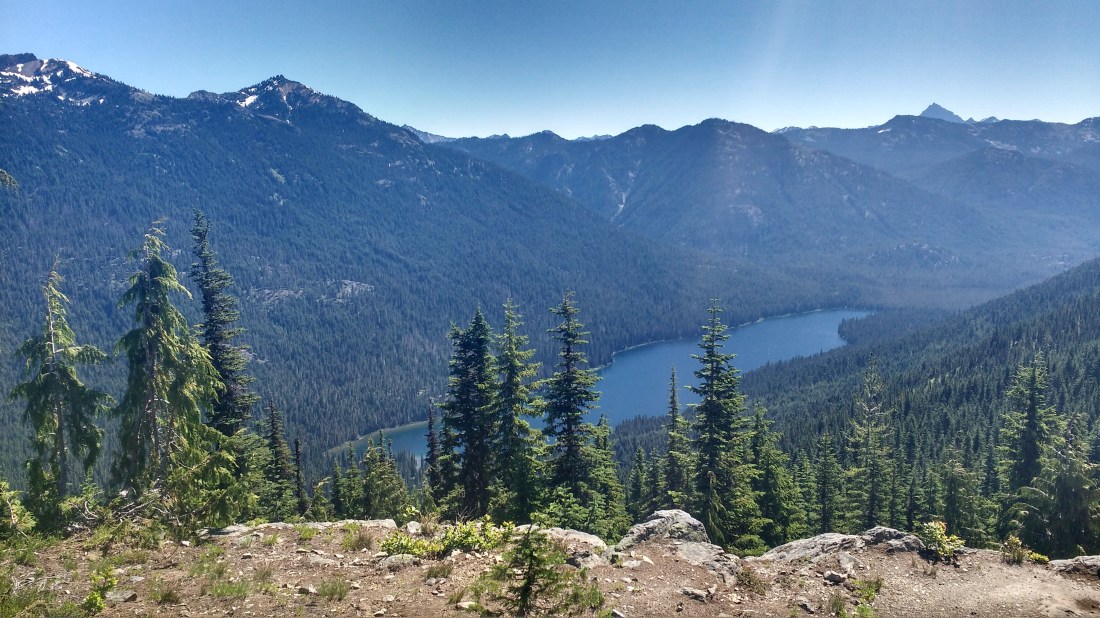
Dry, well graded dirt makes for easy walking and pretty quickly I found myself overlooking Waptus Lake where I ate lunch. I’d rejoined the PCT proper near Waptus Lake the year before and remembered the climb out of it. Things went pretty much the same this time. The climb doesn’t look too hard but it’s in tall bushes with no tree cover which makes for hot, dense air. While cruising around the lake, though, I ran across some section hikers who let me know that there was more snow ahead and that they thought it was pretty deep but that they’d come in a side trail and only hit the edge of it.
While resting after a shallow stream crossing shortly before Deep Lake, I was looking through my maps at the trail ahead. As I recalled, the trickiest section was coming up next and that must have been so because I now discovered that I was missing that section (later I found it on my desk where I’d been giving it extra attention). While taking my shoes off to cross the outlet stream from Deep Lake a short way down the trail, I got to talking with a quartet of hikers who, as luck would have it, had come in from Steven’s pass. They assured me that the snow was doable and that a particularly troublesome stream crossing was possible. On top of that, it turns out they had the same map set I did and gave me the missing section. For the first time on the trip, I had total confidence that I could make it through. Less than an hour before, I’d resigned myself to abandoning the effort.

It did take a little bit of phone-as-divining stick to find my way past the snow around Cathedral peak. There were foot prints though they were sometimes misleading and sometimes disappeared. There was a lot of boot skiing though and that was a ton of fun. I was worried about missing the last switchback under the snow and winding up below the trail while thinking it was above me but that didn’t happen. I camped after an icy, knee deep stream crossing at a campsite from which the trail exit was not obvious. If memory serves, I’d had the same problem the year before but couldn’t remember how things had played out. Yet another wonderful day, now that it was over.
Monday
The big event of this morning was crossing a stream which is marked as potentially unpassable in early spring. I’d been worried about it from the start of the trip but knowing that the quartet of hikers I’d passed yesterday had made it through made me sure I could do it as well since some of them were smaller than me.
I spent several minutes picking the point at which I crossed the first branch and was pleased to find it shallower than I’d expected. The froth doesn’t press against you the like a the main body of a stream and so in practice it the effects of the water ended just above the knee though I got splashed high on the thighs. The second branch of the stream creek was a much shorter crossing but in a place which was much steeper and required some precision with foot placement. There was no room to let the water push you backwards because a few inches away, it continued steeply downwards.
After that, hiking was easy and with the sun just topping the ridge, quite pretty.

The day’s great misadventure was a repeat of events from 2016. I managed to misinterpret a trail sign and descend a bunch of switchbacks before getting stuck at a river crossing two miles later when I realized I was on the wrong trail. On the way down, I remember thinking that there were a lot of switchbacks and that I pitied the poor sap who had to climb up them. An hour or two later, that poor sap was me. I tried to take them at a charge but ran out of steam before I got back to the PCT and had to sit down. When I did get to Deception Lakes and ate the late lunch which was supposed to have been an early one, I felt spent. The lakes made a nice place to be exhausted, though.

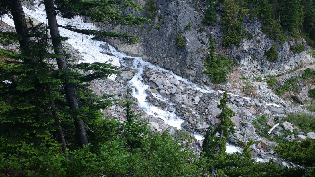
My map didn’t have the other trail when I’d mistakenly turned off the PCT so I’d stopped a passing backpacker to ask to ask for directions on my way back. He’d told me that the PCT wasn’t passable due to the snow. His expensive cottage industry backpack didn’t have enough dirt on it to make him a credible source and I’d now heard enough warnings about snow on this trip that I wasn’t having it. When I got to the patch he’d talked about, it was steep enough that the ice axe and microspikes provided some comfort but it would have been par for the course two days before.
After some cruising along nice, sunny dirt, I wound up picking my way through a forest whose undergrowth was primarily late spring snow. Route finding was a little tricky but I was able to spot tracks here and there, play peek-a-boo with the trail, and when necessary use my trail divining smartphone. This section was mostly flat or downhill and so contained a joyous amount of boot skiing. No lift ticket required.

I did really lose the trail once but after after less a hundred yards of bushwhacking in the same general direction, it reappeared. While wandering around off trail I found a ski pole, which would have been really useful if I’d lost one of my trekking poles. Why one was out here is beyond me but it goes to show how well trodden much of our wilderness really is: replacement gear is conveniently available even when lost.
The day ended by a lake where I found a pair of sunglasses and a guy who said he was the foremost south-bound PCT through hiker of the year. We hit it off with trail talk and I enjoyed his stories from the AT a few years before. Given how things have been on this short stretch, I was reasonably impressed with the effort it must have taken to get through the North Cascades. All’s well that ends well.

Tuesday
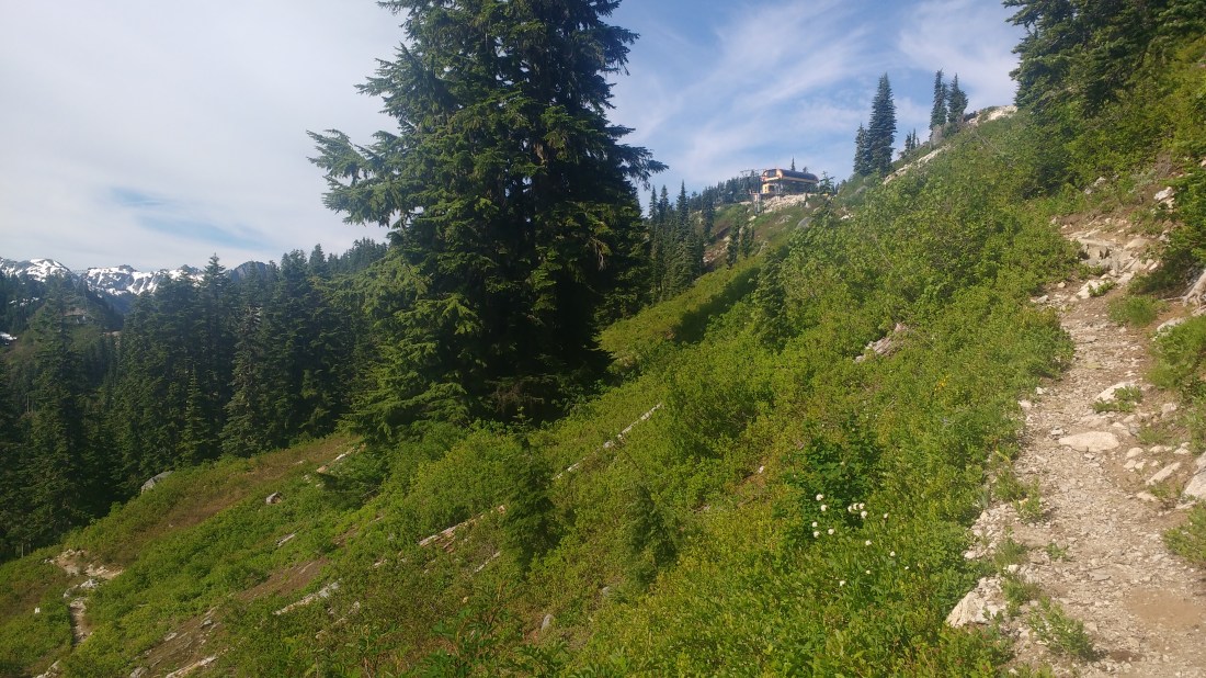
At this point, Steven’s pass was closer to 10 than 20 miles and there wasn’t going to be much snow left. While walking, I thought fondly back to the these same few miles the year before, talking economics while trying to keep up with a fast talkin’, fast walkin’ recent graduate from somewhere in the British commonwealth. The trail isn’t just about a nature experience but to a surprising extent, the people you meet.
Shortly before starting the last climb through the back side of the Steven’s Pass ski area, I ran across a Dutch hiker who laboring up a short slope, off trail, under a huge pack. He’d missed what seemed like an obvious turn, though perhaps he was mislead by some flagging and I was worried about his ability to get through to Snoqualmie given how few miles he’d made the day despite hiking in good conditions. However, he was well kitted out and there’s a fine line between giving someone a report on the conditions ahead and unsolicited advice so I told him to expect snow, gave him my phone number in case something went wrong, and wished him well.
Sitting under the chair lift at the top of Steven’s pass I was a happy and nostalgic. This trip had been unexpectedly adventurous and there’s a strong elation which comes from doing something you doubted you could (or with an eye towards safety, should).
Epilogue
I managed not to buy more than one ice cream at the store at the base of the Steven’s Pass ski area. That I bought any at all was a consolation prize to myself after watching a stream of cars pass by my outstretched, upturned thumb for an hour. I’d picked what I thought was an ideal hitching pace: lots of cars and a long, wide shoulder to pull over. Going into the second hour, I made a sign with the name of the well-to-do city to which I was returning, hoping a yuppy, upper-middle-class name would help counteract the ice axe protruding from my pack.
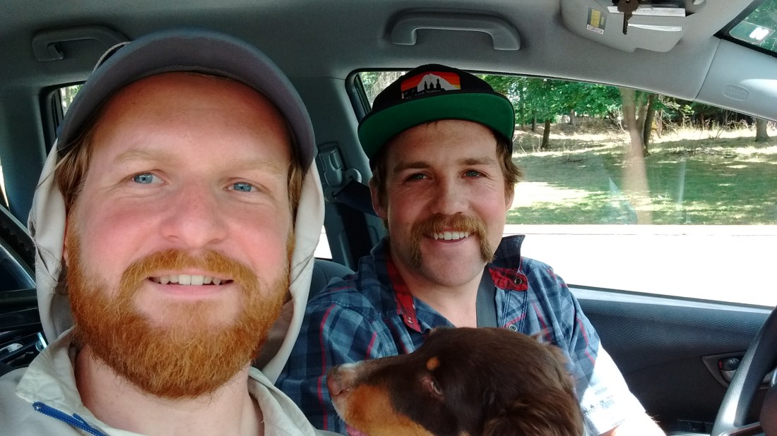
Ultimately, it was a wilderness ranger who gave me a lift. In an unexpected turn of events, I’d actually met him the week before on a trip to Kaleetan lake. We’d had a friendly, passing exchange and moved on. As we now had over an hour to talk, I got to hear about what it was like caring for the public trails and lands which I so enjoy passing through. He even gave me a few tips on abandoned trails he’d been assigned to walk, flagging them as a first step for potential restoration. It was also uncomfortable thinking about the broader implications that a sane, well off, and civil guy wearing expensive, branded clothes wasn’t able to get a hitch until someone from the same affinity group came along. Consequently, I resolved to make giving a hitch my default course of action when the situation presents itself, and by the time of this writing have done so twice.

One thought on “Snoqualmie to Steven’s (June 30 – July 4, 2017)”