Hayduke Day 21

Memories from October 24, 2018.

At the confluence with Roger’a Canyon, there was a stream. This started today’s theme of beautiful was water can pour over rock. Pictures never really captured it though.

Boulders, which had slowed yesterday’s progress significantly, eventually disappeared and walking became easy on the wide, level stream bed. I had a small pain in my left knee after a particularly large jump down but that subsided by the end of the day.

Navajo Canyon was barren with dark and light sand, mud, and stones. This was a stark contrast to Roger’s Canyon where there and been trees, grasses, and sometimes even real dirt instead of fine sand.

One of the unique features seems to be this rock which is usually bluish and appears to be flaking off the way a charred log flakes off as it burns. This is a small piece but there are layers of the stuff in the canyon walls.

As I moved up Navajo Canyon, there were a few small blockages caused by seemingly out of place boulders.

While bypassing one, I almost stepped up onto this little snake which rattled at me. It’s positioned so precariously, as though it has just jumped up or was about to jump down, that it made me think that it was trying to bypass the boulder as well.

Eventually the stark barrenness changed to the more common yellow sandstone with attendant small trees and shrubs. The turn-off of Surprise Valley was marked by an easy to miss cairn so I was happy to have GPS.

Reese Canyon seemed like yet another world. The going was easy, on a dry, hard streamed. The rock was red with lots of green cover.

Eventually the rock itself became green. It felt kind of like walking through an aquarium.

I camped by the confluence of Reese Canyon and Last Chance Creek. There was an old trailer and corral nearby. With Reese Canyon’s bed a better road than some ATV tracks I’m not surprised that someone ran cattle down here.

Hayduke Day 20

Memories from October 23, 2018.

Today started at normal hiking hours despite being in town. By 7:15am we were packed up and at a coffee shop. My folks dropped me at at a tour company where I’d reserved a ride down Hole-In-The-Rock road back to the Hayduke. I’d made a reservation online but it was only in person that they told me there was a two person minimum. There was some confuse with the software, in part because I was only going one way, so we’ll see what I wind up being charged.

I had a great time chatting with Mark, the driver, as we fish-tailed and slid along the road. He even drove me a bit past the official drop-off point. Free miles!

Then it was up, up, up, into the mist shrouding the 50 Mile Cliffs. It was one of those quintessential Hayduke moments where the place you’re definitely going doesn’t look passable at all.

Just before the cliffs, I ran across what looks like an old water cache.

The climb through the upper cliff band was on a trail which I appreciated a great deal as I couldn’t have found my own route in the fog.

The kinda cross country portion at the top of the cliffs was also cloud enshrouded. I’ve given up the map-and-compass-only game and having “hiking avionics” made life much easier as there wasn’t really a trail.

I loaded up water at the not at all muddy Mudhole Spring which had a cabin nearby.

Around mid-afternoon I’d made my way into Monday Canyon. The going was pretty rough but the colors were pretty even if they made the going slow.

In several places I slid down sandstone slides.

For some reason the canyon walls made me think of the monkey’s palace in The Jungle Book.

I mistook a side canyon for Roger’s Canyon and thought I’d been making great time. Checking the GPS, as I have to do when I’m not “staying found” with map and compass was a let down.

A real tent had higher requirements for a campsite than a tarp and the canyon was rough and uneven as light began to fade. After a steep bypass of some pour-offs on loose dirt, I suddenly came across a spot just large enough and relatively flat after clearing out the sticks and small plants. While tents seem demanding, they sure are nice once set up. This is a small two person tent and it feels palatial after my one person tarp.

Hayduke Day 16-19

Memories from October 19, 2018.

This is my first zero day after about two weeks of hiking and a few particularly hard days recently. I spent as much time as possible in the motel bed napping, consuming digital media, eating trail food, and getting the crumbs on the blankets.

Memories from October 20, 2018.

I checked out of the motel and loitered around Hanksville waiting for my parents. I listen to Man’s Search For Meaning and then chat with the fellow running the restaurant whose porch I’ve been sitting on for 5 or more hours.

The parental units arrive and we drive to a campsite near Escalante, stopping to eat at a restaurant with a view so good I wonder why I’m hiking the Hayduke.

Memories from October 21, 2018.

I spent the day doing little hikes with my parents until it rained in the afternoon. They got to experience slickrock, ambiguous trails because footprints never wash out and so you can’t tell the main trail from the side ones, and incorrect directions because pour-offs aren’t the end of washes. They did get to see petroglyphs. We had dinner at the Hell’s Backbone Grill and it was one of the best meals I’ve probably ever eaten – and that was before digging into the meatloaf.

Memories from October 22, 2018.

Forecast thunderstorms made me decide not to get back on trail today. I got my resupply boxes. One had food and the other had cold weather gear because based on historical averages I’d been expecting things to start getting cold soon. It looks like I won’t need it in the near future and the freestanding tent, zero degree sleeping bag, and extra layers significantly increase my base weight.

In the evening after the storms cleared, we went on a short hike in Petrified Forest State Park. There was definitely a closed sign at the start of the trail but mom said, “what about this way?” and pointed to an alternate start of the trail five yards away which immediately joined the trail behind the sign which said closed. The parents got to experience hiking in the mud but the view from the top of the cliffs above camp was picturesque.

Hayduke Day 15

Memories from October 18, 2018.

I woke up some time last night to find that the side of my quilt had slid to the edge of my shelter and was getting some water on it. Closer examination showed that snow had bowed the tarp in. That’s what I get for taking my good weather shelter into the rainy, snowy, sleeting desert.

At daylight, I broke camp packing things up without much care as everything was a little damp and headed for the road back to Hanksville in the snow and rain. I unapologetically used the GPS as I just wanted to get back to town. I’d gotten lost in this section on the way out and I wasn’t feeling like extending the hike back.

It took less than an hour to get a hitch but it was something of a cold and miserable hour. Several jeeps pulled in to Poison Spring Wash and an outbound hiker actually got dropped off.

Looking cold and wet apparently increases your pathos among the we-just-want-to-make-sure-you’re-ok-but-don’t-have-any-seats crowd but not the luxury sedan crowd. A local woman and her son gave me eventually picked me up. I haven’t hitched enough to know for sure but is seems like locals are the most generous when giving rides. They also mentioned that they’d gotten as much rain in the last (two?) weeks as in the last two years as there’s been a drought.

I crashed at a restaurant to warm up and dry out. I must have looked the part as another patron asked what had happened as I was walking to the bathroom to clean up. “I was setting out for a 120 miles section of this hike I’m doing and 35 miles in discovered that I’d lost the satellite communicate which keeps my parents from calling search and rescue. After hiking back seven hours in to find it, I was left I only had four days of food for the five days it would take to try and finish so had to bail out” became a pretty well rehearsed story.

I’d spent the morning’s muddy slog figuring out what the criteria would be to quit this trip. There were lots of justifications and rationalizations but eventually it came down to weather. I came out here to have an experience of walking all day in bright, clear weather, cool by day and cold by night with a sprinkle of rain here and a dusting of snow there. That my most valued piece of gear has been neoprene socks and that my greatest difficulty has been moisture management say that this trip has not met expectations. There have been some incredible experiences but I’ve been saving vacation for two years to make this trip happen which means there’s a lot to lose if I’m ultimately unhappy.

Around 2pm the sun first started lightening a section of the otherwise unyielding grey overhead. By 4pm the clouds were beginning to break up. I checked into a motel and started laundry. The hiker who had been dropped off outbound while I was hitching in showed up while I was sitting outside the laundromat in my rain clothes (so everything else can be washed) trying to dry my shoes in the sun. He’d come back in because of the mud was aggravating a foot injury. We hit it off talking trail. He’s hiked the triple crown and has met some interesting personalities.

The forecast shows several days of rain but mostly sun. My mood had changed. Cuts and scrapes which had never scabbed properly on account of the moisture final started forming protective shells. My folks had been planning on visiting at the end of the next section (another reason to rescue the all important satellite communicator) and we rearranged plans. While I could possibly be back on trail the day after tomorrow the logistics are tricky, brittle, and potentially expensive. To stay on schedule I need to skip from Hanksville to Escalante which isn’t an easy connection to make without a car. Better to take a few days off, see my parents, rest and try again in a few days.

Hayduke Day 14

Memories from October 17, 2018.

It rained a long time last night and was still raining this morning. I was going to get to the nearest road 10 trail miles away but guessing from the map, it looks like a rarely used 4×4 road and a hitch would be unlikely. That means the better thing is to go back the way I came. I remembered where I last used the inReach and it was 7hrs of hiking from where I camped. So back I went.

This is where the rain comes in. The ascent onto Tarantula Mesa is steep and muddy at the start. It had been dry, soft, loose dirt the day before and I was initially concerned that it might not be passable. I accidentally ascended in the wrong cove and that was not passable due to cliffs but that’s a different issue. Taken one step at a time and with GPS to help my failing memory, things worked out. Plants make good footholds in the mud. Everything else might move under you. Two sandstone handholds exploded during the course of ascending between cliff bands. Very adventurous.

The walk back from Tarantula Mesa to Pilot Spring where I’d left my inReach was long, rainy, muddy, and eventually snowy. When I found the inReach on an exposed rock down trail from where I’d sheltered to eat lunch yesterday (down trail so I couldn’t miss it on my way out – has always worked before), it was showing yesterday’s forecast for today: warmish and sunny.

At this point, if I’d tried to continue the section, I’d have about 100 miles and 4 days of food. Fine for most of the PCT. Not good for the Hayduke. Plus, the road had degraded significantly from the rain and sleet while I walked and I wasn’t sure I really wanted to try descending Tarantula Mesa in conditions much worse than I ascended this morning.

So I hauled myself back up to Copper Ridge and made it down to the reservoir my the mine just as it got dark. After a very pouty mood this morning (I hate having to re-hike miles and Tarantula Mesa isn’t very interesting) the snow actually made me quite cheery. There was just enough sun behind the clouds to keep things visually crisp and never having had to shovel snow as a chore, I have only fond associations with it.

Tomorrow I’ll get back to Hanksville and figure out my next move. Section 6 is probably a lost cause on account of limited vacation time.

Hayduke Day 12

Memories from October 15, 2018

I woke up in town, finished my blog posts, ate breakfast, got my resupplying boxes from the post office, exploded my backpack, then filled it up with new food and cleaned gear. Then I went to hitch back to the trail.

It took about an hour and twenty minutes to get a hitch. After the first hour, I got a milkshake and asked the cashier for a cardboard box with which to make a sign. After moving to a better spot, I got a ride from a beer drinking pair who had trouble staying straight in the lane. They also gave me some chapstick.

After getting dropped off at Poison Springs, it was a little hard to find the ATV road where the trail was supposed to continue. I made it to the guidebook’s first waypoint easily. I’m really not sure what happened thereafter.

The book says to follow to a T intersection. The T intersection I came to was definitely not the right one. I tried to piece something together from Skurka’s notes (which say that the map doesn’t show the roads correctly) but eventually gave up. With two hours of daylight I finally used the GPS to find my way back to a Crescent Creek Rd. GPS is so convenient.

My objective for the evening was to get to what looked like a small pond after a small mining operation. While walking the road, an ATV came by in the opposite direction and asked if I was OK. He said they’d rescued three women off the pass over which the route goes. The top of Mt Ellen is covered in snow and I had been planning on taking an alternate. He confirmed it would be clear. Much thanks to Mike McCandless.

Mike had said it was 15F and I’d noticed that despite hiking hard, I wasn’t cold so I put on everything I have while still warm. The reservoir as the pond turned out to be was well sheltered. I’ll collect water in the morning so it doesn’t freeze overnight.

Hayduke Day 13

Memories from October 16, 2018.

I took the bypass route around Mt Ellen today so everything was a road walk. It was actually quite pleasant morning because there was this odd feeling that I was walking through a landscape painting. Something about the colors and muted light.

In the afternoon I descended off Tarantula Mesa. I had a hard time finding the start because I was sure there would be cairns be there weren’t any even though everything was lining up on the map. Finally I realized that I’d made the mistake of not getting close enough to the edge. Sure enough, there was another 20yds of the same point of land that I was on.

The actual descent was much sketchier than the one into Fiddler Cove or either descent in Young’s Canyon. Notably, instead of dirt, it was dry mud which crumbled easily. Also, there were a few places where the distance to the rock below was just a little too far to be done easily. I damaged my pot by dropping my pack down first so I could balance without it. There were several places where I would not have guessed that the trail would go without cairns.

Tonight when I went to send a waypoint in my InReach, I discovered that I’ve lost it. The nearest road is the Burr Trail road in about 10 miles so I’ll go there and hope to find people with whom I can leave a message for my parents. My parents will probably call search and rescue after not getting a message for 48hrs so as much as I hate it, I’m going to have to treat this like an emergency. No map and compass guesswork tomorrow, all GPS.

Hayduke Day 11

Memories from October 15, 2018.

There was a lot of wind last night. This doesn’t usually matter on a warm night but at some point moves into a depression a few feet away to have less sand blown in my face and my inflatable pillow get blown away in the process so I used my shoes instead.

The Dirty Devil dance, a side moving two-step that looks a lot like good stream crossing technique continued this morning until about 10am. Neoprene socks made this a much better experience.

Final score: two misadventures in deep, sucking mud (no shoes lost); two falls onto sticky mud, one instance of getting cliffed out; three failed crossing attempts; zero encounters with quick sand; and one pair of shorts which are still dry. The trick to the dry keeping the short part of zip-off pants dry is that I have far thighs and can pull leg hole up and the larger size of the thigh holds them up.

The little boy in me was smiling.

From there it was just canyon cruising for 15 miles to the road where I could hitch into Hanksville where I have a resupply box.

On nearing the road, I saw an SUV with its flashers on and three people who, as I got closer, looked like hikers. Two were getting off trail and dropping off the third back at the trail. It was a little awkward to introduce myself in the middle of their goodbyes. It turns out that I’d seen their entry in the Needles Outpost log and it was Superhip whose footprints I had followed across the Red Benches the day before when I was struggling to reconcile map, compass, and directions. I’m pretty sure that I later overheard myself described as “overeager” which is probably accurate given that I hadn’t talked with a human (besides myself) in over two and a half days.

The two leaving trail graciously gave me a ride to Hanksville and recommended I ask about a hiker discount at the motel. There was a discount but the heater didn’t work. The shower was hot and the internet connection fast enough to get photos uploaded.

Hayduke Day 10

Memories from October 13, 2018.

Today had even more adventures than usual.

I woke up when I opened my eyes at some point and realized that instead of stars I could see things next to me. My sleeping pad popped last night a few seconds after I tried reinflating it while laying on it. This meant I spent most of the night separated from a rock by a few millimeters of plastic. I’ve been sleeping on my backpack because of a slow leak in my pad but wanted to be up and out quickly this morning and so left my things all packed up except for my sleep system. It wound up being good that I just threw my quilt in the top and hiked because there was a lot of condensation last night and I had to leave my quilt out twice for it to dry sufficiently.

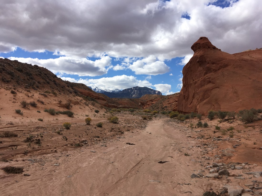
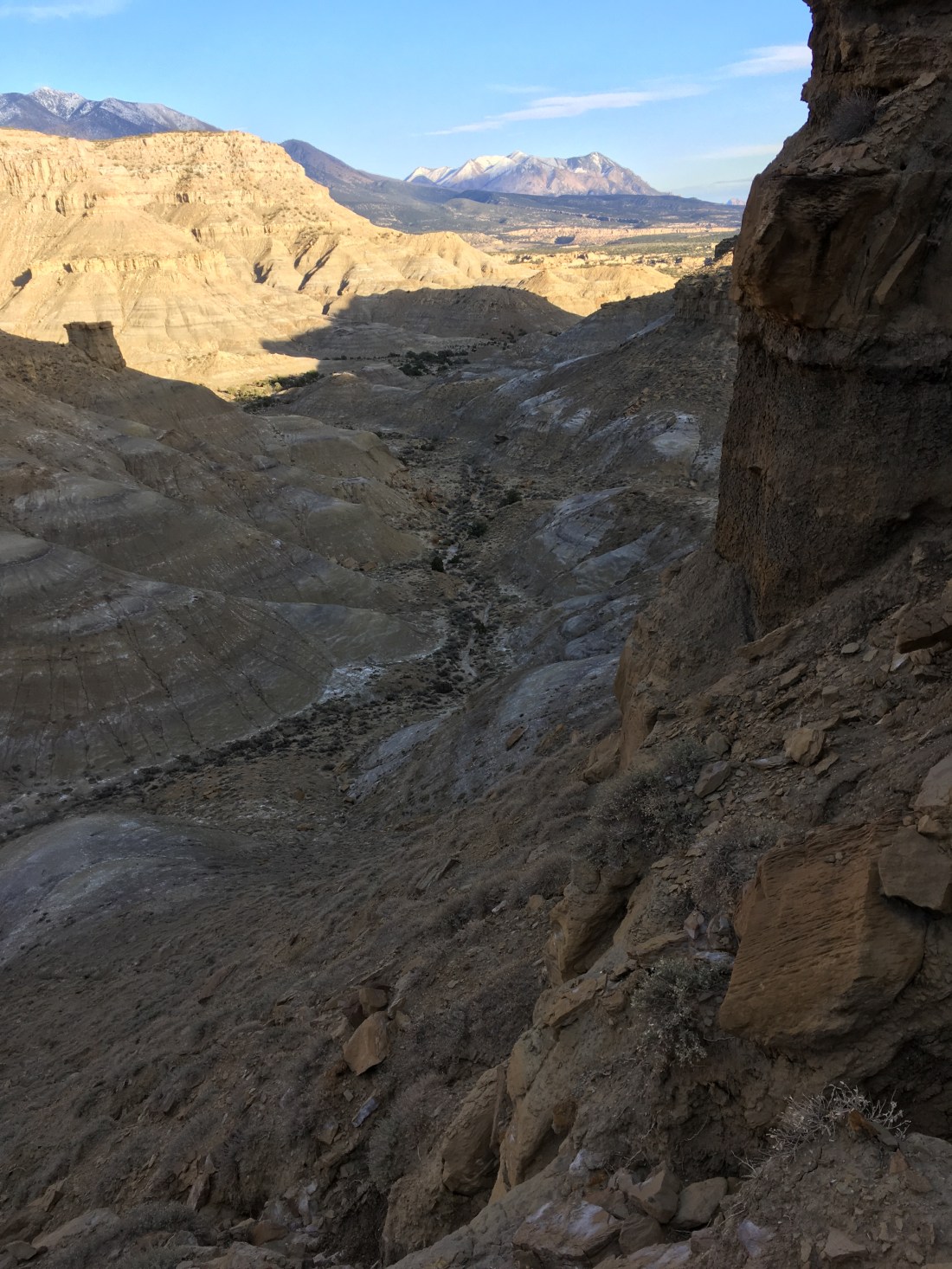
After a quick road walk and cutting up a sandstone slope, I followed a 4×4 road along the Orange Cliffs (according to a kiosk I passed). I had zoned out and missed the point where I was supposed to turn off and just follow the canyon and so had to hike back a ways.

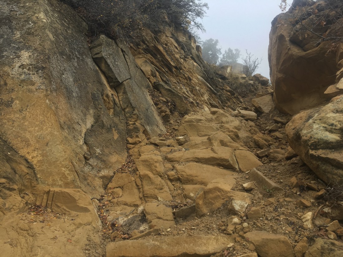
I was having a little trouble lining the map up with the narrowing canyon and so just didn’t worry about it since the next move was to exit the canyon by climbing a crack near the end. Unfortunately, when you’re not paying attention, you run out of canyon having seen many cracks but none you can climb.

I’d actually gotten as far as examining one in detail and trying to figure out how I’d place my hand initially like a route at the climbing gym when I realized that someone who usually can’t get up a V2 at an indoor shouldn’t even be thinking about how to scale a 50ft vertical wall. With this, I started wondering if I were going to have to abandon the section, how I’d get a ride to Hanksville, etc… when I rounded the previous bend in the canyon and the exit was obvious.

The crack is about 3x my height but the top third isn’t really a climb. There are nice places to rest after getting one and two body lengths up. This was crucial because I’d never had to haul a pack up. I knotted together some guy lines, tied it around by belt, repacked everything to be inside, and climbed up to the first lip. I had to pull harder than I’d expected but the pack came up without problem. Then then up to the second lip. Unfortunately, the pack is now directly below me. I untie it from my belt in case something goes wrong and try to pull it up. The pack gets stuck and I miss trying to set it back on the first ledge so it goes all the way back down. Fortunately, I have long guy lines. I have to yank it around a few times get the trekking poles which are catching on the underside of the rock to be oriented away and the it comes up with a few hard pulls. I was extremely pleased with myself.

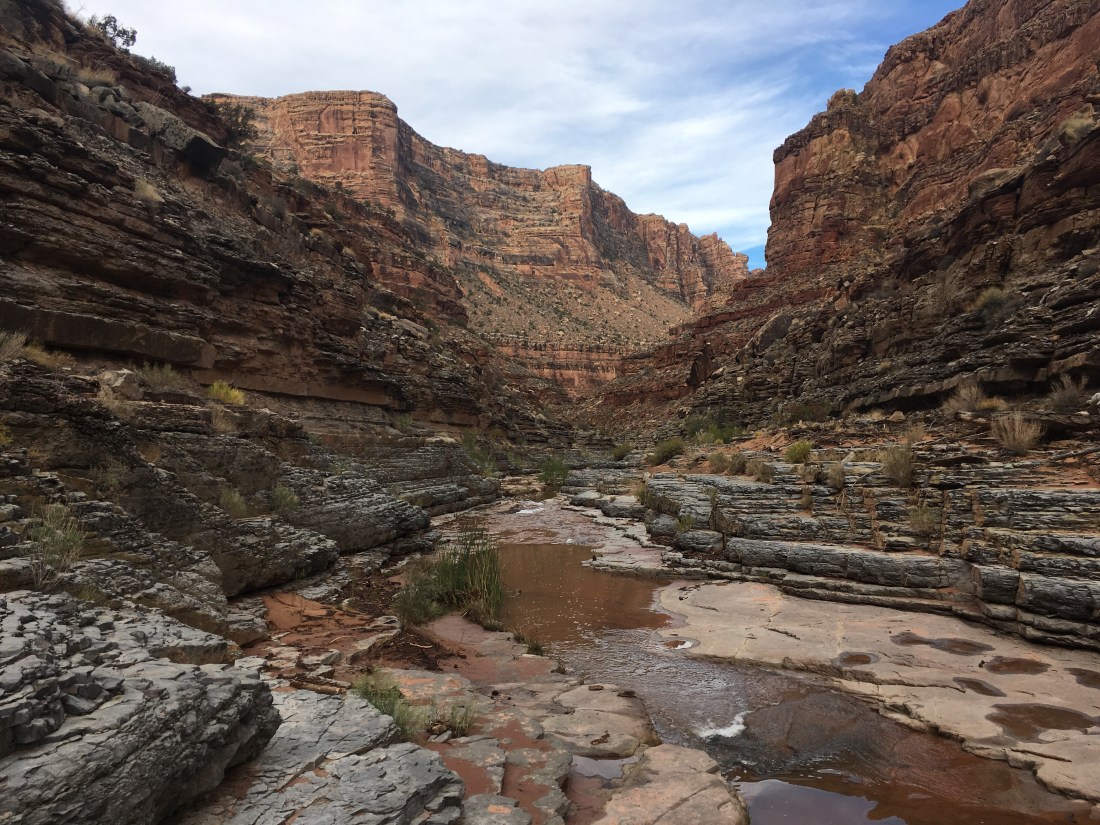
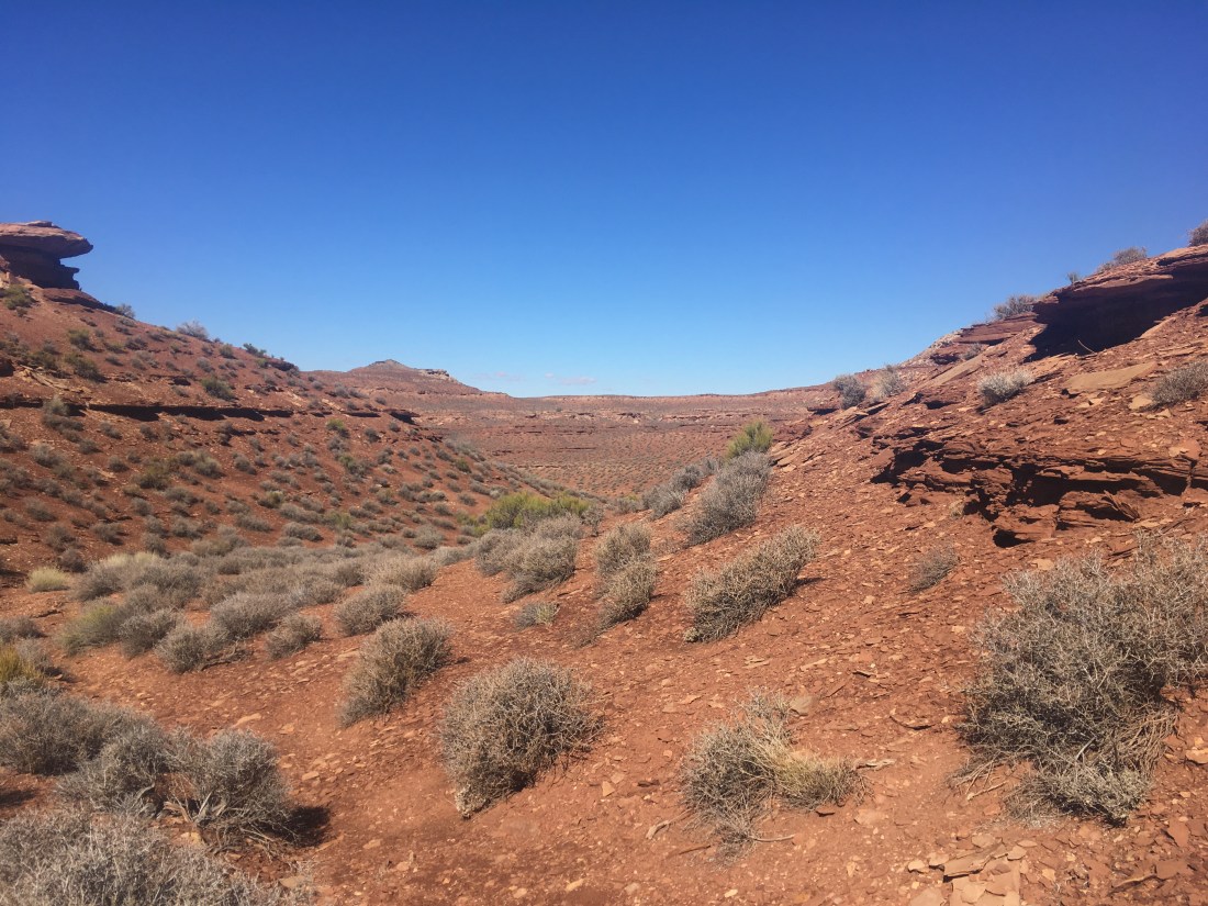
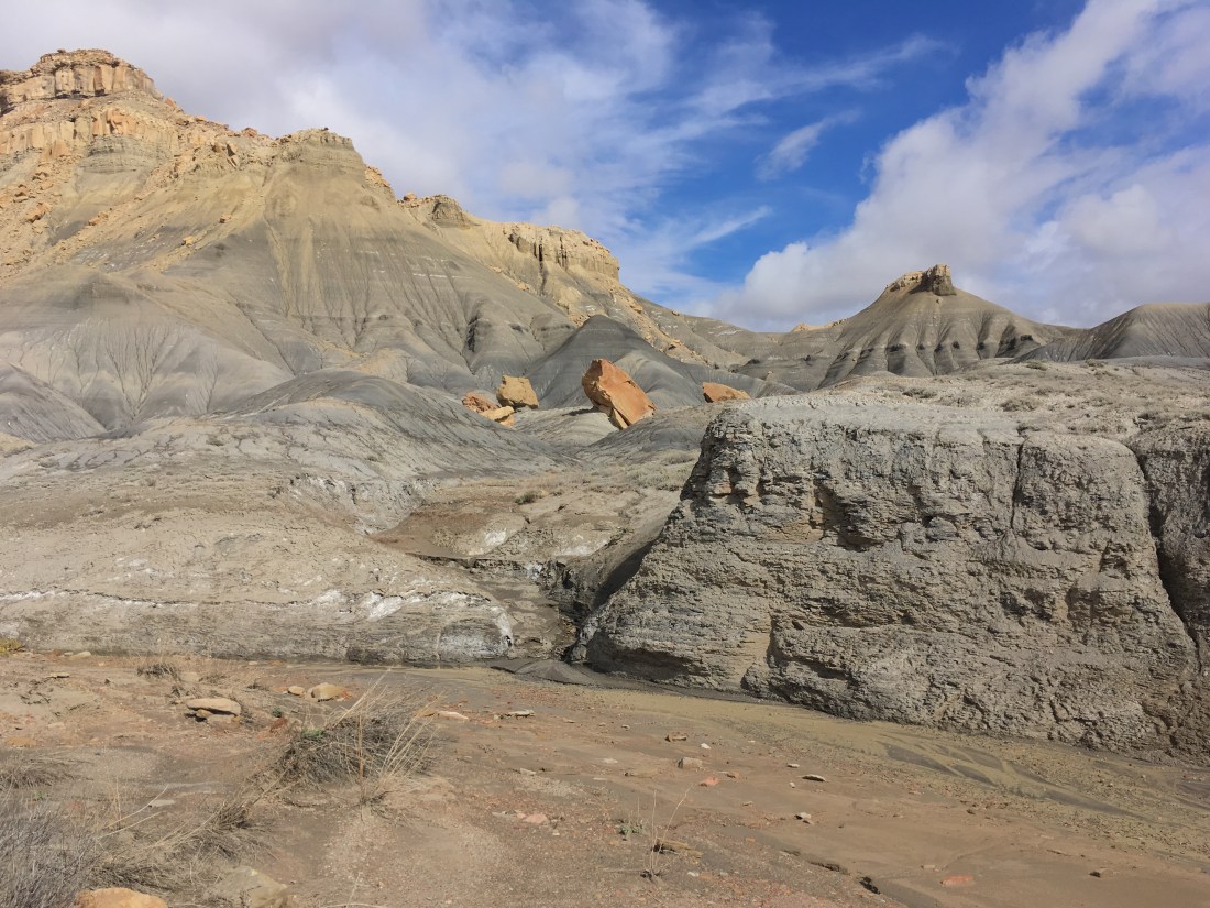
From there, I had cross-country orienteering exercise. I followed Andrew Skurka’s directions instead of the guidebook route. In summary, I made three mistakes where I had to backtrack. Towards the end, I wound up relying pretty heavily on the footprints of someone who passed recently enough that their tracks were deep because of the recent rain. After a lot of expletives both from frustration and sudden insight, I wound up at the lip of Fiddler’s Cove and contoured to the entry point.

The descent into Fiddler’s Cove was exhilarating without ever feeling dangerous. It’s steep and twisted enough that you can’t see how the whole thing will go and just have to trust that it will. A few well placed cairns help you keep the faith.

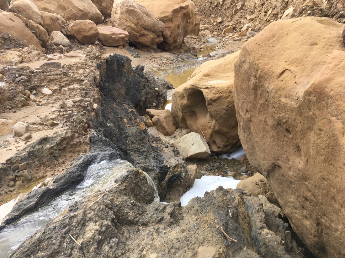
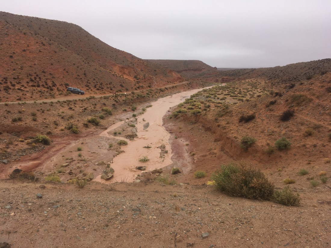
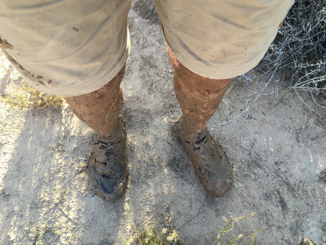
After a quick jaunt from Fiddler’s Cove to the Dirty Devil River, I ate dinner and then got started working my way up river. It’s deep enough that I have to pick my crossing points or risk getting in too deep. I like wide, fast moving water with ripples to indicate rocks. You have to cross many times because some the turns run up against canyon wall. The worst crossing so far (I’m probably about a quarter of the way I need to go) took me about a hundred yards and three attempts to find. It as mid-thigh deep with a muddy bottom but at least I didn’t have to backtrack. I’m getting better at reading the water and only stopped hiking when I went down to the bank to cross but the moonlight wasn’t enough to discern what pattens the water was moving in.

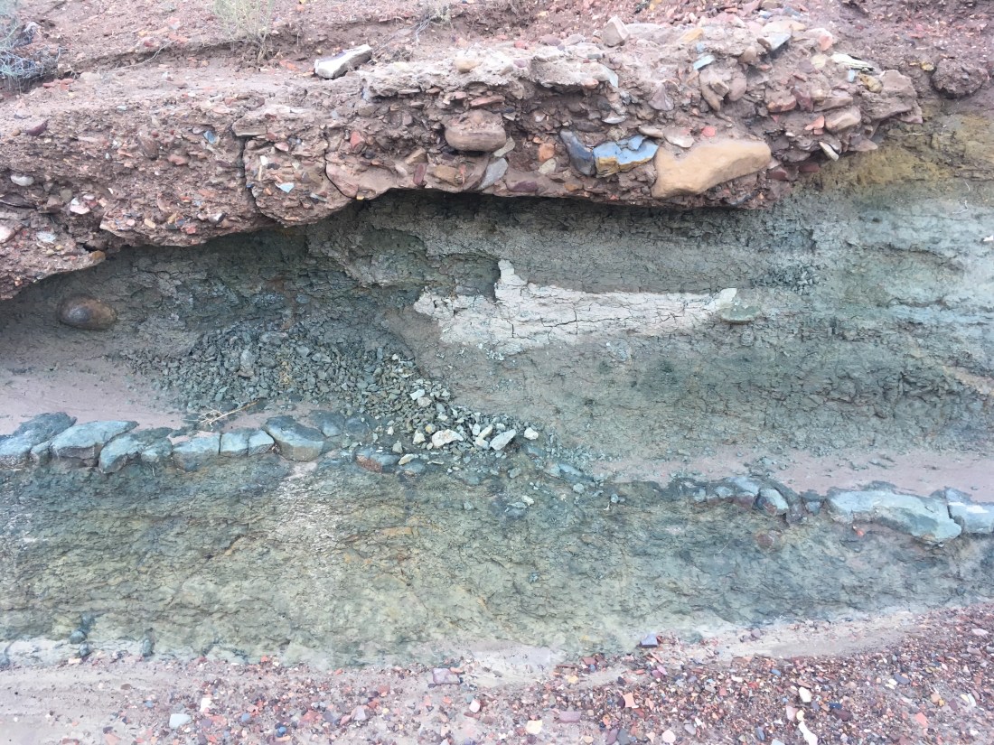
The Dirty Devil has about three sets of banks. The lowest are covered in slick mud and are at or near water level. These are bare or have thin reeds you can easily push through. The second level is semi-dry sand and has all kinds of bushes which cut up my legs as I try to get to the water’s edge. The second bank may be 6ft above water level and so sliding down then to the first bank can be fun. The third bank, usually sloping a little up from the second is dry sand and only has low plants. It’s the nicest for walking but the eye-level bushes on the second level of bank prevent you from seeing the water and so identifying a good crossing point. This makes for a difficult balance of forward progress (the 3rd bank) at the risk of having to double back to find a good crossing point or getting cut up bushwhacking through the second bank so you can drop down to the first bank when you think there might be a good place to cross.

I didn’t make it quite as far as I’d wanted to set up for getting into Hanksville tomorrow but the evening is warm and the stars are out and I’m going to sleep.

Hayduke Day 9

Memories from October 12, 2018.

Dark Canyon was quite easy after Young’s Canyon yesterday. Most of the time there are flat solid rock ledges to walk in above the river. From time to time you have to cross but not as frequently as other canyons wheee you had to cross every time the canyon turned. However, with the ledges there wee fewer crossing points where you could get down and then up the other side. It made an interesting game.

Getting out of Dark Canyon is done by hiking the Sundown Trail. There are so many crisscrossing paths near the base of the climb, it took me a few tries to find the one which actually went up. When I got to the top there were more crisscrossed trails. I followed a fresh set of tracks to know which ones to follow though some guesswork was still required as when they disappeared until I found them a steep but walkable sandstone slope.

After that it was road walking to Hite to get water. As far as road walks go, this had very nice views. I wouldn’t have minded a hitch to speed things along.

Hite itself seemed oddly absent of human life. On my way in, a car passed first coming then going. That and other cars in the distance were my human contact for the day. I’d been hoping to camp at Hite (I couldn’t figure out if it was an option and there was no one to talk to) so I refilled water and left.

Tonight I’m cowboy camping (finally) begins a rock which slopes away from the road like a horseshoe. Tomorrow morning I walk across the bridge over the Colorado River and into section 4.