Hayduke Day 12

Memories from October 15, 2018

I woke up in town, finished my blog posts, ate breakfast, got my resupplying boxes from the post office, exploded my backpack, then filled it up with new food and cleaned gear. Then I went to hitch back to the trail.

It took about an hour and twenty minutes to get a hitch. After the first hour, I got a milkshake and asked the cashier for a cardboard box with which to make a sign. After moving to a better spot, I got a ride from a beer drinking pair who had trouble staying straight in the lane. They also gave me some chapstick.

After getting dropped off at Poison Springs, it was a little hard to find the ATV road where the trail was supposed to continue. I made it to the guidebook’s first waypoint easily. I’m really not sure what happened thereafter.

The book says to follow to a T intersection. The T intersection I came to was definitely not the right one. I tried to piece something together from Skurka’s notes (which say that the map doesn’t show the roads correctly) but eventually gave up. With two hours of daylight I finally used the GPS to find my way back to a Crescent Creek Rd. GPS is so convenient.

My objective for the evening was to get to what looked like a small pond after a small mining operation. While walking the road, an ATV came by in the opposite direction and asked if I was OK. He said they’d rescued three women off the pass over which the route goes. The top of Mt Ellen is covered in snow and I had been planning on taking an alternate. He confirmed it would be clear. Much thanks to Mike McCandless.

Mike had said it was 15F and I’d noticed that despite hiking hard, I wasn’t cold so I put on everything I have while still warm. The reservoir as the pond turned out to be was well sheltered. I’ll collect water in the morning so it doesn’t freeze overnight.

Hayduke Day 13

Memories from October 16, 2018.

I took the bypass route around Mt Ellen today so everything was a road walk. It was actually quite pleasant morning because there was this odd feeling that I was walking through a landscape painting. Something about the colors and muted light.

In the afternoon I descended off Tarantula Mesa. I had a hard time finding the start because I was sure there would be cairns be there weren’t any even though everything was lining up on the map. Finally I realized that I’d made the mistake of not getting close enough to the edge. Sure enough, there was another 20yds of the same point of land that I was on.

The actual descent was much sketchier than the one into Fiddler Cove or either descent in Young’s Canyon. Notably, instead of dirt, it was dry mud which crumbled easily. Also, there were a few places where the distance to the rock below was just a little too far to be done easily. I damaged my pot by dropping my pack down first so I could balance without it. There were several places where I would not have guessed that the trail would go without cairns.

Tonight when I went to send a waypoint in my InReach, I discovered that I’ve lost it. The nearest road is the Burr Trail road in about 10 miles so I’ll go there and hope to find people with whom I can leave a message for my parents. My parents will probably call search and rescue after not getting a message for 48hrs so as much as I hate it, I’m going to have to treat this like an emergency. No map and compass guesswork tomorrow, all GPS.

Hayduke Day 11

Memories from October 15, 2018.

There was a lot of wind last night. This doesn’t usually matter on a warm night but at some point moves into a depression a few feet away to have less sand blown in my face and my inflatable pillow get blown away in the process so I used my shoes instead.

The Dirty Devil dance, a side moving two-step that looks a lot like good stream crossing technique continued this morning until about 10am. Neoprene socks made this a much better experience.

Final score: two misadventures in deep, sucking mud (no shoes lost); two falls onto sticky mud, one instance of getting cliffed out; three failed crossing attempts; zero encounters with quick sand; and one pair of shorts which are still dry. The trick to the dry keeping the short part of zip-off pants dry is that I have far thighs and can pull leg hole up and the larger size of the thigh holds them up.

The little boy in me was smiling.

From there it was just canyon cruising for 15 miles to the road where I could hitch into Hanksville where I have a resupply box.

On nearing the road, I saw an SUV with its flashers on and three people who, as I got closer, looked like hikers. Two were getting off trail and dropping off the third back at the trail. It was a little awkward to introduce myself in the middle of their goodbyes. It turns out that I’d seen their entry in the Needles Outpost log and it was Superhip whose footprints I had followed across the Red Benches the day before when I was struggling to reconcile map, compass, and directions. I’m pretty sure that I later overheard myself described as “overeager” which is probably accurate given that I hadn’t talked with a human (besides myself) in over two and a half days.

The two leaving trail graciously gave me a ride to Hanksville and recommended I ask about a hiker discount at the motel. There was a discount but the heater didn’t work. The shower was hot and the internet connection fast enough to get photos uploaded.

Hayduke Day 10

Memories from October 13, 2018.

Today had even more adventures than usual.

I woke up when I opened my eyes at some point and realized that instead of stars I could see things next to me. My sleeping pad popped last night a few seconds after I tried reinflating it while laying on it. This meant I spent most of the night separated from a rock by a few millimeters of plastic. I’ve been sleeping on my backpack because of a slow leak in my pad but wanted to be up and out quickly this morning and so left my things all packed up except for my sleep system. It wound up being good that I just threw my quilt in the top and hiked because there was a lot of condensation last night and I had to leave my quilt out twice for it to dry sufficiently.

After a quick road walk and cutting up a sandstone slope, I followed a 4×4 road along the Orange Cliffs (according to a kiosk I passed). I had zoned out and missed the point where I was supposed to turn off and just follow the canyon and so had to hike back a ways.

I was having a little trouble lining the map up with the narrowing canyon and so just didn’t worry about it since the next move was to exit the canyon by climbing a crack near the end. Unfortunately, when you’re not paying attention, you run out of canyon having seen many cracks but none you can climb.

I’d actually gotten as far as examining one in detail and trying to figure out how I’d place my hand initially like a route at the climbing gym when I realized that someone who usually can’t get up a V2 at an indoor shouldn’t even be thinking about how to scale a 50ft vertical wall. With this, I started wondering if I were going to have to abandon the section, how I’d get a ride to Hanksville, etc… when I rounded the previous bend in the canyon and the exit was obvious.

The crack is about 3x my height but the top third isn’t really a climb. There are nice places to rest after getting one and two body lengths up. This was crucial because I’d never had to haul a pack up. I knotted together some guy lines, tied it around by belt, repacked everything to be inside, and climbed up to the first lip. I had to pull harder than I’d expected but the pack came up without problem. Then then up to the second lip. Unfortunately, the pack is now directly below me. I untie it from my belt in case something goes wrong and try to pull it up. The pack gets stuck and I miss trying to set it back on the first ledge so it goes all the way back down. Fortunately, I have long guy lines. I have to yank it around a few times get the trekking poles which are catching on the underside of the rock to be oriented away and the it comes up with a few hard pulls. I was extremely pleased with myself.

From there, I had cross-country orienteering exercise. I followed Andrew Skurka’s directions instead of the guidebook route. In summary, I made three mistakes where I had to backtrack. Towards the end, I wound up relying pretty heavily on the footprints of someone who passed recently enough that their tracks were deep because of the recent rain. After a lot of expletives both from frustration and sudden insight, I wound up at the lip of Fiddler’s Cove and contoured to the entry point.

The descent into Fiddler’s Cove was exhilarating without ever feeling dangerous. It’s steep and twisted enough that you can’t see how the whole thing will go and just have to trust that it will. A few well placed cairns help you keep the faith.

After a quick jaunt from Fiddler’s Cove to the Dirty Devil River, I ate dinner and then got started working my way up river. It’s deep enough that I have to pick my crossing points or risk getting in too deep. I like wide, fast moving water with ripples to indicate rocks. You have to cross many times because some the turns run up against canyon wall. The worst crossing so far (I’m probably about a quarter of the way I need to go) took me about a hundred yards and three attempts to find. It as mid-thigh deep with a muddy bottom but at least I didn’t have to backtrack. I’m getting better at reading the water and only stopped hiking when I went down to the bank to cross but the moonlight wasn’t enough to discern what pattens the water was moving in.

The Dirty Devil has about three sets of banks. The lowest are covered in slick mud and are at or near water level. These are bare or have thin reeds you can easily push through. The second level is semi-dry sand and has all kinds of bushes which cut up my legs as I try to get to the water’s edge. The second bank may be 6ft above water level and so sliding down then to the first bank can be fun. The third bank, usually sloping a little up from the second is dry sand and only has low plants. It’s the nicest for walking but the eye-level bushes on the second level of bank prevent you from seeing the water and so identifying a good crossing point. This makes for a difficult balance of forward progress (the 3rd bank) at the risk of having to double back to find a good crossing point or getting cut up bushwhacking through the second bank so you can drop down to the first bank when you think there might be a good place to cross.

I didn’t make it quite as far as I’d wanted to set up for getting into Hanksville tomorrow but the evening is warm and the stars are out and I’m going to sleep.

Hayduke Day 9

Memories from October 12, 2018.

Dark Canyon was quite easy after Young’s Canyon yesterday. Most of the time there are flat solid rock ledges to walk in above the river. From time to time you have to cross but not as frequently as other canyons wheee you had to cross every time the canyon turned. However, with the ledges there wee fewer crossing points where you could get down and then up the other side. It made an interesting game.

Getting out of Dark Canyon is done by hiking the Sundown Trail. There are so many crisscrossing paths near the base of the climb, it took me a few tries to find the one which actually went up. When I got to the top there were more crisscrossed trails. I followed a fresh set of tracks to know which ones to follow though some guesswork was still required as when they disappeared until I found them a steep but walkable sandstone slope.

After that it was road walking to Hite to get water. As far as road walks go, this had very nice views. I wouldn’t have minded a hitch to speed things along.

Hite itself seemed oddly absent of human life. On my way in, a car passed first coming then going. That and other cars in the distance were my human contact for the day. I’d been hoping to camp at Hite (I couldn’t figure out if it was an option and there was no one to talk to) so I refilled water and left.

Tonight I’m cowboy camping (finally) begins a rock which slopes away from the road like a horseshoe. Tomorrow morning I walk across the bridge over the Colorado River and into section 4.

Hayduke Day 8

When I woke up it was raining. Today had what sounded like some intense route finding across steep canyon sides so I waited out the rain before descending into Horse Pasture.

The first thing the guidebook makes a big deal about is the climb to bypass a large pour off in Young’s Canyon. That climb really didn’t feel so bad compared to the exit from Butler Wash yesterday.

The one notable difficulty was figuring out how to get out of a chimney which I’d entered with my backpack. I wound up stashing my pack in a bush which was blocking the top so I could climb out over it, then to extract my pack had to pull it under the bush.

Walking over to the descent back into Young’a Canyon was an exercise in imprecision as I followed the rim, my compass, and various use trails at will. I wound up on the wrong overlook but it was an obvious mistake 1) because there was no way down and 2) because there was a beaten path to the correct overlook. The correct overlook is as far west as you can get while following the rim without starting into a side canyon to the south.

The first part of the descent would have been a disaster without the cairns marking a pretty clear route. At one point I almost didn’t make a turn because I thought I’d gotten to the bench mentioned in the guidebook when I was still above it.

After passing the gap between the canyon wall and the “pinnacle”, things got steeper, more narrow, less obvious, thinner, more likely to slide under your feet, etc… (aka sketchy) but it was still either pretty obvious where you needed to go or caromed. This was huge for me because I probably wouldn’t even have correctly identified the start of the descent without a hint.

Back in Young’s Canyon, there was bush whacking. To avoid this, I tried to find little trails on the sides above the stream. One of these lead to a USGS marker and then dead-ended so I cut back to the canyon bottom just in time to run across the pour off which Skurka’s Supplement mentions can bypassed by contouring, descending, contouring, and more descending. So simple the guidebook doesn’t even mention it. I started the contour and at some point noticed a few sticks blocking the trail. This is the universal symbol for “the trail after this is not where you want to go”. I stepped over them because I didn’t see anything else that could be a trail. After I’d gone far enough for it to be clear I’d gone too far, I doubled back and noticed not one but two cairns near the stocks. After a few seconds of searching that this was the beginning of the next descent. The trail wasn’t immediately distinguishable from general rubble but didn’t immediately get clogged out either. It looked impassable but that was just from where I stood. This has been the big lesson today. It’s really hard to tell whether something goes. Unless it’s a vertical cliff, it might be the trail.

I’ve decided that the guidebook description of Lower Young’s Canyon as having a few easily bypassed pour offs is a joke because of how hard Upper Young’s Canyon was when they went through. Skurka’s description of the one bypass is probably worth the entire price of his supplement because without it and the cairns I quite possibly would not have figured out the route and certainly not before sundown. The Hayduke readjusts your sense of what is possible and reasonable.

To illustrate, at the end of Young’s Canyon just before the confluence with Dark Canyon, I had to bypass a pour off on steep rubble which overlooks a pool which looked deeper than I was tall. This ended at a small overlook where I could see two guys camping in the other side of the steam. I asked if they could see a way down. They said no but they’d heard there was one. After looking around very carefully I found a place where a few steps would get me to an overhanging ledge. This dropped off (as in I sat above it, pushed off so my pack would clear the edge, and dropped a few feet) onto one rock which dropped onto another which dropped onto the mud. Not particularly dangerous but neither rock was level or had room to catch yourself if you stumbled.

The two guys were named Dave and Josh, a father-son hiking pair with a penchant for obscure canyon hikes. We hit it off and so I decided to call it quits with an hour of daylight despite only making it 7 miles today. They shared whiskey and made a fire. Trail magic. Josh has hiked the AT in 1997 and we traded stories until the coals were dead.

Hayduke Day 7

Memories from October 10, 2018.

I was cold last night because my deflated sleeping pad didn’t insulate against the wet sand very much. I wound up shoving my backpack under my torso and hips which let me pass out but not sleep well. Also, it had been calm when I pitched my tarp so I pitched it high and in the night gusts were coming from all sides.

I successfully tracked every turn of the remaining miles of Butler Wash by compass and was expecting the spire which marks the exit canyon when it came into view.

Getting out of Butler Wash felt like a minor ordeal. However the Fable Valley exit was so much more intense that I can only remember a few things about it.

Getting out of Butler wash involves most of the way up one drainage then cutting over to another, contouring to it’s head, then scrambling out. I actually got lucky with identifying the cut-over point. I was tired of taking steep scrambled to bypass things and saw a gap where a ridge came down and thought I might see if I could bypass a couple of things at once. Then I checked the guidebook and map and realized that this was the point where I switched drainages instead of continuing to go up this one.

Finally getting out of Butler Wash and looking out across Beef Basin (I did see some beef while crossing it) felt so good.

During the descent into the wash after the pleasant walk across Beef Basin, I didn’t see either of the springs I’d intended to refill water at, probably because I came in a little lower than you’re supposed to. I wound up finding relatively clear water in potholes on the way down.

Fable Valley trail should be more popular given that it goes next to the HUGE Gypsum Canyon. Maybe the problem is that it’s accessed by a 4×4 road. The rest of it is pretty ho-hum after that.

[The WordPress app doesn’t show panoramas in its picture selector and I only took panoramas]

Getting out of Fable Valley by means of a side canyon involves, according to the guidebook author “numerous pour-offs. The Skurka supplement says three. I think he has a higher standard for what counts as a pour-off or bypassed two and once on several occasions. By the end I was getting fed up and started looking for bypasses as soon as I thought a pour-off might be coming.

Finally getting to the Dark Canyon Plateau with it’s gentle slope, grass, and trees which were far enough apart not to try to steal the trekking poles you had stashed so you could scramble with both hands.

Tonight ended by unexpectedly finding a campsite in a pleasant spot on the track into Horseshoe Pasture. I’ve given up on my air mattress staying inflated so I spent some time building an elaborate nest with my backpack.

Hayduke Day 6

Memories from October 9, 2018

After packing up to leave the Needles Outpost this morning, I discovered that I didn’t have my trekking poles. I resigned myself to wait until 9am when it opened so I could search the store but managed to catch an employee doing chores to look for me. Ultimately, they were just outside where I’d been trying to patch my sleeping pad. The patch didn’t hold so this morning I tried the rubber cement under tenacious tape. As I’m typing this, I’m feeling that not work either. Nights are pretty warm but I’ll need a new sleeping pad at my next resupply otherwise it could be safety issue as you can lose a lot of heat through the ground without a proper pad.

Leaving out a few shorter sections, the hike had several distinct experiences:

1) Road walk to the Big Spring Trailhead. This means I skipped the last ~4mi of section 3. I accidentally threw out the guidebook page for section 3 forgetting I had a little bit more. The terrain looks pretty difficult so I’m just going to let it go. The road walk however was like flying.

2) Walking good quality trail (a first as previously the route has been on road, rarely maintained trail with navigation hazards, or cross country) to Butler Wash. Also like flying, though I got winded trying to hike too fast uphill.

3) The beginning of Butler Wash which is best thought of as a constant obstacle course. Like doing a lot of slow step-ups at the gym on uneven surfaces.

There was one pour-off which had some trouble navigating around. After exploring a couple of promising options which didn’t quite go, I ended up going back a hundred yards or so and scrambling up a steep dirt slope. On the way up, I saw a nice shallow slope up just another 50yds back. Oh well.

4) The majority of Butler Wash (admittedly, I’m not done with it yet) which was like walking on a beach near the tide line where the sand is reasonably firm. Like flying.

This part of Butler Wash wiggles like crazy (also, it doesn’t seem to be consistently up or downhill) and I was trying to track my progress on the map. Since it’s annoying walking with map and compass in hand and trekking poles tucked under an arm, I would put the map and compass away after having memorized the next few turns the was was supposed to take so I could trace them as I went. I’m one place, I got a NE turn of the wash confused with a side canyon which came in from the east. Multiple other things lined up well enough that when I pulled the map and compass back out to try to find my position, I was thoroughly confused. I walked back until I was sure I knew where I was, then walked the turns carefully watching the compass. This time, however, I got SW and SE backwards when translating from map to compass. I was so confused (side note: all three streams which converged at this point flowed downhill yet there was no outlet and there didn’t appear to be water pooling despite recent rain). I just couldn’t find the place where the wash turned NE. Then I got all the way back to where I was sure that the side canyon joined from the east, read the bearing, and it was NE.

Hayduke Day 5

Memories from October 8, 2018

I waited for it to be sufficiently light to travel without a headlamp before starting today. This paid off as within a few minutes I had made it to the top and the terrain lined up with the map and everything was good again. The rain just made it more epic.

Last night’s decision to stop not quite at the top was a good one because it did rain a little and the alcove provided better shelter than my tarp and ground cloth would have in the shallow mud. However last night I was literally in an in-between state both physically and mentally. This morning’s quick resolution and the ease of following the map and guidebook step by step on this ridiculous cross country route so much better. I didn’t move quickly but it all made sense and the scenery was grandiose.

There is a lot in the guidebook and Skurka’s supplement about the descent down “We Hope So” wash. Taken step by step nothing felt difficult or intimidating as it had the day before. I’m much worse at down climbing than climbing up but there wasn’t really any climbing, just some lowing yourself down with tricep dips and a few feet of steep descent to get between things.

I missed the turn up the Canyon and headed for the Colorado for a few dozen yards before turning around. The sandstone sometimes formed steps at the banks where so it seemed like an urban river walk, though one through a manicured garden.

When the canyon came to an end, the rest of the day was spent road walking. First to salt river where the Hayduke would begin to cut cross country again. However with storm clouds moving in I made a break for the Needles Outpost where I had a resupply box. I got wet anyways. On the walk in, little after noon, I saw my first human since two days ago around around 8am. Until seeing them, I hadn’t even realized. Maybe it’s because there are so many footprints and my imagination passively invents the people who made them.

Since I was passing a ranger station anyways, I stopped in to get a permit in case I don’t make it out of the park tomorrow. The juxtaposition of the two clean couples ahead of me at the Backcounty Office, worrying about water, scenic-ness of an area, the rain, whether there was water in the canyons, dressed in dry, clean clothes compared with my mud-spattered, rain soaked garments was fantastic. At one point someone asked if the rain would let up tomorrow (forecast says it will and I really hope it does as a rotting smell is beginning to emanate from the depths of my backpack) and I laughed quietly because I’m so beyond worrying about getting wet. They overheard me but chose to smile and understand given my sodden state.

Resupplying at the Needles Outpost went quite quickly. After reloading my pack it was only around 3:30pm. However, Caleb wound up helping me find and patch the slow leak in my sleeping pad. Both he and Amber were very welcoming. I paid to sleep in “the cave” which is a blasted out cavern with about the size of five small campsites. My gear is finally getting the drying it needs. Unfortunately, while writing this, I’m detecting that the patch in my air mattress isn’t holding.

Hayduke Day 4

I can’t believe how much happened today. I had to look backs my previous post to know where to start.

My alcove was pretty cozy last night. At one point drops started pooling on the roof near my head but I just had to move a few inches and it as only when the rain was the hardest.

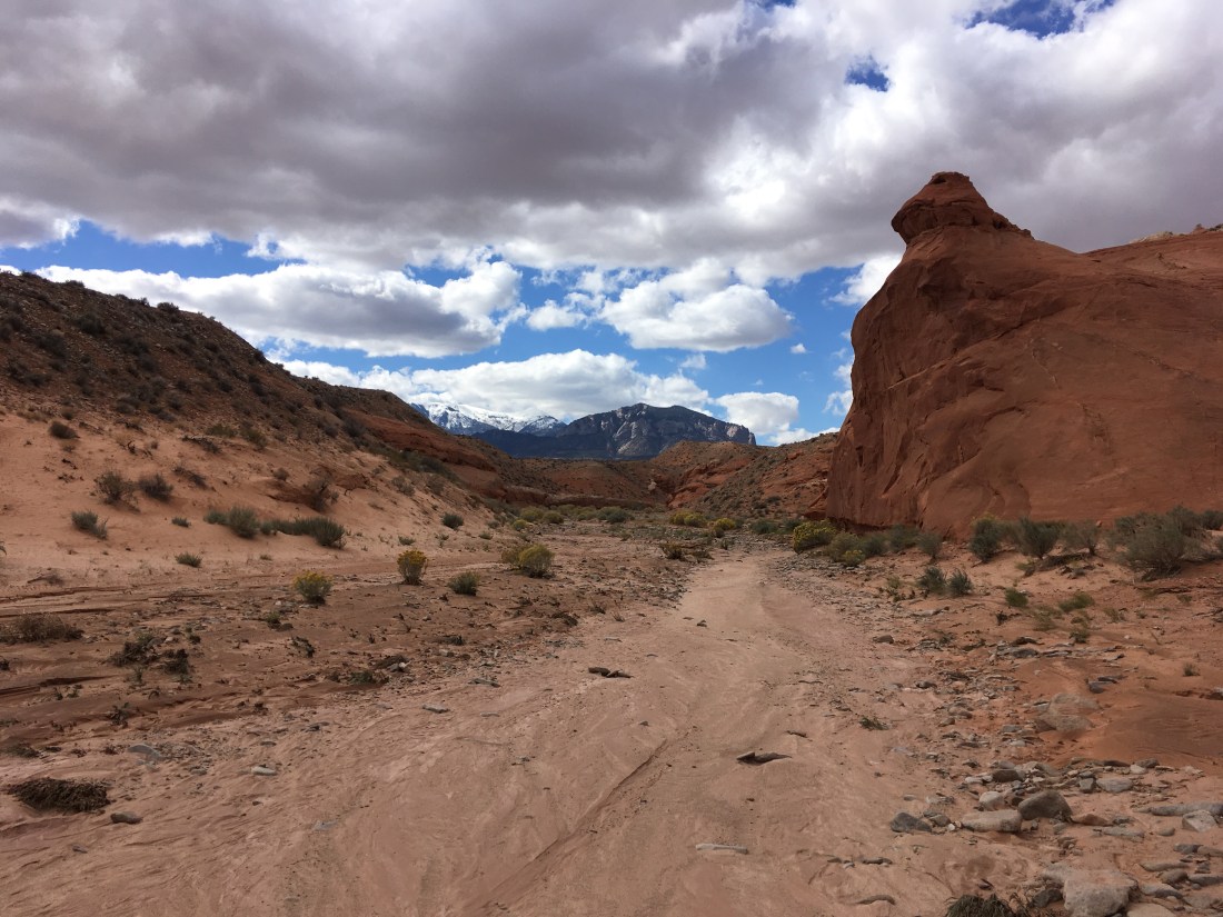
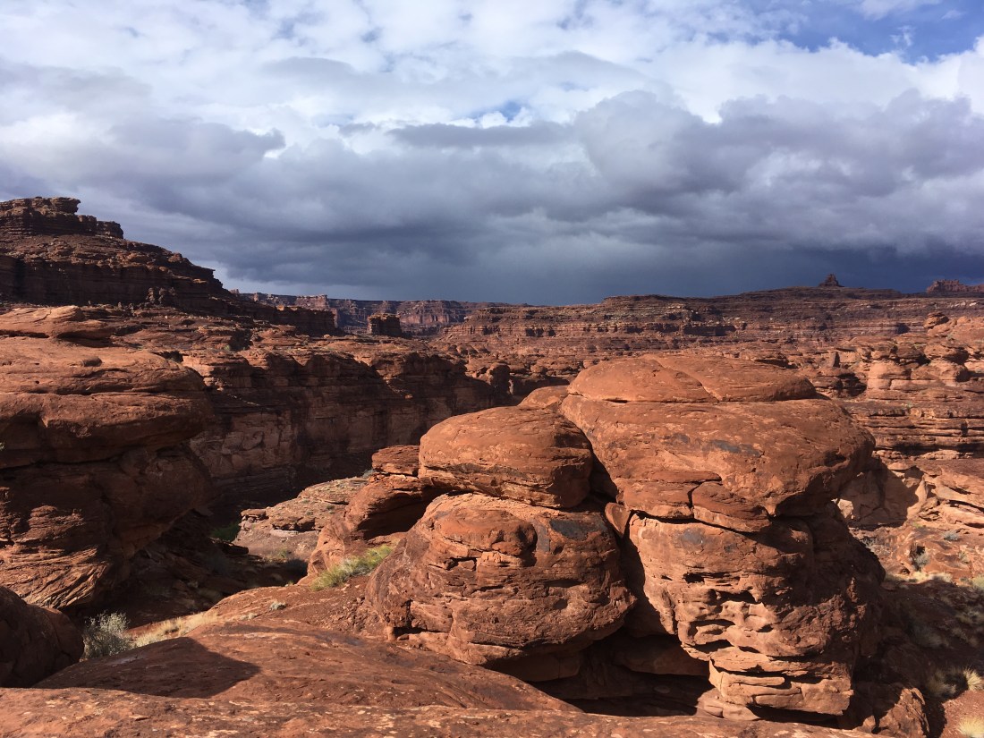
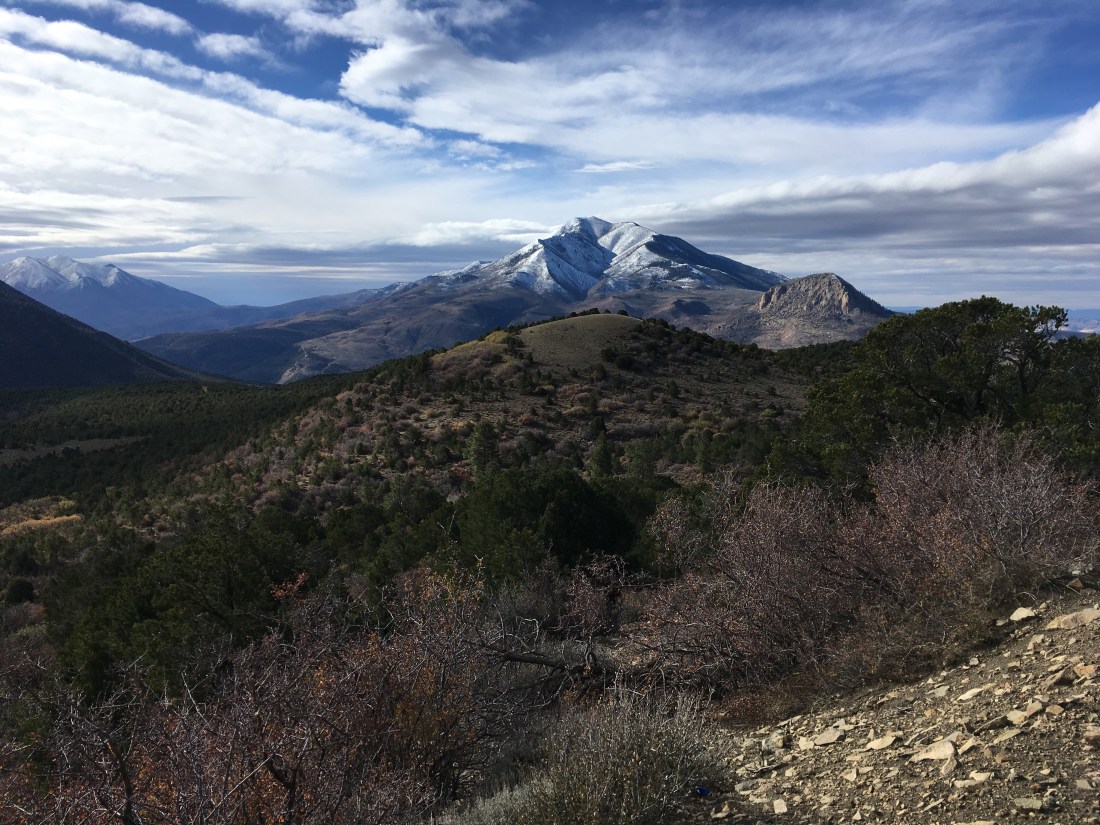
I suited up for a proper rainy day from the get go. While it was wet much of the morning, things never got going very hard and most of the afternoon was dry, even sunny for a moment as I was climbing out of Indian Canyon.

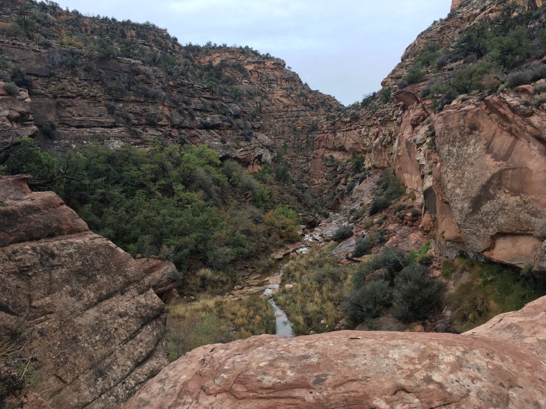
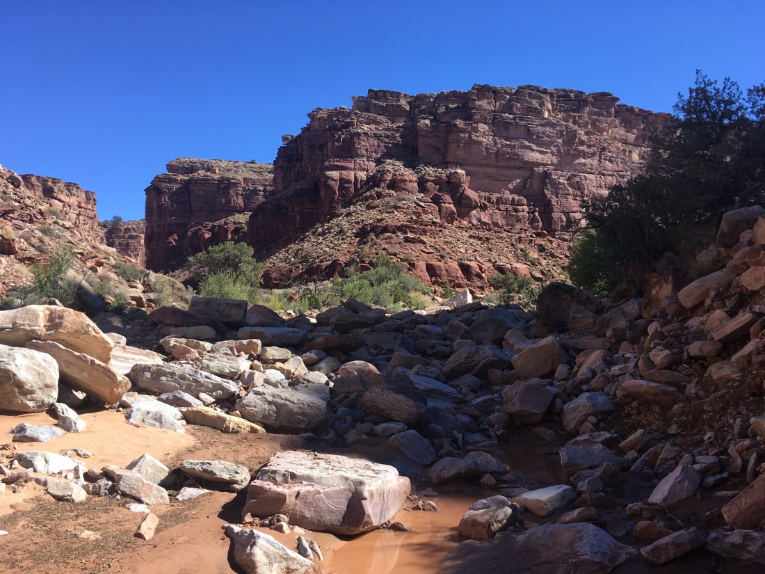
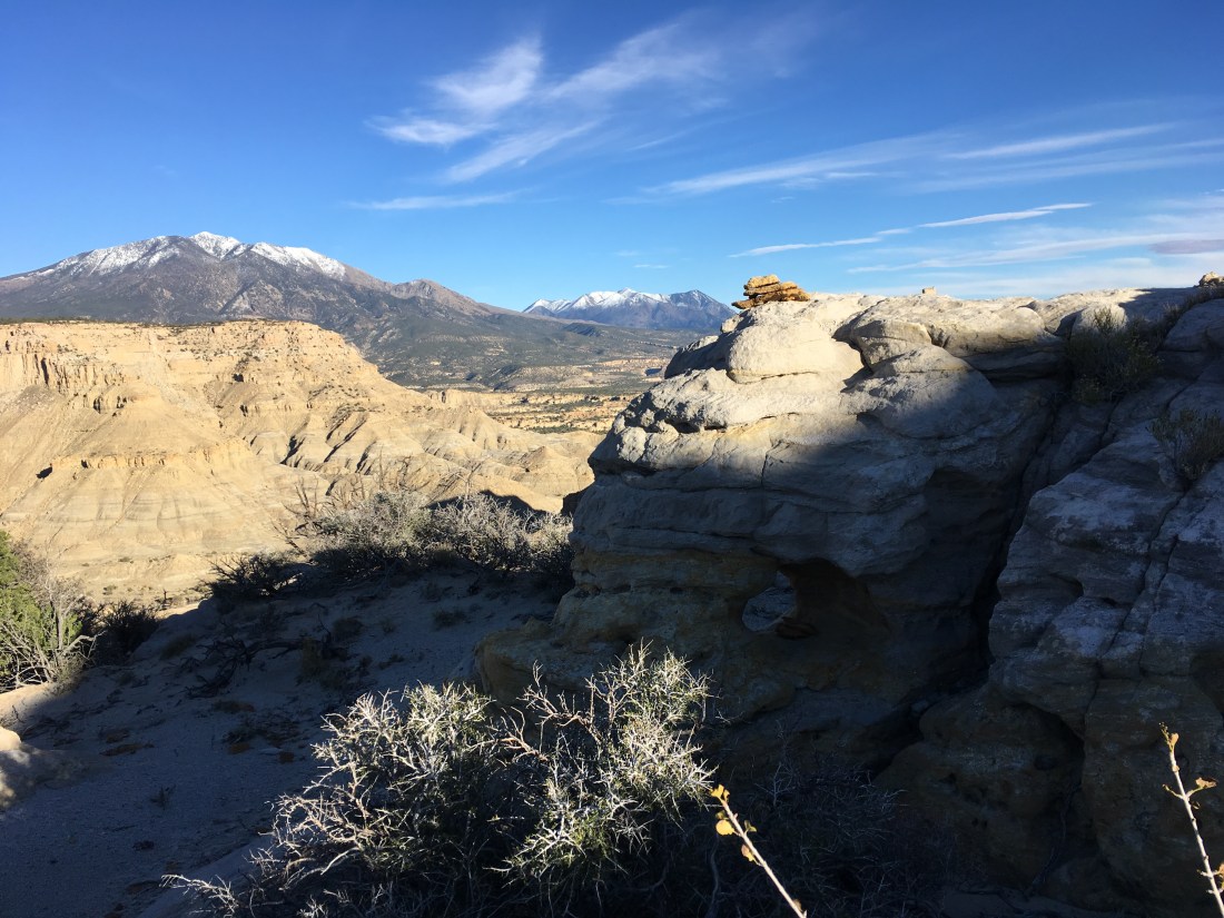
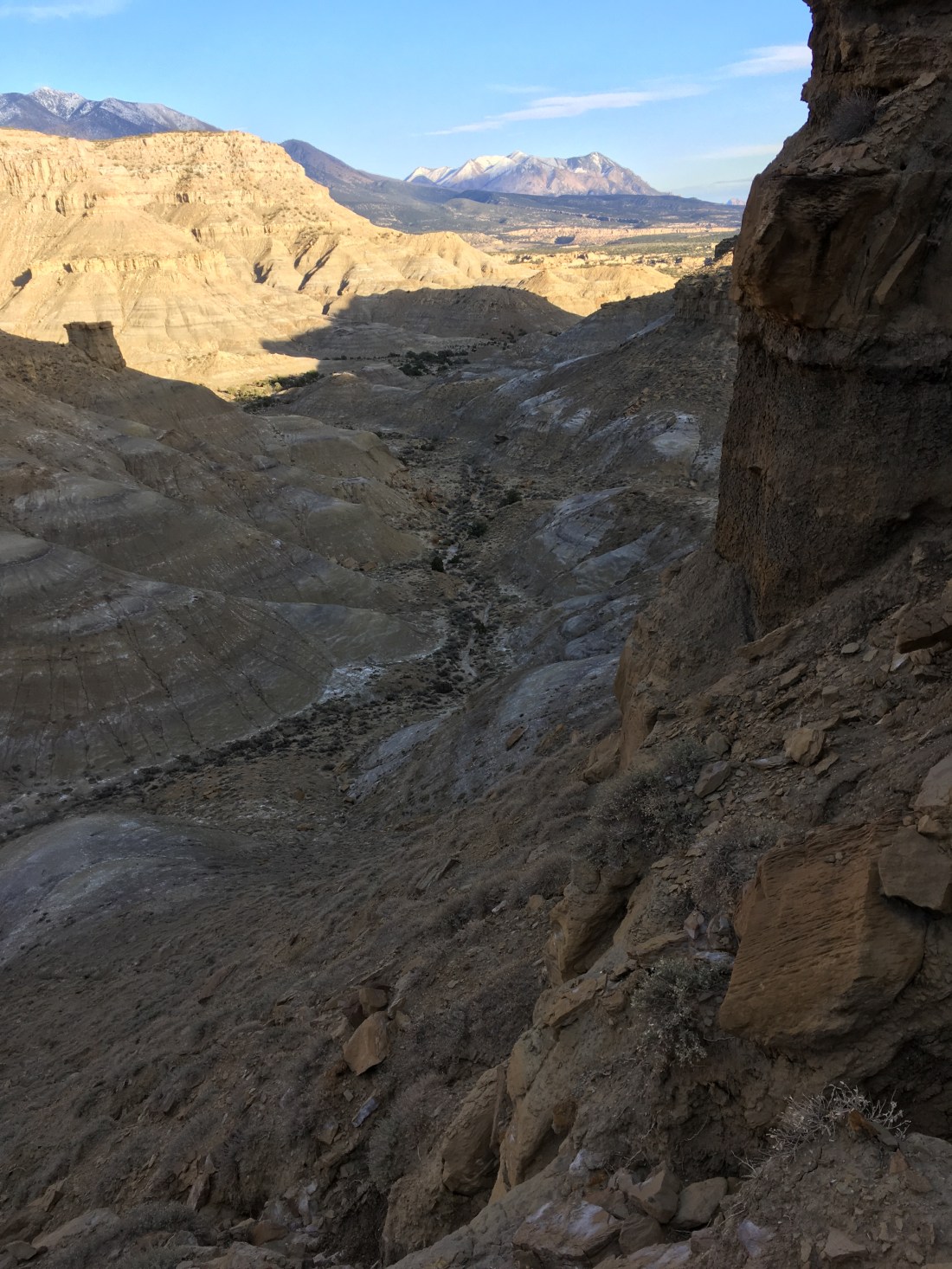
The big pour off was obvious as was the bench across which the route. What learned next was that “desert” means land of red waterfalls.

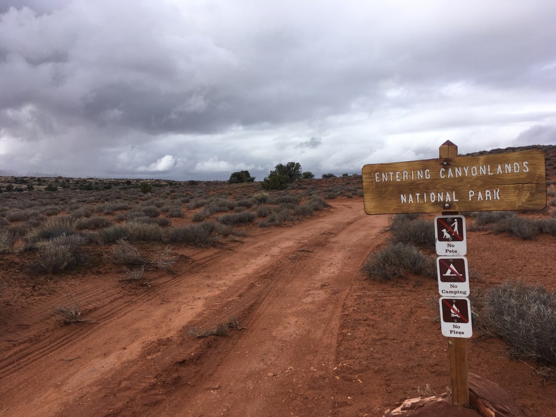
I’d been worried about the descent into Lockhart Canyon with the water flowing in the same places where I might have needed to climb down something but these were unfounded. The turn-off into the canyon was easy to spot and the whole experience was quite pleasant.

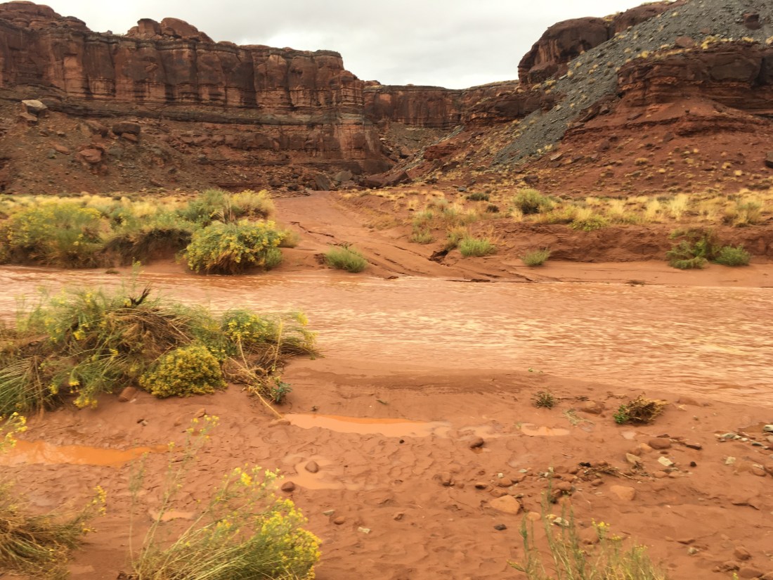
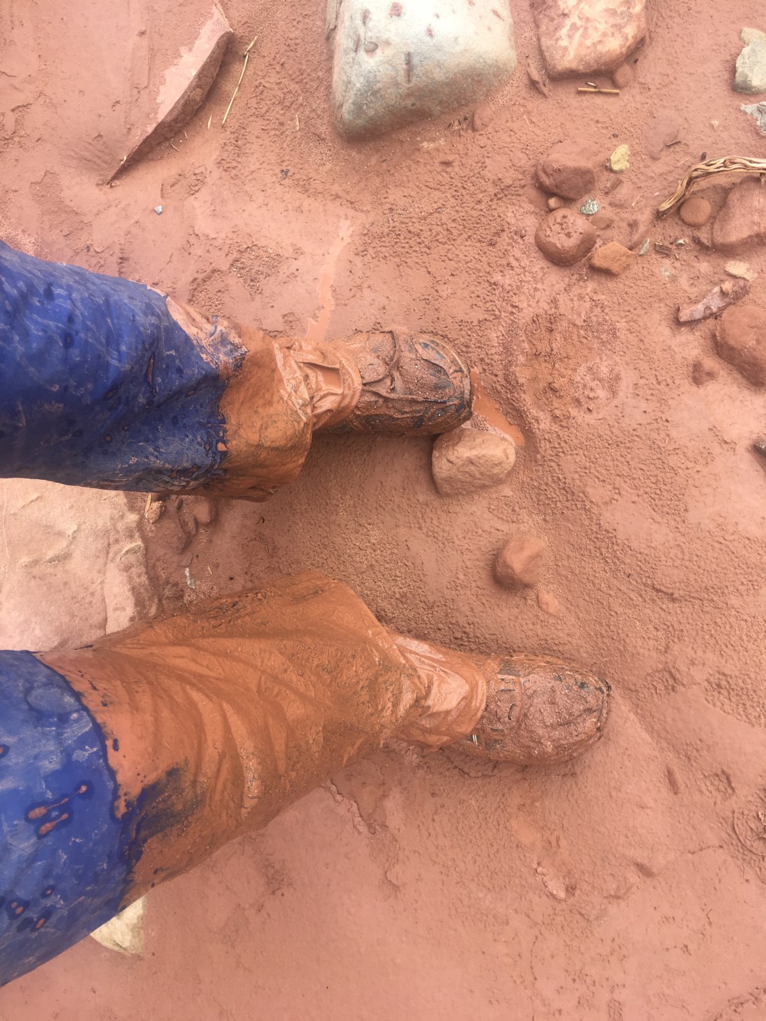
I had put on neoprene socks this morning thinking that it as going to raining all day. Instead those came in useful at the frequent stream crossings as the Jeep road at the bottom of Lockhart Canyon crosses it frequently.

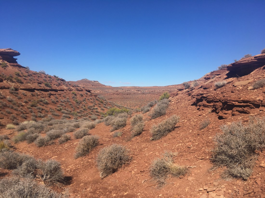
The road appear at to have a 4-way intersection where you turn right. It was actually two three way intersections and this threw me for a bit since at the first intersection none of the directions went west or south which were the directions I expecting to turn or, if it wasn’t the correct intersection, continue.

The road walk to the drill bit was muddy. I don’t thinks this road is almost ever actually used despite being in great shape because my footprints were deeper than any rut.

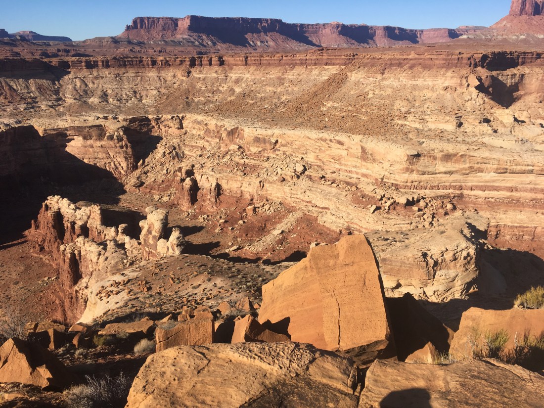
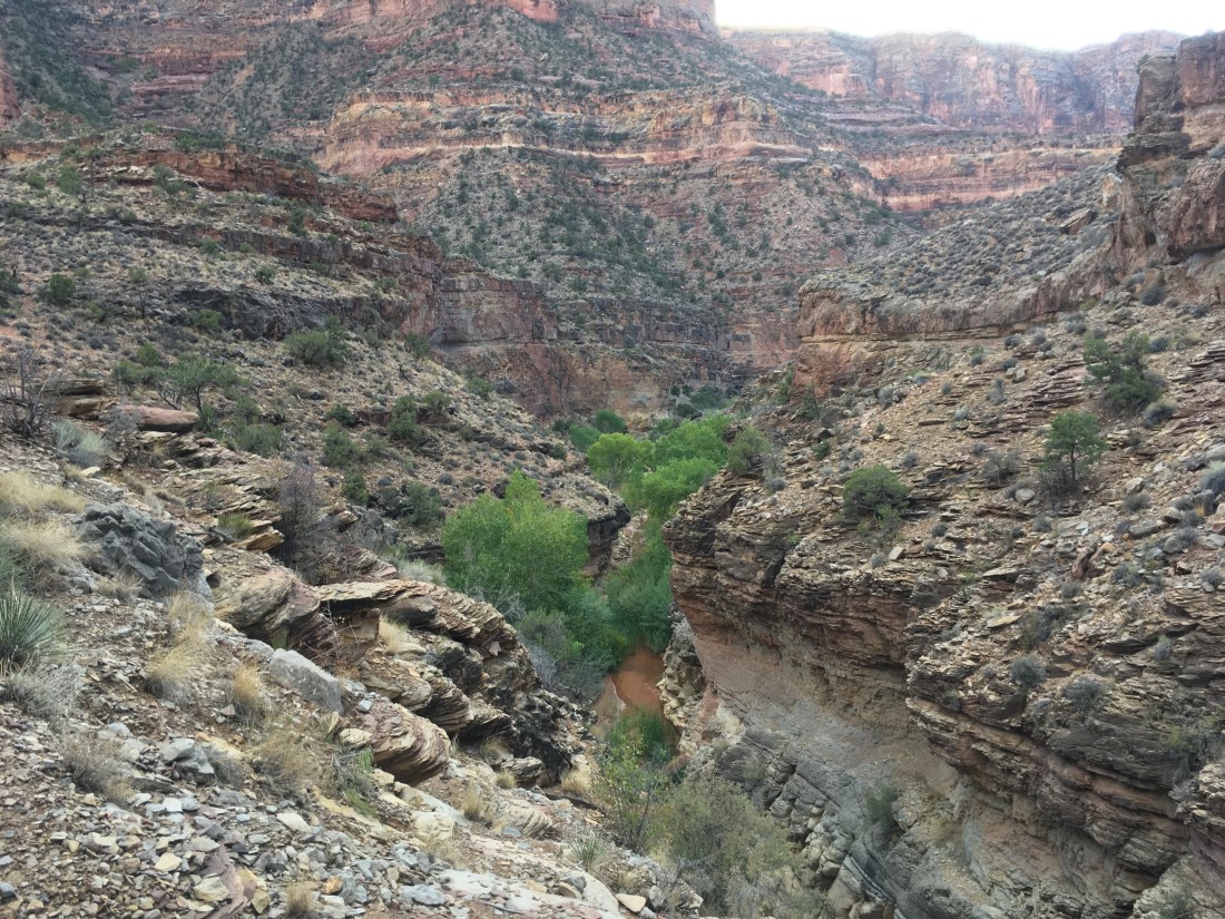
On the descent into Rustler Canyon, I got stuck because there’s a pour off you have to bypass and I didn’t see the bypass immediately.

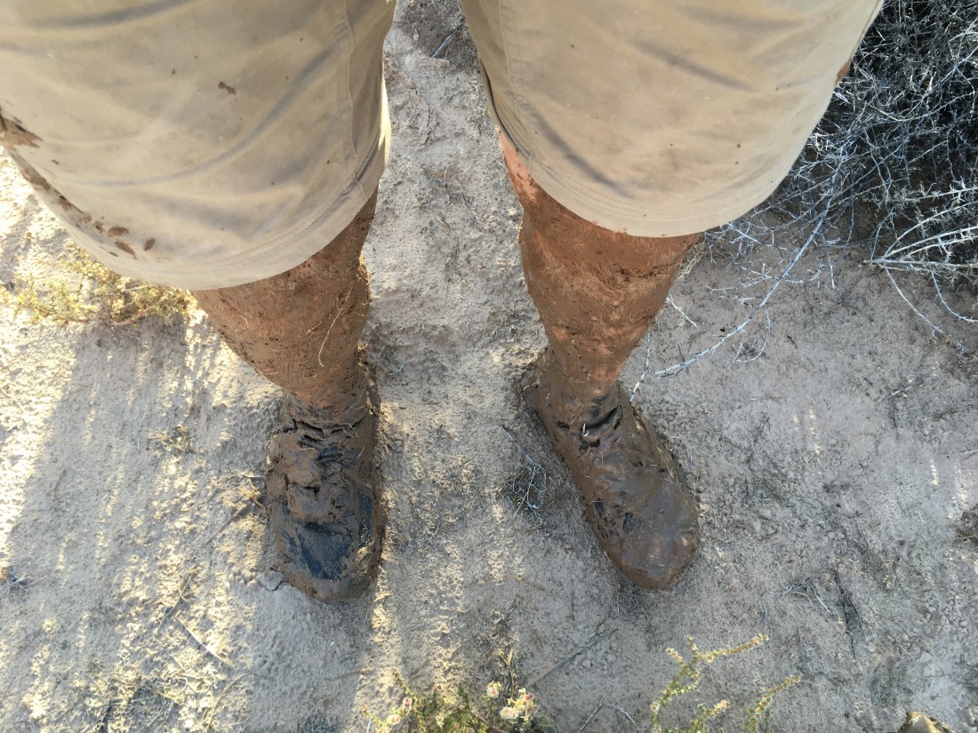
After that it was mostly a pleasant, if slippery and muddy walk. Neoprene socks were definitely a boon.

Then I came across this plunge hole. I thought it might be like the previous pour off and looked for a bypass. It turns out the guidebook says to go down through the hole. This is the scenario I had feared: having to climb down where water was flowing. I removed the guy-lines from my tarp, attached them and a single line to my backpack. Then threw the loose end down so I could pull the pack after me when I climbed down. It turned out to be quite easy as the rock was easy to grip despite being wet and the shelves you use to clamber down weren’t quite as far apart as they’d looked.

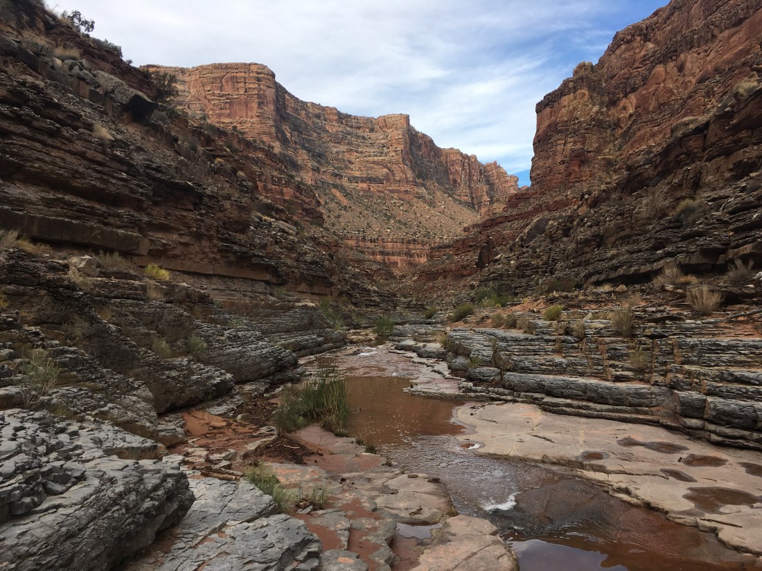
From there Rustler Canyon was a cake walk.

On meeting Indian Springs Canyon, I had a foot step in sand which was at water level and sink almost to my knee. I moved pretty slowly after that.

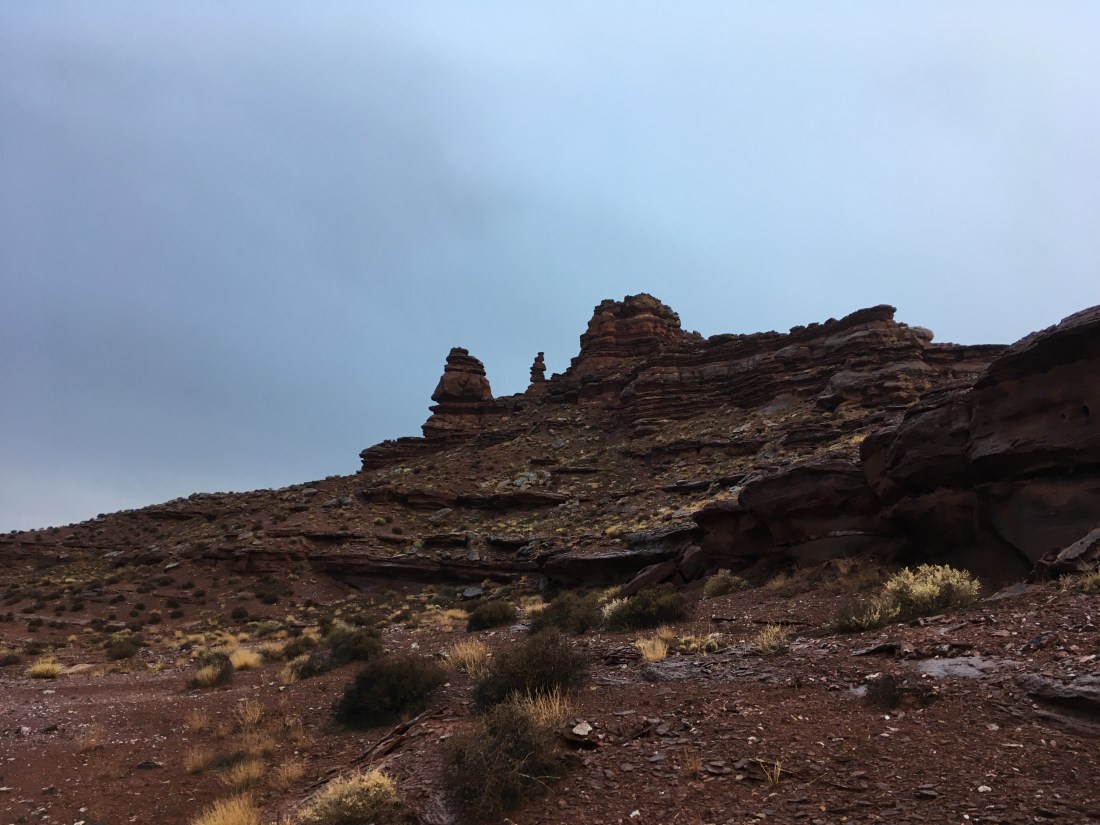
At the eastward turn where you exit Indian Canyon, I drew water and started trying to find my way up the series of ledges the guidebook mentioned. The way up would frequently be visible only once you were right under it. This was disconcerting because I couldn’t tell if I’d gotten high enough to start contouring which is the next step in the guidebook. I spent a great deal of time trying to figure out where thing were supposed to go but was worried about exploring because in the thin, sodden soil. I was leaving deep footprints and as I frequently use footprints as guides and confirmation, I didn’t want to leave a wrong step to confuse others.

I’d just gotten past the second of what wound up being a many-stages process when the sun came out. While it hadn’t been raining constantly, it hadn’t been dry either and I was good to strip off the rain gear and let my feet dry. I was also able to replace some of my muddy river water with clean rain water from depressions in the rocks.

Today closes with me somewhat unsure of where I am. The topography has been hard to align with the map and not wanting to make missteps has worn on me. It has taken a long time to go a very short distance. In one instance I shoved my pack through a crack between two rocks and had to work my way up after it which marks the first time I’ve used a climbing move. Immediately after that, I had to get on top of a large rock by bracing my feet in opposite rocks. Probably not a big deal for climbers but it feels like I’m playing a very different game.

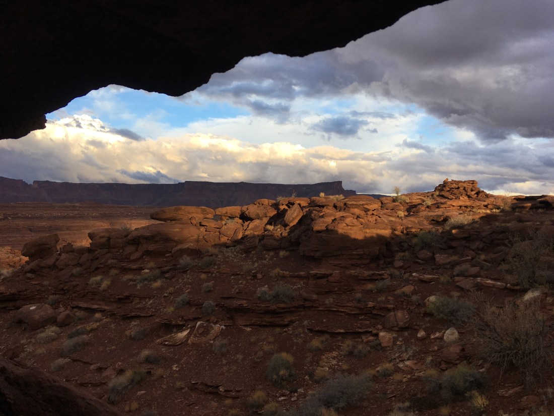
At this point I’m about as high as I can go and decided to find some place to camp since large dark clouds were blowing in to replace the playful white ones. At that point I realized that all the “dirt” (half-dry mud and gravel) on which I could pitch my tarp was too shallow for stakes. So after some desperate searching, I wound up in another alcove, this one not so nice as last night’s: thing and sloped to roll you out. Fortunately the clouds haven’t lived up to their potential. Hope that keeps up.