Friday, May 28
I took the afternoon off work so Lydia and I could get up to the North Cascades National Park Ranger Station in Marblemount in time to get permits before they closed. Unfortunately, I hadn’t packed and so we were about 10 minutes late leaving my place. The plan was to borrow a canoe (the Slick ‘Nanner) from a friend of Lydia’s. Lydia had some concern that strapping it into her kayak carrier upright wasn’t safe (most canoes are carried upside-down on cars). The straps felt tight and the connection seemed solid, but Lydia felt her car pulling to the right as she drove and so we took state highways instead of the interstate. After a while, I took over driving to experience the effect the canoe was having. It was less than the tire alignment problem my first car had had for over a year when I first bought it (I didn’t know what “tire alignment” was and just assumed the car was that way) and so I wound up driving most of the way.
Our schedule had been tight and so with the slower drive, we were going to get to the ranger station after it closed. Instead, we took our time and stopped by a restaurant in one of the rural towns on the way. Normally, I drive right through bent on getting to a trailhead or back home as quickly as possible so the change actually made for a pleasant afternoon. For sleeping accommodations, we explored a forest road which we’d been down the previous winter on a snowshoe trip (which didn’t happen because the road got dangerous once it left the river bottom). Back then, I’d noted some campsites off to the side and thought it would be fun to come back some day and stay at one. This was that day. Surprisingly, they were all occupied and we wound up pitching the tent on a spur road which ended in an unused gate.
Saturday, May 29
I know that getting walk-up permits for campsites in North Cascades National Park can be competitive and so we were up a 4:45am to get back to the ranger station by 6am to stand in line for when it opened at 7am. It turns out they had a take-a-number system, so maybe we could have just grabbed one the night before. Also, we made good time and were there at 5:30am. The first competitor, a ski touring / mountaineering group didn’t arrive until 15 minutes later. No one with a boat showed up until after 6am. We cooked breakfast in the parking lot, then rearranged and packed things into Lydia’s giant blue dry bag. This being a canoe trip, we weren’t worried about bulk or weight. When things didn’t all fit, we just put them in extra dry-bags.
Being first in line did have it’s privileges and we got our preferred itinerary without contest. The one question was whether to put in at Diablo Lake and portage one mile around the Ross Lake Dam or carry everything down from the road directly to Ross Lake. Lydia has issue with her leg at the moment and so we decided on the portage as it was described as a well graded forest road instead of a windy and rocky trail (we’d hiked down to Ross Lake Dam before and could confirm). Then it was off to the gas station for gas, but really to buy a toothbrush since I’d forgotten to bring one. It took several trips to get down the short trail from the Colonial Creek Campground parking lot to the water. Not a good sign for the portage. As we paddled away under idyllic conditions, we noticed a boat launch which would have made the put-in easier. Coming from a hiking background, it’s strange to think that the goal is to not walk.
We passed under a bridge and then through a narrow boat passage in some kind of floating cordon. It’s been a long time since I’ve been in a canoe and I was in front so I decided to paddle four strokes on each side and told Lydia she could do the steering. She was fine at steering but it turns out we were both bad a navigating. As a dam and floating building appeared, I started looking for a place to pull out and start the portage thinking I was look at the Ross Lake Dam and the Ross Lake Resort. Of course, the Ross Lake Resort was supposed to be on the other side of the dam so I was a little confused but memory is known to be faulty. Also, the dam looked a little wider than I remembered Ross Lake Dam looking and the water was kinda high on it for being the down-stream side. Lydia identified the building as a a nature center on the map and we had to pull a >90 degree turn to get into the arm of Diablo Lake which would take us to Ross Lake.
The arm of Diablo Lake which reaches out to Ross Lake, is a channel with steep sides. There were red boxes on the right and green boxes on the left, both with what appeared to be lights on top. I assume they were for navigation of some kind. There were also waterfalls. It was quite enchanting. A power boat passed us, slowing well before crossing paths and then speeding up thereafter which we appreciated as the wake might have rocked the canoe more than we’d have been comfortable.
There’s a small dock which you come on suddenly at a turn in the lake (which sounds odd to say – there was no current like a river) shortly after a waterfall. It felt kinda like a secret place with just one road leading down to it and no visible buildings. We pulled the canoe out, pulled the bags out of the canoe, and debated how best to carry the metal mixing bowl of muffins (a canoe trip has it’s advantages, like bringing 30 muffins and a cake). Our first attempt at the portage was for us to put as much gear on our backs as we could, then carry the canoe together by grabbing the front and rear crossbars and walking in tandem. We were having to set it down ever ~100ft or so due to tired arms.
A truck passed, slowed down to get a good look at us, then drove off. Lydia’s leg pain started. We’d gone maybe 10% of the way. New tactics were needed. We ditched the canoe in a rocky drainage ditch (pun intended) and carried all the gear we could, deciding to make two trips.
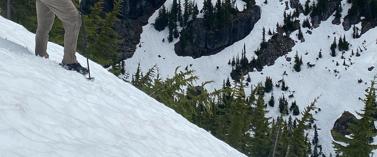
At an intersection, we descended to the Ross Lake Dam and dropped the baggage. Then we realized there wasn’t a way to get to the water from the dam itself. Damn! (sorry, that never gets old). In the pictures, we’re smiling, but you’ll notice that there aren’t any pictures from this point on the trip. We had lunch at the dam instead of at the lake as we’d hoped. We carried our gear back up to that fateful intersection and I scouted the correct route to the water. If only the signs pointing to the Ross Lake Ferry had been so obvious when we first passed. I went back and got the canoe which, oddly, was easier to carry by myself. The trick was to hoist it upside down with the middle crossbar laid across the shoulders.
In the end, we made it. Four hours to travel one mile. A rough introduction to portaging, though I expect that most introductions to portaging are pretty rough.
As I was carrying the canoe down the final stretch to Ross Lake, I passed a car with a boat trailer. The driver was still there when I came down with the dry bags and we started arranging the canoe to put in. It turned out that this good natured fellow owned Ross Lake Resort. He motored off and just as we were about to put in, returned with beer for us. I guess it counts as trail magic even though we were on a road going to the water (lake magic?). He drove off to some errand and we left a muffin as a thank you on his foredeck.
Finally, at 2:30pm we shoved off and could begin the paddle up to Spencer’s, the campsite we’d selected for the night. The water was glassy. The sun was bright. It seemed a great reward after the struggle of the portage.
Ross Lake is oddly like a pond in that the wonder seems completely immobile. Flotsam will remain unmoved as you approach and pass. Waves seem to move the water up and down but don’t push it anywhere. So, despite there being water everywhere, we pulled off to a small cascade to get something fresher for drinking.
As we paddled, we noticed that brown forest service signs like you might see by the road were posted at boat-in campsites. There was something humorous about about it. They’re sensible, as campsites are tucked up in the trees and so hard to spot from the lake. It would be easy to boat past your destination. While it’s easy to follow the outline of the lake on a map if you know roughly where you are, we’d already made one navigational error despite having ideal conditions.
Ross Lake was still in the process of filling up for the year and about 50 feet below it’s full depth. This meant that the boat ramps at many of the campsites were well above the water. We beached the canoe on a beach of coarse sand and tied it off to a stump. Having learned from the portage, it only took us two trips to bring everything up to camp, not the three it had to get the gear down to the water at the start of the day.
In the late afternoon, while we were sunning ourselves on the boat ramp, we heard voices and spotted two inflatable kayaks dragging a third inflatable dingy with backpacks in it. These would be our neighbors for the night. I have an inflatable kayak and can say that paddling a canoe was a much better experience, especially because we didn’t need to tow a baggage raft and weren’t worried about popping our boat on the stumps and rocks near the shore. Their portage had been easier though. The fellows were pleasant and accepted our remaining beers as gifts from fellow adventurers.
Lydia found sticks and and stripped them with her hatchet to roast sausages for dinner. As a modern suburbanite, I’ve barely used a hatchet and am just learning the childish joys of whacking things with one.
Sunday May 30
This was a slow morning. The mountains above Ross Lake block the rising sun until it’s high enough to crest them and so the tent doesn’t turn unbearably hot shortly after daylight.
Our unique chore was gathering firewood for the next two days. Per the ranger who gave us our permits, collection of firewood, even dead branches, isn’t allowed on the islands where we’d be camping. The islands are small and so it’s reasonable to think that they’d quickly be stripped of anything burnable if foraging for firewood were allowed and so there would be nothing to return to the ecosystem for those islands. Driftwood is fair game but we hadn’t seen much of it at Spencer’s so we set about collecting enough firewood for the rest of the trip. Despite being connected to the mainland and relatively near two other camps, there’s no trail to Spencer’s so it still has the feeling of being on an island even if the rules are different. We piled the fuel on the groundcloth from under the tent so we could wrap it into a bundle and keep it relatively dry from the water which gets into the canoe as when we move the paddles from one side to the other.
Our first aim after loading the canoe was to find running water to filter for drinking. The stream we found was cut into the banks of the lake despite the water level being low. I took this to mean that it had been this way before Ross Dam was put in. It seemed like a special experience to see part of a stream which only existed a “low tide”.
Our destination for the night was 10 Mile Island which is about half way up the lake. Again, the water was calm and the day was warm. As we paddled north, we got a glimpse of Hozomeen, the dual-peaked mountain at the north end of the lake which is notable from Dharma Bums.
Video of paddling towards Hozomeen on a glassy lake.
On the way, we explored up Devil’s Creek. This was much anticipated on my part, as I’ve hiked across the beautiful suspension bridge above it many times and always wished I could explore the deep, narrow inlet.
It turns out that Devil’s Creek doesn’t got very far back before it becomes a shallow, creek draining over rocks which aren’t navigable. However, this arm of the lake is incredibly deep for such a narrow crack in the rock. The walls actually appear to widen underwater instead of forming a continuously narrowing V.
When we reached it, 10 Mile Island, wasn’t an island because the water level was low enough that it’s connected to the near shore. We beached on a muddy, gravelly, shore below a kiosk visible from the water. Unlike Spencer’s and many of the boat-in campsites we’d passed, there was no boat ramp here. Lydia went on a walk around the island to find one and never did.
During lunch we decided that we’d brought a huge amount of food and should prioritize the heavy stuff – which happened to be all the vegetables, sauces, and dips. Lydia assembled the healthiest meal I’ve ever had in the backcountry. Somehow she manages to make healthy food taste good, which is something I’ve never mastered. This lead to the decision that more paddling trips should be in our future, just ones that don’t require portaging so we can bring things like almond milk and butternut squash soup like we did on this trip.
The sky had grown overcast and the air felt heavy like it was about to rain. Still, it was early enough in the afternoon that I wanted to try and explore up Lighting Creek. The route to Canada which starts on the east side of Ross Lake crosses a bridge over Lightning Creek, then follows high above the creek almost all the way up the drainage before taking a pass to the northeast after the ominously named Nightmare camp (on previous trips Nightmare camp has looked like a nightmare because it’s in dark, dense woods and is full of deadfall).
We hauled the gear up to camp then I set out by myself in the now empty Slick ‘Nanner. Sitting in the rear seat, it felt like the front wasn’t always in contact with the water. It handled very differently from when loaded, and was much more influenced by local currents. I had to spin around backwards at one point to get out of the small bay formed by the neck of land connecting 10 Mile Island to the shore.
Despite bouncing on the shallow undulations of the lake and the canoe always pulling to turn right, I made good time up to Lightning Creek. It wasn’t nearly as dramatic as Devil’s Creek, but I got to play a little bit with the current where the stream entered the still water. Like Devil’s Creek, this inlet didn’t go very far back.
The weather held and the trip back to 10 Mile Island was smooth, notable only in that I spotted some hikers sitting on a beach watching me paddle by. I tried to stare back just as pointedly to make things fair. Seeing other people, even if rarely, changes the feel of this trip from wilderness experience to playing in a large park.
There are two campsites on 10 Mile Island and we’d taken the better one. The other had a working bear box (unlike ours) but had grass growing up through the tent area which means it’s rarely used. Maybe that’s a consequence of there being no boat ramp. However, as with the camp at Spencer’s, the toilet appears new. It’s a made with coated metal framework and recycled plastic boards which look like the same material used in decking. The toilet paper dispenser was even full. Definitely the best latrine experience I’ve ever had in a national park.
We stayed up until the stars were out, sitting in our backpacking chairs next to a fire from the wood we’d carried in. Paddling trips are so luxurious.
Monday, May 31
For this morning’s water collection, we paddled across the lake and drew from a long cascade which we’d spotted the day before. As this was the start of our return journey, we decided to paddle down the other side of the lake to pass by a number of waterfalls we’d previously only seen from a distance.
We were planning to stop at the Big Beaver beach, a campsite which we suspected to be particularly popular. On the way there Lydia’s leg started acting up so we pulled over for a snack on a rocky point.
Big Beaver turns out to be where two creeks drain into Ross Lake. There were was a couple on the beach next to the lake but no one by either of the creeks.
We beached the canoe on a soft, slightly muddy beach near the outlet of the second creek. It’s water was clear and came tumbling down dramatically like Devil’s Creek had at the point where we couldn’t navigate farther. Despite having just had a snack, we ate lunch, prioritizing whatever seemed heavy. This time it was dolmas and sauce. Those things go down fast. Since we were expecting not have water on Cougar Island for the night, we drew water again before setting out for our last campsite.
We’d seen the boat ramp to Cougar Island on the way outbound and it seemed to be on a steep, rocky shore. Instead of tying up near it, we saw two canoes on a shallow, sandy beach and tied off next to them while we scouted for the campsite.
I happened across several people at the first campsite who apologetically cleared out with little prompting. They were just passing through for the day. We got to talking and it turns out they’d been the other car with canoes on top on Saturday morning when we’d gotten permits at the ranger station. They’d carried everything directly to Ross Lake down the hiker trail and recommended it, though they also had their gear packed neatly in backpacking backpacks which might have made our experience easier too.
We’d gotten to camp relatively early in the afternoon and spent the time lazily. Lydia strung up a hammock, journaled and napped. I put out a chair and read nearby. Later we played in the lake, though I found it too cold to get very far in. This is strange because I have no problem charging into an icy stream crossing and usually have good temperature regulation. Lydia gets cold easily and yet loves icy dips.
Dinner was a funny affair since we’d already eaten all the heavy food and finally had to open packets of tuna and concoct more traditional backcountry fare.
After dinner we lazed by a fire, watching the colors in the trees, water, and mountains soften as the sun declined behind the western mountains.
Tuesday, June 1
Packing up this morning, we made a point to consolidate as much as possible for the upcoming portage. Some things were still left out loose and not everything could fit in the giant blue drybag, but having finished the firewood and overeating in service of weight reduction, two drybags disappeared into the larger sack during consolidation.
Of course, we had had to stop by a stream to filter water and this morning we had our choice of three streams just across from the island.
The paddle back wasn’t notable. We chose not to explore up Ruby Arm as it didn’t seem likely to offer anything we hadn’t seen at Devil’s Creek or Big Beaver. Some time, when we’re more accomplished canoeists, it might be fun to try to put in at the East Bank Trailhead (less distance to carry gear) and get flushed out Ruby Arm into Ross Lake in the swift current.
The portage back to Diablo Lake only took one hour, forty minutes this time with a lighter, consolidated load and the experience of how to move everything efficiently. However, I wasn’t able to figure out how to settle the canoe quite the same way onto my shoulders and it wound up resting on my neck which was sore for several days thereafter. Yet another reason to avoid future portages.
The paddle back out Devil’s lake was pretty. There were a surprising number of people given that it was a a week day, even after a holiday weekend. When taking out, we used the boat ramp this time, and left sodas in the lake to cool while we packed everything into the car for a relaxed drive home.

One thought on “Ross Lake by Canoe (May 29 – June 1, 2021)”