I was signed up for the Sawtooth Ridge 50 miler over July 4th weekend. There was enough elevation gain that finishing before the cutoff might have been a questionable proposition. I won’t find out this year, however, because I withdrew in favor of other plans for the long weekend. Still, I resolved to hike the course on my own as I’ve wanted to hike in the mountains east of Lake Chelan but didn’t get to last year due to horrible smoke conditions. In the days leading up to this year’s race, the race directors sent an e-mail warning about snow on the course but then wound up canceling a few days after this hike due to to heat (the heat wave set records), so I might still get to run the Sawtooth Ridge 50 miler in its inaugural year.
Friday, June 25th
I pulled in to the Foggy Dew campground after dark. There’s a traditional car camping situation south of the road but I was intending to start at dawn so taking up a campsite (and paying for it) seemed to be a waste. There was an overgrown lot on the north side of the road with a number of RVs, trucks, and canopies which I circled several times trying to figure out if all the motorbikes meant I might be parking amidst a gang of some sort. Ultimately I parked as far out of the way as I could and while I was getting ready to sleep, I saw a small posse heading in my direction. I went out to inquire about the parking situation and they turned out to be a trail crew made up of motorbikers. I hadn’t realized that these were motorbike trails. The fellows were friendly, gave me some tips (I should be more worried about snow than heat and that the trails were steep) then left me alone.
Saturday, June 26th
I became conscious about as the sky was beginning to lighten and was packed up shortly thereafter. Gear for this trip was relatively minimal as I was expecting warm weather so my pack initially felt light as I walked quickly up the road from where I assumed the race would have started.
The route turns off the road at an S curve and goes up a series of switchback cut for bikes. The dirt is loose and the trail bed tends to form a U making your foot roll as it lands.
Near the top of the ridge, I was on lookout for a trail coming in from the left (west) as it would be the return leg of the route meeting up with this trail before descending to the start/finish whence I’d came. The fork happened far enough from where my phone app said it would that I realized some of the trails might not be mapped in detail.
The ridge was covered in trees and brush so I only had peek-a-boo views of the sun cresting the hilltops above the valley as I began to descend the north side. The trail here showed evidence of having been maintained some time ago but had too many logs down to be considered runnable. One of the trail crew who I talked with after this hike told me it used to be called the Sheep Trail and had been used by fire crews to access one valley from the other. Access to the other valley is now most easily done via a dirt road. Just before crossing a knee deep stream, the trail disappeared and I was left to find that road on my own.
I scrambled up an embankment following a social trail which petered out at the top. Looking around, there was some flagging to my right (downhill) so I began to move towards it. The next piece of flagging seemed to indicate a route back down the river cut I’d just escaped.
I checked my GPS and decided to pick a line in the opposite direction of the flagging. After pushing through some trees, I came across a scar torn through the bushes. It was road, though clearly unused for some time.
I couldn’t help but think that the experience crossing Foggy Dew Ridge was an excellent way to put racers on notice as to the nature of this course as it’s not trivial to fit ~18,000 ft of climbing into 50 miles. That nature, however changed again with the road. The unused road led to a well used, dirt forest road which climbed either moderately or steeply depending on its mood, but always climbed. I found the road and it’s regularity to be an emotional release and pulled out a snack as I walked, realizing I’d been going several hours without refueling.
The road lead to a well used trailhead and a nicely maintained trail. This trail continued the constant climb through the trees but less steeply. It brought me to a campsite at a stream which I understood was intended to host an aid station. The Sawtooth Ridge 50 Miler clearly presents a challenge for course designers as there are long stretches which don’t come near roads. This campsite had a sign I’d never seen before, “Motorcycle Camp”. I’m guessing that the trail crew I’d seen the night before maintains many of these trails and so makes them easy to ride. Perhaps the plan is to bring the aid station supplies in by motorbike. While I appreciate the uninterrupted solitude of hiking in designated Wilderness (federal law prohibits mechanical aids – even trail crews have to use crosscut saws instead of chain saws), I found myself smiling at the thought that there was a place for dedicated group of motorbike enthusiasts to maintain a pleasant outdoors experience for themselves in a manner which also created good hiking experiences. I’ve been quick to slur “dirt bike” into “dirt bag” in places where two wheelers rip up beautiful, sensitive ecosystems and it felt like the motorbike community here was redeeming that image.
It was late morning and I ate a first lunch by a stream which ran through the camp. The early start and continuous walking were beginning to catch up to me, and I had many more miles to go.
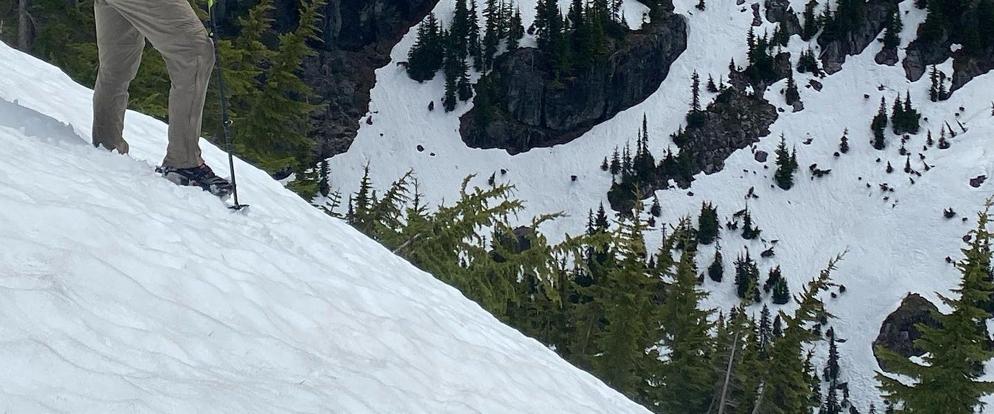
From the motorcycle camp by the stream, the trail broke from the cover of the trees and started working its way upward through a field of granite. The views opened up. I put on my large sun hat as this was supposed to be the start of a heat wave there seemed little prospect of shade ahead. At one switchback, I heard rockfall in the small cut which the trail had reversed to avoid. I assume it was triggered by the rapid melt withdrawing the snow’s support from a precarious boulder.
The view from my second ridge top of the day was of a lake below a semi-circular ridge. It was an idyllic view with a dainty little trail cutting across the meadow beside the lake. I was trying to hike quickly but found myself taking too many pictures to exceed an ambling pace.
The route switch backed down to the lake, then ran below the ridge for several miles, skirting alpine bowls. There were a few footprints and one set of tire tracks. The trail split in many places into a double track as frequently happens when the main trail channels water and so travelers form a second trail beside it just a few inches higher and drier. However, these two trails forked and I followed the footprints. I should have followed the GPS as I had to turn around when the trail ended at a campsite in a picturesque meadow. I’m still not sure exactly where I turned wrong as I ended up the proper trail by cutting down a dry creek bed.
After passing a sign to the “Angel Stairs” trail which I was glad not to take as the name seemed to imply a long, steep climb, I found myself looking up at a low point on a ridge which would be the Prince Creek aid station in the race. Below it was a hillside covered in snow. While there had been some patches of snow thus far, the route had been easy to follow. I decided to try to stay on the switch backs under the snow and spent a great deal of time being excessively pedantic about staying “on trail” only to give up at the end and cut straight up the snowfield.
Apparently, more deer had passed this way than people. The ambition of the race directors to hold a race in such a remote area is fantastic.
The race director’s ambition became more obvious at the top of the ridge. The map showed a three way intersection. I could see the trail I’d come up, if only because I’d just come up it. I couldn’t see any trail to the right. I could see a sign for a trail to the left but no trail to go with it. This was supposed to be the the most critical juncture of the race. Racers would pass through here twice. It was also the last full aid station and the only break in the final 24 miles.
Having now reached four of the six aid stations, I assumed that I was about two thirds done with the route’s mileage. That would be about 30 miles by 2pm which is excellent work if I do say so myself. The problem, however was that I felt spent and after spending some time with them map realized that there were about 25 miles to go. While this was a two day hike, I’d wanted no more than 15 left over for tomorrow. 10 miles after 2pm would normally be a reasonable proposition but I didn’t know if there was any more natural water on the course. Poor planning on my part; I’d glanced at the map and seen some valleys which I assumed would have a river in them. However, looking these new hillsides, it seemed clear that I’d underestimated their steepness, solar exposure, and it was quite possible that all the water had run off. The map appeared to show a traversal across steep hillsides not below the bowls I’d been walking through which had collected streams. Pictures of Lake Chelan tend to show brown slopes not lush hillsides.
Eventually I struck out towards the trail to the left and eventually trail tread materialized. The map showed it meeting up with another, very steep trail in half a mile and I figured I’d try to go that far and decide how ambitious I was feeling. Apparently the answer was, “not very” because on encountering a rivulet next to a tree, I filled my belly with a second lunch, my bottles with later, and napped for about an hour. The sun kept moving and shifting the shade so it wasn’t much of a nap but it was nice to be off my feet. I did eventually get up and hike as far as an intersection with a trail which went straight up the still hillside above. The way ahead appeared pass through a large fire scar as far as I could see. I had a flight to catch the next evening and my faltering ambition failed for good. This would an 50km trip, not 50 miles.
I turned around and decided that after hiking hard this far, I’d have an easy afternoon and finish up the next day. I boot skied down the snowfield, and hiked back to the “Angel Stairs” trail, then sat down under a tree, ate a third lunch, and tried to doze off again.
The Angel Stairs trail turned out not to be quite so steep as I’d imagined but I took pictures as an excuse to go slow. The vista near the top was an overview of the latter half of the hike. I love these views which allow you to reflect on the distance you’ve traveled. The reverse view was of Merchant Basin, where the fall line trail I’d turned around at descended and then climbed up to meet the race course. It’s an alternate route which was so immediately inspiring that I found myself wondering when I could get back and walk it.
An enjoyable irony at the top of the last climb was a sign declaring itself at the summit… with the actual summit visible a short distance away. However, the mileages on the sign were a nice check as I’d been measuring things on my phone’s map app in only the most approximate way.
I decided to camp for the night at Cooney lake, expecting an easy hike downhill to wrap up the day. Of course when I got to the top of the descent over the lake, I had to boot-ski down a snowfield steep enough that to find the way down, I had to sneak right up to the edge and peek over to be sure it wasn’t actually a cornice.
There were hints here and there where the trail peeked out from under the snow, so I played hide-and-seek with it until I found a campground just east of the outlet stream. The view was great and despite the heat wave happening somewhere, temperatures were perfect for the fleece, gloves, and beanie I’d brought.
Dinner was cold soaked breakfast and dessert since I wanted sugar and crunch not salty, soft noodles. I wandered around the campground and found the toilet which was facing passerbys and had a snow patch in front the way some thrones have a stool. Having the place to myself seemed ideal given the circumstances.
Sunday, June 27
I’d slept under my poncho tarp and so while I had a full setup to tear down, I was still out of camp pretty quickly. No need for breakfast as I was still full from the night before. I guess when you eat an oversized breakfast for dinner, it still counts as breakfast.
I found a set of footprints in the snow leaving camp and followed them to the trail. I’d been hoping to use this as something of a training hike but without much mileage today and most of it downhill, I figured the only training to do was to try running. However, when I got to the point where the GPS said to start ascending Foggy Dew Ridge instead of following the valley bottom, there was simply no turn-off (I actually overran the point despite looking for a turnoff). I walked the trail several hundred feet before and after peering into the woods and found nothing. Then I tried cutting straight uphill until the GPS said I was above the trailand looked around for anything resembling a path through the trees. There was one pile of rocks which might have been a cairn but anything which might have been a route turned out to be an example of humans’ ability to see things which aren’t there.
I gave up looking for the Foggy Dew Ridge Trail and ran the rest of the way out along the valley bottom. A motorbike had been up the trail and cleared out the deadfall, making my journey easy. “Course like water” is what running on a slightly downhill trail with a few roots and rocks feels like and so I repeated that phrase to myself until the trailhead came into view.
Since I’d found the toilet at Cooney lake amusing, I noticed that the trailhead toilet was labeled, “USE AT YOUR OWN RISK”. Apparently the Forest Service doesn’t keep as close an eye on these trail as the motorbike crews.
Running the few miles back to the car from the Foggy Dew Trailhead was smooth and fast. Emotionally it was a great finish despite the roller coaster of a course.
