Around 5:45am continues down Kane Creek roada road. The road was easy to follow even without my headlamp so I turned it off and let daylight come naturally.
But Hurrah pass itself almost put me out of my mind.
On the way down, I saw the same Jeep come and go then come and go again. They said they’d forgotten some clothes. I guess that’s what’s nice about backpacking, you always have all your stuff.
Most of the day was spent on a 4×4 track which doesn’t sound that exciting. After Hurrah pass, things were nice but not grand. I took a wrong turn once on an ATV playground but it was easy to backtrack. I skipped going down to the Colorado to get more water. More on that in a bit.
After turning off into the Lockhart Basin track, things got interesting fast. I’m impressed that someone found a path wide enough for a vehicle up the frequently narrow or rocky bands in the cliffs. While this is a 4×4 road, none of the tracks looked recent and so I decided to think of it as a hiking trail that ATVs could go on a well.
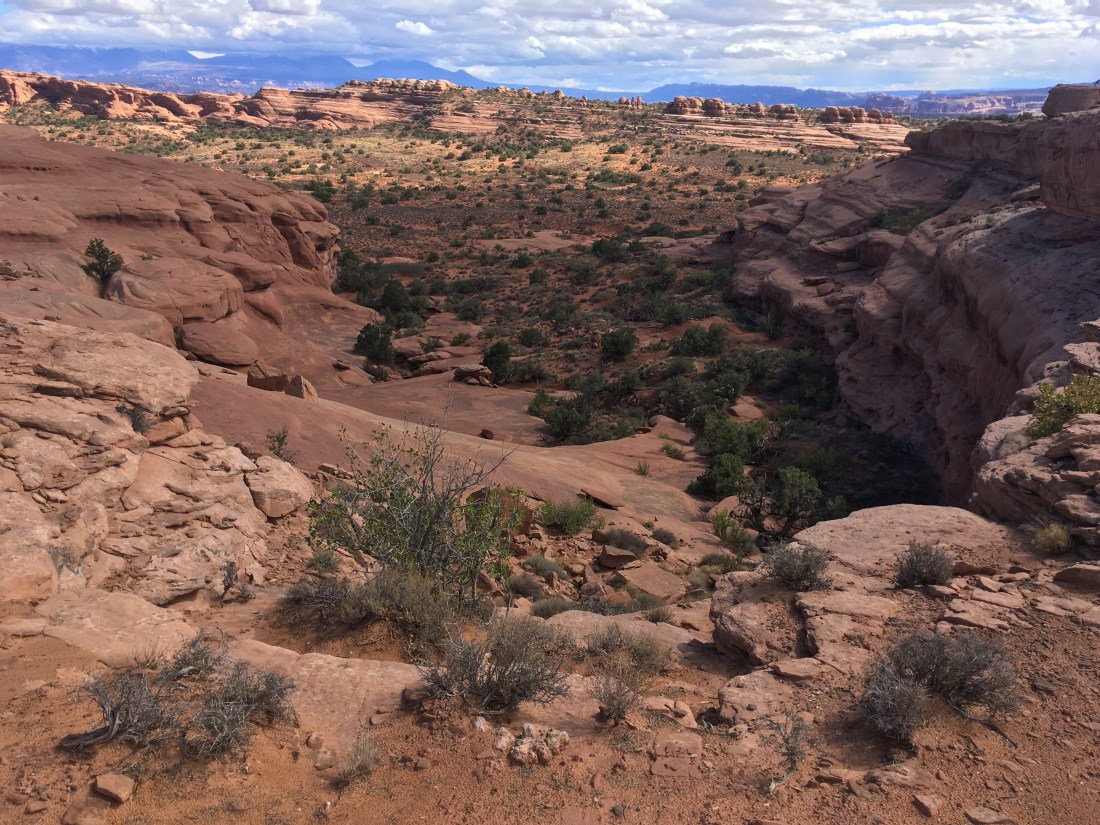
Lockhart Basin sounds like you’d be down inside a basin. In fact, you’re above things. The route follows the bench in and until it turns into the next valley.
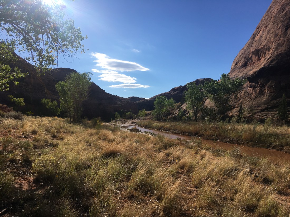
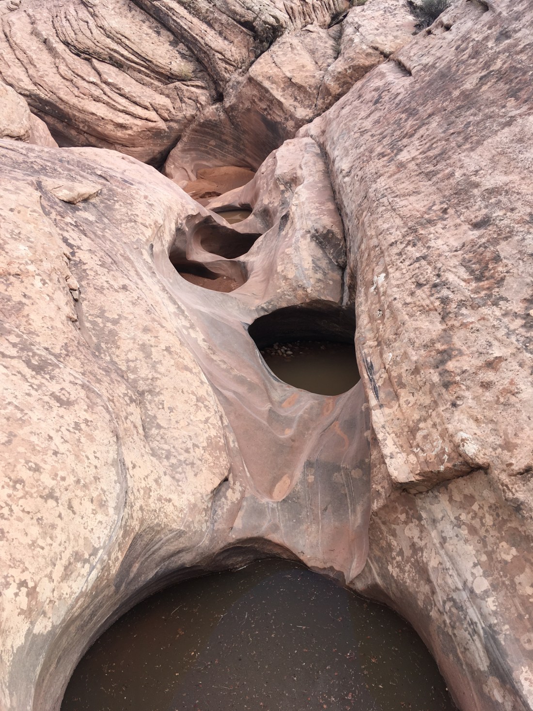
During this time, I realized I’d miscalculated my water supply and so was probably going to have to bail out two miles each way once I got into Lockhart Canyon to draw water from the Colorado. I hate “bonus miles” and was very excited to find a shallow puddle of clean, clear water in a rock.
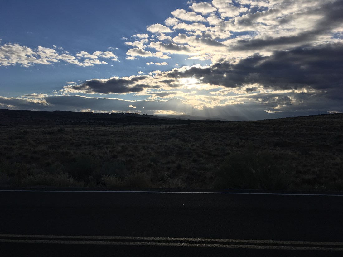
It had been raining intermittently and when I stopped drying out between drizzles and the drizzles became light rain, I gave in and put on my rain clothes. The upside is the rainclouds added a constantly varying aspect to the views. Sometimes two ranges looked similarly distant but then one would disappear in the clouds and you’d realize it was farther away. Watching the clouds come in waves and watching each wave advance was a interesting game as well.
Also, the rain provides more places to drink from the rocks. I’d do a diamond push-up down so that my chest could rest on my hands and my clothes wouldn’t get too wet but I could still suck up the clean rainwater.
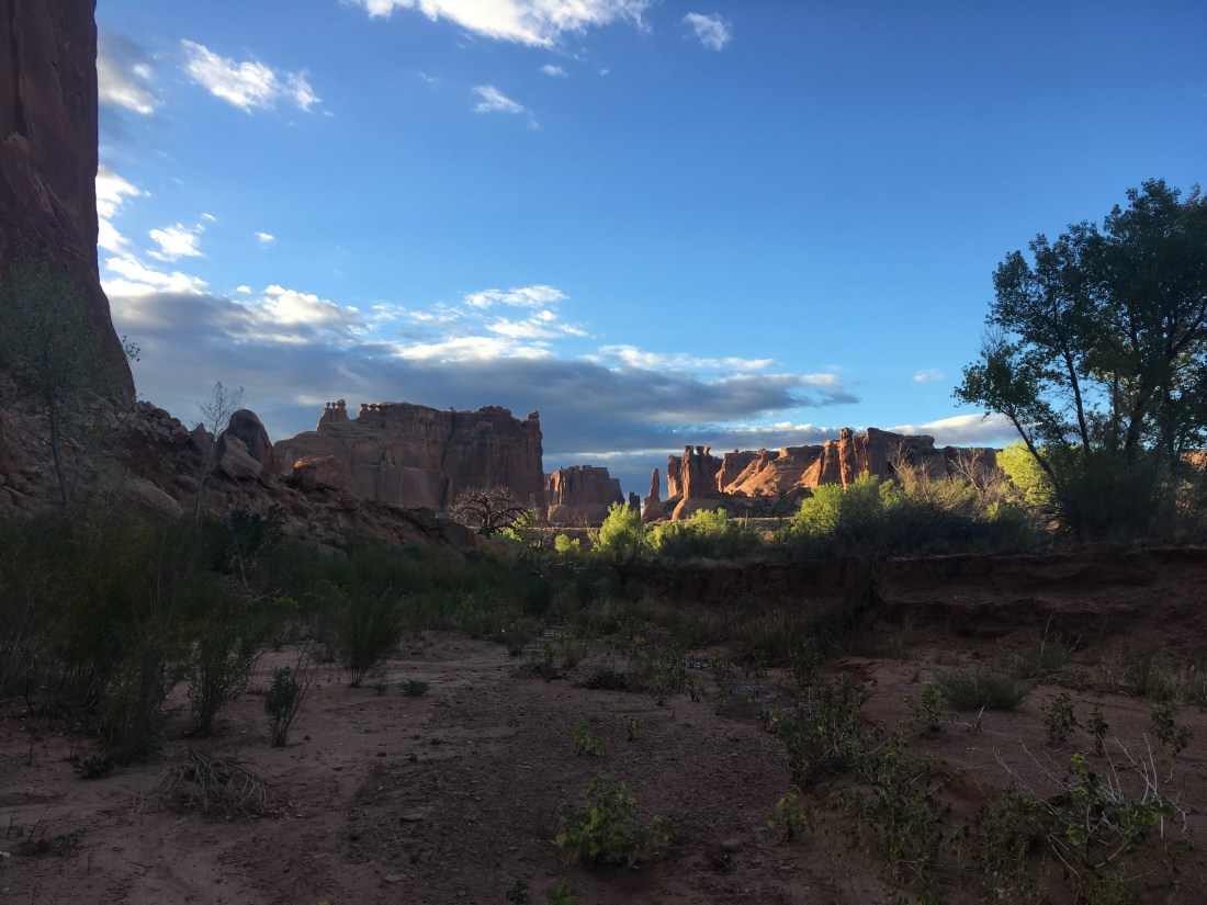
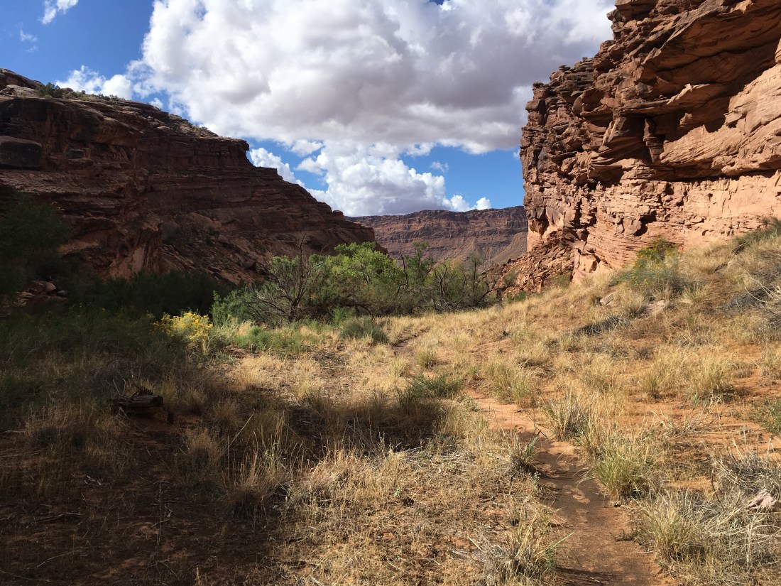
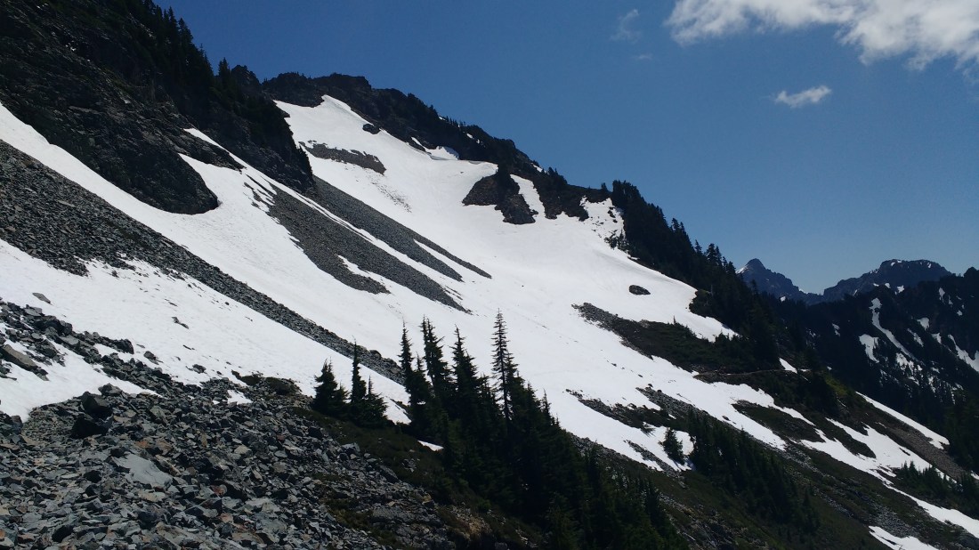
Finally, the big event for the day was finding and successfully navigating (so far) the drainage where the Hayduke leaves the 4×4 track. I’m not in Lockhart canyon yet but as someone not familiar with off-trail travel, I couldn’t believe it when the “forming wash” as the guidebook called it, actually started to go (ie was passable). On approach, you can see huge cliff bands which seem like they would quickly block any exit from the 4×4 track so you don’t quite believe that the drainage is going to be hikable but it is. I’m still expecting to hit those cliff bands eventually but I’m far enough that I expect the guidebooks to work at that point.
I found an overhang under which to camp for the night. No need to set up a tent. It’s on the high side so no worries about flash floods.
I woke up to may alarm at 5:00am but didn’t manage to actually get in the trail until 5:45am. Things got tough fast.
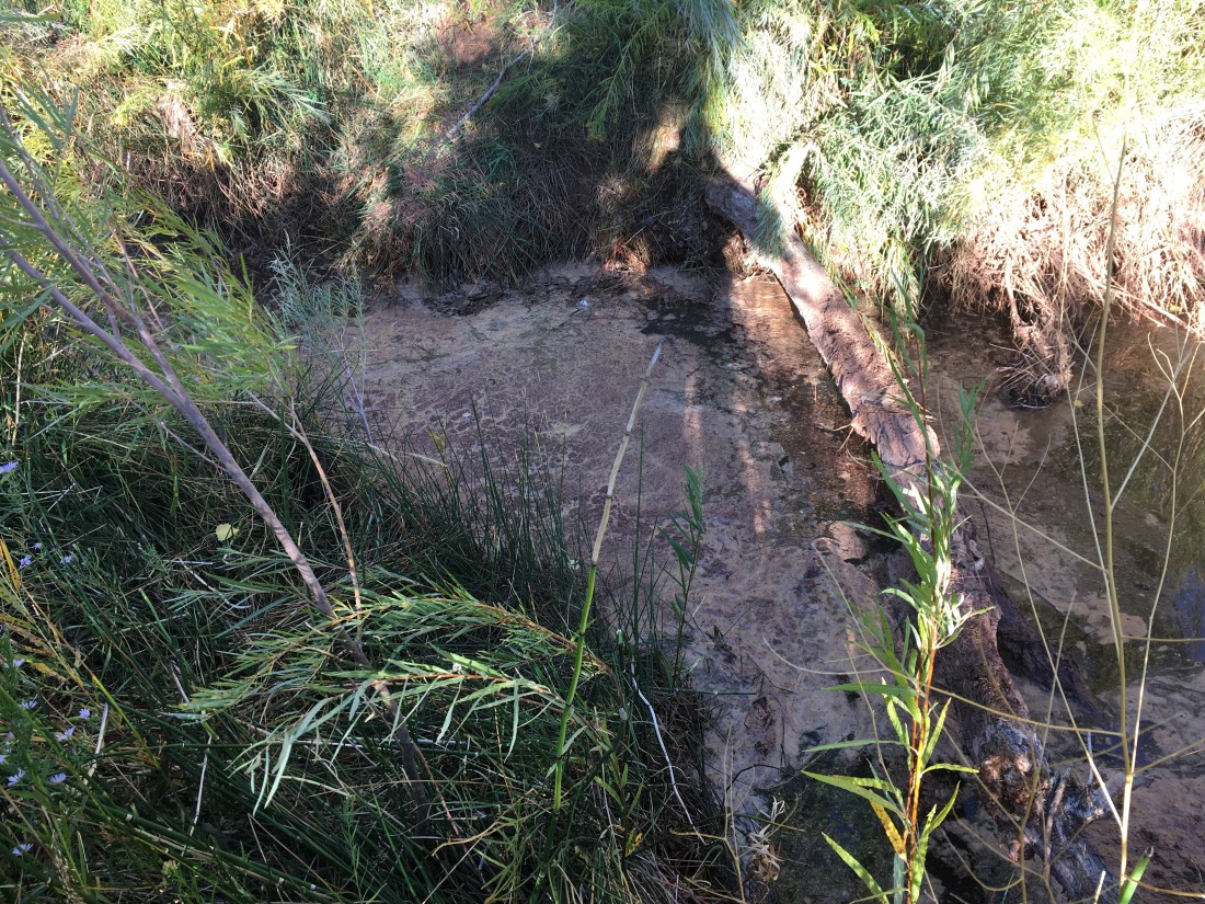
That water is mid-thigh and opaque.
Don’t let the evidence of trail work fool you, this was some solid bushwhacking until about the time the sky started tuning light and things began to open up.
The wash pushes you west and if I’d actually looked at the map instead of thinking “get to the road” I would have been carried along the proper route. Instead I punched through some reeds and a water filled ditch to make it to the road. At that point I pulled out the map and realized I should have just stayed in the wash.
A brief road walk west and I was back in Courthouse Wash which has an intermittent trail. Unfortunately, the tail will try to kill you if you don’t outsmart it by crossing to the trail on the other side of the wash at the lowest point of the water. Otherwise, you get trapped against the canyon wall and try crossing neck deep stagnant water.
The water is neck deep. If there hadn’t been a branch to drag my pack across, I’d have been in over my head.
After getting the hang of it Lower Courthouse Wash was something of a fun obstacle course with the feel of a Tough Mudder.
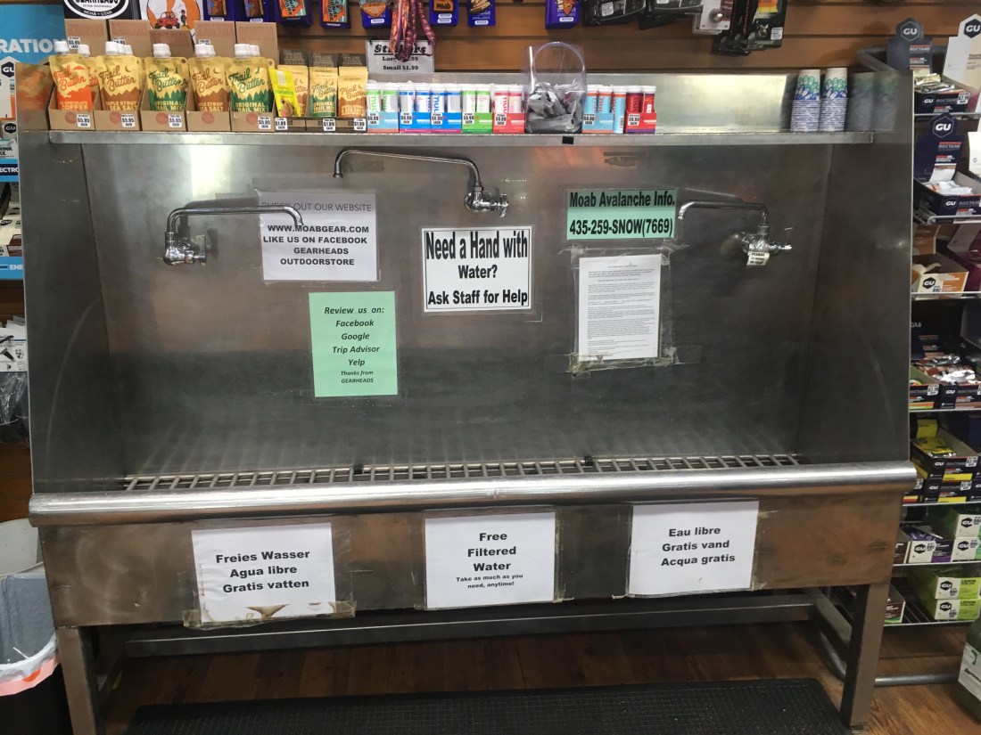
I made it to the road into Moab around 11am and walked into town. A peach seller recommended Gearheads as a place to replace my bent pole and the compass I lost, probably during the neck-September adventure. The place is a gem. Very helpful and will refill you water.
After a burger at the Moab Brewery, I’m on my way out of town to see if I can get across Kane Creek before the rain as was recommended by Bill at Gearheads. He actually recommended I stay in town and wait out the rain but I’m from the Pacific Northwest so I wasn’t having it.
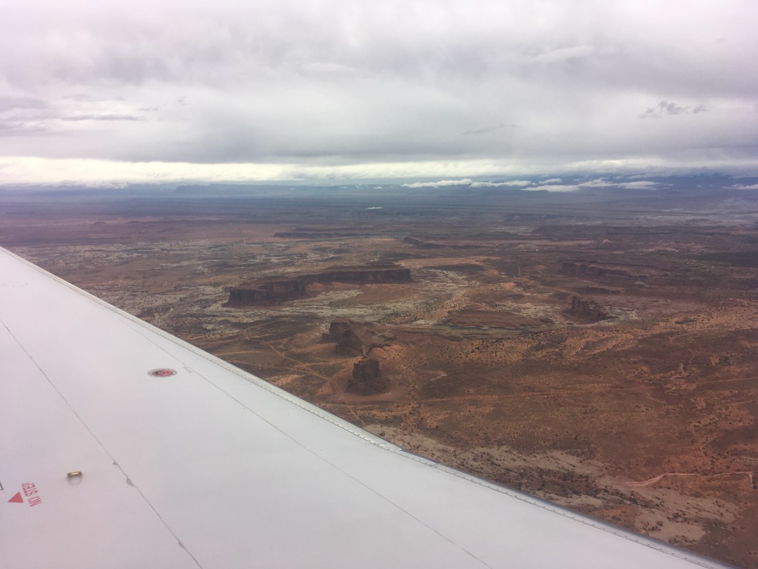
My alarm went off at 6am to wake me on the floor of gate B83 in the Denver airport. Camping gear makes sleeping at the airport much more comfortable but until the tests of the emergency warning system stopped around 3am, I didn’t sleep well enough to dream. So I slept on the flight to Canyonlands Airport outside Moab, UT. I woke that time by turbulence shortly before landing and slid the window screen up.
I’ve read several blogs about the Hayduke but there’s a reason you do it yourself.
A nice fellow named Brodie from Wyoming who had introduced himself before departure on account of our similar taste in trail runners wished me well on the trip. Then, I loaded up the 7 liters of water I’d taken carry-on when my bag was gate checked (the airline employee who had directed me to remove the water apologized after seeing all my bottles and bladders) and headed for the road.
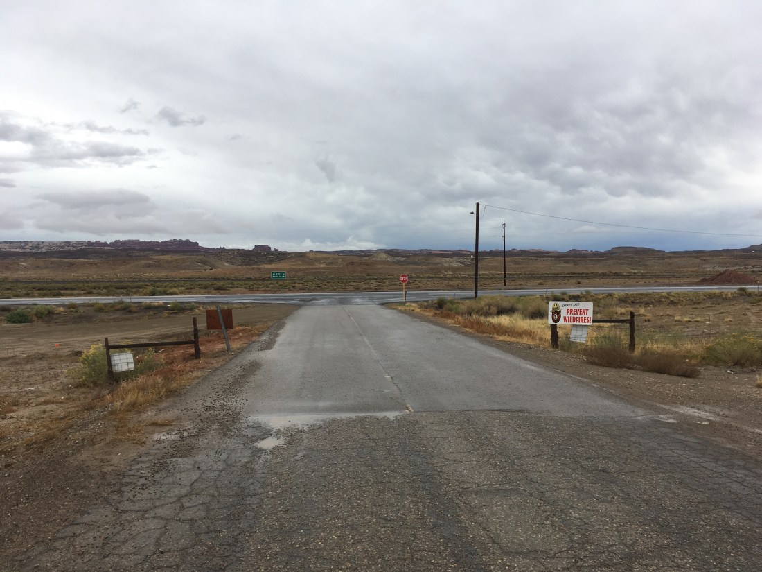
I’m not to use GPS as a personal challenge (I’m sure I’ll give in eventually and have the route loaded in my phone) and I’m not great at map and compass so I had a little trouble finding the road dirt road which forms the “Klondike Alternate” start to the Hayduke. It’s primary advantage is that it starts at the airport which saved me from having to arrange transit. Eventually after some cross country meandering, I wound up cutting through an RV’s campsite since RVs need roads.
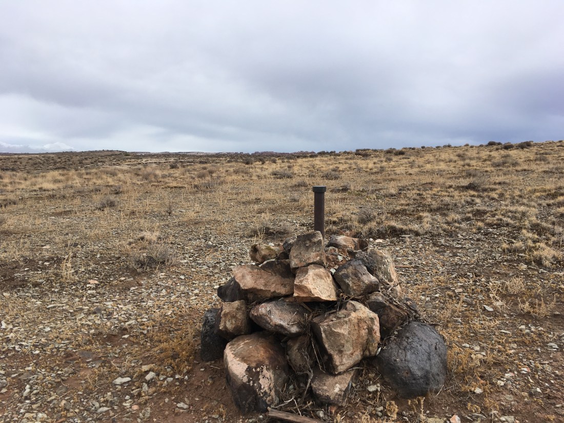
Some kind of trail marker?
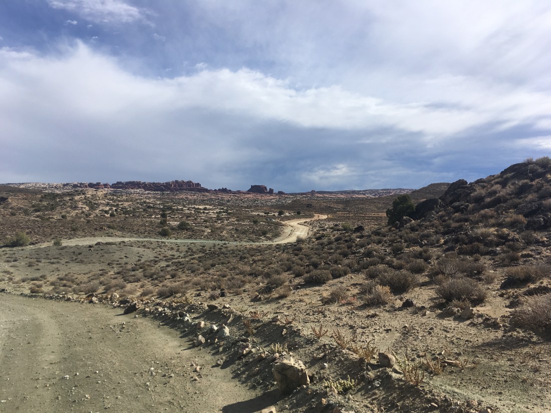
Road makes walking pretty easy.
It has rained this morning before I landed and things initially smelled like salt marsh with a hint of urine. This disappeared as I led the road for a 4×4 track. The destination was a rock formation called Marching Men. Initially, I wasn’t sure I’d located it properly when I took a beating but as you get close enough to make it out, there’s no question.
Nothing else looks like men marching.
Unfortunately, I took a right when I should have taken a left and didn’t get to see them up close. When the 4×4 route was clearly heading in the wrong direction, I left it and wound up cutting through a little streambed only to run across… another 4×4 track.
This wound up taking me to the Hayduke at the point desired, just not the route desired.
After lunch, I turned down another 4×4 road (so far thing are pretty easy) and noticed a single set of footprints which appeared to have passed since this morning’s rain. A Jeep at one point informed me that their creator was about a mile ahead.
Unfortunately the identity of the person who left the footprints will have to remain a mystery. They disappeared right around a side trail which in hindsight, I should have taken as well. I’d noticed it but thought it was too early for me to be there. Instead I saw the pipeline.
From there the route was actually pretty easy, it just didn’t feel that way because I’m new at this whole cross country thing.
1) Follow the pipeline to the fence
2) Follow the fence to the “fins” which are apparently sandstone formations which don’t look particularly like fins to me.
3) Pretend you’re water and you’ll eventually wind up in Courthouse wash.
Just go with the flow.
But remember you’re human and you’re actual object is to get where water would eventually go so maybe don’t jump in there.
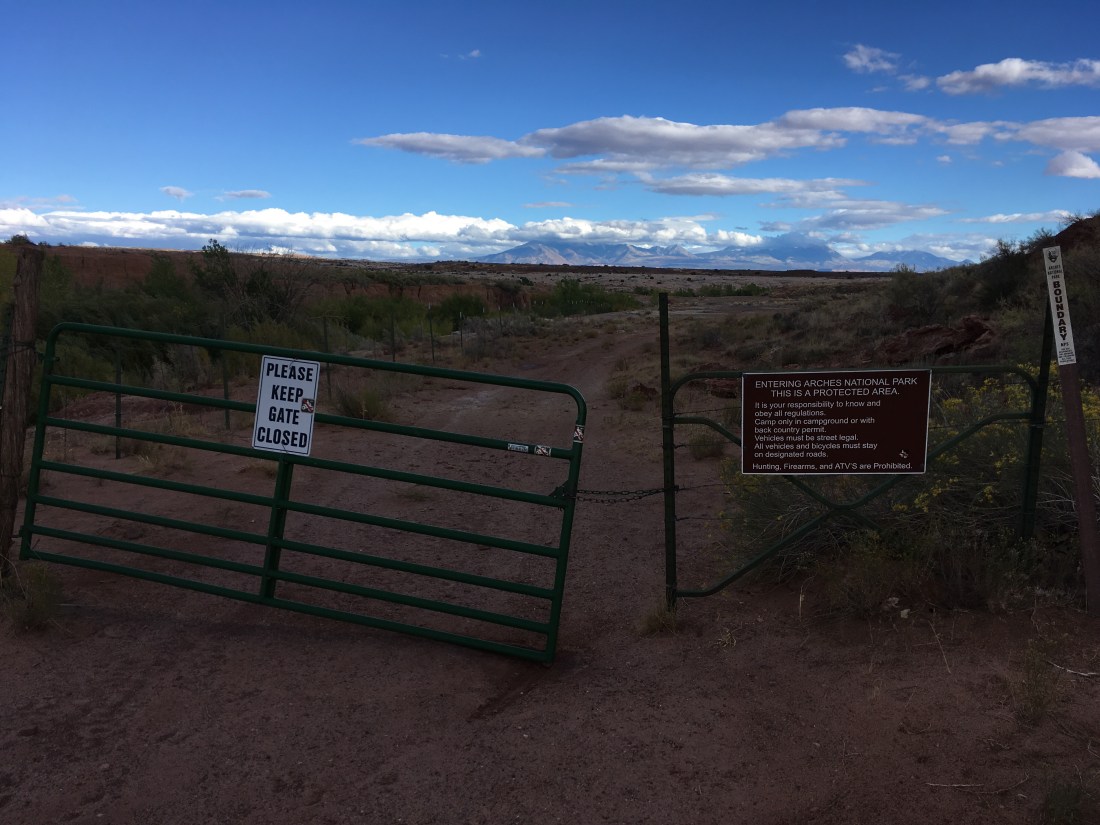
4) Because I don’t have an overnight permit for Arches NP, turn right instead of left (where the trail goes), climb out of the wash because you’re blocked by a hanging fence, and set up camp outside the second fence they have outside the wash.
I wound up stopping with over two hours of hikeable light left because I need to do all of Courthouse Wash in one go due to the lack of an overnight permit. I didn’t get one because you have to apply in person and time is precious so I wanted to start hiking. Instead, I got this as my bedroom tonight.
Today was a great first day in the trail. The weather was cool and initially overcast which made for great lighting. I’m probably sunburned from when that burned off. The navigation challenges didn’t cost me much and so mostly served as a gentle introduction to not worrying so much. Finally, I was forced to go to bed early which Is probably for the best since I didn’t sleep enough last night.
As with any trip, I forgot some things: a ziplock for trash, sunscreen. Fortunately I can probably get those and a jar of Nutella or peanut butter in Moab tomorrow. Doing the Hayduke westward seems to have lots of small benefits.
I just finished taping and addressing resupply boxes, finding a location near Bryce Canyon to ship that resupply box, and packing my backpack (weighing 11.4lbs w/o food). The dryer just finished with the laundry so I my dirty duds won’t be perfuming my room for two months while I’m gone. More loose ends come to mind. At some point, I still need to go to work today.
4:45pm
Shipping my resupply boxes packages held up the normal line at the post office this morning. I’ve changed into the hiking clothes I’ll be wearing until Thanksgiving. The feeling that I’ve forgotten something keeps worrying me. I print off a map of the Klondike Alternate which I’ll be taking for the first several miles because I realized I’d only printed the main route.
It turns out that large jars of Nutella aren’t allowed through airport security so that’s something to pick up in Moab. I fly to Denver tonight for a 6hr layover (good thing I have camping gear) before taking the morning flight to Canyonlands Airport.
This summer was a bit of a blur so instead of proper write-ups of each worthy hike, they’ll all just get a quick recap.
Thompson Lake Fail (May 12)
Take 2 on my attempt to make a loop out of Thompson Lake and the Pratt River trail. This time I onto the traverse past Thompson lake under Putrid Pete’s Peak before turning back because the going was too slow and I didn’t feel safe. The clinometer showed a 45+ degree slope, there was a lot of post holing, no trail, and no GPS. In the Thompson Lake basin, the snow was ~5ft deep but it was cut through all the way through where the little streams which you’d barely notice in the summer ran. Just finding my way down to Thompson lake was fun as the trail seems to be maintained mostly through use and so it wasn’t always clear where it was though the destination was never in question. At least this was a fun fail.
This was an out-and back scouting trip. Last year, a ranger who hitched me off Steven’s Pass said he’d hiked this and flagged it for potential restoration. The trail follows an old, straight forest road which is nice in that it’s usually flat but sufficiently overgrown. The state of disrepair varies from slightly mossy to a few sketchy footlogs where things have been washed out.
It started raining as I headed out in the after noon and after a proper downpour, things dried up until sundown. I abandoned my interest in trying to cross Pratt River early and see if I could make it up to Spider lake. I was able to identify the correct valley with map, compass, and “staying found” (taking a class paid off) but lost my appetite for what would have been a at least a waist deep crossing in a fast current. However, I discovered that there used to be a ramp down to the river at about where I’d intended to cross and so wonder what the history is there. Maybe the used to float logs down the Pratt River?
I spent the night in a hammock gifted me by my Senior year of College roommate. I’d only used it once before and gotten too cold. This time I brought a mat and it kinda worked. It took some work to set up but was quite a comfortable cocoon until the prolonged “banana bend” (even though it’s an asym design) began to wear on me. Also got to play with the cat can stove which worked quite well.
The East Bank trail is long and pretty flat and made a chance to stretch my legs (~24 miles day 1, ~36 day 2) and see if the post-surgery knee would hold up. It did and so I got to tag Canada. I woke up on on day 2 and despite having overslept and despite feeling it prudent to turn back, decided to go to Canada anyways and deal with the fallout later. Seeing the border again made me really happy.
It turns out you can just drive into the US from Canada without any sort of border security which surprised me. This wasn’t a particularly notable trip from a nature viewing perspective and so I listened to two books by people who you might term cultural ambassadors. The whole things had an oddly disembodied political – social – emotional feel which is different from most of my hikes where I don’t listen to audio books.
Thompson Lake through Pratt River Loop (June 23-24)
I’d taken two attempts at this route earlier this year and finally it free enough of snow to make it through. This trip was a fantastic blend of conditions: cool uphill through the forest, long traverse across a steep mountain side with just enough snow to be interesting but not enough be dangerous, mist making things mysterious, just a dash of route finding, easy miles with pretty lakes, discovering that the Pratt Lake trail is in great condition besides being abandoned (not to be confused with Pratt River trail to which it connects), and an ahead-of-schedule finish with a road walk down the Middle Fork of the Snoqualmie River.
I want to try this again next year but packraft the road walk.
Back to the East Bank trail but this time with the ambition of climbing Desolation peak on the way to and from Canada. As it turned out the half inch of rain which was supposed to be gone by midnight instead became thunderstorms. Ella and I had only brought emergency camping gear since we were going for a speed hike as she’s training for ultras. The most miserable night’s sleep I’ve ever gotten started at 1:30am on top of Desolation peak when I didn’t realize that my emergency bivvy would prevent anything from drying and so tried sleeping in my wet clothes. I’d hoped that they’d dry out a little and I’d get to warm-and-damp.
I’d brought a day hiking backpack which didn’t give me easy access to water when it was stuffed and I was moving quickly so despite the rain I was probably dehydrated. For dinner, I had a peanut butter and raisins on a tortilla which was mostly a giant glob of peanut butter. This didn’t sit well in the stomach. The next morning, without a clear guarantee that it would be sunny enough to dry our gear or that my stomach would stop feeling like the beginning of poisoning, we decided to head back and netted 44mi in 20 hours (or something like that). Day 2 was even quite pretty.
This was my only hike with a partner this summer and without one, it would have been pure misery. I’d probably have just turned around. However misery loves company and so I look back on the experience with unadulterated fondness.
Wanting a shot at redemption after getting queasy and weak a few weeks before, I set out for a 34 mile day hike. You know, as one does. With only oat bars for energy. Problems didn’t start until the last climb to Devil’s ridge when my heart rate didn’t settle despite taking a 15min break. Also, I was beginning to feel weak. I ran across two parties of heavily laden backpackers both of which commented that I was going really fast. That’s easy when you don’t have a tent or sleeping back in your running vest. By the time I got to the top of Devil’s Dome, I’d been having to make deals with myself about not worrying about how much daylight was left. Fortunately, there’s less elevation gain on the way back and the moral of the story is that if you put one foot in front on another, eventually you make it home. However, being sick to your stomach and having to hike for three hours by headlamp might have been a new low in my hiking career.
The upside is that I finally got to see Devil’s Ridge on a relatively clear day.
Feeling pretty beat up and so this was a pretty easy weekend where I hit the trailhead after noon and was back well before dinner the next day. I even brought a full tent instead of a tarp which was fortunate because there were mosquitoes. This trail follows the classic Seattle-area pattern of a boring climb (punctuated by views of a waterfall) followed something fantastic at the top. In this case a string of large, beautiful lakes with granite backdrops. The crowd thins, the trail gets less maintained and much rougher, and in a surprisingly short distance (7-9 miles) the experience is ravishing. There’s a thin, twisting, not quite tortured ridge walk worth of the Goat Rocks or Enchantments which drops you towards a saddle. The saddle was still covered in snow and I followed boot tracks over. The descent towards Chetwoot Lake is steep and I think I missed a turn-off because it looked like a pour-off. The boot tracks ended at the outlet stream from Chetwoot to Angeline which was just passable by rock-hop if you pointed your feet down-stream the current broke against your sole when stepping barely submerged rocks. The crossing is followed by a bush-whack. I started descending towards the lake but remembering seeing no backs and usually sheer cliffs, made eastward around it probably just .1 to .2mi before setting up camp in a dried mosquito bath. The feeling of solitude (surprisingly hard to come by in the near-Seattle cascades) was delicious.
On the way back out the next day, I spent some time at the Saddle overlooking Chetwoot and ferocious mountainscape behind it and got worked up a little.
No Pictures – Some things are too precious to share 😉
Jackita Ridge to Woody Pass (August 13-14)
This trip had dual purposes: figure out if I can hike all day without getting sick to my stomach and see the eastern end of Devil’s ridge. Also there’s ~10.5kft of climbing on day 1 and ~6kft on day 2 so it was also something of an attempt to be athletic again after a couple of rough goes. The trick seems to be not bringing oat bars.
Things went well. I was able to walk all day at an even pace. I only stopped twice on the first day: to draw water from a spring (springs are the best) and eat dinner. The east end of Devils ridge descends to a valley then comes up to a saddle where it becomes the PCT. The long traverse started with a good view but was quickly overtaken by foliage. The PCT really stands out in how easy it is and how beautiful it is. The traverses are high and long with sweeping views. The descents and ascents well graded.
I ate dinner of cold soaked ramen looking west from the dramatically cut Woody Pass while watching sunbursts dance and roll through storm clouds and holding onto my hat when a strong gust would come whipping through the otherwise dead air.
I ran into several through and section hikers finishing up their trips. I enjoyed being back in through-hiking territory even if I had to introduce myself as “just out for a weekend but I was class of 2016” when several asked if I were making a border push.
No Pictures – Left my phone at the shelter 3hrs up Jackita ridge when I took a break on the way back.
Dingford – PCT Loop Did Not Go (Sept 1-3)
Starting from the not-a-named-trailhead 6mi before the Dingford Trailhead (I didn’t know the road was passable by non-4×4 cars), I tried to set up a 67mi training loop which would bring me to the PCT near Waptus lake and connect back via the Red Mountain after going south to Kendall Catwalk. This was a training hike and I carried 4 gallons of water which I didn’t touch. Max pack weight was 56lbs and my pack is only rated for 40 so the discomfort on days 1 and 2 weren’t surprising. Revisiting the beautiful Dutch Miller Gap and Ivanhoe Lake on the first evening was enough to break through the exhaustion a little. Some streams were dry (yes, even in the PNW) and I had to jog back a half mile for water that first night.
Day two was a little better physically. I visited Pete Lake which isn’t quite the PCT route but takes a turn-off which is a real trail despite there being a lot of sticks placed to say “don’t go this way”. I also got to visiting all the sites of my struggles with navigation and snow last year. The trail south from Spectacle Lake is a true gem and almost would have been worth carrying a pack this heavy to see. A surprise was when a vlogger I follow came hiking by in his trademark ping running shorts. I was racing daylight and really not moving nearly as quickly as I’d wanted but it about 20 miles in time to set up at a dry pond set in a ridge line which is maybe a hundred yards wide but falls off steeply on each side. I’d noticed this area last year and thought it would be a great opportunity to camp. There was even water. Carrying 4 gallons of water as training weight when my bottles were dry and I was thirsty was a unique aspect of the struggle.
On day three I passed a few more places I remembered from the year before though Kendall Catwalk itself isn’t as stunning as I recalled. The area became thick with through-hikers and then day hikers. I turned up the Red Mountain trail and the crowd dropped off. I only saw and old man and in talking with him discovered that the trail had been abandoned and was degraded past the point of safe travel. As I discovered, there is actually a sign which says, “Abandoned”. This is what you get for clicking through a route on CalTopo too quickly. Fortunately, the saddle had line-of-sight to Snoqualmie Pass and I was able to call a friend who gave me a ride back to my car that evening where I found I’d been issued a ticket because I’d left my pass face down. More unfortunate was that in the last three miles, (after 51 miles, why pick the last 3?) my knee started having real pain such that I limped visibly. That’s my first time it’s acted up significantly while hiking and is a real blow since it seems that running longer distances (on concrete at least) inflames it as well. I guess the indestructibility of youth has truly faded from me.
I didn’t make it out of the first valley on the west side of this route 😦
The first stop was Thompson Lake and I didn’t even make it there.
Having largely recovered from ACL surgery back in September 2017 and having recently tested the generously donated tibial ligament which replaced my anterior cruciate ligament on a nearby peak known for it’s steep trail, I decided it was time to practice foul weather backpacking and spring-snow travel. To that end, I mapped out a loop in terrain which I expected to either be snow free, familiar, or have been visible from Mailbox Peak the week before. After work on Friday, I headed out with a bunch of new gear which more reflected the pent up hiking lust I’d experienced during recovery than a sober assessment of the conditions, and headed out in to the rain.
Just in case they needed to know where to find the body.
Things actually started quite well. The rain was light and it was a mile or two before I had to unzip my rain shell to vent the heat which was threatening to make me sweat. Instead of using trekking poles, I held the edge of my shell like a shawl, hunched forward and got along OK.
I had been expecting snow to start above the junction to Granite Lakes and so had planned on camping there. However snow patches started covering the trail and eventually buried it well before. It was less than half an hour before dark when I turned down the Granite Lakes trail and within fifteen minutes hit a small stream washing over the trail and couldn’t spot a dry-footed way across. The nearby hillside was shallow and while damp, was not soggy. With no flat spot large enough for my body, I settled into a dip between several trees and was glad that I’d brought a tarp and so the requirements for adequate pitch were lower.
I had been excited to put the catfood can stove I’d recently manufactured to the test but couldn’t find my lighter. Morning light would reveal it a few feet away where it had fallen out of my ditty bag (aka head net) when I’d moved to a slightly less bad spot. Not having cold soaked ramen before, I wasn’t sure how long it would so I ate the next day’s lunch and set my noodles to cold soak overnight. Due to the slope of the “campsite” I slid slightly out from under my tarp several times that night and my sleeping bag got damp but not enough that it needed to be dried before another use. It wasn’t the most comfortable situation but it could have been much worse. Having brought my thickest air mattress (which had a slow leak and so had to be reinflated several times) was key here due to the roots I hadn’t been able to avoid lying on.
First night under my new tarp.
The next morning, it was still raining lightly and I made the rare decision to keep my synthetic puffy on while hiking. This turned out to be the right call as I moved slowly and so never really built up much heat.
The trail towards Thompson Lake starts by following a decommissioned Forrest Service road. I’d brought snow shoes and enjoyed the large, slow, crunching motion which so differs from a normal hiking gait. That said, going was much slower as I’d anticipated compact spring snow which I could walk on top of.
It was pretty easy to follow the trail here.
Eventually, the trail leaves the old road and continues through the trees. I was initially able to follow a pair of tracks which got me to a sign indicating I was on the trail to Thompson Lake. I’d been hoping to follow tracks, or a trail corridor, blazes, cut logs, etc… but there wasn’t much to see. The tracks were faint and seemed and initially went down-hill even though the map didn’t indicate any downs in the area. Also, I hadn’t counted switchbacks or tracked my heading as I went and so I wasn’t completely sure where I was on the map and the fog meant I couldn’t look across the valley for peaks I’d expected to use as reference in a map and compass situation.
But where does the trail go?
The tracks hinted that I should cross a stream at a sketchy snow bridge, which I did, and shortly thereafter faded out. I continued for several minutes following in a traverse trying to slowly increase elevation as my understanding was that the trail would eventually cross the ridge I was now under. However, I really didn’t have my bearings and so to get them, took a bearing perpendicular to the slope. It was almost exactly south. According to the book on map and compass navigation that I’d read (but never practiced), this meant I was looking for a spot on the map where the hillside ran east-west. All the contour lines on the map along the Thompson Lake trail, however, run south-westish near where I thought I was. I’m still really not sure what all went wrong but at that point I decided to acknowledge that I didn’t have a lot of confidence in my ability to get myself to Thompson Lake and that the proper thing to do was minimize my chances of needing to have search and rescue called.
It’s hard to make a decision to turn around but a bunch of things weren’t quite right. I’d switched to microspikes for the hard snow under the trees and they were a little too large for the shoes I’d taken. I could probably have hiked up to the ridge line and followed it instead of a traverse but in the fog, when would I have known to turn off it? My post-surgical knee was holding up well but with each step it would feel more pressure. In the past, I’ve gotten lost retracing my steps to camp after pooping in the woods and so have a heightened sensitivity to that possibility.
On the way out, I tried to snow shoe up to Thompson point by following the forrest road. I turned back when that crossed a snowfield with cracks in it. That decision was easier because there were tracks and they turned back at that point as well.
Just before crossing under the snowline, I ran across two men with a dog and stopped to chat. It turns out one of them volunteered with a local search and rescue group. Much better, I thought, to meet search and rescue like this – found and self-evacuating – than lost and scared.
In my attempts to find the largest, most interesting hikes I could do before ACL surgery in September 2017, I started browsing Caltopo and drawing loop trails, hoping they’d be as long as could I could safely undertake in one weekend. The most promising was The Devil’s Ridge Loop. It turns out this is a pretty well known hike and one of the Ultrapedestrian Wilderness Challenges but at the time it was just a loop on a map.
Friday
I “cheated in” Friday night in case the going was slow but got a late start because I gave a hitch to a guy holding a sign saying PCT. I wasn’t able to get him all the way to Hart’s Pass but dropped him in Mazama which worked well because I’d put off buying food for the trip so I could get to the ranger station in time to get a permit. As it turns out, only the 13 miles of the route along Ross Lake require a permit. The rest is Forest Service land. Also, parking is free at the East Bank Trailhead. What’s not to like?
It was evening when I started and I’d been assigned a spot at the May Creek horse camp 7 miles in – the last site available within 10 miles of the trailhead. I wanted to start clockwise in case I felt ambitious and wanted to extend the loop’s eastern section (spoiler alert: when the time came, I didn’t). The start wasn’t auspicious as I missed one of the few turns in the dark and crossed a stream on a sketchy log so I could come in the back of some people’s campsite to ask them for directions.
Saturday
The sun was up but hadn’t crested the hills when I rolled out of camp the next morning. The East Bank Trail, which had been removed from Ross Lake, now ran down to tickle it’s eastern shore. Smoke was blowing in from Forest Fires in Canada (the border is about 20 miles away) which made things seem more mysterious.
Turning east at the Devil’s Ridge Trail, I climbed quickly through the forest and found myself out of breath and short on water. I knew the ridge would probably be dry but bet that there would be a rivulet somewhere on the way up. It surprisingly late in the climb before I found one and was filled with gratitude. The hike up to the ridge also solved a longstanding curiosity of mine: why people were strapping what looked like explosive belts to trees.
The trees have eyes.
Reaching the ridge was both an excuse for a snack though it’s real purpose was to rest. Gazing across at the ridges and peaks, the haze was smudged what should have been a glorious and brilliant view like a faded picture. Walking the ridgeline was still fantastic and I’d love to see it in it’s true splendor some time.
I guess the smoke is OK here, it adds a nice depth effect.
Where the haze was thinner, the clouds could play pleasantly with the light.
Devil’s Ridge really is a ridge trail.
Working my way down the ridge, I ran across several PNT hikers and stopped for conversation. It was so much fun connecting with these people undertaking a similar venture to the one I’d done last year. They all looked like through hikers: tanned, dirty, walking fast, usually carrying SmartWater bottles. I gave some bread to a couple who were resupplying the next day and had run out of everything but peanut butter. Through hiker habits never change.
Eventually, Jackita Ridge came into view and between slower than expected but very pleasant progress and on the recommendation of passing hikers (and because I was feeling pretty beat), I snacked at that turn off before beginning to descend a slope which alternated between medium gravel and pine trees.
Jackita Ridge coming into view from the left.
Gravel and pine. No dirt.
I’d considered calling it quits early around 6pm but after finding water for the first time since mid-morning and sitting around with the intent of putting up my shelter, I instead put on my pack and kept walking. Perhaps the single greatest pleasure I have in carrying a relatively light pack is that I can pick it up with a single hand an swing it onto my back in a fluid, casual motion. Even when tired. No clean and jerk motion. No hoisting the bag onto a knee or stump. When your mind is in a good place, you just pick up and keep walking.
The Jackita Ridge Trail near the the Devil’s Ridge Trail is a series of up-and-overs and I made it into the next valley before calling it quits. A young couple with a huge tent with vestibule for their large dog and tarp for rain collection provided a convenient excuse for some trail talk over dinner (theirs anyways as I’d already eaten) and to watch the sky turn colors. Then I decamped to camp in the valley just below positioned to make the last climb while I was full of energy the next morning.
Sunday
I heard rocks slide during the night and was a little worried about the stability of the trail when I got up in the morning. However the trail was clear and mostly well packed with a few sections of looser gravel. The Canadian smoke had been replaced by a fog layer which started just under the rest of the ridge I was heading for. A deer was ahead of me on the switchbacks and on seeing a human decided to make it’s own route. The slow process knocked loose many rocks and solved the mystery of last night’s rock falls.
From that ridge, it was miles of downhill. Downhill across hillsides with moisture darkened granite. Downhill through meadows clean and wet. Downhill through trees and flowers damp with fog. Downhill through hikerwash (plants dump water into socks). Steep downhill with tight, jagged turns. Soft, mellow downhill with shallow turns. Down hill, down hill, down hill.
Glorious, glorious, downhill.
And then finally, it was flat for a final stretch along the river returning to the trailhead where my car sat waiting to take me back to home to a hot shower and an early bed. And lest things be too perfect, there was this a collapsed cabin.
What I’m calling the Grey Wolf – Cameron loop started at the Deer Park trailhead around 10am. The late start was due to the usually obligatory visit to the Port Angeles Wilderness Information Center for the purpose of getting permits, passes, and parking (the 3Ps of Olympic National Park) arranged. This time I was informed that trips originating from the Deer Park trailhead could be arranged by phone and mail.
Deer Park Ranger station doesn’t issue permits or passes.
The trail descends a steep hillside and dumps you into a river valley where the’s a campsite with a shelter. This struck me as a great place to take people for a first backpacking trip: secluded feel but easy access and well signed, existing shelter in case of gear issues or rain, campfire ring to play with fire, lots of interesting streams, and a tough climb out so they’d have something to brag about the next day.
Immediately thereafter is a bridge across Grand creek. Despite the large number of signs, before the crossing, the trail towards Gray Wolf River became indistinct and I spent some trying to figure out how to get across, instead of along, Cameron Creek. It’s a little more confusing in person than when looking at the map since there are multiple streams which merge in the area and I wanted to be sure I was at the correct one.
The area is covered in moss and old, fallen trees. This continued as I turned up the Grey Wolf Trail.
The Grey Wolf Trail climbs gradually, eventually escaping the moss and enclosing trees. My first and much needed break was at what was clearly a well maintained campsite adjacent to the river though the Olympic National Park trip planner didn’t show it. I would encounter several of these on this trip. They create a feeling of depth, that there’s more history to this place than you can learn by looking at a map.
The final climb up to Gray Wolf pass saw me taking a lot of stops to enjoy the view (aka catch my breath). The stunted trees and low scrubby ground cover are actually some of my favorite flora because they decorate instead of obfuscate the underlying terrain.
Part way up Gray Wolf Pass looking back whence I’ve come.Looking up at Gray Wolf Pass, out of breath, and thinking that it’s still a long way up.
The pass itself was par-for-the-course beautiful. I hadn’t seen anyone since turning up the Grey Wolf Trail and the isolation produced wonderful sense of engagement with the surrounding and valleys.
Attaining Gray Wolf Pass and finally getting to see what’s on the other side.
The trail continued down the other side of the pass into a valley running perpendicular. I’d passed through the same area on my big pre-PCT training hike in 2015. The tall grasses and leafy, flowery plants press in around you and sometimes overwhelm the trail a little. It’s probably a pleasant section to meander and revel, but compared to the expansive high of being in the open spaces near the top the pass I’d just crossed, it felt a little constraining.
View near Dose Meadows of something which turned out not to be Lost Pass.
Per itinerary, I camped at Dose Meadows where I had on my pre-PCT trip. It was about 7pm and I was considering getting a head start on tomorrow’s climb since from the map it looked steep I figured there was at least an hour of daylight. Instead, I contented myself with scouting where the trail to Lost Pass forked off since I hadn’t seen it on the way in to camp and the map marked it as a “primitive trail”. Primitive trails in Olympic National Park had never failed to produce some engaging and stressful adventure.
Sunday
The hike up to Lost Pass had appeared quite steep as I’d tried to trace it from below. Despite being worried about the trail quality, it was well cut and I soon found myself at the top. The traverse to Cameron pass was relatively level and well cut. I love high traverses where you can look out and down and see far away things, not just up and see trees. It was short and so pleasant that I didn’t even think to take a picture.
At Cameron pass, the middle of the trail sign at the pass had fallen out and rocks had been put in a spacers to replace it. Seems like it should trade signs with Lost Pass.
Looking toward the interior of Olympic National Park from Cameron Pass.
To the north from Cameron Pass runs a soft ridge of mounds which, from the topo map, looks like they almost connect to Grand Pass which in on an alternate route I was considering. The elevations lines were so mellow and far apart that it was enticing to try a little off-trailing, especially since I’ve realized how much I use the presence of a trail as a safety blanket instead of constantly being aware of my surroundings. As the ridge line turns north-east, however, the elevation lines come closer together and so I decided to resist the temptation to take what looked like a faint use trail off to the north. Off-trailing would just have to wait, though only for another hour or two.
Tempting but I ultimately decided not to go this way.
The trail down from Cameron pass was clear but steep and the gravel was loose. It’s clearly not well maintained but is sufficiently traveled that with this little vegetation, no maintenance is needed.
I get lost somewhere in the bowl above the valley towards the top of this picture.
After descending the gravel and reconnecting a good old solid dirt trail which passed a campsite, I found myself in a small, soggy meadow which the trail clearly entered but did not appear to exit. I walked back to the campsite I’d just passed thinking I might have taken a side trail out of it but other branches seemed to peter out even faster. It was time to see about those cross-country skills after all.
Google Maps which told me that there was a lake or pond directly north along the trail. After that, the little blue dot (me) turned grey (no GPS) and didn’t update as I moved. After rebooting the phone, the trail which had shown previously didn’t show. As the employee of a corporate rival to Google, this felt like a particularly low blow.
Fortunately, I had a map and compass. Or rather, map because I’d forgotten or left it at home because I’ve never practiced triangulation or any other useful compass skill besides orienting a map. Fortunately, the map showed the same body of water I’d seen on my phone and so I roughly followed my compass in that direction. Unfortunately the body of water wasn’t there.
That body of water is not there. Trust me, I looked.
My confusion from the missing body of water stemmed from the fact that in an area which might generally be characterized as a large, gently sloped “bowl” (in the skier, not soup, sense of the term) below a pass but well above the valley along whose bottom the trail eventually ran. There isn’t much room for a lake to hide. I assumed that a body of water large enough to put on the map wouldn’t be seasonal. My searching uncovered a depression which a pond might have been but it was covered with grass not bog or dry lake bed. Also, the depression didn’t have an outlet stream on the tip facing the valley, it had a large embankment on that side.
The advantage of my position was that I couldn’t really get lost. I was hemmed in on all sides by mountains. One way or another, I just needed to get to the bottom of the valley and cross the stream. If I just kept walking away from the stream, I’d have to cross the trail. Trails don’t just disappear for no reason and then reappear elsewhere (OK, they do, but I wasn’t thinking that at the time despite being in a situation caused by exactly that). So I set out on a meandering course following whatever seemed like the easiest way to lose elevation. I also didn’t think to keep taking pictures so you’ll just have to read the narrative.
The problem with just trying to find the easiest way down is that I’d frequently run into little cliffs. They wouldn’t drop far but were definitely too steep to for me to descend. They’re also not really visible on a topo map. I guess they kinda sneak in between the elevation lines or get lost in some sort of averaging. Eventually, I wound up climbing down the dry edge of a small water fall maybe three times my height because the exposed rock was easier to grip than dirt.
This little cascade of water of water met up with a stream which would probably have been less than knee deep but was wide enough that when I wanted to cross, I found several dry stones peaking out of the flow to form a rock hop. This stream I followed figuring it was a tributary to Cameron Creek. I crossed it again as the bank I was on became a steep cut and continued through a flat area with light underbrush until I ran into a real drop off.
This new waterfall leapt off the side and down far enough trigger my concern about getting too close to the edge. The creek below didn’t really have banks, it had tall, steep, eroded sides hundreds of feet tall. I imagine, when the banks just collapse like an iceberg calving. Striking out eastward, I followed the forested rim which the vertical, light, red-brown dirt rushed up to meet. No way down that either.
My search for a way down probably didn’t take very long in either time or space but as I lack experience with this kind of situation, and being alone, it felt like a big deal. Strangely, there’s a kind of time pressure knowing that you’re expected to be back at your car before the rangers notice and call you in missing. Or my boss starts wondering on Monday why he hasn’t seen me. I have no particular concern for myself as the food in my pack will last an extra day and there has to be some way down since the small patches of snow I’d crossed showed others’ footprints. Worry about not meeting expectations makes you a great student, an average employee, and keeps your mother’s nerves calm (I was a pretty well behaved kid) but it does not help you find a way down. This is what I’m thinking when I find the trail again, a few steps from being under my own feet.
Within those few steps it is clear that this trail is not the the trail but a deer trail. I have a habit of mistaking the deer trails as human trails, particularly lost while following lines marked as “primitive trails” in the Olympic National Park Wilderness Trip Planner. This time, however, I decide to follow the deer trail since deer, not being able to teleport, must have gotten up here the same way that I must get down – one step at a time. This logic is exhilarating.
Deer, however, have more feet than humans and those feet have small hooves which jab into dirt kinda like small, dull crampons. At least that’s what I imagine as I lay my body (disconcertingly upright given that my stomach is in contact with the dirt) on the forested slope while I grasp at little roots and try not to move more than one appendage at a time. The there are enough trees that if one of the shrubs gave way, I’d probably hit something before sliding too far. However, they’re just far enough apart that I think I’d work up enough speed while falling between then that I couldn’t hang on. In reality, it was probably less than a dozen yards before the slope eased enough that I was able to stand with hips perpendicular to the slope and step forward placing each foot carefully.
Things continued to flatten out and eventually became quite easy despite it being my first time hiking seriously off trail. I would lose the deer track from time to time the following a path of least resistance would usually link me back up to it. When the slope was low enough, I started zig-zagging down pretend switchbacks towards the valley bottom.
The creek at the bottom of the valley was choked on both sides with bushes which were the were the first bushes I’d had to whack on my inaugural bushwhack. I entered the creek barefoot with my shoes around my neck and walked upstream a few yards in knee deep water to a gap in the defensive breastwork of bushes on the far side. After using the opportunity to give my now clean feet little care, I crawled up a steep embankment and before I had stood up, could see the trail. The real Cameron Creek Trail this time. Que a flood of relief.
From there back to the campsite with the shelter was largely unremarkable aside from seeing the remnants of an abandoned cabin and some temptation to explore the side trail up to Grant Pass. There and been enough adventure for one day and so I knocked down the miles back to the car as quickly as possible. I was in such a rush that I didn’t take on water before ascending the steep last four-ish miles up to the trailhead wound up incredibly thirsty.
The camp near Deer Park doesn’t have a spigot. However, while searching for one, I encountered a friendly volunteer staffing the ranger station and we got to chatting about the history of the area. It turns out that heading north from Cameron pass as I’d been considering wouldn’t necessarily have gotten me around to Grant Pass but to another lake where there’s an old trapper’s cabin. He told me about a few other secret destinations and gave me a bottle of water when I tried to cut the conversation short to keep looking for one. Finally, in a satisfying coda to the days events, he confirmed that there is no lake near Cameron pass.
When I hiked the PCT in 2016, I took an alternate route out of Snoqualmie Pass to stop by the Goldmeyer hotsprings (and cut 10 miles off the trail). Now, I was curious to see what I’d missed.
Friday
My housemate dropped me off at the PCT trailhead after work on Friday so I could, “cheat in” a little. My understanding was that this was still early season for this section and I wasn’t sure what to expect from the conditions so I didn’t mind knocking a few extra miles of climbing off the start. They weren’t particularly notable miles, mostly treed with one nice view down a valley. Some day hikers on their way out said they’d been turned around by snow near Kendall Catwalk but I’d planned to stop before that. The highlight of the pleasant, bugless evening was walking a forested ridge. Even without the views, having the land fall away to both sides creates a feeling of adventure.
Saturday
When I turned my phone on in the morning, it said the time was about 9am. I hadn’t seen the sun come up but was surprised it was so late. Either way, the patches of snow I started encountering were still hard packed. I had my ice axe and microspikes but didn’t use them yet since the patches were brief and stopping to gear up is irritating.
Kendall Catwalk is amazing.
Shortly after the catwalk, I’m trying to follow footprints over snow which completely buried the trail. At one point, someone had drawn an arrow where two footprint tracks diverged. Crossing snow without a strong sense of where the trail is can be uncomfortable for me as it’s easy to imagine ways to get lost and there may be few indications that you’ve diverged significantly from the route. I guess that’s what I get for being a fair weather hiker.
Small signs that I was heading in the correct direction were very reassuring. At one point, I saw a tent off by a small pond. Shortly after that, I unexpected encountered a trail sign. Eventually, I wound up on a traverse where the snow was intermittent and the contents of the valley below were easy to align with the map.
With a clear entrance and exit, this was probably the easiest large snow patch to cross today.
While the going was usually easy, I found myself quickly winded when the trail turned slightly up and made the most of lunch of tortillas, spam, American cheese, and Nutella. At the end of a long traverse where the trail doubles back on itself, but on the other side of the ridge, I stopped for a time check. It was late afternoon by my phone and I wasn’t making nearly enough progress to keep with pace needed to get through on Tuesday. There had been a few tricky, exposed, snow crossings with little runout where I’d felt compelled to bury the ice axe’s head with each step since I felt so close to sliding. These were tiring because all limbs were engaged and the motion was awkward. In once case, I’d crawled down and around a patch of snow thinking it would be faster but the mountainside was steep enough that it proved not to be. I’d even seen two bears in the distance, romping around on the slope as though it were flat. Certainly enough adventure for one day, just not enough miles.
At this turn in the trail, I pulled out my compass to align the map. The view was fantastic but some lakes below didn’t quite match the shape I’d have expected from the map. I’d discovered that morning that the backup battery I’d brought was drained so I wanted to use my phone for navigation as little as possible. The question I was trying to answer was whether the trail (nowhere in sight after switchbacking down under the snow) went to the left or right of the lakes. In the distance, I saw a pair of hikers heading towards a middle route which didn’t help matters. Ultimately, I couldn’t make up my mind and so followed the trail until it disappeared and then tried keep going according to little hints. When some tracks I found petered disappeared into a patch of dry ground but without apparent exit, I reluctantly pulled out my phone for a GPS check and found myself a quarter mile off trail. What followed as a great deal of playing hot and cold as the my GPS app only has a back-to-trail pointer, not a map displaying your position. As it turns out, the trail had switchbacked under the snow (one of my great snowtravel fears) and what the track leavers had been up to is anyone’s guess. I’d had a terrible map reading, even by my standards and mistaken those lakes for ones several miles away.
Do you see footprints here?
For the next hour or so the land rolled lightly as I wandered around with my phone out like a divining stick. Walk a hundred yards, check the back-to-trail arrow, and correct for the next hundred yards. At some point I ran across a trail sign. I heard a dog bark. Distant voices. Learned that it’s easier to spot shallow footprints if you crouch down to look across the snow across instead of looking straight down. And saw no one. Eventually the snow lessened a little and I’d be able to catch glimpses of the trail like someone playing hide and seek.
The climax of this game was when my phone lead me to the dry edge of a slope with a trail visible. That trail dead-ended within 15 yards like the little trails which hang off the edges of campsites. Even as I followed, it my back-to-trail pointer would tell me I needed to go back to the edge, away from this little trail I’d found. Could the trail possibly be down a relatively steep snow-covered slope? If so, I should probably just give up now. If I was having this much trouble navigating now, how much worse would it get if I just went deeper? if the trail did go over that edge, I didn’t feel equipped to handle the conditions. After having tried several times to suss out where to go, I was resolved to give it one last try and if that failed, to admit defeat and go home.
Oh trail, where are you?
Then I spotted dog prints on the top of the mound of snow that formed the top of the slope. I had been visualizing things wrong – this wasn’t a rapid, steep descent, it was the beginning of a short traverse. That short traverse still ended in a descent steep enough that I boot-skied part of it. However there were dog prints, boot tracks, and the corners of switch backs to guide me. Eventually the snow gave way and I was flying down switchbacks past the turn-off to Spectacle lake.
As my phone read 9pm then 10pm then 11pm, there was still sun, if late afternoon sun. By my guess, it had jumped 3 or 4 hours ahead when I turned it on in the morning. What stress this had caused!
I ended the day with a long flat walk into some campsites. I had trouble finding an empty one and was too tired to care when I interrupted a couple snuggling by the fire to ask if they knew of any available spots. The guy was actually quite helpful and walked with me just down the way to point out site whose entrance was overgrown, making it hidden. He also mentioned that a ranger had said that the top of the next valley was full of snow. Wonderful day now that it’s over.
Sunday
I was up out pretty early, being sure to track time roughly by the sun and less by my phone and proceeded down the valley.
Fortunately, there was a footlog.
Near the top of the valley, I hit snow again and the trail disappeared. I was trying to line the map up and not really confident at all given how yesterday’s map reading had gone. While I was puzzling things over and beginning to feel like I might need to bail soon, a woman and her dog came from behind me (wow am I bad with direction) and said that she’d made it about one pass over before not being able to find her way around a lake because she’d lost her map. For the life of me, I can’t remember if I asked her whether she’d been on the PCT near Spectacle Lake the day before as her large boots and dog roughly match the tracks which had gotten me through in my moment of despair the day before. Her tracks were pretty easy to follow and I used the snaking of the trail to find myself on the map. When I made it to the next lake (a pond really), I was able to circle it at the water line then cut uphill in a dry patch until I found the trail. From there, the snow disappeared and it was smooth sailing.
More or less as the guy said the ranger said – covered in snow.
Dry, well graded dirt makes for easy walking and pretty quickly I found myself overlooking Waptus Lake where I ate lunch. I’d rejoined the PCT proper near Waptus Lake the year before and remembered the climb out of it. Things went pretty much the same this time. The climb doesn’t look too hard but it’s in tall bushes with no tree cover which makes for hot, dense air. While cruising around the lake, though, I ran across some section hikers who let me know that there was more snow ahead and that they thought it was pretty deep but that they’d come in a side trail and only hit the edge of it.
Overlooking Waptus Lake. Climbing out of there is not my friend.
While resting after a shallow stream crossing shortly before Deep Lake, I was looking through my maps at the trail ahead. As I recalled, the trickiest section was coming up next and that must have been so because I now discovered that I was missing that section (later I found it on my desk where I’d been giving it extra attention). While taking my shoes off to cross the outlet stream from Deep Lake a short way down the trail, I got to talking with a quartet of hikers who, as luck would have it, had come in from Steven’s pass. They assured me that the snow was doable and that a particularly troublesome stream crossing was possible. On top of that, it turns out they had the same map set I did and gave me the missing section. For the first time on the trip, I had total confidence that I could make it through. Less than an hour before, I’d resigned myself to abandoning the effort.
Making boot-ski tracks (lower left) below Cathedral Peak.
It did take a little bit of phone-as-divining stick to find my way past the snow around Cathedral peak. There were foot prints though they were sometimes misleading and sometimes disappeared. There was a lot of boot skiing though and that was a ton of fun. I was worried about missing the last switchback under the snow and winding up below the trail while thinking it was above me but that didn’t happen. I camped after an icy, knee deep stream crossing at a campsite from which the trail exit was not obvious. If memory serves, I’d had the same problem the year before but couldn’t remember how things had played out. Yet another wonderful day, now that it was over.
Monday
The big event of this morning was crossing a stream which is marked as potentially unpassable in early spring. I’d been worried about it from the start of the trip but knowing that the quartet of hikers I’d passed yesterday had made it through made me sure I could do it as well since some of them were smaller than me.
I spent several minutes picking the point at which I crossed the first branch and was pleased to find it shallower than I’d expected. The froth doesn’t press against you the like a the main body of a stream and so in practice it the effects of the water ended just above the knee though I got splashed high on the thighs. The second branch of the stream creek was a much shorter crossing but in a place which was much steeper and required some precision with foot placement. There was no room to let the water push you backwards because a few inches away, it continued steeply downwards.
Not quite as deep as it looks but the safe places to cross don’t have much margin of error.
After that, hiking was easy and with the sun just topping the ridge, quite pretty.
The day’s great misadventure was a repeat of events from 2016. I managed to misinterpret a trail sign and descend a bunch of switchbacks before getting stuck at a river crossing two miles later when I realized I was on the wrong trail. On the way down, I remember thinking that there were a lot of switchbacks and that I pitied the poor sap who had to climb up them. An hour or two later, that poor sap was me. I tried to take them at a charge but ran out of steam before I got back to the PCT and had to sit down. When I did get to Deception Lakes and ate the late lunch which was supposed to have been an early one, I felt spent. The lakes made a nice place to be exhausted, though.
Stay right. I’ve done the other thing. Twice.
My map didn’t have the other trail when I’d mistakenly turned off the PCT so I’d stopped a passing backpacker to ask to ask for directions on my way back. He’d told me that the PCT wasn’t passable due to the snow. His expensive cottage industry backpack didn’t have enough dirt on it to make him a credible source and I’d now heard enough warnings about snow on this trip that I wasn’t having it. When I got to the patch he’d talked about, it was steep enough that the ice axe and microspikes provided some comfort but it would have been par for the course two days before.
You call that snow?
After some cruising along nice, sunny dirt, I wound up picking my way through a forest whose undergrowth was primarily late spring snow. Route finding was a little tricky but I was able to spot tracks here and there, play peek-a-boo with the trail, and when necessary use my trail divining smartphone. This section was mostly flat or downhill and so contained a joyous amount of boot skiing. No lift ticket required.
Clearly I’m not the first boot skiing enthusiast to have passed this way.
I did really lose the trail once but after after less a hundred yards of bushwhacking in the same general direction, it reappeared. While wandering around off trail I found a ski pole, which would have been really useful if I’d lost one of my trekking poles. Why one was out here is beyond me but it goes to show how well trodden much of our wilderness really is: replacement gear is conveniently available even when lost.
The day ended by a lake where I found a pair of sunglasses and a guy who said he was the foremost south-bound PCT through hiker of the year. We hit it off with trail talk and I enjoyed his stories from the AT a few years before. Given how things have been on this short stretch, I was reasonably impressed with the effort it must have taken to get through the North Cascades. All’s well that ends well.
Tuesday
At this point, Steven’s pass was closer to 10 than 20 miles and there wasn’t going to be much snow left. While walking, I thought fondly back to the these same few miles the year before, talking economics while trying to keep up with a fast talkin’, fast walkin’ recent graduate from somewhere in the British commonwealth. The trail isn’t just about a nature experience but to a surprising extent, the people you meet.
Shortly before starting the last climb through the back side of the Steven’s Pass ski area, I ran across a Dutch hiker who laboring up a short slope, off trail, under a huge pack. He’d missed what seemed like an obvious turn, though perhaps he was mislead by some flagging and I was worried about his ability to get through to Snoqualmie given how few miles he’d made the day despite hiking in good conditions. However, he was well kitted out and there’s a fine line between giving someone a report on the conditions ahead and unsolicited advice so I told him to expect snow, gave him my phone number in case something went wrong, and wished him well.
Sitting under the chair lift at the top of Steven’s pass I was a happy and nostalgic. This trip had been unexpectedly adventurous and there’s a strong elation which comes from doing something you doubted you could (or with an eye towards safety, should).
That ski lift is marks the top of Steven’s pass and my emotional, “I made it!” moment.
Epilogue
I managed not to buy more than one ice cream at the store at the base of the Steven’s Pass ski area. That I bought any at all was a consolation prize to myself after watching a stream of cars pass by my outstretched, upturned thumb for an hour. I’d picked what I thought was an ideal hitching pace: lots of cars and a long, wide shoulder to pull over. Going into the second hour, I made a sign with the name of the well-to-do city to which I was returning, hoping a yuppy, upper-middle-class name would help counteract the ice axe protruding from my pack.
They do more than just maintain public land.
Ultimately, it was a wilderness ranger who gave me a lift. In an unexpected turn of events, I’d actually met him the week before on a trip to Kaleetan lake. We’d had a friendly, passing exchange and moved on. As we now had over an hour to talk, I got to hear about what it was like caring for the public trails and lands which I so enjoy passing through. He even gave me a few tips on abandoned trails he’d been assigned to walk, flagging them as a first step for potential restoration. It was also uncomfortable thinking about the broader implications that a sane, well off, and civil guy wearing expensive, branded clothes wasn’t able to get a hitch until someone from the same affinity group came along. Consequently, I resolved to make giving a hitch my default course of action when the situation presents itself, and by the time of this writing have done so twice.
In January 2017, I tore my ACL (partially, according to the MRI) playing soccer. It was the first injury I literally could not walk away from. My teammates carried me off the indoor field, the game continued, the opposing player checked on me after the game. After consulting with the physician’s assistant who saw me at the hospital I picked arbitrarily off a list of local medical establishments, I decided to see which activities could be undertaken with only a period of rest and no other medical intervention. Nothing against modern medicine or healthcare providers but I’ve always preferred to let my body do it’s own thing. On the PCT in 2016, I never used pain killers or caffeine. However, after the ACL injury, I was never able to run without pain and became resigned to surgery, scheduling it for August. In the mean time, I was determined to make the best use of the summer and that meant hiking.
On Friday night, I cached a bike out of sight at the Stewart Lake trailhead which is monotonically uphill from the Snow Lakes trailhead where my trip would start the next morning. This meant several thousand extra feet of climbing on Saturday morning but the end of the day would be a lot easier. To sleep, I “stealth camped” just down a small dirt turn-off on Icicle Creek Rd which is sufficiently rugged that I doubted my two wheel drive station wagon could make it. I was pleasantly surprised to discover other people had had the same idea, I wound up talking with a young guy about the resupply packages he was putting together for his girlfriend who was hiking the PCT. He’d put a bunch of creativity into it and we connected over interests relating to the freedom of the outdoors. Then I slept in the back of my car. Why set up a tent when one of my primary criteria for car buying had been that I could sleep in the back?
The trail up towards Snow Lake starts with an unrelenting though gradual climb which isn’t particularly pretty. There’s a large burn area and the sun exposure makes an early start important. Eventually you reach a field of granite boulders and the trail switchbacks up. I missed a switchback somewhere and blindly followed what I guess was was a dry rivulet until I saw some hikers above me and could course correct towards them. On reaching the trail I was met by a mountain goat who for several yards would walk away down the trail as I walked forwards though in a casual manner as though to say it wasn’t really from which it was keeping its distance.
Can you find the mountain goat?
There’s a dam which separates upper and lower snow lake and a logjam behind it. The dam was just overtopping by less than an inch and so I could walk across though I took my shoes off. On the far side, I dried my feet and dug into the loaf of bread I’d baked the night before. There was something incredibly rewarding about tearing hunks of bread off a loaf and bread and stuffing them into your face as recovery food.
The dam and logjam between Upper and Lower Snow Lakes.
A group of hikers passed and I moved on around Upper Snow Lake where I saw a deer. Wildlife sightings seem to correlate more with the protections on an area than how many humans pass through it. The Enchantments are so popular that it’s hard to feel alone when you pee but I several animals on this trip.
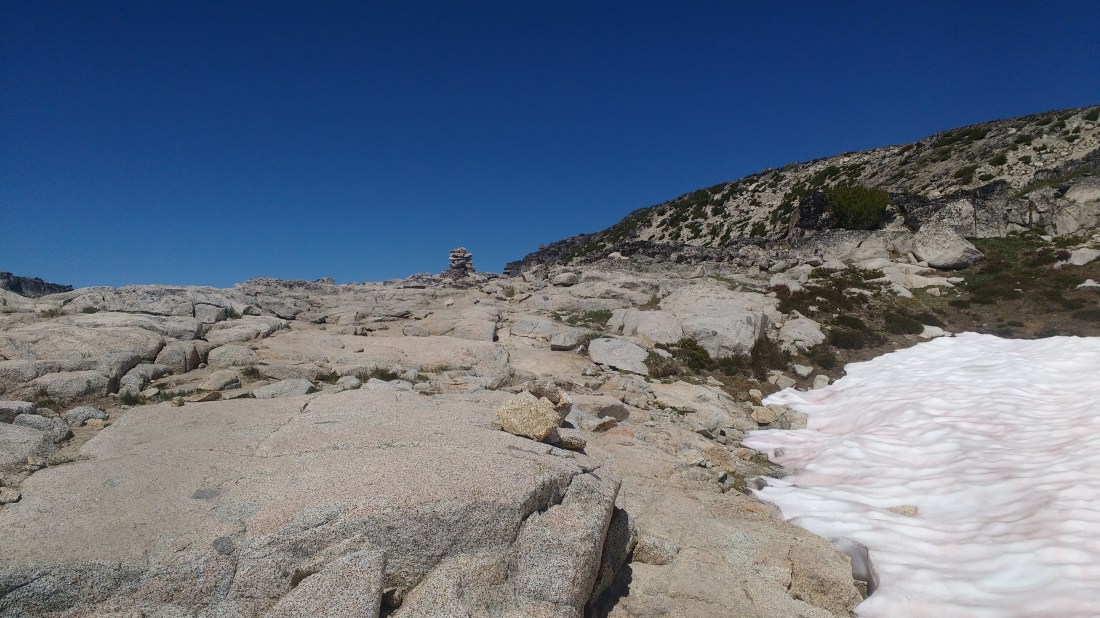
Above Upper Snow Lake, the trail gets steep and rocky. It’s easy to lose when it runs over a granite rock face or switchbacks in the middle of one. I spent several minutes near the top trying to find where a trail exited a larger rock face before giving up and finding it by accident as I retraced my steps. There are several short traverses across smooth granite which slopes down to steep rock faces. Despite the good weather and dry surface, I step across them carefully because there is no place to grip if you started sliding. At the end of this climb is the Core Enchantments Zone.
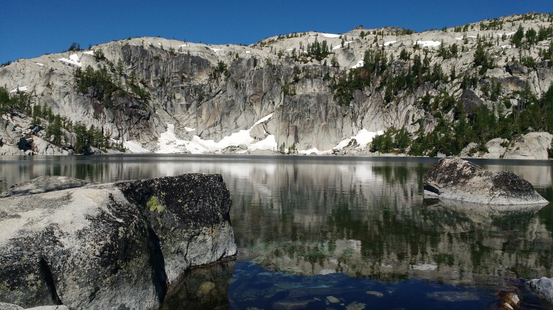
Lake Viviane. This is just the beginning.
The Enchantments are what make it hard for me to explain to a Washingtonian what makes the Sierra Nevada in California special. Clear lakes in pristine granite bowls? Check. Decorated with lingering snow and stunted trees? Check (in the Enchantments they even turn colors in the Fall). The Sierras are a lot bigger than the Cascades but bigger doesn’t necessarily mean better and so I struggle to articulate what the Enchantments might be lacking since as I walk, nothing comes to mind.
Just around the corner from Lake Viviane is a a switchback with special significance to me. You’re following the trail over granite and having to look for clues as to where it goes since there aren’t any markings on the granite itself other than sometimes a little dirt. The trail seems like it would start climbing and so you take a few steps up but it doesn’t really look like it continues. As you begin to look around for hints of a trail further off, some cuts in the dirt below and to the left catch your attention and so you follow them. This leads you on, though never in a very distinct way, but always with some hint of human passage, until you end up at a lake with a trail which is completely disconnected from the main corridor. This is what happened the first time I came through the Enchantments with a friend in the fog and no map and was too tired to take just a few extra steps. Those extra steps get your head up high enough to see concrete steps and rebar have been put in to the smooth shallow incline sharply to the right making an obvious trail. I don’t miss it this time but didn’t see the rebar where I thought I would and so might very well have gotten lost again if I didn’t know to keep looking.
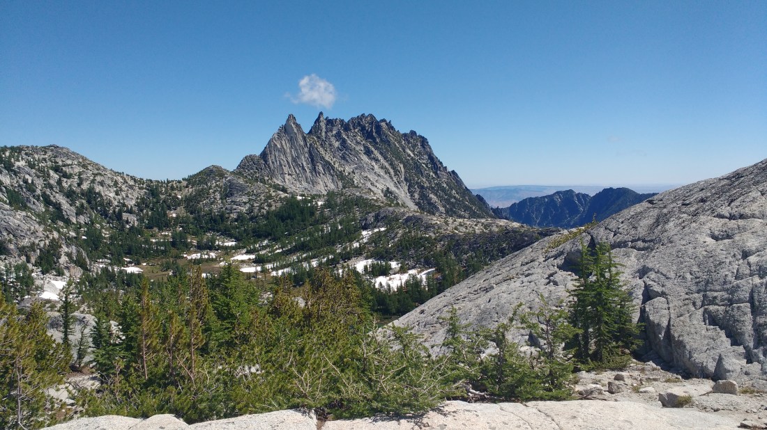
After that, the trail much runs a course up to Aasgard Pass with so much visual stimulation that it could keep an ADD child engaged. I won’t give away the crown jewels (you can look hike it yourself) but here’s the first example of a couple of features which I happened to capture on my cellphone.
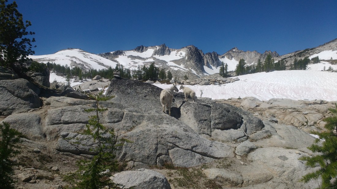
Water pouring over granite.Ragged peaks rising dramatically into the sky.Families of goats.Discovering that there are some things which even mountain goats have trouble climbing.Cairns guiding you through otherwise invisible trails.
I don’t seem to have taken any pictures of Aasgard Pass or its ridiculously steep descent Colchuck Lake which seems to grow significantly you drop towards it the way that buildings grow as a plane lands. At the bottom as you start around Colchuck Lake there’s a boulder field which feels like a jungle gym and which I always think would be so much more fun if I hadn’t just burned up my legs coming down Aasgard Pass.
By the time I’ve rounded Colchuck Lake, I’ve seen it all and am ready to be done but still have several miles of downhill. I’m back in the forest and forest can be experienced off any trailhead. I come off the high of the Core Enchantments pretty hard.
Coasting on my bike down from the Stuart Lake trailhead to where I’ve left my car a the Snow Lakes trailhead cures all that. The breeze and feeling of motion are good. The washboard road requires focus to avoid spine jarring bumps. I try to use the brakes as little as possible so I can stay ahead of cars and not get caught in their dust. It’s just fun, even if sometimes it’s type-II fun.