Hayduke Day 8

When I woke up it was raining. Today had what sounded like some intense route finding across steep canyon sides so I waited out the rain before descending into Horse Pasture.

The first thing the guidebook makes a big deal about is the climb to bypass a large pour off in Young’s Canyon. That climb really didn’t feel so bad compared to the exit from Butler Wash yesterday.

The one notable difficulty was figuring out how to get out of a chimney which I’d entered with my backpack. I wound up stashing my pack in a bush which was blocking the top so I could climb out over it, then to extract my pack had to pull it under the bush.

Walking over to the descent back into Young’a Canyon was an exercise in imprecision as I followed the rim, my compass, and various use trails at will. I wound up on the wrong overlook but it was an obvious mistake 1) because there was no way down and 2) because there was a beaten path to the correct overlook. The correct overlook is as far west as you can get while following the rim without starting into a side canyon to the south.

The first part of the descent would have been a disaster without the cairns marking a pretty clear route. At one point I almost didn’t make a turn because I thought I’d gotten to the bench mentioned in the guidebook when I was still above it.

After passing the gap between the canyon wall and the “pinnacle”, things got steeper, more narrow, less obvious, thinner, more likely to slide under your feet, etc… (aka sketchy) but it was still either pretty obvious where you needed to go or caromed. This was huge for me because I probably wouldn’t even have correctly identified the start of the descent without a hint.

Back in Young’s Canyon, there was bush whacking. To avoid this, I tried to find little trails on the sides above the stream. One of these lead to a USGS marker and then dead-ended so I cut back to the canyon bottom just in time to run across the pour off which Skurka’s Supplement mentions can bypassed by contouring, descending, contouring, and more descending. So simple the guidebook doesn’t even mention it. I started the contour and at some point noticed a few sticks blocking the trail. This is the universal symbol for “the trail after this is not where you want to go”. I stepped over them because I didn’t see anything else that could be a trail. After I’d gone far enough for it to be clear I’d gone too far, I doubled back and noticed not one but two cairns near the stocks. After a few seconds of searching that this was the beginning of the next descent. The trail wasn’t immediately distinguishable from general rubble but didn’t immediately get clogged out either. It looked impassable but that was just from where I stood. This has been the big lesson today. It’s really hard to tell whether something goes. Unless it’s a vertical cliff, it might be the trail.

I’ve decided that the guidebook description of Lower Young’s Canyon as having a few easily bypassed pour offs is a joke because of how hard Upper Young’s Canyon was when they went through. Skurka’s description of the one bypass is probably worth the entire price of his supplement because without it and the cairns I quite possibly would not have figured out the route and certainly not before sundown. The Hayduke readjusts your sense of what is possible and reasonable.

To illustrate, at the end of Young’s Canyon just before the confluence with Dark Canyon, I had to bypass a pour off on steep rubble which overlooks a pool which looked deeper than I was tall. This ended at a small overlook where I could see two guys camping in the other side of the steam. I asked if they could see a way down. They said no but they’d heard there was one. After looking around very carefully I found a place where a few steps would get me to an overhanging ledge. This dropped off (as in I sat above it, pushed off so my pack would clear the edge, and dropped a few feet) onto one rock which dropped onto another which dropped onto the mud. Not particularly dangerous but neither rock was level or had room to catch yourself if you stumbled.

The two guys were named Dave and Josh, a father-son hiking pair with a penchant for obscure canyon hikes. We hit it off and so I decided to call it quits with an hour of daylight despite only making it 7 miles today. They shared whiskey and made a fire. Trail magic. Josh has hiked the AT in 1997 and we traded stories until the coals were dead.

Hayduke Day 7

Memories from October 10, 2018.

I was cold last night because my deflated sleeping pad didn’t insulate against the wet sand very much. I wound up shoving my backpack under my torso and hips which let me pass out but not sleep well. Also, it had been calm when I pitched my tarp so I pitched it high and in the night gusts were coming from all sides.

I successfully tracked every turn of the remaining miles of Butler Wash by compass and was expecting the spire which marks the exit canyon when it came into view.

Getting out of Butler Wash felt like a minor ordeal. However the Fable Valley exit was so much more intense that I can only remember a few things about it.

Getting out of Butler wash involves most of the way up one drainage then cutting over to another, contouring to it’s head, then scrambling out. I actually got lucky with identifying the cut-over point. I was tired of taking steep scrambled to bypass things and saw a gap where a ridge came down and thought I might see if I could bypass a couple of things at once. Then I checked the guidebook and map and realized that this was the point where I switched drainages instead of continuing to go up this one.

Finally getting out of Butler Wash and looking out across Beef Basin (I did see some beef while crossing it) felt so good.

During the descent into the wash after the pleasant walk across Beef Basin, I didn’t see either of the springs I’d intended to refill water at, probably because I came in a little lower than you’re supposed to. I wound up finding relatively clear water in potholes on the way down.

Fable Valley trail should be more popular given that it goes next to the HUGE Gypsum Canyon. Maybe the problem is that it’s accessed by a 4×4 road. The rest of it is pretty ho-hum after that.

[The WordPress app doesn’t show panoramas in its picture selector and I only took panoramas]

Getting out of Fable Valley by means of a side canyon involves, according to the guidebook author “numerous pour-offs. The Skurka supplement says three. I think he has a higher standard for what counts as a pour-off or bypassed two and once on several occasions. By the end I was getting fed up and started looking for bypasses as soon as I thought a pour-off might be coming.

Finally getting to the Dark Canyon Plateau with it’s gentle slope, grass, and trees which were far enough apart not to try to steal the trekking poles you had stashed so you could scramble with both hands.

Tonight ended by unexpectedly finding a campsite in a pleasant spot on the track into Horseshoe Pasture. I’ve given up on my air mattress staying inflated so I spent some time building an elaborate nest with my backpack.

Hayduke Day 6

Memories from October 9, 2018

After packing up to leave the Needles Outpost this morning, I discovered that I didn’t have my trekking poles. I resigned myself to wait until 9am when it opened so I could search the store but managed to catch an employee doing chores to look for me. Ultimately, they were just outside where I’d been trying to patch my sleeping pad. The patch didn’t hold so this morning I tried the rubber cement under tenacious tape. As I’m typing this, I’m feeling that not work either. Nights are pretty warm but I’ll need a new sleeping pad at my next resupply otherwise it could be safety issue as you can lose a lot of heat through the ground without a proper pad.

Leaving out a few shorter sections, the hike had several distinct experiences:

1) Road walk to the Big Spring Trailhead. This means I skipped the last ~4mi of section 3. I accidentally threw out the guidebook page for section 3 forgetting I had a little bit more. The terrain looks pretty difficult so I’m just going to let it go. The road walk however was like flying.

2) Walking good quality trail (a first as previously the route has been on road, rarely maintained trail with navigation hazards, or cross country) to Butler Wash. Also like flying, though I got winded trying to hike too fast uphill.

3) The beginning of Butler Wash which is best thought of as a constant obstacle course. Like doing a lot of slow step-ups at the gym on uneven surfaces.

There was one pour-off which had some trouble navigating around. After exploring a couple of promising options which didn’t quite go, I ended up going back a hundred yards or so and scrambling up a steep dirt slope. On the way up, I saw a nice shallow slope up just another 50yds back. Oh well.

4) The majority of Butler Wash (admittedly, I’m not done with it yet) which was like walking on a beach near the tide line where the sand is reasonably firm. Like flying.

This part of Butler Wash wiggles like crazy (also, it doesn’t seem to be consistently up or downhill) and I was trying to track my progress on the map. Since it’s annoying walking with map and compass in hand and trekking poles tucked under an arm, I would put the map and compass away after having memorized the next few turns the was was supposed to take so I could trace them as I went. I’m one place, I got a NE turn of the wash confused with a side canyon which came in from the east. Multiple other things lined up well enough that when I pulled the map and compass back out to try to find my position, I was thoroughly confused. I walked back until I was sure I knew where I was, then walked the turns carefully watching the compass. This time, however, I got SW and SE backwards when translating from map to compass. I was so confused (side note: all three streams which converged at this point flowed downhill yet there was no outlet and there didn’t appear to be water pooling despite recent rain). I just couldn’t find the place where the wash turned NE. Then I got all the way back to where I was sure that the side canyon joined from the east, read the bearing, and it was NE.

Hayduke Day 5

Memories from October 8, 2018

I waited for it to be sufficiently light to travel without a headlamp before starting today. This paid off as within a few minutes I had made it to the top and the terrain lined up with the map and everything was good again. The rain just made it more epic.

Last night’s decision to stop not quite at the top was a good one because it did rain a little and the alcove provided better shelter than my tarp and ground cloth would have in the shallow mud. However last night I was literally in an in-between state both physically and mentally. This morning’s quick resolution and the ease of following the map and guidebook step by step on this ridiculous cross country route so much better. I didn’t move quickly but it all made sense and the scenery was grandiose.

There is a lot in the guidebook and Skurka’s supplement about the descent down “We Hope So” wash. Taken step by step nothing felt difficult or intimidating as it had the day before. I’m much worse at down climbing than climbing up but there wasn’t really any climbing, just some lowing yourself down with tricep dips and a few feet of steep descent to get between things.

I missed the turn up the Canyon and headed for the Colorado for a few dozen yards before turning around. The sandstone sometimes formed steps at the banks where so it seemed like an urban river walk, though one through a manicured garden.

When the canyon came to an end, the rest of the day was spent road walking. First to salt river where the Hayduke would begin to cut cross country again. However with storm clouds moving in I made a break for the Needles Outpost where I had a resupply box. I got wet anyways. On the walk in, little after noon, I saw my first human since two days ago around around 8am. Until seeing them, I hadn’t even realized. Maybe it’s because there are so many footprints and my imagination passively invents the people who made them.

Since I was passing a ranger station anyways, I stopped in to get a permit in case I don’t make it out of the park tomorrow. The juxtaposition of the two clean couples ahead of me at the Backcounty Office, worrying about water, scenic-ness of an area, the rain, whether there was water in the canyons, dressed in dry, clean clothes compared with my mud-spattered, rain soaked garments was fantastic. At one point someone asked if the rain would let up tomorrow (forecast says it will and I really hope it does as a rotting smell is beginning to emanate from the depths of my backpack) and I laughed quietly because I’m so beyond worrying about getting wet. They overheard me but chose to smile and understand given my sodden state.

Resupplying at the Needles Outpost went quite quickly. After reloading my pack it was only around 3:30pm. However, Caleb wound up helping me find and patch the slow leak in my sleeping pad. Both he and Amber were very welcoming. I paid to sleep in “the cave” which is a blasted out cavern with about the size of five small campsites. My gear is finally getting the drying it needs. Unfortunately, while writing this, I’m detecting that the patch in my air mattress isn’t holding.

Hayduke Day 4

I can’t believe how much happened today. I had to look backs my previous post to know where to start.

My alcove was pretty cozy last night. At one point drops started pooling on the roof near my head but I just had to move a few inches and it as only when the rain was the hardest.

I suited up for a proper rainy day from the get go. While it was wet much of the morning, things never got going very hard and most of the afternoon was dry, even sunny for a moment as I was climbing out of Indian Canyon.

The big pour off was obvious as was the bench across which the route. What learned next was that “desert” means land of red waterfalls.

I’d been worried about the descent into Lockhart Canyon with the water flowing in the same places where I might have needed to climb down something but these were unfounded. The turn-off into the canyon was easy to spot and the whole experience was quite pleasant.

I had put on neoprene socks this morning thinking that it as going to raining all day. Instead those came in useful at the frequent stream crossings as the Jeep road at the bottom of Lockhart Canyon crosses it frequently.

The road appear at to have a 4-way intersection where you turn right. It was actually two three way intersections and this threw me for a bit since at the first intersection none of the directions went west or south which were the directions I expecting to turn or, if it wasn’t the correct intersection, continue.

The road walk to the drill bit was muddy. I don’t thinks this road is almost ever actually used despite being in great shape because my footprints were deeper than any rut.

On the descent into Rustler Canyon, I got stuck because there’s a pour off you have to bypass and I didn’t see the bypass immediately.

After that it was mostly a pleasant, if slippery and muddy walk. Neoprene socks were definitely a boon.

Then I came across this plunge hole. I thought it might be like the previous pour off and looked for a bypass. It turns out the guidebook says to go down through the hole. This is the scenario I had feared: having to climb down where water was flowing. I removed the guy-lines from my tarp, attached them and a single line to my backpack. Then threw the loose end down so I could pull the pack after me when I climbed down. It turned out to be quite easy as the rock was easy to grip despite being wet and the shelves you use to clamber down weren’t quite as far apart as they’d looked.

From there Rustler Canyon was a cake walk.

On meeting Indian Springs Canyon, I had a foot step in sand which was at water level and sink almost to my knee. I moved pretty slowly after that.

At the eastward turn where you exit Indian Canyon, I drew water and started trying to find my way up the series of ledges the guidebook mentioned. The way up would frequently be visible only once you were right under it. This was disconcerting because I couldn’t tell if I’d gotten high enough to start contouring which is the next step in the guidebook. I spent a great deal of time trying to figure out where thing were supposed to go but was worried about exploring because in the thin, sodden soil. I was leaving deep footprints and as I frequently use footprints as guides and confirmation, I didn’t want to leave a wrong step to confuse others.

I’d just gotten past the second of what wound up being a many-stages process when the sun came out. While it hadn’t been raining constantly, it hadn’t been dry either and I was good to strip off the rain gear and let my feet dry. I was also able to replace some of my muddy river water with clean rain water from depressions in the rocks.

Today closes with me somewhat unsure of where I am. The topography has been hard to align with the map and not wanting to make missteps has worn on me. It has taken a long time to go a very short distance. In one instance I shoved my pack through a crack between two rocks and had to work my way up after it which marks the first time I’ve used a climbing move. Immediately after that, I had to get on top of a large rock by bracing my feet in opposite rocks. Probably not a big deal for climbers but it feels like I’m playing a very different game.

At this point I’m about as high as I can go and decided to find some place to camp since large dark clouds were blowing in to replace the playful white ones. At that point I realized that all the “dirt” (half-dry mud and gravel) on which I could pitch my tarp was too shallow for stakes. So after some desperate searching, I wound up in another alcove, this one not so nice as last night’s: thing and sloped to roll you out. Fortunately the clouds haven’t lived up to their potential. Hope that keeps up.

Hayduke Day 3

Today it felt like the Hayduke started for real.

Around 5:45am continues down Kane Creek roada road. The road was easy to follow even without my headlamp so I turned it off and let daylight come naturally.

But Hurrah pass itself almost put me out of my mind.

On the way down, I saw the same Jeep come and go then come and go again. They said they’d forgotten some clothes. I guess that’s what’s nice about backpacking, you always have all your stuff.

Most of the day was spent on a 4×4 track which doesn’t sound that exciting. After Hurrah pass, things were nice but not grand. I took a wrong turn once on an ATV playground but it was easy to backtrack. I skipped going down to the Colorado to get more water. More on that in a bit.

After turning off into the Lockhart Basin track, things got interesting fast. I’m impressed that someone found a path wide enough for a vehicle up the frequently narrow or rocky bands in the cliffs. While this is a 4×4 road, none of the tracks looked recent and so I decided to think of it as a hiking trail that ATVs could go on a well.

Lockhart Basin sounds like you’d be down inside a basin. In fact, you’re above things. The route follows the bench in and until it turns into the next valley.

During this time, I realized I’d miscalculated my water supply and so was probably going to have to bail out two miles each way once I got into Lockhart Canyon to draw water from the Colorado. I hate “bonus miles” and was very excited to find a shallow puddle of clean, clear water in a rock.

It had been raining intermittently and when I stopped drying out between drizzles and the drizzles became light rain, I gave in and put on my rain clothes. The upside is the rainclouds added a constantly varying aspect to the views. Sometimes two ranges looked similarly distant but then one would disappear in the clouds and you’d realize it was farther away. Watching the clouds come in waves and watching each wave advance was a interesting game as well.

Also, the rain provides more places to drink from the rocks. I’d do a diamond push-up down so that my chest could rest on my hands and my clothes wouldn’t get too wet but I could still suck up the clean rainwater.

Finally, the big event for the day was finding and successfully navigating (so far) the drainage where the Hayduke leaves the 4×4 track. I’m not in Lockhart canyon yet but as someone not familiar with off-trail travel, I couldn’t believe it when the “forming wash” as the guidebook called it, actually started to go (ie was passable). On approach, you can see huge cliff bands which seem like they would quickly block any exit from the 4×4 track so you don’t quite believe that the drainage is going to be hikable but it is. I’m still expecting to hit those cliff bands eventually but I’m far enough that I expect the guidebooks to work at that point.

I found an overhang under which to camp for the night. No need to set up a tent. It’s on the high side so no worries about flash floods.

Hayduke Day 2

Memories from October 5, 2018

I woke up to may alarm at 5:00am but didn’t manage to actually get in the trail until 5:45am. Things got tough fast.

That water is mid-thigh and opaque.

Don’t let the evidence of trail work fool you, this was some solid bushwhacking until about the time the sky started tuning light and things began to open up.

The wash pushes you west and if I’d actually looked at the map instead of thinking “get to the road” I would have been carried along the proper route. Instead I punched through some reeds and a water filled ditch to make it to the road. At that point I pulled out the map and realized I should have just stayed in the wash.

A brief road walk west and I was back in Courthouse Wash which has an intermittent trail. Unfortunately, the tail will try to kill you if you don’t outsmart it by crossing to the trail on the other side of the wash at the lowest point of the water. Otherwise, you get trapped against the canyon wall and try crossing neck deep stagnant water.

The water is neck deep. If there hadn’t been a branch to drag my pack across, I’d have been in over my head.

After getting the hang of it Lower Courthouse Wash was something of a fun obstacle course with the feel of a Tough Mudder.

I made it to the road into Moab around 11am and walked into town. A peach seller recommended Gearheads as a place to replace my bent pole and the compass I lost, probably during the neck-September adventure. The place is a gem. Very helpful and will refill you water.

After a burger at the Moab Brewery, I’m on my way out of town to see if I can get across Kane Creek before the rain as was recommended by Bill at Gearheads. He actually recommended I stay in town and wait out the rain but I’m from the Pacific Northwest so I wasn’t having it.

I’ll finish this post when I have service again.

Hayduke Day 1

Memories from October 4, 2018

My alarm went off at 6am to wake me on the floor of gate B83 in the Denver airport. Camping gear makes sleeping at the airport much more comfortable but until the tests of the emergency warning system stopped around 3am, I didn’t sleep well enough to dream. So I slept on the flight to Canyonlands Airport outside Moab, UT. I woke that time by turbulence shortly before landing and slid the window screen up.

I’ve read several blogs about the Hayduke but there’s a reason you do it yourself.

A nice fellow named Brodie from Wyoming who had introduced himself before departure on account of our similar taste in trail runners wished me well on the trip. Then, I loaded up the 7 liters of water I’d taken carry-on when my bag was gate checked (the airline employee who had directed me to remove the water apologized after seeing all my bottles and bladders) and headed for the road.

I’m not to use GPS as a personal challenge (I’m sure I’ll give in eventually and have the route loaded in my phone) and I’m not great at map and compass so I had a little trouble finding the road dirt road which forms the “Klondike Alternate” start to the Hayduke. It’s primary advantage is that it starts at the airport which saved me from having to arrange transit. Eventually after some cross country meandering, I wound up cutting through an RV’s campsite since RVs need roads.

Some kind of trail marker?

Road makes walking pretty easy.

It has rained this morning before I landed and things initially smelled like salt marsh with a hint of urine. This disappeared as I led the road for a 4×4 track. The destination was a rock formation called Marching Men. Initially, I wasn’t sure I’d located it properly when I took a beating but as you get close enough to make it out, there’s no question.

Nothing else looks like men marching.

Unfortunately, I took a right when I should have taken a left and didn’t get to see them up close. When the 4×4 route was clearly heading in the wrong direction, I left it and wound up cutting through a little streambed only to run across… another 4×4 track.

This wound up taking me to the Hayduke at the point desired, just not the route desired.

After lunch, I turned down another 4×4 road (so far thing are pretty easy) and noticed a single set of footprints which appeared to have passed since this morning’s rain. A Jeep at one point informed me that their creator was about a mile ahead.

Unfortunately the identity of the person who left the footprints will have to remain a mystery. They disappeared right around a side trail which in hindsight, I should have taken as well. I’d noticed it but thought it was too early for me to be there. Instead I saw the pipeline.

From there the route was actually pretty easy, it just didn’t feel that way because I’m new at this whole cross country thing.

1) Follow the pipeline to the fence

2) Follow the fence to the “fins” which are apparently sandstone formations which don’t look particularly like fins to me.

3) Pretend you’re water and you’ll eventually wind up in Courthouse wash.

Just go with the flow.

But remember you’re human and you’re actual object is to get where water would eventually go so maybe don’t jump in there.

4) Because I don’t have an overnight permit for Arches NP, turn right instead of left (where the trail goes), climb out of the wash because you’re blocked by a hanging fence, and set up camp outside the second fence they have outside the wash.

I wound up stopping with over two hours of hikeable light left because I need to do all of Courthouse Wash in one go due to the lack of an overnight permit. I didn’t get one because you have to apply in person and time is precious so I wanted to start hiking. Instead, I got this as my bedroom tonight.

Today was a great first day in the trail. The weather was cool and initially overcast which made for great lighting. I’m probably sunburned from when that burned off. The navigation challenges didn’t cost me much and so mostly served as a gentle introduction to not worrying so much. Finally, I was forced to go to bed early which Is probably for the best since I didn’t sleep enough last night.

As with any trip, I forgot some things: a ziplock for trash, sunscreen. Fortunately I can probably get those and a jar of Nutella or peanut butter in Moab tomorrow. Doing the Hayduke westward seems to have lots of small benefits.

Hayduke Day 0

Memories from October 3, 2018

910856AD-3DB0-45AE-A519-A4A4032FEEC5

7:35am

I just finished taping and addressing resupply boxes, finding a location near Bryce Canyon to ship that resupply box, and packing my backpack (weighing 11.4lbs w/o food). The dryer just finished with the laundry so I my dirty duds won’t be perfuming my room for two months while I’m gone. More loose ends come to mind. At some point, I still need to go to work today.

4:45pm

Shipping my resupply boxes packages held up the normal line at the post office this morning. I’ve changed into the hiking clothes I’ll be wearing until Thanksgiving. The feeling that I’ve forgotten something keeps worrying me. I print off a map of the Klondike Alternate which I’ll be taking for the first several miles because I realized I’d only printed the main route.

I’ll paste this here for anyone who wants follow: https://share.garmin.com/IsaacWilson

Now it’s off to the bus to get to the airport…


7:48pm

It turns out that large jars of Nutella aren’t allowed through airport security so that’s something to pick up in Moab. I fly to Denver tonight for a 6hr layover (good thing I have camping gear) before taking the morning flight to Canyonlands Airport.

Summer Hikes – 2018

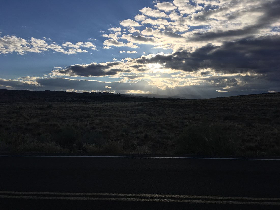
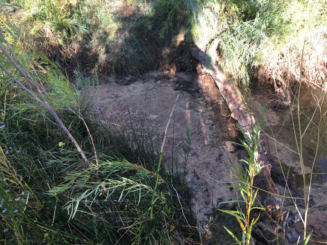
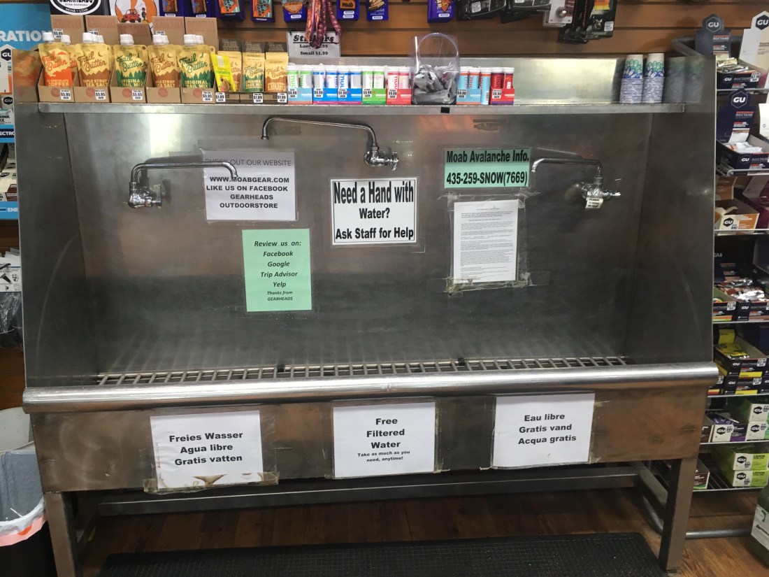
This summer was a bit of a blur so instead of proper write-ups of each worthy hike, they’ll all just get a quick recap.

Thompson Lake Fail (May 12)

Take 2 on my attempt to make a loop out of Thompson Lake and the Pratt River trail. This time I onto the traverse past Thompson lake under Putrid Pete’s Peak before turning back because the going was too slow and I didn’t feel safe. The clinometer showed a 45+ degree slope, there was a lot of post holing, no trail, and no GPS. In the Thompson Lake basin, the snow was ~5ft deep but it was cut through all the way through where the little streams which you’d barely notice in the summer ran. Just finding my way down to Thompson lake was fun as the trail seems to be maintained mostly through use and so it wasn’t always clear where it was though the destination was never in question. At least this was a fun fail.

Pictures


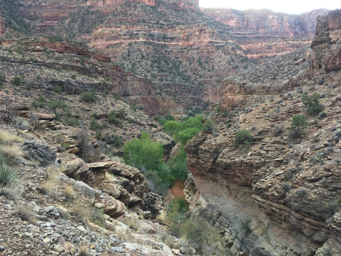
Pratt River Trail (May 19-20)

This was an out-and back scouting trip. Last year, a ranger who hitched me off Steven’s Pass said he’d hiked this and flagged it for potential restoration. The trail follows an old, straight forest road which is nice in that it’s usually flat but sufficiently overgrown. The state of disrepair varies from slightly mossy to a few sketchy footlogs where things have been washed out.

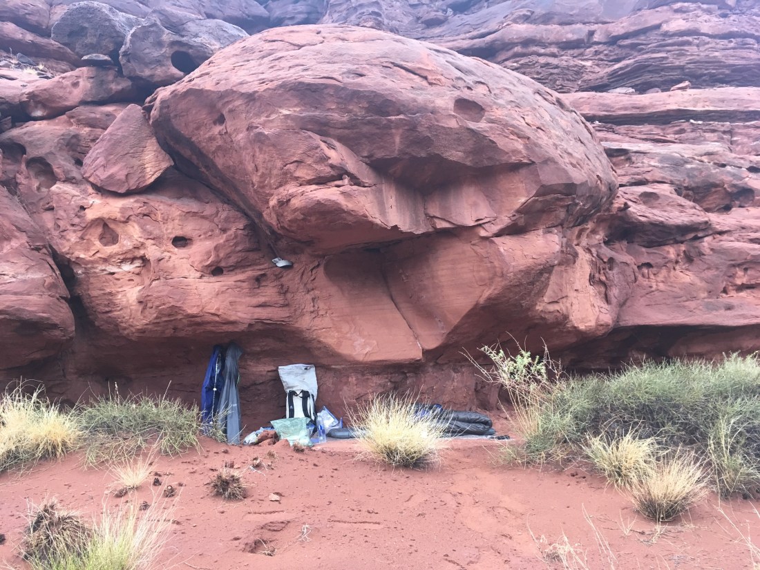
It started raining as I headed out in the after noon and after a proper downpour, things dried up until sundown. I abandoned my interest in trying to cross Pratt River early and see if I could make it up to Spider lake. I was able to identify the correct valley with map, compass, and “staying found” (taking a class paid off) but lost my appetite for what would have been a at least a waist deep crossing in a fast current. However, I discovered that there used to be a ramp down to the river at about where I’d intended to cross and so wonder what the history is there. Maybe the used to float logs down the Pratt River?

I spent the night in a hammock gifted me by my Senior year of College roommate. I’d only used it once before and gotten too cold. This time I brought a mat and it kinda worked. It took some work to set up but was quite a comfortable cocoon until the prolonged “banana bend” (even though it’s an asym design) began to wear on me. Also got to play with the cat can stove which worked quite well.

Pictures


Ross Lake East Bank Trail (May 26-27)

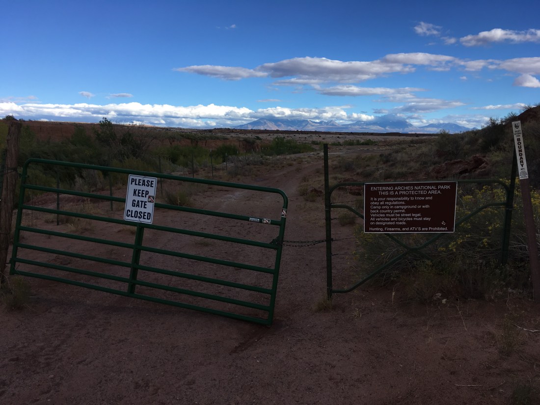
The East Bank trail is long and pretty flat and made a chance to stretch my legs (~24 miles day 1, ~36 day 2) and see if the post-surgery knee would hold up. It did and so I got to tag Canada. I woke up on on day 2 and despite having overslept and despite feeling it prudent to turn back, decided to go to Canada anyways and deal with the fallout later. Seeing the border again made me really happy.

It turns out you can just drive into the US from Canada without any sort of border security which surprised me. This wasn’t a particularly notable trip from a nature viewing perspective and so I listened to two books by people who you might term cultural ambassadors. The whole things had an oddly disembodied political – social – emotional feel which is different from most of my hikes where I don’t listen to audio books.

Pictures


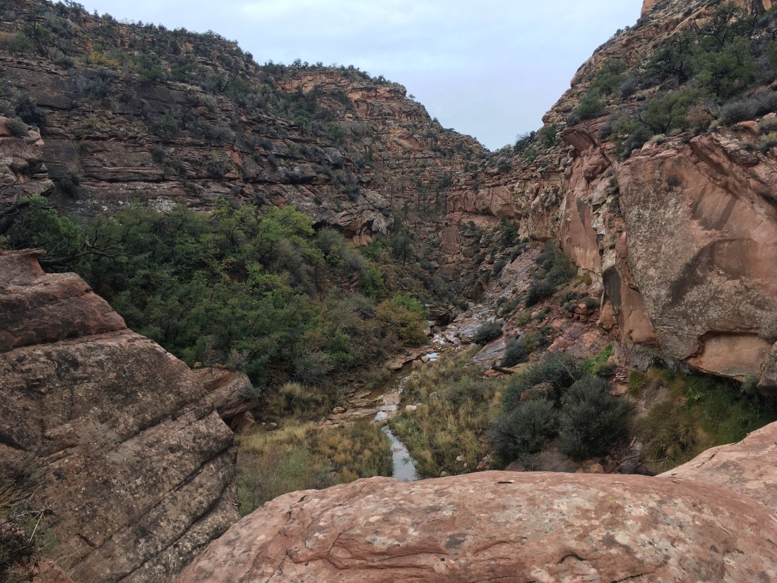
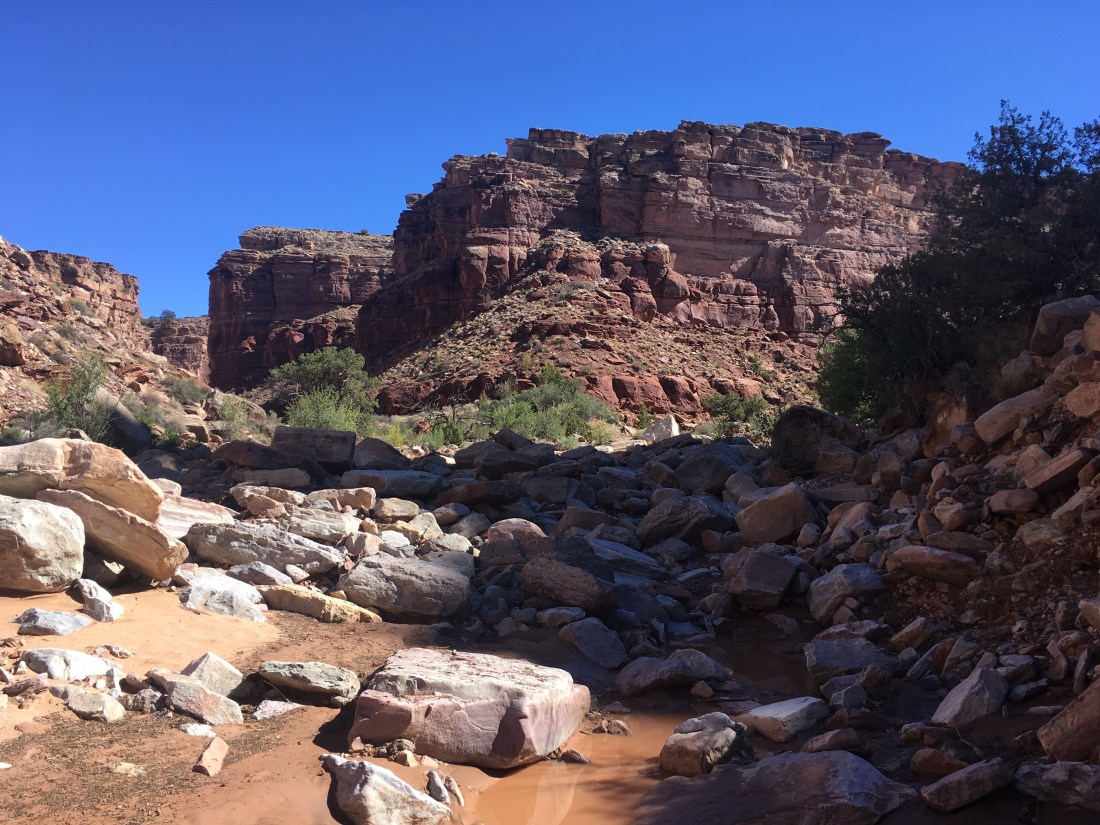
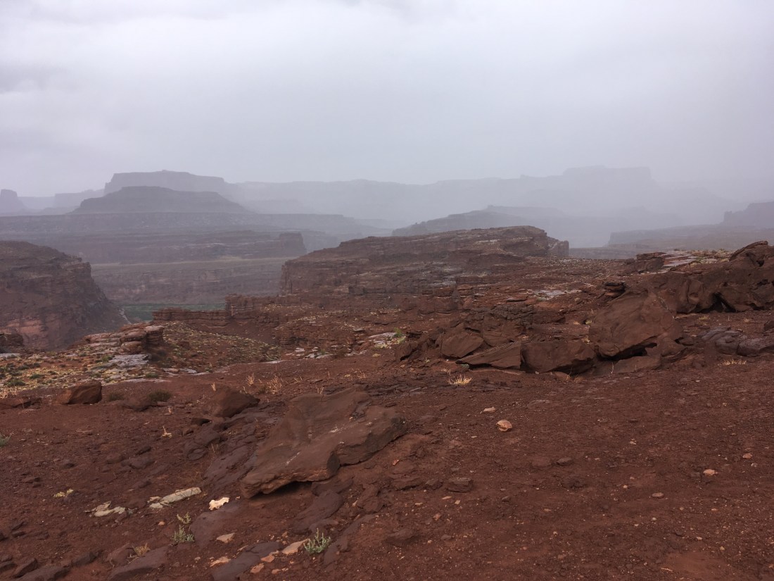
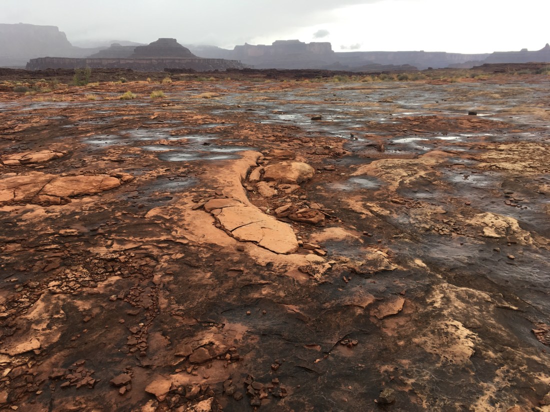
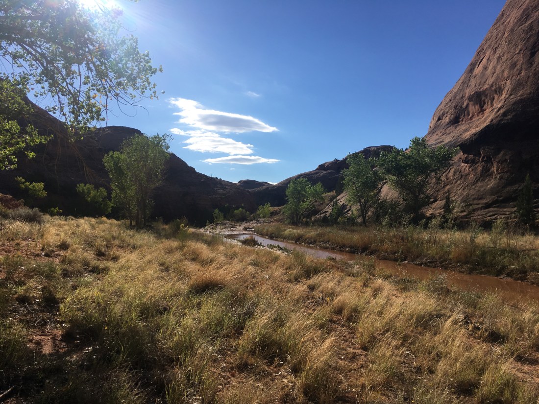
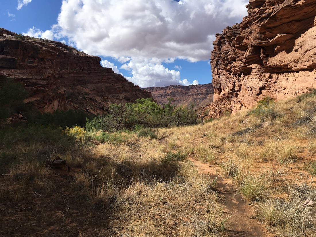
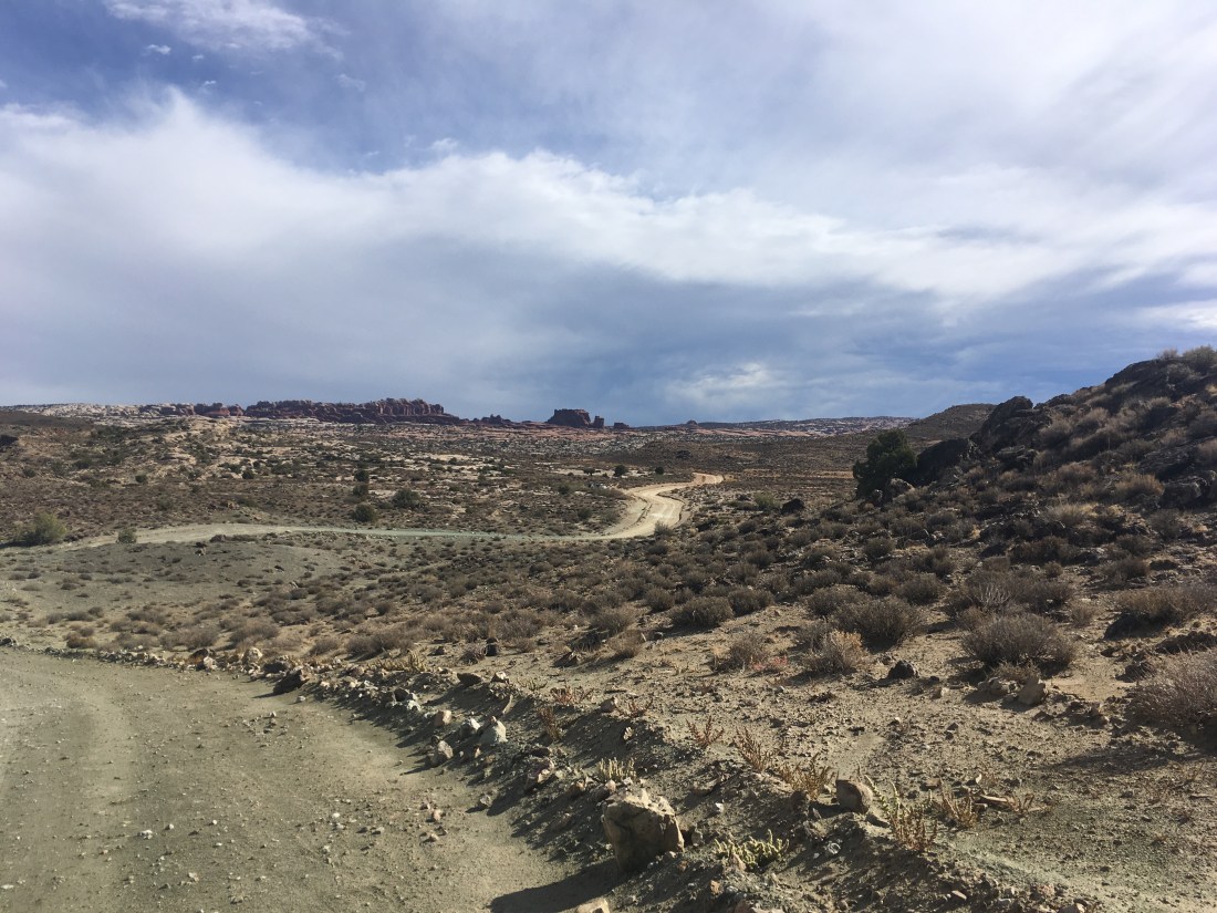
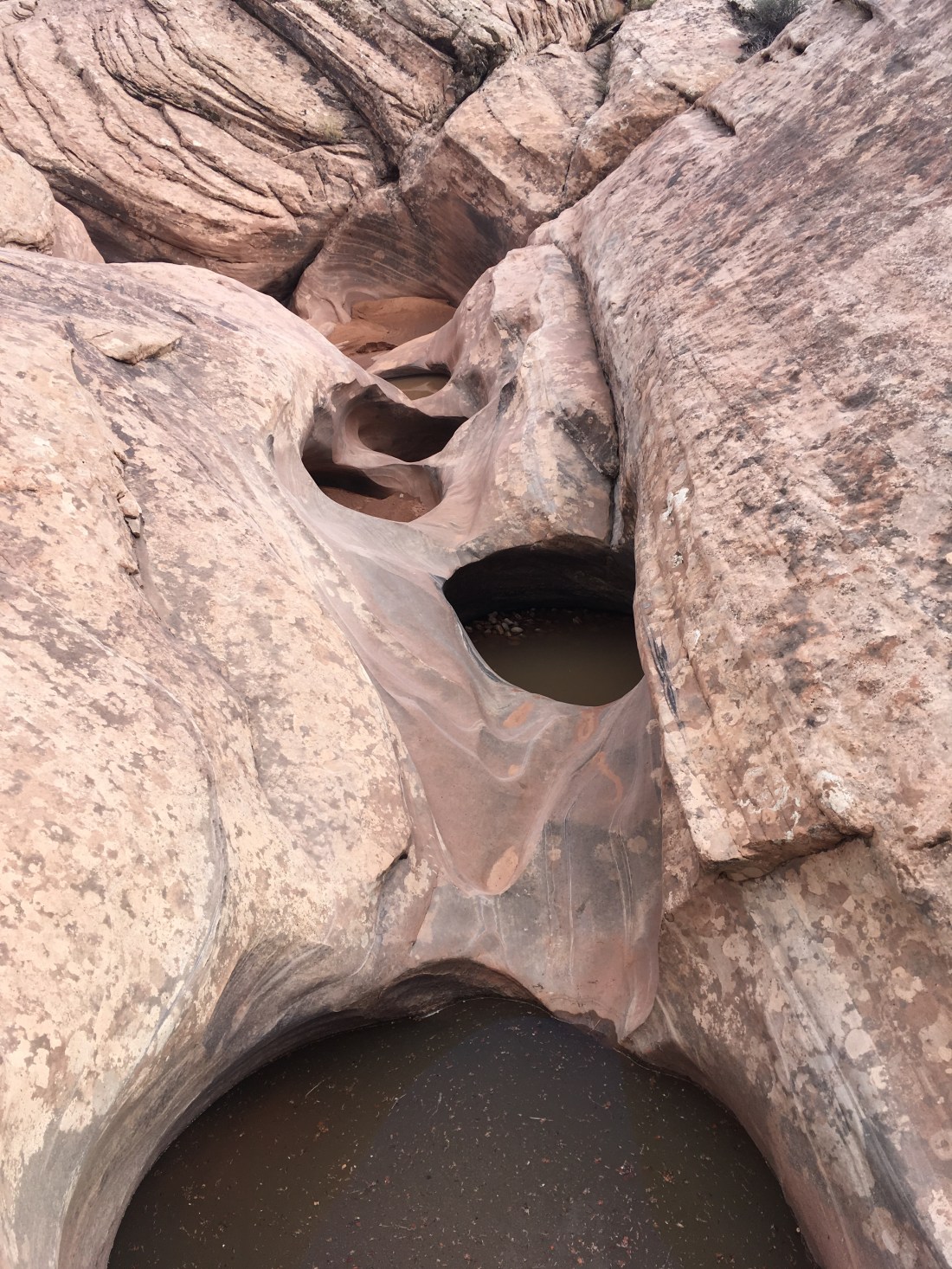
Thompson Lake through Pratt River Loop (June 23-24)

I’d taken two attempts at this route earlier this year and finally it free enough of snow to make it through. This trip was a fantastic blend of conditions: cool uphill through the forest, long traverse across a steep mountain side with just enough snow to be interesting but not enough be dangerous, mist making things mysterious, just a dash of route finding, easy miles with pretty lakes, discovering that the Pratt Lake trail is in great condition besides being abandoned (not to be confused with Pratt River trail to which it connects), and an ahead-of-schedule finish with a road walk down the Middle Fork of the Snoqualmie River.

I want to try this again next year but packraft the road walk.

Pictures


Desolation Double Fail (July 6-7)

Back to the East Bank trail but this time with the ambition of climbing Desolation peak on the way to and from Canada. As it turned out the half inch of rain which was supposed to be gone by midnight instead became thunderstorms. Ella and I had only brought emergency camping gear since we were going for a speed hike as she’s training for ultras. The most miserable night’s sleep I’ve ever gotten started at 1:30am on top of Desolation peak when I didn’t realize that my emergency bivvy would prevent anything from drying and so tried sleeping in my wet clothes. I’d hoped that they’d dry out a little and I’d get to warm-and-damp.

I’d brought a day hiking backpack which didn’t give me easy access to water when it was stuffed and I was moving quickly so despite the rain I was probably dehydrated. For dinner, I had a peanut butter and raisins on a tortilla which was mostly a giant glob of peanut butter. This didn’t sit well in the stomach. The next morning, without a clear guarantee that it would be sunny enough to dry our gear or that my stomach would stop feeling like the beginning of poisoning, we decided to head back and netted 44mi in 20 hours (or something like that). Day 2 was even quite pretty.

This was my only hike with a partner this summer and without one, it would have been pure misery. I’d probably have just turned around. However misery loves company and so I look back on the experience with unadulterated fondness.

Pictures Ella’s Blog


Devil’s Dome “Day” Hike (July 28)

Wanting a shot at redemption after getting queasy and weak a few weeks before, I set out for a 34 mile day hike. You know, as one does. With only oat bars for energy. Problems didn’t start until the last climb to Devil’s ridge when my heart rate didn’t settle despite taking a 15min break. Also, I was beginning to feel weak. I ran across two parties of heavily laden backpackers both of which commented that I was going really fast. That’s easy when you don’t have a tent or sleeping back in your running vest. By the time I got to the top of Devil’s Dome, I’d been having to make deals with myself about not worrying about how much daylight was left. Fortunately, there’s less elevation gain on the way back and the moral of the story is that if you put one foot in front on another, eventually you make it home. However, being sick to your stomach and having to hike for three hours by headlamp might have been a new low in my hiking career.

The upside is that I finally got to see Devil’s Ridge on a relatively clear day.

Pictures


Angeline Lake (August 4-5)

Feeling pretty beat up and so this was a pretty easy weekend where I hit the trailhead after noon and was back well before dinner the next day. I even brought a full tent instead of a tarp which was fortunate because there were mosquitoes. This trail follows the classic Seattle-area pattern of a boring climb (punctuated by views of a waterfall) followed something fantastic at the top. In this case a string of large, beautiful lakes with granite backdrops. The crowd thins, the trail gets less maintained and much rougher, and in a surprisingly short distance (7-9 miles) the experience is ravishing. There’s a thin, twisting, not quite tortured ridge walk worth of the Goat Rocks or Enchantments which drops you towards a saddle. The saddle was still covered in snow and I followed boot tracks over. The descent towards Chetwoot Lake is steep and I think I missed a turn-off because it looked like a pour-off. The boot tracks ended at the outlet stream from Chetwoot to Angeline which was just passable by rock-hop if you pointed your feet down-stream the current broke against your sole when stepping barely submerged rocks. The crossing is followed by a bush-whack. I started descending towards the lake but remembering seeing no backs and usually sheer cliffs, made eastward around it probably just .1 to .2mi before setting up camp in a dried mosquito bath. The feeling of solitude (surprisingly hard to come by in the near-Seattle cascades) was delicious.

On the way back out the next day, I spent some time at the Saddle overlooking Chetwoot and ferocious mountainscape behind it and got worked up a little.

No Pictures – Some things are too precious to share 😉


Jackita Ridge to Woody Pass (August 13-14)

This trip had dual purposes: figure out if I can hike all day without getting sick to my stomach and see the eastern end of Devil’s ridge. Also there’s ~10.5kft of climbing on day 1 and ~6kft on day 2 so it was also something of an attempt to be athletic again after a couple of rough goes. The trick seems to be not bringing oat bars.

Things went well. I was able to walk all day at an even pace. I only stopped twice on the first day: to draw water from a spring (springs are the best) and eat dinner. The east end of Devils ridge descends to a valley then comes up to a saddle where it becomes the PCT. The long traverse started with a good view but was quickly overtaken by foliage. The PCT really stands out in how easy it is and how beautiful it is. The traverses are high and long with sweeping views. The descents and ascents well graded.

I ate dinner of cold soaked ramen looking west from the dramatically cut Woody Pass while watching sunbursts dance and roll through storm clouds and holding onto my hat when a strong gust would come whipping through the otherwise dead air.

I ran into several through and section hikers finishing up their trips. I enjoyed being back in through-hiking territory even if I had to introduce myself as “just out for a weekend but I was class of 2016” when several asked if I were making a border push.

No Pictures – Left my phone at the shelter 3hrs up Jackita ridge when I took a break on the way back.


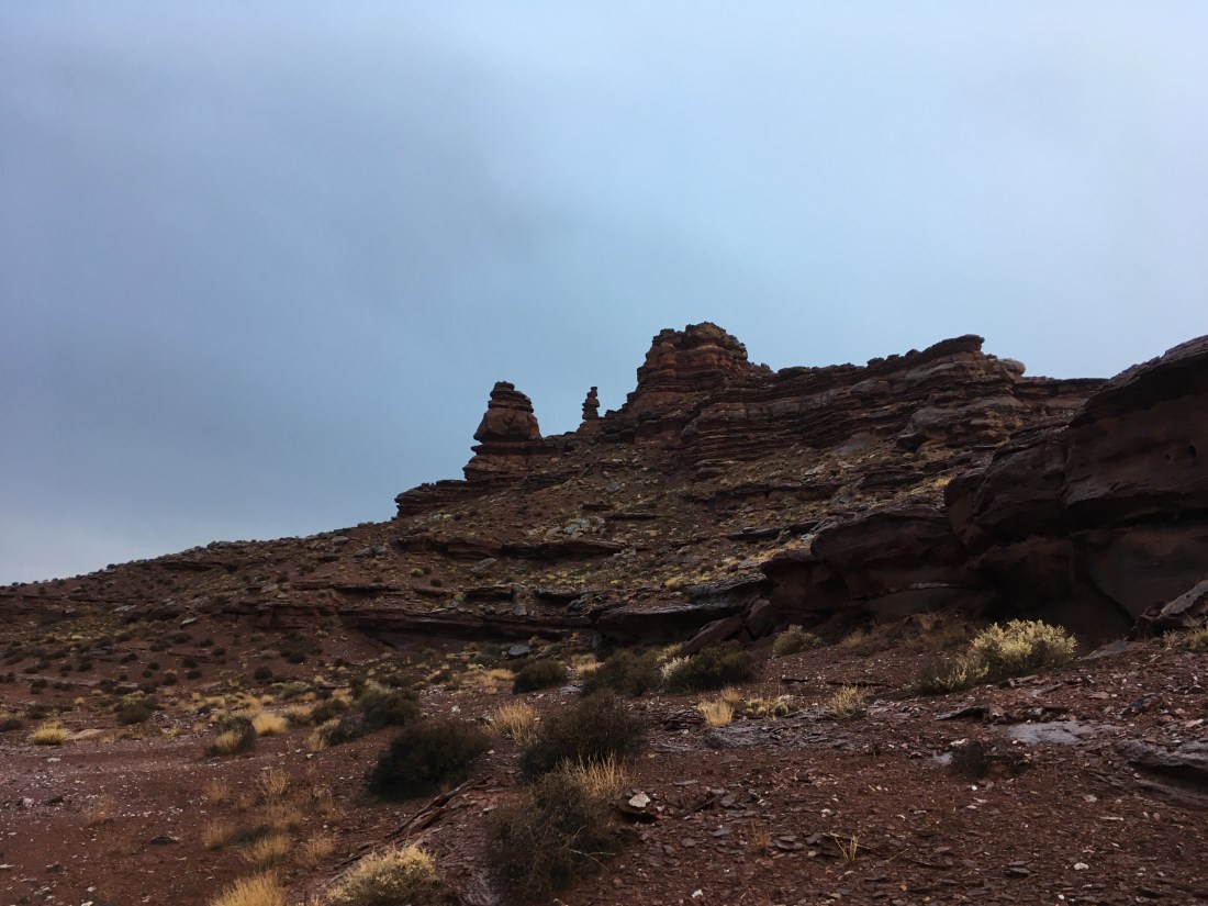
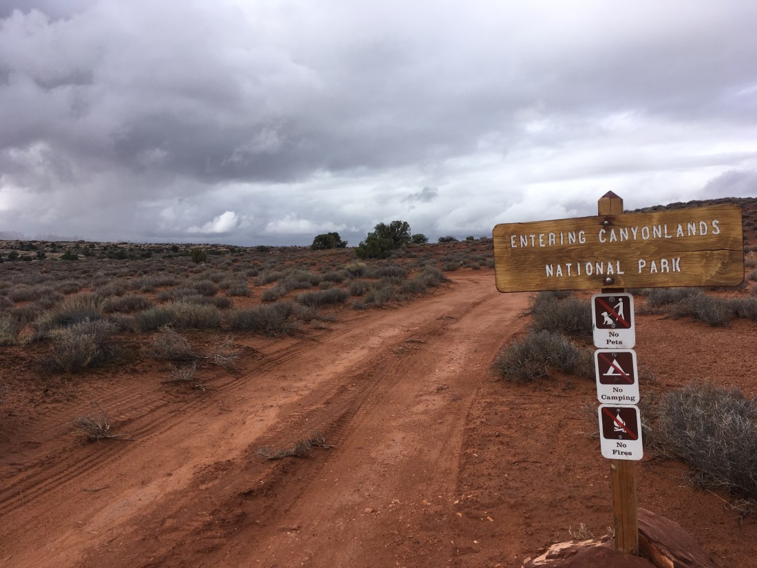
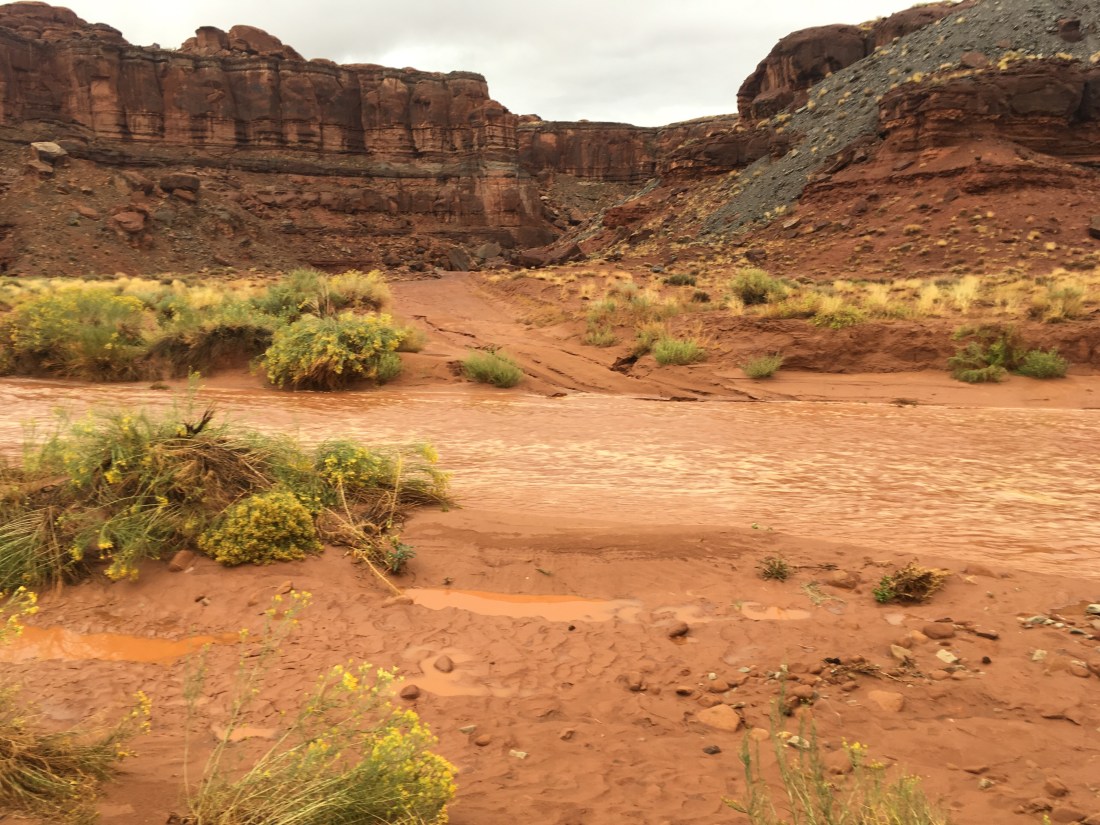
Dingford – PCT Loop Did Not Go (Sept 1-3)

Starting from the not-a-named-trailhead 6mi before the Dingford Trailhead (I didn’t know the road was passable by non-4×4 cars), I tried to set up a 67mi training loop which would bring me to the PCT near Waptus lake and connect back via the Red Mountain after going south to Kendall Catwalk. This was a training hike and I carried 4 gallons of water which I didn’t touch. Max pack weight was 56lbs and my pack is only rated for 40 so the discomfort on days 1 and 2 weren’t surprising. Revisiting the beautiful Dutch Miller Gap and Ivanhoe Lake on the first evening was enough to break through the exhaustion a little. Some streams were dry (yes, even in the PNW) and I had to jog back a half mile for water that first night.

Day two was a little better physically. I visited Pete Lake which isn’t quite the PCT route but takes a turn-off which is a real trail despite there being a lot of sticks placed to say “don’t go this way”. I also got to visiting all the sites of my struggles with navigation and snow last year. The trail south from Spectacle Lake is a true gem and almost would have been worth carrying a pack this heavy to see. A surprise was when a vlogger I follow came hiking by in his trademark ping running shorts. I was racing daylight and really not moving nearly as quickly as I’d wanted but it about 20 miles in time to set up at a dry pond set in a ridge line which is maybe a hundred yards wide but falls off steeply on each side. I’d noticed this area last year and thought it would be a great opportunity to camp. There was even water. Carrying 4 gallons of water as training weight when my bottles were dry and I was thirsty was a unique aspect of the struggle.

On day three I passed a few more places I remembered from the year before though Kendall Catwalk itself isn’t as stunning as I recalled. The area became thick with through-hikers and then day hikers. I turned up the Red Mountain trail and the crowd dropped off. I only saw and old man and in talking with him discovered that the trail had been abandoned and was degraded past the point of safe travel. As I discovered, there is actually a sign which says, “Abandoned”. This is what you get for clicking through a route on CalTopo too quickly. Fortunately, the saddle had line-of-sight to Snoqualmie Pass and I was able to call a friend who gave me a ride back to my car that evening where I found I’d been issued a ticket because I’d left my pass face down. More unfortunate was that in the last three miles, (after 51 miles, why pick the last 3?) my knee started having real pain such that I limped visibly. That’s my first time it’s acted up significantly while hiking and is a real blow since it seems that running longer distances (on concrete at least) inflames it as well. I guess the indestructibility of youth has truly faded from me.
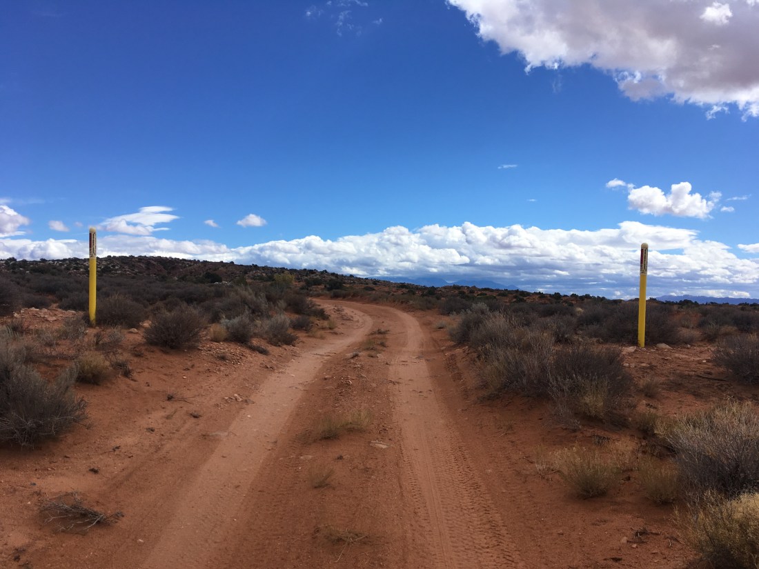
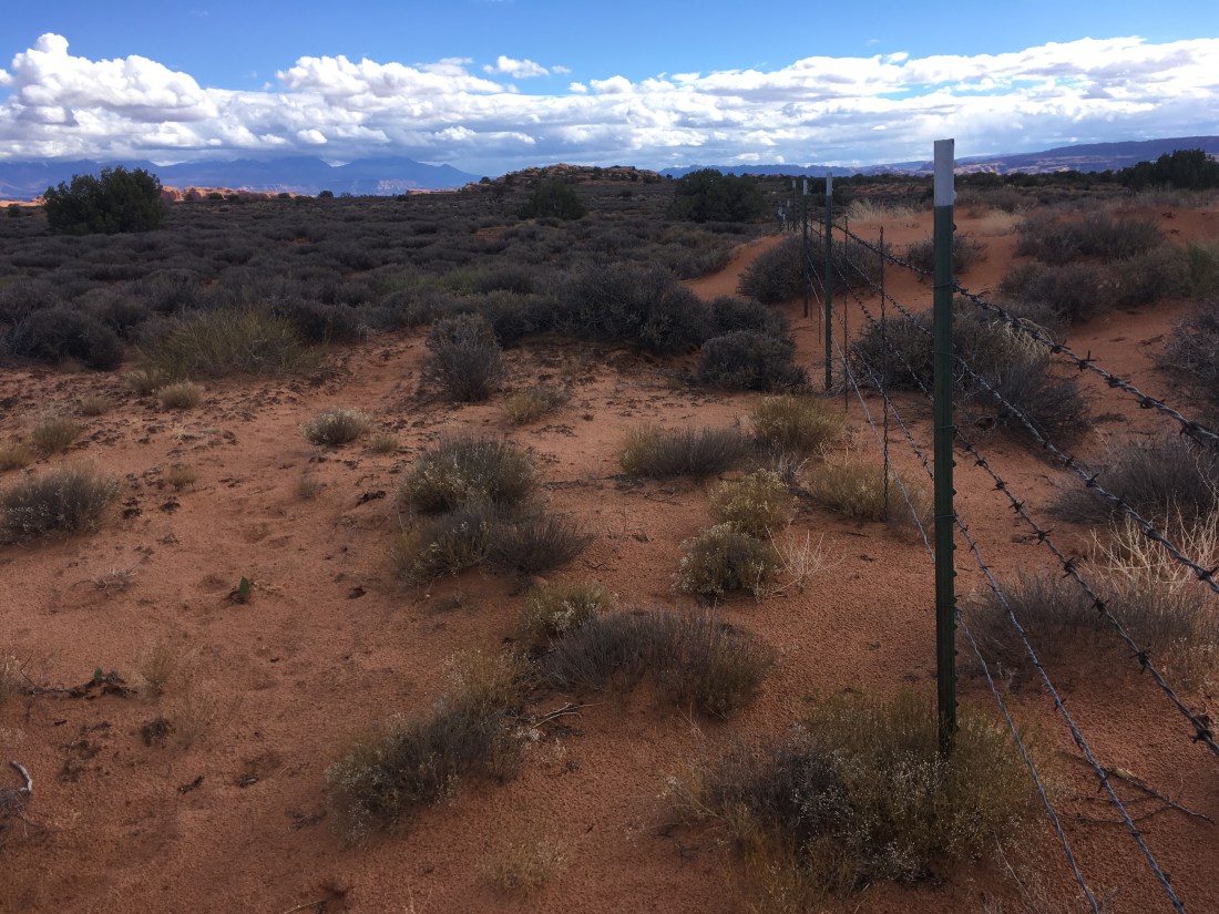
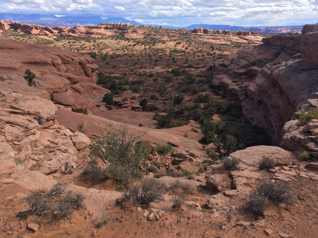
Pictures