Day 120: Do Goats Rock?

Memories from August 18

Leaving camp this morning

Lava Springs. Fortunately, no lava.

In the Goat Rocks Wilderness, the view begins to open up in some places. It’s been a while since I’ve seen a ridge of exposed rock so this was a little exciting. From this angle, the rocks look like an eagle trying to take off. I don’t know why the area is called Goat Rocks but maybe they are other animal shaped rock formations.

I know the PCT is supposed to be a pack trail but I’ve never heard of someone riding a tree. It doesn’t seem like they’ll be able to get all the way from Mexico to Canada in one year. Maybe they’re just section riding.

In the evening, I passed the Grey Coyotes and spent some time talking with them before finding a campsite a short way down a side trail.

Day 120:

Memories from August 18

Leaving camp this morning

Lava Springs. Fortunately, no lava.

In the Goat Rocks Wilderness, the view begins to open up in some places. It’s been a while since I’ve seen a ridge of exposed rock so this was a little exciting. From this angle, the rocks look like an eagle trying to take off. I don’t know why the area is called Goat Rocks but maybe they are other animal shaped rock formations.

I know the PCT is supposed to be a pack trail but I’ve never heard of someone riding a tree. It doesn’t seem like they’ll be able to get all the way from Mexico to Canada in one year. Maybe they’re just section riding.

In the evening, I passed the Grey Coyotes and spent some time talking with them before finding a campsite a short way down a side trail.

Day 119: Mt Adams

Memories from August 17

I got up late today and probably wasn’t on the trail until 8:15am. Five miles later, at the road in to Trout Lake, I found two trash cans. One of them did not contain trash but snacks. A hiker who was there when I arrived said the Trout Lake Abbey puts them out for hikers. This would explain why one of the cans had “may all beings find peace” written on it which is a somewhat loftier ideal than “make this garbage someone else’s problem” which is what I think most people would emblazon on their rubbish bins were they to endocrine them with an honest benediction. In situations like these, where a supervisory trail angel isn’t present, one is faced with an ethical dilemma as to the appropriate amount to take. I decided on three things: a drink, a snack, and one for the road (er, trail). I’m trying to ration a little to see if I can take an on trail zero or nearo in the Goat Rocks Wilderness since it’s supposed to be beautiful. Free calories go a long way towards that.

Salty passed by while I was at the trail magic. He’s a fast hiker with the worst luck when it comes to the mail. He’s passed me several times only to have me catch him while he’s waiting multiple days to solve the mystery of a package which didn’t show up. For his sake, I hope not to see him again in the trail since I’ll be going at a much slower pace but it was a little sad to say another farewell. Good bye until now has always meant, “see you down the trail” now it has a much greater finality since the likelihood of seeing someone again are reduced with the waning miles. Since I tried to practice footprint reading this afternoon in the fine sand, here’s a picture of Sally’s footprint. He’s currently wearing a “sawed off Croc” (he cut the top off a pair of Crocs and ran paracord through them to make sandals) after his hiking samdals broke.

The footprint of an old salt.

Another probably final meeting was with Strapless who in this picture is showing off his hipbelt-less pack. He’s one of only two people I’ve met who don’t use a hip belt though word has it the other has taken up the practice again.

I hiked with Strapless for a bit, crossing a lava field and a turbid stream with a log bridge so low you could feel the water beneath. There haven’t been a lot a strong streams lately so it was an interesting call back to the Sierra.

Strapless crossing a river of chocolate milk in Willy Wonka’s factory.

Where I parted from Strapless was at Killen Creek which had the best view of Mt Adams for the whole day. That’s saying something because I’d spent most of the day on its slopes though the views were usually partially obscured by dead trees from an old burn. It was pretty sweet to end the day just enjoying a glorious view and then camp a few dozen yards away by a waterfall.

Yes, yes,a water piece, just like this one. You may install it next to my bed in the master suite. That will be all Jeeves.

Day 118: You Get Lost, You Probably Weren’t Planning on It

Memories from August 16

The Swiss couple who I’d shared a campsite with were out early while I didn’t get up until 7:00am or so which is normally pretty late but since I’m only trying to hike 20ish miles a day, it’s fine.

I ran into Pathfinder who I’d been leap frogging on Oregon and walked most of the way into Cascade Locks with. We talked continuously as we had before when hiking together and we kept each other to a good pace, 1:30pm found me at my destination and we parted.

I cleaned up in the little Trout Lake Creek and sat on the shaded side of the little bridge with my solar charger and drying clothes on the other. This is more or less what I wanted to do more of in Washington, they sitting around in a beautiful place with nothing to do. I made a list of the big things I want to do after getting home: career things to discuss with my boss which I’ve collected over the course of the trail, some big picture personal direction for the next season of life, and a spiritual discipline I’d like to work on. As the trail begins to come to an end, it feels like a good time to try to collect all the stray threads my mind has spun out here.

After that, I remembered I had The Old Man and the Sea on audiobook and listened to that as it wouldn’t drain my cellphone’s battery as much as reading it would have. With so much tree cover, I haven’t been able to charge the battery in my solar panel very often and so battery power is a resource I’ve had to be more conscious of.

On a much less ethereal note, I got lost while trying to find the campsite after digging a cat hole this evening. Usually, no one did their car hole the proper 200ft from the trail and water due to terrain and urgency. Since I had time, I figured I’d try to do it properly but instead of turning 180° I probably turned something like 120°. I hadn’t noted any major reference points since I didn’t feel like I was going that far and when camp didn’t appear where I thought it should be, worked my way towards the creek knowing that, given the direction of flow when I crossed it and the side of the trail  I was on, following the creek downstream should lead me to the trail. When, guided my the sound of water, I encountered a stream, it was flowing in the opposite direction that I expected. This was very disconcerting because the light was low enough that there were no shadows with to roughly align a compass rose knowing that the sun sets in the west. Was I really so turned around that my sense of direction was so completely turned around? Was there another stream so close and I hadn’t noticed? Suddenly nothing was sure. Am I wrong or is the stream wrong? I decided to try to find the cat hole and then redo my attempt to walk back to camp. After probably 30 seconds, it became clear that I had no idea where my cat hole was as I hadn’t expected to ever have to find it again. Still certain down trees looked familiar as did an a patch of young pine trees. At some point, I spotted a stream where I didn’t expect the previous stream to be. This stream was even flowing in the expected direction. I walked out onto a downed log to get a clear view up and down stream to look for a bridge. I didn’t see one in either direction. Could I really be that far? The stones in the creek and it’s width were more similar to the creek near the camp. After a quick check up stream found no bridge, I turned around and headed in the direction I’d had have expected camp to be if this were the stream I thought it was. Ironically, it was a pile of unburied toilet paper which first clued me in that camp must be nearby. People don’t like to go far from camp to defecate and the close proximity of this pile to water (no PCT Hiker would be so thoughtless since water quality is always on our minds and this, if I was correct, was even upstream of where most people would draw water) and the campsite’s close proximity to a road made me think that this was the work of an over-nighter who was especially interested in keeping their trip to the latrine short. Sure enough, as I clambered over the chest chest high fallen tree, I spotted my sleeping bag. 

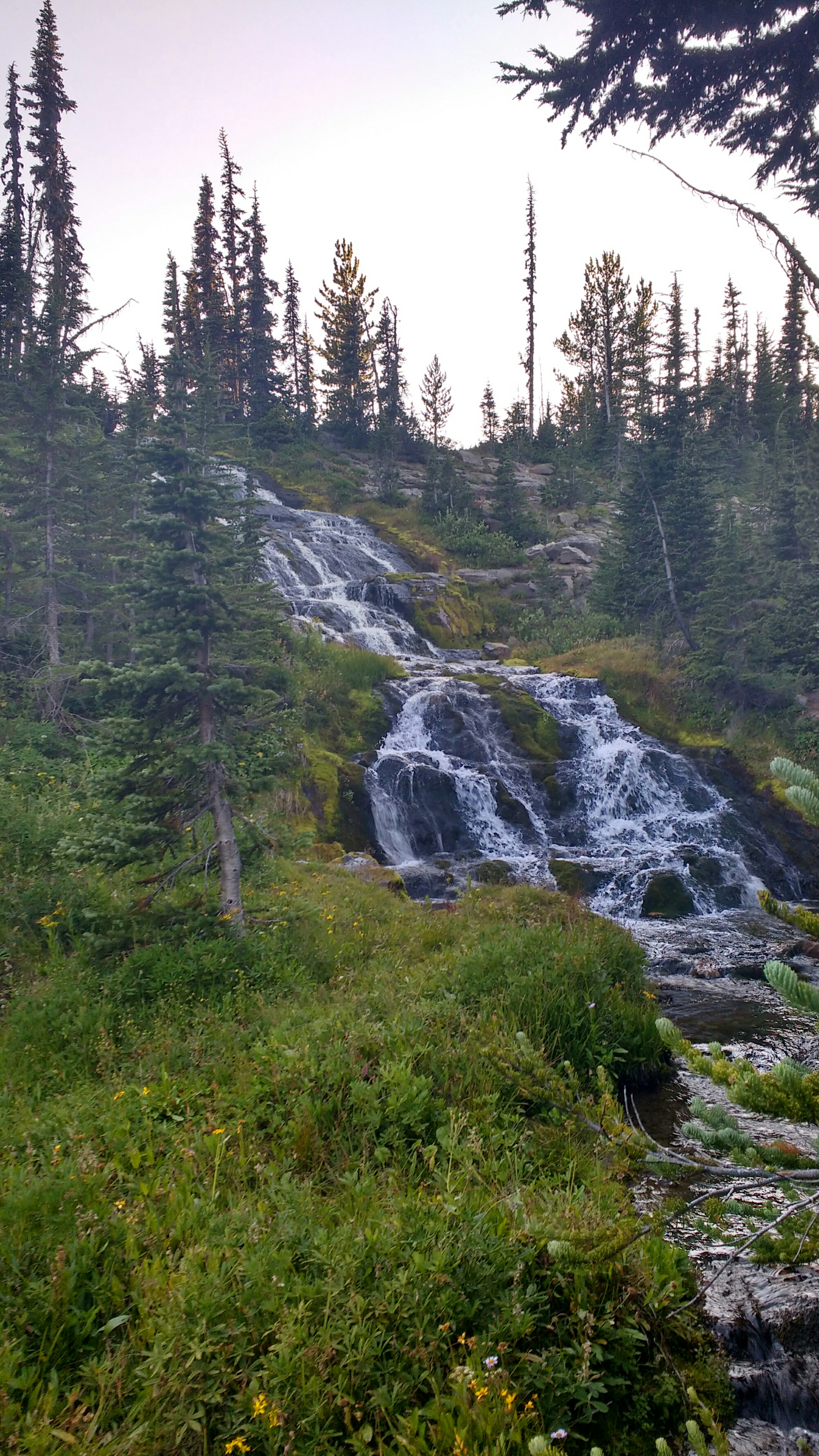
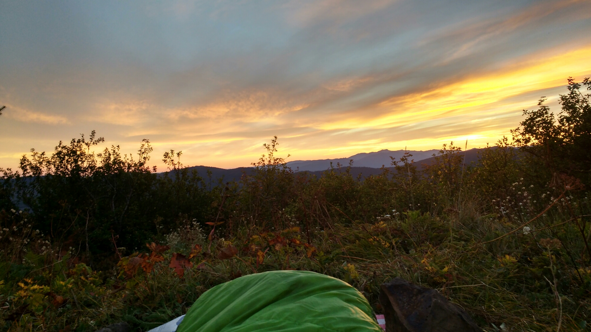
Lemei Lake by early morning.

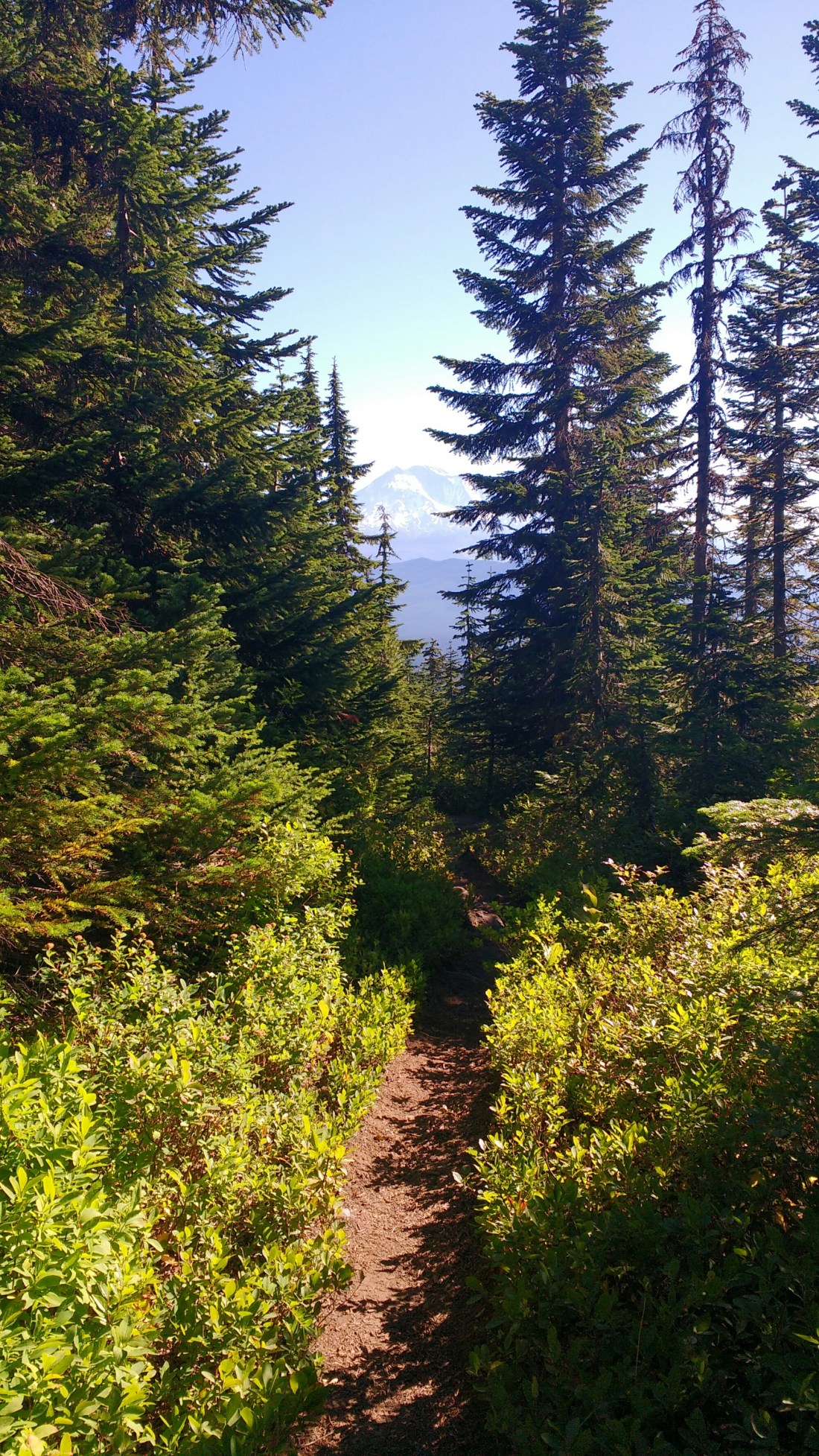
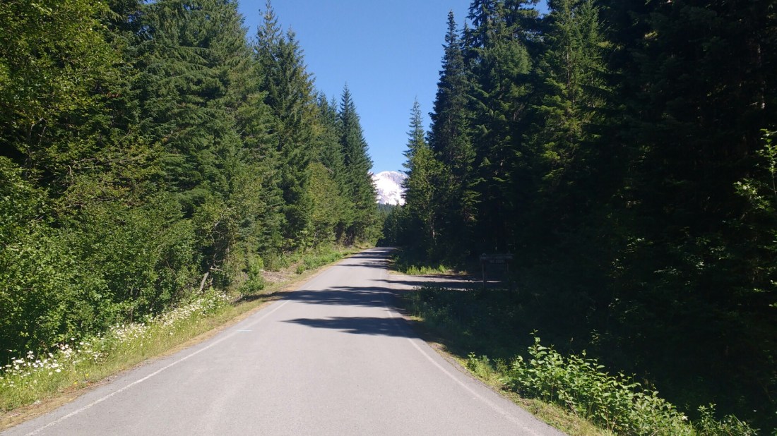
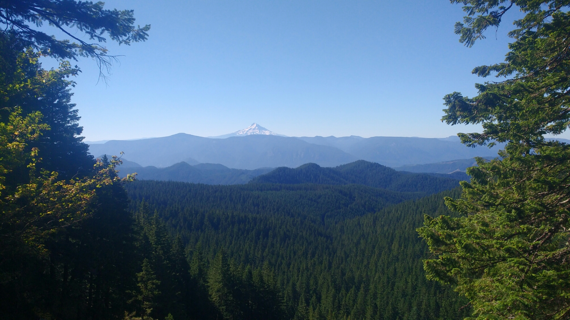
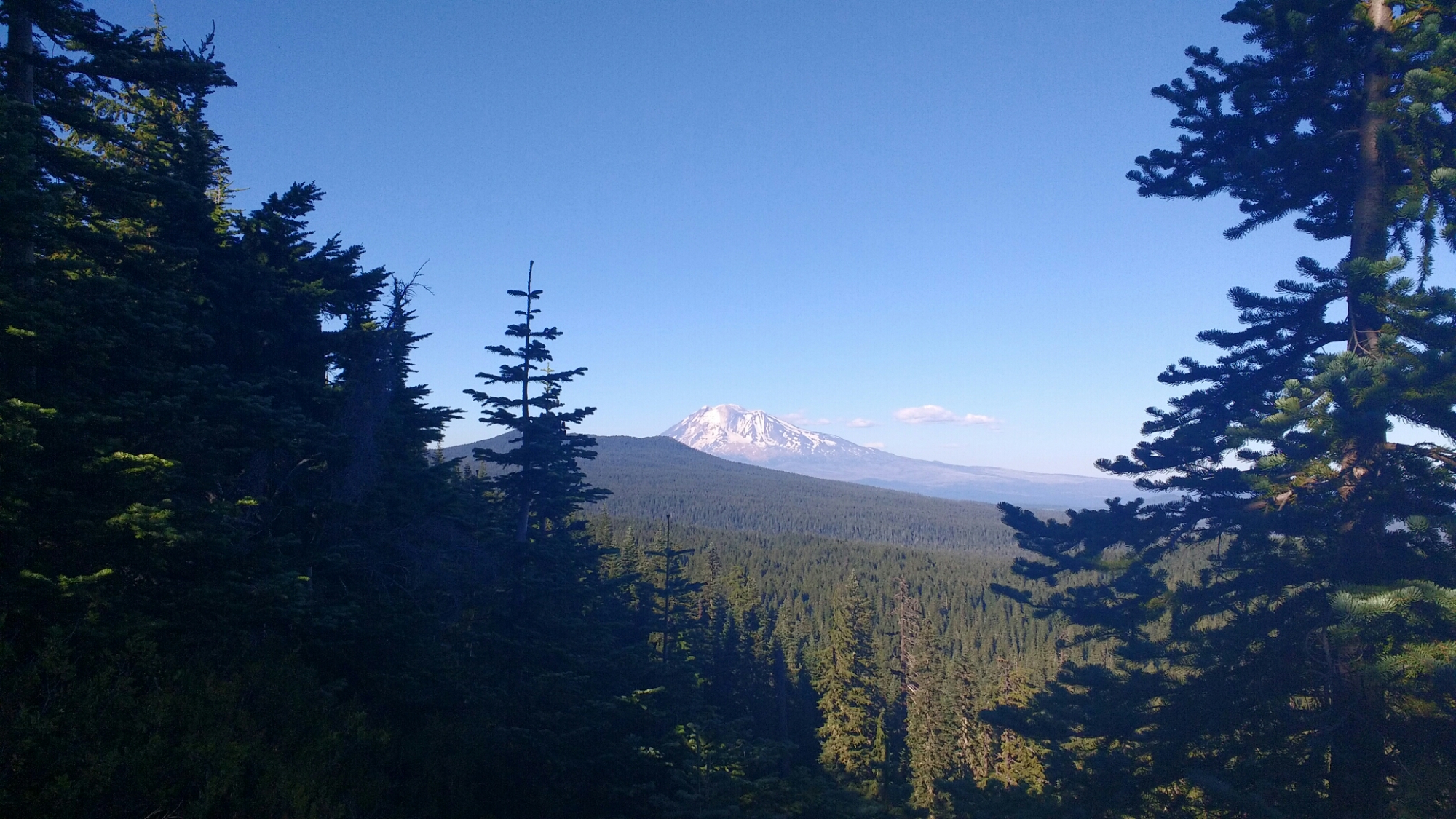
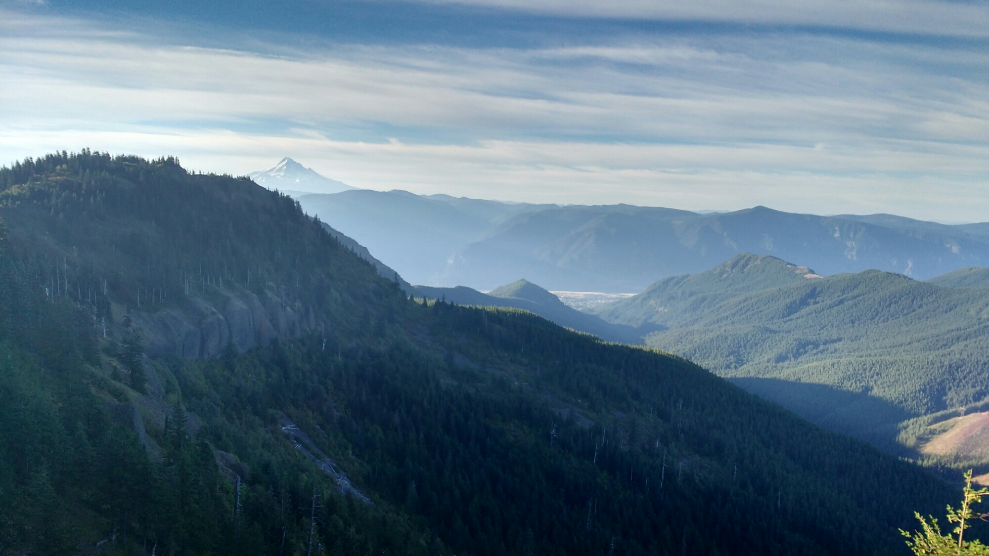
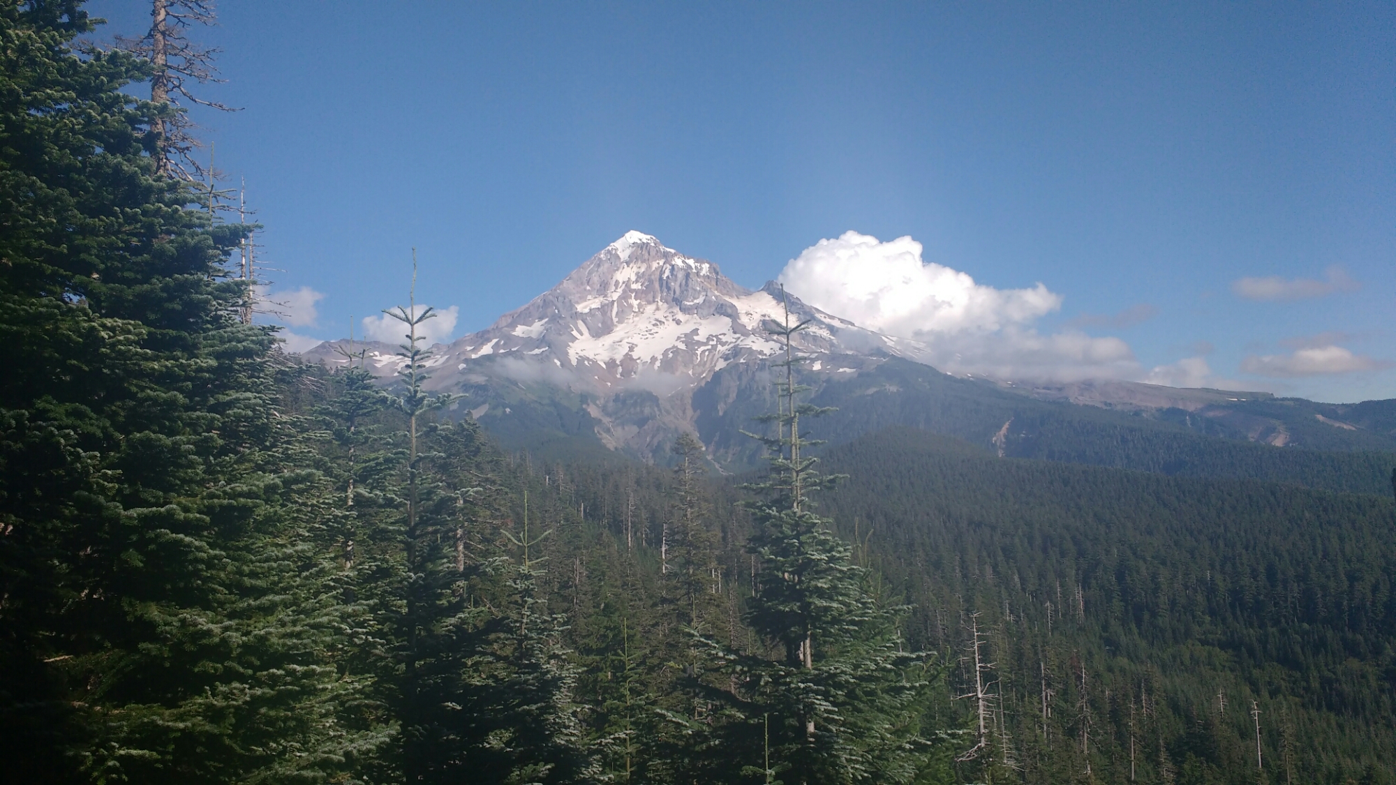
More peek-a-boo mountain views. It’s like in a monster movie when you get a glimpse of part of the monster tough a window or between building.


Day 117: Peek-a-boo Mountain Views

Memories from August 15

Today the trail was mostly tree covered but had a number of peek-a-boo views of Hood, Adams, and St Helens.

Even the ridge walks were tree covered.
There was a bit of volcanic rock in the afternoon but unlike other volcanic sections, the trail was mostly dirt and so easy to walk on.

This particular spring looked like it was part of the set of a horror movie. Fortunately I hadn’t planned on stopping there anyways.

And after some more children’s games played with large prominent geographical features I wound up at Blue Lake.

Blue Lake, not to be confused with Upper and Lower Blue Lakes in California (this isn’t nearly the first such instance) was supposed to only have camping in designated spots. A trip around the lake showed none available and so I wound up finding a site with a tent made of cuben fiber with a  few SmartWater water bottles lying around (sure signs of a PCT hiker) and asked if I might share the site. The residents obliged and I passed the evening quizzing an elderly swiss couple about their home country. They had just retired and had decided to hike the PCT. Their original plan was to do 15 miles per day but were now doing about 20.

Day 116: Two Baths

Memories from August 14

Today was mostly a walk in the woods. While this means no big views, my lower mileage days in Washington mean I have time for things like swimming. I took two baths today. One, a sponge bath with my bandana in the morning and the second a proper dunking in a nice creek. Since the forest is so dense, I had to dry off my just walking. It was hot enough that walking in wet clothes was a given, whether it was stream water or sweat and I was glad for the near constant shade.

The view from my campsite while drying gear from the large quantity of dew.

Bath number one.

Washington is clearly a much wetter environment than elsewhere on the trail because the density of moss in some places looks like the rocks are molding.

This was today’s one view. Forested hills with a creek (not pictured) running near the base of the ledge.

Is your favorite day spa this picturesque?

I camped with English and Tater Tot near, but not on, a river. I’ve been surprised how few of today’s streams had campsites immediately adjacent.

Day 115: Into Washington

Memories from August 13

This morning I arranged resupply through Washington, bought six days of food at the small grocery store in town, managed to fit it all into my backpack which is only 36 liters (the most common pack on the trail is 58 and its rare to see one less than 48). After buying the largest soft serve ice cream cone I’ve ever seen (it was probably a foot tall and they hand you 24oz cup to put it in but it overflows that), I headed out across the Bridge of the Gods and into Washington.

I promise that I’ll try not to post any more selfies.

Something about being in the last state on the trail and in my home state was overwhelming and I almost teared up several times in the first mile.

The heat due to the low elevation and infrequency of breeze put an end to emotional indulgence as did the hard, uneven surface of the trail in places which was a surprising change from Oregon. I’d previously removed my packs hip belt because I rarely carried been four days of food so my shoulders quickly wearied under the weight of six. However, I only have to average about 20 miles a day to make it to Canada by September 7, when I have a room booked in the Manning Park Resort, 8 miles north of the border. Since today is only a half day, I took frequent breaks, especially in cooler spots with cold water.

Eventually, the trail which has been generally been trying to escape the low elevation where it crosses the Columbia, broke out of the trees which had been hiding the surrounding terrain.

For me, Oregon was about big miles and physical accomplishment. I want to Washington to be a relaxed and introspective time. So instead of going to 3.77 more miles to where I’d intended to end the day in a small campsite, according to my trail notes by a jeep road, I just stopped, dropped, and rolled into my sleeping bag to enjoy the fire of a setting sun.

Fruit Cup came by and noted my change of pace. He’s still going to be doing big miles to finish things off which will be impressive as Washington has much more elevation change than Oregon. As he was putting in his ear buds to continue on for the night we traded real names as a sort of farewell, though he shouted over his shoulder, “but my real name is Fruit Cup” as he walked away. Trail names may be a light hearted but I’ve always know him as Fruit Cup and it made me think about how many people associate everything they know about me with the name Dairy Queen.

Day 114: Zero in Cascade Locks

Memories from August 12

Today was mostly spent catching up on overdue blog posts and getting in touch with people who had expressed interest in hiking with me in Washington. Apparently I’m not the only one who has problems with the mobile app for this blogging platform as I heard cursing from a nearby tent about dissapearing posts.

The most disappointing part of the day was when I realized that I’d written down my date of entry into Oregon wrong and so had crossed it in 15 days, failing the Oregon in 2 Weeks Challenge. There’s some cold comfort in that some people start the challenge at Ashland in which case I succeeded, though I’ve always looked down on this version and so can’t retroactively embrace it.

The Port of Cascade Locks has a very nice campground with good facilities and a pleasant view. A wedding party has rented all the car camping spots and I saw the wedding party taking pictures on a nearby bridge.

I didn’t manage to get my resupply arranged for Washington but hope to get that sorted in the morning.

Day 113: End of Oregon

Memories from August 11

The 29 miles into Cascade Locks on the Oregon-Washington border were pretty easy. I hiked most of it with Pathfinder who I’d run across shortly after starting.

The highlight of the morning was a view if Mt St Helens, Rainier, and Adams. They’re pretty far away so I don’t know how easy it is to see in the picture. The pile of stones in the right is a cairn, not a mountain.


We took the Eagle Creek alternate, like all PCT hikers (it’s closed to riders), and will let the pictures speak for themselves though the lighting made it difficult to get good shots.


At the Eagle Creek trailhead, there was a man and woman who asked if we were PCT hikers and offered donuts. I recognized the man as the hiker with the smallest pack I’d ever seen who passed me shortly after Ebbet’s Pass moving faster than I’d ever seen walk without great exertion. He introduced himself as John. The woman introduced herself as Carrot and since I had asked how they supported themselves since they were both clearly experienced hikers mentioned a few things and finally that she did some writing. She’s the author of  Thru Hiking Will Break Your Heart. I was tickled as it was my first time meeting the author of a book I’ve read. I talked with them for a while until other hikers showed up. One of the best moments in the conversation was when John, a very accomplished hiker, talked with honest amazement about people who carry heavy packs (40lbs). He’s a very down to earth person and it was amusing hearing the same honest surprised respect in him about others which many others would have about him.

Finally, I walked down a bike path (by chance with Chance, another hiker), under the highway, and to the end of Oregon.

Day 112: Breakfast at Timberline

Memories from August 10

The much renowned Timberline Lodge breakfast was excellent. I’ve been waiting this entire trip for it and was a little disappointed in only managing three trips back to the buffet tables. Most of the PCT hikers were put at one table which made for good company and conversation as I only knew half of them. At some point Star appeared, wide eyed, and almost unblinking, and announced that she and Fruit Cup had hiked 100km in the last 22hrs and 100mi in the last 48. She then proceeded to gather far more food than she was able to eat. We counseled her to consider a brief nap before conducting any business of import. Fruit Cup appeared shortly thereafter apparently unaffected by their exertions. Neither’s natural penchant activity appeared abated.

I ran some internet errands from a soft chair in the great room, deciding eventually that my shoes would probably hold up through Washington and that I didn’t need to order another pair. Eventually, I moved on, unsurprisingly stiff given yesterday’s activity, before the lunch buffet tempted me to stay into the afternoon.

Timberline Lodge is a wonderful place, as this trail sign points out, it’s right next to paradise.

The trail was narrow and frequently along precipitous hillsides. This sometimes added an event of excitement when passing the many day hikers and overnighters. It also had somewhat more elevation change than most of Oregon but as today was for recovery, I took them as slowly as I liked which made the afternoon pleasant.

With no fog, Mt Hood was visible where the trees separated.

I ended at a small campsite on uneven ground squeezed in near two other hikers on a steep hillside. Someone had recently left unburied excrement, complete with toilet paper at one end of the amorphous campsite and no one wanted to deal with it. Usually, I would have walked on as campsites are plentiful. Steep hillsides like the one we were on are the exception and I was sore. I’ve never seen unburied human poop or toilet paper on parts of the trail which are remote enough to be outside the range of a weekend backpacking trip and as we were half a mile from a forest service road, this was no exception. Darn those uneducated day hikers! And near a water source too! In hind sight, we should probably have buried it.